Items Similar to Antique Map of the Tunquin River and Bay to Cacho, the Capital City, Siam, 1758


Want more images or videos?
Request additional images or videos from the seller
1 of 6
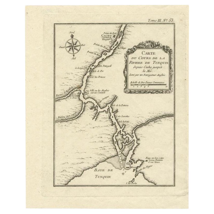
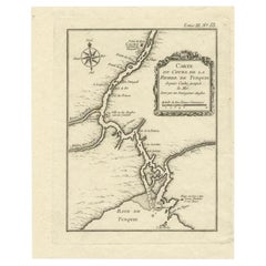
Antique Map of the Tunquin River and Bay to Cacho, the Capital City, Siam, 1758
About the Item
Antique map titled ‘Kaart van den Loop der Rivier van Tonkin van Cacho tot aan de Zee / Carte du Cours de la Riviere de Tunquin Depuis Cacho jusqu'à la Mer J. v. Schley direx.’ Detailed map of the Tunquin River and Bay, extending north to Cacho, the capital city. While these maps by Van Schley after Bellin were initially made for 'Histoire Generale des Voyages' (Paris 1746-1759), this is from the 1758 Dutch edition of that work published by Arkstee & Merkus.
Artists and Engravers: Made by 'Jakob van Schley' after 'Jacques Nicolas Bellin'. Jakob van der Schley (1715-1779) was a Dutch draughtsman and engraver, who studied under Bernard Picart. Jacques-Nicolas Bellin (1703-1772) was a French hydrographer, geographer and member of The Philosophes. His career, spanning over 50 years, caused an enormous output in maps, particular of maritime interest.
Condition: Good, some age related toning. Original plate mark visible. Please study scan carefully.
Date: 1758
Overall size: 18.9 x 25.8 cm
Image size: 14.4 x 21 cm
We sell original antique maps to collectors, historians, educators and interior decorators all over the world. Our collection includes a wide range of authentic antique maps from the 16th to the 20th centuries. Buying and collecting antique maps is a tradition that goes back hundreds of years. Antique maps have proved a richly rewarding investment over the past decade, thanks to a growing appreciation of their unique historical appeal. Today the decorative qualities of antique maps are widely recognized by interior designers who appreciate their beauty and design flexibility. Depending on the individual map, presentation, and context, a rare or antique map can be modern, traditional, abstract, figurative, serious or whimsical. We offer a wide range of authentic antique maps for any budget.
- Dimensions:Height: 10.16 in (25.8 cm)Width: 7.45 in (18.9 cm)Depth: 0 in (0.01 mm)
- Materials and Techniques:
- Period:
- Date of Manufacture:1758
- Condition:Condition: Good, some age related toning. Original plate mark visible. Please study scan carefully.
- Seller Location:Langweer, NL
- Reference Number:
About the Seller
5.0
Platinum Seller
These expertly vetted sellers are 1stDibs' most experienced sellers and are rated highest by our customers.
Established in 2009
1stDibs seller since 2017
1,919 sales on 1stDibs
Typical response time: <1 hour
- ShippingRetrieving quote...Ships From: Langweer, Netherlands
- Return PolicyA return for this item may be initiated within 14 days of delivery.
More From This SellerView All
- Antique Map of the Tunquin River and Bay, Siam, 1757Located in Langweer, NLAntique map titled ‘Carte du Cours de la Riviere de Tunquin Depuis Cacho jusqu'à la Mer’. Detailed map of the Tunquin River and Bay, extending north to Cacho, the capital city. Made ...Category
Antique 18th Century Maps
MaterialsPaper
- Antique Map of the Tunquin River and Bay by Van Schley 'c.1750'Located in Langweer, NLAntique map titled ‘Kaart van den Loop der Rivier van Tonkin van Cacho tot aan de Zee / Carte du Cours de la Riviere de Tunquin Depuis Cacho jusqu'à la Mer J. v. Schley direx.’ Detai...Category
Antique Mid-18th Century Prints
MaterialsPaper
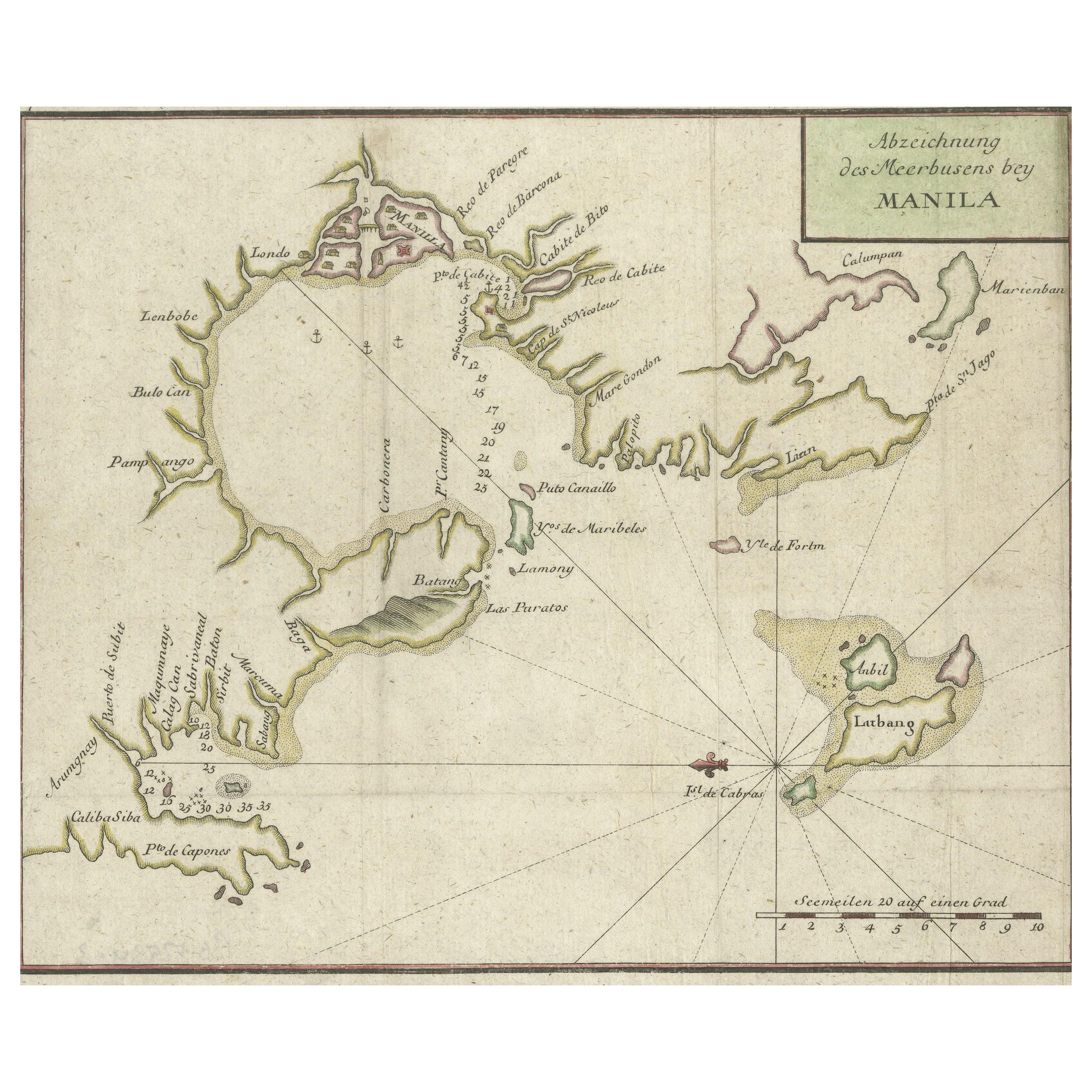
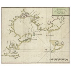
- Antique Map of the Bay of Manila, Capital of the PhilippinesLocated in Langweer, NLAntique map titled 'Abzeichnung des Meerbusens bey Manila'. Map of the Bay of Manila, capital of the Philippines. This map originates from a German edition of 'Voyage around the World...Category
Antique Mid-18th Century Maps
MaterialsPaper
- Antique Map of Cities in the Region of Hubei in China, 1758Located in Langweer, NLAntique map titled 'Plans de Quelques villes de la province de Hou-Quang.' Three plans of cities in a region named Hou-Quang (currently Hubei). While these maps by Van Schley after B...Category
Antique 18th Century Maps
MaterialsPaper
- Antique Map of Egypt and the Nile RiverLocated in Langweer, NLAntique map titled 'Egypten nach dem Zustand der alten Zeit vorgestellt'. This uncommon and richly detailed map of Egypt features hundreds of place names along the Nile. The Sinai Pe...Category
Antique Mid-18th Century Maps
MaterialsPaper
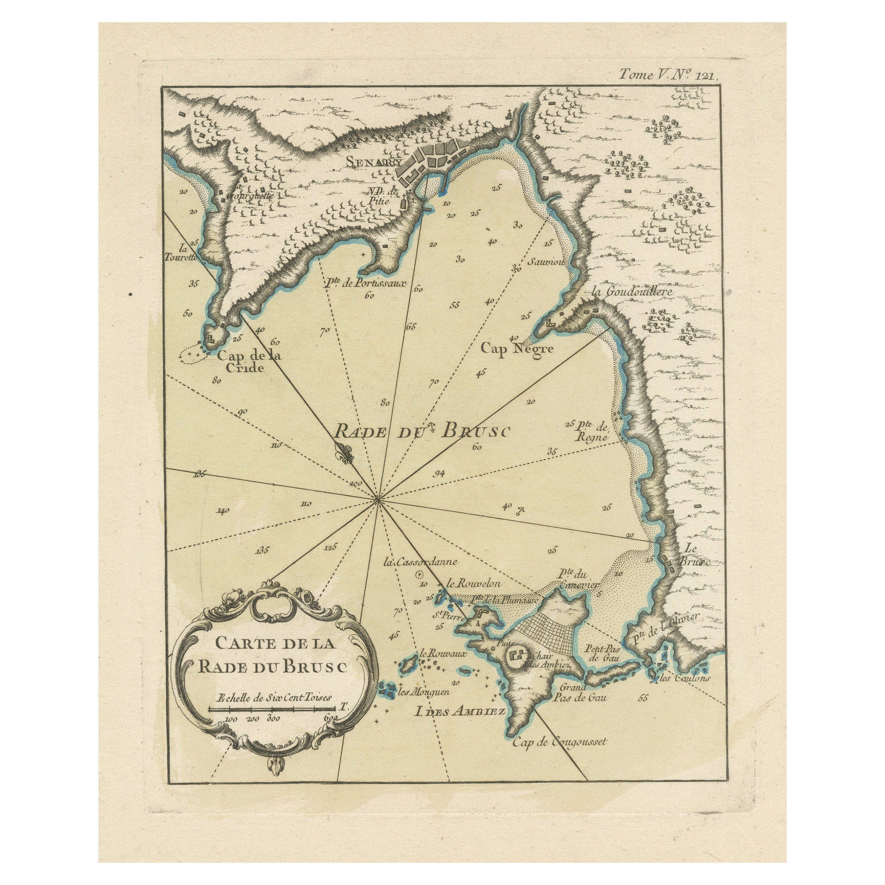
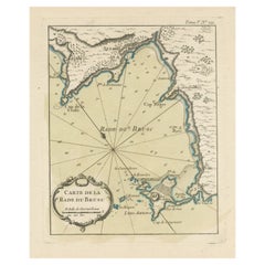
- Antique Map of the Bay of Brusc, FranceLocated in Langweer, NLAntique map titled 'Carte de la rade du Brusc'. Original map of the bay of Brusc, France. This map originates from 'Le Petit Atlas Maritime (..)' by J.N. Bellin. Published 1764. ...Category
Antique Mid-18th Century Maps
MaterialsPaper


You May Also Like
- Original Antique Map / City Plan of Brussels by Tallis, circa 1850Located in St Annes, LancashireGreat map of Brussels. Steel engraving. Published by London Printing & Publishing Co. (Formerly Tallis), C.1850 Free shipping.Category
Antique 1850s English Maps
MaterialsPaper
- Map of the Republic of GenoaLocated in New York, NYFramed antique hand-coloured map of the Republic of Genoa including the duchies of Mantua, Modena, and Parma. Europe, late 18th century. Dimension: 25...Category
Antique Late 18th Century European Maps
- Antique Map of Principality of MonacoBy Antonio Vallardi EditoreLocated in Alessandria, PiemonteST/619 - "Old Geographical Atlas of Italy - Topographic map of ex-Principality of Monaco" - ediz Vallardi - Milano - A somewhat special edition ---Category
Antique Late 19th Century Italian Other Prints
MaterialsPaper
- Original Antique Map of The World by Thomas Clerk, 1817Located in St Annes, LancashireGreat map of The Eastern and Western Hemispheres On 2 sheets Copper-plate engraving Drawn and engraved by Thomas Clerk, Edinburgh. Published by Mackenzie And Dent, 1817 ...Category
Antique 1810s English Maps
MaterialsPaper
- Antique 18th Century Map of the Province of Pensilvania 'Pennsylvania State'Located in Philadelphia, PAA fine antique of the colony of Pennsylvania. Noted at the top of the sheet as a 'Map of the province of Pensilvania'. This undated and anonymous map is thought to be from the Gentleman's Magazine, London, circa 1775, although the general appearance could date it to the 1760's. The southern boundary reflects the Mason-Dixon survey (1768), the western boundary is placed just west of Pittsburgh, and the northern boundary is not marked. The map has a number of reference points that likely refer to companion text and appear to be connected to boundaries. The western and southern boundaries are marked Q, R, S, for example. A diagonal line runs from the Susquehanna R to the Lake Erie P. A broken line marked by many letters A, B, N, O, etc., appears in the east. There are no latitude or longitude markings, blank verso. Framed in a shaped contemporary gilt wooden frame and matted under a cream colored matte. Bearing an old Graham Arader Gallery...Category
Antique 18th Century British American Colonial Maps
MaterialsPaper
- Map "Estuary- Mouth of the Thames"Located in Alessandria, PiemonteST/426 - Antique French Map of the estuary of the Thames, map dated 1769 - "Mape of the entrance of the Thames. Designed by filing of Navy cards fo...Category
Antique Mid-18th Century French Other Prints
MaterialsPaper


