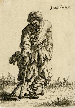
Old Masters Landscape Prints

OLD MASTERS

Encompassing centuries of change in Europe between 1300 and 1800, from booms of prosperity to bloody revolutions, Old Masters describes a wide range of artists. The informal term was derived from the title of an artist who trained in a guild long enough to become a master, such as Leonardo da Vinci, who studied in a Florence painters’ guild. However, Old Masters paintings, prints and other art is now used to refer to work made by any artist with a high level of skill in painting, drawing, sculpture or printmaking who worked during this era.

The 15th century’s expansive trade and commerce spread culture across borders. A vibrant period of art emerged, bolstered by studies of anatomy and nature that influenced a new visual realism. From Raphael and Michelangelo in the Renaissance to Rembrandt van Rijn and Johannes Vermeer in the Dutch Golden Age, artists expressed emotion, naturalism, color and light in new ways. El Greco and Paolo Veronese were leaders in the dramatic style of Mannerism, while Caravaggio and Peter Paul Rubens demonstrated the movement and meticulous detail of Baroque art.

Historically, most attention was concentrated on male artists, but recent research and exhibitions have elevated the impactful work of women such as Rachel Ruysch and Artemisia Gentileschi. In late-18th-century France, female artists like Adélaïde Labille-Guiard and Élisabeth Vigée Le Brun were prominent names. Nevertheless, access to the academies and guilds was highly restricted for women, and even those able to establish practices were expected to adhere to portraits and still lifes rather than the grand history paintings being created by men.

Find a collection of Old Masters prints, paintings, drawings and watercolors and other art on 1stDibs.

to
9
274
110
35
7
2
Overall Width
to
Overall Height
to
4,735
3,164
1,068
844
813
638
598
340
90
77
70
27
15
94
28
14
14
9
359
66
5
1
1
281
325
65
38
260
157
117
58
51
49
42
38
37
36
26
24
21
18
15
15
14
13
13
12
328
93
56
46
22
49
204
168
160
Style: Old Masters
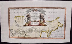
Map of the Russian Empire: An Original 18th Century Hand-colored Map by E. Bowen
Located in Alamo, CA
This is an original 18th century hand-colored map entitled "A New & Accurate Map of The Whole Russian Empire, As Contain'd Both In Europe and Asia, Drawn from Authentic Journals, Sur...
Category

Mid-18th Century Old Masters Landscape Prints

Materials

Engraving

Archangel - Original Lithograph - Early 19th Century
Located in Roma, IT
Archangel is an original modern artwork realized in Germany in the first half of the 19th Century. Original B/W Lithograph on Ivory Paper. Inscripted on the lower margin in Capit...
Category

Early 19th Century Old Masters Landscape Prints

Materials

Lithograph

The Great Landscapes II, (4th State)
Located in Chicago, IL
Watermark: Schellenkappe (Foolscap) Similar to Churchill no. 340
Category

17th Century Old Masters Landscape Prints

Materials

Etching

Frontispiece with stepped fountain.
Located in Middletown, NY
Dujardin, Karel. Frontispiece with stepped fountain; a stone wall with water spout pouring water into a rectilinear basin, from which a second spout pour...
Category

Mid-17th Century Old Masters Landscape Prints

Materials

Handmade Paper, Etching, Laid Paper

18th Century Engraving "Attack with a Battering Ram" by Montfaucon
Located in Alamo, CA
This early original copper-plate engraving entitled "Attaque avec le Belier" from 'L'antiquité expliquée et représentée en figures' (Antiquity Explained and Represented in Diagrams), published in Paris in 1719 by Bernard de Montfaucon. It depicts an ancient...
Category

Early 18th Century Old Masters Landscape Prints

Materials

Engraving

Vue de la Bastille, Old Masters Hand-Colored Engraving after Hyacinthe Rigaud
Located in Long Island City, NY
Hyacinthe Rigaud, After, French (1659 -1743) - Vue de la Bastille, Year: of original: 1750, Medium: Hand-Colored Engraving, signed in the plate, Edition: ~1000, Image Size: 8.5 x...
Category

1750s Old Masters Landscape Prints

Materials

Engraving

The Queen of Great Britain arriving in Portsmouth 25 May 1662 & The Arrival in L
Located in Middletown, NY
Two images of Queen Catharina of Braganza; one before her marriage to King Charles II, the other after, as Queen of Great Britian. Engraved by Matthiäus Merian, father of Maria Sybli...
Category

Mid-17th Century Old Masters Landscape Prints

Materials

Laid Paper, Engraving

Il tempio del Sole
Located in Middletown, NY
Etching on hand made cream laid paper, 2 7/8 x 6 1/4 inches (72 x158 mm), 1/4 inch margins. In very good condition with minor edge wear. Adhered with adhesive along the left top shee...
Category

Early 17th Century Old Masters Landscape Prints

Materials

Handmade Paper, Etching, Laid Paper

Letter of the Alphabet V - Etching by Luigi Vanvitelli - 18th Century
Located in Roma, IT
Letter of the Alphabet V, from the series "Antiquities of Herculaneum", is an etching on paper realized by Luigi Vanvitelli in the 18th century. Good conditions with some folding. ...
Category

Late 18th Century Old Masters Landscape Prints

Materials

Etching

Arcadian riverscape with different figures by a tree [Arcadisch rivierlandschap]
Located in Middletown, NY
A beautiful Arcadian landscape after Johannes Glauber. Amsterdam: 1721. Etching on handmade laid paper with an intact fleur-de-lis watermark. 203 x 275 mm; 8 x 10 7/8 inches, trimm...
Category

18th Century Old Masters Landscape Prints

Materials

Handmade Paper, Laid Paper, Etching

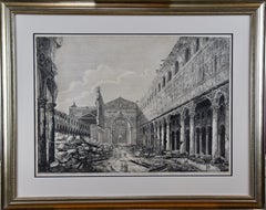
18th Century Etching of "Chiesa di S. Lucia" in Rome by Giuseppe Vasi
Located in Alamo, CA
This 18th century etching is entitled "Chiesa di S. Lucia alle Botteghe Oscure" by Giuseppe Vasi was published in Rome in 1747 in Vasi's 'Magnificenze di Roma Antica e Moderna', whic...
Category

Mid-18th Century Old Masters Landscape Prints

Materials

Etching

Set of Two Engravings from Campbell's "Vitruvius Britannicus" /// Architecture
Located in Saint Augustine, FL
Artist: Colen Campbell (Scottish, 1676-1729) Titles: "The Plan of Lindsey House in Lincolns Inn Fields" (Vol. 1, Plate 49) and "Lindsey House in Lincolns Inn Fields" (Vol. 1, Plate 5...
Category

1710s Old Masters Landscape Prints

Materials

Laid Paper, Engraving, Etching, Intaglio

The Pump House, Notre Dame, Paris
Located in Storrs, CT
La Pompe Notre Dame. (The Pumphouse, Notre Dame). Schneiderman catalog 26.x. 1861. Etching. Image 6 3/4 x 10. Edition of 30 in this state. Series: Eaux-Fortes sur Paris . Initial...
Category

Mid-19th Century Old Masters Landscape Prints

Materials

Etching

New Map of the Terraqueous Globe - WORLD MAP - CALIFORNIA AS AN ISLAND
By Edward Wells
Located in Santa Monica, CA
EDWARD WELLS (British 1667- 1727) A NEW MAP of the TERRAQUEOUS GLOBE - according to the latest Discoveries and most general Divisions of it into CONTINENTS and OCEANS, 1700-01 (Shirley 609) Engraved by Michael Burghers, Oxford. Hand-colored, Platemark 14 1/4 x 20 1/8 inches. Central cartouche flanked by figures representing the continents with dedication to William, Duke of Gloucester...
Category

Early 1700s Old Masters Landscape Prints

Materials

Engraving

Collegio De Neofiti - Etching by Giuseppe Vasi - Late 18th Century
Located in Roma, IT
Collegio De Neofiti is an original black and white etching of the Late 18th century realized by Giuseppe Vasi. Signed and titled on plate lower margin. Good conditions and aged mar...
Category

Late 18th Century Old Masters Landscape Prints

Materials

Etching

Fontana e Teatro di Marcello- Etching by Giuseppe Vasi - Late 18th Century
Located in Roma, IT
Fontana e Teatro di Marcello is an original etching hand watercolored of the Late 18th century, realized by Giuseppe Vasi. Signed and titled on plate lower margin. Good conditions...
Category

Late 18th Century Old Masters Landscape Prints

Materials

Etching

Landschap Met Vierkante Toren - Engraving after Rembrandt - 19th Century
Located in Roma, IT
Landschap Met Vierkante Toren is an engraving on ivory-colored paper realized by Charles Amand Durand after an etching by Rembrandt dated 1650. This wonderful piece of art belongs to...
Category

19th Century Old Masters Landscape Prints

Materials

Etching

Seascape With Monuments - Etching by Raffaele Barone - 18th Century
Located in Roma, IT
Seascape With Monuments is an Etching realized by Raffaele Barone (18th Century). The etching belongs to the print suite “Antiquities of Herculaneum Exposed” (original title: “Le A...
Category

Late 18th Century Old Masters Landscape Prints

Materials

Etching

16th c. woodcut map - Tabula Asiae Vlll
Located in Santa Monica, CA
SEBASTIAN MUNSTER (1488-1652) ASIAE TABVLA Vlll 1540 (45) Woodcut from Munster's edition of Geographia Universalis, Basel, Henri Petri. 1545 edit...
Category

16th Century Old Masters Landscape Prints

Materials

Woodcut

Seascapes With Monument and Figures - Etching by Giuseppe Aloja - 18th Century
Located in Roma, IT
Seascapes With Monument and Figures is an Etching realized by Giuseppe Aloja (1783-1837). The etching belongs to the print suite “Antiquities of Herculaneum Exposed” (original titl...
Category

18th Century Old Masters Landscape Prints

Materials

Etching

Seascape with Monument and Figures- Etching by Luigi Aloja - 18th Century
Located in Roma, IT
Seascape With Monument and Figures is an Etching realized by Luigi Aloja (1783-1837). The etching belongs to the print suite “Antiquities of Herculaneum Exposed” (original title: “L...
Category

Late 18th Century Old Masters Landscape Prints

Materials

Etching

Seascape with Monument and Figures - Etching by Luigi Aloja - 18th Century
Located in Roma, IT
Seascape With Monument and Figures is an Etching realized by Luigi Aloja (1783-1837). The etching belongs to the print suite “Antiquities of Herculaneum Exposed” (original title: “L...
Category

Late 18th Century Old Masters Landscape Prints

Materials

Etching

Liber Veritatis - Original B/W Etching after Claude Lorrain - 1815
Located in Roma, IT
Image dimensions: 21 x 27 cm. Liber Veritatis - Plate 191 is a beautiful black and white etching and aquatint on paper realized by the Italian artist ...
Category

1810s Old Masters Landscape Prints

Materials

Etching, Aquatint

Liber Veritatis - B/W Etching after Claude Lorrain - 1815
Located in Roma, IT
Image dimensions: 21 x 27 cm. Liber Veritatis - Plate 177 is a beautiful black and white etching and aquatint on paper realized by the Italian artist ...
Category

1810s Old Masters Landscape Prints

Materials

Etching, Aquatint

View of Seravalle, Italy: A 16th Century Hand-colored Map by Braun & Hogenberg
Located in Alamo, CA
This is an original 16th century copperplate originally hand-colored engraved map of View of Seravalle, Italy entitled "Seravallum Celeberrimum Marchiae Tarvisiniae in Agro Foro Juliensi Opp. - Seravalli, quam vides, Spectator, iconem, operi huic nostro suis sumptib. . . ." by Georg Braun & Franz Hogenberg, from their famous city atlas "Civitates Orbis Terrarum", published in Augsberg, Germany in 1575. The map depicts a view of Seravalle, now Vittorio Veneto, in San Marino, Italy, north of Venice, in a topographically accurate bird's-eye view from the south. A water-filled moat is seen to the south of the city walls and farmland to the east. Two men are depicted standing on a hill in the lower right in conversation next to grain sacks and a grazing horse, while a younger man behind them to the right herds a mule carrying presumably pigs. A very colorful and ornate title cartouche is in the upper center and coat-of-arms are in the right and left upper corners. Serravalle lies in an idyllic setting in the foothills and surrounded by orchards. St Mary's Cathedral with its tall bell tower is prominent in the center of the town. The marketplace and town hall with a bell tower in the square are depicted. Houses and shops are around the main square. Serravalle's importance as an agricultural centre is emphasized by the figures in the foreground. In 1337 Serravalle was conquered by the Republic of Venice. In 1866 the town was united with neighbouring Ceneda to form the town of Vittorio Veneto. The following is an English translation of an excerpt from the French description of the city on the back of the map: "Serravalle, a market town renowned for cloth, wine and grain, is in such a beautiful situation that the number of its inhabitants, attracted by the loveliness of the place, has grown so much at times that the wall encircling it has had to be enlarged for the third time. The city with the surrounding town once belonged to the Church in Ceneda as an imperial fief. It subsequently became the seat of the Da Camino family (a princely house that at that time was one of the five most noble in all Italy). Now the city is under the sway of the Venetians but is prudently governed by them. For they send only one city councillor with instructions to ensure that justice prevails and to collect duties. In all else, power lies in the hands of the noble families." This is a translation of the Latin in the title cartouche on the front: "The picture of the town of Serravalle, which you see, viewer, has been contributed to our work entirely at his own expense by Minutius, son of Hieronymus Minutius, a noble gentleman and one renowned for the far-reaching competence of his jurisdiction. We saw him sojourning in Cologne, where he was on business for Gregory XIII; while our good wishes accompany him, we should also like to accompany him on his way with this remembrance, even though it might be against his will, so that even those who have not seen him may learn of his excellence. However, those who do not yet know him will also see his excellence if God the Almighthy does not summon erring souls too soon back to the eternal seat of the Blessed." References: Van der Krogt 4, 4728, State 1; Taschen, Braun and Hogenberg, p.331; Fauser, #14960 This striking hand-colored city view is printed on laid, chain-linked paper with wide margins. The sheet measures 16" high by 21" wide. There is a central vertical fold as issued and French text on the verso, with Latin on the front. There is some discoloration in the upper and right margins which may represent some watercolor paint from the time of the original hand-coloring of the map. There is a small hole to the right of the upper portion of the vertical fold, which is only visible when held up to light and an area of reinforcement on the verso of the lower vertical fold. The map is otherwise in very good to excellent condition. Braun and Hogenberg's 'The Civitates Orbis Terrarum' was the second atlas of maps ever published and the first atlas of cities and towns of the world. It is one of the most important books published in the 16th century. Most of the maps in the atlas were engraved by Franz Hogenberg and the text, with its descriptions of the history and additional factual information of the cities, was written by a team of writers and edited by Georg Braun. The work contained 546 bird-eye views and map views of cities and towns from all over the world. It gave graphic representation of the main features of the illustrated cities and towns, including the buildings and streets. Although the ordinary buildings are stylized, the principal buildings are reproduced from actual drawings created on location. The principal landmarks and streets can still be recognized today. In addition, the maps often include the heraldic arms of the city, the nature of the surrounding countryside, the important rivers, streams and harbors, even depicting stone bridges, wooden pontoons, flat-bottomed ferries, ships and working boats, wharves and jetties, as well as land-based activities, including horsemen, pedestrians, wagons, coaches, and palanquins. Small vignettes are often included which illustrate the trade, occupations and habits of the local inhabitants, such as agriculture, paper-making and textiles, as well as local forms of punishment, such as gibbets, wheels, floggings etc. Large figures dressed in their local costume are often presented out of proportion in the foreground. The aim of the authors was to give as much information as possible in a pleasing visual form. They succeeded in creating maps that were both informative and decorative works of art. The atlas is a wonderful glimpse of life in medieval Europe. Georg Braun (1541-1622) was German Catholic...
Category

16th Century Old Masters Landscape Prints

Materials

Engraving

Assassinat de Basseville à Rome - Original Etching by P.G. Berthault - 1793
Located in Roma, IT
Assassinat De Basseville à Rome is an original black and white etching realized by Pierre Gabriel Berthault, after Jacques François Joseph Swebach-Desfontaines in 1793. Title with caption on plate on the lower center: "Assassinat de Basseville, à Rome/ le 13 Janvier 1793, ou 23 Nivose An Ier de la République". Below the image on the lower margin, "Swebach Desfontaines onv. et del. / Berthault sculp." is etched on plate. This modern artwork is numbered "N. 76", because it is from the series Les Tableaux historiques de la Révolution française. As a matter of fact, Pierre-Gabriel Berthault is well-known for having engraved plates from this collection with the collaboration of the engraver Jean Duplessis-Bertaux. A work - hanging in the balance between news and history - with illustrations of salient or minimal events occurred during the French Revolution. As a celebration of the new ideals of brotherhood, justice, and equality, Les Tableaux immediately became a point of reference for journalism at the time. Of traditional cut, namely showing a view with many human figures, the engraving simplified the lines to be immediately readable for the general public. In our specific case, this original print represents the murder of Hugou de Bassville or Basseville (7 February, 1743 – 13 January, 1793), a French journalist and diplomatist, and protector of the radical Jacobins in Rome. In excellent conditions, except for a usual yellowing of the paper on the edges and a light trace of oxidations on the lower and right margins, beyond the marginal line of the matrix. Pierre-Gabriel Berthault (Saint-Maur-des-Fossés, 1737 - Paris, 1831) was a French master who made engravings from drawings by Jean-Claude Richard de Saint-Non (known as the Abbot of Saint-Non) and from paintings by Louis François Cassas. He depicted many views of Italy and created the collections Voyage à Naples and Voyage pittoresque de la Syrie, de la Palestine et de la basse-Egypte. Before the French Revolution, he was famous for being the author of the Vues intérieures de Paris and for tables with architectural elevations.
Category

1790s Old Masters Landscape Prints

Materials

Etching

Chiesa di S.Carlo ed Ambrogio al Corso - Etching by G. Vasi - 18th century
Located in Roma, IT
Chiesa di S.Carlo ed Ambrogio al Corso is an original etching of the Late 18th century realized by Giuseppe Vasi. Signed and titled on plate lower margin. Good conditions except f...
Category

Late 18th Century Old Masters Landscape Prints

Materials

Etching

The New Athenaeum, Waterloo Place - Hand-Colored Engraving after Thomas Shepherd
By Thomas Hosmer Shepherd
Located in Long Island City, NY
Thomas Hosmer Shepherd, After by James Tingle, British (1793 - 1864) - The New Athenaeum, Waterloo Place, Medium: Hand Colored Engraving, Image Size: 3.75 x 5.75 inches, Frame Siz...
Category

Early 19th Century Old Masters Landscape Prints

Materials

Engraving

Landscape with an Obelisk - Engraving after Rembrandt - 19th Century
Located in Roma, IT
Landscape with an Obelisk is an engraving on ivory-colored paper realized after an etching by Rembrandt dated 1650 ca. This wonderful piece of art belongs to an edition of the late 1...
Category

19th Century Old Masters Landscape Prints

Materials

Engraving

Ancient View of Benares - Original Lithograph - 1850s
Located in Roma, IT
Ancient View of Benares is an original modern artwork realizedin the first half of the 19th Century. Original Black and White Lithograph on Ivory Paper. Inscripted on the lower ma...
Category

Early 19th Century Old Masters Landscape Prints

Materials

Lithograph

Cartusia Bruxellensis Monastery in Brussels: A 17th C. Hand-colored Engraving
Located in Alamo, CA
This is a 17th century hand-colored copperplate engraving entitled "Cartusia Bruxellensis" by Lucas Vorsterman, the Younger, after a drawing by Jacob van Werden or Jacques van Weerden, published in 1659 in Antonius Sanderus' book 'Chorographia sacra Brabantiae sive celebrium aliquot in ea provincia ecclesiarum et coenobiorum descriptio . . . Brussel' (A sacred chorography of Brabant, or a description of several famous churches and convents in that province). It also appeared in other publications by Sanderus. In the 17th century, Brussels was within the Duchy of Brabant. This engraving depicts a bird's-eye view of the Scheut Carthusian Monastery in Brussels. Scheut is a district of Anderlecht, a municipality of Brussels, Belgium. The monastery housed monks, who took a vow of silence, in 20 rooms. There is a central courtyard with trees and shrubs. Monks are depicted strolling along its pathways. The cells for the friars are in the middle the cloister. There are people along the streets in the foreground and to the right of the large, imposing monastery. Some are on horseback, others are walking. In the lower right, what appears to be a dog pulls a small cart containing barrels, possibly of beer or wine. Districts and neighborhoods are labelled in the background, including Scheut, Anderlecht and Ransfort. A very ornate cartouche in the lower left contains Latin and the artist's attribution. Another decorative cartouche in the upper central area contains the title. This beautifully hand-colored and detailed engraving is printed on laid, chain-linked paper with wide, full margins. The sheet measures 17.25" high and 21.25" wide. It has Latin text on the verso. It has a central vertical fold, as issued, which is reinforced on the verso. Two small spots in the lower margin may actually represent drops of watercolor paint used to color the engraving. It is otherwise in very good condition. Antonius Sanderus (1586-1664) was a Flemish Catholic cleric and historian. He was born "Antoon Sanders", but Latinized his name like many writers and scholars of his time. He was the author of several books, including 'Chorographia Sacra Brabantiae', which was illustrated with this engraving. Lucas Vorsterman the Younger (1624-between 1666 & 1676) was a Flemish Baroque engraver and draughtsman. He produced engravings after the work of contemporary painters and for books by Antwerp publishers. Jacob van Werden or Jacques van Weerden (active 1643-1669), was a Flemish draughtsman, cartographer, military engineer and archer who was active in the Habsburg Netherlands. His drawings were used as designs for prints executed by various printmakers. He worked on maps, topographical views, historical scenes, portraits and book illustrations. He had a career as a military engineer and a member of the guard of the Spanish King. He advised on various military engineering projects and was an engineer of the Spanish army...
Category

Mid-17th Century Old Masters Landscape Prints

Materials

Engraving

Map of the East Indies: An Original 18th Century Hand-colored Map by E. Bowen
Located in Alamo, CA
This is an original 18th century hand-colored map entitled "An Accurate Map of the East Indies Exhibiting the Course of the European Trade both on the Continent and Islands" by Emanu...
Category

Mid-18th Century Old Masters Landscape Prints

Materials

Engraving

Venice - Original Woodcut - 1950s
Located in Roma, IT
Venice is an original artwork realized in 1950s. Original woodcut on ivory paper; reissue of a hand-printed woodcut, 1950s. Good conditions. Image Dimensions: 18 x 19 cm.
Category

Mid-20th Century Old Masters Landscape Prints

Materials

Woodcut

View of Meissen, Germany: A 16th Century Hand-colored Map by Braun & Hogenberg
Located in Alamo, CA
This is a 16th century original hand-colored copperplate engraved map of View of View of Meissen, Germany entitled "Misena Hermun Duvorum Urbs" by Georg Braun & Franz Hogenberg, from their famous city atlas "Civitates Orbis Terrarum", published in Cologne, Germany in 1575. The map depicts a side view and bird's-eye view, looking across the Elbe River (labelled Albis Fluvius on the map; White River in Latin) from the northeast. In the foreground are three women in conversation on a hill above the city, along with a man and a woman in conversation by a road, all dressed in contemporary costumes of the upper class. A coat-of-arms is present in each upper corner. A great castle sits atop a hill in the background on the left. Meissen grew up around Albrechtsburg castle, built by Emperor Henry I around AD 929, and was granted a municipal charter at the end of the 12th century. From 1471 onwards, the castle complex was reconstructed as the residence of the Saxon electors on the northeast corner of the Domberg (Cathedral Hill). Meissen cathedral is a Gothic hall church begun c. 1270; in 1413 a bolt of lightning destroyed its west towers, which were replaced only in the 20th century. Meissen lies to the northwest of Dresden, Germany in Saxony. Meissen is famous for its Meissen porcelain and the Albrechtsburg castle The following is an English translation of an excerpt from Braun's description of the city:  "This city is surrounded by very many rivers, to the east flows the Elbe, to the south the Triebisch, to the west are the mountains, to the north the Meisse, after which the city is said to be named. The city is well-situated in its surroundings, the navigable rivers, the mountains and the healthy air. Around the city there is a good land to grow grain, fertile vineyards on the hillsides and without doubt the mountains are not without ore, for one mile away, up the Elbe, is Scharfenberg, where silver and lead ore are mined.." 
  References: Van der Krogt 4, 2684; Taschen, Braun and Hogenberg...
Category

16th Century Old Masters Landscape Prints

Materials

Engraving

View of Emden, Germany: A 16th Century Hand-colored Map by Braun & Hogenberg
Located in Alamo, CA
This is a 16th century original hand-colored copperplate engraved map of a bird's-eye View of Embden, Germany entitled " Emuda, vulgo Embden vrbs Frisia orientalis primaria" by Georg Braun & Franz Hogenberg, in volume II of their famous city atlas "Civitates Orbis Terrarum", published in Cologne, Germany in 1575. This is a beautifully colored and detailed map of Emden, a seaport in northwestern Germany, along the Ems River and perhaps portions of over Dollart Bay, near the border with the Netherland. The map depicts a bird's-eye view of the city from the southwest, as well as a view of the harbor and an extensive system of canals. Numerous ships of various sizes, as well as two rowboats containing numerous occupants are seen in the main waterway in the foreground and additional boats line two canals in the center of the city. Two men and two women are shown on a hill in the foreground on the right, dressed in the 16th century style of nobility. Two ornate crests are included in each corner. A title strap-work cartouche is in the upper center with the title in Latin. The crest on the right including Engelke up de Muer (The Little Angel on the Wall) was granted by Emperor Maximilian I in 1495. This is an English translation of an excerpt of Braun's description of Embden: "In Emden, the capital of East Frisia, rich merchants live in very fine houses. The city has a broad and well-situated harbour, which in my opinion is unique in Holland. Frisia and the whole of the Netherlands, for the ships can anchor here right under the city walls. They have also extended the harbour as far as the New Town, so that up to 400 ships can now find shelter here when the sea is rough." The emphasis on the harbor and waterways within the city highlights the importance of Emden's place as a seaport at this time. Embden developed from a Dutch/Flemish trading settlement in the 7th-8th centuries into a city as late as late 14th century. In 1494 it was granted staple rights, and in 1536 the harbour was extended. In the mid-16th century Emden's port was thought to have the most ships in Europe. Its population then was about 5,000, rising to 15,000 by the end of the 16th century. The Ems River flowed directly under the city walls, but its course was changed in the 17th century by the construction of a canal. Emden has canals within its city limits, a typical feature of Dutch towns, which also enabled the extension of the harbor. In 1744 Emden was annexed by Prussia and is now part of Germany. It was captured by French forces in 1757 during the Seven Years' War, but recaptured by Anglo-German forces in 1758. During the Napoleonic French era, Emden and the surrounding lands of East Frisia were part of the short-lived Kingdom of Holland. References:Van der Krogt 4, 1230, State 2; Taschen, Braun and Hogenberg...
Category

16th Century Old Masters Landscape Prints

Materials

Engraving

Map of Dordrecht - Etching by G. Braun/F. Hogenberg - Late 16th Century
Located in Roma, IT
Map od Dordrecht is an artwork realized by Braun and Hogemberg in the late 16th century. Hand watercolored etching. 40x54 cm. Good conditions. Braun Hoghemberg (1541-1622) was a ...
Category

16th Century Old Masters Landscape Prints

Materials

Etching

Letter V - Etching by Luigi Vanvitelli - 18th Century
Located in Roma, IT
Letter V is an Etching realized by Luigi Vanvitelli in 18th century. The etching belongs to the print suite “Antiquities of Herculaneum Exposed” (ori...
Category

Late 18th Century Old Masters Landscape Prints

Materials

Etching

Palazzo Colonna di Sciarra - Etching by G. Vasi - Late 18th century
Located in Roma, IT
Palazzo Colonna di Sciarra is an original etching of the Late 18th century realized by Giuseppe Vasi. Signed and titled on plate lower margin. Good conditions except for consumed ...
Category

Late 18th Century Old Masters Landscape Prints

Materials

Etching

View of the Tiber with Country Landscape
By Jan Dirksz Both
Located in Chicago, IL
Etching on paper with Schriftband watermark. Reference: Bartsch 7 III/IV (from VI). A very fine, early impression. Printed with the name of the artist, but before the addition...
Category

15th Century and Earlier Old Masters Landscape Prints

Materials

Etching

Chiesa di S. Marcello - Etching by Giuseppe Vasi - Late 18th Century
Located in Roma, IT
Chiesa di S. Marcello is a black and white etching of the Late 18th century realized by Giuseppe Vasi. Signed and titled on plate lower margin. Good conditions and aged margins wi...
Category

Late 18th Century Old Masters Landscape Prints

Materials

Etching

Vestigie dell'Antico Ponte Trionfale - Etching by G. Vasi - 18th Century
Located in Roma, IT
Vestigie dell'antico Ponte Trionfale is an etching of the Late 18th century realized by Giuseppe Vasi. Signed and titled on plate lower margin. Good conditions except for consumed margins with some foxings. Giuseppe Vasi (Corleone,1710 - Rome, 1782) was an engraver, architect, and landscape artist. Between 1746 and 1761, Vasi published 10 volumes with 240 engravings of the monuments of Rome...
Category

Late 18th Century Old Masters Landscape Prints

Materials

Etching

Landscape fromLiber Veritatis - Original B/W Etching after Claude Lorrain - 1815
Located in Roma, IT
Image dimensions: 21 x 27 cm. Liber Veritatis - Plate 162 is a beautiful black and white etching and aquatint on paper realized by the Italian artist Ludovico Caracciolo, after Clau...
Category

1810s Old Masters Landscape Prints

Materials

Etching, Aquatint

Classic Bird Color Prints x 3 - Beautiful Set of 3 Classical Birds
Located in Cirencester, Gloucestershire
Set of 3 Colored Bird Prints each unframed, 10.5 x 14.5 inches condition: very good A beautiful set of 3 colored prints of classical birds in landscape settings. As a set, they make wonderful interior design either presented on their own or as a gallery wall grouping.
Category

20th Century Old Masters Landscape Prints

Materials

Color

Ancient View of Sultan Selims Moschee in Costantinople - Lithograph - 1850s
Located in Roma, IT
Ancient View of Sultan Selims Moschee in Costantinople is an original modern artwork realized in the first half of the 19th Century. Original Black and W...
Category

Mid-19th Century Old Masters Landscape Prints

Materials

Lithograph

Red Roses: A Framed 17th C. Hand-colored Botanical Engraving by Basilius Besler
Located in Alamo, CA
"Rosa ex rubro nigricans" (Red Roses); a hand-colored copper engraving from Basilius Besler's landmark work, Hortus Eystettensis (Garden at Eichstatt), first published in 1613 in Eichstatt, Germany near Nuremberg and later in 1640 and 1713. This engraving is presented in a glossy silver and matte gold-colored wood frame with a green edge and an elaborate double cream-colored French mats with light mauve bands; each accented by a broad decorative marbleized green band. It is glazed with plexiglass. There is text offset and a very small crease in the left margin, but the print is otherwise in excellent condition. Provenance: W. Graham Arader Gallery...
Category

17th Century Old Masters Landscape Prints

Materials

Engraving

Letter of the Alphabet P - Etching by Luigi Vanvitelli - 18th Century
Located in Roma, IT
Letter of the Alphabet P, from the series "Antiquities of Herculaneum", is an etching on paper realized by Luigi Vanvitelli in the 18th century. Good conditions. The etching belon...
Category

Late 18th Century Old Masters Landscape Prints

Materials

Etching

Palazzo Pontificio - Etching by Giuseppe Vasi - Late 18th Century
Located in Roma, IT
Palazzo Pontificio is an original black and white etching of the Late 18th Century realized by Giuseppe Vasi. The beautiful etching represents a glimpse of Rome. Signed and titled ...
Category

Late 18th Century Old Masters Landscape Prints

Materials

Etching

"St. Martin's Abbey" and "Lady's Chappel" from "Buck's Antiquities" /// British
Located in Saint Augustine, FL
Artist: Samuel and Nathaniel Buck (English, 1696-1779) and (?-1759/1774) Title: "St. Martin's Abbey" (Plate 333) and "Lady's Chappel" (Plate 331) Portfolio: Buck's Antiquities or Venerable Remains of Above 400 Castles, Monasteries, Palaces in England and Wales Year: 1726-1739 Medium: Set of Two Original Engravings on watermarked laid paper Limited edition: Unknown Printer: Unknown Publisher: Robert Sayer, London, UK Reference: Lowndes page 303-304; Upcott page 33 Sheet size (each): approx. 11.13" x 18.25" Image size (platemark) (each): approx. 7.5" x 14.5" Condition: "St. Martin's Abbey" has a minor crease to upper left corner and repaired edge wear to lower right corner. "Lady's Chappel" has faint toning to sheet and minor soiling in margins. They are both otherwise strong impressions in excellent condition Notes: Comes from Samuel and Nathaniel Buck's three volume portfolio "Buck's Antiquities" or "Venerable Remains of Above 400 Castles, Monasteries, Palaces in England and Wales" (1726-1739), which consists of 428 engravings. Both "St. Martin's Abbey" and "Lady's Chappel" have unidentified watermarks in the center of their sheets. They both also have "Liverpool Free Public Library" chop mark/blind stamps at bottom center of their sheets. Old price pencil inscribed in margins. Saint Martin's Abbey is a community of Roman Catholic Benedictine monks who follow the Rule of St Benedict...
Category

1720s Old Masters Landscape Prints

Materials

Laid Paper, Engraving, Intaglio

Cadiz Island: A Framed 17th Century Hand-colored Map from Blaeu's Atlas Major
Located in Alamo, CA
This is a 17th century hand-colored map entitled "Insula Gaditana Isla de Cadiz" from Johannes (Joan) Blaeu's Atlas Maior, published in Amsterdam in 1662. The map provides an excellent plan of Cadiz Island on the southwest coast of Spain, with its harbor, fortifications, agricultural fields and several surrounding salt processing areas. Numerous sailing ships of various sizes are included in and around the harbor and bay, including five large sailing ships, as well as twenty-four smaller ships. There is a small compass rose overlying the bay. The bridge to the mainland from the island is shown on the right. There is an extremely ornate and colorful title cartouche in the lower left, with its mythological figures reminiscent of Raphael’s Galatea fresco at the Villa Farnesina in Rome. The vibrant colors are vividly preserved. The master colorist tried to emulate a painting by using various tones to create a three-dimensional effect.
 Blaeu's name is present in the plate in the lower right. Blaeu stated in his description of Cadiz: “The main wealth of the islanders consists of salt, which they harvest, and
 the tuna fisheries.” 
 This 17th century hand-colored map is framed in an ornate, partially textured bronze-colored wood frame and glazed with UV protected conservation glass. There is a vertical center fold, as issued. There is a faint crease in the lower right and faint color offset on the left from the right side of the map, resulting from having been in an atlas for hundreds of years. Small foci of paint are present in the upper portion of the left margin and in the left corner margin. The map is otherwise in very good condition. Due in large part to their powerful trade empire, the Dutch became known for cartography in the seventeenth century. This period is considered the Golden Age of Dutch cartography. Their publishing houses produced the highest quality work in Europe, particularly those maps and charts of foreign lands, and Dutch map-making set the bar for cartographic accuracy and artistry into the early-eighteenth century. Some of the most well-known cartographers worked in Amsterdam during this period. Perhaps the most famous of these was the Blaeu family. Willem Janszoon Blaeu, set up shop in Amsterdam. His son, Johannes (Joan), succeeded him upon his death in 1638, continuing in his father’s position as Hydrographer to the Dutch East India Company and selling maps to the public. The Blaeu map presses, located near Amsterdam’s Dam Square...
Category

Mid-17th Century Old Masters Landscape Prints

Materials

Engraving

West Coast of Africa; Guinea & Sierra Leone: Bellin 18th Century Map
Located in Alamo, CA
This is a Jacques Bellin copper-plate map entitled "Partie de la Coste de Guinee Dupuis la Riviere de Sierra Leona Jusquau Cap das Palmas", depicting the coast of Guinea and Sierra L...
Category

1740s Old Masters Landscape Prints

Materials

Engraving

Roman Costume - Etching by Bartolomeo Pinelli - 1819
Located in Roma, IT
Roman Costume is an original hand-colored etching artwork realized by Bartolomeo Pinelli in 1819. Signed by the artist on the plate, dated lower left "Roma, 1819", titled in Italian...
Category

1810s Old Masters Landscape Prints

Materials

Etching

The Great Landscapes VI (2nd State)
Located in Chicago, IL
Watermark: Wappen von Amsterdam mit Nebenmarke
Category

17th Century Old Masters Landscape Prints

Materials

Etching

Ancient View of Oxonium - Etching by G. Braun and F. Hogenberg - 17th Century
Located in Roma, IT
Ancient view of Oxonium (Oxford) is an old master artwork realized by George Braun and Franz Hogenberg in the early 17th Century, as part of the famous Series "Civitates Orbis Terrar...
Category

17th Century Old Masters Landscape Prints

Materials

Etching

Colleggio Nazzareno - Etching by G. Vasi - Late 18th century
Located in Roma, IT
Colleggio Nazzareno is an original etching of the Late 18th century realized by Giuseppe Vasi. Signed and titled on plate lower margin. Good conditions except for margins with som...
Category

Late 18th Century Old Masters Landscape Prints

Materials

Etching

Baths of Titus - Etching by G. Vasi - Late 18th century
Located in Roma, IT
Bath of Titus is an artwork realized by Giuseppe Vasi in the late 18th century. Etching, 33 x 45 cm. "Vasi and Piranesi dis.e inc" in the lower left part. Good conditions! Giuseppe Vasi (Corleone,1710 - Rome, 1782) was an engraver, architect, and landscape artist. Between 1746 and 1761, Vasi published 10 volumes with 240 engravings of the monuments of Rome...
Category

Late 18th Century Old Masters Landscape Prints

Materials

Etching

Asia Declineatio: A 17th Century Hand-colored Map of Asia by Justus Danckerts
Located in Alamo, CA
This is a scarce 17th century beautifully hand-colored copperplate engraved map of Asia entitled “Exactissima Asiae Delineatio in Praecipuas Regiones Caerterasque Partes divisa et de...
Category

Late 17th Century Old Masters Landscape Prints

Materials

Engraving

L'Isle de France: A Hand-colored 17th Century Map by De Wit
Located in Alamo, CA
This colorful and detailed 17th century hand-colored copperplate map by Frederick De Wit was published in Amsterdam between 1666 and 1760. The map depicts the Île-de-France, which is one of the ancient provinces of France. Paris is located in the center of the map, with Versailles to the southwest The map extends from Rouen in the west to Reims in the east. The area around Paris, the Véxin Français, was the original domain of the king of France. Other areas were ruled by French feudal lords. For example, the Véxin Normand area was the domain of the Duke of Normandy...
Category

Early 18th Century Old Masters Landscape Prints

Materials

Engraving

The Landscape - Engraving after Rembrandt - 19th Century
Located in Roma, IT
The landscape is an engraving on ivory-colored paper realized by Charles Amand Durand after an etching by Rembrandt. This wonderful piece of art belongs t...
Category

19th Century Old Masters Landscape Prints

Materials

Engraving

Landscape - Engraving after Rembrandt - 19th Century
Located in Roma, IT
Landscape is an engraving on ivory-colored paper realized by Charles Amand Durand (1831-1905) after an etching by Rembrandt. This wonderful piece of art belongs to a late edition of ...
Category

19th Century Old Masters Landscape Prints

Materials

Engraving

Ruines de Rome - Etching by Stefano Della Bella - 17th Century
Located in Roma, IT
Paysages et ruines de Rome is an original artwork realized by Stefano Della Bella in 1646. Etching in paper, signed on plate on the left margin, es. II/VI. Th...
Category

17th Century Old Masters Landscape Prints

Materials

Etching

Old Masters landscape prints for sale on 1stDibs.

Find a wide variety of authentic Old Masters landscape prints available for sale on 1stDibs. Works in this style were very popular during the 20th Century, but contemporary artists have continued to produce works inspired by this movement. Many Pop art paintings were created by popular artists on 1stDibs, including Giuseppe Vasi, Giovanni Battista Piranesi, Ludovico Caracciolo, and Frans Hogenberg. Frequently made by artists working with Etching, and Engraving and other materials, all of these pieces for sale are unique and have attracted attention over the years. Not every interior allows for large Old Masters landscape prints, so small editions measuring 2.37 inches across are also available. Prices for landscape prints made by famous or emerging artists can differ depending on medium, time period and other attributes. On 1stDibs, the price for these items starts at $66 and tops out at $45,000, while the average work sells for $655.

Recently Viewed

View All