Maps
to
4,255
5,437
240
5,682
3
77
35
18
13
6
5
4
4
4
3
1
1
2,973
2,236
473
3
288
34
9
126
8
36
9
2
5
4
3
2
5,595
122
55
34
32
712
332
217
146
138
5,685
5,685
5,685
104
63
28
24
16
Maps For Sale
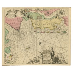
Rare Sea Chart of the East Frisian Islands or Watten and the North Sea, c.1700
Located in Langweer, NL
Description: Antique map titled 'Paskaarte van de rievier de Elve streckende van Oldenbroek tot Hamburgh.'
Rare and interesting chart of the East Frisian Islands (or Watten) and ...
Category
Early 1700s Antique Maps
Materials
Paper
$1,773 Sale Price
20% Off
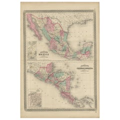
Antique Map of Mexico and Central America by Johnson '1872'
Located in Langweer, NL
Antique map titled 'Johnson's Mexico (..)'. Two maps one one sheet showing Mexico and Central America, with inset maps of Tehuantepec and Panama. This map originates from 'Johnson's ...
Category
Late 19th Century Antique Maps
Materials
Paper
$287 Sale Price
20% Off
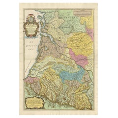
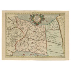
Large 1695 Hand-Colored Engraved Map of Gascony (Gascogna), France
Located in Langweer, NL
This map, created by Giacomo Cantelli da Vignola in 1695, represents the "General Government of Guyenne and Gascony" in southwest France. Cantelli da Vignola was a renowned Italian c...
Category
1690s Antique Maps
Materials
Paper
$2,156 Sale Price
20% Off
The Travel Sale: Natural History and Maps. November 2001: Sotheby's London
By Sotheby's
Located in valatie, NY
The Travel Sale: Natural History and Maps. November 2001: Sotheby's London. 1st Ed softcover. Lots 1-16; New Zealand 17-22; China Trade and Far East Asia 23-51; India 52-74; Africa 7...
Category
21st Century and Contemporary English Maps
Materials
Paper
Mercator's Ptolemaic Map of Ancient Assyria, Media, and Persia
Located in Langweer, NL
This map, "Asiae I Tab:", features the region corresponding to modern-day Iran and Iraq, intricately depicted in Gerard Mercator's edition of Claudius Ptolemy's "Tabulae Geographicae...
Category
16th Century Antique Maps
Materials
Paper
$1,092 Sale Price
20% Off
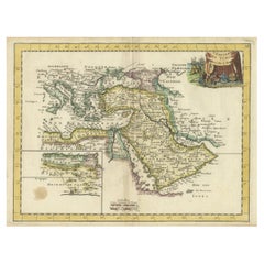
Orginal Antique Handcolored Map of the Turkish Empire, 1748
Located in Langweer, NL
Antique map titled 'L'Empire des Turcs'. Old map of the Turkish Empire with an inset of the North African regions. Originates from 'Atlas Nouveau Portatif' by G.L. le Rouge.
Artis...
Category
18th Century Antique Maps
Materials
Paper
$342 Sale Price
35% Off
Rare Hand-Colored Antique Map of Asia, 1788
Located in Langweer, NL
Antique map titled 'Kaartje van Asia'.
Original antique map of Asia. This map originates from 'Nieuwe Natuur- Geschied- en Handelkundige Zak- en Reisatlas' by N.T. Gravius, 1788....
Category
1780s Antique Maps
Materials
Paper
$594 Sale Price
20% Off
Levant in Antiquity: Lands of Phoenicia, Judea, and Neighboring Kingdoms, 1880
Located in Langweer, NL
The map is titled "PHOENICE, COELESYRIA, IDUMAEA, JUDAEA MACCABAEORUM TEMPORE," which translates to "Phoenicia, Coele-Syria, Idumea, Judea at the Time of the Maccabees."
This origi...
Category
1880s Antique Maps
Materials
Paper
$354 Sale Price
20% Off
Antique Map of the Coast of Roussillon, France
Located in Langweer, NL
Antique map titled 'Coste de Roussillon depuis Port Vendres, jusqu'au golphe de Rozes'. Original map of the coast of Roussillon, France. This map originates from 'Le Petit Atlas Mari...
Category
Mid-18th Century Antique Maps
Materials
Paper
$325 Sale Price
20% Off
Huy (Huum) Cityscape 1574: Historical Copper Engraving by Braun & Hogenberg
Located in Langweer, NL
Title: Huum opp. condrusorum caput (...) Anno partae salutis 1574.
**Type:** Print (Colored Copper Engraving)
**Year:** Circa 1580
**Technique:** Colored Copper Engraving
**Medium:...
Category
16th Century Antique Maps
Materials
Paper
$613 Sale Price
20% Off
French Guiana and Cayenne: Mid-19th Century Map from France Pittoresque Series
Located in Langweer, NL
This map titled "Guyane" is part of the France Pittoresque series and provides a detailed view of French Guiana along with a plan of the city of Cayenne.
Features:
- The map showcases the broader region of French Guiana, indicating key rivers, settlements, and the coastline along the Atlantic Ocean.
- To the left, there's an inset labeled "Plan de la Ville de Cayenne", which shows the street layout, squares, and main buildings of the capital city, Cayenne. This inset provides a more detailed view of the urban area, highlighting its geometric grid layout near the coast.
- The larger map outlines geographical features such as rivers (e.g., Oyapock and Maroni), forests, and territories in the surrounding area, including the neighboring Brazilian Empire...
Category
1850s Antique Maps
Materials
Paper
$115 Sale Price
20% Off
Original Engraving of the West Indies, Gulf of Mexico, Antilles, Caribbean, 1780
Located in Langweer, NL
Rigobert Bonne and G. Raynal's 1780 map of the West Indies, Gulf of Mexico, Antilles, and the Caribbean stands as a remarkable cartographic piece, offering a detailed and expansive v...
Category
Late 18th Century Antique Maps
Materials
Paper
$373 Sale Price
20% Off
Antique Map of North Africa by Ortelius, c.1600
Located in Langweer, NL
Antique map titled 'Barbariae et Biledulgerid nova descriptio'.
Old map of coastal North Africa and the Mediterranean. The map extends from Morocco and the Sahara to Libya and sh...
Category
17th Century Antique Maps
Materials
Paper
$359 Sale Price
20% Off
Copper Engraving of Kamchadal Women from Kamchatka, Russia, 1770
Located in Langweer, NL
Description: Antique print titled 'Habillemens des Femmes du Kamtchatka'. Copper engraving of Kamchadal women. This print originates from volume 19 of 'Histoire generale des voyages (..)' by Antoine Francois Prevost d'Exile.
Artists and Engravers: Published by Panckoucke.
The Kamchadals inhabit Kamchatka, Russia. The name "Kamchadal" was applied to the descendants of the local Siberians and aboriginal peoples (the Itelmens, Ainu, Koryaks and Chuvans) who assimilated with the Russians. The descendants of the mixed-blood Russian settlers in 18th-19th century are called Kamchadals these days. The Kamchadals speak Russian with a touch of local dialects of the aboriginal languages of Kamchatka. The Kamchadals engage in fur trading...
Category
1770s Antique Maps
Materials
Paper
$325 Sale Price
20% Off
Newfoundland and St. Pierre & Miquelon: Uncoloured French Map of circa 1820
Located in Langweer, NL
The map is titled "Île et Banc de Terre-Neuve avec les Îles St. Pierre et Miquelon", depicting Newfoundland and the French islands of St. Pierre and Miquelon. It is from the Petit Atlas National series.
Features:
- The map is divided into two sections:
1. The left side shows Newfoundland (Terre-Neuve) and its surrounding waters, including important locations such as the Île du Cap Breton and Grand Bank fishing areas.
2. The right side focuses on St. Pierre and Miquelon, a French overseas territory near Newfoundland.
- Administrative divisions and key geographic features, such as capes, bays, and towns, are labeled on the map.
Historical Context:
- This map is part of a collection meant to showcase France's overseas colonies and territories, including the small but significant St. Pierre and Miquelon, which has been under French control for centuries and was a critical fishing and trading hub.
- The Petit Atlas National series was typically published in the early 19th century, and this map likely dates from the same period, around 1815–1820.
Here the text transalated:
Here is the translation of the text from French to English:
---
**NOTICE.**
The islands of St. Pierre and Miquelon, the only remaining French possession in this part of America since the loss of Canada, are located a few miles from the southern coast of Newfoundland, which belongs to the English. Their relatively fertile soil is broken up by hills that give rise to small streams.
**Grande Miquelon**, the northernmost of the two islands, has a circumference of about 9 to 10 leagues. It offers a convenient port for fishing boats.
**Petite Miquelon**, to the south of Grande Miquelon, has a circumference of about 6 leagues. It is well-watered and well-wooded.
**Saint Pierre**, to the south-southwest of the two other islands, presents a somewhat similar appearance but is devoid of trees. Although it is the smallest of the three islands, it is the most important due to the size of its harbor, which can accommodate 30 to 40 ships of various sizes, and because of its favorable coastline for the preparation, preservation, and export of cod. On its eastern coast, at the bottom of a beautiful bay, lies the town of Saint Pierre, the only notable settlement on the three islands. It is the residence of a naval officer who, under the title of Commander, governs the colony.
The permanent population is about 2,000 souls, of which 800 reside in Saint Pierre. However, sailors come to the islands from the coasts of Brittany and Normandy during the cod fishing season on the Grand Banks of Newfoundland and the Gulf of St. Lawrence. In 1833, it was estimated that about 14,000 sailors were employed in this fishery, and the purchase of supplies required by the colony was valued at over one million francs.
---
This translation reflects the original notice describing the French islands of St. Pierre and Miquelon, with details about their geography, population, and economic activities related to the fishing industry.
People searching for maps or information about Newfoundland and the French islands of St. Pierre and Miquelon use the following keywords:
1. Newfoundland map...
Category
1820s Antique Maps
Materials
Paper
$153 Sale Price
20% Off
Antique Map of Austria-Hungary by Levasseur, '1875'
Located in Langweer, NL
Antique map titled 'Carte générale de la Monarchie Austro-Hongroise (..)'. Large map of Austria-Hungary. This map originates from 'Atlas de Géographie M...
Category
Late 19th Century Antique Maps
Materials
Paper
$311 Sale Price
35% Off
Newfoundland and St. Pierre & Miquelon: Early 19th Century French Map
Located in Langweer, NL
The map is titled "Île et Banc de Terre-Neuve avec les Îles St. Pierre et Miquelon", depicting Newfoundland and the French islands of St. Pierre and Miquelon. It is from the Petit Atlas National series.
Features:
- The map is divided into two sections:
1. The left side shows Newfoundland (Terre-Neuve) and its surrounding waters, including important locations such as the Île du Cap Breton and Grand Bank fishing areas.
2. The right side focuses on St. Pierre and Miquelon, a French overseas territory near Newfoundland.
- Hand-colored outlines mark the territories, with color distinctions for the different islands.
- Administrative divisions and key geographic features, such as capes, bays, and towns, are labeled on the map.
Here the text translated:
Here is the translation of the text from French to English:
**NOTICE.**
The islands of St. Pierre and Miquelon, the only remaining French possession in this part of America since the loss of Canada, are located a few miles from the southern coast of Newfoundland, which belongs to the English. Their relatively fertile soil is broken up by hills that give rise to small streams.
**Grande Miquelon**, the northernmost of the two islands, has a circumference of about 9 to 10 leagues. It offers a convenient port for fishing boats.
**Petite Miquelon**, to the south of Grande Miquelon, has a circumference of about 6 leagues. It is well-watered and well-wooded.
**Saint Pierre**, to the south-southwest of the two other islands, presents a somewhat similar appearance but is devoid of trees. Although it is the smallest of the three islands, it is the most important due to the size of its harbor, which can accommodate 30 to 40 ships of various sizes, and because of its favorable coastline for the preparation, preservation, and export of cod. On its eastern coast, at the bottom of a beautiful bay, lies the town of Saint Pierre, the only notable settlement on the three islands. It is the residence of a naval officer who, under the title of Commander, governs the colony.
The permanent population is about 2,000 souls, of which 800 reside in Saint Pierre. However, sailors come to the islands from the coasts of Brittany and Normandy during the cod fishing season on the Grand Banks of Newfoundland and the Gulf of St. Lawrence. In 1833, it was estimated that about 14,000 sailors were employed in this fishery, and the purchase of supplies required by the colony was valued at over one million francs.
---
This translation reflects the original notice describing the French islands of St. Pierre and Miquelon, with details about their geography, population, and economic activities related to the fishing industry.
Historical Context:
- This map is part of a collection meant to showcase France's overseas colonies and territories, including the small but significant St. Pierre and Miquelon, which has been under French control for centuries and was a critical fishing and trading hub.
- The Petit Atlas National series was typically published in the early 19th century, and this map likely dates from the same period, around 1815–1820.
People searching for maps or information about Newfoundland and the French islands of St. Pierre and Miquelon use the following keywords:
1. Newfoundland map...
Category
1820s Antique Maps
Materials
Paper
$153 Sale Price
20% Off
Guadeloupe and Dependencies: 19th Century French Map and Inset of Pointe-à-Pitre
Located in Langweer, NL
This map titled "La Guadeloupe et ses Dépendances" (Guadeloupe and its Dependencies) is from a Petit Atlas National series, focusing on the French Caribbean islands of Guadeloupe, Ma...
Category
1820s Antique Maps
Materials
Paper
$134 Sale Price
20% Off
Antique County Map, Oxfordshire, English, Framed Cartography Interest, Victorian
Located in Hele, Devon, GB
This is an antique lithography map of Oxfordshire. An English, framed atlas engraving of cartographic interest, dating to the mid 19th century and later.
Superb lithography of Oxfo...
Category
Mid-19th Century British Mid-Century Modern Antique Maps
Materials
Wood
Antique Map of the Antilles in the Caribbean, '1875'
Located in Langweer, NL
Antique map titled 'Carte des Iles Antilles'. Large map of the Antilles. This map originates from 'Atlas de Géographie Moderne Physique et Politique' by A. Levasseur. Published, 1875.
Category
Late 19th Century Antique Maps
Materials
Paper
$359 Sale Price
40% Off
Decorative Antique Map of Cyprus and Asia Minor by Christoph Weigel, Circa 1720
Located in Langweer, NL
Title: Asiae Peninsula sive Asia Intra Taurum by Christoph Weigel, Circa 1720 – Decorative Antique Map of Cyprus and Asia Minor
Description: Thi...
Category
1720s Antique Maps
Materials
Paper
$632 Sale Price
20% Off
A General View of Jerusalem in the Early Part of the 18th Century" (circa 1752)
Located in Langweer, NL
The print is signed by the artist "S. Mynde sc." in the lower right corner. This suggests that the maker of the print is Samuel Mynde, a known engraver from the 18th century. His wor...
Category
1750s Antique Maps
Materials
Paper
$421 Sale Price
20% Off
Antique Map of Persia with Dedication Cartouche
Located in Langweer, NL
Antique map titled 'Persia sive Sophorum Regnum'. Original old map of Persia. The map extends from the Eastern Mediteranian to Tacalistan and the Indus River and the Dalanguer Mounta...
Category
Mid-17th Century Antique Maps
Materials
Paper
$1,341 Sale Price
20% Off
Map Holy Land La Terre Sainte Engraved van Loon Published N de Fer 1703 French
Located in BUNGAY, SUFFOLK
La Terre Sainte, The Holy Land, Tiree Des Memoires De M.De.La Rue. Par N. de Fer. Geographe de Sa Majeste Catoliq et de Monseigneur le Dauphin. Avec Privil du Roi 1703
Detailed map of the Holy Land from Nicholas de Fer's L'Atlas Curieux ou le Monde. East is oriented at the top.
MAKER Nicolas de Fer 1646-1720
The French cartographer and engraver, Nicolas de Fer, was a master at creating maps that were works of art. The maps that he published were printed during the Baroque period when the decorative arts were characterized by ornate detail. De Fer’s detailed maps and atlases were valued more for their decorative content than their geographical accuracy.
Nicolas de Fer was born in 1646. His father, Antoine de Fer, owned a mapmaking firm. At the age of twelve, Nicolas was apprenticed to a Parisian engraver named Louis Spirinx. The family business was starting to decline when his father died in 1673. Nicolas de Fer’s mother, Genevieve, took over the business after the death of her husband. In 1687 the business was passed on to Nicolas and the profits increased after he took over the firm. Nicolas de Fer was a prolific cartographer who produced atlases and hundreds of single maps. He eventually became the official geographer to King Louis XIV of France and King Philip V...
Category
Early 1700s French Louis XIV Antique Maps
Materials
Paper
Map of Southern Spain Depicting Castile, Andalusia, Granada, Murcia and Valencia
Located in Langweer, NL
Antique map titled 'Partie Meridionale Des Etats de Castille (..)'. Decorative and highly detailed map of the southern part of Castile, Spain, including a decorative cartouche. Publi...
Category
Mid-18th Century Antique Maps
Materials
Paper
$632 Sale Price
20% Off
Duchy of Brunswick-Lüneburg, 1595: A Renaissance Cartographic Masterpiece
Located in Langweer, NL
Title: "Braunschweig and Lüneburg Duchies: Authentic Depiction by Abraham Ortelius"
This is an exquisite example of Abraham Ortelius’s cartographic craftsmanship: an original antiqu...
Category
16th Century Antique Maps
Materials
Paper
$335 Sale Price
20% Off
Antique Map of Austria- Hungary by Johnston '1909'
Located in Langweer, NL
Antique map titled 'Austria- Hungary'. Original antique map of Austria- Hungary. With inset maps of Vienna, Dalmatia and Herzegovina. This map o...
Category
Early 20th Century Maps
Materials
Paper
$239 Sale Price
20% Off
1663 Blaeu's Engraved Map of Frankfurt with Decorative Coats of Arms
Located in Langweer, NL
This map, titled "Novam Hanc Territorii Francofurtensis Tabulam," is an exquisite hand-colored engraved map from around 1663, created by the renowned cartographers J. and C. Blaeu of...
Category
1660s Antique Maps
Materials
Paper
$948 Sale Price
20% Off
Coast of Northumberland, England, Incl the Holy & Farne Islands, Etc, 1693
Located in Langweer, NL
Antique map titled 'Holy Island, Staples and Barwick.'
A map of the coast of Northumberland, England. This map includes Holy Island, Buckton, Sunderland and the Farne Islands. Th...
Category
1690s Antique Maps
Materials
Paper
$364 Sale Price
20% Off
World Map in Two Hemispheres: Eastern & Western - 1802 Tardieu Atlas
Located in Langweer, NL
Antique Map with Title: "Mappemonde en Deux Hémisphères"
Publication Details:
- **Atlas Title:** Nouvel Atlas Universel de Géographie Ancienne et Moderne
- **Purpose:** For the Nouvelle Edition de la Géographie de Guthrie
- **Mapmakers:** P. F. Tardieu, with contributions from various geographical works
- **Publisher:** Chez Hyacinthe Langlois, Libraire, quai des Augustins, n° 45
- **Year:** An X - 1802 (French Revolutionary Calendar)
**Geographical Scope:**
This antique map illustrates a double-hemisphere world map, showing both the Eastern (Old World) and Western (New World) hemispheres. It provides a global perspective, capturing the entire known world as understood in the early 19th century.
**Map Features:**
- **Hemispheres Displayed:**
- **Western Hemisphere:** The Americas, labeled as "Hémisphère Occidental ou Nouveau Monde...
Category
Early 1800s Antique Maps
Materials
Paper
$440 Sale Price
20% Off
Old Print Depicting Various Inhabitants of Tonga Tabu, ca.1836
Located in Langweer, NL
Antique print titled 'Tonga-Tabu'.
Old print depicting various inhabitants of Tonga Tabu. This print originates from 'Entdeckungs, Reise der Franzosischen Corvette Astrolabe Unternomen auf Befehl Konig Karls...
Category
1830s Antique Maps
Materials
Paper
$345 Sale Price
20% Off
Original Antique Engraving of Otoo, King of Tahiti, by Cook, 1803
By James Cook
Located in Langweer, NL
Antique print titled 'Otoo Koning van Otahiti'. Antique print depiciting Otoo, King of Tahiti. Originates from 'Reizen Rondom de Waereld door James Cook (..)'.
Artists and Engrave...
Category
19th Century Antique Maps
Materials
Paper
$230 Sale Price
20% Off
1579 Ornate Map of Burgundy County by Ferdinand de Lannoy
Located in Langweer, NL
1579 Ornate Map of Burgundy County by Ferdinand de Lannoy
Description of the Map:
This is a beautifully detailed map of the Burgundy region, titled "Bvrgvndiae Comitatus Recentiss....
Category
16th Century Antique Maps
Materials
Paper
$948 Sale Price
20% Off
Map of the Vietnamese Coast, Centered on Turon Harbor 'Da Nang Area', 1796
Located in Langweer, NL
Antique map titled 'A chart of part of the coast of Cochin-China including Turon Harbour and the Island Callao'.
Detailed map of the Vietnamese Coast, centered on Turon Harbor (D...
Category
1790s Antique Maps
Materials
Paper
$642 Sale Price
20% Off
Old Print of Anjer or Anyer, Coastal Town in Banten, West Java, Indonesia, 1844
Located in Langweer, NL
Antique print titled 'Anjer - Anjer'. View of Anyer (also known as Anjer or Angier), a coastal town in Banten, formerly West Java, Indonesia. This print originates from 'Gezigten uit...
Category
1840s Antique Maps
Materials
Paper
$431 Sale Price
20% Off
Antique Map of Greece and Its Colonies, with Frame Style Border
Located in Langweer, NL
Antique map titled 'La Grèce'. Attractive map of Greece and its Colonies. The map covers from the southern part of Italy, including Sicily, to the western parts of Asia Minor and fro...
Category
Mid-19th Century Antique Maps
Materials
Paper
$162 Sale Price
20% Off
Striking Antique View of Kozhikode, also known as Calicut, in Kerala, India
Located in Langweer, NL
Antique print titled 'Calechut'. Wonderful, miniature copper engraving depicting Arion riding on a very cheerful looking sea monster in the important tradi...
Category
Mid-17th Century Antique Maps
Materials
Paper
$421 Sale Price
20% Off
Antique Map of Persia and Afghanistan by Johnston '1909'
Located in Langweer, NL
Antique map titled 'Persia and Afghanistan'. Original antique map of Persia and Afghanistan. This map originates from the ‘Royal Atlas o...
Category
Early 20th Century Maps
Materials
Paper
$239 Sale Price
20% Off
Map of French Guiana, Suriname and Cayenne: Plan from Petit Atlas National, 1820
Located in Langweer, NL
This map, titled "Guyane" (French Guiana), is part of the Petit Atlas National series, focusing on French colonies. Here are the key elements of the map and its context:
Features:
-...
Category
1820s Antique Maps
Materials
Paper
$153 Sale Price
20% Off
Asia Minor and Provinces: A Roman Empire Map from Spruner-Menke Atlas, 1880
Located in Langweer, NL
This authentic map of the 19th century, titled "PONTUS ET BITHYNIA, ASIA, LYCIA ET PAMPHYLIA, GALATIA, CAPPADOCIA, SYRIA, CRET, CYPRVS," details the regions of Asia Minor and surrounding territories during the Roman Empire.
The map is interesting for a number of reasons:
1. **Comprehensive Detail**: It covers a wide range of regions that played significant roles in ancient history, from the cultural crossroads of Asia Minor to the strategic island of Cyprus.
2. **Geographical Information**: It includes detailed topographical features such as mountain ranges, river systems, and coastlines, illustrating the complex geography that influenced ancient political and military strategies.
3. **Historical Context**: The map reflects the Roman administrative organization of these provinces, which were critical for trade, military campaigns, and cultural exchange within the empire.
4. **Inset Maps**: The presence of inset maps for Lycia, Ionia, and Asia Minor provides focused details on regions that had substantial historical significance due to their cultural heritage and geopolitical importance.
5. **Latin Labels**: The use of Latin in the map’s labels and descriptions adds to the historical authenticity and would have served as a scholarly reference for 19th-century academics.
6. **Ancient Civilizations**: This area was the cradle of numerous ancient civilizations and the map likely includes cities of ancient Greek...
Category
1880s Antique Maps
Materials
Paper
$354 Sale Price
20% Off
Original Antique Map of the Island of Dominica in the West Indies, 1794
Located in Langweer, NL
MAP OF THE ISLAND OF DOMINICA for the History of the West Indies, by Bryan Edwards. Esq.
Dominica, an island renowned for its lucrative exports of sugar, cocoa, and coffee, operated...
Category
1790s Antique Maps
Materials
Paper
$230 Sale Price
20% Off
Original Antique Map of Friesland in Decorative Hand-Colouring, 1600
Located in Langweer, NL
Antique map titled 'Frisiae antiquissima trans rhenu provinc et adiacentium regionum nova et exacta descriptio'. Original antique map of the province of Friesland, the Netherlands. T...
Category
17th Century Antique Maps
Materials
Paper
$594 Sale Price
20% Off
Antique Map of Turkey, Persia and Afghanistan, 1842
Located in Langweer, NL
Antique map titled 'Carte de la Turquie d'Asia, de la Perse, de l'Afghanistan'. Map of Turkey, Persia and Afghanistan. This map originates from 'Atlas universel de géographie ancienn...
Category
19th Century Antique Maps
Materials
Paper
$364 Sale Price
20% Off
Old Map of Ancient Spain and Portugal – Hispania Antiqua Featuring Roman Cities
Located in Langweer, NL
Title: "Hispania Antiqua in Tres Praecipuas Partes Divisa: Tarraconensem, Lusitaniam, et Bæticam" by Robert de Vaugondy, 18th Century
Description:
This beautifully detailed map titl...
Category
Late 18th Century Antique Maps
Materials
Paper
$632 Sale Price
20% Off
Antique Map of Cyprus (Cypern) from Meyer's Lexikon, Leipzig, circa 1890
Located in Langweer, NL
Antique Map of Cyprus (Cypern) from Meyer's Lexikon, Leipzig, circa 1890
This finely detailed antique map titled "Cypern" presents the island of Cyprus as it appeared in the late 19...
Category
1890s Antique Maps
Materials
Paper
Large Antique County Map of Derbyshire, England
Located in Langweer, NL
Antique map titled 'A Map of Derbyshire from the best Authorities'. Original old county map of Derbyshire, England. Engraved by John Cary. Originates from 'New British Atlas' by John...
Category
Early 19th Century Antique Maps
Materials
Paper
$268 Sale Price
20% Off
Maritime and Terrestrial Survey of Spanish Santander in 1901, An Original Map
Located in Langweer, NL
This antique map is a historical map of the province of Santander (currently known as Cantabria) from the year 1901. Santander is located along the northern coast of Spain, bordering...
Category
Early 1900s Antique Maps
Materials
Paper
$277 Sale Price
20% Off
Map of Ancient Gaul & Roman Provinces: Early 19th Century - 1802 Tardieu Atlas
Located in Langweer, NL
### Antique Map Description
**Title:** La Gaule et Ses Grandes Dignités Romaines au Temps des Empereurs
**Publication Details:**
- **Atlas Title:** Nouvel Atlas Universel de Géogra...
Category
Early 1800s Antique Maps
Materials
Paper
Map of the British Isles with Historical Kings, 1719
Located in Langweer, NL
This antique map, titled "Les Royaumes d'Angleterre d'Escosse et d'Irlande," offers a detailed view of the British Isles, including England, Wales, Scotland, and Ireland. Additionall...
Category
Early 18th Century Antique Maps
Materials
Paper
$421 Sale Price
20% Off
Antique Map of the City of Visby 'Sweden' by F. Hogenberg, 1598
Located in Langweer, NL
This is a wonderful bird's-eye plan/view of the oldest city in Sweden.
Visby, the largest city on the island of Gotland was an important Viking city and the main centre of the Hanseatic League...
Category
16th Century Antique Maps
Materials
Paper
$2,348 Sale Price
20% Off
Antique Print of the Dutch Trading Post Deshima in Japan, circa 1738
Located in Langweer, NL
Antique print titled 'Isoletta Desima abittata Dagli Olandesi nel Giappone secondo la delineazione del Sigr. Voogt'. Bird's-eye view of Deshima (or Dejima) copied from a manuscript b...
Category
18th Century Antique Maps
Materials
Paper
Antique Print of Persian Decorative Art by Racinet, 1869
Located in Langweer, NL
Old print of Persian decorative art. This print originates from 'L'Ornement polychrome'. A beautiful work containing about 2000 patterns of all the styles of Art old and Asian, middl...
Category
19th Century Antique Maps
Materials
Paper
$134 Sale Price
20% Off
Old Map Depicting Turkey, Persia, Arab and Black Sea Etc, 1778
Located in Langweer, NL
Antique map titled 'Turquie d'Asie, Arabie, Perse, Tartarie Independante'.
Old map of Turkey in Asia. The map shows all of Turkey and the Black Sea, and extends east to include t...
Category
1770s Antique Maps
Materials
Paper
$517 Sale Price
20% Off
Original Antique Engraving of a Sea Chart of the Western Mediterranean, ca.1650
Located in Langweer, NL
Antique map titled 'Pascaerte van 't westlyckste deel vande Middelandsche-Zee (..)'.
Sea chart of the Western Mediterranean. The map extends from the Straits of Gibralter to Italy ...
Category
1650s Antique Maps
Materials
Paper
$1,198 Sale Price
20% Off
Beira Baixa: A Cartographic Portrait of Portugal's Historic Frontier in 1903
Located in Langweer, NL
The uploaded image is a historical map of the Beira Baixa region in Portugal. The map details the topography, including mountain ranges and river systems, as well as the transportati...
Category
Early 1900s Antique Maps
Materials
Paper
$277 Sale Price
20% Off
Original Antique Map of Abyssinia, Sudan and the Red Sea, 1749
Located in Langweer, NL
Antique map titled 'Nubie, Abissinie et Cote d'Ajan'.
Map of Abyssinia, Sudan and the Red Sea by Robert Vaugondy. Covers from Arabia and Egypt south to M...
Category
1740s Antique Maps
Materials
Paper
$325 Sale Price
20% Off
Antique Map of North America by Lowry '1852'
Located in Langweer, NL
Antique map titled 'North America'. Original map of North America. This map originates from 'Lowry's Table Atlas constructed and engraved from the...
Category
Mid-19th Century Antique Maps
Materials
Paper
$143 Sale Price
20% Off
Large Antique County Map of Buckinghamshire, England
Located in Langweer, NL
Antique map titled 'A Map of Buckinghamshire from the best Authorities'. Original old county map of Buckinghamshire, England. Engraved by John Cary. Originates from 'New British Atla...
Category
Early 19th Century Antique Maps
Materials
Paper
$277 Sale Price
20% Off
Political Map of Europe: Early 19th Century, from the 1802 Tardieu Atlas
Located in Langweer, NL
Antique Map Description
Title: Carte Générale et Politique de l'Europe
Publication Details:
- **Atlas Title:** Nouvel Atlas Universel de Géographie Ancienne et Moderne
- **Purpose...
Category
Early 1800s Antique Maps
Materials
Paper
$460 Sale Price
20% Off
1907 Chart of Nantucket Harbor by George Eldridge
Located in Norwell, MA
Chart of Nantucket Harbor from 1907 by cartographer George W. Eldridge. The chart shows the channel passing by the jetty into the harbor, by Brant Point to Steamboat Wharf. Also show...
Category
Early 1900s North American Antique Maps
Materials
Paper
Recently Viewed
View AllMore Ways To Browse
Antique Wellington Chests
Antonio Cassi Ramelli
Archimede Seguso Birds
Art Deco Coasters
Art Deco Footballer
Art Deco Music Cabinet
Art Deco Waterfall Bedroom Furniture
Art Deco Waterfall Bedroom
Art Deco Whisky
Art Foulard
Art Nouveau Sunflower
Arts And Crafts Silver Coffee Pot
Asian Pink Bowl
Avesn Vase
Baccarat Carafe
Bakelite Bird
Bakelite Cocktail Picks
Bamboo Ikebana Vase
