Maps
to
4,255
5,437
240
5,682
3
77
35
18
13
6
5
4
4
4
3
1
1
2,973
2,236
473
3
288
34
9
126
8
36
9
2
5
4
3
2
5,595
122
55
34
32
712
332
217
146
138
5,685
5,685
5,685
104
63
28
24
16
Maps For Sale
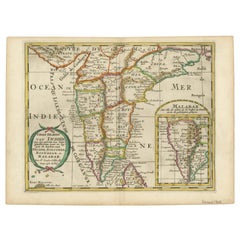
1705 Sanson Map of Southern India and Malabar with an Inset Map
Located in Langweer, NL
Title: 1705 Sanson Map of Southern India and Malabar with an Inset Map
Description: This finely engraved and beautifully hand-colored antique map, published in 1705, depicts south...
Category
Early 1700s Antique Maps
Materials
Paper
$738 Sale Price
20% Off
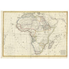
Antique Map of Africa by Bordiga Fratelli 'circa 1818'
Located in Langweer, NL
Antique map titled 'Carta dell Africa'. Large and quite scarce Italian map of Africa, reflecting the then-current knowledge of the continent's geography, with large areas left comple...
Category
Early 19th Century Antique Maps
Materials
Paper
$1,725 Sale Price
20% Off
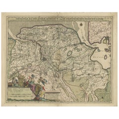
Antique Map of the Province Groningen in The Netherlands, c.1680
Located in Langweer, NL
Antique map titled 'Groningae et Omlandiae Dominium vulgo de Provincie van Stadt en Lande'.
Old map of the province of Groningen, the Netherlands. This map originates from 'Germani...
Category
17th Century Antique Maps
Materials
Paper
$469 Sale Price
20% Off
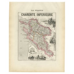
Map of Charente-Inférieure France with La Rochelle and Coastal Vineyards, c.1850
Located in Langweer, NL
Map of Charente-Inférieure France with La Rochelle and Coastal Vineyards, 19th c
Description:
This decorative 19th-century map of the former department of Charente-Inférieure, now k...
Category
Mid-19th Century French Antique Maps
Materials
Paper
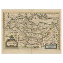
1640 Map of North Africa Nova Barbariae Descriptio or The Barbarian Coast
Located in Langweer, NL
1640 Antique Map of North Africa 'Nova Barbariae Descriptio' by Johannes Janssonius
This antique map titled Nova Barbariae Descriptio*, published by Johannes Janssonius around 1640,...
Category
1640s Antique Maps
Materials
Paper
$460 Sale Price
20% Off
West Coast of Africa, Guinea & Sierra Leone: An 18th Century Map by Bellin
Located in Alamo, CA
Jacques Bellin's copper-plate map entitled "Partie de la Coste de Guinee Dupuis la Riviere de Sierra Leona Jusquau Cap das Palmas", depicting the coast of Guinea and Sierra Leone in ...
Category
Mid-18th Century French Antique Maps
Materials
Paper
Antique Map of Italy, Showing Corsica, Sardinia, Croatia, Malta and More, C.1740
Located in Langweer, NL
Antique map titled 'Nieuwe Kaart van Italie na de Nieuwste waarnemingen van de l'Isle en andere.'
Attractive detailed map showing Italy as well as Corsica, Sardinia, Minorca, Croat...
Category
18th Century Antique Maps
Materials
Paper
Antique Map of Asia, Vignette of Benares 'Varanasi' Showing Ganges River, 1892
Located in Langweer, NL
Antique map titled 'Asie'. Color map of Asia. With decorative vignette of Benares (Varanasi) showing Ganges River. This map originates from 'Nouvel Atlas Illustre Geographie Universe...
Category
19th Century Antique Maps
Materials
Paper
$230 Sale Price
20% Off
1948 "A Hysterical Map of Yellowstone National Park" by Jolly Lindgren, 2nd Ed.
Located in Colorado Springs, CO
Presented is a second edition printing of Jolly Lindgren’s “Hysterical Map of Yellowstone National Park.” This comical pictorial map h...
Category
1940s American Vintage Maps
Materials
Paper
16-Inch Terrestrial Globe 1986 National Geographic
Located in Ottawa, Ontario
A 16-INCH TERRESTRIAL GLOBE 1986
NATIONAL GEOGRAPHIC
Large terrestrial globe with paper gores
on a stylish black lucite base
scale 1: 31,350,000
18" inches, (45.5cm.) high.
16" in...
Category
Late 20th Century American Modern Maps
Materials
Metal
Antique Map of North America, 1821
Located in Langweer, NL
Antique map of America titled 'Carte de l'Amerique septentrionale'. Scarce map of North America, shortly after the Louisiana Purchase and the first ...
Category
19th Century Antique Maps
Materials
Paper
$623 Sale Price
20% Off
Antique Map of Tracks of Anson's Ships around South America & Cape Horn, 1749
Located in Langweer, NL
Description: Antique map titled 'Kaart van het Zuidelykste Gedeelte van Zuider Amerika (..) - Carte de la Partie Meridionale de l'Amerique Meridionale (..)'.
Detailed chart tracking the route of Capt. George Anson's ship The Centurion in 1745. The chart shows the tracks of Anson's ships around South America & Cape Horn to the Juan Fernandes Islands, with notes on currents and positions.
In 1740 Capt. George Anson (1697-1762) of the Royal Navy, was given command of a squadron of ships. As England was at war with France and Spain, Anson's task was to intercept and capture a Spanish treasure...
Category
1740s Antique Maps
Materials
Paper
$623 Sale Price
20% Off
Antique Map of the Bildt Region by Schotanus, 1664
Located in Langweer, NL
Antique map titled 'De Grietenije van der Bildt (..)' Map of the Grietenij of Het Bildt, Friesland, The Netherlands. Multiple cartouches, key and coat of arms. Originates from ""Besc...
Category
17th Century Antique Maps
Materials
Paper
Madrid 1901: A Historical Map of Spain's Capital Province
Located in Langweer, NL
The map is of the province of Madrid, the capital region of Spain, as it appeared in 1901. Here are the key features it displays:
The map shows the central part of Spain, with the Guadarrama mountain range prominently visible, marking the natural border to the north of Madrid.
Blue lines likely indicate rivers, including the Manzanares River, which flows through Madrid, and the Jarama River, a tributary to the Tagus.
Red lines depict the roads and railways, outlining the infrastructure that connects Madrid's various towns and cities within the province and beyond.
Symbols and labels mark the locations of cities, towns, and villages, with Madrid itself likely being the focal point. Dotted lines may represent the administrative divisions within the province. The map includes a legend (Signos Convencionales) that explains the symbols used for provincial capitals, roads, railways, and other geographic features.
The coat of arms of Madrid, featuring a bear and a strawberry tree (madroño), is prominently featured, symbolizing the city's and the province's historical coat of arms.
About the province of Madrid:
Madrid is not only the capital of Spain but also the heart of the Iberian Peninsula, both geographically and politically. The city is renowned for its rich repositories of European art, including the Prado Museum's works by Goya, Velázquez, and other Spanish masters. The province of Madrid is characterized by a blend of historical and modern elements, with a rich cultural life that includes theater, opera, and flamenco, as well as gastronomy that features a mix of traditional Spanish dishes and international cuisine...
Category
Early 1900s Antique Maps
Materials
Paper
$661 Sale Price
20% Off
Map of the Hawaiian Islands with a Large Inset of Karakakooa Bay, 1803
Located in Langweer, NL
Antique map titled 'Kaart van de Sandwich Eilanden'.
Map of the Hawaiian Islands with a large inset of Karakakooa Bay, including soundings and anchorages. Originates from 'Reizen R...
Category
Early 1800s Antique Maps
Materials
Paper
$2,156 Sale Price
20% Off
Large 1750 Map of the Kingdoms of Spain and Portugal by Robert de Vaugondy
Located in Langweer, NL
1750 Map of the Kingdoms of Spain and Portugal by Robert de Vaugondy
Description:
This map, titled *"Royaumes d'Espagne et de Portugal,"* was created in 1750 by the esteemed French ...
Category
Mid-18th Century Antique Maps
Materials
Paper
$623 Sale Price
20% Off
1616 Petrus Bertius Miniature Map of Cambay (Gujarat, India)
Located in Langweer, NL
Title: 1616 Petrus Bertius Map of Cambay and Gujarat, India
Description: This early seventeenth-century map, titled Descriptio Cambaiæ, was published in 1616 by Petrus Bertius, a ...
Category
1610s Antique Maps
Materials
Paper
Map of Polynesia Highlighting Cultural Landscapes and Maritime Activities, 1851
Located in Langweer, NL
John Tallis & Company was a London-based map publisher that flourished during the 19th century. Their maps, characterized by elaborate borders and decorative vignettes, are some of t...
Category
1850s Antique Maps
Materials
Paper
$277 Sale Price
20% Off
Antique Map of Zeeland 'The Netherlands' by N. Visscher, circa 1690
Located in Langweer, NL
Antique map titled 'Comitatus Zelandiae (..)'. Detailed chart of the province Zeeland, The Netherlands, with details shown pictorially. Published by N. Visscher.
Category
Late 17th Century Antique Maps
Materials
Paper
$632 Sale Price
20% Off
Nautical Chart of Cape Verde Islands by J.W. Norie, 1824 Coastal Map
Located in Langweer, NL
Nautical Chart of Cape Verde Islands by J.W. Norie, 1824 Coastal Map
This beautifully engraved nautical chart, titled “A New Chart of the Cape Verde Islands,” was drawn by J.W. Nori...
Category
Early 19th Century English Antique Maps
Materials
Paper
Detailed 1795 Map of the Americas with Exploration Tracks and Nice Cartouche
Located in Langweer, NL
This is a very handsome and rare 1795 map of the Americas titled "Amerique ou Nouveau Continent Dressee sur les Nouvelles Relations Decouvertes et Observations" by Jean Baptiste Noli...
Category
1790s Antique Maps
Materials
Paper
$2,242 Sale Price
20% Off
Rare Antique Map of the Americas with Island California by Danckerts, c.1680
Located in Langweer, NL
Rare Antique Map of the Americas with Island California by Justus Danckerts, ca. 1696
This exceptional antique map titled Novissima et Accuratissima Totius Americae Descriptio per I...
Category
Late 17th Century Dutch Antique Maps
Materials
Paper
Rare 1864 Civil War Era Map of Illinois with Lake Michigan Detail
Located in Langweer, NL
Title: Rare 1864 Civil War Era Map of Illinois with Lake Michigan Detail
Description: This intricately detailed antique map, titled "Johnson's Illinois," was published in 1864 by Jo...
Category
1860s Antique Maps
Materials
Paper
Historical Map of Greece and the Eastern Mediterranean by Delisle - 1780
Located in Langweer, NL
Historical Map of Greece and the Eastern Mediterranean by Guillaume Delisle - 1780 Reissue
This captivating map titled "Carte de la Grèce" was originally crafted by the eminent Fr...
Category
1780s Antique Maps
Materials
Paper
$277 Sale Price
20% Off
Palermo – 1620 Braun & Hogenberg Bird’s-Eye Map of Palermo, Sicily
Located in Langweer, NL
Palermo – 1620 Braun & Hogenberg Bird’s-Eye Map of Palermo, Sicily
This beautifully detailed bird’s-eye view of Palermo, Sicily, was created by Georg Braun and Frans Hogenberg aro...
Category
1620s Antique Maps
Materials
Paper
France Map 1757 – Southern Provinces by Isaak Tirion in Dutch Engraving
Located in Langweer, NL
France Map 1757 – Southern Provinces by Isaak Tirion in Dutch Engraving
This original copperplate engraving published in 1757 by Isaak Tirion in Amsterdam presents a highly detailed...
Category
Mid-18th Century Dutch Antique Maps
Materials
Paper
Antique Map of Tartary, Also Showing the Great Wall of China
Located in Langweer, NL
Antique map titled 'Carte de Tartarie'. Detailed map of Tartary, consisting of the Eastern part of Russia, Central Asia, China and Korea, first published by Guillaume De L'Isle in 1706. The map extends from the Peninsula of Korea in the east to the Caspian and Black Seas. The Great Wall of China...
Category
Early 18th Century Antique Maps
Materials
Paper
$1,054 Sale Price
20% Off
Old Map of the Balkans Incl Greece, Turkey, Serbia, Montenegro, Bulgaria, C.1900
Located in Langweer, NL
Antique map titled 'Carte de la presqu-île du Balcan - Karte der Balkan Halbinsel'.
Original antique map of the Balkans including Greece, Turkey, Serbia, Montenegro, Bulgaria and...
Category
Early 1900s Antique Maps
Materials
Paper
$623 Sale Price
20% Off
1645 Blaeu Map of Westmorland, Northern England – Hand Colored, Decorative
Located in Langweer, NL
This map, "Westmoria Comitatus; Anglice Westmorland", was created by the esteemed Dutch cartographer Willem Blaeu and was published around 1645 in 'Le Theatre du Monde ou Nouvel Atlas'. It provides a detailed look at Westmorland, a historic county in northern England, based on John Speed’s earlier map. The map features numerous place names, parks, and estates, including Brigster Park, Colnhead Park, Crosbye, and Midleton, along with a detailed depiction of Windermere (spelled Wynandermere) and the surrounding regions.
Additional Features:
- Hand-colored map, with vibrant and detailed colors that bring out the topographical and decorative features.
- Includes intricate cartouches, such as the royal coat of arms, a decorative title cartouche topped with putti (cherubic figures), and six coats of arms (two left blank).
- Depicts the region’s rich landscape, including the rolling hills and mountainous terrain of northern England.
- French text on the verso, indicative of the publication period from 1645-1648, part of Blaeu’s highly sought-after atlases.
- Map shows precise details of small towns, estates, and parks, such as Brigster Park, Colnhead Park, Crosbye, and Wynandermere (now Windermere Lake).
This map would be of particular interest to collectors of English county maps, antique maps of northern England, 17th-century cartography, and the decorative works of Willem Blaeu. Blaeu's maps are renowned for their accuracy, artistic beauty, and historical significance.
Keywords: Willem Blaeu, Westmorland map, northern England, 17th-century map, antique map, English county map, John Speed, Windermere, decorative cartography, hand-colored map, rare map, antique cartography...
Category
1640s Antique Maps
Materials
Paper
$1,198 Sale Price
20% Off
Original Antique Map of Canaan, Armenia, Syria, Mesopotamia and Arabia, 1709
Located in Langweer, NL
Antique map titled 'Descriptio Paradisi et Terrae Canaan'.
Original antique map of Canaan, Armenia, Syria, Mesopotamia and Arabia. It displays the Middle East from the eastern Mediterranean Sea to the Persian Gulf...
Category
Early 1700s Antique Maps
Materials
Paper
$647 Sale Price
20% Off
Small Antique Map of the European Turkey, Greece & Ionian Islands – c.1860
Located in Langweer, NL
Antique Map of the European Turkey, Greece & Ionian Islands – Stieler, c.1860
Original antique map titled *Die Europaeische Türkei, Griechenland und die ...
Category
1860s Antique Maps
Materials
Paper
$115 Sale Price
20% Off
Old Map of Guyana, Suriname and French Guiana with Paramaribo and Cayenne, c1760
Located in Langweer, NL
Description: Antique map titled 'Carte de la Guiane.'
Antique map of the Guianas - present day Guyana, Suriname and French Guiana, including Paramaribo and Cayenne. Source unknown, to be determined.
Artists and Engravers: Made by 'Jacques-Nicholas Bellin...
Category
1760s Antique Maps
Materials
Paper
$431 Sale Price
20% Off
1850-1960 Cram's Superior Latest Federal Census Texas Map
By G. F. Cram Company
Located in New York, NY
The 1850-1960 Cram's Superior Latest Federal Census Texas Map, crafted from pine wood, steel, and canvas, is a valuable historical cartographic piece. Publi...
Category
1910s American Vintage Maps
Materials
Canvas
1750 Map of the Holy Land: The Land of Canaan and the Twelve Tribes
Located in Langweer, NL
Carte de la Terre de Canaan ou Terre Promise
Cartographer: Le St. Robert
Date of Publication: 1750
This exquisite 18th-century map, 'Carte de la Terre de Canaan ou Terre Promise', w...
Category
1750s Antique Maps
Materials
Paper
Original Antique Map of the Western Part of NEW MEXICO & CALIFORNIA
Located in Langweer, NL
Title: "Map of the Western Part of NEW MEXICO and CALIFORNIA According to the Latest Discoveries by the Jesuits and Others"
Description:
This exquisite original Dutch map, titled "...
Category
1760s Antique Maps
Materials
Paper
$1,246 Sale Price
20% Off
Original Antique Print of Two Women and a Man from Bolivia, South America, 1843
Located in Langweer, NL
Antique print titled 'Bolivia'.
Original antique print of two women and a man from Bolivia. This print originates from a work by Captain Gabriel-Pierre Lafond and illustrates peo...
Category
1840s Antique Maps
Materials
Paper
$210 Sale Price
20% Off
Old Map of Gloucestershire by Samuel Lewis 1844 – Gloucester, Cheltenham, Bristo
Located in Langweer, NL
Title: Old Map of Gloucestershire by Samuel Lewis 1844 – Gloucester Cheltenham Bristol Cirencester Tewkesbury
Description:
This antique 1844 map of Gloucestershire was engraved for Samuel Lewis’ Topographical Dictionary of England. It includes major towns such as Gloucester, Cheltenham, Bristol, Cirencester, and Tewkesbury. Roads, rivers, and topographical details are finely engraved, with hand-colored borders marking the county boundaries. The map also shows neighboring counties including Herefordshire, Somerset, Wiltshire, and Oxfordshire. A decorative compass rose completes the elegant composition.
Condition:
The map is in good condition with slight age toning and wide clean margins. The engraved lines remain sharp and the original hand coloring is well preserved. Folding line as issued. No tears or stains are visible.
Framing suggestions:
Use an acid-free mat in ivory or light beige to complement the map’s aged tone. A dark wood, black, or antique gold frame will enhance the historic style. UV-protective glass is recommended for long-term preservation. Ideal for display in a home library, study, or office with a classic interior.
Keywords:
Gloucestershire map 1844 Samuel Lewis antique...
Category
1840s Antique Maps
Materials
Paper
$182 Sale Price
20% Off
Rare 1864 Civil War Era Map of North America with Detailed Borders
Located in Langweer, NL
Title: Rare 1864 Civil War Era Map of North America with Detailed Borders
Description: This remarkable antique map, titled "Johnson's North America," was published in 1864 by Johnso...
Category
1860s Antique Maps
Materials
Paper
Framed 1838 Mexico & Gulf of Mexico Map
Located in Stamford, CT
Framed 1838 Mexico & Gulf of Mexico map. Printed by Fisher, Son & Co. of London in 1838. As found framed condition. Map has not been examined outside of th...
Category
1830s English American Classical Antique Maps
Materials
Glass, Wood, Paper
Antique Map of Part of the United States Including Lower California & Arizona
Located in Langweer, NL
Antique map of part of the United States of America including Lower California, Arizona and part of Mexico. This map was part of a set of six individual sheets with maps of the Unite...
Category
Late 19th Century Antique Maps
Materials
Paper
$421 Sale Price
20% Off
Antique Map of Cuba, Haiti and Porto Rico by W. G. Blackie, 1859
Located in Langweer, NL
Antique map titled 'The Leeward or North Caribbean Islands'. Original antique map of Cuba, Haiti and Porto Rico. This map originates from ‘The Imperial Atla...
Category
Mid-19th Century Antique Maps
Materials
Paper
$239 Sale Price
20% Off
Vintage Afghan Pictorial Map Rug
Located in New York, NY
A vintage Afghan Pictorial map rug from the mid-20th century.
Measures: 3' 0" x 4' 10"
Category
Mid-20th Century Afghan Folk Art Maps
Materials
Wool
$660 Sale Price
20% Off
Antique Map of The Nile, Egypt, Nubia and Abyssinia and Inset of Jerusalem, 1880
Located in Langweer, NL
Antique map titled 'Égypte Moderne'. Old map of Egypt, Nubia and Abyssinia (Ethiopia), Kordofan and Darfour (parts of Sudan), as well as part of Arabia. With decorative vignette of J...
Category
19th Century Antique Maps
Materials
Paper
Rare 1730 Roman Empire Map by Moll - Detailed and Engraved Masterpiece
Located in Langweer, NL
An Historical Map of the Roman Empire and the Neighbouring Barbarous Nations by Herman Moll - Circa 1730
This grand and historically significant map of the Roman Empire was create...
Category
1730s Antique Maps
Materials
Paper
$1,341 Sale Price
20% Off
Pl. 43 Antique Print of Decorative Art in the Middle Ages by Racinet, 1869
Located in Langweer, NL
Old print of decorative art in the Middle Ages. This print originates from 'L'Ornement polychrome'. A beautiful work containing about...
Category
19th Century Antique Maps
Materials
Paper
$69 Sale Price
20% Off
18th-Century Biblical Map of the Colonies of Ham: Africa, Middle East and Beyond
Located in Langweer, NL
This map, titled "A Map of the Colonies of the Descendants of Ham," dates to around 1790. It illustrates regions in Africa, the Middle East, and parts of Europe that were traditional...
Category
1790s Antique Maps
Materials
Paper
$268 Sale Price
20% Off
Antique Print of Decorative Art in the 16th and 17th Century, 1869
Located in Langweer, NL
Old print of decorative art in the 16th and 17th century. This print originates from 'L'Ornement polychrome'. A beautiful work containing about 2000 patterns of all the styles of Art...
Category
19th Century Antique Maps
Materials
Paper
$143 Sale Price
20% Off
Historic 1864 Civil War Era Map of Canada with Great Lakes Detail
Located in Langweer, NL
Title: Rare 1864 Civil War Era Map of Canada with Great Lakes Detail
Description: This finely detailed antique map, titled "Johnson's Canada," was published in 1864 by Johnson and W...
Category
1860s Antique Maps
Materials
Paper
Original Antique Map of the American State of Michigan ( Southern Part ), 1903
Located in St Annes, Lancashire
Antique map of Michigan ( Southern part )
Published By A & C Black. 1903
Original colour
Good condition
Unframed.
Free shipping
Category
Early 1900s English Antique Maps
Materials
Paper
Rare Unusual Antique Map of Asia with a Landbridge from Korea to America, 1717
Located in Langweer, NL
Antique map titled 'L'Asie Suivant les Nouvelles Decouvertes (..).' Interesting and very unusual map of the Asian continent.
The map is based primarily on Dutch sources, particular...
Category
18th Century Antique Maps
Materials
Paper
Map of The East Indies with the Route of Capt. William Dampier's Voyage, 1698
Located in Langweer, NL
Antique map titled 'Kaart van Oost Indie'.
Old map of the East Indies. It shows the routes of Captain William Dampier's voyage throughout the regio...
Category
1690s Antique Maps
Materials
Paper
$699 Sale Price
20% Off
Antique 1683 Map of Hispaniola and Puerto Rico in the Caribbean by Mallet
Located in Langweer, NL
Title: 17th Century Map of Hispaniola and Puerto Rico by Mallet (1683)
This exquisite 17th-century map by Mallet, titled "I. d'Hispaniola et P.to Rico," showcases the islands of Hispaniola and Puerto Rico with remarkable detail. Published in Paris in 1683 as part of Mallet's monumental "Description de l'Univers," this map is a prime example of historical cartography from the era.
Map Features:
- Detailed depiction of Hispaniola and Puerto Rico
- Nearby islands: Inagua islands, Mayaguana, Île-à-Vache, Saona, and Mona
- Three illustrated naval battles surrounding the islands
- Hand-colored illustrations typical of the period
- Published in Paris, 1683, as part of the "Description de l'Univers"
- Engraved with artistic and geographic precision
Collectors and enthusiasts of antique maps will appreciate the historical significance and artistic detail of this rare print. Although small, the map is perfect for framing and this map serves as a captivating piece of history, reflecting the maritime exploration and territorial knowledge of the late 17th century.
The maker of the map is Allain Manesson Mallet, a notable 17th-century cartographer, military engineer, and author. Born in Paris in 1630, Mallet served in the French army and worked as a military engineer under Louis XIV. He later became a professor of mathematics and military architecture.
Mallet is best known for his monumental work, "Description de l'Univers," published in Paris in 1683. This extensive publication is considered one of the greatest works of its kind in the 17th century, providing detailed descriptions and maps of various parts of the world. Mallet's maps are renowned for their artistic quality, intricate details, and the inclusion of illustrative elements such as ships, sea creatures, and topographical features.
Mallet's contributions to cartography and his work in "Description de l'Univers" have left a lasting impact on the field, making his maps highly valued by collectors and historians.
Keywords:
- 17th-century map
- Mallet map 1683
- Hispaniola map
- Puerto Rico map
- Antique Caribbean map...
Category
1830s Antique Maps
Materials
Paper
$364 Sale Price
20% Off
Antique Map of Christmas Island by Cook, C.1781
Located in Langweer, NL
Antique map Kiribati titled 'Christmas Island (..)'. Antique map of Christmas Island, also known as Kiritimati. Originates from an edition of Cook's Voyages.
Artists and Engravers: Engraved by Duff.
Condition: Good, some wear and age-related toning. Please study image carefully.
Date: c.1781
Overall size: 27.5 x 21.5 cm.
Image size: 20.5 x 18 cm.
We sell original antique maps to collectors, historians, educators and interior decorators all over the world. Our collection includes a wide range of authentic antique maps...
Category
18th Century Antique Maps
Materials
Paper
$230 Sale Price
20% Off
European Vintage Earth Globe on Stand with Compass
Located in Sofia, BG
Vintage handmade world globe standing on a base with small compass in the bottom. The piece is in fare condition with no restaurations ever made.
France, circa 1950
Category
Mid-20th Century French Maps
Materials
Plastic, Paper
Antique Map of the British Isles with Contemporary Hand Coloring
Located in Langweer, NL
Antique map titled 'Les Isles Britanniques'. Original antique map of the British Isles, with original/contemporary hand coloring. Published by Crepe, circa 1767.
Category
Late 18th Century Antique Maps
Materials
Paper
$268 Sale Price
20% Off
German Globe by C. Abel-Klinger, Nuremberg, circa 1860
Located in Milano, IT
Terrestrial globe
Artistic company C. Abel - Klinger
Nuremberg, circa 1860
H cm 31 x 22 cm (12.20 x 8.66 in); sphere 14 cm (5.51 in) in diameter
lb 2.30 (kg 1.04)
State of conservation: good. On the sphere there are slight visible signs of accidental bumping at the poles, as well as on New Guinea and England (vertical and more visible); some ink stains, especially at the South Pole and on the meridian that crosses North America.
The globe is composed of twelve whole gores of printed paper, juxtaposed and glued on a sphere made with a chalky base mixture.
The circle of the meridian, made of brass...
Category
1860s German Other Antique Maps
Materials
Wood, Paper
Beautiful Rare Antique Map of the Holy Land, 1648
Located in Langweer, NL
Antique map Holy Land titled 'Perigrinatie ofte Veertich-Iarige Reyse, der kinderen Israels uyt Egipten, door de Roode-Zee; mitsgaders de Woestyne tot int Beloofde Landt Canaan, : met groote vlyt uyt verscheryden auctoren by een gestelt, uyt de H. Schrift gecorigeert, ende int licht gegeven'.
Beautiful and rare antique map of the Holy Land...
Category
1640s Antique Maps
Materials
Paper
$805 Sale Price
20% Off
Original Antique Map of the American State of Ohio ( Southern Part ), 1903
Located in St Annes, Lancashire
Antique map of Ohio ( Southern part )
Published By A & C Black. 1903
Original colour
Good condition
Unframed.
Free shipping
Category
Early 1900s English Antique Maps
Materials
Paper
Large Original Vintage Map of Egypt, circa 1920
Located in St Annes, Lancashire
Great map of Egypt
Unframed
Original color
By John Bartholomew and Co. Edinburgh Geographical Institute
Published, circa 1920
Free shipping.
Category
1920s British Vintage Maps
Materials
Paper
Johnson’s Illinois Map, USA c.1864 – Hand-Colored with Chicago Courthouse View
Located in Langweer, NL
Johnson’s Illinois Map, USA c.1864 – Hand-Colored with Chicago Courthouse View
This is a finely engraved and hand-colored map titled Johnson’s Illinois, published by Johnson and War...
Category
Mid-19th Century American Antique Maps
Materials
Paper
Recently Viewed
View AllMore Ways To Browse
Antique Wellington Chests
Antonio Cassi Ramelli
Archimede Seguso Birds
Art Deco Coasters
Art Deco Footballer
Art Deco Music Cabinet
Art Deco Waterfall Bedroom Furniture
Art Deco Waterfall Bedroom
Art Deco Whisky
Art Foulard
Art Nouveau Sunflower
Arts And Crafts Silver Coffee Pot
Asian Pink Bowl
Avesn Vase
Baccarat Carafe
Bakelite Bird
Bakelite Cocktail Picks
Bamboo Ikebana Vase
