Maps
to
4,255
5,437
240
5,682
3
77
35
18
13
6
5
4
4
4
3
1
1
2,973
2,236
473
3
288
34
9
126
8
36
9
2
5
4
3
2
5,595
122
55
34
32
712
332
217
146
138
5,685
5,685
5,685
104
63
28
24
16
Maps For Sale
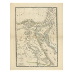
Antique Map of Ancient Egypt Also Depicting the Nile River and Red Sea, 1845
Located in Langweer, NL
Antique map Egypt titled 'General Karte von Alt Aegypten von A.H. Brué'. Large map of Egypt also depicting the Nile river and Red Sea. Source unknown...
Category
19th Century Antique Maps
Materials
Paper
$239 Sale Price
20% Off
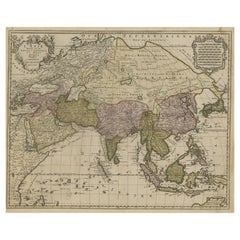
Large Antique Map of Asia including All of Southeast Asia, c.1792
Located in Langweer, NL
Antique map titled 'L' Asie Divisee en ses Empires, Royaumes, et Etats'. Attractive, large map of Asia including all of Southeast Asia. The cartography is archaic for the period with...
Category
18th Century Antique Maps
Materials
Paper
$1,437 Sale Price
20% Off
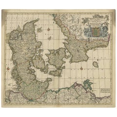
Antique Map of Denmark by F. de Wit, 1680
Located in Langweer, NL
Antique map titled 'Dania Regnum'. Large, attractive map of Denmark, Sleschwig-Holstein and southern Sweden. Good detail throughout. Embellished with a title cartouche with the Danis...
Category
Late 17th Century Antique Maps
Materials
Paper
$924 Sale Price
20% Off
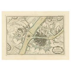
Antique Plan of the City of Bayonne, France
Located in Langweer, NL
Antique map titled 'Plan de Bayonne'. Original old plan of the city of Bayonne, France. This map originates from 'Le Petit Atlas Maritime (..)' by J.N. Bellin. Published 1764.
Be...
Category
Mid-18th Century Antique Maps
Materials
Paper
$325 Sale Price
20% Off
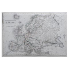
Large Original Antique Map of Europe by Sidney Hall, 1847
Located in St Annes, Lancashire
Great map of Europe
Drawn and engraved by Sidney Hall
Steel engraving
Original colour outline
Published by A & C Black. 1847
Unframed
Free shipping.
Category
1840s Scottish Antique Maps
Materials
Paper
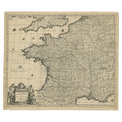
Large Antique Map of France by De Wit, c.1680
Located in Langweer, NL
Antique map titled 'Accuratissima Galliae Tabula vulgo Royaume de France'. Detailed map of France. Shows provinces, cities, rivers etc.
Artists and Engravers: Frederick de Wit (1...
Category
17th Century Antique Maps
Materials
Paper
$623 Sale Price
20% Off
Antique Map of the Antilles by Meyer, 1878
Located in Langweer, NL
Antique map titled 'Die Antillen'. Old map of the Antilles, it shows Jamaica, Puerto Rico, the Bahamas and Cuba. With inset maps of the Lesser Antilles and Havana. This map originate...
Category
19th Century Antique Maps
Materials
Paper
$81 Sale Price
20% Off
Large Antique Map of Europe, Showing the Empire of Charlemagne
Located in Langweer, NL
Antique map titled 'Imperium Caroli Magni (..)'. Large antique map of Europe, showing the Empire of Charlemagne in the 8th Century. Engraved by T. Kitchin. Published J. Blair, circa ...
Category
Late 18th Century Antique Maps
Materials
Paper
$440 Sale Price
20% Off
17th Century Nautical Chart of Skagerrak and Øresund by Johannes van Keulen
Located in Langweer, NL
This map titled *Pascaret van Schager-Rack de Bælt en de Sondt* was created by the prominent Dutch cartographer Johannes van Keulen and published in Amsterd...
Category
Late 17th Century Antique Maps
Materials
Paper
$920 Sale Price
20% Off
Antique Print of the Malabar Coast of India showing the VOC establishments, 1726
Located in Langweer, NL
Dutch print with the title: Platte Grond van t'Fort Tricoen male met de daar aangelegen Pagoods-Berg (Trincomalee, Sri Lanka)
The map is taken from: 'Oud en Nieuw Oost-Indiën' van François Valentyn.
1) Ottens, Frederik (engraver / etcher)
2) Braam, J. van (publisher)
3) Linden, Gerard onder de (publisher)
MALABAR COAST...
Category
1720s Antique Maps
Materials
Paper
$268 Sale Price
20% Off
Map of Rhône: Culture and Commerce in Lyon's Silk and Wine Legacy, 1852
Located in Langweer, NL
This original hand-colored map is from the "Atlas National Illustré," a work by Victor Levasseur, a French geographer and cartographer known for his richly illustrated maps.
The map...
Category
1850s Antique Maps
Materials
Paper
$325 Sale Price
20% Off
Map of Eure-et-Loir France with Chartres Cathedral and Marceau Portrait, c.1850
Located in Langweer, NL
Map of Eure-et-Loir France with Chartres Cathedral and Marceau Portrait, 19th c
This detailed and elegantly illustrated 19th-century map of the Eure-et-Loir department in north-cent...
Category
Mid-19th Century French Antique Maps
Materials
Paper
Rare Map of Rama or Ramma 'Ramallah?' in Palestine or the Holy Land, ca.1730
Located in Langweer, NL
Antique map titled 'Rama'.
This maps shows a view of Ramma (Ramallah?) in Palestine or the Holy Land. With Dutch legend. Source unknown, to be determined.
Artists and Engraver...
Category
1730s Antique Maps
Materials
Paper
$268 Sale Price
20% Off
1821 Thomson Map of Guadeloupe, Marie-Galante and Antigua in the West Indies
Located in Langweer, NL
This map, published in 1821 by John Thomson, showcases Guadeloupe, Marie-Galante, and Antigua from the *West India Islands* collection. Part of Thomson's *New General Atlas*, it prov...
Category
1820s Antique Maps
Materials
Paper
$555 Sale Price
20% Off
1874 Map of the United States with Territorial Boundaries
Located in Langweer, NL
Title: 1874 Map of the United States with Territorial Boundaries
Description: This is an 1874 map titled "Map of the United States," showcasing the country during a period of rapid ...
Category
1870s Antique Maps
Materials
Paper
$249 Sale Price
20% Off
Decorative 1864 Civil War Era Map of Indiana with Lake Michigan Detail
Located in Langweer, NL
Title: Rare 1864 Civil War Era Map of Indiana with Lake Michigan Detail
Description: This finely detailed antique map, titled "Johnson's Indiana," was published in 1864 by Johnson a...
Category
1860s Antique Maps
Materials
Paper
Navigating the Spice Trade: A Maritime Chart of the Banda Sea, 1799
Located in Langweer, NL
This original antique map is an 18th-century nautical chart by Laurie & Whittle, a well-known British firm that was involved in the publication of maps, charts, and maritime books. ...
Category
Late 18th Century Antique Maps
Materials
Paper
$948 Sale Price
20% Off
Barbados Island at the Height of the Plantation Economy, Circa 1759
Located in Langweer, NL
Carte de l'Isle de la Barbade by Jacques-Nicolas Bellin (1703–1772), Circa 1759
This rare antique map of Barbados, titled Carte de l'Isle de la Barbad...
Category
1750s Antique Maps
Materials
Paper
$421 Sale Price
20% Off
Antique Map of the Province of Constantine, Algeria by Migeon, 1880
Located in Langweer, NL
Antique map titled 'Province de Constantine'. Old map of the province of Constantine, Algeria. The Department of Constantine existed from 1848 to 1962 and was one of the three admini...
Category
19th Century Antique Maps
Materials
Paper
$100 Sale Price
20% Off
Original Antique Map of the Northern Baltic Region
Located in Langweer, NL
Title: "Livonia: Antique Map of the Northern Baltic Region"
Description: This antique map, titled "Livonia," is a detailed representation of the northern Baltic region. Centered on ...
Category
Early 17th Century Antique Maps
Materials
Paper
$948 Sale Price
20% Off
Map of Independent Tartary with Vignettes of the Region's Culture, 1851
Located in Langweer, NL
The map of Independent Tartary is part of the collection by John Tallis & Company, which were unique for their elaborate decorative elements and detailed illustrations.
**The Maker ...
Category
1850s Antique Maps
Materials
Paper
$277 Sale Price
20% Off
The World in the Assyrian Empire's Era: A Historical Map, Published in 1880
Located in Langweer, NL
This map from the "Spruner-Menke Atlas Antiquus" is titled "ORBIS TERRARVM regni Assyrii tempore," which translates to "The World at the Time of the Assyrian Kingdom." It depicts the...
Category
1880s Antique Maps
Materials
Paper
$354 Sale Price
20% Off
Antique Print of Cairo in Egypt, 1698
Located in Langweer, NL
Untitled antique print with two views of Cairo, Egypt. 78: Palace of Sultan Gori. 79. Tower and aqueduct. This print originates from 'Reizen van Cornelis de Bruyn, door de vermaardst...
Category
17th Century Antique Maps
Materials
Paper
$277 Sale Price
20% Off
Antique Map of North America by Levasseur '1875'
Located in Langweer, NL
Antique map titled 'Carte générale de l'Amérique Septentrionale'. Large map of North America. This map originates from 'Atlas de Géographie Modern...
Category
Late 19th Century Antique Maps
Materials
Paper
$479 Sale Price
20% Off
Map of Groningen from The Genealogy of the Illustrious Counts of Nassau (1615)
Located in Langweer, NL
Title: Map of Groningen from "The Genealogy of the Illustrious Counts of Nassau" (1615)
Description: This antique map, titled "Gronenga," offers a detailed depiction of the forti...
Category
1610s Antique Maps
Materials
Paper
$527 Sale Price
20% Off
1889s Antique Celestial Globe Signed Gussoni e Dotti Milano Papier Maché Sphere
Located in Milan, IT
Celestial globe compiled on the Hesi & Gould catalogs by Eng. Pini and published in 1889 by Gussoni & Dotti Milano piazza del Duomo. Sphere in paper mache covered with paper printed by engraving on copper plate and hand watercolored, base in turned and ebonized wood.
Good condition, conservative restoration at the base. Measures: Height 45 cm, inche 17.8, sphere diameter 22 cm 8.7.
Giovanni Gussoni in 1874 bought the business of Antonio Ronchi typographer in Via Unione 5 in Milan, and then moved in 1883 to the shop of the Southern Porticoes in Piazza Duomo. Giovanni Gussoni was followed by his son Vittorio, who on April 16, 1907 sold the company to a collaborator, Giovanni Serra, who continued the business until November 1914.
Man has always wanted to know the world in which he lives and has used all the means available to measure the space that surrounds him to expand his knowledge more and more. The conditions that allowed man to develop models of the world and space were probably realized only after...
Category
1880s Antique Maps
Materials
Paper
Antique Map of Egypt, '1875'
Located in Langweer, NL
Antique map titled 'Carte des l'Égypte'. Large map of Egypt. This map originates from 'Atlas de Géographie Moderne Physique et Politique' by A. Levasseur....
Category
Late 19th Century Antique Maps
Materials
Paper
$335 Sale Price
30% Off
Original Antique Map of Greece and part of Turkey
Located in Langweer, NL
Original antique map titled 'La Grece ou partie meridionale de la Turquie d'Europe'. Small map of Greece and part of Turkey. This map originates from 'Le nouveau et curieux Atlas Geo...
Category
Early 18th Century Antique Maps
Materials
Paper
$364 Sale Price
20% Off
Original Antique Map of Ancient Greece- Boeotia, Thebes, 1787
Located in St Annes, Lancashire
Great map of Ancient Greece. Showing the region of Boeotia, including Thebes
Drawn by J.D. Barbie Du Bocage
Copper plate engraving by P.F T...
Category
1780s French Other Antique Maps
Materials
Paper
Old Engraving of Longvek or Lavek (Eauweck), the Second Capital City of Cambodia
Located in Langweer, NL
Antique print titled 'Eauweck, capitale de Camboye'. Decorative panoramic view of the town of Longvek (or Lavek) in Cambodia. It was the second capital city during the Cambodia's Mid...
Category
18th Century Antique Maps
Materials
Paper
$287 Sale Price
20% Off
Antique Map of Sri Lanka with an unusual five-sided shape, circa 1606
Located in Langweer, NL
Antique map titled 'Ins. Ceilan quae incolis Tenarisin dicitur'. This exquisite, early map of Sri Lanka is shown with an unusual five-sided shape. North is oriented to the left by an...
Category
Early 17th Century Antique Maps
Materials
Paper
$613 Sale Price
20% Off
Roman Frontiers Engraved: Germania, Raetia, and Noricum, Published in 1880
Located in Langweer, NL
The map, titled "GERMANIA, RAETIA, NORICUM," depicts the regions of Germania, Raetia, and Noricum, which correspond to parts of modern-day Central and Eastern Europe, including areas of Germany, Austria, Switzerland, and the Balkans.
Features of the map include:
1. **Regional Divisions**: The map is divided into the regions of Germania, Raetia, and Noricum, each likely differentiated by color or shading.
2. **Topography**: It details the mountain ranges, rivers, and other geographical features of the region. The Alps, which are central to Raetia, are prominently displayed.
3. **Roman Settlements and Roads**: The map likely marks Roman...
Category
1880s Antique Maps
Materials
Paper
$354 Sale Price
20% Off
Map of India and Ceylon with Inset of Calcutta and the Ganges, by Bonne, 1780
Located in Langweer, NL
The map on offer is an antique copperplate engraving of India and Ceylon (Sri Lanka), created by Rigobert Bonne (1727-1794), a prominent French cartographer. Here is a breakdown of t...
Category
1780s Antique Maps
Materials
Paper
$325 Sale Price
20% Off
Ancient Italy: Regions and Rome in the Roman Empire, Published in 1880
Located in Langweer, NL
This print is an original detailed map titled "ITALIAE REGIONES I VII VIII IX XI," representing the regions of ancient Italy.
Key Features of the Print:
1. **Regional Demarcations...
Category
1880s Antique Maps
Materials
Paper
$354 Sale Price
20% Off
Map of The Italian Peninsula with the islands of Sicily, Sardinia, Corsica, 1880
Located in Langweer, NL
This map, titled "ITALIA, Sicilia, Sardinia, Corsica," represents the Italian Peninsula along with the islands of Sicily, Sardinia, and Corsica. Inset maps offer detailed views of "R...
Category
1880s Antique Maps
Materials
Paper
$354 Sale Price
20% Off
Decorative 1850s Map of Eastern Canada and New Brunswick with Historic Vignettes
Located in Langweer, NL
Decorative 1850s Map of Eastern Canada and New Brunswick with Historic Vignettes
This beautifully crafted 19th-century map of Eastern Canada and New Brunswick, drawn and engrave...
Category
1850s Antique Maps
Materials
Paper
Rare Large Etching of a Market of War Horses, Ca.1720
Located in Langweer, NL
Huchtenburg, J. van (1647-1733).
Impressive rare large etching of a 'War-" Horse-market. - This print has been professional doubled with Japanes...
Category
1720s Antique Maps
Antique Print of a Landscape with Rock Formation in New Zealand by Cook, 1803
By Cook
Located in Langweer, NL
Antique print New Zealand titled 'Gezigt van eene doorboorde Rots in Nieuw-Zeeland'. Antique print depicting a landscape with rock formation,...
Category
19th Century Antique Maps
Materials
Paper
$220 Sale Price
20% Off
French Antique Map of Oceania with Details of the Australian Colonies, c.1840
Located in Langweer, NL
Antique map Oceania titled 'Océanie par C.V. Monin'. Old map of Oceania with an inset of New South Wales. Originates from 'Atlas Classique de la Géographie Ancienne (..)'.
Artists ...
Category
19th Century Antique Maps
Materials
Paper
$210 Sale Price
20% Off
Antique Map of Champagne and surrounding Regions, France
Located in Langweer, NL
Antique map titled 'Carte de la Champagne et des Pays Voisins (..)'. Detailed map of Champagne and surrounding regions of Chalons and Soissons, Reims,...
Category
Mid-18th Century Antique Maps
Materials
Paper
Spectacular 1770 Bird's-Eye View of Dunkirk Harbor by Basset, with 66 Landmarks
Located in Langweer, NL
This engraving, titled *Vue de Dunkerque du coté de la Mer*, is a spectacular bird's-eye view of Dunkirk from the sea, published by Basset around 1770.
It provides a detailed panor...
Category
1770s Antique Maps
Materials
Paper
$469 Sale Price
20% Off
Antique Map of France at the Beginning of the 17th Century by Zannoni, 1765
Located in Langweer, NL
Antique map France titled 'Carte pour servir à intelligence de l'Histoire de France (..)'. Beautiful old map of France. This map originates from 'At...
Category
18th Century Antique Maps
Materials
Paper
$152 Sale Price
20% Off
The Antient City of Jerusalem and Places Adjacent, Hand-Colored Map, 1699
Located in Langweer, NL
Title: "1699 Hand-Colored Bird's-Eye Plan of Jerusalem with Ancient and Biblical Landmarks"
This beautifully hand-colored, imaginary bird's-eye plan of Jerusalem, published in 1699,...
Category
1690s Antique Maps
Materials
Paper
$249 Sale Price
20% Off
1625 Petrus Plancius / Cloppenburg Map of the Holy Land with Biblical Vignettes
Located in Langweer, NL
1625 Petrus Plancius / Johannes Cloppenburg Map of the Holy Land with Biblical Vignettes
This exquisite 1625 map by Petrus Plancius and Johannes Cloppenburg represents the Holy Lan...
Category
1620s Antique Maps
Materials
Paper
English Mahogany Wooden Folio Stand, Map and Document Holder, circa 1820
Located in Hamilton, Ontario
Regency era mahogany wood folio stand rack, map, poster, document holder used in a library, office or den, circa 1820. Folds out to six positions ...
Category
Early 19th Century English Regency Antique Maps
Materials
Wood
$5,200 Sale Price
20% Off
Antique Map of the Holy Land, with vignette of the Garden of Eden
Located in Langweer, NL
Antique map titled 'Hondius his Map of Paradise'. Beautiful map of the region bounded by the Holy Land. Syria, Mesopotamia, Chaldea and part of Arabia. W...
Category
Mid-17th Century Antique Maps
Materials
Paper
$460 Sale Price
20% Off
Antique Map of the United States of America, also showing the Caribbean
Located in Langweer, NL
Antique map titled 'Verein-Staaten von Nord-America, Mexico, Yucatan u.a.'. Very detailed map of the United States of America showing the ...
Category
Mid-19th Century Antique Maps
Materials
Paper
$785 Sale Price
20% Off
Antique Map of Northern Germany, Including Schleswig-Holstein and Hamburg
Located in Langweer, NL
Antique map titled 'Basse Partie de la Basse Saxe ou sont les Duchés de Sleswick, Holsace, Meckelenbourg et Lauvenbourg (..)'. Original old map of northern Germany, including Schlesw...
Category
Mid-17th Century Antique Maps
Materials
Paper
$517 Sale Price
20% Off
Original Hand-Colored Antique Costume Print of a Peasant from Hungary, 1804
Located in Langweer, NL
Old print of a Hungarian peasant. This print originates from 'The Costume of the Hereditary States of the House of Austria' by William Miller.
Artists and Engravers: Engraved by William Ellis.
Category
Early 1800s Antique Maps
Materials
Paper
$268 Sale Price
20% Off
Saint-Domingue (French Section): 18th Century Map from France Militaire Series
Located in Langweer, NL
This map is titled "St. Domingue (Partie Française)" and is part of the France Militaire series. It focuses on the French portion of Saint-Domingue, which corresponds to modern-day H...
Category
1790s Antique Maps
Materials
Paper
$115 Sale Price
20% Off
Antique Map of England and Wales Depicting the Period of the Saxon Heptarchy
Located in Langweer, NL
Antique map titled 'Britain as divided under the Saxon Heptarchy'. An antique copper engraving map of England and Wales by Joseph Ellis depicting the period of the Saxon Heptarchy. E...
Category
Late 18th Century Antique Maps
Materials
Paper
$421 Sale Price
20% Off
Antique Map of the World in Hemispheres by Keizer & de Lat, 1788
Located in Langweer, NL
Antique map titled 'Schuine Ronde Aard-Bolle waar van 't Middelpunt is Amsterdam (..)'. Interesting double hemisphere world map on polar projections. In North America, there is a large Island of California. Australia and New Zealand are shown with incomplete coastlines. The map contains six smaller astronomical...
Category
Late 18th Century Antique Maps
Materials
Paper
$479 Sale Price
20% Off
Antique Bible Plan of Ancient Jerusalem, 1743
Located in Langweer, NL
This plan originates from ‘Biblia Sacra, dat is, de H. Schriftuer van het Oude, en het Nieuwe Testament, naer de laetste Roomsche keure der gemeine Latijnsche overzettinge, in nederd...
Category
Mid-18th Century Antique Maps
Materials
Paper
$819 Sale Price
37% Off
Antique Map of the Region of Mansfeld, Saxony-Anhalt, Germany
Located in Langweer, NL
Antique map titled 'Mansfeldiae Comitatus Descriptio'. Original antique map of the region of Mansfeld, Saxony-Anhalt, Germany. Shows the area between Halle a. d. Saale, Aschersleben,...
Category
Early 17th Century Antique Maps
Materials
Paper
$632 Sale Price
20% Off
Antique Map of the Turkish Empire and Persia, circa 1890
By J. Migeon
Located in Langweer, NL
Antique map Turkish Emprie titled 'Turquie d'Asie et Perse'. Beautiful map depicting the Turkish Empire and Persia. With vignette depicting Damascus. This map originates from 'Nouvel...
Category
19th Century Antique Maps
Materials
Paper
$364 Sale Price
20% Off
Antique Map of Persia and Tartary by Lowry, '1852'
Located in Langweer, NL
Antique map titled 'Persia and Tartary'. Original map of Persia and Tartary. This map originates from 'Lowry's Table Atlas constructed and engraved from the most recent Authorities' ...
Category
Mid-19th Century Antique Maps
Materials
Paper
$95 Sale Price
20% Off
Empire of the Parthians: Historical Cartographic Masterpiece by d'Anville, 1819
Located in Langweer, NL
Description:
Ancient map of the Parthian Empire (19th century), original engraving extracted from the atlas of the history of the emperors from 1819, based on the history of the Rom...
Category
1810s Antique Maps
Materials
Paper
$94 Sale Price
20% Off
Original Antique Miniature Map of Persia, Published, ca.1601
Located in Langweer, NL
Antique miniature map titled 'Persia'. Small map of Persia published in the Epitome, or pocket-edition of the "Theatrum Orbis Terrarum".
Artists and e...
Category
Early 1600s Antique Maps
Materials
Paper
$517 Sale Price
20% Off
Large Antique County Map of Nottinghamshire, England
Located in Langweer, NL
Antique map titled 'A Map of Nottinghamshire from the best Authorities'. Original old county map of Nottinghamshire, England. Engraved by John Cary. Originates from 'New British Atla...
Category
Early 19th Century Antique Maps
Materials
Paper
$230 Sale Price
20% Off
Old Map of the American Railroad Network and All Weather Roads on Verso, 1931
Located in Langweer, NL
This is the “New Census Edition” of Clason’s United States Green Guide. It features two large maps of the United States on a single sheet.
The recto map shows the complete road net...
Category
1930s Vintage Maps
Materials
Paper
$431 Sale Price
20% Off
Recently Viewed
View AllMore Ways To Browse
Antique Wellington Chests
Antonio Cassi Ramelli
Archimede Seguso Birds
Art Deco Coasters
Art Deco Footballer
Art Deco Music Cabinet
Art Deco Waterfall Bedroom Furniture
Art Deco Waterfall Bedroom
Art Deco Whisky
Art Foulard
Art Nouveau Sunflower
Arts And Crafts Silver Coffee Pot
Asian Pink Bowl
Avesn Vase
Baccarat Carafe
Bakelite Bird
Bakelite Cocktail Picks
Bamboo Ikebana Vase
