Items Similar to Antique Map of the Arctic Ocean and Novaya Zemlya by Bellin '1759'


Want more images or videos?
Request additional images or videos from the seller
1 of 5
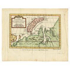
Antique Map of the Arctic Ocean and Novaya Zemlya by Bellin '1759'
$330.21
$412.7620% Off
£247.17
£308.9620% Off
€280
€35020% Off
CA$454.46
CA$568.0720% Off
A$506.54
A$633.1820% Off
CHF 265.76
CHF 332.2120% Off
MX$6,185.69
MX$7,732.1120% Off
NOK 3,365.16
NOK 4,206.4520% Off
SEK 3,180.58
SEK 3,975.7320% Off
DKK 2,131.56
DKK 2,664.4520% Off
About the Item
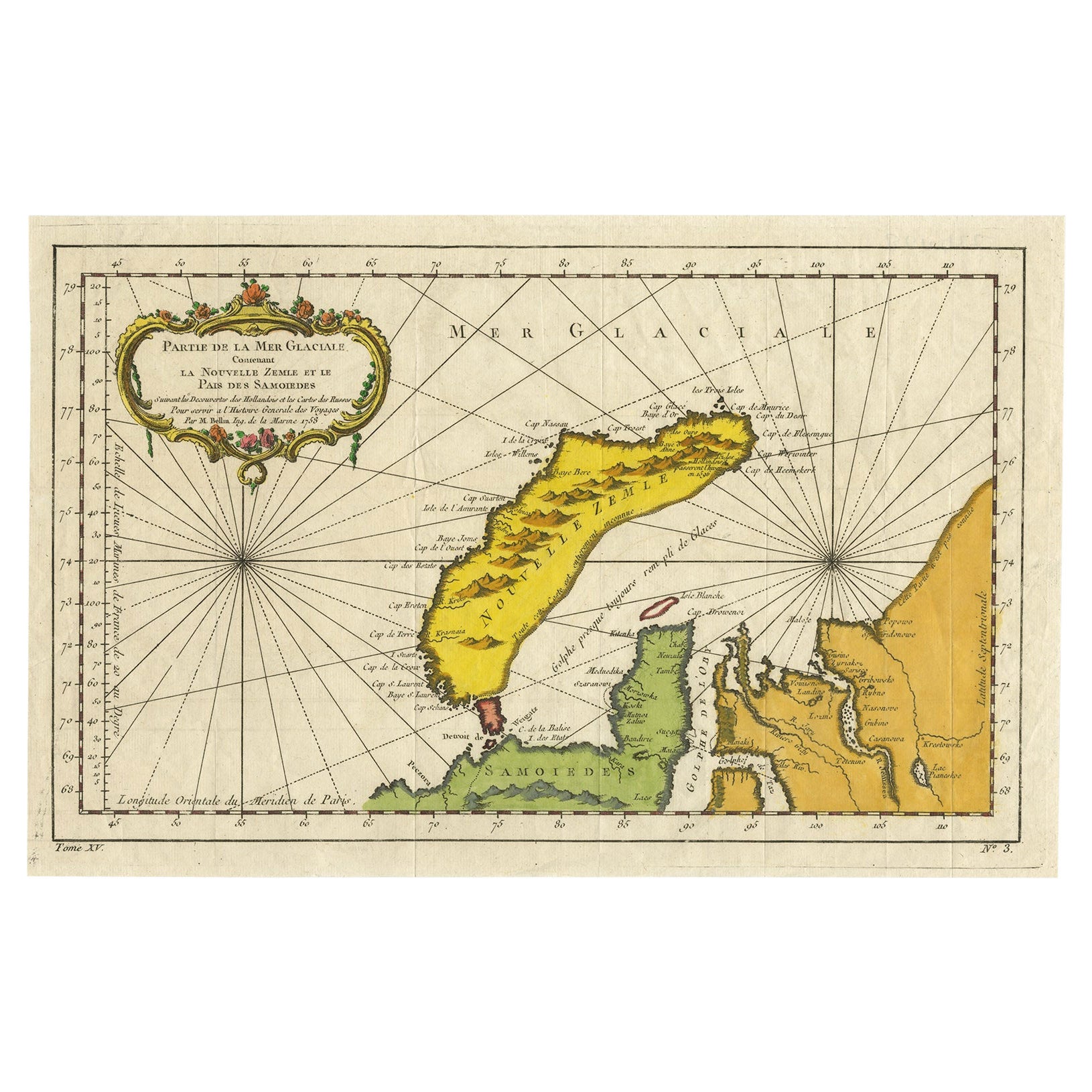
Antique map titled 'Partie de la Mer Glaciale contenant la Nouvelle Zemle et le Pais des Samoiedes (..)'. Original antique map of the Arctic Ocean containing Novaya Zemlya and the country of the Samoyedic people. Engraved by J.N. Bellin for 'Histoire Générale des Voyages'. Published 1759.
- Dimensions:Height: 9.85 in (25 cm)Width: 15.16 in (38.5 cm)Depth: 0.02 in (0.5 mm)
- Materials and Techniques:
- Period:
- Date of Manufacture:1759
- Condition:General age-related toning, original folding lines. Minor wear/creasing, blank verso. Please study image carefully.
- Seller Location:Langweer, NL
- Reference Number:Seller: BG-12645-31stDibs: LU3054323728322
About the Seller
5.0
Recognized Seller
These prestigious sellers are industry leaders and represent the highest echelon for item quality and design.
Platinum Seller
Premium sellers with a 4.7+ rating and 24-hour response times
Established in 2009
1stDibs seller since 2017
2,513 sales on 1stDibs
Typical response time: <1 hour
- ShippingRetrieving quote...Shipping from: Langweer, Netherlands
- Return Policy
Authenticity Guarantee
In the unlikely event there’s an issue with an item’s authenticity, contact us within 1 year for a full refund. DetailsMoney-Back Guarantee
If your item is not as described, is damaged in transit, or does not arrive, contact us within 7 days for a full refund. Details24-Hour Cancellation
You have a 24-hour grace period in which to reconsider your purchase, with no questions asked.Vetted Professional Sellers
Our world-class sellers must adhere to strict standards for service and quality, maintaining the integrity of our listings.Price-Match Guarantee
If you find that a seller listed the same item for a lower price elsewhere, we’ll match it.Trusted Global Delivery
Our best-in-class carrier network provides specialized shipping options worldwide, including custom delivery.More From This Seller
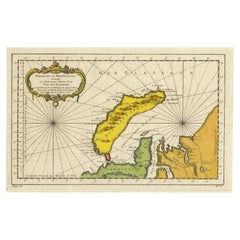
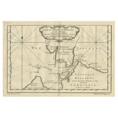
View AllAntique Map of Novaya Zemlya by Bellin, 1758
Located in Langweer, NL
Antique map titled 'Partie de la Mer Glaciale Contenant la Nouvelle Zemle et le Pais des Samoiedes'. This map features Novaya Zemlya, the island off northern Russia in the Barents Se...
Category
Antique 18th Century Maps
Materials
Paper
Antique Map of Nova Zembla ‘Russia’ by J.N. Bellin, 1758
Located in Langweer, NL
An interesting map of Nova Zembla and surrounding areas. With details on the eastern tip of Nova Zembla of the place where the stranded Dutch sailors under Willem Barentsz spent the ...
Category
Antique Mid-18th Century Maps
Materials
Paper

$226 Sale Price
20% Off
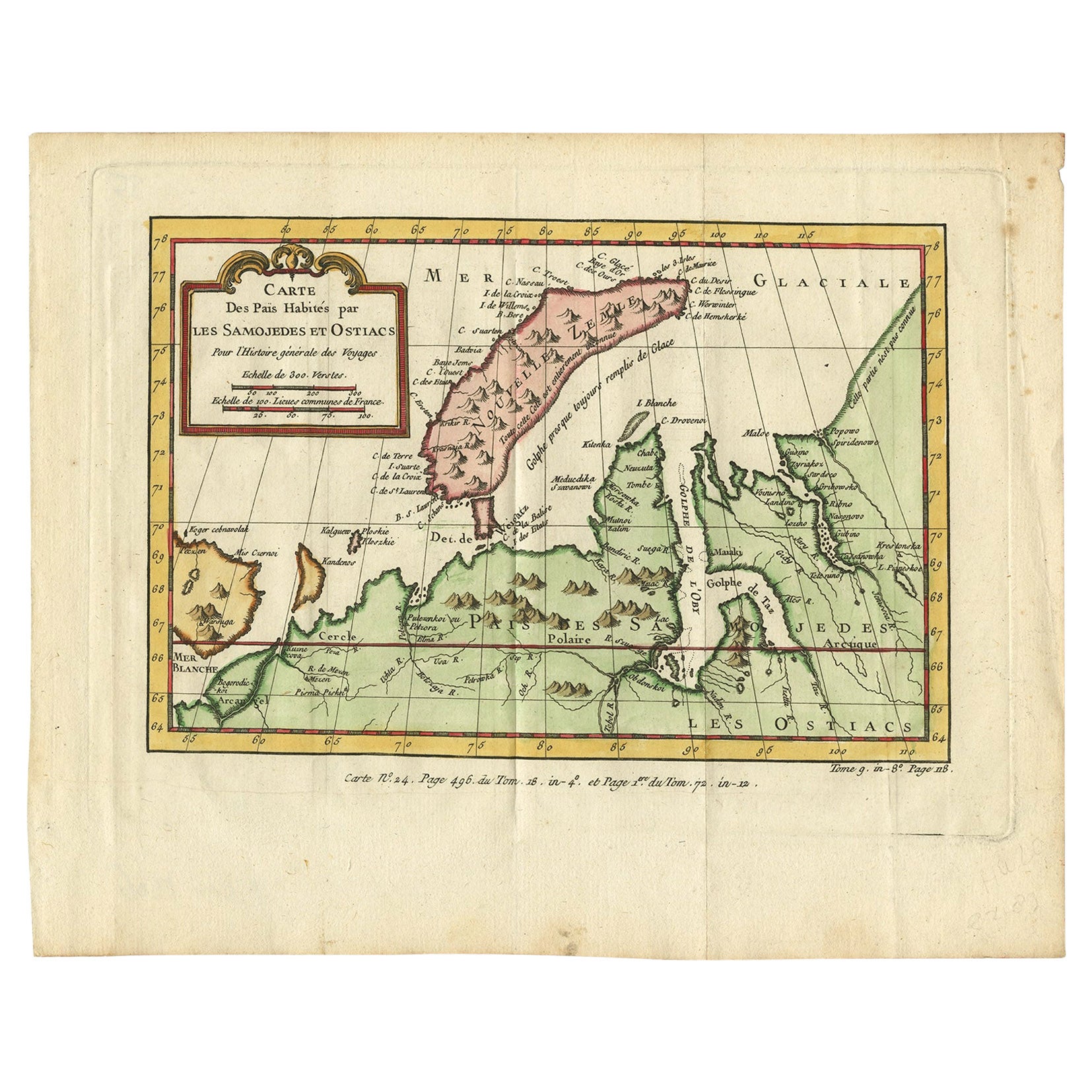
Antique Map of Novaya Zemlya and the Russian Mainland by Bellin, c.1760
Located in Langweer, NL
Antique map titled 'Carte Des Pais Habites par les Samojedes et Ostiacs.' Map of Novaya Zemlya and the Russian mainland. Source unknown, to be determined. Artists and Engravers: Made...
Category
Antique 18th Century Maps
Materials
Paper
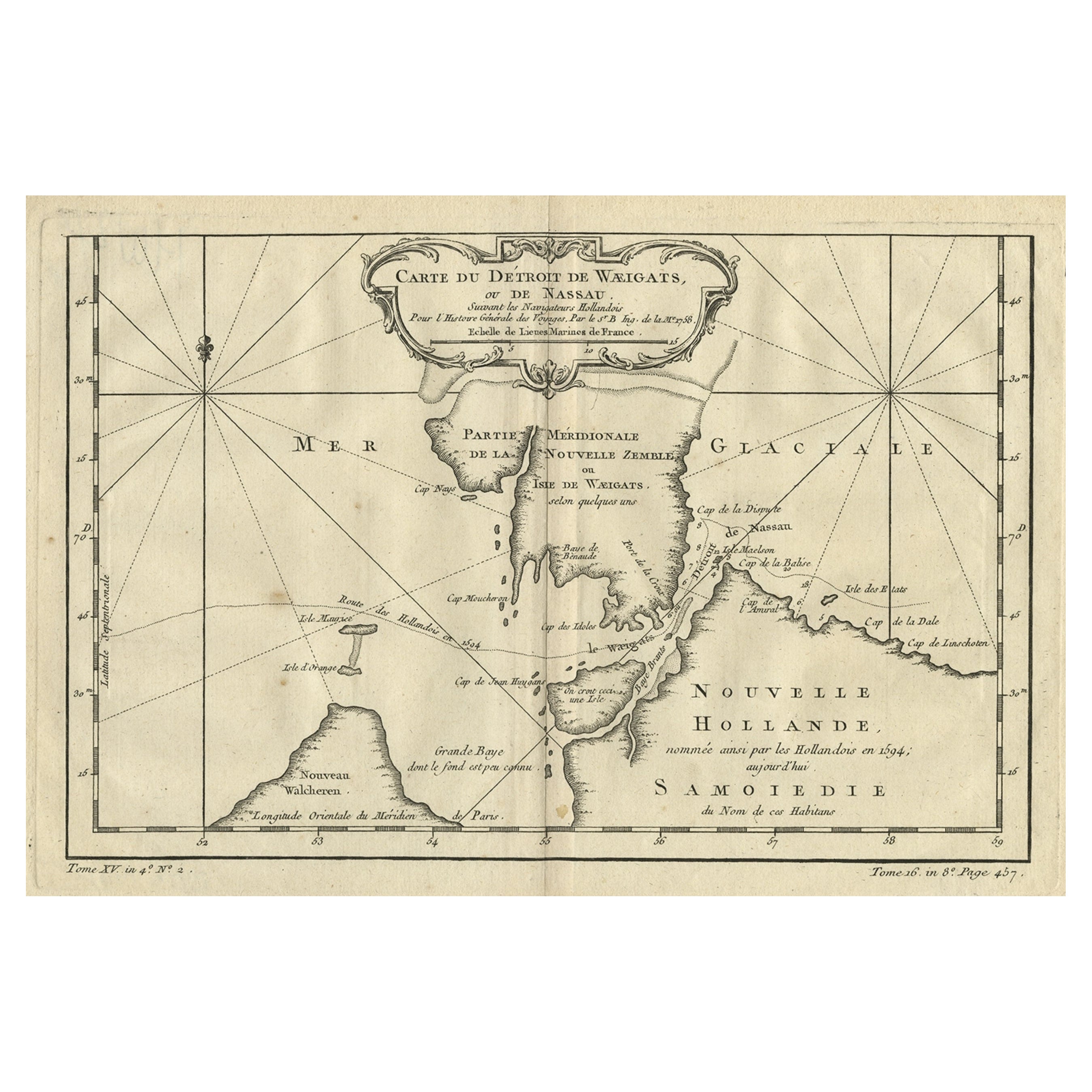
Map of the Russian Islands of Novaya Zemlya and Pechorskaya Guba, 1758
Located in Langweer, NL
Antique map titled 'Carte du detroit de Waeigats ou de Nassau.'
Map of the Russian islands of Novaya Zemlya (Nova Zembla) and Pechorskaya Guba, here Nouvelle Zemble and Grande Ba...
Category
Antique 1750s Maps
Materials
Paper
$245 Sale Price
20% Off
Antique Map of Nova Zembla 'Russia' by J.N. Bellin, 1757
Located in Langweer, NL
Decorative map of Nova Zembla and environs in the Arctic Sea. Includes a large decorative title cartouche. One of the maps produced by Jacques-Nicolas Bellin for Prevost d'Exiles inf...
Category
Antique Mid-18th Century Maps
Materials
Paper

$259 Sale Price
20% Off
Antique Map of Eastern Siberia by Bellin '1768'
Located in Langweer, NL
Antique map titled 'Suite de la Carte de la Siberie et le Pays de Kamtchatka'. Original antique map of the eastern portion of Siberia, centered on eastern Russia and the Mer d'Ochozk (Sea of Okhotsk) showing the Kamchatka Peninsula and I. de Beringe and I. Sagalin. The map shows the tracks of Russian ships...
Category
Antique Mid-18th Century Maps
Materials
Paper

$283 Sale Price
20% Off
You May Also Like
Ancient Map-Poli Arctici (Map of the Poles)-Etching by Johannes Janssonius-1650s
By Johannes Janssonius
Located in Roma, IT
Poli Arctici is an ancient map realized in 1650 by Johannes Janssonius (1588-1664).
The Map is a Hand-colored etching, with coeval watercoloring.
Good conditions with slight foxing...
Category
1650s Modern Figurative Prints
Materials
Etching

1646 Jansson Map Entitled "Procinvia Connactiae, " Ric.a006
Located in Norton, MA
1646 Jansson map entitled
"Procinvia connactiae,"
Ric.a006
Description: The PROVINCE of CONNAVGT 490 x 380From vol 4 of Jansson's Atlas Novus 1646, published in Amsterdam with...
Category
Antique 17th Century Unknown Maps
Materials
Paper

California, Alaska and Mexico: 18th Century Hand-Colored Map by de Vaugondy
By Didier Robert de Vaugondy
Located in Alamo, CA
This is an 18th century hand-colored map of the western portions of North America entitled "Carte de la Californie et des Pays Nord-Ouest separés de l'Asie par le détroit d'Anian, ex...
Category
Antique 1770s French Maps
Materials
Paper

West Coast of Africa, Guinea & Sierra Leone: An 18th Century Map by Bellin
By Jacques-Nicolas Bellin
Located in Alamo, CA
Jacques Bellin's copper-plate map entitled "Partie de la Coste de Guinee Dupuis la Riviere de Sierra Leona Jusquau Cap das Palmas", depicting the coast of Guinea and Sierra Leone in ...
Category
Antique Mid-18th Century French Maps
Materials
Paper

Hand-Colored 18th Century Homann Map of Denmark and Islands in the Baltic Sea
By Johann Baptist Homann
Located in Alamo, CA
An 18th century copper plate hand-colored map entitled "Insulae Danicae in Mari Balthico Sitae utpote Zeelandia, Fionia, Langelandia, Lalandia, Falstria, Fembria Mona" created by Joh...
Category
Antique Early 18th Century German Maps
Materials
Paper

Von Reilly Map of the Russian Empire, 1796
Located in Savannah, GA
A map of the Russian Empire in Europe by Von Reilly. Published in Vienna, 1796.
32 inches wide by 24 ½ inches tall
Category
Antique 1790s Austrian Prints
Materials
Glass, Wood, Paper

More Ways To Browse
Antique Mediterranean Map
Map Of Great Britain
Antique Map New York
Antique Wine Maps
Antique Map Of The South Of France
Antique Maps Of Greece
Large Framed Maps
Java Map
Antique Marine Maps
Antique Indian Maps
West Africa Map
Antique Maps Of Wales
Antique Map Denmark
Antique Mining
Antique World Globe Map
Antique Oregon
Hemispheres Map
Map New Holland