Items Similar to Map of the Russian Islands of Novaya Zemlya and Pechorskaya Guba, 1758


Want more images or videos?
Request additional images or videos from the seller
1 of 5
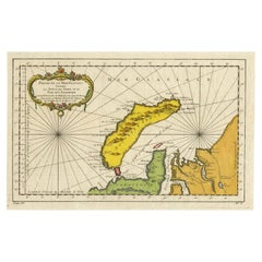
Map of the Russian Islands of Novaya Zemlya and Pechorskaya Guba, 1758
About the Item
Antique map titled 'Carte du detroit de Waeigats ou de Nassau.'
Map of the Russian islands of Novaya Zemlya (Nova Zembla) and Pechorskaya Guba, here Nouvelle Zemble and Grande Baye. The detailed chart shows the lower part of the island and mainland. Embellished with rhumb lines, fleur-de-lys and fancy cartouche. Source unknown, to be determined.
Artists and Engravers: Made by 'Jacques-Nicolas Bellin' after an anonymous artist. Jacques-Nicolas Bellin (1703-1772) was a French hydrographer, geographer and member of The Philosophes. His career, spanning over 50 years, caused an enormous outut in maps, particular of maritime interest. He was appointed the first Ingenieur Hydrographe de la Marine, and also Official Hydrographer to the French King. In smaller format, he issued the Petit Atlas Maritime (1764), which contained 580 charts, as well as maps to illustrate l' Abbe Prevost's Histoire Generale des Voyages (1746-1757). Bellin also produced a substantial number of important separately issued maps.
- Dimensions:Height: 14.89 in (37.8 cm)Width: 10.63 in (27 cm)Depth: 0 in (0.02 mm)
- Materials and Techniques:
- Period:1750-1759
- Date of Manufacture:1758
- Condition:Wear consistent with age and use. Condition: Good, given age. A few small spots. Original folds as issued. General age-related toning and/or occasional minor defects from handling. Please study image carefully.
- Seller Location:Langweer, NL
- Reference Number:
About the Seller
5.0
Platinum Seller
These expertly vetted sellers are 1stDibs' most experienced sellers and are rated highest by our customers.
Established in 2009
1stDibs seller since 2017
1,929 sales on 1stDibs
Typical response time: <1 hour
- ShippingRetrieving quote...Ships From: Langweer, Netherlands
- Return PolicyA return for this item may be initiated within 14 days of delivery.
More From This SellerView All
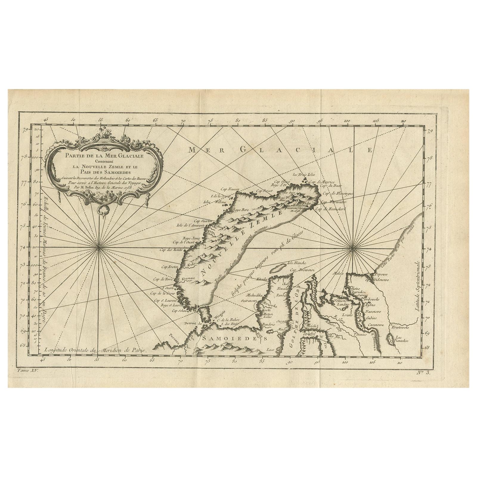
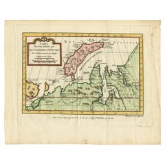
- Antique Map of Novaya Zemlya by Bellin, 1758Located in Langweer, NLAntique map titled 'Partie de la Mer Glaciale Contenant la Nouvelle Zemle et le Pais des Samoiedes'. This map features Novaya Zemlya, the island off northern Russia in the Barents Se...Category
Antique 18th Century Maps
MaterialsPaper
- Antique Map of the Arctic Ocean and Novaya Zemlya by Bellin '1759'Located in Langweer, NLAntique map titled 'Partie de la Mer Glaciale contenant la Nouvelle Zemle et le Pais des Samoiedes (..)'. Original antique map of the Arctic Ocean containing Novaya Zemlya and the co...Category
Antique Mid-18th Century Maps
MaterialsPaper
- Antique Map of Novaya Zemlya and the Russian Mainland by Bellin, c.1760Located in Langweer, NLAntique map titled 'Carte Des Pais Habites par les Samojedes et Ostiacs.' Map of Novaya Zemlya and the Russian mainland. Source unknown, to be determined. Artists and Engravers: Made...Category
Antique 18th Century Maps
MaterialsPaper
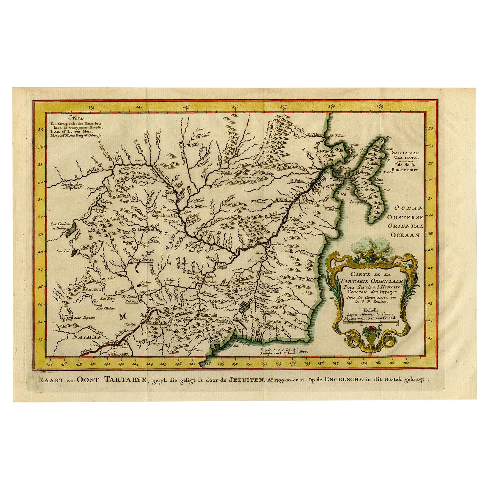
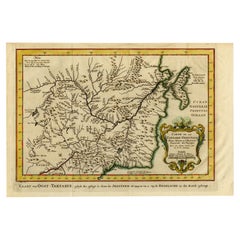
- Antique Map of Eastern Tartary, now the Primorsky Krai Area, Russia, 1758By Jakob van der SchleyLocated in Langweer, NLAntique map titled 'Carte de la Tartarie orientale.' A map of Eastern Tartary. East Tartary is an old names for the Manchu-inhabited territory extending from the River Amur to Sakhal...Category
Antique 18th Century Maps
MaterialsPaper
- Antique Map of Nova Zembla ‘Russia’ by J.N. Bellin, 1758Located in Langweer, NLAn interesting map of Nova Zembla and surrounding areas. With details on the eastern tip of Nova Zembla of the place where the stranded Dutch sailors under Willem Barentsz spent the ...Category
Antique Mid-18th Century Maps
MaterialsPaper
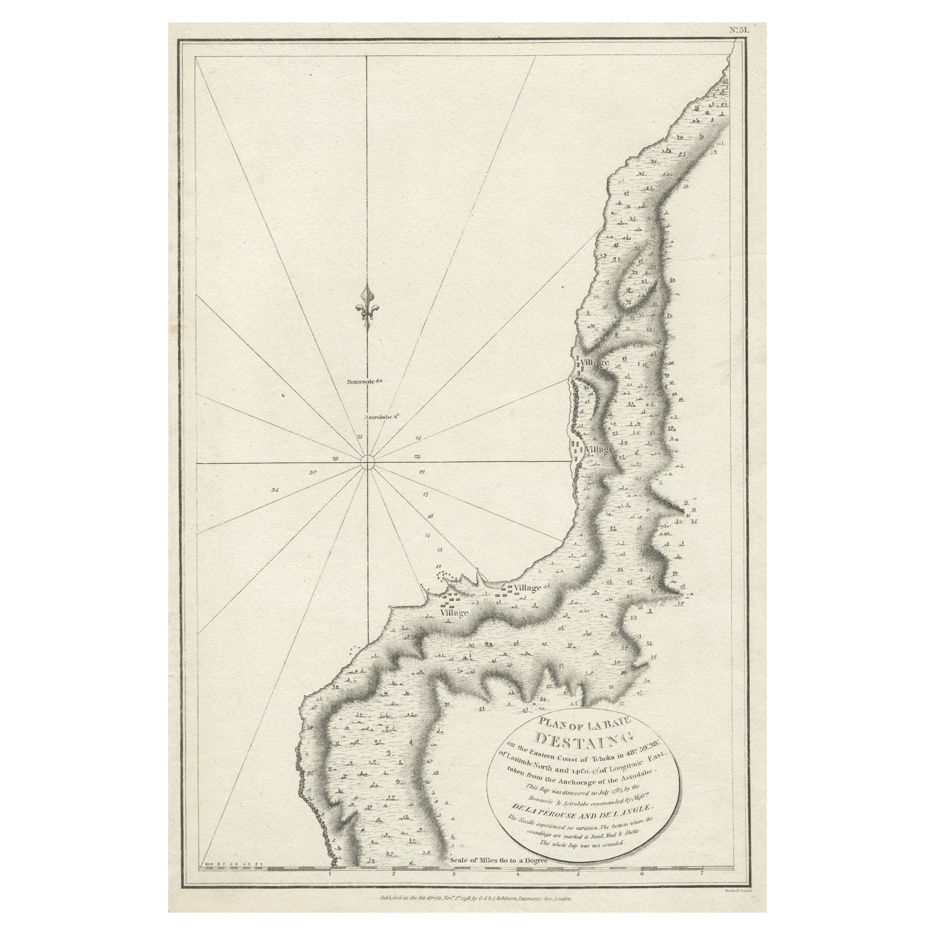
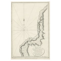
- Antique Map of The Bay of D'Estaing located on the Russian island Sakhalin, 1798Located in Langweer, NLAntique map titled 'Plan of La Baie d'Estaing'. This map shows the bay of D'Estaing located on the Russian island of Sakhalin. La Perouse was selected b...Category
Antique 1790s Maps
MaterialsPaper


You May Also Like
- Hand-Colored 18th Century Homann Map of Denmark and Islands in the Baltic SeaBy Johann Baptist HomannLocated in Alamo, CAAn 18th century copper plate hand-colored map entitled "Insulae Danicae in Mari Balthico Sitae utpote Zeelandia, Fionia, Langelandia, Lalandia, Falstria, Fembria Mona" created by Joh...Category
Antique Early 18th Century German Maps
MaterialsPaper
- Original Antique Map of Russia By Arrowsmith. 1820Located in St Annes, LancashireGreat map of Russia Drawn under the direction of Arrowsmith Copper-plate engraving Published by Longman, Hurst, Rees, Orme and Brown, 1820 Unframed.Category
Antique 1820s English Maps
MaterialsPaper
- Map of the Republic of GenoaLocated in New York, NYFramed antique hand-coloured map of the Republic of Genoa including the duchies of Mantua, Modena, and Parma. Europe, late 18th century. Dimension: 25...Category
Antique Late 18th Century European Maps
- Map "Estuary- Mouth of the Thames"Located in Alessandria, PiemonteST/426 - Antique French Map of the estuary of the Thames, map dated 1769 - "Mape of the entrance of the Thames. Designed by filing of Navy cards fo...Category
Antique Mid-18th Century French Other Prints
MaterialsPaper
- Vintage "View of the Center of Paris Taken from the Air" Lithograph MapLocated in San Diego, CAA very stylish "View of the Center of Paris Taken from the Air" lithograph map published by the Paris Ministry of Tourism, circa early 1950s. The piece measures 27" x 43" and shows...Category
20th Century French Mid-Century Modern Prints
MaterialsPaper
- New Map of North America from the Latest Discoveries, 1763Located in Philadelphia, PAA fine antique 18th century map of the North American seaboard. Entitled "A New Map of North America from the Latest Discoveries 1763". By the Cartographer/Engraver - John Spil...Category
Antique Mid-18th Century English Georgian Maps
MaterialsPaper


Recently Viewed
View AllMore Ways To Browse
French Antique Island
Marine Collectibles
La Marine Antique
A La Carte
Antique Russian Map
Antique Maritime Marine Maritime
Antique Marine Maritime
Marine Maritime Antique Marine Maritime
Antique Map Russia
Antique Map Of Russia
Antique Maps Of Russia
Nicolas Russian
Antique Marine Maps
Antique Furniture Detroit
Maritime Map
Antique Furniture Nassau
Nicolas Petit
Maritime Chart