Items Similar to Antique Map of Asia 'in Frame, circa 1739'


Want more images or videos?
Request additional images or videos from the seller
1 of 5
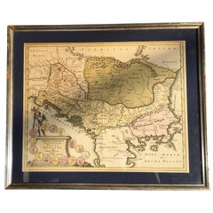
Antique Map of Asia 'in Frame, circa 1739'
$623.03
$958.5135% Off
£463.72
£713.4235% Off
€520
€80035% Off
CA$853.40
CA$1,312.9335% Off
A$949.17
A$1,460.2635% Off
CHF 495.63
CHF 762.5035% Off
MX$11,550.38
MX$17,769.8135% Off
NOK 6,329.91
NOK 9,738.3235% Off
SEK 5,936.34
SEK 9,132.8335% Off
DKK 3,958.58
DKK 6,090.1235% Off
Shipping
Retrieving quote...The 1stDibs Promise:
Authenticity Guarantee,
Money-Back Guarantee,
24-Hour Cancellation
About the Item
Antique map titled 'Asia Dividida em suas Regioens & Principaes Estados'. Rare and uncommon map of Asia. Signed '1739'. Source unknown, to be determined.
Frame included. We carefully pack our framed items to ensure safe shipping.
- Dimensions:Height: 12.41 in (31.5 cm)Width: 13.78 in (35 cm)Depth: 0.6 in (1.5 cm)
- Materials and Techniques:
- Period:
- Date of Manufacture:circa 1739
- Condition:General age-related toning, original folding lines. Uncommon frame with a suede-like passepartout. Frame lightly used. Please study images carefully.
- Seller Location:Langweer, NL
- Reference Number:Seller: BG-116621stDibs: LU3054321392192
About the Seller
5.0
Recognized Seller
These prestigious sellers are industry leaders and represent the highest echelon for item quality and design.
Platinum Seller
Premium sellers with a 4.7+ rating and 24-hour response times
Established in 2009
1stDibs seller since 2017
2,502 sales on 1stDibs
Typical response time: <1 hour
- ShippingRetrieving quote...Shipping from: Langweer, Netherlands
- Return Policy
Authenticity Guarantee
In the unlikely event there’s an issue with an item’s authenticity, contact us within 1 year for a full refund. DetailsMoney-Back Guarantee
If your item is not as described, is damaged in transit, or does not arrive, contact us within 7 days for a full refund. Details24-Hour Cancellation
You have a 24-hour grace period in which to reconsider your purchase, with no questions asked.Vetted Professional Sellers
Our world-class sellers must adhere to strict standards for service and quality, maintaining the integrity of our listings.Price-Match Guarantee
If you find that a seller listed the same item for a lower price elsewhere, we’ll match it.Trusted Global Delivery
Our best-in-class carrier network provides specialized shipping options worldwide, including custom delivery.More From This Seller
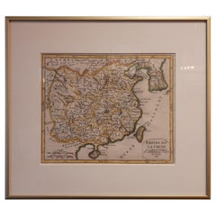
View AllAntique Map of China Including Korea and Taiwan by Vaugondy, 1749
Located in Langweer, NL
Antique map titled 'Empire de la Chine'. Beautiful map of China including Korea and Taiwan (Formosa). This map originates from 'Atlas Universel (..)' by Gilles Robert de Vaugondy, 17...
Category
Antique Mid-18th Century Maps
Materials
Paper
$479 Sale Price
20% Off
Antique Map of the Eastern Hemisphere in Frame, 'circa 1683'
Located in Langweer, NL
Antique map titled 'Climats selon les Anciens'. Miniature map of the Eastern Hemisphere showing the climatic regions. This map originates from 'Description de l'Univers' by A.M. Mall...
Category
Antique Late 17th Century Maps
Materials
Paper

Antique Map of Asia by Sanson, circa 1705
By Nicolas Sanson
Located in Langweer, NL
Dutch edition of Sanson's map of Asia. Shows a large, dramatic version of Terre de Jesso, drawn from the discoveries of the Maarten de Vries expedition of 1643.
Category
Antique Early 18th Century Dutch Maps
Materials
Paper

$383 Sale Price
20% Off
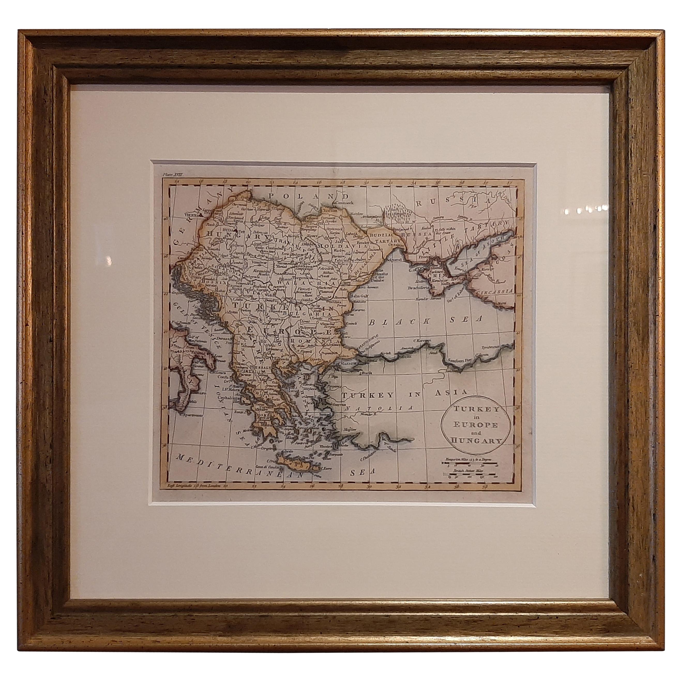
Antique Map of Turkey in Europe by Russell, circa 1795
Located in Langweer, NL
Antique map titled 'Turkey in Europe and Hungary'. Original map of Turkey in Europe. Covers present day Northern Turkey, Greece, Albania, Romania, Hungary, Croatia, Bosnia Herzogovin...
Category
Antique Late 18th Century Maps
Materials
Paper
$335 Sale Price
20% Off
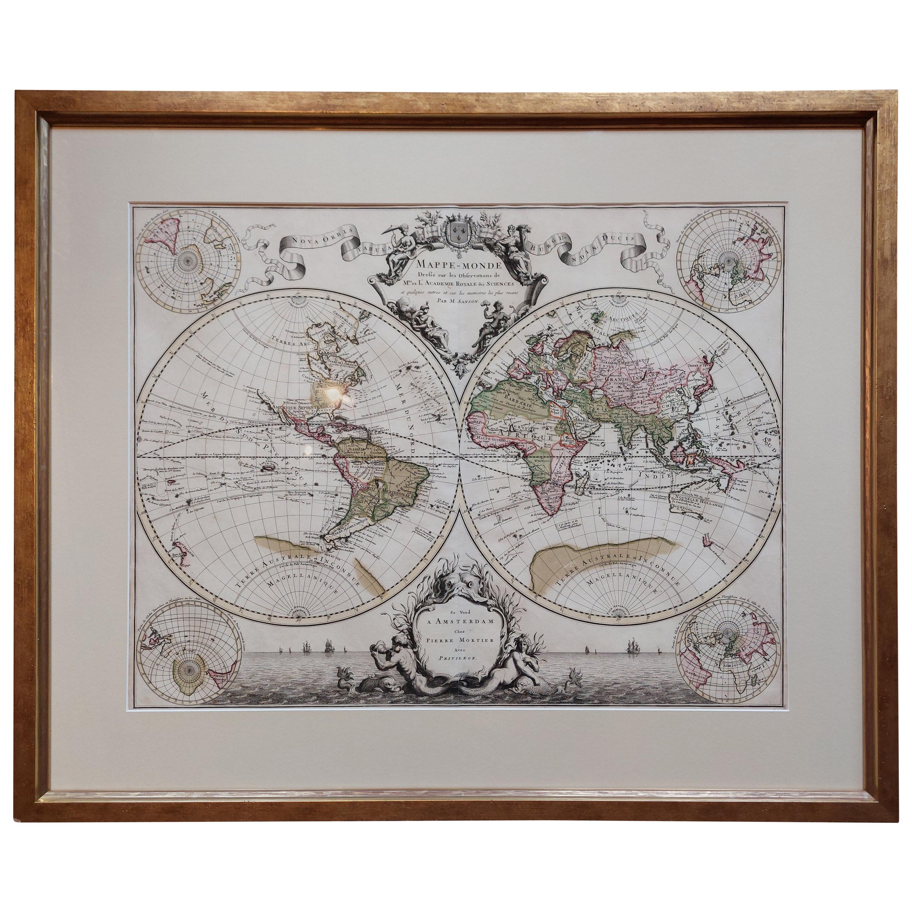
Original Antique Hand-colored World Map with or without Frame, '1696'
Located in Langweer, NL
Antique world map titled 'Mappe-Monde dressee sur les Observations de Mrs. de l'Academie Royale des Sciences (..)'. Beautiful original antique world map...
Category
Antique Late 17th Century Maps
Materials
Paper

$4,313 Sale Price
20% Off
Antique Map of Asia by Tirion 'c.1760'
Located in Langweer, NL
Antique map titled 'Nuova Carta dell Asia'. Decorative map of Asia. Published by I. Tirion, circa 1760.
Category
Antique Mid-18th Century Maps
Materials
Paper

$1,054 Sale Price
20% Off
You May Also Like
Vintage Reproduction 17th Century Map of Europe, American, Cartography, Blaeuw
Located in Hele, Devon, GB
This is a vintage reproduction map of Europe. An American, paper stock cartography print in frame after the work by Blaeuw, dating to the late 20t...
Category
Late 20th Century Central American Mid-Century Modern Maps
Materials
Glass, Wood, Paper

Antique Lithography Map, Bedfordshire, English, Framed Engraving, Cartography
Located in Hele, Devon, GB
This is an antique lithography map of Bedfordshire. An English, framed atlas engraving of cartographic interest, dating to the mid 19th century and...
Category
Antique Mid-19th Century British Victorian Maps
Materials
Wood

Antique Lithography Map, Cumberland, English, Framed, Cartography, Victorian
Located in Hele, Devon, GB
This is an antique lithography map of Cumberland. An English, framed atlas engraving of cartographic interest, dating to the mid 19th century and la...
Category
Antique Mid-19th Century British Victorian Maps
Materials
Wood

Antique County Map, Middlesex, English, Framed, Litho, Cartography, Victorian
Located in Hele, Devon, GB
This is an antique lithography map of Middlesex. An English, framed atlas engraving of cartographic interest, dating to the mid 19th century and later.
Superb lithography of Middle...
Category
Antique Mid-19th Century British Victorian Maps
Materials
Paper
Four 18th Century Engraved and Hand-Colored Maps by Weigel
By Christoph Weigel
Located in Copenhagen, K
Small collection of four engraved maps of Italy, Balkan and of Central Asia.
Two are of Italy, one Corsica and Northern Italy and the other of the Southern Italian boot...
Category
Antique 18th Century German Maps
Materials
Paper
Framed 17th Century Map of Cumberland, England by John Speed, 1610
By John Speed
Located in Middleburg, VA
A fascinating and richly detailed antique map of Cumberland County in northwest England, drawn and published by the celebrated English cartographer John Spe...
Category
Antique Early 17th Century English British Colonial Maps
Materials
Copper, Gold Leaf

More Ways To Browse
18th Century Safe
Antique Maps Scotland
Denmark Map
Antique Maps Of North America
Wine Map
Map Greece
Roman Map
Antique Maps Of Russia
Antique Roman Map
Maps Of Mediterranean
Mercator Map
Antique Railroad Furniture
Atlas Globe
Antique Mississippi Furniture
Framed World Map
Hand Drawn Map
Rare Compass
Antique Furniture Rollers