Items Similar to Antique Map of the Region of Wakayama, Nara and Osaka 'Japan'

Want more images or videos?
Request additional images or videos from the seller
1 of 7
Antique Map of the Region of Wakayama, Nara and Osaka 'Japan'
$885.55
$1,106.9320% Off
£667.86
£834.8320% Off
€760
€95020% Off
CA$1,224.34
CA$1,530.4320% Off
A$1,371.47
A$1,714.3420% Off
CHF 720.35
CHF 900.4320% Off
MX$16,676.66
MX$20,845.8220% Off
NOK 9,121.94
NOK 11,402.4220% Off
SEK 8,659.17
SEK 10,823.9720% Off
DKK 5,785.62
DKK 7,232.0220% Off
About the Item
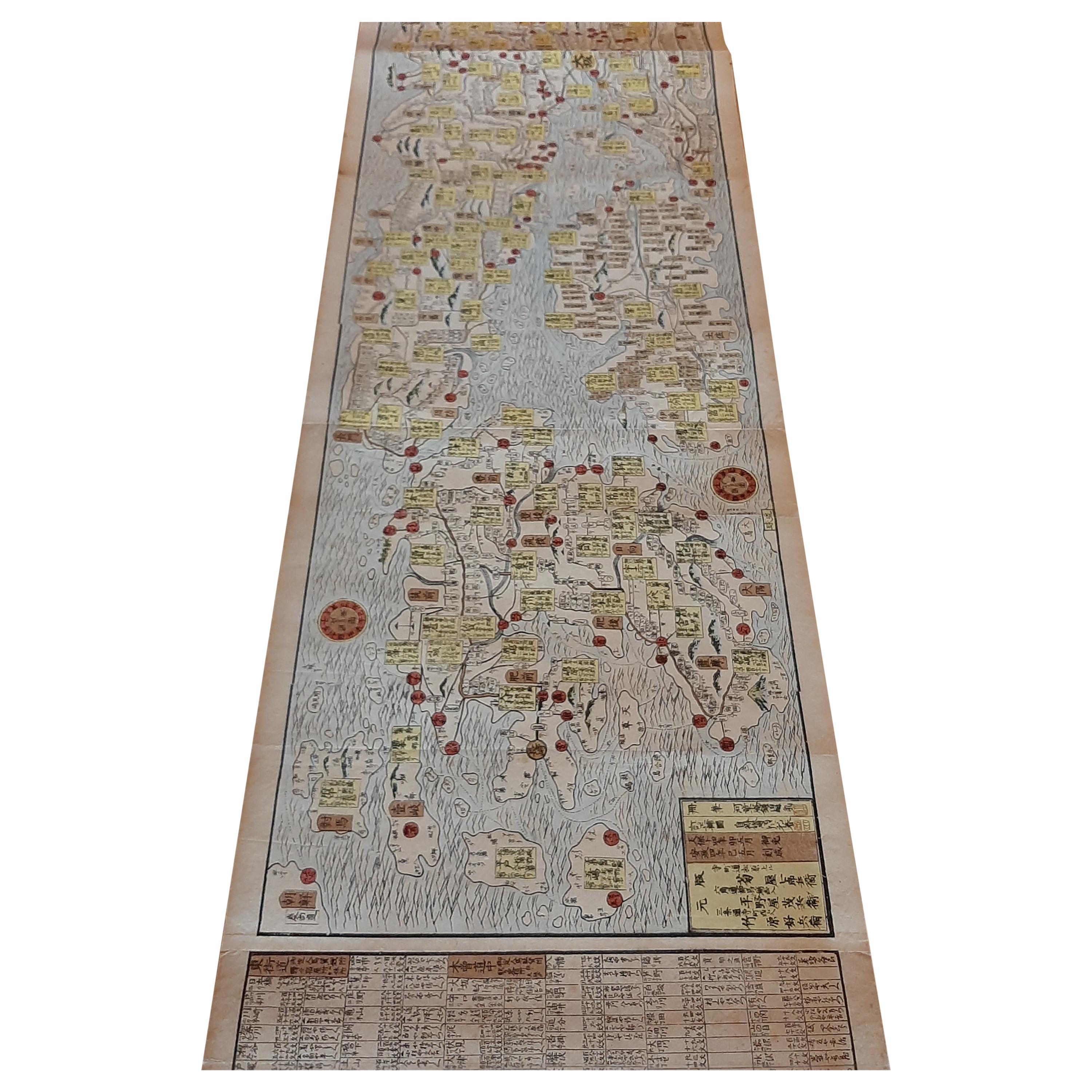
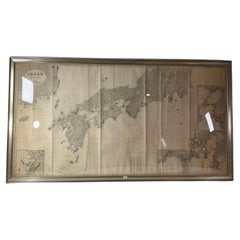
Geological folding map of the area with Wakayama, Nara, Osaka, Mie, and Shiga in Japan, circa 1880:
This map is a geological folding map, which means it was designed to be portable and easily used in the field. Created around 1880, it represents a period in Japanese history when Western scientific methods were increasingly being adopted, including in the field of geology.
The map covers a significant portion of the Kansai region of Japan, including the prefectures of Wakayama, Nara, Osaka, Mie, and Shiga. This area is known for its diverse geological features, ranging from coastal areas to mountainous regions.
As a geological map, it details the various types of rock formations, geological structures, fault lines, and possibly mineral deposits in these areas. The late 19th century was a time of rapid modernization in Japan, and such maps would have been crucial for various purposes, including mining, construction, and educational purposes.
The 1880s was a transformative period in Japan, known as the Meiji era, when the country was undergoing significant modernization and westernization. The creation of a detailed geological map during this time indicates the growing interest in and adoption of Western scientific techniques in Japan.
Since it's a folding map, it has been printed on durable paper and designed to withstand frequent use. The map features color-coding or other visual elements to distinguish different geological features.
This geological map of the Kansai region in Japan is not just a scientific tool but also a historical artifact that reflects the intersection of geography, geology, and the cultural and scientific evolution of Japan during a pivotal era in its history.
- Dimensions:Height: 48.43 in (123 cm)Width: 31.5 in (80 cm)Depth: 0.02 in (0.5 mm)
- Materials and Techniques:
- Period:
- Date of Manufacture:circa 1880
- Condition:Folding map, mounted on linen. Shows general age-related toning, foxing and some wear. Please study images carefully.
- Seller Location:Langweer, NL
- Reference Number:Seller: BG-115271stDibs: LU3054321190372
About the Seller
5.0
Recognized Seller
These prestigious sellers are industry leaders and represent the highest echelon for item quality and design.
Platinum Seller
Premium sellers with a 4.7+ rating and 24-hour response times
Established in 2009
1stDibs seller since 2017
2,517 sales on 1stDibs
Typical response time: <1 hour
- ShippingRetrieving quote...Shipping from: Langweer, Netherlands
- Return Policy
Authenticity Guarantee
In the unlikely event there’s an issue with an item’s authenticity, contact us within 1 year for a full refund. DetailsMoney-Back Guarantee
If your item is not as described, is damaged in transit, or does not arrive, contact us within 7 days for a full refund. Details24-Hour Cancellation
You have a 24-hour grace period in which to reconsider your purchase, with no questions asked.Vetted Professional Sellers
Our world-class sellers must adhere to strict standards for service and quality, maintaining the integrity of our listings.Price-Match Guarantee
If you find that a seller listed the same item for a lower price elsewhere, we’ll match it.Trusted Global Delivery
Our best-in-class carrier network provides specialized shipping options worldwide, including custom delivery.More From This Seller
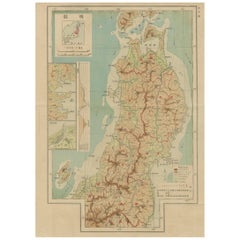
View AllAntique Map of the Region of Tokyo and Nagasaki in Japan, 1922
Located in Langweer, NL
Antique map of Japan titled 'Japan - Environs of Tokio & Nagasaki'. Old map of Japan, includes inset maps of Tokyo, Nagasaki and surroundings. This map or...
Category
20th Century Maps
Materials
Paper

$167 Sale Price
20% Off
Set of 11 Antique Maps of Japan Originating from a Japanese Atlas, 1906
Located in Langweer, NL
Set of 11 antique maps depicting various regions of Japan. These maps originate from a Japanese atlas, dated 1906. All text is in Japanese.
Category
20th Century Maps
Materials
Paper
$466 Sale Price / set
20% Off
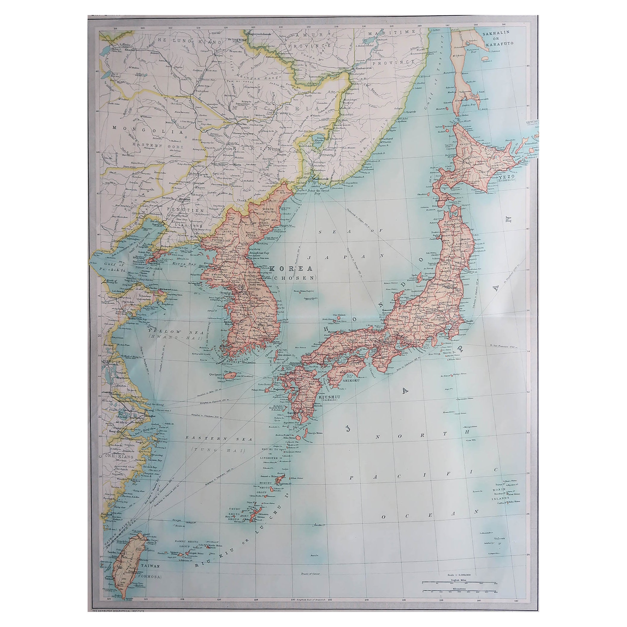
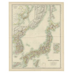
Antique Map of Japan and Korea by Johnston '1909'
Located in Langweer, NL
Antique map titled 'Japan and Korea'. Original antique map of Japan and Korea. With inset maps of the Japanese Empire, Port Arthur, Formosa ,Tokyo and Yoko...
Category
Early 20th Century Maps
Materials
Paper
$326 Sale Price
20% Off
Antique Woodblock Print Map of Japan 'circa 1860'
Located in Langweer, NL
Original Japanese woodblock print map of Japan. Very large and fascinating map, rebacking with Japanese paper. Published circa 1860.
Category
Antique Late 19th Century Maps
Materials
Paper
Antique Political Map of the Japanese Empire, 1922
Located in Langweer, NL
Antique map of Japan titled 'Japanese Empire - Political Map'. Old map of Japan depicting Japan, Korea and surroundings. This map originates from 'The Ti...
Category
20th Century Maps
Materials
Paper
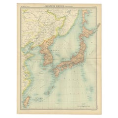
Antique Map of Japan, the Kurile Islands and Liu Kiu Islands, 1886
Located in Langweer, NL
The map is an exquisite piece, showcasing Japan's vibrant geography. Engraved by J. Bartholomew and published by George Philip & Son in London & Liverpool, it presents a detailed and...
Category
Antique Late 19th Century Maps
Materials
Paper
$111 Sale Price
20% Off
You May Also Like
Large Original Vintage Map of Japan, circa 1920
Located in St Annes, Lancashire
Great map of Japan
Unframed
Original color
By John Bartholomew and Co. Edinburgh Geographical Institute
Published, circa 1920
Free shipping.
Category
Vintage 1920s British Maps
Materials
Paper

Large Original Vintage Map of Japan, circa 1920
Located in St Annes, Lancashire
Great map of Japan
Original color. Good condition
Published by Alexander Gross
Unframed.
Category
Vintage 1920s English Maps
Materials
Paper

Chart of Japan by James Imray and Son
Located in Norwell, MA
Chart of southern Japan compiled by James F. Imray and published in 1870. The chart captures the coast and islands. Includes Nagasaki, Kii Channel, Gulf of Yed...
Category
Antique 1870s English Nautical Objects
Materials
Paper
China and Japan, English antique map by Alexander Keith Johnston, 1901
Located in Melbourne, Victoria
'China and Japan', antique lithographic map by Keith Johnston.
Central vertical fold as issued.
495mm by 625mm (sheet)
Alexander Keith Johnston FRS...
Category
Early 20th Century Victorian More Prints
Materials
Lithograph

Vintage Rollable Map Asia Japan Korea Wall Chart Poster Countrycore Decoration
Located in Berghuelen, DE
A decorative country core pull-down map depicting Japan and Korea. Published by Haack-Paincke Justus Perthes. Colorful print on paper reinforced with canvas.
Measurements:
Width 199....
Category
Late 20th Century German Country Prints
Materials
Canvas, Wood, Paper
Antique 1803 Italian Map of Asia Including China Indoneseia India
Located in Amsterdam, Noord Holland
Antique 1803 Italian Map of Asia Including China Indoneseia India
Very nice map of Asia. 1803.
Additional information:
Type: Map
Country of Manufacturing: Europe
Period: 19th centu...
Category
Antique 19th Century European Maps
Materials
Paper

$584 Sale Price
20% Off
More Ways To Browse
Japan Antiques Collectables
Antique Linen Map
Antique Geological Maps
Antique Compass Map
Blaeu Maps
Antique Collectables Australia
Military Map
Antique Maps Scotland
Mississippi Antique
Denmark Map
Antique Maps Of North America
Wine Map
Map Greece
Roman Map
Antique Maps Of Russia
Antique Roman Map
Maps Of Mediterranean
Mercator Map