Items Similar to Antique Map and Views of Batavia by Homann Heirs, '1733'


Want more images or videos?
Request additional images or videos from the seller
1 of 5
Antique Map and Views of Batavia by Homann Heirs, '1733'
$2,246.52
$2,995.3625% Off
£1,672.39
£2,229.8525% Off
€1,875
€2,50025% Off
CA$3,077.17
CA$4,102.8925% Off
A$3,422.48
A$4,563.3125% Off
CHF 1,787.12
CHF 2,382.8225% Off
MX$41,648
MX$55,530.6625% Off
NOK 22,824.19
NOK 30,432.2525% Off
SEK 21,405.06
SEK 28,540.0825% Off
DKK 14,273.72
DKK 19,031.6325% Off
Shipping
Retrieving quote...The 1stDibs Promise:
Authenticity Guarantee,
Money-Back Guarantee,
24-Hour Cancellation
About the Item
Antique map titled 'Der Hollaendisch-Ostindianischen Compagnie weltberuhmte Haupt-Handels und Niederlags-Stadt Batavia, in Asien auf dem grossen Eyland Iava in dem konigreich Iacatra nord-westlich gelegen, nach ihrem grund-ris und prospect mit erlauterung einiger ihrer besondersten merkwurdigkeiten / auf das accurateste vorgestellet von Homannischen Erben'.
Beautiful plan and views of Batavia, Jakarta, Indonesia. The various types of land use are shown, along with a comprehensive index and a text concerning the history of the city. Along the top, decorative galleons are shown, along with anchorage points. At the bottom is a large view of the fortified city from the water, along with smaller views of VOC Governor General's residence and the town hall.
Published by Homann Heirs, 1733. Homann Heirs was a German publishing firm that enjoyed a major place in the European map market throughout the 18th century. Founded in 1702 by Johann Baptist Homann, the business passed to his son, Christoph, upon Johann’s death in 1724. Christoph died in 1730, aged only 27, and the firm was inherited by subsequent Homann Heirs. This altered the name of the company, which was known as Homann Erben, or Homann Heirs. The firm continued in business until 1848.
- Dimensions:Height: 20.08 in (51 cm)Width: 24.02 in (61 cm)Depth: 0.02 in (0.5 mm)
- Materials and Techniques:
- Period:
- Date of Manufacture:1733
- Condition:General age-related toning. Original folding line, few worm holes outside image. Minor wear, blank verso. Please study images carefully.
- Seller Location:Langweer, NL
- Reference Number:Seller: BG-127231stDibs: LU3054321576902
About the Seller
5.0
Recognized Seller
These prestigious sellers are industry leaders and represent the highest echelon for item quality and design.
Platinum Seller
Premium sellers with a 4.7+ rating and 24-hour response times
Established in 2009
1stDibs seller since 2017
2,510 sales on 1stDibs
Typical response time: <1 hour
- ShippingRetrieving quote...Shipping from: Langweer, Netherlands
- Return Policy
Authenticity Guarantee
In the unlikely event there’s an issue with an item’s authenticity, contact us within 1 year for a full refund. DetailsMoney-Back Guarantee
If your item is not as described, is damaged in transit, or does not arrive, contact us within 7 days for a full refund. Details24-Hour Cancellation
You have a 24-hour grace period in which to reconsider your purchase, with no questions asked.Vetted Professional Sellers
Our world-class sellers must adhere to strict standards for service and quality, maintaining the integrity of our listings.Price-Match Guarantee
If you find that a seller listed the same item for a lower price elsewhere, we’ll match it.Trusted Global Delivery
Our best-in-class carrier network provides specialized shipping options worldwide, including custom delivery.More From This Seller
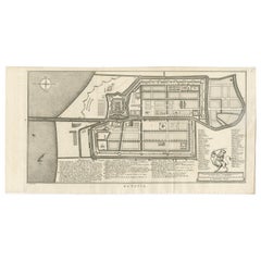
View AllAntique Map of the City of Batavia by Van der Aa 'c.1730'
Located in Langweer, NL
Antique map titled 'Plan de la Ville et du Chateau de Batavia en l'Isle de Iava - Ware affbeeldinge wegens het Casteel ende Stadt Batavia gelegen op groot Eylant Java'. Detailed plan...
Category
Antique Mid-18th Century Maps
Materials
Paper

$1,150 Sale Price
20% Off
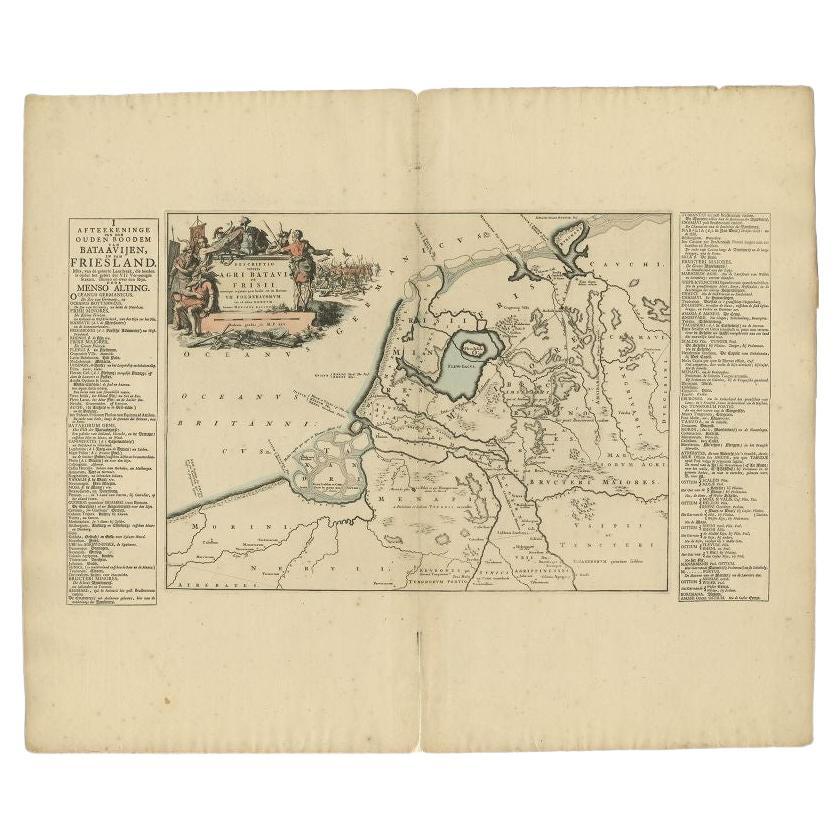
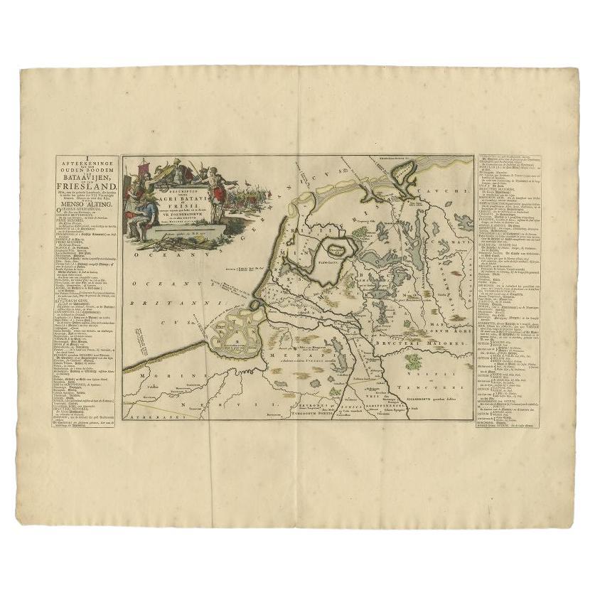
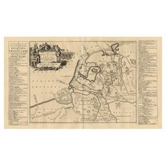
Antique Map of the Old Land of Batavia and FriesLand by Halma, 1718
Located in Langweer, NL
Antique map Friesland titled 'Descriptio veteris Agri Batavi et Frisii (..)'. Old map of Friesland, the Netherlands. This map depicts the old land of Batavia and Friesland. Originate...
Category
Antique 18th Century Maps
Materials
Paper
Rare 1681 Map of Batavia: Detailed Dutch Colonial Era Cartography, 1681
Located in Langweer, NL
The map of Batavia (modern-day Jakarta) from 1681, attributed to Frederick de Wit holds significant historical importance for several reasons:
Historical Context
1. Colonial Era: This map dates back to the Dutch colonial era when Batavia served as the administrative and commercial hub of the Dutch East India Company (VOC). The VOC was a powerful trading entity that played a crucial role in the global spice trade and colonization in Southeast Asia.
2. Strategic Importance: Batavia was strategically located on the northwestern coast of Java, providing the Dutch with a critical base for their maritime operations. The city became the center of Dutch political and military control in the region.
Cartographic Significance
1. Detailed Urban Layout: The map meticulously details the layout of Batavia, including its fortifications, canals, streets, and significant buildings. This level of detail provides insights into the urban planning and architectural styles of the period.
2. Military Engineering: The fortifications shown on the map illustrate the advanced military engineering techniques used by the Dutch to protect their valuable colony. The walls, bastions, and moats indicate the strategic considerations taken to defend against potential invasions.
3. Maritime Activity: The depiction of ships in the harbor highlights Batavia's role as a major maritime center. The VOC's fleets were essential for trade routes connecting Europe, Africa, and Asia, making Batavia a crucial node in global commerce.
Artistic and Cultural Value
1. Artistic Elements: The decorative elements, such as the lion holding a shield and the intricate cartouches, reflect the artistic trends of Dutch Golden Age cartography. These embellishments were not only informative but also served to display the cartographer's skill and the map's prestige.
2. Cultural Exchange: Maps like this one provide evidence of cultural exchange between the Dutch and the indigenous populations of Java. The blending of Dutch and local influences can be seen in various aspects of the map and the architecture of the city.
Rarity and Preservation
1. Rarity: Maps from the 17th century, especially those in good condition, are relatively rare and highly valued by collectors and historians. Each map provides a unique snapshot of historical geography and urban development.
2. Preservation of History: This map serves as a historical document, preserving knowledge about Batavia's cityscape, infrastructure, and colonial governance. It helps historians and scholars understand the socio-economic and political dynamics of the period.
Conclusion
The map of Batavia from 1681 is special due to its detailed depiction of one of the most important colonial cities in Southeast Asia during the Dutch Golden Age. It reflects the strategic, economic, and cultural significance of Batavia, serving as a valuable resource for understanding the history of Dutch colonialism and its global impact. The map's artistry and precision make it an important artifact in the history of cartography.
---------------
The map is an original and historical map of Batavia (present-day Jakarta) on the island of Java, dated 1681. There are several details to consider when evaluating its origins and possible authorship:
1. **Style and Detail**: The intricate details and style are reminiscent of maps created by Frederick de Wit, a prominent Dutch cartographer and engraver of the 17th century. He was known for his detailed city maps and sea charts.
2. **Lack of Signature**: The absence of "F. de Wit, Excudit" could indicate either an omission or a different engraver. However, it is essential to note that some maps from that period were reproduced or copied by other engravers and cartographers. This was not uncommon, as map-making was a collaborative effort, and copies of popular maps were frequently made.
3. **Map Characteristics**:
- The depiction of ships and the detailed fortifications are typical of Dutch cartography in the late 17th century.
- The decorative elements, such as the lion holding a shield, are also characteristic of Dutch map engravers.
4. **Other Possible Engravers**: While Frederick de Wit is a strong candidate, other notable Dutch engravers from that period include Joan Blaeu and Willem Janszoon Blaeu. They also produced highly detailed maps and could potentially be the creators or inspirers of this map.
To determine the precise authorship, you might consider:
- **Comparing** this map with other confirmed works of Frederick de Wit and his contemporaries to identify stylistic similarities and differences.
- **Historical Records**: Consulting historical records or publications related to Dutch cartography in the 17th century might provide more context or even direct references to this particular map.
If you have access to additional details or higher-resolution images of specific sections, it might help further pinpoint the map's origin and authorship.
-------------
Frederick de Wit (1629–1706) was a prominent Dutch cartographer, engraver, and publisher known for his detailed and decorative maps, atlases, and globes. He played a significant role in the Dutch Golden Age of cartography, contributing to the wealth of geographic knowledge and artistic achievement during this period. Here are key aspects of his life and work:
### Biography
- **Early Life**: Frederick de Wit was born in Gouda, Netherlands, in 1629. Little is known about his early years, but he moved to Amsterdam, the epicenter of Dutch cartography, in the mid-17th century.
- **Career Beginnings**: De Wit began his career as an engraver and publisher, initially producing maps that were reissues of earlier works by other cartographers, such as Joan Blaeu and Willem Janszoon Blaeu.
### Contributions to Cartography
- **Mapmaking**: De Wit was known for his meticulous attention to detail and artistic flair. He produced a wide range of maps, including world maps, regional maps, city plans, and maritime charts...
Category
Antique 1680s Maps
Materials
Paper
$5,655 Sale Price
20% Off
Free Shipping
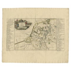
Antique Map of the Old Land of Batavia and Friesland by Halma, 1718
Located in Langweer, NL
Antique map Friesland titled 'Descriptio veteris Agri Batavi et Frisii (..)'. Old map of Friesland, the Netherlands. This map depicts the old land of Batavia and Friesland. Originate...
Category
Antique 18th Century Maps
Materials
Paper
$220 Sale Price
20% Off
Antique Map of the Old Land of Batavia and Friesland by Halma, 1718
Located in Langweer, NL
Antique map Friesland titled 'Descriptio veteris Agri Batavi et Frisii (..)'. Old map of Friesland, the Netherlands. This map depicts the old land of Batavia and Friesland. Originate...
Category
Antique 18th Century Maps
Materials
Paper
$244 Sale Price
20% Off
Antique Map of Batavia by Van Schley 'c.1750'
Located in Langweer, NL
Antique map titled 'Batavia'. Original antique map of Batavia, Jakarta, Indonesia. This print originates from the Dutch edition of Prevost's 'Histoire Generale des Voyages' (Paris 17...
Category
Antique Mid-18th Century Prints
Materials
Paper
$431 Sale Price
20% Off
You May Also Like
1643 Willem&Joan Blaeu Map NW Flanders "Flandriae Teutonicae Pars Prientalior
Located in Norton, MA
1643 Willem and Joan Blaeu map of northwest Flanders, entitled
"Flandriae Teutonicae Pars Prientalior,"
Ric0012
" Authentic" - Map of the northwest Fl...
Category
Antique 17th Century Dutch Maps
Materials
Paper

1654 Joan Blaeu Map the Sutherland, Scotland, Entitled "Southerlandia, "Ric0007
Located in Norton, MA
1654 Joan Blaeu map of the
Sutherland, Scotland, entitled
"Southerlandia,"
Hand Colored
Ric0007
Description:
Lovely map centered on Sedan and D...
Category
Antique 17th Century Dutch Maps
Materials
Paper

1635 Willem Blaeu Map of Northern France"Comitatvs Bellovacvm" Ric.a08
Located in Norton, MA
1635 Willem Blaeu map of northern France, entitled.
"Comitatvs Bellovacvm Vernacule Beavvais,"
Colored
Ric.a008
“COMITATVS BELLOVACVM…” Amsterdam: W...
Category
Antique 17th Century Unknown Maps
Materials
Paper

1620 Map of Artois Entitled "Artesia Comitatvs Artois, " by Bleau, Ric.a012
Located in Norton, MA
1640 map of Artois entitled
"Artesia Comitatvs Artois,"
by Bleau
Colored
A-012.
Detailed map of the northern province of Artois, France on the border with Belgium. Feature...
Category
Antique 17th Century Dutch Maps
Materials
Paper

Framed 1731 Color Engraving, Map of Rotterdam by Matthaus Seutter, "Roterodami"
Located in Bridgeport, CT
"Roterodami". Seutter (1678-1757) was an important German 18th century map maker. Bird's eye view of the city above with full details, neoclassi...
Category
Antique 18th Century European Renaissance Maps
Materials
Glass, Wood, Paper

Antique Map Of Brabantia Ducantus By Bleau Circa 1640
Located in Brussels, Brussels
map of theBrabantia Ducantus (Belgium) circa 1640 by Bléau. Bléau was well known for antique atlas that he draw during the 17 century
beautiful map, double page folded in the middle,...
Category
Antique 17th Century French Renaissance Maps
Materials
Paper

More Ways To Browse
Antique Galleon
Used Furniture Anchorage
Antique Roman Map
Maps Of Mediterranean
Mercator Map
Antique Railroad Furniture
Atlas Globe
Antique Mississippi Furniture
Framed World Map
Hand Drawn Map
Rare Compass
Antique Furniture Rollers
16th Century Scotland
Antique Wood Coat Of Arms
Antique Maps Australia
Antique Quadrant
Caribbean Antique Furniture
Antique Native American Collectibles