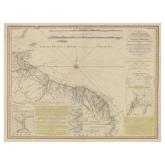
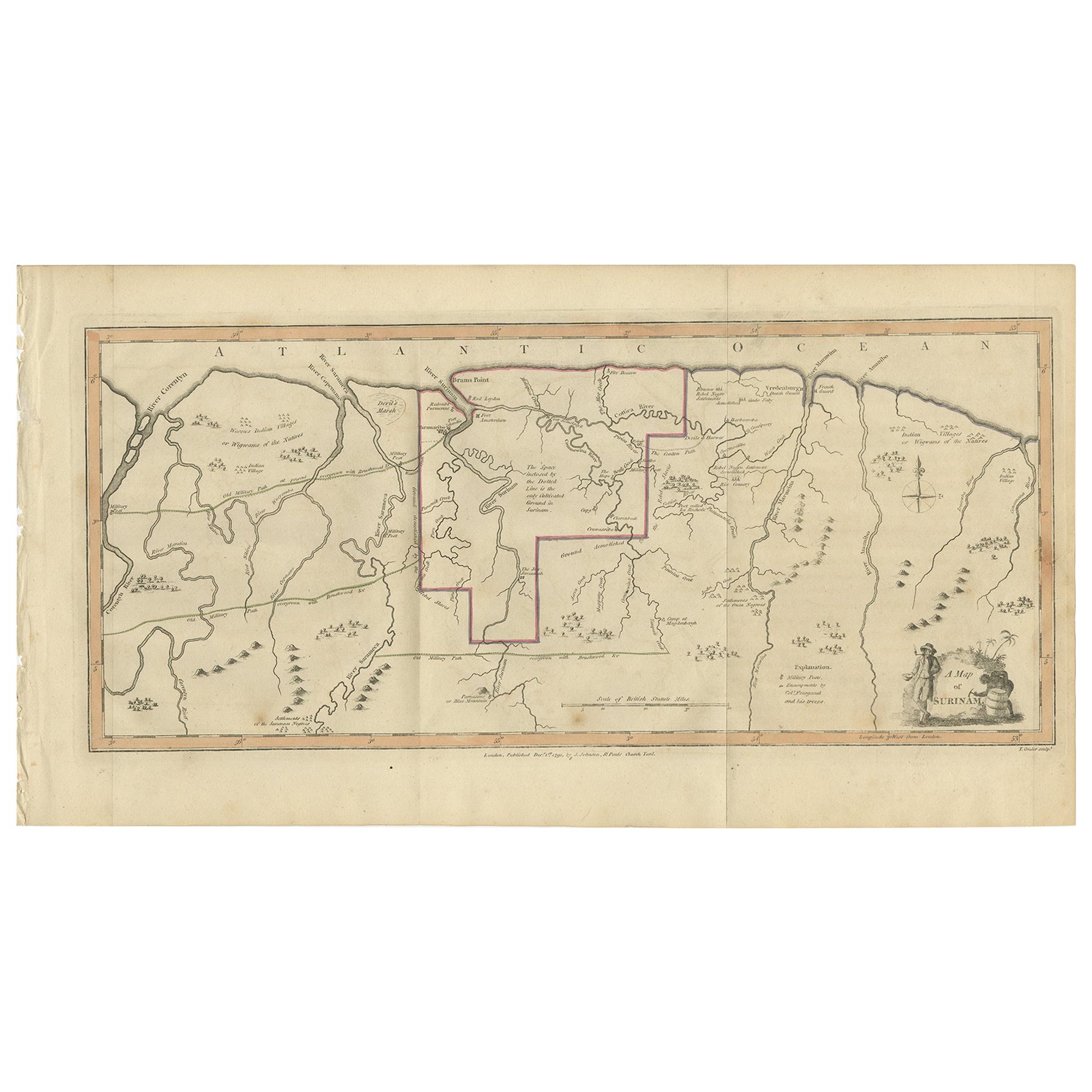
Old Map of the Coast of Guyana and Surinam, South America, 1783
View Similar Items


Want more images or videos?
Request additional images or videos from the seller
1 of 7
Old Map of the Coast of Guyana and Surinam, South America, 1783
Price:$826
$1,107.91List Price
About the Item
- Dimensions:Height: 23.04 in (58.5 cm)Width: 30.91 in (78.5 cm)Depth: 0 in (0.02 mm)
- Materials and Techniques:
- Period:1780-1789
- Date of Manufacture:1783
- Condition:Repaired: Some tears professionally restored (slightly affecting image). Condition: Good, some tears professionally restored (slightly affecting image). Please study image carefully.
- Seller Location:Langweer, NL
- Reference Number:Seller: BG-06206 1stDibs: LU3054327385012
About the Seller
5.0
Recognized Seller
These prestigious sellers are industry leaders and represent the highest echelon for item quality and design.
Platinum Seller
Premium sellers with a 4.7+ rating and 24-hour response times
Established in 2009
1stDibs seller since 2017
2,534 sales on 1stDibs
Authenticity Guarantee
In the unlikely event there’s an issue with an item’s authenticity, contact us within 1 year for a full refund. DetailsMoney-Back Guarantee
If your item is not as described, is damaged in transit, or does not arrive, contact us within 7 days for a full refund. Details24-Hour Cancellation
You have a 24-hour grace period in which to reconsider your purchase, with no questions asked.Vetted Professional Sellers
Our world-class sellers must adhere to strict standards for service and quality, maintaining the integrity of our listings.Price-Match Guarantee
If you find that a seller listed the same item for a lower price elsewhere, we’ll match it.Trusted Global Delivery
Our best-in-class carrier network provides specialized shipping options worldwide, including custom delivery.More From This Seller
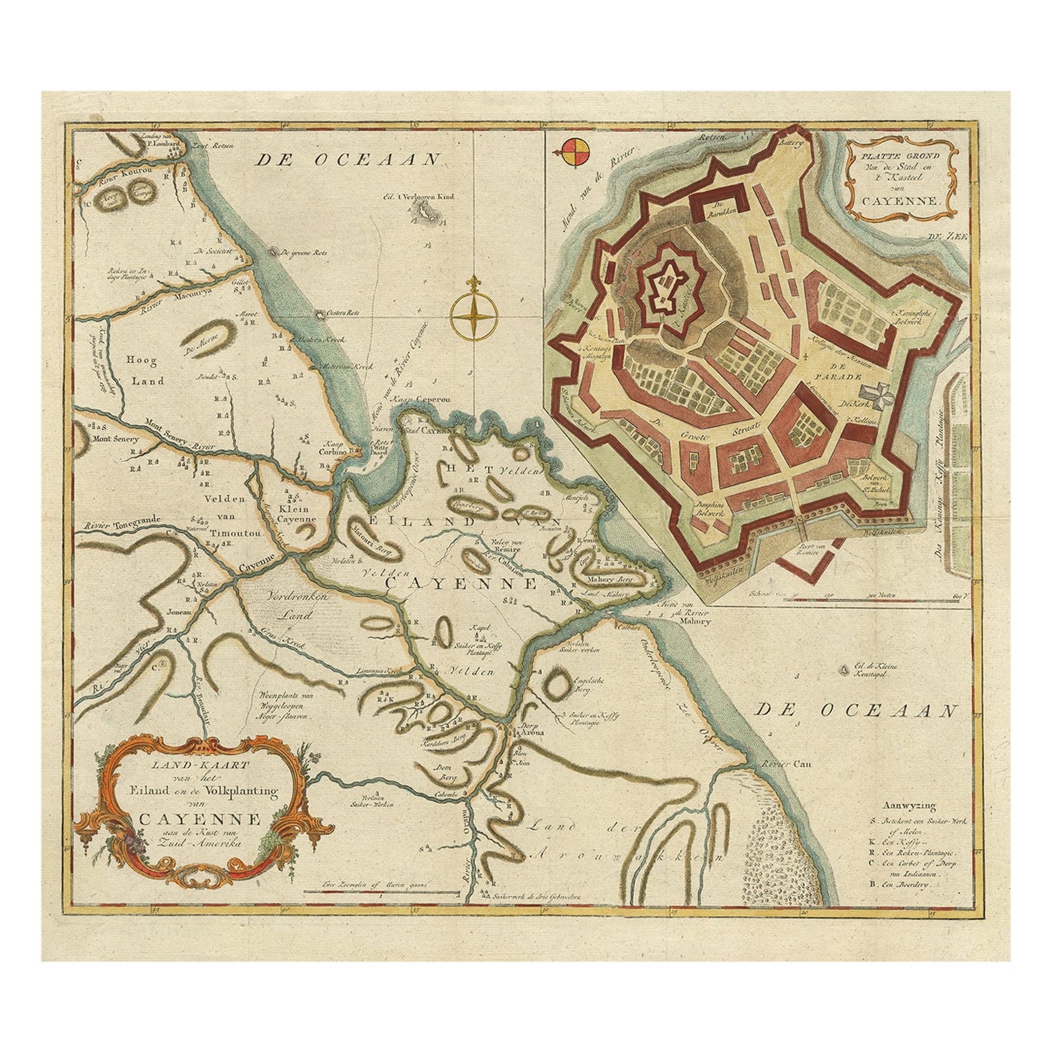
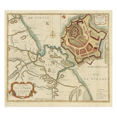
View AllStriking Antique Map of Cayenne in French Guyana, South America, ca.1760
Located in Langweer, NL
Description: Antique map titled 'Land-kaart van het Eiland en de Volkplanting van Cayenne aan de Kust van Zuid-Amerika'.
Striking map of the island and settlement of Cayenne in F...
Category
Antique 1760s Maps
Materials
Paper
$1,272 Sale Price
20% Off
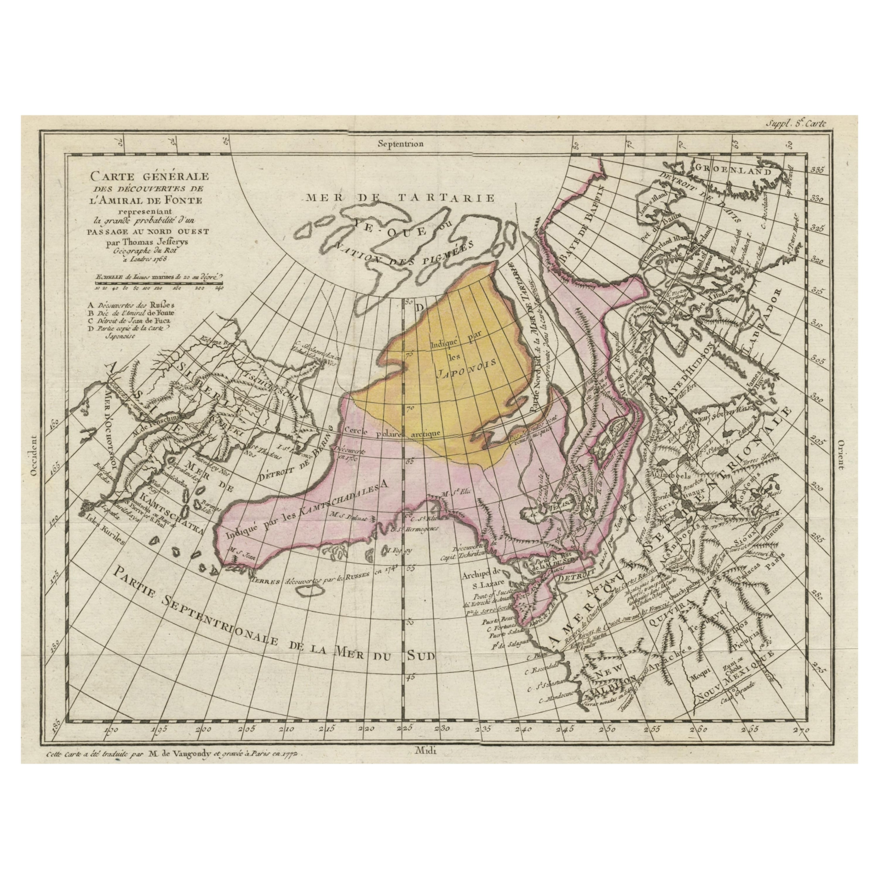
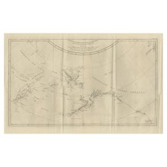
Interesting Old Map of the Nw Coast of America and the Ne Coast of Asia, ca.1772
Located in Langweer, NL
Antique map titled 'Carte Generale des Decouvertes de l'Amiral de Fonte (..)'.
Original antique map of the discoveries of Admiral de Fonte, showing the possibility of a north-west passage. Interesting map of the NW Coast...
Category
Antique 1770s Maps
Materials
Paper

$559 Sale Price
35% Off
Antique Map of a Bay on the Coast of Chile, South America, c.1749
Located in Langweer, NL
Antique map titled 'Plan van een Baai en Haven aan de Kust van Chili (..) - Plan d'une Baye de la Côte du Chili (..)'. Original antique map of a bay on the coast of Chile discovered ...
Category
Antique 18th Century Maps
Materials
Paper

$301 Sale Price
20% Off
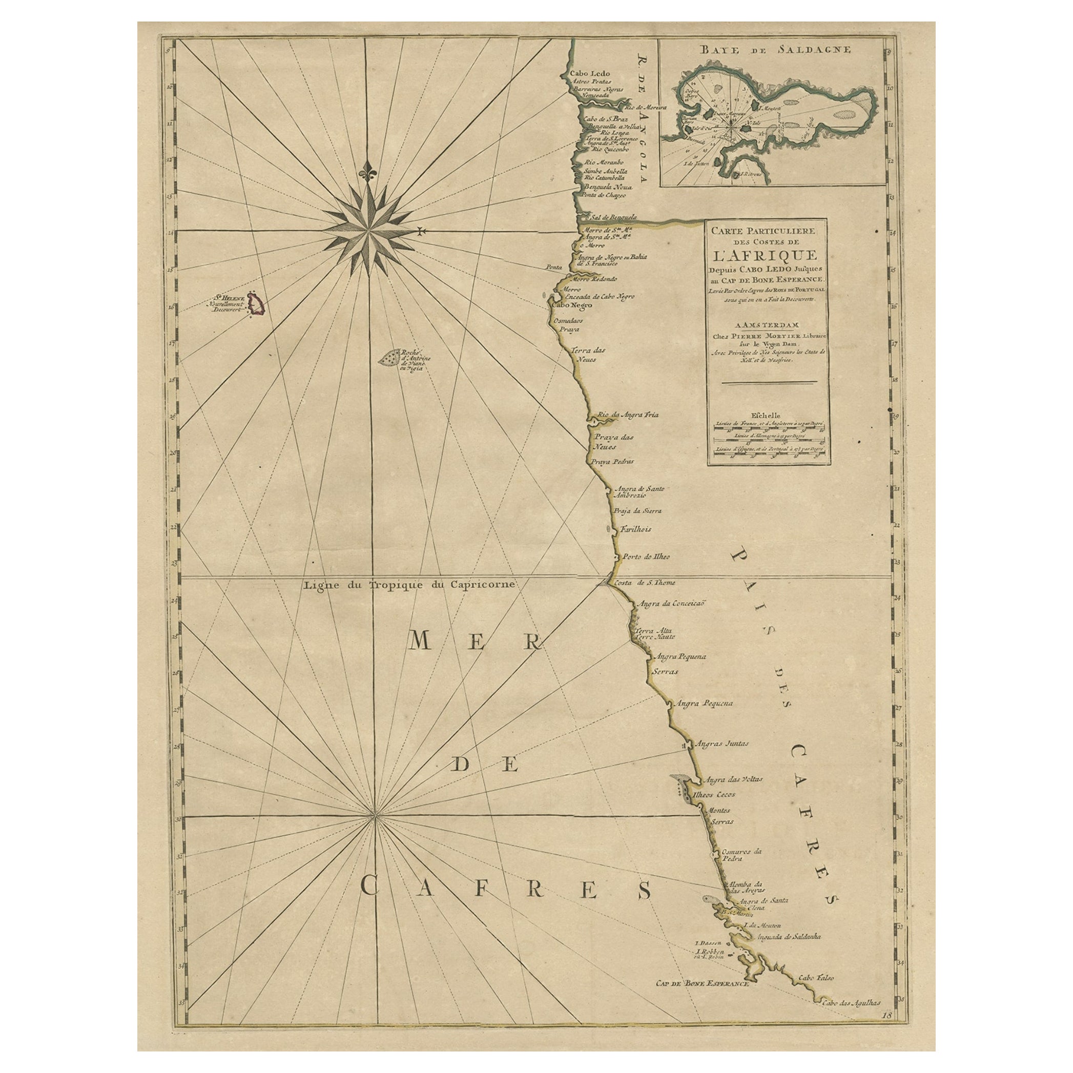
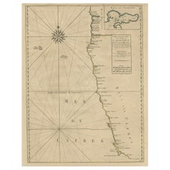
Old Map of the Namibia and South Africa Coasts & Inset of Saldanha Bay, ca.1700
Located in Langweer, NL
Antique map titled 'Carte particuliere des Costes de l'Afrique'.
Map of the coasts of Namibia and South Africa. With an inset map of Saldanha Bay.
Artists and Engravers: Publ...
Category
Antique Early 1700s Maps
Materials
Paper
$603 Sale Price
20% Off
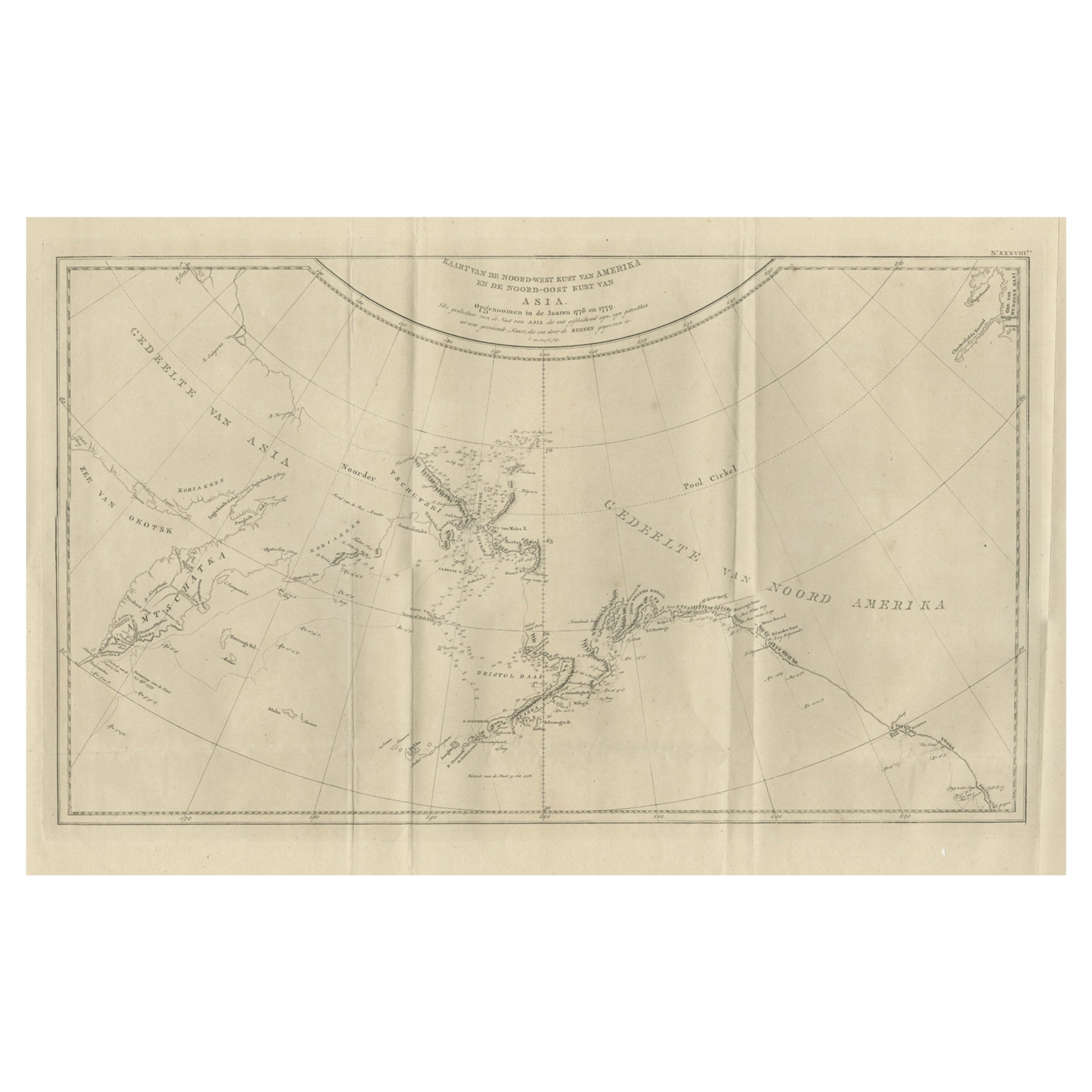
Old Map Showing the Tracks of Cook Between North America and Asia's Coast, 1803
Located in Langweer, NL
Description: Antique map titled 'Kaart van de Noord-West kust van Amerika en de Noord-Oost kust van Asia'.
Antique chart depicting America's northwest coast and Asia's northeast ...
Category
Antique Early 1800s Maps
Materials
Paper
$895 Sale Price
20% Off
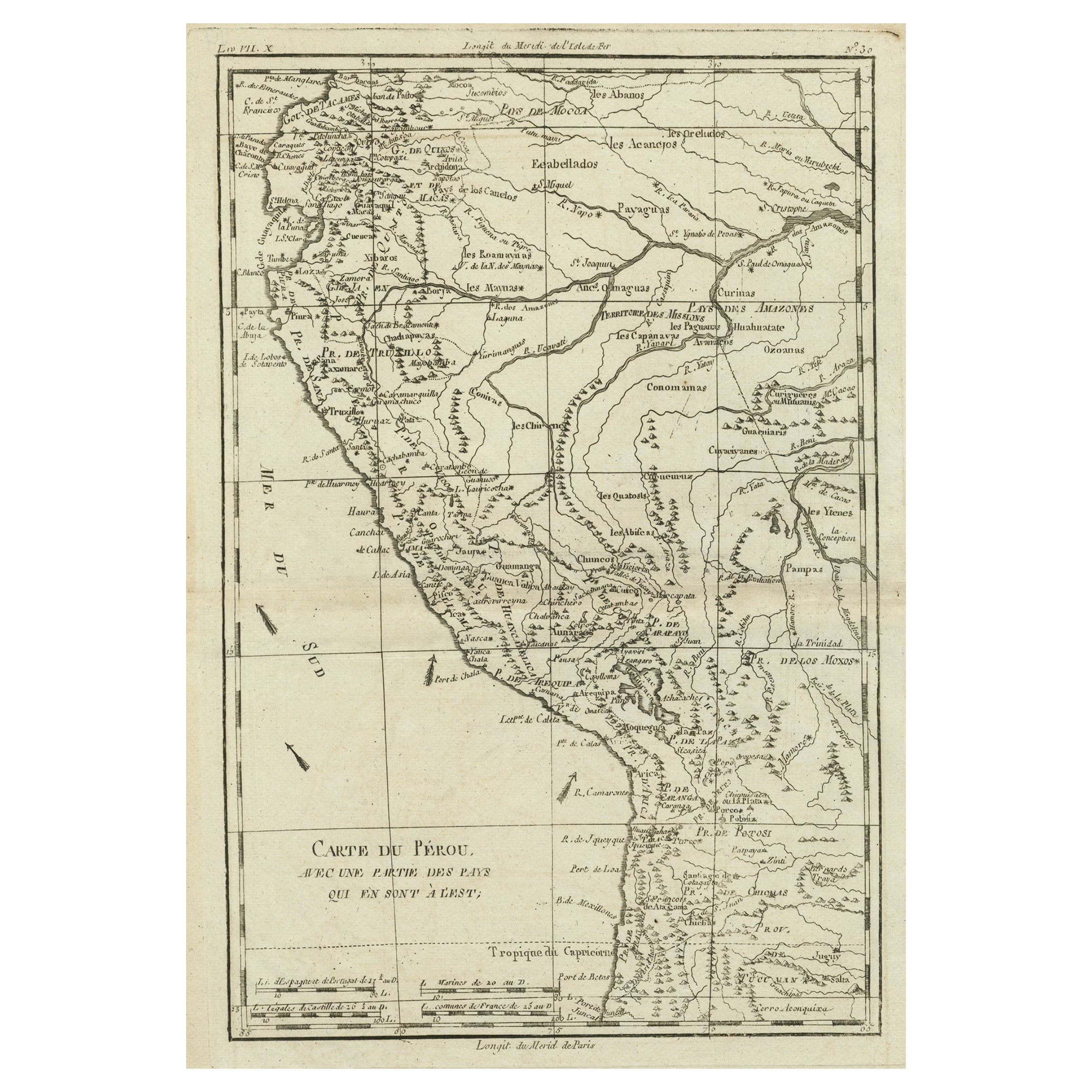
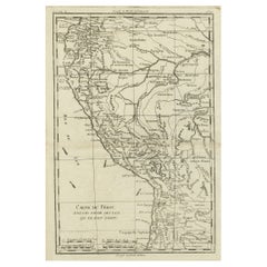
Map of the Western Coast of South America from Ecuador into Chili, ca.1780
Located in Langweer, NL
Antique map titled 'Carte du Perou avec une partie des pays qui en sont a l'est.'
Map of the western coast of South America extending from Ecuador, through Peru and present-day B...
Category
Antique 1780s Maps
Materials
Paper
$320 Sale Price
20% Off
You May Also Like
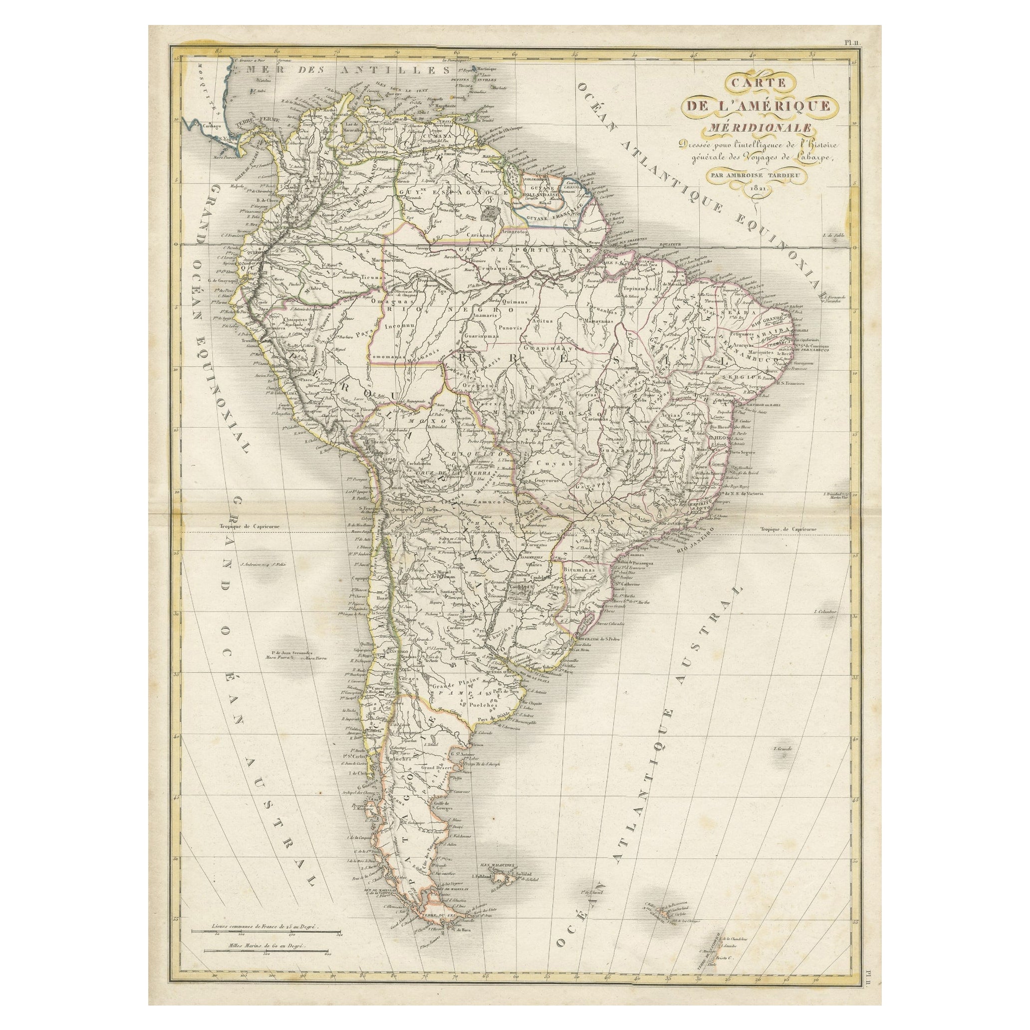
Original Antique Map of South America. C.1780
Located in St Annes, Lancashire
Great map of South America
Copper-plate engraving
Published C.1780
Two small worm holes to left side of map
Unframed.
Category
Antique Early 1800s English Georgian Maps
Materials
Paper

Old Horizontal Map of England
By Tasso
Located in Alessandria, Piemonte
ST/520 - Old rare Italian map of England, dated 1826-1827 - by Girolamo Tasso, editor in Venise, for the atlas of M.r Le-Sage.
Category
Antique Early 19th Century Italian Other Prints
Materials
Paper

New Map of North America from the Latest Discoveries, 1763
Located in Philadelphia, PA
A fine antique 18th century map of the North American seaboard.
Entitled "A New Map of North America from the Latest Discoveries 1763".
By the Cartographer/Engraver - John Spil...
Category
Antique Mid-18th Century English Georgian Maps
Materials
Paper

Original Antique Map of South Africa, Arrowsmith, 1820
Located in St Annes, Lancashire
Great map of South Africa.
Drawn under the direction of Arrowsmith.
Copper-plate engraving.
Published by Longman, Hurst, Rees, Orme and Br...
Category
Antique 1820s English Maps
Materials
Paper

South America: Hand-colored 18th Century Framed Map by Thomas Jefferys
By Thomas Jefferys
Located in Alamo, CA
This detailed hand-colored map of South America by Thomas Jefferys was published in London in 1750. The map shows countries, early colonial possessions, towns, rivers, mountains, and...
Category
Antique Mid-18th Century English Maps
Materials
Paper

North & South America: A 17th Century Hand-colored Map by Jansson & Goos
By Johannes Janssonius
Located in Alamo, CA
A 17th century hand-colored map of North & South America entitled "Americae Descriptio" by the cartographer Johannes Jansson, published in Jansson's Atlas Minor in Amsterdam in 1628....
Category
Antique 1620s Dutch Maps
Materials
Paper

Recently Viewed
View AllMore Ways To Browse
Guyana Antique Map
Antique Map Of Thailand
Antique Mississippi Map
Antique Ohio Maps
Burgundy Map
John Speed Maps
Antique Map Of Turkish Empire
Antique Portuguese Scales
Canadian Atlas Furniture
Prussia Map
Afghanistan Map
Malabar Map
Antique Compass Made In France
Antique Maps Dublin
Antique Newfoundland Canada
John Speed Antique Maps
Malaysia Map
Sebastian Munster