18th Century and Earlier Maps
to
2,337
2,901
64
2,968
26
12
1
1
2,968
2,281
475
3
290
34
10
126
10
37
9
2
5
4
3
3
2,954
30
20
3
3
347
114
90
81
52
2,968
2,968
2,968
59
21
13
12
12
Period: 18th Century and Earlier
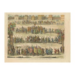
Old Original Copper Engraving Depicting a Viceroy with Entourage in China, 1735
Located in Langweer, NL
Original handtinted copper engraving with title: 'Cortege d'un Viceroy tout les fois qu'il sort de son palais'.
Translate in English: 'Procession of a Viceroy whenever he leaves h...
Category
Antique 18th Century and Earlier Maps
Materials
Paper
$341 Sale Price
20% Off
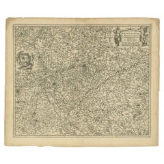
Antique Map of the Hainaut Region by Visscher, c.1690
Located in Langweer, NL
Antique map titled 'Comitatus Hannoniae et Archiepiscopatus Cameracensis Tabula'. Large map of the Hainaut region, France.
Artists and Engravers: Nicolaes Visscher II (1649, Amst...
Category
Antique 18th Century and Earlier Maps
Materials
Paper
$308 Sale Price
20% Off
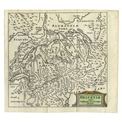
Antique Map of Switzerland by Cluver, 1685
Located in Langweer, NL
Antique map titled 'Helvetiae Conterminarumque Terrarii, antiqua descriptio.' Miniature map of Switzerland, from the pocket atlas 'Introductionis in...
Category
Antique 18th Century and Earlier Maps
Materials
Paper
$109 Sale Price
20% Off
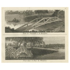
Print of the Bridge of Painshill & Windsor Park, Belfast, Northern Ireland, 1785
Located in Langweer, NL
Antique print titled 'Pont de Painshill á M. Hamilton (..)'.
Copper engraving of the bridge of Painshill and Windsor Park. This print originates from 'Jardins Anglo-Chinois à la ...
Category
Antique 18th Century and Earlier Maps
Materials
Paper
$369 Sale Price
20% Off
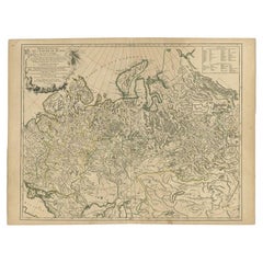
Antique Map of the Russian Empire in Europe by Vaugondy, 1750
Located in Langweer, NL
Antique map titled 'Partie Occidentale de l'Empire de Russie (..)'. Detailed map of the western part of Russia, extending south to the Caspian and east to Irkurkoy and Ilimskoy.
A...
Category
Antique 18th Century and Earlier Maps
Materials
Paper
$322 Sale Price
20% Off
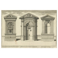
Antique Print of Water Fountains in Paris by Perelle, c.1660
Located in Langweer, NL
Antique print titled 'Fontaine de la Ruë St. Louis au Marais - Fontaine de la Porte St. Germain - Fontaine St. Ovide'. Elevations of water fountains in Paris, France. Source unknown,...
Category
Antique 18th Century and Earlier Maps
Materials
Paper
$104 Sale Price
20% Off
Antique Print of San Nicola Da Tolentino Agli Orti Sallustiani by De Rossi
Located in Langweer, NL
Antique print titled 'Facciata della Chiesa di S. Nicola da Tolentio, a Capo le Case'. Old print of the San Nicola da Tolentino agli Orti Sallustiani church...
Category
Antique 18th Century and Earlier Maps
Materials
Paper
Antique Map of the Region of the Sok River in Russia, 1794
Located in Langweer, NL
Antique map titled 'Carte de la Contrée qui s’étend le long de la Soka, depuis sa source jusquá Sergiefskoi Prigorod et le long des petites rivieres de Sourgout et de Schoumbout’.
...
Category
Antique 18th Century and Earlier Maps
Materials
Paper
Two Antique Sea Charts of the Thousand Islands between Batavia and Bantam, c1734
Located in Langweer, NL
Antique maps titled 'A large draught of the Coast of Iava from Bantam Point to Batavia'. Two seperate sheets, joined together they depict the island of Java, Indonesia.
Condition...
Category
Antique 18th Century and Earlier Maps
Materials
Paper
$1,564 Sale Price / set
20% Off
Antique Map of the Region of Salzburg by Ortelius 'circa 1606'
Located in Langweer, NL
Antique map titled 'Salisburgensis Iurisdictionis'. Original antique map of the region of Salzburg, Austria. Published by A. Ortelius, circa 1606.
Category
Antique 18th Century and Earlier Maps
Materials
Paper
$711 Sale Price
20% Off
Antique Map of Silesia, Southwest Poland and a City View of Wroclaw, c 1720
Located in Langweer, NL
Antique map titled 'Superioris et Inferioris ducatus Silesiae (..)'.
Detailed map of Silesia by Johann Baptist Homann. Shows the Southwestern part of Poland between Frankfurt Oder ...
Category
Antique 18th Century and Earlier Maps
Materials
Paper
Regional Antique Map of the Baltic, Extending from Stralsund to Dantzig, ca.1720
Located in Langweer, NL
Antique map titled 'Ducatus Pomeraniae (..)'. Regional map of the Baltic, extending from Stralsund and Rugia in the west to Dantzig and Culman on the Vistula in the east. Large carto...
Category
Antique 18th Century and Earlier Maps
Materials
Paper
$843 Sale Price
20% Off
Antique Map of Estates of The Year 1669 in Amsterdam, Published c.1767
Located in Langweer, NL
Antique map titled 'Kaart der Landerijen, gelegen aan of onder de rooyinge der honderd gaarden (..)'. Map showing estates in Amsterdam in 1669. Published by Yntema and Tieboel, 1767....
Category
Antique 18th Century and Earlier Maps
Materials
Paper
$331 Sale Price
20% Off
Original Hand-Coloured Nautical Chart of West-Africa, c.1680
Located in Langweer, NL
NIEUWE PASKAERT VAN DE KUST VAN GENEHOA (Senegal) alsmede een gedeelte van Gambia beginnende an C. Blanco tot C. Verde (...). Amsterdam, Johannus van Keulen, c. 1680.
Large folio...
Category
Antique 18th Century and Earlier Maps
Materials
Paper
$1,374 Sale Price
20% Off
Copper Engraving with a View on the Volga River in Russia, 1714
Located in Langweer, NL
Antique print titled 'Gezicht op de Rivier'.
Copper engraving with a view on the Volga river. This print originates from 'Reizen over Moskovie, door Persie en Indie (..)' by C. d...
Category
Antique 18th Century and Earlier Maps
Materials
Paper
$180 Sale Price
20% Off
Pl. 21 Antique Print of a Garden Fountain by Le Rouge, c.1785
Located in Langweer, NL
Antique print titled 'Fontaine Rouge No. 3 du Plan Général'. Copper engraving of a garden fountain. This print originates from 'Jardins Anglo-Chinois à la Mode' by Georg Louis le Rou...
Category
Antique 18th Century and Earlier Maps
Materials
Paper
Antique Map of Northamptonshire by Speed, 1676
Located in Langweer, NL
Antique map titled 'Norhamtonshire'. Map of Norhamptonshire, England. Includes inset town plans of Peterborough and Northampton. This map originates from 'Theatre of Great Britaine' ...
Category
Antique 18th Century and Earlier Maps
Materials
Paper
$521 Sale Price
20% Off
Pl. 25 Antique Print of a Gallery Cross-Section by Le Rouge, c.1785
Located in Langweer, NL
Antique print titled 'Coupe sur la largeur de la même Galerie'. Copper engraving showing a cross-section of a gallery. This print originates from 'Jardins Anglo-Chinois à la Mode' by...
Category
Antique 18th Century and Earlier Maps
Materials
Paper
Set of 2 Costume Prints and a Map of Spain and Portugal, circa 1720
Located in Langweer, NL
Set of two costume prints and a map of Spain and Portugal. The costume prints show costumes of Portugal and Spain and originate from Nouvelle méthode pour apprendre la géographie uni...
Category
Antique 18th Century and Earlier Maps
Materials
Paper
$426 Sale Price
20% Off
Antique Print of Sandon Hall by White, c.1770
Located in Langweer, NL
Antique print titled 'Principal Front of Sandon'. Architectural elevation of Sandon Hall, Staffordshire. This print originates from 'Vitruvius...
Category
Antique 18th Century and Earlier Maps
Materials
Paper
Antique Map of the Region of Brie and Champagne by Zatta, 1779
Located in Langweer, NL
Antique map titled 'Li Governi di Sciampagna e Brie'. Old map of France showing the provinces of Brie and Champagne. This map originates from 'Atlante Novissimo, illustrato ed accres...
Category
Antique 18th Century and Earlier Maps
Materials
Paper
Antique Print of the South-East Facade of the Mansion at Kirtlington Park, c1770
Located in Langweer, NL
Antique print titled 'South East Front of Kirtlington Park (..)'.
View of the south-east facade of the mansion at Kirtlington Park, Oxfordshire. This print originates from 'Vitru...
Category
Antique 18th Century and Earlier Maps
Materials
Paper
$530 Sale Price
20% Off
Antique Map of the Vermandois Region by Janssonius, circa 1650
Located in Langweer, NL
Antique map titled 'Vermandois'. Old map of the Vermandois region, France. Vermandois was a French County that appeared in the Merovingian period. Its na...
Category
Antique 18th Century and Earlier Maps
Materials
Paper
$426 Sale Price
20% Off
Engraving of an Orang-Utan on Borneo 'Kalimantan' or Sumatra, Indonesia, 1739
Located in Langweer, NL
Antique print titled 'Orang-Oetang of Bosch-mensch'. This print depicts an Orang-Utan on Borneo or Sumatra, Indonesia. Originates from 'Hedendaagsche Historie, of tegenwoordige staat...
Category
Antique 18th Century and Earlier Maps
Materials
Paper
$132 Sale Price
20% Off
Sea Chart Titled 'Baya de Saldanha' with Robben Island in South Africa, 1726
Located in Langweer, NL
Antique map titled 'Baya de Saldanha'.
Sea chart covering the South African coast from the Cape of Good Hope to Saldanha Bay. This print originates from 'Oud en Nieuw Oost-Indiën...
Category
Antique 18th Century and Earlier Maps
Materials
Paper
$1,061 Sale Price
20% Off
Antique City View and Map of IJlst, City in Friesland, Holland, Framed, 1664
Located in Langweer, NL
Antique map titled 'Ylst'. Old map and city view of the city of IJlst, Friesland. This map originates from 'Beschrijvinge van de Heerlyckheydt van Frieslandt' by B. Schotanus à Sterr...
Category
Antique 18th Century and Earlier Maps
Materials
Paper
$474 Sale Price
20% Off
Antique Map of the Bay of Chin Chew by Child, 1747
Located in Langweer, NL
Antique map titled 'A Chart of the Bay of Chin-Chew or Chang-Chew in China'. Small but very early and interesting map, engraved by G. Child for 'The Universal Traveller', by Thomas S...
Category
Antique 18th Century and Earlier Maps
Materials
Paper
$161 Sale Price
20% Off
Antique Map of the Maluku Islands by Van der Aa, 1725
Located in Langweer, NL
Antique map titled 'Les Iles Moluques (..).' (The Moluccan Islands, Maluku, Moluccas, Spice Islands, Indonesia.) Extremely rare in this edition. This plate originates from the very s...
Category
Antique 18th Century and Earlier Maps
Materials
Paper
$249 Sale Price
20% Off
Antique Print of Palazzo Bonaparte by De Rossi, C.1710
Located in Langweer, NL
Antique print titled 'Finestre del Terzo piano del detto Palazzo (..)'. Old print of the third floor windows of Palazzo Bonaparte, Rome. This print originates from 'Studio d'architet...
Category
Antique 18th Century and Earlier Maps
Materials
Paper
Antique Map of the Sanaga River, Senegal, 1747
Located in Langweer, NL
Antique map titled 'Cours De La Riviere De Sanaga Ou Senegal (..) - Kaart van den Loop der Riviere Sanaga (..)'. Attractive double map of the Sanaga River, Senegal, Africa. This map ...
Category
Antique 18th Century and Earlier Maps
Materials
Paper
$322 Sale Price
20% Off
Antique Map of Oostergo, Friesland by Tirion, 1785
Located in Langweer, NL
Antique map Friesland titled 'Oostergo'. Antique map of part of Friesland depicting the 'Oostergo' region. Decorative titled cartouche with horse and plough. Originates from 'Tegenwo...
Category
Antique 18th Century and Earlier Maps
Materials
Paper
$184 Sale Price
20% Off
Antique Map of the Harbour of Samganoodha by Cook, c.1781
Located in Langweer, NL
Antique map titled 'Sketch of the Harbour of Samganooda (..)'. Antique map of the Harbour of Samganoodha, Oonalaska, North America. Originates from an edition of Cook's Voyages.
Art...
Category
Antique 18th Century and Earlier Maps
Materials
Paper
$131 Sale Price
20% Off
Antique Map of the Region of the Loire Valley by Janssonius, 1657
Located in Langweer, NL
Antique map of France titled 'Aniou'. Decorative map centered on the Loire valley, France. This map originates from 'Atlas Novus, Sive Theatrum Orbis Orbis Terrarum: In quo Galliae, ...
Category
Antique 18th Century and Earlier Maps
Materials
Paper
$325 Sale Price
20% Off
Antique Map of the Roadstead of Batavia by Van der Aa, 1725
Located in Langweer, NL
Antique map titled 'La rade de Batavia'. (The roadstead of Batavia.) This map shows the roadstead before the Indonesian city of Batavia, nowadays Jakarta. This plate originates from ...
Category
Antique 18th Century and Earlier Maps
Materials
Paper
$292 Sale Price
20% Off
Antique Map of the Bay and Island of Arguin by Van Schley, 1747
Located in Langweer, NL
Antique map titled ?Plan de la Baye et Isle d'Arguim (..) - Oppervlakte van de Baai en 't Eiland van Arguin (..)'. Original antique map of the bay and the island of Arguin. This map ...
Category
Antique 18th Century and Earlier Maps
Materials
Paper
$92 Sale Price
20% Off
Antique Map of Oostergo by Von Reilly, 1791
Located in Langweer, NL
Antique map titled 'Oostergo'. Map of the Oostergo region, Friesland, the Netherlands. This map orginates from 'Schauplatz der fünf Theile der Welt'. Artists and Engravers: Franz Jos...
Category
Antique 18th Century and Earlier Maps
Materials
Paper
$173 Sale Price
20% Off
Antique Map of the Cities of the Province of Quey-Chew by Basire, 1738
Located in Langweer, NL
Antique print titled 'Cities of the Province of Quey-Chew'. Old map depicting four walled cities of the Chinese Qing dynasty province of Quey-Chew (modern day Guizhou) in S.W. China:...
Category
Antique 18th Century and Earlier Maps
Materials
Paper
$193 Sale Price
20% Off
Antique Map of North and East Asia, 1751
Located in Langweer, NL
Map 2: 'Carte des parties nord et est de L'Asie'. (Map of the Northern parts and East Asia.) Five maps on one sheet, showing California, Alaska and Siberia, Korea and Japan. South to...
Category
Antique 18th Century and Earlier Maps
Materials
Paper
Detailed Original Antique Map of the Russian Empire in Asia, 1750
Located in Langweer, NL
Antique map titled 'Partie Orientale de l'Empire de Russie en Asie (..)'.
Detailed map of the Russian Empire in Asia.
Artists and Engravers: Gilles Robert de Vaugondy (1688-1766) was the head of a leading family of geographers in eighteenth century France. Gilles got his start when he jointly inherited the shop of Pierre-Moullart Sanson, grandson of the famous geographer Nicholas Sanson. The inheritance included the business, its stock of plates, and a roller press...
Category
Antique 18th Century and Earlier Maps
Materials
Paper
$559 Sale Price
20% Off
Antique Map of Southern Italy by Janssonius, C.1650
Located in Langweer, NL
"Antique map titled 'Itala nam tellus Graecia Maior erat Ovid. IV. Fastor. Haec Italiae pars nunc primum de prica aerugine est abstersa (..)'. Beautiful map of Southern Italy...
Category
Antique 18th Century and Earlier Maps
Materials
Paper
$701 Sale Price
20% Off
Two Maps of Asia on One Sheet, India, Bangladesh and Malaysia & Burma etc., 1617
Located in Langweer, NL
Antique map titled 'Tabula Asiae'.
Two maps of Asia on one sheet, recto and verso. The recto features an interesting map of India, Bangladesh and the Ganges River. On the verso, ...
Category
Antique 18th Century and Earlier Maps
Materials
Paper
$606 Sale Price
20% Off
Antique Map of the City of Workum by Merian, 1654
Located in Langweer, NL
Antique map titled 'Worcum'. Old map of the city of Workum, Friesland. Originates from 'Topographia Germaniæ Inferioris' by C. Merian.
Artists and Engravers: Caspar Merian (1627-1...
Category
Antique 18th Century and Earlier Maps
Materials
Paper
$69 Sale Price
20% Off
Antique Map of the Northern Coast of Tongatapu by Benard, c.1785
Located in Langweer, NL
Antique map titled 'Plan du Havre de Tongataboo'. Original antique map of Tongapatu's northern coast. This map originates from 'A New, Authentic and Complete Collection of Voyages Ro...
Category
Antique 18th Century and Earlier Maps
Materials
Paper
$118 Sale Price
20% Off
Antique Map of the City of Franeker by Guicciardini, 1613
Located in Langweer, NL
Antique map titled 'Franicher'. Plan of the city of Franeker, Friesland, the Netherlands. This map originates from the 1613 edition of 'Discrittione di tutti i Paesi Bassi', by L. Gu...
Category
Antique 18th Century and Earlier Maps
Materials
Paper
$113 Sale Price
20% Off
Antique Map of Stavoren by Coronelli, 1706
Located in Langweer, NL
Antique map titled 'Staveren'. Rare antique map of the city of Stavoren, Friesland, the Netherlands. This map originates from 'Teatro della Guerra' by P. Coronelli, 1706. Artists and...
Category
Antique 18th Century and Earlier Maps
Materials
Paper
$107 Sale Price
20% Off
Antique Map of the Region of Blois by Janssonius, 'circa 1640'
Located in Langweer, NL
Antique map titled 'Description du Blaisois'. Old map of the region of Blois, France. It shows the city of Blois, Amboise, the Loire River and more. Published by J. Janssonius, circa...
Category
Antique 18th Century and Earlier Maps
Materials
Paper
$385 Sale Price
35% Off
Antique Map of the Shanxi Province of China by Du Halde, 1738
Located in Langweer, NL
Antique map titled 'Province IX Shan-Si'. Old map depicting the Shanxi province of China. Originates from 'A description of the Empire of China and Chinese-Tartary' by J.B. du Halde....
Category
Antique 18th Century and Earlier Maps
Materials
Paper
$322 Sale Price
20% Off
Pl. 29 Antique Print of Garden Kiosks by Le Rouge, c.1785
Located in Langweer, NL
Antique print titled 'Differens Kiosques par Halfpenny'. Copper engraving showing various garden kiosks. This print originates from 'Jardins Anglo-Chinois à la Mode' by Georg Louis l...
Category
Antique 18th Century and Earlier Maps
Materials
Paper
Antique Map of ancient France by Zannoni, 1765
Located in Langweer, NL
Antique map France titled 'Galliae Veteris (..)'. Beautiful old map of France. This map originates from 'Atlas Historique de la France Ancienne et Moderne' ...
Category
Antique 18th Century and Earlier Maps
Materials
Paper
$303 Sale Price
20% Off
Pl. 10 Antique Print of various Garden Temples by Le Rouge, c.1785
Located in Langweer, NL
Untitled antique print showing various garden temples. This print originates from 'Jardins Anglo-Chinois à la Mode' by Georg Louis le Rouge. Artists and ...
Category
Antique 18th Century and Earlier Maps
Materials
Paper
Antique Map of Southeast Asia by Chatelain, c.1732
Located in Langweer, NL
"Antique map titled 'La Royaume de Siam avec les Royaumes qui luy sont Tributaires et les Isles de Sumatra Andemaon'. It shows: Southeast Asia; Borneo, Java, Siam (Thailand), Malacca...
Category
Antique 18th Century and Earlier Maps
Materials
Paper
$734 Sale Price
20% Off
Engraved Map of Northern England, Focusing on Northumberland, 1658
Located in Langweer, NL
Antique map titled 'Ancien Royaume de Northumberland, aujourdhuy Provinces de Nort (..)'.
Engraved map of northern England, focusing on Northumber...
Category
Antique 18th Century and Earlier Maps
Materials
Paper
$417 Sale Price
20% Off
Antique Map of the City of Coevorden by Blaeu, 1649
Located in Langweer, NL
Antique map titled 'Coeverden'. Original map of the city of Coevorden, the Netherlands. This map originates from 'Novum Ac Magnum Theatrum Urbium Belgicae Liberae Ac Foederatae' publ...
Category
Antique 18th Century and Earlier Maps
Materials
Paper
$215 Sale Price
20% Off
Antique Map of Piedmonte and Savoie 'Italy' by N. Visscher, circa 1683
Located in Langweer, NL
Antique map titled 'Regiae Celsitudinis Sabaudicae Status consistens in Sabaudiae ac Montisferrati Ducatus, Pedemontii Principatum (..). This map originates from 'Atlas Minor Sive Ge...
Category
Dutch Antique 18th Century and Earlier Maps
Materials
Paper
$587 Sale Price
20% Off
Antique Map of the Region of Osaka and Hirado Island in Japan, 1725
Located in Langweer, NL
Antique map titled 'Description exacte et fidele des villes, bourgs et villages qui les Ambassadeurs de Hollande ont rencontrez dans leur voyage par terre de la ville Osacca jusqu'a ...
Category
Antique 18th Century and Earlier Maps
Materials
Paper
$1,256 Sale Price
20% Off
Antique Map of Friesland at a Time the Franks Left and Saxons Came, 1718
Located in Langweer, NL
Antique map Friesland titled 'Summaria descriptio Fresiae Universae (..)'.
Old map of Friesland, the Netherlands. Depicts the general delineation of Friesland during its widest s...
Category
Antique 18th Century and Earlier Maps
Materials
Paper
$341 Sale Price
20% Off
Antique Map of the City of Muiden by Merian, 1659
Located in Langweer, NL
Antique map titled 'Muyden'. Original antique map of the city of Muiden, the Netherlands. This map originates from 'Topographia Germania Inferioris' by C. Merian. Published 1659.
...
Category
Antique 18th Century and Earlier Maps
Materials
Paper
$146 Sale Price
20% Off
Antique Print of Various Mirrors, C.1700
Located in Langweer, NL
Antique print titled 'Spiegel und Wand Leuchter vor Bildhauer und Goldtschmidt'. This print shows decorative mirrors/wall decoration. Artists and Engravers: Made after P. Decker.
...
Category
Antique 18th Century and Earlier Maps
Materials
Paper
$101 Sale Price
20% Off
Antique Map of the Beaujolais Region by Homann Heirs, 1762
Located in Langweer, NL
Antique map titled 'La Generalite Proprie Taire De Lyon (..) - Propriae Lugudunensis Generalitatis (..)'. Detailed regional map of the Beaujolais region including the cities of Lyon,...
Category
Antique 18th Century and Earlier Maps
Materials
Paper
$298 Sale Price
20% Off
Antique Map of Stavoren by Blaeu, 1649
Located in Langweer, NL
Antique map titled 'Staveren'. Original antique map of the city of Stavoren, Friesland, The Netherlands. This map originates from 'Novum Ac Magnum Theatrum Urbium Belgicae Liberae Ac...
Category
Antique 18th Century and Earlier Maps
Materials
Paper
$442 Sale Price
20% Off
