Items Similar to Antique Map of Friesland at a Time the Franks Left and Saxons Came, 1718


Want more images or videos?
Request additional images or videos from the seller
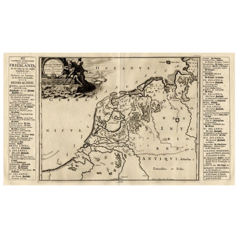
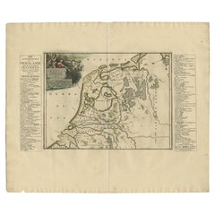
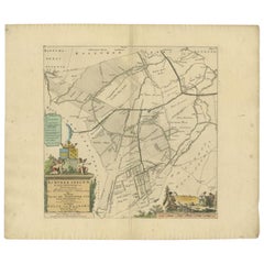
Antique Map of Friesland at a Time the Franks Left and Saxons Came, 1718
About the Item
Antique map Friesland titled 'Summaria descriptio Fresiae Universae (..)'.
Old map of Friesland, the Netherlands. Depicts the general delineation of Friesland during its widest spread after the Franks left and the Saxens came. Originates from 'Uitbeelding van de Heerlijkheid van Friesland' by Bernardus Schotanus à Sterringa. This atlas is considered the best atlas of Friesland, the Netherlands. Artists and Engravers: Published by F. Halma, Leeuwarden.
Artist: Published by F. Halma, Leeuwarden.
Condition: Good, general age-related toning. Minor defects and repair on folding line, please study image carefully.
Date: 1718
We sell original antique maps to collectors, historians, educators and interior decorators all over the world. Our collection includes a wide range of authentic antique maps from the 16th to the 20th centuries. Buying and collecting antique maps is a tradition that goes back hundreds of years. Antique maps have proved a richly rewarding investment over the past decade, thanks to a growing appreciation of their unique historical appeal. Today the decorative qualities of antique maps are widely recognized by interior designers who appreciate their beauty and design flexibility. Depending on the individual map, presentation, and context, a rare or antique map can be modern, traditional, abstract, figurative, serious or whimsical. We offer a wide range of authentic antique maps for any budget.
- Dimensions:Height: 21.66 in (55 cm)Width: 25.99 in (66 cm)Depth: 0 in (0.01 mm)
- Materials and Techniques:
- Period:
- Date of Manufacture:1718
- Condition:
- Seller Location:Langweer, NL
- Reference Number:
About the Seller
5.0
Platinum Seller
These expertly vetted sellers are 1stDibs' most experienced sellers and are rated highest by our customers.
Established in 2009
1stDibs seller since 2017
1,951 sales on 1stDibs
Typical response time: <1 hour
- ShippingRetrieving quote...Ships From: Langweer, Netherlands
- Return PolicyA return for this item may be initiated within 14 days of delivery.
More From This SellerView All
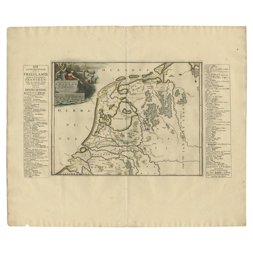
- Antique Map of Friesland in the Time of the Franks, 1718Located in Langweer, NLAntique map Friesland titled 'Descriptio Frisiae sub Francorum reditum (..)'. Old map of Friesland, the Netherlands, in the time of the Franks. Originates from 'Uitbeelding van de He...Category
Antique 18th Century Maps
MaterialsPaper
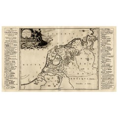
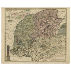
- Antique Map of The Netherlands in The The Saxons and The Franks Period, 1718Located in Langweer, NLAntique map Friesland titled 'Summaria descriptio Fresiae Universae (..)'. Old map of Friesland, the Netherlands. Depicts the general delineation of Friesland during its widest sprea...Category
Antique 18th Century Maps
MaterialsPaper
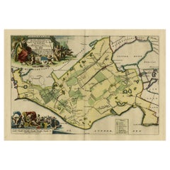
- Antique Map of Gaasterland in Friesland, the Netherlands, 1718Located in Langweer, NLAntique map titled 'Gaasterland. De zevende Grietenije van de Zevenwolden (..)'. Original antique map of Gaasterland, Friesland, the Netherlands. Originates from 'Uitbeelding van de ...Category
Antique 18th Century Maps
MaterialsPaper
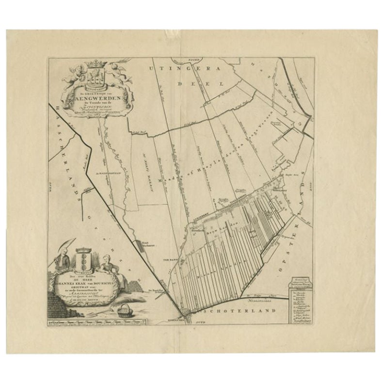
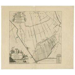
- Antique Map of the Aengwirden Township, Friesland, the Netherlands, 1718Located in Langweer, NLAntique map titled 'De Grietenije van Aengwerden, de Tweede van de Zevenwolden (..)'. Old map of Friesland, the Netherlands. This map depicts the region of Aengwirden and includes ci...Category
Antique 18th Century Maps
MaterialsPaper
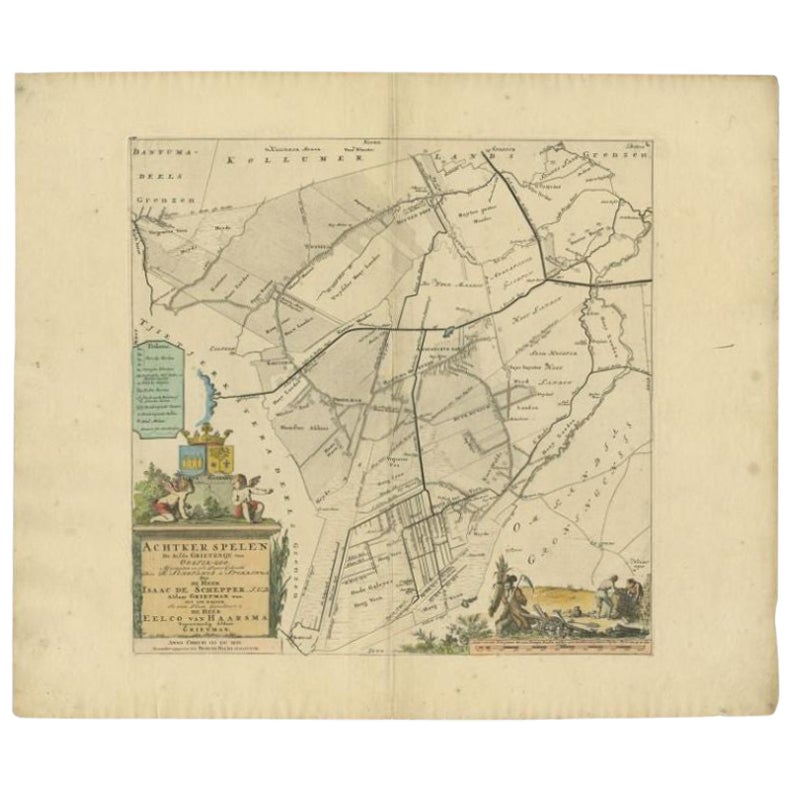
- Antique Map of the Achtkarspelen township, Friesland, The Netherlands, 1718Located in Langweer, NLAntique map Friesland titled 'Achtkarspelen, de sesde Grietenije van Ooster-Goo (..)'. Old map of Friesland, the Netherlands. This map depicts the region of Achtkarspelen and include...Category
Antique 18th Century Maps
MaterialsPaper
- Antique Map of the Province of Friesland in The Netherlands, 1718Located in Langweer, NLAntique map titled 'Frisiae Dominium vernacule Friesland (..)'. Original antique map of Friesland, the Netherlands. Originates from 'Uitbeelding van de Heerlijkheid van Friesland...Category
Antique 18th Century Maps
MaterialsPaper
You May Also Like
- The Holy Land at the Time of Jesus: A 17th Century Dutch Map by VisscherBy Nicolaes Visscher IILocated in Alamo, CAThis detailed Dutch map entitled "Het Beloofe de Landt Canaan door wandelt van onsen Salichmaecker Iesu Christo, nessens syne Apostelen" by Nicolaes Visscher was published in Amsterd...Category
Antique Mid-17th Century Dutch Maps
MaterialsPaper
- 1847 “World at One View” Antique Hand-Colored Wall Map of the WorldLocated in Colorado Springs, COThis is a highly desirable hanging wall map of the "World at One View", published in 1847 by Ensign and Thayer, New York. This pictorial map was printed as a broadside and features...Category
Antique 19th Century American Maps
MaterialsPaper
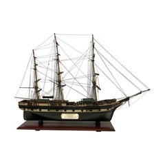
- Period Model of the Packet Anglo SaxonLocated in Norwell, MAAntique ship model with provenance. This model of the packet ship “Anglo Saxon” was “presented by Charles H Taylor of Boston to the Pelham Country Club as ...Category
Vintage 1930s North American Models and Miniatures
MaterialsWood
- 1861 Topographical Map of the District of Columbia, by Boschke, Antique MapLocated in Colorado Springs, COPresented is an original map of Albert Boschke's extremely sought-after "Topographical Map of the District of Columbia Surveyed in the Years 1856 ...Category
Antique 1860s American Historical Memorabilia
MaterialsPaper
- 1854 Map of Massachusetts, Connecticut and Rhode Island, Antique Wall MapLocated in Colorado Springs, COThis striking wall map was published in 1854 by Ensign, Bridgman & Fanning and has both full original hand-coloring and original hardware. This impression is both informative and highly decorative. The states are divided into counties, outlined in red, green, and black, and subdivided into towns. Roads, canals, and railroad lines are prominently depicted, although they are not all labeled. The mapmakers also marked lighthouses, banks, churches, and prominent buildings, with a key at right. The map is an informative and comprehensive overview of the infrastructural development of New England prior to the Civil War. Physical geographies depicted include elevation, conveyed with hachure marks, rivers and lakes. The impression features an inset map of Boston...Category
Antique 19th Century American Maps
MaterialsPaper
- Original Antique Map of the American State of Washington, 1889Located in St Annes, LancashireGreat map of Washington Drawn and Engraved by W. & A.K. Johnston Published By A & C Black, Edinburgh. Original colour Unframed.Category
Antique 1880s Scottish Victorian Maps
MaterialsPaper


Recently Viewed
View AllMore Ways To Browse
Antique Map Of The United States
Antique Maps Of The United States
Antique African American
African American Antique
Antique Furniture East London
Antique Eastern European Furniture
Vintage Map Of The United States
Antique House Plans
Antique Metal Window
Antique Metal Windows
Antique Furniture Rollers
Antiques Compasses
India Map
Antique Map Book
Antique Maps Book
Antique Maps Italy
Antique Map Italy
Antique Italian Maps