18th Century and Earlier Maps
to
2,336
2,869
64
2,936
26
12
1
1
2,936
2,283
475
3
290
34
10
126
10
37
9
2
5
4
3
3
2,922
30
20
3
3
307
111
81
53
52
2,936
2,936
2,936
59
21
13
12
12
Period: 18th Century and Earlier
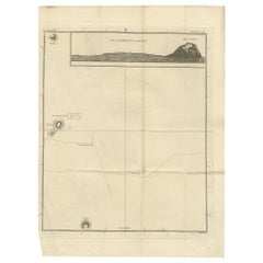
Antique Map of Suffren Island by Cook, c.1781
Located in Langweer, NL
Antique map titled 'View of Sulphur Island (..)'. Antique map and view of Suffren Island. Originates from an edition of Cook's Voyages.
Artists and Engravers: Engraved by Duff.
...
Category
Antique 18th Century and Earlier Maps
Materials
Paper
$142 Sale Price
20% Off
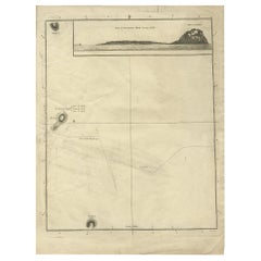
Antique Map of Suffren Island by Cook, 1784
Located in Langweer, NL
Antique map titled 'View of Sulphur Island (..)'. Antique map and view of Suffren Island. Originates from an edition of Cook's Voyages.
Artists and Engravers: Published by Nicol, ...
Category
Antique 18th Century and Earlier Maps
Materials
Paper
$142 Sale Price
20% Off
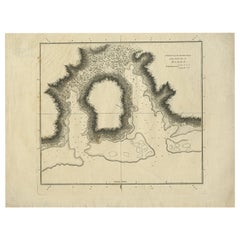
Antique Plan of the Harbour of Taloo by Cook, 1784
Located in Langweer, NL
Antique map titled 'Sketch of the Harbours on the North Side of Eimeo (..)'. Plan of the harbour of Taloo in the Island of Moorea, one of the Society Islands, French Polynesia. Origi...
Category
Antique 18th Century and Earlier Maps
Materials
Paper
$180 Sale Price
20% Off
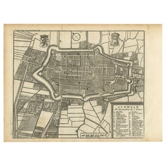
Antique Map of Alkmaar, City Know for Its Cheese Market, Netherlands, circa 1740
Located in Langweer, NL
Antique map titled 'Alkmaar'. Old map of the city of Alkmaar, the Netherlands. This map originates from 'Hedendaagsche Historie of Tegenwoordige staat van alle volkeren' by I. Tirion...
Category
Antique 18th Century and Earlier Maps
Materials
Paper
$161 Sale Price
20% Off
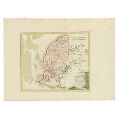
Antique Map of Westergo in Friesland, 1791
Located in Langweer, NL
Antique map titled 'Westergo'. Map of the Westergo region, Friesland, the Netherlands. This map orginates from 'Schauplatz der fünf Theile der Welt'.
Artists and Engravers: Franz...
Category
Antique 18th Century and Earlier Maps
Materials
Paper
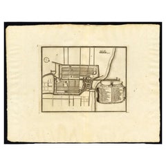
Antique Plan of Batavia, Capital of the Dutch East Indies, by Van Der Aa, 1725
Located in Langweer, NL
Antique map titled 'Plan de Batavia'. (Plan of Batavia.) This plate shows a plan of the city of Batavia / Jakarta in Indonesia. With extensive legend, compass rose and scale. This pl...
Category
Antique 18th Century and Earlier Maps
Materials
Paper
$542 Sale Price
20% Off
Antique Print of Various Apples by Knoop, 1758
Located in Langweer, NL
Antique print depicting apple variaties including the Soete Erveling, Winter Striepeling, Blanke Pepping, Soete Son-Appel, Witte Soete Jopen, Princesse Noble, Soete Robbert, Grauwe R...
Category
Antique 18th Century and Earlier Maps
Materials
Paper
$285 Sale Price
25% Off
Antique Print of Various Pears by Knoop, 1758
Located in Langweer, NL
Antique print depicting pear variaties including the Robine, Eyer-Peer, Kalmer-Peer, Rouselet, Orange Musque, Fondante Franse Canneel, Diamond Peer, Bergamot Suisse Longe, Hoe langer...
Category
Antique 18th Century and Earlier Maps
Materials
Paper
$304 Sale Price
20% Off
Antique Print of Various Pears by Knoop, 1758
Located in Langweer, NL
Antique print depicting pear variaties including the Besy de Chaumontel, Saint Germain, Foppen Peer, Poire de la Force, Winter Bergamot, Bergamotte d'Hyver, Colmar Incomparable, Gran...
Category
Antique 18th Century and Earlier Maps
Materials
Paper
Antique Map of the Waldeck Region of Germany by Homann Heirs, circa 1733
By Homann Heirs
Located in Langweer, NL
Antique map titled 'Waldecciae ac finitimorum Dominiorum (.)'. Map of the Waldeck region of Germany. With decorative cartouche depicting people mining, fishing and deer hunting with ...
Category
Antique 18th Century and Earlier Maps
Materials
Paper
$313 Sale Price
20% Off
Antique Map of Vlaams-Brabant by Homann Heirs, c.1720
By Homann Heirs
Located in Langweer, NL
Antique map titled 'Ducatus Brabantiae Nova Tabula in qua (..).' Fully engraved copper plate map filled with details. Covers Flanders centered roughly on Ascot and delineating the wa...
Category
Antique 18th Century and Earlier Maps
Materials
Paper
$400 Sale Price
20% Off
Antique Map of Turkey in Europe, c.1780
Located in Langweer, NL
Antique map titled 'Bowles's new pocket map of Turky in Europe divided into its Provinces'. Large map of Turkey in Europe. Source unknown, to be determined.
Artists and Engravers: Made by 'Thomas & Carington Bowles' after an anonymous artist. Thomas Bowles, born around 1712, was map publisher and seller in London...
Category
Antique 18th Century and Earlier Maps
Materials
Paper
$342 Sale Price
20% Off
Antique Plan of the Fortress of Greetsiel, Germany, by Blaeu, c.1650
Located in Langweer, NL
Antique plan titled 't Fort van Griet-Zyl in Oost-Vrieslant'. Plan of the fortress of Greetsiel, Germany. This print originates from 'Novum ac magnum theatrum urbium Belgicae' by J. ...
Category
Antique 18th Century and Earlier Maps
Materials
Paper
$314 Sale Price
20% Off
Antique Map of Cap Providence, St. David's Cove and Surroundings
Located in Langweer, NL
Antique map titled 'Baye du Cap Upright (..)'. Eight charts on one sheet of Cap Providence, St. David's Cove, the Bay of the Island, Swallow's Haven, Puzzlin...
Category
Antique 18th Century and Earlier Maps
Materials
Paper
$342 Sale Price
20% Off
Antique Map of Western Tartary, with Information from Kyrkov's Surveys
Located in Langweer, NL
Antique map titled 'Carte de la Tartarie Occidentale'. This map covers western Tartary with a focus on the region of present-day Mongolia. This map includes information from Kyrkov's...
Category
Antique 18th Century and Earlier Maps
Materials
Paper
$295 Sale Price
20% Off
Antique Map Centered on Turkestan
Located in Langweer, NL
Antique map titled 'Carte de Karazm, Turkestan et Grande Bukarie'. Engraved map centered on Turkestan. Extends to include the Black and Caspian Seas, Uzbekistan, Tajikistan, Turkmeni...
Category
Antique 18th Century and Earlier Maps
Materials
Paper
$323 Sale Price
20% Off
Antique Map of Southern India, the Maldives and Sri Lanka with Currents
Located in Langweer, NL
Antique map titled 'Carte de la Partie Inferieure De L'Inde En Deca Du Gange (..)'. Interesting map of Southern India, the Maldives and Sri Lanka. Includes a month by month charting ...
Category
Antique 18th Century and Earlier Maps
Materials
Paper
$266 Sale Price
20% Off
Antique Map of the Vitim and Lena Rivers, Russia, 1768
By Prevost
Located in Langweer, NL
Antique map titled 'Carte du District de Witim et Phénomene (..)'. Map of the confluence of the Vitim and Lena rivers, and an illustration of atmospheric phenomena. This print origin...
Category
Antique 18th Century and Earlier Maps
Materials
Paper
$228 Sale Price
20% Off
Antique Map of the West Coast of Africa, 1771
Located in Langweer, NL
Antique map titled 'Carte de la Guinee contenant les Isles du Cap Verd, le Senegal, la Cote de Guinee proprement dite, les Royaumes de Loango, Congo, Angola, et Benguela avec les Pay...
Category
Antique 18th Century and Earlier Maps
Materials
Paper
$333 Sale Price
20% Off
Antique Map of Cordes Bay and Surroundings
Located in Langweer, NL
Antique map titled 'Baye et Havre de Cordes (..)'. Four maps on the one sheet of; Cordes Bay, Port Famine, Woods Pay, Port Gallant, Fortescue Bay, Chile based on the voyage of John B...
Category
Antique 18th Century and Earlier Maps
Materials
Paper
$247 Sale Price
20% Off
Antique Map of New Ireland with 7 Coastal Profiles
Located in Langweer, NL
Antique print titled 'l'Isle St. Jean (..) - Cap St. George (..)'. Antique map of New Ireland, an island in the Bismarck Archipelago, New Guinea. Lying just north of New Britain, fro...
Category
Antique 18th Century and Earlier Maps
Materials
Paper
$304 Sale Price
20% Off
Nicely Hand-Colored Antique Print of Various Apples, 1758
Located in Langweer, NL
Antique print depicting apple variaties including the Enkelste Griet, Witte Platte Appel, Bloem-Suir, Eyer-Appel, Brand-Appel, Heer-Appel, Pomme Rose, Rode Soete Jopen, Somer Striepe...
Category
Antique 18th Century and Earlier Maps
Materials
Paper
$180 Sale Price
20% Off
Antique Map of the Region of Pavia, Lodi, Novara, Tortona & Alessandria, Italy
Located in Langweer, NL
Antique map titled 'Territorio di Pavia, Lodi, Novarra, Tortona, Alessandria e altri vicini dello Stato di Milano'. Original old map of the region of Pavia, Lodi, Novara, Tortona and...
Category
Antique 18th Century and Earlier Maps
Materials
Paper
$942 Sale Price
20% Off
Antique Map of England with Contemporary Hand Coloring
Located in Langweer, NL
Antique map titled 'l'Angleterre'. Original antique map of England, with original/contemporary hand coloring. Published by Crepy, circa 1767.
Category
Antique 18th Century and Earlier Maps
Materials
Paper
$247 Sale Price
20% Off
Small Antique Map of England, Wales, Scotland and Ireland with Original Coloring
Located in Langweer, NL
Antique map titled 'Les Royaumes d'Angleterre d'Escosse et d'Irlande (..)'. A lovely, small map of England, Wales, Scotland and Ireland with a portion of the coastline of France and ...
Category
Antique 18th Century and Earlier Maps
Materials
Paper
$438 Sale Price
20% Off
Antique Map of the British Isles, Insets of the Shetland Islands and Hebrides
Located in Langweer, NL
Antique map titled 'Great Britain and Ireland with ye Judges Circuits'. A scarce map of the British Isles, with inset maps of the Shetland Islands and The Hebrides. Large triangular ...
Category
Antique 18th Century and Earlier Maps
Materials
Paper
$628 Sale Price
20% Off
Attractive Small Map of the British Isles with Decorative Cartouche
Located in Langweer, NL
Antique map titled 'Isles Britaniques ou sont les Royaumes d'Angleterre, D'Escosse et d'Irlande'. Attractive small map of the British Isles with decorative cartouche. Published circa...
Category
Antique 18th Century and Earlier Maps
Materials
Paper
$247 Sale Price
20% Off
Original Antique Map of the British Isles Surrounded by Text
Located in Langweer, NL
Antique map titled 'Des Isles Britanniques'. Original antique map of the British isles. This map is divided in to three major regions of the 18th century United Kingdom: England, Ire...
Category
Antique 18th Century and Earlier Maps
Materials
Paper
$352 Sale Price
20% Off
Denbighshire & Flintshire – Antique Map from Drayton’s Poly-Olbion, 1622
Located in Langweer, NL
Denbighshire & Flintshire – Antique Map from Drayton’s Poly-Olbion, 1622
This rare and original antique map of Denbighshire and Flintshire in Wales originates from the celebrated Po...
Category
Antique 18th Century and Earlier Maps
Materials
Paper
$733 Sale Price
20% Off
Antique Map of the British Isles with Walls, Settlements and Other Features
Located in Langweer, NL
Antique map titled 'Insulae Britannicae'. Interesting map of Britain, Scotland, and Ireland. It shows a rudimentary outline of the islands according to the geography of the Roman Emp...
Category
Antique 18th Century and Earlier Maps
Materials
Paper
$209 Sale Price
20% Off
Small Antique Map of England and Wales as It Was During the Heptarchy
Located in Langweer, NL
Antique map titled 'La Britannique dans sa Heptarchie Anglois Saxonique'. This little map shows England and Wales as it was during the Heptarchy, a phrase referring to the seven king...
Category
Antique 18th Century and Earlier Maps
Materials
Paper
$276 Sale Price
20% Off
Interesting Small Map of the British Isles with Hand Coloring
Located in Langweer, NL
Antique map titled 'Insularum Britannicarum Tabula'. Interesting small map of the British Isles by Wells. This map originates from 'Oikumenes Periegesis, sive, Dionysii Geographia em...
Category
Antique 18th Century and Earlier Maps
Materials
Paper
$361 Sale Price
20% Off
Antique Map of European Russia with Picture Frame Border
Located in Langweer, NL
Antique map titled 'La Moscovie Septentrionale (..)'. Decorative example of van der Aa's map of the northern part of European Russia. With the picture frame border, which appeared in...
Category
Antique 18th Century and Earlier Maps
Materials
Paper
$361 Sale Price
20% Off
Large Antique Map England and Wales, with Part of the Coastlines
Located in Langweer, NL
Antique map titled 'A Map of England and Wales (..)'. Large antique map of England and Wales, with part of the continental and Irish coasts. Published J. Blair, circa 1779.
Category
Antique 18th Century and Earlier Maps
Materials
Paper
$552 Sale Price
20% Off
Antique Print of Harlingen, Stavoren and Sneek in Friesland, 1680
Located in Langweer, NL
Antique print titled 'Harlingen, Staveren, Sneck'. Views of the cities of Harlingen, Stavoren and Sneek, Friesland, the Netherlands. This print originates from 'Thooneel der Steden e...
Category
Antique 18th Century and Earlier Maps
Materials
Paper
$219 Sale Price
20% Off
Antique Print of Fort Brittenburg by Guiccardini, 1612
Located in Langweer, NL
Antique print titled 'Ruinarum Arcis Britannica Apud Batavos Typus.' Old print of the ruins of the Roman fortress Brittenburg near Katwijk, The Netherlands. Source unknown, to be det...
Category
Antique 18th Century and Earlier Maps
Materials
Paper
$419 Sale Price
20% Off
Antique Chart of the Friendly Islands or Nowadays Tonga, by Cook, 1784
By James Cook
Located in Langweer, NL
Antique print titled 'Chart of the Friendly Islands'. Antique map of the Friendly Islands depicting Rotterdam or Anamocka, Middelburg or Eaoowe and Amsterdam or Tongatabu. Originates...
Category
Antique 18th Century and Earlier Maps
Materials
Paper
$323 Sale Price
20% Off
Antique Map of the Cocos or Keeling Islands, 1778
Located in Langweer, NL
Antique map titled 'Die Cocos Insel vom Capt. Wallis Bosawren. Die Verrather Islel von Capt. Wallis Keppel Genannt'. Also with French subtitles. Old map of the Cocos or Keeling Islan...
Category
Antique 18th Century and Earlier Maps
Materials
Paper
$276 Sale Price
20% Off
Antique Map of France by Tirion, c.1740
Located in Langweer, NL
Antique map titled 'Nieuwe Kaart van Frankryk.' - Attractive detailed map showing France. Title in block-style cartouche with a simple compass rose. Source unknown, to be determined....
Category
Antique 18th Century and Earlier Maps
Materials
Paper
$428 Sale Price
20% Off
Original Hand-Colored Antique Print of Various Apples, 1758
Located in Langweer, NL
Antique print depicting apple variaties including the Borsdorsser Appel, Goud-Reinet, Krappe-Kruin, Nelguin, Reinette de Montbron, Caracter Appel, Soete Veentje, Courtpendu Rouge, An...
Category
Antique 18th Century and Earlier Maps
Materials
Paper
$304 Sale Price
20% Off
Original Antique Hand-Colored Print of Various Apples, 1758
Located in Langweer, NL
Antique print depicting apple variaties including Witte Kruid-Appel, Rode Somer-Calville, Rode Jopen, Witte Somer-Calville, Somer Citroen Appel, Somer Kroon, Engelse Carolyn, Roos-Ap...
Category
Antique 18th Century and Earlier Maps
Materials
Paper
$304 Sale Price
20% Off
Engraving of Tienen in the province of Flemish Brabant, in Flanders, Belgium
Located in Langweer, NL
Antique map titled 'Thienen'. Old map of Tienen showing the siege of Tienen in 1588. This map originates from 'La genealogie des illustres comtes de Nassau' by Jan Jansz. Orlers.
...
Category
Antique 18th Century and Earlier Maps
Materials
Paper
$266 Sale Price
20% Off
Original Antique Map of Zuid-Holland in the Netherlands by Blaeu, C.1645
Located in Langweer, NL
Antique map titled 'Zuydhollandia stricte sumta'. Old map of the province of Zuid-Holland, the Netherlands. This map originates from 'Theatrum Orbis Terrarum (..)'.
Artists and E...
Category
Antique 18th Century and Earlier Maps
Materials
Paper
$523 Sale Price
20% Off
Original Antique Map of Utrecht in the Netherlands by Blaeu, C.1645
Located in Langweer, NL
Antique map titled 'Ultraiectum Dominium'. Old map of the province of Utrecht, the Netherlands. This map originates from 'Theatrum Orbis Terrarum (..)'.
Artists and Engravers: Wi...
Category
Antique 18th Century and Earlier Maps
Materials
Paper
$523 Sale Price
20% Off
Antique Map of the Tunquin River and Bay, Siam, 1757
Located in Langweer, NL
Antique map titled ‘Carte du Cours de la Riviere de Tunquin Depuis Cacho jusqu'à la Mer’. Detailed map of the Tunquin River and Bay, extending north to Cacho, the capital city. Made ...
Category
Antique 18th Century and Earlier Maps
Materials
Paper
$219 Sale Price
20% Off
Antique Print of Franeker, Friesland, the Netherlands by Guicciardini, 1616
Located in Langweer, NL
Antique print titled 'Franicker'. View of the city of Franeker, Friesland, the Netherlands. This print originates from 'Omnium Belgii sive Inferioris Germaniae (..)' by L. Guicciardi...
Category
Antique 18th Century and Earlier Maps
Materials
Paper
$104 Sale Price
20% Off
Antique Print of the Old University Town Franeker in the Netherlands '1786'
Located in Langweer, NL
Antique print titled 'Franeker van den kant van Schalsum te zien'. Old print with a view on the city of Franeker, as seen from Schalsum. This print originates from 'Hedendaagsche His...
Category
Antique 18th Century and Earlier Maps
Materials
Paper
$257 Sale Price
20% Off
Antique Plan of Plan of St. Julian's Harbour on the Coast of Patagonia
Located in Langweer, NL
Antique map titled 'Plan des Hafens St. Iulian auf der Küste von Patagonien'. Plan of St. Julian's Harbour on the Coast of Patagonia. This map originates from a German edition of 'Voyage around the World...
Category
Antique 18th Century and Earlier Maps
Materials
Paper
$276 Sale Price
20% Off
A Rare and Old Trapezoidal Projection of the Ganges and Himalaya Range in India
Located in Langweer, NL
Antique map titled 'Tabula Asiae X'. This Ptolemaic map on a trapezoidal projection is centered on India with recognizable river systems, but completely lacking the sub-continental shape of the landmass. The top of a large unnamed Sri Lanka appears at bottom. Latin text...
Category
Antique 18th Century and Earlier Maps
Materials
Paper
$609 Sale Price
20% Off
Engravings of Harlingen, Stavoren and Sneek in Friesland, the Netherlands, 1680
Located in Langweer, NL
Antique print titled 'Harlingen, Staveren, Sneck'. Views of the cities of Harlingen, Stavoren and Sneek, Friesland, the Netherlands. This print originates from 'Thooneel der Steden e...
Category
Antique 18th Century and Earlier Maps
Materials
Paper
$438 Sale Price
20% Off
Antique Print of the Churches of Cathay and Waranni in Ceylon 'Sri Lanka', 1703
Located in Langweer, NL
Antique print titled 'Cathay, Waranni'. Copper engraving of the churches of Cathay and Waranni, Sri Lanka (Ceylon). This print originates from 'A true and exact description of the mo...
Category
Antique 18th Century and Earlier Maps
Materials
Paper
$180 Sale Price
20% Off
Engravings of the Frisian Cities of Sloten, IJlst, Workum and Hindelopen, c.1650
Located in Langweer, NL
Antique print titled 'Slooten - Ylst - Worcum - Hinloopen'. Three plans and a bird's eye view on one sheet. The plans show the Frisian cities Sloten, IJlst, Workum and the view shows...
Category
Antique 18th Century and Earlier Maps
Materials
Paper
$628 Sale Price
20% Off
Nicely Colored Antique Print of Surat in India, 1751
Located in Langweer, NL
Antique print titled 'Vuë de Surate du côté de la Riviere'. View of Surat, a city in the state of Gujarat, India. This print originates from 'Histoire générale des voyages' by A. Pré...
Category
Antique 18th Century and Earlier Maps
Materials
Paper
$342 Sale Price
20% Off
Rare Engraving of the Coast of Dabhol or Dabul, Ratnagiri, Maharashtra in India
Located in Langweer, NL
Antique print titled 'De Kust van Dabul'. Antique print depicting the coast of Dabhol / Dabul in India. This print originates from 'Oud en Nieuw Oost-Indiën' by F. Valentijn.
Artist...
Category
Antique 18th Century and Earlier Maps
Materials
Paper
$609 Sale Price
20% Off
Antique Print of the City of Kinnungam in China, 1668
Located in Langweer, NL
Antique print China titled 'Kinnungam'. Old print depicting a view of the Chinese city of Kinnungam with its ramparts. This print originates from t...
Category
Antique 18th Century and Earlier Maps
Materials
Paper
$371 Sale Price
20% Off
Antique Print of the Coromandel Coast in India, 1726
Located in Langweer, NL
Antique print depicting the Coromandel Coast, India. This print originates from 'Oud en Nieuw Oost-Indiën' by F. Valentijn.
Artists and Engravers: François Valentijn (1666-1727), a ...
Category
Antique 18th Century and Earlier Maps
Materials
Paper
$361 Sale Price
20% Off
Antique Print of Kannur or Cananore with Ships, in Kerala, India, 1726
Located in Langweer, NL
Antique print India titled: 'Cananor'. Old print of a view of Kannur (or Cannanore), Kerala, India. From the monumental 'Oud en Nieuw Oost-Indiën ...
Category
Antique 18th Century and Earlier Maps
Materials
Paper
$361 Sale Price
20% Off
Original Antique Map of the Harbour of Tongatabu by Cook, 1784
Located in Langweer, NL
Antique map titled 'Sketch of Tongataboo Harbour (..)'. Antique map of the harbour of Tongatabu, one of the Tonga Islands. Originates from an edition of Cook's Voyages.
Artists an...
Category
Antique 18th Century and Earlier Maps
Materials
Paper
$419 Sale Price
20% Off
Antique Print of the City of Koesuwen, China, 1665
Located in Langweer, NL
Antique print titled 'Teywanmiao'. Old print depicting the city of Koesuwen, China. This print originates from 'Het gezantschap der Nee^rlandtsche Oost-Indische Compagnie, aan den gr...
Category
Antique 18th Century and Earlier Maps
Materials
Paper
$209 Sale Price
20% Off
Antique Print with Views of Cape Blanco on the Patagonia / Argentina Coast, 1749
Located in Langweer, NL
Antique print titled 'Kaap Blanco aan de kust van Patagonia (..)' and 'Kaap Blanco strekkende Zuid ten Westen.' Coastal views of Cape Blanco on the Patagonia / Argentina coast with t...
Category
Antique 18th Century and Earlier Maps
Materials
Paper
$209 Sale Price
20% Off
