20th Century Maps
to
232
415
56
473
15
6
4
4
3
2
2,974
2,230
473
3
288
34
9
126
8
36
9
2
5
4
3
2
435
27
20
19
12
109
86
70
42
32
473
473
473
5
2
2
1
1
Period: 20th Century
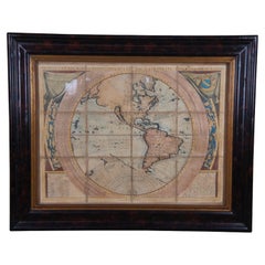
Vincenzo Coronelli's Colored Map of the New World Western Hemisphere Framed 47"
Located in Dayton, OH
A Framed Reproduction of Coronelli's Map of the New World, Attributed to Trevor James Company. The map shows the Western Hemisphere including the discoveries made by Abel Tasman in A...
Category
20th Century Maps
Materials
Paper
$1,080 Sale Price
20% Off
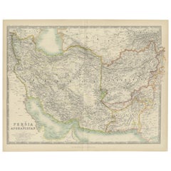
Antique Map of Persia and Afghanistan by Johnston '1909'
Located in Langweer, NL
Antique map titled 'Persia and Afghanistan'. Original antique map of Persia and Afghanistan. This map originates from the ‘Royal Atlas o...
Category
20th Century Maps
Materials
Paper
$235 Sale Price
20% Off
1907 Chart of Nantucket Harbor by George Eldridge
Located in Norwell, MA
Chart of Nantucket Harbor from 1907 by cartographer George W. Eldridge. The chart shows the channel passing by the jetty into the harbor, by Brant Point to Steamboat Wharf. Also show...
Category
North American Antique 20th Century Maps
Materials
Paper
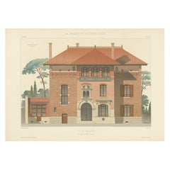
Architectural Print of the French Villa Weber, Chabat, c.1900
Located in Langweer, NL
Antique print titled 'Villa Weber, Mr. Paul Sédille Architecte'. This print depicts the design of a building in France. Originates from 'La Brique et La Terre Cuite' by P. Chabat. Ar...
Category
20th Century Maps
Materials
Paper
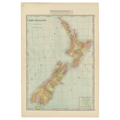
Antique Map of New Zealand by G.F. Cram, 'circa 1906'
Located in Langweer, NL
Antique map titled 'New Zealand'. Large map of New Zealand with a small legend of the Chatham Islands. On the verso, a map of the North Polar regions and a map of Tasmania can be fou...
Category
20th Century Maps
Materials
Paper
$330 Sale Price
20% Off
Large Original Vintage Map of The World, circa 1920
Located in St Annes, Lancashire
Great map of The World
Original color.
Good condition / minor foxing
Published by Alexander Gross
Unframed.
Category
English Vintage 20th Century Maps
Materials
Paper
1970's rotating replogle world globe
Located in Los Angeles, CA
An elegant world globe by Paul Mc Cobb, the brass patina is much nicer in person
Category
American Mid-Century Modern Vintage 20th Century Maps
Materials
Brass
1901 Nautical Chart Showing Woods Hole, Mass
Located in Norwell, MA
Rare 1901 chart of Woods Hole, Mass., showing Buzzards Bay, Penzance Point, Nonamesset Island, Downtown Woods Hole, Parker Neck, Nobska Head, Vineyard Sound, Woods Hole Golf Club, Ra...
Category
North American Antique 20th Century Maps
Materials
Paper
World Globe With Wooden Foot, and Brass 20th Century
Located in Mombuey, Zamora
Beautiful and elegant ball of the world to decorate any studio, living room or bedroom, it is small, with the base about 26 cm high and 10 wide.
Category
Italian Other 20th Century Maps
Materials
Brass
$660 Sale Price
20% Off
Antique Map of South America by Johnston '1909'
Located in Langweer, NL
Antique map titled 'South America, Southern Sheet'. Depicting Chile, Argentina, Brazil, Patagonia, the Falkland Island and more. With inset maps of Valparaiso, Rio de Janeiro and Bue...
Category
20th Century Maps
Materials
Paper
$235 Sale Price
20% Off
1904 "Nell's Topographical Map of the State of Colorado"
Located in Colorado Springs, CO
This highly detailed pocket map is a topographical map of the state of Colorado by Louis Nell from 1904. The map "has been compiled from all available...
Category
American Antique 20th Century Maps
Materials
Leather, Paper
Large 1950's Philips' Hanging Globe
By Philips
Located in Hastings, GB
A superb decorators' interior design piece, this very large hanging globe made by the Philips' company in the 1950's hangs from a brass chain, the ...
Category
English Mid-Century Modern Vintage 20th Century Maps
Materials
Brass
1901 Chart of Port Jefferson, New York
Located in Norwell, MA
Original chart by George Eldridge of Port Jefferson on Long Island, New York. The identified waters include Setauket Harbor, Mount Misery Point, and Match Rock. Two channels are mark...
Category
North American Antique 20th Century Maps
Materials
Paper
Rare and Early Plaster Relief Map of Adirondack Mountains by F J H Merrill
By E. W. Merrill, P.F. Howells
Located in Buffalo, NY
Rare and Early Monumental Plaster Relief Map of Adirondack Mountains by The University of the State of New York, New York State Museum..F J H Merrill director,,,modeled by Howell's ...
Category
American Industrial Vintage 20th Century Maps
Materials
Plaster, Wood
Maitland Smith Globe on Stand
Located in Norwell, MA
World globe with brass horizon band. Intricately carved pedestal base with ball and claw feet. Quite detailed. By the famous Maitland Smith, globe itself is from Replogle. 62" H x 26...
Category
North American Vintage 20th Century Maps
Materials
Wood
Antique Weber Costello 30" Floor Globe 1914-1924
By Costello
Located in Los Angeles, CA
Lucky to find a 30" globe in this condition. The best that Weber Constello ever put out.
Category
American American Craftsman 20th Century Maps
Materials
Brass
Antique Maritime Chart of East Coast Virginia to Nova Scotia
Located in Norwell, MA
1920 nautical chart of the East Coast of the United States from Virginia to Maine, New Brunswick, and Nova Scotia. The chart shows Cape Cod, Long Island, the Connecticut coast, Jersey Shore, Maine, New Hampshire, etc. Very detailed, showing ports, lighthouses, shoals, depths, etc. The chart is by famous cartographer George W. Eldridge, compiled from surveys of the United States government, British Admiralty, George Eldridge, and others. First authorized by George Eldridge, published in 1916 by Wilfred O. White with a merchant's stamp of Charles Hutchinson...
Category
North American Vintage 20th Century Maps
Materials
Paper
Mid-Century World Map Globe Table Light or Lamp
Located in Miami, FL
Good quality world map globe lamp.
If you are looking for stylish and beautiful quality item to upgrade your interior (whether at home or in your office) then this Parisian globe...
Category
French Mid-Century Modern 20th Century Maps
Materials
Chrome
$595 Sale Price
57% Off
1923 "Washington, The Beautiful Capital of the Nation" Baltimore and Ohio RR Map
Located in Colorado Springs, CO
This is a fabulous 1923 bird's eye map of Washington, DC that shows the city in amazing detail. Every building is individually drawn and all major roads in the city are shown. The vi...
Category
American Art Deco Vintage 20th Century Maps
Materials
Paper
"Atlas to Accompany Monograph XXXII on the Geology of Yellowstone National Park"
By United States Geological Survey
Located in Colorado Springs, CO
This is an original 1904 "Atlas to Accompany Monograph XXXII on the Geology of the Yellowstone National Park" by Arnold Hague. Published by the Department of the Interior, the Atlas ...
Category
American Antique 20th Century Maps
Materials
Leather, Fabric, Paper
Large Scale Map of the London Metropolis
Located in Dallas, TX
The product is a large scale map of the London Metropolis, specifically focusing on the city in intricate detail. It would be a valuable collectible for those interested in maps and ...
Category
English 20th Century Maps
Materials
Paper
French 18th Century Map of Paris by Turgot
By Michel Etienne Turgot
Located in Los Angeles, CA
Complete Paris map set of etchings by Turgot. This printing is from the 1960s and have warm natural color to the paper. Frame each individually to your liking. The overall dimension ...
Category
French French Provincial Vintage 20th Century Maps
Materials
Paper
$4,500 / set
Burnished brass earth globe - Circa 1930s
Located in Linkebeek, BE
Burnished brass earth globe - Circa 1930s
Globe - World map
Measures : 20x18cm H:25cm
Wear consistent with age and use
Category
20th Century Maps
Materials
Brass
Vintage North Polar Chart Featuring Arctic Exploration Routes, 1903
Located in Langweer, NL
Title: Vintage North Polar Chart Featuring Arctic Exploration Routes, 1903
This vintage map titled "North Polar Chart" offers a fascinating glimpse into early 20th-century Arctic ex...
Category
20th Century Maps
Materials
Paper
Original Antique Map of the American State of Wisconsin, 1903
Located in St Annes, Lancashire
Antique map of Wisconsin
Published By A & C Black. 1903
Original colour
Good condition
Unframed.
Free shipping
Category
English Antique 20th Century Maps
Materials
Paper
Early 20th Century American Library Globe
Located in Norwell, MA
Fine library globe with makers logo from Atlas School Supply Co., Chicago. Hardwood base with rich finish and nice detail. Celestial globe with equ...
Category
North American Vintage 20th Century Maps
Materials
Wood
Tony Sarg Map of Nantucket Town, 1937
By Tony Sarg
Located in Nantucket, MA
Tony Sarg Map of Residential Main Street, Nantucket, 1937, a black and white printed map of our historic downtown area, with images of each building, street names and whimsical figur...
Category
American Other Vintage 20th Century Maps
Materials
Paper
Nantucket High-Ways, By-Ways and Not-Ways Decorative Map by Tony Sarg, ca 1930
By Tony Sarg
Located in Nantucket, MA
Vintage Nantucket High-Ways, By-Ways and Not-Ways Decorative Map by Tony Sarg, (Nantucket: 1880 - 1942) circa 1930, a decorative tourist map of Nantucket Island with details of roadw...
Category
American Other Vintage 20th Century Maps
Materials
Paper
Antique Map of New Zealand and Tasmania, 1904
Located in Langweer, NL
This large antique map is taken from; 'Andrees Allgemeiner Handatlas in 126 Haupt-Und 139 Nebenkarten', Bielefeld; Leipzig: Velhagen & Klasing 1899. Andrees Allgemeiner Handatlas was...
Category
20th Century Maps
Materials
Paper
$84 Sale Price
20% Off
Set of 6 Original Vintage Maps of American States, circa 1900
Located in St Annes, Lancashire
Wonderful set of 6 vintage maps.
Random American states including Maine, Utah, New Hampshire, Nevada, Vermont and New Mexico.
Monochrome with red color outline.
Published by Rand,...
Category
American Edwardian Antique 20th Century Maps
Materials
Paper
Antique Map of the Malay Archipelago by Walker, 1911
Located in Langweer, NL
Antique map titled 'Malay Archipelago'. Old map of the Malay Archipelago including Borneo, Celebes, New Guinea, Java, Timor and others. This map ...
Category
20th Century Maps
Materials
Paper
$84 Sale Price
20% Off
Map of the Southeastern USA and Atlantic States – Vintage 1903 Geography
Located in Langweer, NL
Map of the Southeastern USA and Atlantic States – Vintage 1903 Geography
This original engraved map, titled “United States of North America (South Eastern Sheet) with the Atlantic S...
Category
20th Century Maps
Materials
Paper
20thC Leather Cased Collection Of Bartholomew Maps Of Great Britain c.1920
Located in Royal Tunbridge Wells, Kent
Antique 20th Century leather-cased collection of Bartholomew British road maps by Edward Stanford Ltd of London. One volume features a map of the entire British Isles, divided into n...
Category
British Other 20th Century Maps
Materials
Leather, Paper
Large Original Vintage Map of Egypt, circa 1920
Located in St Annes, Lancashire
Great map of Egypt
Unframed
Original color
By John Bartholomew and Co. Edinburgh Geographical Institute
Published, circa 1920
Free shipping.
Category
British Vintage 20th Century Maps
Materials
Paper
1950's Glass Globe Lamp, Denmark
Located in New York, NY
Danish Glass Globe Lamp, c. 1950's.
Can be lit with inner bulb.
Category
Danish Mid-Century Modern Vintage 20th Century Maps
Materials
Glass, Wood
Silver Leaf Foil Wall World Map Engraving Based on the Original Moses Pitt, 1681
Located in West Sussex, Pulborough
We are delighted to offer for sale this lovely antique style pictorial silver leaf foil world map taken from and original engraving my Moses Pitt, 1681
This is a very interesting ...
Category
English Modern 20th Century Maps
Materials
Silver Leaf
$261 Sale Price
30% Off
Original Antique Map of the American State of Missouri ( Southern part ), 1903
Located in St Annes, Lancashire
Antique map of Missouri ( Southern Part )
Published By A & C Black. 1903
Original colour
Good condition
Unframed.
Free shipping
Category
English Antique 20th Century Maps
Materials
Paper
Large Original Vintage Map of S.E Asia, with a Vignette of Singapore
Located in St Annes, Lancashire
Great map of South East Asia
Original color. Good condition
Published by Alexander Gross
Unframed.
Category
English Vintage 20th Century Maps
Materials
Paper
Egypt and Lower Nubia, 1903 - Historical Map Highlighting Nile and Red Sea
Located in Langweer, NL
Egypt and Lower Nubia, 1903 - Historical Map Highlighting Nile and Red Sea
This beautifully detailed map titled "Egypt, Arabia Petraea, and Lower Nubia" was engraved, printed, and p...
Category
20th Century Maps
Materials
Paper
Antique Map of France, 1903, with Inset of Paris and Corsica
Located in Langweer, NL
Title: Antique Map of France, 1903, with Inset of Paris and Corsica
Description:
This antique map, titled "France," was engraved and published in 1903 by the renowned W. & A.K. John...
Category
20th Century Maps
Materials
Paper
Antique Map of Denmark and German Empire Regions, 1903, Intricate and Colorful
Located in Langweer, NL
Title: Antique Map of Denmark and German Empire Regions, 1903, Intricate and Colorful
Description:
This antique map, titled "Denmark with North West Portions of the German Empire," ...
Category
20th Century Maps
Materials
Paper
Italian modern Table globe map of the world in metal, 1960s
Located in MIlano, IT
Italian modern Table globe map of the world in metal, 1960s
Table map of the world with metal structure. The globe rotates thanks to the pins of the curved metal structure. The base ...
Category
Italian Modern Vintage 20th Century Maps
Materials
Metal
Original Antique Map of the American State of New York ( Southern Part ) 1903
Located in St Annes, Lancashire
Antique map of New York ( Southern Part )
Published By A & C Black. 1903
Original colour
Good condition
Unframed.
Free shipping
Category
English Antique 20th Century Maps
Materials
Paper
Map of Lancashire
Located in Cheshire, GB
Saxton Map of Lancashire hand coloured. Encased in an ebonised frame.
Dimensions
Height 21 Inches
Width 24 Inches
Depth 1 Inches
Category
British 20th Century Maps
Materials
Paper
$757 Sale Price
20% Off
Original Antique Map of the American State of Virginia, 1903
Located in St Annes, Lancashire
Antique map of West Virginia
Published By A & C Black. 1903
Original colour
Good condition
Unframed.
Free shipping
Category
English Antique 20th Century Maps
Materials
Paper
French Pavillon de la Grande Tuilerie, Chabat, Architectural Print, c.1900
Located in Langweer, NL
Antique print titled 'Pavillon de la Grande Tuilerie de Bourgogne (de Montghanin) Exposition Universelle de 1889, Mrs. Wulliam et Farge Architectes'. This print depicts the design of...
Category
20th Century Maps
Materials
Paper
Old Map of South East Asia Showing the Malay Archipelago, incl Borneo etc, 1922
Located in Langweer, NL
Antique map of South East Asia titled 'Malay Archipelago'.
Old map of South East Asia depicting the Malay Archipelago including Sumatra, Java...
Category
Vintage 20th Century Maps
Materials
Paper
$179 Sale Price
20% Off
Rare Old Map of the British Solomon Islands Protectorate, 1925
Located in Langweer, NL
Antique map titled 'British Solomon Islands Protectorate'.
Old map of the British Solomon Islands Protectorate.
Artists and Engravers: Published by Waterlow & Sons, London & D...
Category
Vintage 20th Century Maps
Materials
Paper
$254 Sale Price
20% Off
Huge Europe and Asia Vintage Wall Map
Located in San Diego, CA
A huge Europe and Asia vintage wall map, circa 1950s. The map is in fair vintage condition and measures 78"W x 73"H". #2863
Category
American 20th Century Maps
Materials
Paper
$380 Sale Price
20% Off
Antique Map of Sweden & Norway, 1903, with Intricate Topographical Detail
Located in Langweer, NL
Title: Antique Map of Sweden & Norway, 1903, with Intricate Topographical Detail
Description:
This antique map, titled "Sweden & Norway (Scandinavia)," was engraved and published in...
Category
20th Century Maps
Materials
Paper
Vintage Swedish Topographic School Map of European Alps, Made in Sweden 1922
Located in Los Angeles, CA
Vintage Swedish Topographic School map of European Alps, Made in Sweden 1922
This vintage Swedish school map is so unique and a great example of why t...
Category
Swedish Vintage 20th Century Maps
Materials
Linen, Wood, Paper
Antique Map of China, Taiwan, Korea, Hong-Kong and Japan, 1903
Located in Langweer, NL
Antique Map of China, Taiwan, Korea, Hong-Kong and Japan, 1903
Description: This antique map, titled "India (Southern Sheet) and the South Eastern Provinces," was engraved and publi...
Category
20th Century Maps
Materials
Paper
Original Antique Map of the American State of California ( Northern Part ), 1903
Located in St Annes, Lancashire
Antique map of California ( Northern part )
Published By A & C Black. 1903
Original colour
Good condition
Unframed.
Free shipping
Category
English Antique 20th Century Maps
Materials
Paper
The History of the Royal Canadian Mounted Police, Published in 1966
Located in Langweer, NL
This rare pictorial map by Peter R. Furse celebrates the history of the Royal Canadian Mounted Police. It was produced with the cooperation of the RCMP, as acknowledged in an elegant...
Category
Vintage 20th Century Maps
Materials
Paper
$849 Sale Price
20% Off
Antique Map of Turkey in Asia (Asia Minor and Transcaucasia), 1903
Located in Langweer, NL
Antique Map of Turkey in Asia (Asia Minor and Transcaucasia), 1903, with Intricate Provincial Borders
This antique map, titled "Turkey in Asia (Asia Minor) and Transcaucasia," was e...
Category
20th Century Maps
Materials
Paper
Antique Map of the Northeast USA - Vibrant 1903 Cartographic Detail
Located in Langweer, NL
Map of the Northeastern United States of North America, 1903
This striking antique map titled “United States of North America (North Eastern Sheet)” was created by the renowned Scot...
Category
20th Century Maps
Materials
Paper
Large Original Vintage Map of Israel, circa 1920
Located in St Annes, Lancashire
Great map of Israel
Original color.
Good condition
Published by Alexander Gross
Unframed.
Category
English Edwardian Vintage 20th Century Maps
Materials
Paper
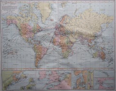
Antique World Map on Mercator's Projection, Ocean Currents and Trade Routes 1903
Located in Langweer, NL
Title: Antique World Map on Mercator's Projection, 1903, Showing Ocean Currents and Trade Routes
Description:
This antique map, titled "Chart of the World on Mercator's Projection,"...
Category
20th Century Maps
Materials
Paper
Antique Map of England and Wales, 1903, with Detailed Counties and Railways
Located in Langweer, NL
Title: Antique Map of England and Wales, 1903, with Detailed Counties and Railways
Description:
This beautifully detailed antique map, titled "England and Wales," was engraved and p...
Category
20th Century Maps
Materials
Paper
Antique Linen Anatomical School Poster from the Cow, 1950s
Located in Leuven, Vlaams Gewest
1950s didactical anatomical school poster of the cow.
Used to explain and show the anatomical aspect of a cow to the pupils.
Printed on linen.
Cool curio item to decorate a ...
Category
Belgian Vintage 20th Century Maps
Materials
Linen
