20th Century Maps
to
232
415
56
473
15
6
4
4
3
2
2,974
2,230
473
3
288
34
9
126
8
36
9
2
5
4
3
2
435
27
20
19
12
109
86
70
42
32
473
473
473
5
2
2
1
1
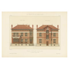
Period: 20th Century
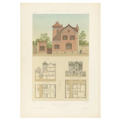
Pl. XXII Maison rue Friant, Chabat, c.1900
Located in Langweer, NL
Antique print titled 'Maison rue Friant. Mr. A. Hedin, Architecte'. This print depicts the design of a building in France. Originates from 'La Brique et La Terre Cuite' by P. Chabat....
Category
20th Century Maps
Materials
Paper
$117 Sale Price
20% Off
Pl. XXIX Restaurant de Bercy, Chabat, c.1900
Located in Langweer, NL
Antique print titled 'Restaurant de Bercy, Mr. l 'Heureux Architecte'. This print depicts the design of a restaurant in France. Originates from 'La Brique et La Terre Cuite' by P. Ch...
Category
20th Century Maps
Materials
Paper
$116 Sale Price
20% Off
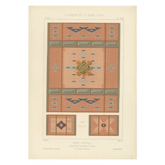
Pl. LXXIII Dôme Central, Chabat, c.1900
Located in Langweer, NL
Antique print titled 'Dôme Central Exposition Universelle de 1889, Mr. J. Bouvard, Architecte'. This print depicts the design of a building in France. Originates from 'La Brique et L...
Category
20th Century Maps
Materials
Paper
$103 Sale Price
20% Off
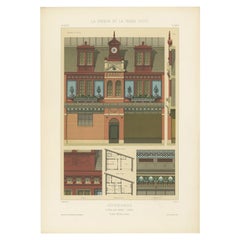
Building Design Print of Hôtel Rue Vernet Paris, Chabat, c.1900
Located in Langweer, NL
Antique print titled 'Dépendances (Hôtel Rue Vernet Paris) Mr. Paul Sédille, Architecte'. This print depicts the design of a hotel in Paris, France. Originates from 'La Brique et La ...
Category
20th Century Maps
Materials
Paper
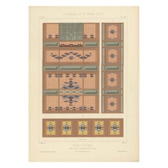
Pl. LXXIV Dôme Central, Chabat, C.1900
Located in Langweer, NL
Antique print titled 'Dôme Central Exposition Universelle de 1889, Mr. J. Bouvard Architecte'. This print depicts the design of a building in France. Originates from 'La Brique et La...
Category
20th Century Maps
Materials
Paper
$99 Sale Price
20% Off
Pl. XLIII Villa a Fontenay-Sous-Bois, Chabat, c.1900
Located in Langweer, NL
Antique print titled 'Villa A Fontenay-Sous-Bois Mr. Ed. Jandelle-Ramier, architecte'. This print depicts the design of a villa in France. Originates from 'La Brique et La Terre Cuit...
Category
20th Century Maps
Materials
Paper
$117 Sale Price
20% Off
Pl. X Villa au Vésinet, Chabat, c.1900
Located in Langweer, NL
Antique print titled 'Villa au Vésinet (Seine et Oise) Mr. Héret Architecte'. This print depicts the design of a villa in France. Originates from 'La Brique et La Terre Cuite' by P. ...
Category
20th Century Maps
Materials
Paper
$113 Sale Price
20% Off
Pl. XXI Antique Print of a Building in France by Chabat, c.1900
Located in Langweer, NL
Antique print titled 'Villa mon Caprice Villers-Sur-Mer. Mr. E. Macé, Architecte'. This print depicts the design of a building in France. Originates from 'La Brique et La Terre Cuite...
Category
20th Century Maps
Materials
Paper
$117 Sale Price
20% Off
Pl. LXXVI Pavillon Royaux Fils, Chabat, c.1900
Located in Langweer, NL
Antique print titled 'Pavillon Royaux Fils Exposition Universelle de 1889, Mrs. P. Chabat Architecte'. This print depicts the design of a building in France. Originates from 'La Briq...
Category
20th Century Maps
Materials
Paper
$117 Sale Price
20% Off
Pl. XXIII Halle a Marchandises, Chabat, c.1900
Located in Langweer, NL
Antique print titled 'Halle à Marchandises'. This print depicts the design of a building in France. Originates from 'La Brique et La Terre Cuite' by P. Chabat. Artists and Engravers:...
Category
20th Century Maps
Materials
Paper
$117 Sale Price
20% Off
Pl. xi Châlet D'ambricourt, Chabat, c.1900
Located in Langweer, NL
Antique print titled 'Châlet d'Ambricourt Villers-Sur-Mer, Mr. Feine Architecte'. This print depicts the design of a building in France. Originates from 'La Brique et La Terre Cuite'...
Category
20th Century Maps
Materials
Paper
$127 Sale Price
20% Off
Pl. XVIII Maison de Jardinier, Chabat, C.1900
Located in Langweer, NL
Antique print titled 'Maison de Jardinier Mr. Pierre Chabat, Architecte'. This print depicts the design of a building in France. Originates from 'La Brique et La Terre Cuite' by P. C...
Category
20th Century Maps
Materials
Paper
$113 Sale Price
20% Off
Pl. XIX Maison de Jardinier, Chabat, c.1900
Located in Langweer, NL
Antique print titled 'Maison de Jardinier Mr. Pierre Chabat, Architecte'. This print depicts the design of a building in France. Originates from 'La Brique et La Terre Cuite' by P. C...
Category
20th Century Maps
Materials
Paper
$113 Sale Price
20% Off
Pl. XV Dépendances, Chabat, c.1900
Located in Langweer, NL
Antique print titled 'Dépendances Mr. Simonet, Architecte'. This print depicts the design of a building in France. Originates from 'La Brique et La Terre Cuite' by P. Chabat. Artists...
Category
20th Century Maps
Materials
Paper
$113 Sale Price
20% Off
Pl. XIII Remise de Locomotives, Chabat, c.1900
Located in Langweer, NL
Antique print titled 'Remise de Locomotives'. This print depicts the design of a building for locomotives. Originates from 'La Brique et La Terre Cuite' by P. Chabat. Artists and Eng...
Category
20th Century Maps
Materials
Paper
$129 Sale Price
20% Off
Architectural Impression of Villa a Pont a Mousson in France, Chabat, c.1900
Located in Langweer, NL
Antique print titled 'Villa Weber, Mr. Paul Sédille Architecte'. This print depicts the design of a building in France. Originates from 'La Brique et La Terre Cuite' by P. Chabat. Ar...
Category
20th Century Maps
Materials
Paper
French Architectural Print of Souches de Cheminées - Chabat, c.1900
Located in Langweer, NL
Antique print titled 'Souches de Cheminées'. This print depicts the design of a building in France. Originates from 'La Brique et La Terre Cuite' by P. Chabat. Artists and Engravers:...
Category
20th Century Maps
Materials
Paper
French Print of Pavillon du Concierge, Chabat, c.1900
Located in Langweer, NL
Antique print titled 'Pavillon du Concierge école nationale professionnelle d'armentiéres, Mr. Charles Chipiez Architecte'. This print depicts the design of...
Category
20th Century Maps
Materials
Paper
Architectural Print of Villa Boulevard de Boulogne in France by Chabat, c.1900
Located in Langweer, NL
Antique print titled 'Villa Boulevard de Boulogne (Seine) Mr. L. Magne, Architecte'. This print depicts the design of a villa in France. Originates from 'La Brique et La Terre Cuite'...
Category
20th Century Maps
Materials
Paper
Architectural Print of 'Ecole Rue Madame' in France by Chabat, c.1900
Located in Langweer, NL
Antique print titled 'Ecole Rue Madame (Paris) Mr. H. Errard Architecte'. This print depicts the design of a school in Paris, France. Originates from 'La Brique et La Terre Cuite' by...
Category
20th Century Maps
Materials
Paper
Antique Map of the Dutch Provinces Groningen and Friesland, 1902
Located in Langweer, NL
Antique map titled 'Groningen en Friesland'. Lithographed map of the provinces of Groningen and Friesland, the Netherlands. This map originates from 'Atlas van Nederland'. Artists an...
Category
20th Century Maps
Materials
Paper
$132 Sale Price
20% Off
Antique Map of Aceh or Adjeh in Northern Sumatra, Indonesia, 1900
Located in Langweer, NL
Antique map of Aceh, Sumatra. This map originates from 'Atlas van Nederlandsch Oost- en West-Indië' by I. Dornseiffen.
Artists and Engravers: Published by Seyffardt's Boekhandel, A...
Category
20th Century Maps
Materials
Paper
Antique Elevation Map of the Netherlands by Beekman & Schuiling, 1927
Located in Langweer, NL
Antique map titled 'Nederland Hoogtekaart'. This map originates from 'Schoolatlas der Geheele Aarde' published in Zutphen by W.J. Thieme & Cie.
Artists and Engravers: Authors: Be...
Category
20th Century Maps
Materials
Paper
$61 Sale Price
20% Off
Old Map of the Dutch City of Megen in Holland, 1916
Located in Langweer, NL
Antique map Megen titled 'Megen'. Antique map depicting the city of Megen, Noord-Brabant, The Netherlands.
Artists and Engravers: Lithograph by J. Smulders & Co, Den Haag.
Con...
Category
20th Century Maps
Materials
Paper
$80 Sale Price
20% Off
Antique Map of Spain and Portugal by Johnston, '1909'
Located in Langweer, NL
Antique map titled 'Spain and Portugal'. Original antique map of Spain and Portugal. With inset maps of the Canary Islands, Madeira, Lisbon and Ma...
Category
20th Century Maps
Materials
Paper
$236 Sale Price
20% Off
Antique Map of India ( Southern ) by Johnston (1909)
Located in Langweer, NL
Antique map titled 'India'. Original antique map of India Southern sheet. With inset maps of south eastern provinces of India. This map originates from the ‘Royal Atlas of Modern Geo...
Category
20th Century Maps
Materials
Paper
$235 Sale Price
20% Off
Antique Map of Belgium and the Netherlands by Johnston '1909'
Located in Langweer, NL
Antique map titled 'Belgium and The Netherlands'. Original antique map of Belgium and the Netherlands. With inset maps of Amsterdam and Brussels. This m...
Category
20th Century Maps
Materials
Paper
$235 Sale Price
20% Off
Antique Map of the United States 'North West' by Johnston, '1909'
Located in Langweer, NL
Antique map titled 'United States of North America'. Original antique map of the United States of North America ( North West ). This map originates from the ‘Royal Atlas of Modern Ge...
Category
20th Century Maps
Materials
Paper
$235 Sale Price
20% Off
Antique Map of Austria- Hungary by Johnston, '1909'
Located in Langweer, NL
Antique map titled 'Austria- Hungary'. Original antique map of Austria- Hungary. This map originates from the ‘Royal Atlas of Modern Geography’....
Category
20th Century Maps
Materials
Paper
$235 Sale Price
20% Off
Antique Map of India 'Northern' by Johnston '1909'
Located in Langweer, NL
Antique map titled 'India'. Original antique map of India, Northern sheet. This map originates from the ‘Royal Atlas of Modern Geography’. Published by W. & A.K. Johnston, 1909.
Category
20th Century Maps
Materials
Paper
$235 Sale Price
20% Off
Antique Map of Scotland 'Northern' by Johnston, '1909'
Located in Langweer, NL
Antique map titled 'Scotland'. Original antique map of Scotland. With inset map of the Shetland Islands. This map originates from the ‘Royal Atlas of M...
Category
20th Century Maps
Materials
Paper
$235 Sale Price
20% Off
Antique Chart of the World by Johnston '1909'
Located in Langweer, NL
Antique map titled 'Chart of the World on Mercator's Projection Showing the directions of the Oceans Currents with the Routes and Distances Between Principal Ports'. Detailed map of ...
Category
20th Century Maps
Materials
Paper
$283 Sale Price
20% Off
Antique Map of the East Indies by Brouwer, 1917
Located in Langweer, NL
Antique map titled 'Geotektonische Schetskaart van het Oostelijk Gedeelte van den Oost-Indischen Archipel':
**Title**: Geotektonische Schetskaart van het Oostelijk Gedeelte van den ...
Category
20th Century Maps
Materials
Canvas, Paper
$1,132 Sale Price
20% Off
Antique Plan of Paramaribo 'Suriname' Published 1920
Located in Langweer, NL
Large lithographed plan of Paramaribo, capital city of Suriname, showing the situation, circa 1916-1917. With small inset plan. Published in 1920.
Category
20th Century Maps
Materials
Paper
$801 Sale Price
20% Off
Set of 11 Antique Maps of Japan Originating from a Japanese Atlas, 1906
Located in Langweer, NL
Set of 11 antique maps depicting various regions of Japan. These maps originate from a Japanese atlas, dated 1906. All text is in Japanese.
Category
20th Century Maps
Materials
Paper
$471 Sale Price / set
20% Off
Large Framed Map of the Mediterranean
Located in Queens, NY
Large map/chart chart of The Mediterranean and the Grecian Archipelago showing Italy, Sardinia, Corsica, part of France, etc. in a black frame.
Category
French Mid-Century Modern 20th Century Maps
Original 1910 George Eldridge Chart
Located in Norwell, MA
Original framed 1910 George Eldridge chart "E" showing Gloucester to the Kennebec river. Showing the coast of Maine in great detail. Towns includ...
Category
Unknown 20th Century Maps
Northwest Coast and Isle of Man Map
Located in Cheshire, GB
Greenville Collins Northwest Coast and Isle of Man. hand coloured chart, encased in an ebonised frame.
Dimensions
Height 26.5 Inches
Width 30 Inches
Depth 1 Inches
Category
British 20th Century Maps
Materials
Paper
$517 Sale Price
20% Off
Large University Chart “Political Map of North America” by Bacon
Located in Godshill, Isle of Wight
Large University Chart “Political Map of North America” by Bacon
W&A K Johnston’s Charts of Physical Maps By G W Bacon,
This is colourful Physical map ...
Category
American Empire 20th Century Maps
Materials
Linen
1918 American Frohse Anatomical Chart, A. J. Nystrom, Max Brodel Illustrator
By A.J. Nystrom & Co, Max Brödel
Located in Buffalo, NY
Antique American Frohse Anatomical pull down chart, by A. J. Nystrom, ,revised and augmented by Max Brodel illustrator... Amazing color, patina, age appropriate wear. dated 1918..
Max (Paul Heinrich) Brödel
1870-1941
Brödel, an illustrator and the first director of the Art as Applied to Medicine program at Johns Hopkins...
Category
American Steampunk Vintage 20th Century Maps
Materials
Wood, Paper
Chart of the Harbour of Liverpool
Located in Cheshire, GB
PL Burdett A Chart of the Harbour of Liverpool hand coloured. Encased in an ebonised frame.
Dimensions
Height 23.5 Inches
Width 28 Inches
Depth 1 Inches
Category
British 20th Century Maps
Materials
Paper
$626 Sale Price
20% Off
Vintage Swedish School Map of Vastergötland, Made in Sweden 1920
Located in Los Angeles, CA
Vintage Swedish School Map of Vastergötland, Made in Sweden 1920
Västergötland also known as West Gothland or the Latinized version Westrogothia in older literature, is one of the...
Category
Swedish Vintage 20th Century Maps
Materials
Linen, Wood, Paper
Large University Chart “Political Map of North America” by Bacon
Located in Godshill, Isle of Wight
Large University chart “Political Map of North America” by Bacon
W&A K Johnston’s Charts of Political Maps by G W Bacon,
This is colorful Physical ...
Category
American Empire 20th Century Maps
Materials
Linen
Chart of Boston's North Shore
Located in Norwell, MA
Rarely found restrike of an 1804 chart by Nathanael Bowditch of the Harbors of Salem, Marblehead, Beverly, and Manchester.
Showing the Islands of Great Misery, Satan, Cuney, Winter,...
Category
North American Vintage 20th Century Maps
Materials
Paper
Map of Harwich, Massachusetts
Located in Norwell, MA
Turn of the century map of Harwich, Massachusetts. Plate from a Cape Cod County Map book showing the Barnstable county town of Harwich including Allens Harbor, Pleasant Lake, Harwich...
Category
20th Century Maps
Luminous Earth Globe on a Chrome Base, Italy, 1980
Located in Paris, FR
Unusual luminous globe on a large chromed metal base, made in Italy by Ricoscope Editions in Firenze.
In perfect condition, except for two very small missing pieces at the junction ...
Category
Italian Space Age Vintage 20th Century Maps
Materials
Chrome
University Chart “Black Map of North America
Located in Godshill, Isle of Wight
University Chart “Black Map of North America
W&A K Johnston’s Charts of Physical Maps By G W Bacon,
This is a Black Physical map of North A...
Category
Industrial 20th Century Maps
Materials
Linen
Large University Chart “Physical Map of Africa” by Bacon
Located in Godshill, Isle of Wight
Large university chart “Physical Map of Africa” by Bacon
W&A K Johnston’s Charts of Physical Maps By G W Bacon,
This is colorful Physical map of North America, it is large lithograph set...
Category
Folk Art 20th Century Maps
Materials
Linen
Gold Leaf Foil Pictorial Plan Map of the West Country of England Antique Style
Located in West Sussex, Pulborough
We are delighted to offer for sale this lovely Antique style pictorial plan map of the West Country of England etched in gold leaf foil
This is a very interesting and decorative p...
Category
English Adam Style 20th Century Maps
Materials
Gold Leaf
$262 Sale Price
30% Off
Large University Chart “Africa Physical ” by Bacon
Located in Godshill, Isle of Wight
Large University chart “Africa Physical ” by Bacon
W&A K Johnston’s charts of physical maps by G W Bacon,
This is a Physical map of Africa, it is lithograph set on Linen mounte...
Category
Beaux Arts 20th Century Maps
Materials
Linen
Mid-Century Earth Globe Electrified
Located in Lisboa, Lisboa
Earth globe, electrified. With polished wooden base and golden metal structure. This model presents a physical and political representation of the world, with reliefs that highlight ...
Category
Portuguese Mid-Century Modern 20th Century Maps
Materials
Metal
Vintage World Map Mirror Based on the Original by Johnson 1882 Military Campaign
Located in West Sussex, Pulborough
We are delighted to offer for sale this lovely Antique style pictorial plan map of the globe based on the original by Johnson in 1882
This is a very interesting and decorative pie...
Category
English Campaign 20th Century Maps
Materials
Mirror
$285 Sale Price
30% Off
FRAME DRIVING SCHOOL 70 S 20th Century
Located in Madrid, ES
Large Globe 50S
THE GLOBE IS IN PLASTIC AND THE FOOT IN WOOD. 1950s. IT HAS LIGHT. GOOD CONDITION WITH CENTURIES OF USE. MEASUREMENTS: 110 CM IN HEIGHT AND 60 CM IN DIAMETER
good con...
Category
English Modern 20th Century Maps
Materials
Plastic, Wood
