20th Century Maps
to
232
415
56
473
15
6
4
4
3
2
2,974
2,230
473
3
288
34
9
126
8
36
9
2
5
4
3
2
435
27
20
19
12
109
86
70
42
32
473
473
473
5
2
2
1
1
Period: 20th Century
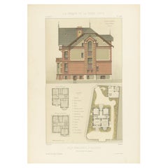
Pl. XXIV Villa Marguerite a Houlgate, Chabat, c.1900
Located in Langweer, NL
Antique print titled 'Villa Marguerite a Houlgate, Mr. E.M. Auburtin, Architecte'. This print depicts the design of a villa in France. Originates from 'La Brique et La Terre Cuite' b...
Category
20th Century Maps
Materials
Paper
$113 Sale Price
20% Off
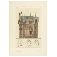
Pl. XL Beuzeval 'Calvados', Chabat, c.1900
Located in Langweer, NL
Antique print titled 'Villa Brodu, Beuzeval (Calvados) Mr. Baumier, Architecte'. This print depicts the design of a villa in Calvados, France. Originates from 'La Brique et La Terre ...
Category
20th Century Maps
Materials
Paper
$113 Sale Price
20% Off
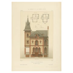
Pl. XLI Villa A Villemonble, Chabat, c.1900
Located in Langweer, NL
Antique print titled 'Villa A Villemonble'. This print depicts the design of a villa in France. Originates from 'La Brique et La Terre Cuite' by P. Chabat. Artists and Engravers: P. ...
Category
20th Century Maps
Materials
Paper
$113 Sale Price
20% Off
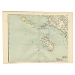
Antique Map of the Nias Archipelago, Sumatra, Indonsia, 1900
Located in Langweer, NL
Antique map of Nias Island and surrounding islands including the Banyak islands, Pini island and Simeulue Island. This map originates from 'Atlas van Nederlandsch Oost- en West-Indië...
Category
20th Century Maps
Materials
Paper
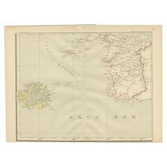
Antique Map of the Java Sea by Dornseiffen, 1900
Located in Langweer, NL
Antique map of the Java Sea. Also depicts Bilitung, the Karimata Islands and Sukadana, Borneo. This map originates from 'Atlas van Nederlandsch Oost- en West-Indië' by I. Dornseiffen...
Category
20th Century Maps
Materials
Paper
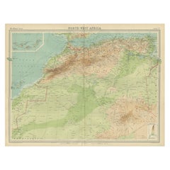
Antique Map of Northwest Africa by Bartholomew, 1922
Located in Langweer, NL
Antique map of Africa titled 'North-West Africa'. Old map of north-west Africa depicting Morocco, Algeria, Tunis and surroundings. This map originates from 'The Times' atlas. Artists...
Category
20th Century Maps
Materials
Paper
$89 Sale Price
20% Off
Pl. XLII Villa a Fontenay-Sous-Bois, Chabat, C.1900
Located in Langweer, NL
Antique print titled 'Villa A Fontenay-Sous-Bois, Mr. Ed. Jandelle-Ramier, Architecte'. This print depicts the design of a villa in France. Originates from 'La Brique et La Terre Cui...
Category
20th Century Maps
Materials
Paper
$113 Sale Price
20% Off
Pl. VIII Villa a Luzarches, Chabat, c.1900
Located in Langweer, NL
Antique print titled 'Villa à Luzarches, Mr. Tronquois, Architecte'. This print depicts the design of a villa in France. Originates from 'La Brique et La Terre Cuite' by P. Chabat. A...
Category
20th Century Maps
Materials
Paper
$113 Sale Price
20% Off
Antique Architectural Print of Villa a Deauville in France, Chabat, c.1900
Located in Langweer, NL
Antique print titled 'Villa a Deauville, Mr. H. Blondel Architecte, Mr. Breney Architecte'. This print depicts the design of a building in France. Originates from 'La Brique et La Te...
Category
20th Century Maps
Materials
Paper
Architectural Building Design Print of Ecuries in France, Chabat, c.1900
Located in Langweer, NL
Antique print titled 'Ecuries Rue Cros (Paris) Mr. L. Lethorel Architecte'. This print depicts the design of buildings in France. Originates from 'La Brique et La Terre Cuite' by P. ...
Category
20th Century Maps
Materials
Paper
Pl. XLIV Maison A Neuilly 'Seine', Chabat, c.1900
Located in Langweer, NL
Antique print titled 'Maison A Neuilly (Seine) Mr. Paul Sédille, Architecte'. This print depicts the design of a building in France. Originates from 'La Brique et La Terre Cuite' by ...
Category
20th Century Maps
Materials
Paper
$120 Sale Price
20% Off
Antique Map of Egypt, Arabia Petraea and Lower Nubia by Johnston '1909'
Located in Langweer, NL
Antique map titled 'Egypt, Arabia Petraea and Lower Nubia'. Original antique map of Egypt, Arabia Petraea and Lower Nubia. With inset maps of Alexandriam Cairo and the Suez Canal...
Category
20th Century Maps
Materials
Paper
$221 Sale Price
24% Off
Antique Map of Sweden and Norway by Johnston (1909)
Located in Langweer, NL
Antique map titled 'Sweden and Norway'. Original antique map of Sweden and Norway. With inset maps of Christiania and Stockholm. This map originates from...
Category
20th Century Maps
Materials
Paper
$235 Sale Price
20% Off
Original Antique Map of England and Wales from the 1909 Royal Atlas
Located in Langweer, NL
The antique map titled 'England and Wales' is a historical cartographic representation of these two nations. This original antique map of England...
Category
20th Century Maps
Materials
Paper
$235 Sale Price
20% Off
Antique Map of West Asia, circa 1900
Located in Langweer, NL
Antique map titled 'Persia, Afghanistan and Beloochistan'. Folding map on linen.
Published circa 1900. Stamp below title.
Category
20th Century Maps
Materials
Paper
Antique Map of Belgium and the Netherlands by Johnston 'c.1920'
Located in Langweer, NL
Antique map titled 'Belgium and the Netherlands'. Original antique map of Belgium and the Netherlands. Published by W. & A.K. Johnston, circa 1920.
Category
20th Century Maps
Materials
Paper
$188 Sale Price
20% Off
Antique Map of the United States ' North East ' by Johnston '1909'
Located in Langweer, NL
Antique map titled 'United States of North America'. Original antique map of United States of North America ( North East ). This map orig...
Category
20th Century Maps
Materials
Paper
$235 Sale Price
20% Off
Antique Map of South-West Russia by Johnston (1909)
Located in Langweer, NL
Antique map titled 'South-West Russia'. Original antique map of South-West Russia. With inset map of Odessa. This map originates from the ‘Royal Atlas of Modern Geography’. Published...
Category
20th Century Maps
Materials
Paper
$235 Sale Price
20% Off
Antique Map of Noord-Holland, Province of The Netherlands, 1902
Located in Langweer, NL
Antique map titled 'Noord-Holland'. Lithographed map of the province of Noord-Holland, the Netherlands. This map originates from 'Atlas van Nederland'. Artists and Engravers: Publish...
Category
20th Century Maps
Materials
Paper
$122 Sale Price
20% Off
Antique Map of Central Java Depicting The Karimun Islands, Indonesia, 1900
Located in Langweer, NL
Antique map of Central Java, also depicting the Karimun Islands. This map originates from 'Atlas van Nederlandsch Oost- en West-Indië' by I. Dornseiffen. ...
Category
20th Century Maps
Materials
Paper
$245 Sale Price
20% Off
Antique Map of The Dutch City of Gorinchem by Smulders, Lithograph, 1916
Located in Langweer, NL
Antique map Gorinchem titled 'Gorkum'. Antique map depicting the city of Gorinchem, The Netherlands.
Artists and Engravers: Lithograph by J. Smulders & Co, Den Haag.
Condition...
Category
20th Century Maps
Materials
Paper
$70 Sale Price
20% Off
Antique Map of the Baltic Sea by Johnston, '1909'
Located in Langweer, NL
Antique map titled 'Basin of the Baltic'. Original antique map of Baltic Sea. With inset maps of Kiel, Stettin, Danzig and St Petersburg. This map originate...
Category
20th Century Maps
Materials
Paper
$235 Sale Price
20% Off
Old Map of The Frisian City of Workum in Holland, 1916
Located in Langweer, NL
Antique map Workum titled 'Workum'. Antique map depicting the Frisian city of Workum, the Netherlands.
Artists and Engravers: Lithograph by J. Smulders & Co, Den Haag.
Condi...
Category
20th Century Maps
Materials
Paper
$80 Sale Price
20% Off
Antique Map of Russia in Europe by Johnston (1909)
Located in Langweer, NL
Antique map titled 'European Russia'. Original antique map of Russia in Europe. With inset maps of St Petersburg and Moscow. This map originates from the ‘Royal Atlas of Modern Geogr...
Category
20th Century Maps
Materials
Paper
$235 Sale Price
20% Off
Antique Map of Denmark by Johnston '1909'
Located in Langweer, NL
Antique map titled 'Denmark'. Original antique map of Denmark. With inset maps of Iceland, Faroe Island, and Copenhagen. This map originates from the ‘Royal Atlas of Modern Geography...
Category
20th Century Maps
Materials
Paper
$235 Sale Price
20% Off
Antique Map of Canada by Johnston '1909'
Located in Langweer, NL
Antique map titled 'Dominion of Canada'. Original antique map of Canada. With inset map of Newfoundland. This map originates from the ‘Royal Atla...
Category
20th Century Maps
Materials
Paper
$235 Sale Price
20% Off
Antique Map of Abyssinia with Upper Nubia by Johnston, '1909'
Located in Langweer, NL
Antique map titled 'Abyssinia with Upper Nubia'. Original antique map of Abyssinia with Upper Nubia. This map originates from the ‘Royal Atlas of Modern Geography’. Published by W. &...
Category
20th Century Maps
Materials
Paper
$235 Sale Price
20% Off
Antique Map of the United States of North America by Johnston '1909'
Located in Langweer, NL
Antique map titled 'United States of North America'. Original antique map of United States of North America ( South West Sheet ). With inset maps of Chicago...
Category
20th Century Maps
Materials
Paper
$330 Sale Price
20% Off
Antique Map of Turkey in Asia by Johnston '1909'
Located in Langweer, NL
Antique map titled 'Turkey Asia ( Asia Minor )'. Original antique map of Turkey in Asia. This map originates from the ‘Royal Atlas of Modern Geog...
Category
20th Century Maps
Materials
Paper
$235 Sale Price
20% Off
Antique Map of Asia by Johnston '1909'
Located in Langweer, NL
Antique map titled 'Asia'. Depicting China, Japan, Indonesia, India, Arabia and more. This map originates from the ‘Royal Atlas of Modern Geography’. Published by W. & A.K. Johnston,...
Category
20th Century Maps
Materials
Paper
$235 Sale Price
20% Off
Antique Map of the Orange River Colony in South Africa, 1901
Located in Langweer, NL
Antique map titled 'Orange River Colony, northern part'. Lithograph of the northern part of the Orange River Colony, Africa. The Orange River Colony was the British colony created af...
Category
20th Century Maps
Materials
Paper
Antique Map of the Asiatic Archipelago by E. Stanford, circa 1910
Located in Langweer, NL
Antique folding map titled 'London Atlas Map of the Asiatic Archipelago'. Centered on the Philippines and Borneo, the map shows a number of different seasonal passages through the region to Hong Kong and Macao. With inset maps of Singapore...
Category
20th Century Maps
Materials
Paper
$943 Sale Price
20% Off
Large Topographical and Geological Map of the Teshio Oil Field, '1936'
Located in Langweer, NL
Topographical and geological map of the Teshio oil field. Shows location of oil well, oil sand, natural gas, coal, Sulphur spring, anticlinal axis, prof...
Category
20th Century Maps
Materials
Linen, Paper
$1,132 Sale Price
20% Off
Vintage Folding Map of the Streets of Moscow, Russia, circa 1950
Located in Langweer, NL
Antique map titled 'Carte Illustree des Rues de Moscou'. Vintage folding map of the streets of Moscow, Russia. Published by Intourist.
Category
20th Century Maps
Materials
Paper
$566 Sale Price
20% Off
Antique Map of the Southern Part of the Orange River Colony by Stanford, 1901
Located in Langweer, NL
Antique map titled 'Orange River Colony, southernpart'. Lithograph of the southern part of the Orange River Colony, Africa. The Orange River Colony was the British colony created aft...
Category
20th Century Maps
Materials
Paper
$94 Sale Price
20% Off
Antique Map of Alaska '1904'
Located in Langweer, NL
An antique map titled 'Map of Alaska Compiled Under the Direction of R.U. Goode, Geographer,' which relies on data from both the U.S. Geological Survey a...
Category
20th Century Maps
Materials
Paper
$566 Sale Price
20% Off
Original Antique Map of the American State of Oregon, 1903
Located in St Annes, Lancashire
Antique map of Oregon
Published By A & C Black. 1903
Original colour
Good condition
Unframed.
Free shipping
Category
English Antique 20th Century Maps
Materials
Paper
Original Antique Map of the American State of North Dakota, 1903
Located in St Annes, Lancashire
Antique map of North Dakota
Published By A & C Black. 1903
Original colour
Good condition
Unframed.
Free shipping
Category
English Antique 20th Century Maps
Materials
Paper
Original Antique Map of the American State of Pennsylvania( Western Part ), 1903
Located in St Annes, Lancashire
Antique map of Pennsylvania ( Western part )
Published By A & C Black. 1903
Original colour
Good condition
Unframed.
Free shipping
Category
English Antique 20th Century Maps
Materials
Paper
Original Antique Map of the American State of Pennsylvania( Eastern Part ), 1903
Located in St Annes, Lancashire
Antique map of Pennsylvania ( Eastern part )
Published By A & C Black. 1903
Original colour
Good condition
Unframed.
Free shipping
Category
English Antique 20th Century Maps
Materials
Paper
Original Antique Map of the American State of New York ( Northern Part ) 1903
Located in St Annes, Lancashire
Antique map of New York ( Northern Part )
Published By A & C Black. 1903
Original colour
Good condition
Unframed.
Free shipping
Category
English Antique 20th Century Maps
Materials
Paper
Original Antique Map of the American States of Vermont & New Hampshire, 1903
Located in St Annes, Lancashire
Antique map of Vermont and New Hampshire
Published By A & C Black. 1903
Original colour
Good condition
Unframed.
Free shipping
Category
English Antique 20th Century Maps
Materials
Paper
1908 John Bartholomew Miniature Map of Penang, Malacca, and Negri Sembilan
Located in Langweer, NL
1908 John Bartholomew Map of Penang, Malacca, and Negri Sembilan from Handy Atlas of Church and Empire
Description:
This finely detailed early twentieth-century map features two...
Category
Antique 20th Century Maps
Materials
Paper
Vintage 50s Topographical Map of the Florida Keys
Located in West Palm Beach, FL
A fabulous vintage 50 original topographical map. A depiction of the Florida Keys and the surrounding waters. Part of a set of three maps. The other t...
Category
American 20th Century Maps
Materials
Glass, Wood, Paper
Cram's 16" Deluxe Globe W/Daily Sun Ray and Season Indicator
Located in San Francisco, CA
Cram's 16" Deluxe Globe W/Daily Sun Ray and Season Indicator
1936
Category
Vintage 20th Century Maps
Materials
Metal
1915 "San Francisco City and County" Hanging Map by W. Bashford Smith
Located in Colorado Springs, CO
Presented is a rare wall map of San Francisco by W. Bashford Smith. Published in San Francisco in 1915, this map indicates streets and city districts, and, most notably, shows the si...
Category
American Art Deco Vintage 20th Century Maps
Materials
Wood, Paper
Mariners Chart of Quicks Hole and Tarpaulin Cove by George Eldridge 1901
Located in Norwell, MA
Nautical chart showing the harbor and local waters of Naushon Island Quick Holes. The chart display depths buoys, lightness, etc., The chart shows the cove in Naushon with ships stor...
Category
North American Antique 20th Century Maps
Materials
Paper
1943 "USO Map Guide to Washington"
Located in Colorado Springs, CO
This is a WWII map of Washington, DC, issued as a guide for service men and women visiting or working in the city during the war. The map was created by Allen F. Free and published a...
Category
American Mid-Century Modern Vintage 20th Century Maps
Materials
Paper
Vintage Framed United States Map
Located in Queens, NY
Vintage aged paper map of the United States mounted on particle board and framed in a simple wooden frame.
Category
American Mid-Century Modern 20th Century Maps
Materials
Wood, Paper
1912 "Panoramic View of New York City and Vicinity" by Jacob Ruppert
Located in Colorado Springs, CO
This is an attractive and very scarce map of New York, published by the Yorkville brewer Jacob Ruppert in 1912. The map shows an expansive view of the region reaching from Sandy Hook in the south and Yonkers to the north, to Hicksville in the east and past Newark to the west. This beautifully colored birds eye view shows waterways with all shipping traffic, boroughs, and clearly labeled railroad routes. It is presented on period dowels and backed on its original linen.
Jacob Ruppert was born in New York City in 1842 to Bavarian immigrants. His father owned a brewery in Manhattan where young Jacob learned the business of brewing. In 1862, Jacob established the Jacob...
Category
American Vintage 20th Century Maps
Materials
Paper
Framed Belmont Park Racetrack Barn Area Guide Map
Located in New York, NY
This piece was acquired from the Belmont Park racetrack in Elmont, New York. It displays an itemized map of the barn area at Belmont Park. It is made of acrylic with a black wood fra...
Category
American 20th Century Maps
Materials
Acrylic, Wood
1939 "A Good-Natured Map of the United States" by Greyhound
Located in Colorado Springs, CO
Presented is an original 1939 map, titled “A Good-Natured Map of the United States Setting Forth the Services of the Greyhound Lines and a Few Principal Connecting Bus Lines.” This brightly colored pictographic map was one of several similar United States maps...
Category
American Art Deco Vintage 20th Century Maps
Materials
Paper
Large Original Vintage Map of New Zealand, North Island, circa 1920
Located in St Annes, Lancashire
Great map of North Island, New Zealand
Original color.
Good condition / minor foxing to right edge
Published by Alexander Gross
Unframed.
Category
English Edwardian Vintage 20th Century Maps
Materials
Paper
Antique Map of Zuid-Holland and Utrecht in The Netherlands, 1902
Located in Langweer, NL
Antique map titled 'Zuid-Holland en Utrecht'. Lithographed map of the provinces of Zuid-Holland and Utrecht, the Netherlands. This map originates from 'Atlas van Nederland'.
Artist...
Category
20th Century Maps
Materials
Paper
$122 Sale Price
20% Off
Antique Political Map of Eastern China, 1922
Located in Langweer, NL
Antique map of China titled 'Eastern China - Political Map'. Old map of eastern China depicting Kiangsi, Chekiang, Fukien, Kwangtung, Taiwan (Formosa) an...
Category
20th Century Maps
Materials
Paper
$226 Sale Price
20% Off
Large Original Antique City Plan of Minneapolis and St Paul, USA, circa 1900
Located in St Annes, Lancashire
Fabulous colorful map of Minneapolis and St Paul, Minnesota.
Original color
By Rand, McNally & Co.
Published, circa 1900
Unframed
Minor edge tears
Free shipping.
Category
American Antique 20th Century Maps
Materials
Paper
Antique Map of the Region of Banjarmasin, Indonesia 1900
Located in Langweer, NL
Antique Map of the Region of Banyuasin, Sumatra. Also depicting Bangka/Banka island. This map originates from 'Atlas van Nederlandsch Oost- en West-Indië' by I. Dornseiffen.
Artist...
Category
20th Century Maps
Materials
Paper
Antique Map of the Batu Islands by Dornseiffen, 1900
Located in Langweer, NL
Antique map of the Batu Islands with the large title 'Soematra, Bangka en de Riouw-Lingga Archipel'. This map originates from 'Atlas van Nederlandsch Oost- en West-Indië' by I. Dorns...
Category
20th Century Maps
Materials
Paper
$80 Sale Price
20% Off
Pl. XXXIII Villa Eugène Decan, Chabat, c.1900
Located in Langweer, NL
Antique print titled 'Villa Eugène Decan, Villers-Sur-Mer'. This print depicts the design of a building in France. Originates from 'La Brique et La Terre Cuite' by P. Chabat. Artists...
Category
20th Century Maps
Materials
Paper
$122 Sale Price
20% Off
Pl. VII Villa a Luzarches, Chabat, C.1900
Located in Langweer, NL
Antique print titled 'Villa a Luzarches, Mr. Tronquois, Architecte'. This print depicts the design of a building in France. Originates from 'La Brique et La Terre Cuite' by P. Chabat...
Category
20th Century Maps
Materials
Paper
$117 Sale Price
20% Off
