20th Century Maps
to
232
415
56
473
15
6
4
4
3
2
2,974
2,230
473
3
288
34
9
126
8
36
9
2
5
4
3
2
435
27
20
19
12
109
86
70
42
32
473
473
473
5
2
2
1
1
Period: 20th Century
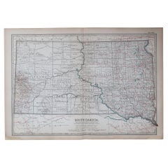
Original Antique Map of the American State of South Dakota, 1903
Located in St Annes, Lancashire
Antique map of South Dakota
Published By A & C Black. 1903
Original colour
Good condition
Unframed.
Free shipping
Category
English Antique 20th Century Maps
Materials
Paper
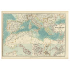
Antique Map of the Basin of the Mediterranean by Johnston '1909'
Located in Langweer, NL
Antique map titled 'Basin of the Mediterranean'. Original antique map of the basin of the Mediterranean. With inset maps of the Strait of Gibraltar, Morocco, Maltese Islands, Valetta...
Category
20th Century Maps
Materials
Paper
$283 Sale Price
20% Off
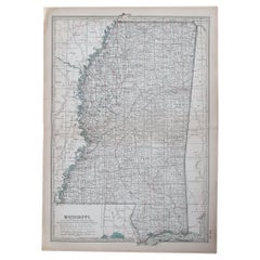
Original Antique Map of the American State of Mississippi, 1903
Located in St Annes, Lancashire
Antique map of Mississippi
Published By A & C Black. 1903
Original colour
Good condition
Unframed.
Free shipping
Category
English Antique 20th Century Maps
Materials
Paper
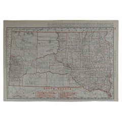
Original Antique Map of South Dakota by Rand McNally, circa 1900
Located in St Annes, Lancashire
Fabulous monochrome map with red outline color
Original color
By Rand, McNally & Co.
Published, circa 1900
Unframed
Minor edge tears.
Category
American Edwardian Antique 20th Century Maps
Materials
Paper
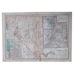
Original Antique Map of the American State of Nevada & Utah, 1903
Located in St Annes, Lancashire
Antique map of Nevada and Utah
Published By A & C Black. 1903
Original colour
Good condition
Unframed.
Free shipping
Category
English Antique 20th Century Maps
Materials
Paper
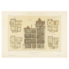
Pl. XLVII Maison de Campagne, Chabat, c.1900
Located in Langweer, NL
Antique print titled 'Maison de Campagne, Mr. Bonnier Architecte'. This print depicts the design of a building in France. Originates from 'La Brique et La Terre Cuite' by P. Chabat. ...
Category
20th Century Maps
Materials
Paper
$117 Sale Price
20% Off
Vintage Globe on Regency Pedestal Stand
Located in Pasadena, TX
This is a nice vintage globe. It sits on a pedestal tripod base. The base is constructed in a regency style. This globe comes from the office of Roger Rolke of Shell Oil Co.
A nice ...
Category
American 20th Century Maps
Materials
Wood
Antique Map of Batavia and Surabaya by Winkler Prins, 1905
Located in Langweer, NL
Antique map titled 'Batavia en Soerabaja'. Detailed plan of Batavia (Jakarta) and Soerabaja (Surabaya), Indonesia. The plans include important places like Tandjoeng Priok, Oedjong, W...
Category
20th Century Maps
Materials
Paper
Large Original Vintage Map of Iceland, circa 1920
Located in St Annes, Lancashire
Great map of Iceland
Original color. Good condition
Published by Alexander Gross
Unframed.
Category
English Victorian Vintage 20th Century Maps
Materials
Paper
Art Deco Cartoon Style Map of Paris possibly by Arthur Zaindenberg circa 1930's
By Arthur Zaidenberg
Located in New York, NY
Art Deco cartoon style map of Paris possibly by Arthur Zaidenberg. The map depicts witty references to Parisians lifestyle, along with drawings of notable landmarks, circa 1930's. T...
Category
American Art Deco Vintage 20th Century Maps
Materials
Paper
Large Original Vintage Map of Japan, circa 1920
Located in St Annes, Lancashire
Great map of Japan
Original color. Good condition
Published by Alexander Gross
Unframed.
Category
English Vintage 20th Century Maps
Materials
Paper
Barcelona 1901: A Cartographic Portrait of Catalonia's Capital Province
Located in Langweer, NL
This orignal antique map is a historical depiction of the province of Barcelona from 1901.
It showcases the varied terrain of the province, with the Serra de Collserola ridge near the city of Barcelona and the Pyrenees to the north. The map includes the coastline along the Mediterranean Sea, indicating Barcelona's position as a coastal province. Blue lines indicate rivers, such as the Llobregat and Besòs, which are significant features in the province's geography. Dotted lines may signify the borders of the province within Catalonia.
The coat of arms of Barcelona, highlighted with gold, is prominently displayed, featuring the Cross of Saint George (Cruz de Sant Jordi), the patron saint of Catalonia, and the red and yellow bars which are a symbol of the Aragonese and Catalan heritage.
About the province of Barcelona:
The province of Barcelona is part of the autonomous community of Catalonia in northeastern Spain. It is the most economically significant region of Catalonia, playing a crucial role in the country's economy due to its port, manufacturing, and service industries. The city of Barcelona is the capital and the second most populous city in Spain, known for its rich cultural heritage, architecture by Antoni Gaudí, such as the Sagrada Família, and its influential art scene. The province enjoys a Mediterranean climate and features diverse landscapes from the beaches along the coast to the mountains in the interior. Barcelona is also known for its vibrant festivals, cuisine, fashion, and sports, particularly football, being home to FC Barcelona...
Category
Antique 20th Century Maps
Materials
Paper
$622 Sale Price
20% Off
Atlantic Eden: The Azores and Madeira Archipelagos in 1903
Located in Langweer, NL
This original antique print is a historical map titled "PORTUGAL INSULAR," which translates to "Insular Portugal." It shows the Portuguese archipelagos of the Azores and Madeira, wit...
Category
Antique 20th Century Maps
Materials
Paper
$320 Sale Price
20% Off
Antique Webber Costello Globe on Metal Tripod Base c 1900 / 1920's
Located in New York, NY
Rare floor model globe made by Weber Costello, circa 1900. The 12" globe rests on a folding metal base. This example is in very good, original condition, showing only light wear, nor...
Category
American Industrial 20th Century Maps
Materials
Metal
Vintage "View of the Center of Paris Taken from the Air" Lithograph Map
Located in San Diego, CA
A very stylish "View of the Center of Paris Taken from the Air" lithograph map published by the Paris Ministry of Tourism, circa early 1950s. The piece measures 27" x 43" and shows...
Category
French Mid-Century Modern 20th Century Maps
Materials
Paper
$680 Sale Price
20% Off
Antique Map of Batavia, Semarang and Surabaya by Wolters 'circa 1910'
Located in Langweer, NL
Antique map titled 'Plattegronden van Steden op Java'. Old map with plans of Batavia (Jakarta), Semarang and Surabaya (Soerabaja)'. Published by J.B. Wolters.
Category
20th Century Maps
Materials
Paper
Old Decorative Pictorial Map of the United States, circa 1953
Located in Langweer, NL
Antique map titled 'A Pictorial Map of the United States of America Showing Principal Regional Resources, Products, and Natural Features'.
This information-packed map was create by the General Drafting Company for the New Jersey Bell Telephone Company. The main map features over 700 drawings in full color including points of interest, natural resources, and agricultural products. At bottom are inset maps showing railroad lines, air routes, telephone lines, as well as a pictorial map of New Jersey...
Category
20th Century Maps
Materials
Paper
$707 Sale Price
20% Off
Globe, Solid Rotating Brass Frame with Spinning Globe
Located in Dallas, TX
Globe, solid rotating brass frame with spinning globe, faux hardstone.
Category
French 20th Century Maps
Materials
Brass
$2,144 Sale Price
20% Off
Map of Southern South America – Richly Detailed Engraving by K.Johnston, 1903
Located in Langweer, NL
Title (80 characters, keyword-first):
Map of Southern South America – Richly Detailed Engraving by Keith Johnston, 1903
Description:
This elegant map titled "South America: Southern...
Category
20th Century Maps
Materials
Paper
Map of Northern South America – Vibrant Engraving by Keith Johnston, 1903
Located in Langweer, NL
Map of Northern South America – Vibrant Engraving by Keith Johnston, 1903
This beautifully engraved map titled "South America: Northern Sheet" was created by Keith Johnston, F.R.G.S...
Category
20th Century Maps
Materials
Paper
Canada’s West – 1903 Engraved Map by Johnston – Unique and Historic
Located in Langweer, NL
This beautiful and detailed map, titled "Dominion of Canada (Western Sheet)," was created by Keith Johnston and published in 1903.
It presents a fascinating depiction of Canada's w...
Category
20th Century Maps
Materials
Paper
Canada Map 1903 - Dominion of Canada, West Central Sheet
Located in Langweer, NL
Title: Canada Map 1903 - Dominion of Canada, West Central Sheet
Description:
This fascinating 1903 map of the Dominion of Canada’s West Central regions by T.R. Johnston offers a viv...
Category
20th Century Maps
Materials
Paper
Canada Map 1903 - East Central Dominion - Ontario, Quebec & More
Located in Langweer, NL
Canada Map 1903 - East Central Dominion - Ontario, Quebec & More
This captivating antique map, titled "Dominion of Canada (East Central Sheet)" and published in 1903 by Keith Johnst...
Category
20th Century Maps
Materials
Paper
Antique Map of Mexico by Johnston, '1909'
Located in Langweer, NL
Antique map titled 'Mexico'. Original antique map of Mexico. This map originates from the ‘Royal Atlas of Modern Geography’. Published by W. & A....
Category
20th Century Maps
Materials
Paper
$235 Sale Price
20% Off
Antique Map of Canada by Johnston '1909'
Located in Langweer, NL
Antique map titled 'Dominion of Canada'. Original antique map of Canada. This map originates from the ‘Royal Atlas of Modern Geography’. Publishe...
Category
20th Century Maps
Materials
Paper
$235 Sale Price
20% Off
Large Original Vintage Map of Japan, circa 1920
Located in St Annes, Lancashire
Great map of Japan
Unframed
Original color
By John Bartholomew and Co. Edinburgh Geographical Institute
Published, circa 1920
Free shipping.
Category
British Vintage 20th Century Maps
Materials
Paper
Antique Map of Central Africa, 1903, With Colonial Territories Explorers Routes
Located in Langweer, NL
Antique Map of Central Africa, 1903, Featuring Colonial Territories and Explorers’ Routes
This antique map, titled "Central Africa," was engraved and published in 1903 by W. & A.K. ...
Category
20th Century Maps
Materials
Paper
Pl. XX Villa Mon Caprice, Chabat, c.1900
Located in Langweer, NL
Antique print titled 'Villa mon Caprice Villers-Sur-Mer. Mr. E. Macé, Architecte'. This print depicts the design of a building in France. Originates from 'La Brique et La Terre Cuite...
Category
20th Century Maps
Materials
Paper
$120 Sale Price
20% Off
Antique Map of the West Indies and Ambon in Indonesia, 1900
Located in Langweer, NL
Two maps on one sheet titled 'De West-Indische Eilanden (Nederlandsch Gedeelte)' and 'Ambon, Leasi-Eilanden en Banda-Eilanden'. Old map of the Dutch West Indies and Ambon Island, Ind...
Category
20th Century Maps
Materials
Paper
$132 Sale Price
20% Off
Antique Map of New Zealand, 1903, Featuring the North and South Islands and Alps
Located in Langweer, NL
Title: Antique Map of New Zealand, 1903, Featuring the North and South Islands and the Southern Alps
Description:
This antique map, titled "New Zealand," was engraved and published ...
Category
20th Century Maps
Materials
Paper
Antique Map of Australia, 1903, with Colonial Divisions and Detailed Topography
Located in Langweer, NL
Title: Antique Map of Australia, 1903, with Colonial Divisions and Detailed Topography
Description: This antique map, titled "Australia," was engraved and published in 1903 by W. & ...
Category
20th Century Maps
Materials
Paper
Antique Map of Oceania, 1903, Featuring the Pacific Islands and Australasia
Located in Langweer, NL
Title: Antique Map of Oceania, 1903, Featuring the Pacific Islands and Australasian Region
Description:
This antique map, titled "Oceania," was engraved and published in 1903 by W. ...
Category
20th Century Maps
Materials
Paper
Antique Map of Southern India and South Eastern Provinces, 1903
Located in Langweer, NL
Title: Antique Map of Southern India and South Eastern Provinces, 1903, with Intricate Detail
Description:
This antique map, titled "India (Southern Sheet) and the South Eastern Pro...
Category
20th Century Maps
Materials
Paper
Antique Map of Northern India, Featuring Boundaries & Himalayan Detail, 1903
Located in Langweer, NL
Antique Map of Northern India, 1903, Featuring Provincial Boundaries and Himalayan Detail
This antique map, titled "India (Northern Sheet)," was engraved and published in 1903 by W....
Category
20th Century Maps
Materials
Paper
Antique Map of Central Asia - Featuring the Caspian Sea and Silk Road Regions
Located in Langweer, NL
Antique Map of Central Asia, 1903, Featuring the Caspian Sea and Silk Road Regions
This antique map, titled "Central Asia," was engraved and published in 1903 by W. & A.K. Johnston ...
Category
20th Century Maps
Materials
Paper
Antique Map of Asia with Intricate Provincial Boundaries, Published in 1903
Located in Langweer, NL
Title: Antique Map of Asia, 1903, with Intricate Provincial Boundaries and Coastal Features
Description:
This antique map, titled "Asia," was engraved and published in 1903 by the r...
Category
20th Century Maps
Materials
Paper
Antique Map of the Austro-Hungarian Monarchy, 1903, with Colorful Borderlines
Located in Langweer, NL
Title: Antique Map of the Austro-Hungarian Monarchy, 1903, with Colorful Provincial Borders
Description:
This antique map, titled "Austro-Hungarian Monarchy," was engraved and publi...
Category
20th Century Maps
Materials
Paper
Antique Map of the German Empire, 1903, with Intricate Provincial Boundaries
Located in Langweer, NL
Title: Antique Map of the German Empire, 1903, with Intricate Provincial Boundaries
Description:
This antique map, titled "Empire of Germany (Southern Portion)," was engraved and pu...
Category
20th Century Maps
Materials
Paper
Antique Map of Belgium and The Netherlands with Delicate Pastel Coloration, 1903
Located in Langweer, NL
Antique Map of Belgium and The Netherlands, 1903, with Delicate Pastel Coloration
This antique map, titled "Belgium and The Netherlands," was engraved and published in 1903 by the d...
Category
20th Century Maps
Materials
Paper
Antique Map of Europe, 1903, with Intricate Political Boundaries and Rich Detail
Located in Langweer, NL
Title: Antique Map of Europe, 1903, with Intricate Political Boundaries and Rich Detail
Description:
This antique map, titled "Europe," is a finely engraved and beautifully colored ...
Category
20th Century Maps
Materials
Paper
Four Rare Heliograph Views of Mining Near Sungei Bessi River in Malaysia, 1907
Located in Langweer, NL
Four views of early Mining operations in Malaysia at the beginning of the 20th century. Published in 1907.
1) A Sand-Lake of Residue (Sungai of Sungei Bessi)
2) Chinese Smelting...
Category
Antique 20th Century Maps
Materials
Paper
$424 Sale Price
20% Off
Algarve: A Tapestry of Sea and Sunlight in an Antique Map, 1903
Located in Langweer, NL
The image is a historical map of the Algarve, the southernmost region of Portugal. The map is titled "FARO. ALGARVE," indicating that it is centered around the city of Faro, which is...
Category
Antique 20th Century Maps
Materials
Paper
$367 Sale Price
20% Off
Antique Map of New Zealand by Johnston '1909'
Located in Langweer, NL
Antique map titled 'New Zealand'. Original antique map of New Zealand. With inset maps of Chatham, Auckland, Wellington, Dunedin, and New Gu...
Category
20th Century Maps
Materials
Paper
$330 Sale Price
20% Off
Vintage Road Map of the Netherlands '1928'
Located in Langweer, NL
Vintage map titled 'Volgens het vijfjarig Werkplan te verbeteren Rijkswegen en nieuw aan te leggen wegen welke voorkomen op het Rijkswegenplan'. Map of the Netherlands...
Category
20th Century Maps
Materials
Paper
$236 Sale Price
20% Off
Cartographic Survey of Pontevedra, 1902: Crossroads of Galicia"
Located in Langweer, NL
This original old map of over 100 years old depicts the province of Pontevedra as it was in 1902. Pontevedra is located in the northwest of Spain, in the autonomous community of Galicia. This coastal province is bordered by the Atlantic Ocean to the west and Portugal to the south. It is a region known for its rugged coastline, which includes the famous Rías Baixas, a series of four estuarine inlets that are known for their scenic beauty, beaches, and seafood. The interior of the province is characterized by a hilly landscape that gradually rises from the coast to the interior.
Pontevedra's capital, which shares the same name, is renowned for its well-preserved old town, rich medieval history, and the iconic Sanctuary of the Pilgrim Virgin...
Category
Antique 20th Century Maps
Materials
Paper
$301 Sale Price
20% Off
Antique Map of the East Coast of Sumatra , Indonesia, 1900
Located in Langweer, NL
Antique map of the East Coast of Sumatra. Also depicting the Strait of Malacca. This map originates from 'Atlas van Nederlandsch Oost- en West-Indië' by I. Dornseiffen.
Artists and...
Category
20th Century Maps
Materials
Paper
Antique Map of Lower Egypt, Showing Port Said, Suez and Surroundings, 1922
Located in Langweer, NL
Antique map of Africa titled 'Lower Egypt '.
Old map of Africa depicting Egypt, Port Said, Suez and surroundings. This map originates from 'The Times' atla...
Category
20th Century Maps
Materials
Paper
$179 Sale Price
20% Off
Antique European War Folding Map, ‘circa 1915’
Located in Langweer, NL
Antique folding map of the European War (1914-1915) titled 'The Eastern Campaign '. From Petrograd to Berlin, geographically colored. Published on linen b...
Category
20th Century Maps
Materials
Paper
$707 Sale Price
20% Off
Antique Map of the Brazil Railway Company, '1912'
Located in Langweer, NL
Antique map titled 'Brazil Railway Company'. This folding map is attached to the booklet titled 'The Brazil Railway Company'. It is a memorandum by A. H. A. Knox-Little, who was the ...
Category
20th Century Maps
Materials
Paper
$141 Sale Price
20% Off
Pl. XXVIII Ecuries, Chabat, c.1900
Located in Langweer, NL
Antique print titled 'Ecuries (Boulevard Beauséjour) Mr. Pierre Chabat Architecte'. This print depicts the design of buildings in France. Originates from 'La Brique et La Terre Cuite...
Category
20th Century Maps
Materials
Paper
$113 Sale Price
20% Off
Antique Map of Burma and the Malayan Peninsula by Andree, 1904
Located in Langweer, NL
Antique map titled 'Burma und Malayische Halbinsel'. Map of Burma / Myanmar and the Malayan peninsula. This map originates from 'Andrees Allgemeiner Handatlas in 126 Haupt-Und 139 Ne...
Category
20th Century Maps
Materials
Paper
$103 Sale Price
20% Off
Large Original Vintage Map of North America, circa 1920
Located in St Annes, Lancashire
Great map of North America
Original color. Good condition
Published by Alexander Gross
Unframed.
Category
English Edwardian Vintage 20th Century Maps
Materials
Paper
Original Old Map of Eastern China, Also Depicting Taiwan 'Formosa', 1922
Located in Langweer, NL
Large map of China titled 'China - Peking'. Old map of eastern China depicting Kiangsi, Chekiang, Fukien, Kwangtung, Taiwan (Formosa) and surroundings. With inset map of Peking. This...
Category
20th Century Maps
Materials
Paper
$207 Sale Price
20% Off
Large Original Vintage Map of The Pacific Islands Including Hawaii
Located in St Annes, Lancashire
Great map of The Pacific Islands
Unframed
Original color
By John Bartholomew and Co. Edinburgh Geographical Institute
Published, circa 1...
Category
British Vintage 20th Century Maps
Materials
Paper
George Philip's Large Relief Map of the World 150x110cm
Located in Linkebeek, BE
George Philip's Large Relief Map of the World 150x110cm
PHILIP, George Relief Map of the World. George Philip and Son Limited, c. 1950. Large 3D relief map of the world. Shaded relie...
Category
British 20th Century Maps
Materials
Plastic, Wood
Large Detailed Map of Australia Wint Inset of Tasmania, 1937
Located in Langweer, NL
Antique map titled 'Australia'. Large folding map of Australia. With inset map of Tasmania. Printed by L.F. Johnston, Canberra.
Artists and Engravers: Compiled and drawn by Propert...
Category
20th Century Maps
Materials
Paper
$330 Sale Price
20% Off
Antique Map of West Kalimantan, Borneo, Indonesia, 1900
Located in Langweer, NL
Antique map titled 'Borneo en Belitoeng'. Old map of West Kalimantan, Borneo. This map originates from 'Atlas van Nederlandsch Oost- en West-Indië' by I. Dornseiffen.
Artists and...
Category
20th Century Maps
Materials
Paper
$273 Sale Price
20% Off
Girona 1902: Geographic and Infrastructural Map of Catalonia’s Northern Province
Located in Langweer, NL
The map provided is of the province of Girona (in Catalan, Girona), located in the northeast of Spain, within the autonomous community of Catalonia, as of the year 1902. Here are the...
Category
Antique 20th Century Maps
Materials
Paper
$367 Sale Price
20% Off
Málaga 1901: A Cartographic Detailing of Andalusia's Coastal Jewel
Located in Langweer, NL
The map depicts the province of Málaga, located in the autonomous community of Andalusia in southern Spain, as it was in 1901. Here are the key features illustrated on the map:
- **...
Category
Antique 20th Century Maps
Materials
Paper
$320 Sale Price
20% Off
Antique Map of Canada by Johnston '1909'
Located in Langweer, NL
Antique map titled 'Dominion of Canada'. Original antique map of Canada. With inset maps of Niagara, Montreal, Quebec. This map originates from t...
Category
20th Century Maps
Materials
Paper
$235 Sale Price
20% Off
