20th Century Maps
to
232
415
56
473
15
6
4
4
3
2
2,974
2,230
473
3
288
34
9
126
8
36
9
2
5
4
3
2
435
27
20
19
12
109
86
70
42
32
473
473
473
5
2
2
1
1
Period: 20th Century
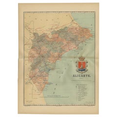
Alicante in a 1901 Antique Map: Maritime Gateway of Spain's Costa Blanca
Located in Langweer, NL
An original antique map of the province of Alicante, dated 1901. It is part of the atlas series by D. Benito Chias y Carbo, featuring cartographic elements.
Here are some characteri...
Category
Antique 20th Century Maps
Materials
Paper
$415 Sale Price
20% Off
Antique Map of the Region of Tokyo and Nagasaki in Japan, 1922
Located in Langweer, NL
Antique map of Japan titled 'Japan - Environs of Tokio & Nagasaki'. Old map of Japan, includes inset maps of Tokyo, Nagasaki and surroundings. This map or...
Category
20th Century Maps
Materials
Paper
$169 Sale Price
20% Off
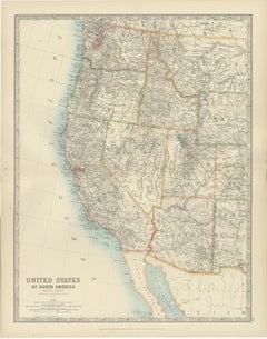
Map of Western United States 1903 – Railroads, State Borders, and Terrain
Located in Langweer, NL
Map of Western United States 1903 – Railroads, State Borders, and Terrain
This beautifully engraved map titled "United States of North America (Western Sheet)" was created by Keith ...
Category
20th Century Maps
Materials
Paper
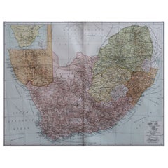
Large Original Vintage Map of South Africa, circa 1920
Located in St Annes, Lancashire
Great map of South Africa
Original color.
Good condition / repair to a minor edge tear middle bottom
Published by Alexander Gross
Unframed.
...
Category
English Edwardian Vintage 20th Century Maps
Materials
Paper
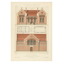
Architectural Print of Pharmacie Gymnase in France, Chabat, c.1900
Located in Langweer, NL
Antique print titled 'Pharmacie Gymnase, École Nationale Professionnelle d'Armentières, Mr. Charles Chipiez Architecte'. This print depicts the design of a building in France. Origin...
Category
20th Century Maps
Materials
Paper
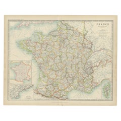
Antique Map of France by Johnston (1909)
Located in Langweer, NL
Antique map titled 'France'. Original antique map of France. With inset maps of France in provinces, part of the Riviera and Corsica. This map or...
Category
20th Century Maps
Materials
Paper
$235 Sale Price
20% Off
Explore North America in 1903 - Intricately Detailed Antique Map
Located in Langweer, NL
North America, 1903 - A Colorful Historical Map with Detailed Borders
This attractive map of North America was engraved, printed, and published by W. & A.K. Johnston in 1903. A wond...
Category
20th Century Maps
Materials
Paper
Antique Map of Africa, Highlighting Colonial Divisions, Geographic Features 1903
Located in Langweer, NL
Title: Antique Map of Africa, 1903, Highlighting Colonial Divisions and Geographic Features
Description: This antique map, titled "Africa," was engraved and published in 1903 by W. ...
Category
20th Century Maps
Materials
Paper
Map of the West India Islands and Central America – Colorful 1903 Engraving
Located in Langweer, NL
Map of the West India Islands and Central America – Colorful 1903 Engraving
This vibrant engraved map, titled "West India Islands and Central America," was created by Keith Johnston...
Category
20th Century Maps
Materials
Paper
Map of United States Central Sheet 1903 – Railroads, States, and Topography
Located in Langweer, NL
Map of United States Central Sheet 1903 – Railroads, States, and Topography
This is a finely engraved and beautifully colored map titled "United States of North America (Central She...
Category
20th Century Maps
Materials
Paper
Canada Dominion Map 1903 - A Detailed View of Eastern Canada and Newfoundland
Located in Langweer, NL
North America, 1903 - A Colorful Historical Map with Detailed Borders
This attractive map of North America was engraved, printed, and published by W. & A.K. Johnston in 1903. A wond...
Category
20th Century Maps
Materials
Paper
Original Antique Map of the American State of Kentucky, 1903
Located in St Annes, Lancashire
Antique map of Kentucky
Published By A & C Black. 1903
Original colour
Good condition
Unframed.
Free shipping
Category
English Antique 20th Century Maps
Materials
Paper
Antique Map of the Netherlands and IJmuiden by Beekman & Schuiling, 1927
Located in Langweer, NL
Two maps on one sheet titled 'Nederland Landbouwkaart' and 'Nederland Groote Verkeerswegen'. With an inset map of the harbour of IJmuiden (The Netherlands). This map originates from ...
Category
20th Century Maps
Materials
Paper
$61 Sale Price
20% Off
Antique Map of Persia and Afghanistan, 1903, with Delicate Pastel Borders
Located in Langweer, NL
Title: Antique Map of Persia and Afghanistan, 1903, with Delicate Pastel Borders and Detailed Topography
Description:
This antique map, titled "Persia and Afghanistan," was engraved...
Category
20th Century Maps
Materials
Paper
Abyssinia and Upper Nubia, 1903 - Detailed Map of the Horn of Africa Region
Located in Langweer, NL
Title: Abyssinia and Upper Nubia, 1903 - Detailed Map of the Horn of Africa Region
This fascinating map titled "Abyssinia and Upper Nubia" was engraved, printed, and published by W....
Category
20th Century Maps
Materials
Paper
Antique Map of Italy, 1903, Featuring Islands of Sardinia and Sicily
Located in Langweer, NL
Title: Antique Map of Italy, 1903, Featuring Islands of Sardinia and Sicily
Description:
This finely detailed antique map, titled "Italy," was engraved and published in 1903 by the ...
Category
20th Century Maps
Materials
Paper
Antique Map of South Australia, New South Wales, Victoria and Queensland, 1903
Located in Langweer, NL
Title: Antique Map of South Australia, New South Wales, Victoria, and Queensland, 1903
Description:
This antique map, titled "South Australia, New South Wales, Victoria, and Queensl...
Category
20th Century Maps
Materials
Paper
1902 Murcia: A Cartographic Snapshot of Spain's Southeastern Province
Located in Langweer, NL
The map represents the province of Murcia, Spain, as it was in 1902. Here's an overview of its characteristics:
- **Geography**: It displays the varied terrain of Murcia, from the c...
Category
Antique 20th Century Maps
Materials
Paper
$320 Sale Price
20% Off
Antique Map of Spain and Portugal, 1903, Regional Boundaries and Coastal Detail
Located in Langweer, NL
Antique Map of Spain and Portugal, 1903, Featuring Regional Boundaries and Coastal Detail
Description: This antique map, titled "Spain & Portugal," was engraved and published in 190...
Category
20th Century Maps
Materials
Paper
Antique Map of European Russia, 1903, with Colorful Provincial Boundaries
Located in Langweer, NL
Title: Antique Map of European Russia, 1903, with Colorful Provincial Boundaries
Description:
This antique map, titled "European Russia," was engraved and published in 1903 by W. & ...
Category
20th Century Maps
Materials
Paper
Antique Map of the German Empire, 1903, Northern Portion with Coastal and Inland
Located in Langweer, NL
Title: Antique Map of the German Empire, 1903, Northern Portion with Coastal and Inland Detail
Description:
This antique map, titled "Empire of Germany (Northern Portion)," was engr...
Category
20th Century Maps
Materials
Paper
Antique Map of Turkey in Europe, 1903, with Delicate Pastel Coloration
Located in Langweer, NL
Title: Antique Map of Turkey in Europe, 1903, with Delicate Pastel Coloration
Description:
This antique map, titled "Turkey in Europe," was engraved and published in 1903 by the dis...
Category
20th Century Maps
Materials
Paper
Antique Map of Switzerland and the Alps of Savoy & Piedmont, 1903 Edition
Located in Langweer, NL
Title: Antique Map of Switzerland and the Alps of Savoy & Piedmont, 1903, with Intricate Topographical Detail
Description:
This beautifully engraved antique map, titled "Switzerland...
Category
20th Century Maps
Materials
Paper
Antique Map of Greece and the Cyclades, 1903, with Many Details and Inset Maps
Located in Langweer, NL
Title: Antique Map of Greece and the Cyclades, 1903, with Intricate Detail and Inset Maps
Description: This antique map, titled "Greece with Its Islands, Including the Cyclades," wa...
Category
20th Century Maps
Materials
Paper
Antique Map of Southern Scotland, 1903, with Coastal and Inland Details
Located in Langweer, NL
Title: Antique Map of Southern Scotland, 1903, with Coastal and Inland Details
Description:
This exquisite antique map, titled "Scotland (Southern Sheet I)," was engraved and publis...
Category
20th Century Maps
Materials
Paper
Antique Map of Southern England & Wales, 1903, with Coastal Details and Railways
Located in Langweer, NL
Title: Antique Map of Southern England and Wales, 1903, with Coastal Details and Railways
Description:
This detailed antique map, titled "England and Wales (Southern Sheet I)," was ...
Category
20th Century Maps
Materials
Paper
Antique Map of Northern Scotland, 1903, with Intricate Coastal Features
Located in Langweer, NL
Title: Antique Map of Northern Scotland and Islands, 1903, with Intricate Coastal Features
Description:
This striking antique map, titled "Scotland (Northern Sheet I)," was engraved...
Category
20th Century Maps
Materials
Paper
Original Antique Map of the American State of Idaho & Wyoming, 1903
Located in St Annes, Lancashire
Antique map of Idaho and Wyoming
Published By A & C Black. 1903
Original colour
Good condition
Unframed.
Free shipping
Category
English Antique 20th Century Maps
Materials
Paper
Original Antique Map of the American State of Arizona & New Mexico, 1903
Located in St Annes, Lancashire
Antique map of Arizona and New Mexico
Published By A & C Black. 1903
Original colour
Good condition
Unframed.
Free shipping
Category
English Antique 20th Century Maps
Materials
Paper
Antique Map of the Region of Bengkulu in Indonesia, 1900
Located in Langweer, NL
Antique map of the region of Benkulu, Sumatra. Also depicting Enggano Island. This map originates from 'Atlas van Nederlandsch Oost- en West-Indië' by I. Dornseiffen.
Artists and E...
Category
20th Century Maps
Materials
Paper
Original Antique Map of the American State of Oklahoma, 1903
Located in St Annes, Lancashire
Antique map of Oklahoma
Published By A & C Black. 1903
Original colour
Good condition
Unframed.
Free shipping
Category
English Antique 20th Century Maps
Materials
Paper
Architectural Building Design Print of Lycée Lakanal in France, Chabat, c.1900
Located in Langweer, NL
Antique print titled 'Lycée Lakanal a Sceaux (Seine) Mr. A. de Baudot Architecte'. This print depicts the design of a school in France. Originates from 'La Brique et La Terre Cuite' ...
Category
20th Century Maps
Materials
Paper
Large Original Antique City Plan of Philadelphia, USA, circa 1900
Located in St Annes, Lancashire
Fabulous colorful map of Philadelphia
Original color
By Rand, McNally & Co.
Published, circa 1900.
Unframed
Free shipping.
Category
American Antique 20th Century Maps
Materials
Paper
Antique Map of Australia by Johnston '1909'
Located in Langweer, NL
Antique map titled 'Australia'. Original antique map of Australia. With inset maps of Melbourne, Port Phillip, Adelaide, Perth, Sydney, Brisba...
Category
20th Century Maps
Materials
Paper
$330 Sale Price
20% Off
The Lay of the Land: A 1901 Topographic Map of Oviedo, Asturias
Located in Langweer, NL
The province depicted on the historical map on offer, Oviedo, corresponds to the modern-day autonomous community of Asturias in northwestern Spain. Here are some points about Asturia...
Category
Antique 20th Century Maps
Materials
Paper
$367 Sale Price
20% Off
Orense in Depth: A 1902 Topographical Map of Galicia's Mountainous Province
Located in Langweer, NL
The map is a detailed cartographic representation of the province of Orense (Ourense in Galician), located in the northwest of Spain, as it was in 1902. Here's a brief description an...
Category
Antique 20th Century Maps
Materials
Paper
$292 Sale Price
20% Off
Original Antique Map of the American State of Louisiana, 1903
Located in St Annes, Lancashire
Antique map of Louisiana
Published By A & C Black. 1903
Original colour
Good condition
Unframed.
Free shipping
Category
English Antique 20th Century Maps
Materials
Paper
Álava in Northern Spain: The Geography of Basque Heritage and Terrain, 1902
Located in Langweer, NL
This original antique map is a historical depiction of the province of Álava (in Basque: Araba), which is one of the provinces of the Basque Country in northern Spain, as indicated b...
Category
Antique 20th Century Maps
Materials
Paper
$273 Sale Price
20% Off
Set of 5 Large Original Vintage Sea Charts, circa 1920
Located in St Annes, Lancashire
5 great maps or charts of the oceans
I particularly like the color of these maps
Unframed
Original color
By John Bartholomew and Co. Edinburgh Geographical Institute
Published, ...
Category
British Vintage 20th Century Maps
Materials
Paper
Antique Map of Korea by Kozaki, 1903
Located in Langweer, NL
Old map of Korea by S. Kozaki. Restored and mounted.
Category
20th Century Maps
Materials
Paper
$896 Sale Price
20% Off
Original Antique Map of the American State of Massachusetts, 1903
Located in St Annes, Lancashire
Antique map of Vermont and New Hampshire
Published By A & C Black. 1903
Original colour
Good condition
Unframed.
Free shipping
Category
English Antique 20th Century Maps
Materials
Paper
Minho: A Legacy of Lush Landscapes and Living Traditions in Portugal, 1903
Located in Langweer, NL
Ths authentic print is a historical map of the Minho region in the northwestern part of Portugal. The map includes detailed geographical features, such as rivers, mountain ranges, an...
Category
Antique 20th Century Maps
Materials
Paper
$320 Sale Price
20% Off
Original Antique Map of the American State of Washington, 1903
Located in St Annes, Lancashire
Antique map of Washington
Published By A & C Black. 1903
Original colour
Good condition
Unframed.
Free shipping
Category
English Antique 20th Century Maps
Materials
Paper
Map of Soria Province, 1901: Detailed Cartography of Northeastern Spain
Located in Langweer, NL
The map is a historical map of the province of Soria from 1901.
A decorative coat of arms enhances the aesthetic of the map, signifying the historical and cultural significance of ...
Category
Antique 20th Century Maps
Materials
Paper
$311 Sale Price
20% Off
Trás-os-Montes: A Cartographic Exploration of Portugal's Hidden Province in 1903
Located in Langweer, NL
This print is an original historical map of the Trás-os-Montes region in the northeastern part of Portugal, dated 1903. Trás-os-Montes is often translated as "behind the mountains," ...
Category
Antique 20th Century Maps
Materials
Paper
$292 Sale Price
20% Off
Old Map of Australia Showing The Routes of the Main Explorers, ca.1900
Located in Langweer, NL
Antique print, untitled. This map shows Australia with the routes of explorers in the continent and marking the furthest point reached.. Source unknown, to be determined.
Artists ...
Category
Antique 20th Century Maps
Materials
Paper
$113 Sale Price
20% Off
La Coruña 1901: A Cartographic View of Galicia's Maritime Province
Located in Langweer, NL
This antique map for sale showcases the province of La Coruña (in Galician, A Coruña), located in the northwest of Spain, within the autonomous community of Galicia, as of the year 1...
Category
Antique 20th Century Maps
Materials
Paper
$349 Sale Price
20% Off
Colourful Old Detailed Map of Northern Carolina, United States of America
Located in Langweer, NL
Vintage map titled 'The Geographical Publishing Company's Premier Map of North Carolina'. Beautiful map of North Carolina. This map originates from Comme...
Category
20th Century Maps
Materials
Paper
$274 Sale Price
20% Off
Crossroads of Continents: Spain's North African Enclaves in 1903
Located in Langweer, NL
The image for sale is a historical map of Spanish possessions in North Africa, dated 1903. The map includes the enclaves of Ceuta and Melilla, the Chafarinas Islands, the Alhucemas I...
Category
Antique 20th Century Maps
Materials
Paper
$377 Sale Price
20% Off
Original Antique Map of the American State of South Carolina, 1903
Located in St Annes, Lancashire
Antique map of South Carolina
Published By A & C Black. 1903
Original colour
Good condition
Unframed.
Free shipping
Category
English Antique 20th Century Maps
Materials
Paper
Antique Map of South Italy and the Island of Sardinia by Johnston (1909)
Located in Langweer, NL
Antique map titled 'South Italy and the Island of Sardinia'. Original antique map of South Italy and the Island of Sardinia. With inset map of Naples. Th...
Category
20th Century Maps
Materials
Paper
$235 Sale Price
20% Off
Original Antique Map of the American State of Virginia, 1903
Located in St Annes, Lancashire
Antique map of Virginia
Published By A & C Black. 1903
Original colour
Good condition
Unframed.
Free shipping
Category
English Antique 20th Century Maps
Materials
Paper
Original Antique Map of the American State of Minnesota, 1903
Located in St Annes, Lancashire
Antique map of Minnesota
Published By A & C Black. 1903
Original colour
Good condition
Unframed.
Free shipping
Category
English Antique 20th Century Maps
Materials
Paper
Granada 1902: A Cartographic Exploration of Andalusia's Mountainous Province
Located in Langweer, NL
This original antique map depicts the province of Granada, part of the autonomous community of Andalusia in southern Spain, as of 1902. The map features several important details:
I...
Category
Antique 20th Century Maps
Materials
Paper
$367 Sale Price
20% Off
Original Antique Map of the American State of Tennessee, 1903
Located in St Annes, Lancashire
Antique map of Tennessee
Published By A & C Black. 1903
Original colour
Good condition
Unframed.
Free shipping
Category
English Antique 20th Century Maps
Materials
Paper
Original Antique Map of the American State of Alabama, 1903
Located in St Annes, Lancashire
Antique map of Alabama
Published By A & C Black. 1903
Original colour
Good condition
Unframed.
Free shipping
Category
English Antique 20th Century Maps
Materials
Paper
Original Antique Map of the American State of Alaska, 1903
Located in St Annes, Lancashire
Antique map of Alaska
Published By A & C Black. 1903
Original colour
Good condition
Unframed.
Free shipping
Category
English Antique 20th Century Maps
Materials
Paper
Antique Map of American Cities, Vignette of New York City, circa 1920
Located in St Annes, Lancashire
Great maps of American Cities
Unframed
Original color
By John Bartholomew and Co. Edinburgh Geographical Institute
Published, circa 1920
Category
British Vintage 20th Century Maps
Materials
Paper
Original Antique Map of the American State of Nebraska, 1903
Located in St Annes, Lancashire
Antique map of Nebraska
Published By A & C Black. 1903
Original colour
Good condition
Unframed.
Free shipping
Category
English Antique 20th Century Maps
Materials
Paper
Old Map of North Africa Depicting Libya, Morocco, Algeria, Tunis Etc, 1922
Located in Langweer, NL
Antique map of Africa titled 'Northern Africa'.
Old map of North Africa depicting Libya, Morocco, Algeria, Tunis and surroundings. This map originates from 'The Times' atlas.
...
Category
Vintage 20th Century Maps
Materials
Paper
$113 Sale Price
20% Off
