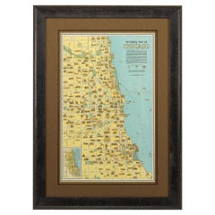
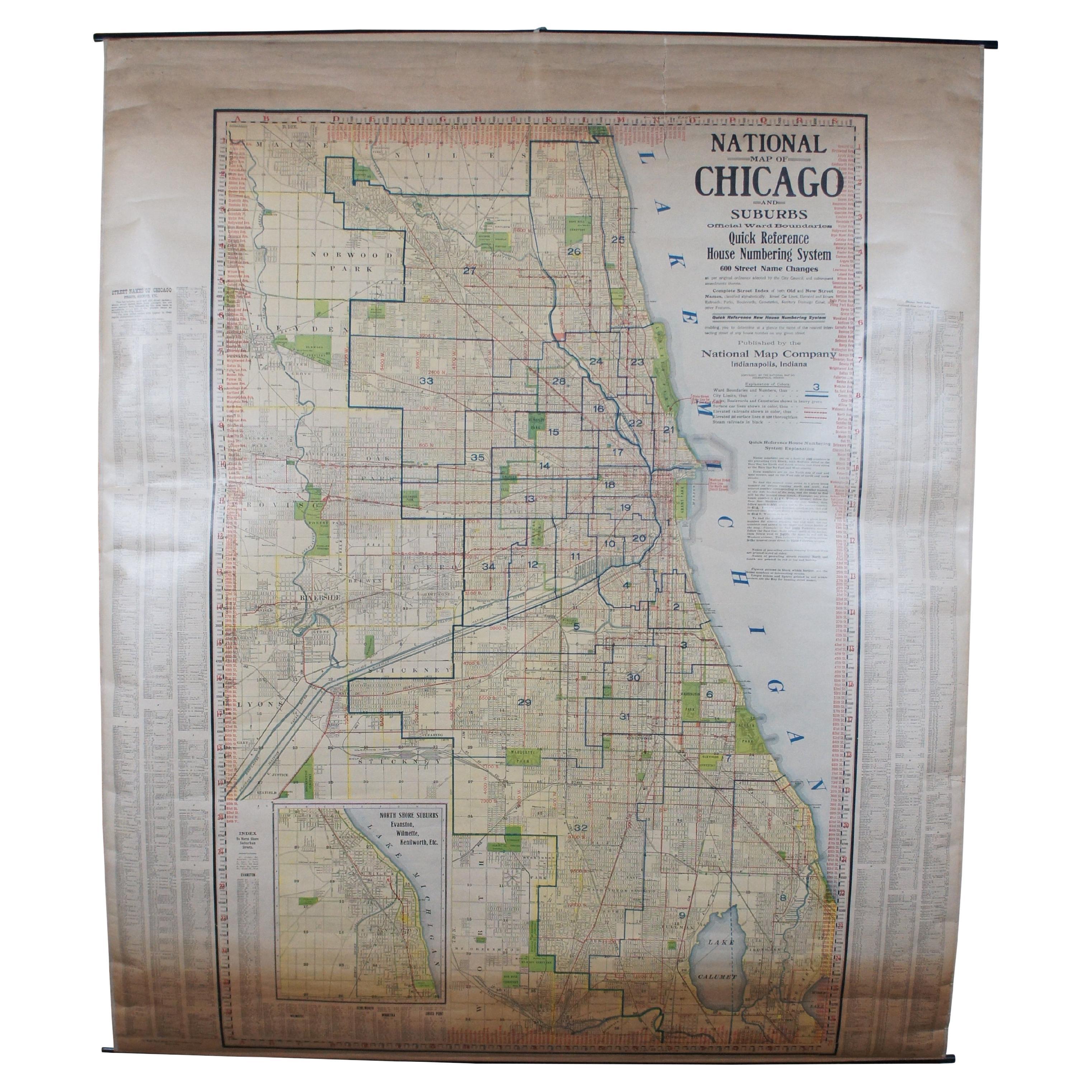
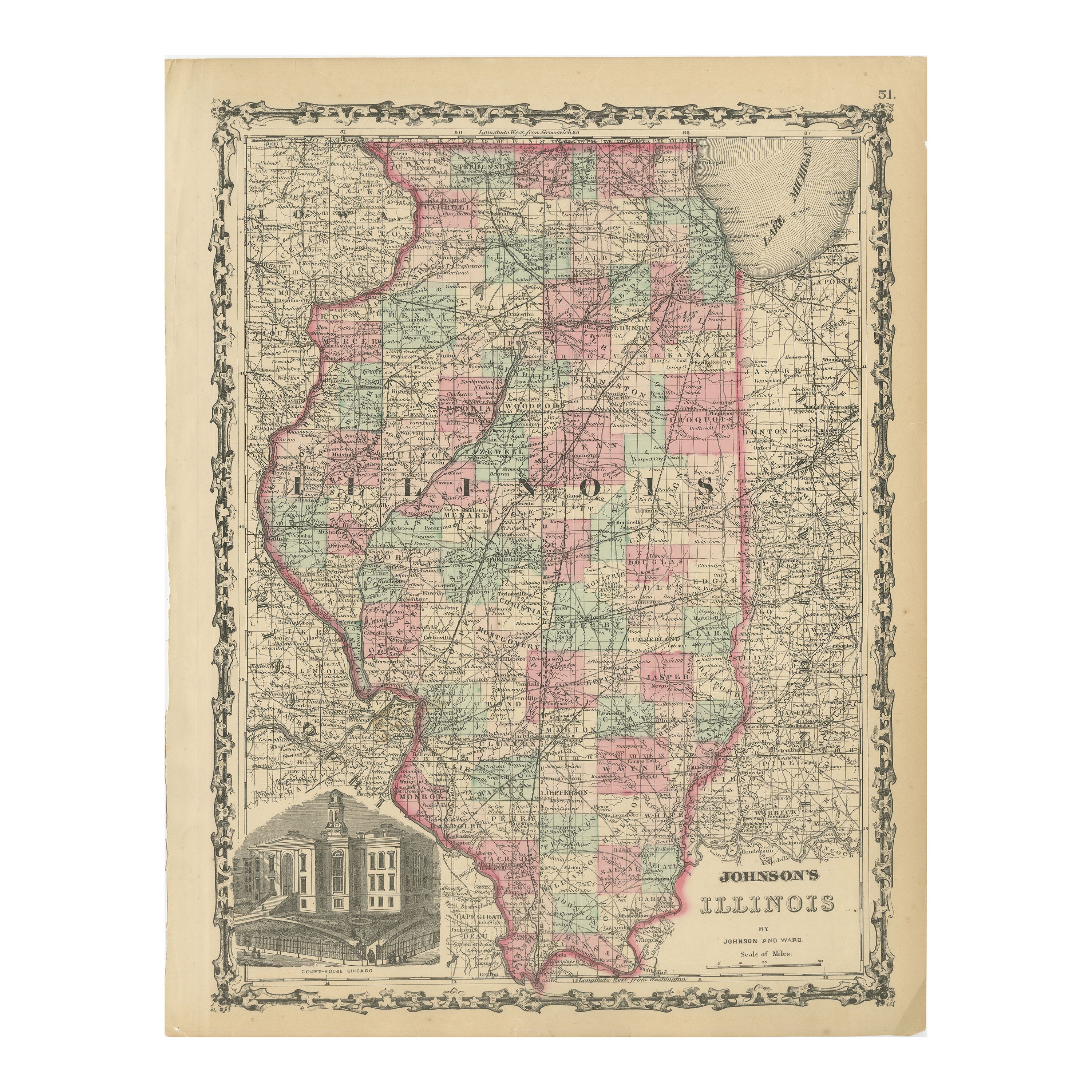
Pictorial Map of Chicago, circa 1926
View Similar Items


Want more images or videos?
Request additional images or videos from the seller
1 of 5
Pictorial Map of Chicago, circa 1926
$2,650List Price
About the Item
- Dimensions:Height: 45 in (114.3 cm)Width: 33 in (83.82 cm)Depth: 1.5 in (3.81 cm)
- Materials and Techniques:
- Place of Origin:
- Period:
- Date of Manufacture:1926
- Condition:Wear consistent with age and use.
- Seller Location:Colorado Springs, CO
- Reference Number:Seller: M2441stDibs: LU909713029002
About the Seller
4.9
Platinum Seller
Premium sellers with a 4.7+ rating and 24-hour response times
Established in 2010
1stDibs seller since 2011
463 sales on 1stDibs
Authenticity Guarantee
In the unlikely event there’s an issue with an item’s authenticity, contact us within 1 year for a full refund. DetailsMoney-Back Guarantee
If your item is not as described, is damaged in transit, or does not arrive, contact us within 7 days for a full refund. Details24-Hour Cancellation
You have a 24-hour grace period in which to reconsider your purchase, with no questions asked.Vetted Professional Sellers
Our world-class sellers must adhere to strict standards for service and quality, maintaining the integrity of our listings.Price-Match Guarantee
If you find that a seller listed the same item for a lower price elsewhere, we’ll match it.Trusted Global Delivery
Our best-in-class carrier network provides specialized shipping options worldwide, including custom delivery.More From This Seller
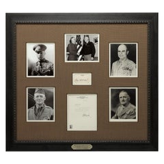
View AllFathers of the Air Service Authentic Signature Collage, circa 1926-1993
Located in Colorado Springs, CO
Presented is a collage celebrating the men who made an early impact on the formation of America’s Air Service. Complete with signatures by Jimmy Doolittle, Tooey Spaatz, Hap Arnold, ...
Category
Late 20th Century American Historical Memorabilia
Materials
Paper
1854 Map of Massachusetts, Connecticut and Rhode Island, Antique Wall Map
Located in Colorado Springs, CO
This striking wall map was published in 1854 by Ensign, Bridgman & Fanning and has both full original hand-coloring and original hardware. This impression is both informative and highly decorative.
The states are divided into counties, outlined in red, green, and black, and subdivided into towns. Roads, canals, and railroad lines are prominently depicted, although they are not all labeled. The mapmakers also marked lighthouses, banks, churches, and prominent buildings, with a key at right. The map is an informative and comprehensive overview of the infrastructural development of New England prior to the Civil War. Physical geographies depicted include elevation, conveyed with hachure marks, rivers and lakes. The impression features an inset map of Boston...
Category
Antique 19th Century American Maps
Materials
Paper

1868 "Lloyd's Topographical Railway Map of North America..." Hanging Wall Map
Located in Colorado Springs, CO
Presented is “Lloyd's Topographical Railway Map of North-America, or the United States Continent in 1900.” This map was published by J. T. Lloyd, in New York, in 1868. A large, hangi...
Category
Antique 1860s American Late Victorian Maps
Materials
Linen, Paper

1864 Map of North America, Antique Hand-Colored Map, by Adolphe Hippolyte Dufour
Located in Colorado Springs, CO
Offered is a map of North America entitled Amerique du Nord from 1864. This rare, separately published wall map was produced by Adolphe Hippolyte Dufour. This map includes vibrant an...
Category
Antique 1860s French Maps
Materials
Paper

1904 "Nell's Topographical Map of the State of Colorado"
Located in Colorado Springs, CO
This highly detailed pocket map is a topographical map of the state of Colorado by Louis Nell from 1904. The map "has been compiled from all available...
Category
Antique Early 1900s American Maps
Materials
Leather, Paper

1859 "Map of the United States of America..." by J. H. Colton
By J.H. Colton
Located in Colorado Springs, CO
Presented is an 1859 “Map of the United States of America, the British Provinces, Mexico, the West Indies and Central America with Part of...
Category
Antique 1850s American Maps
Materials
Paper

You May Also Like
Old Decorative Pictorial Map of the United States, circa 1953
Located in Langweer, NL
Antique map titled 'A Pictorial Map of the United States of America Showing Principal Regional Resources, Products, and Natural Features'.
This information-packed map was create by the General Drafting Company for the New Jersey Bell Telephone Company. The main map features over 700 drawings in full color including points of interest, natural resources, and agricultural products. At bottom are inset maps showing railroad lines, air routes, telephone lines, as well as a pictorial map of New Jersey...
Category
20th Century Maps
Materials
Paper

$713 Sale Price
20% Off
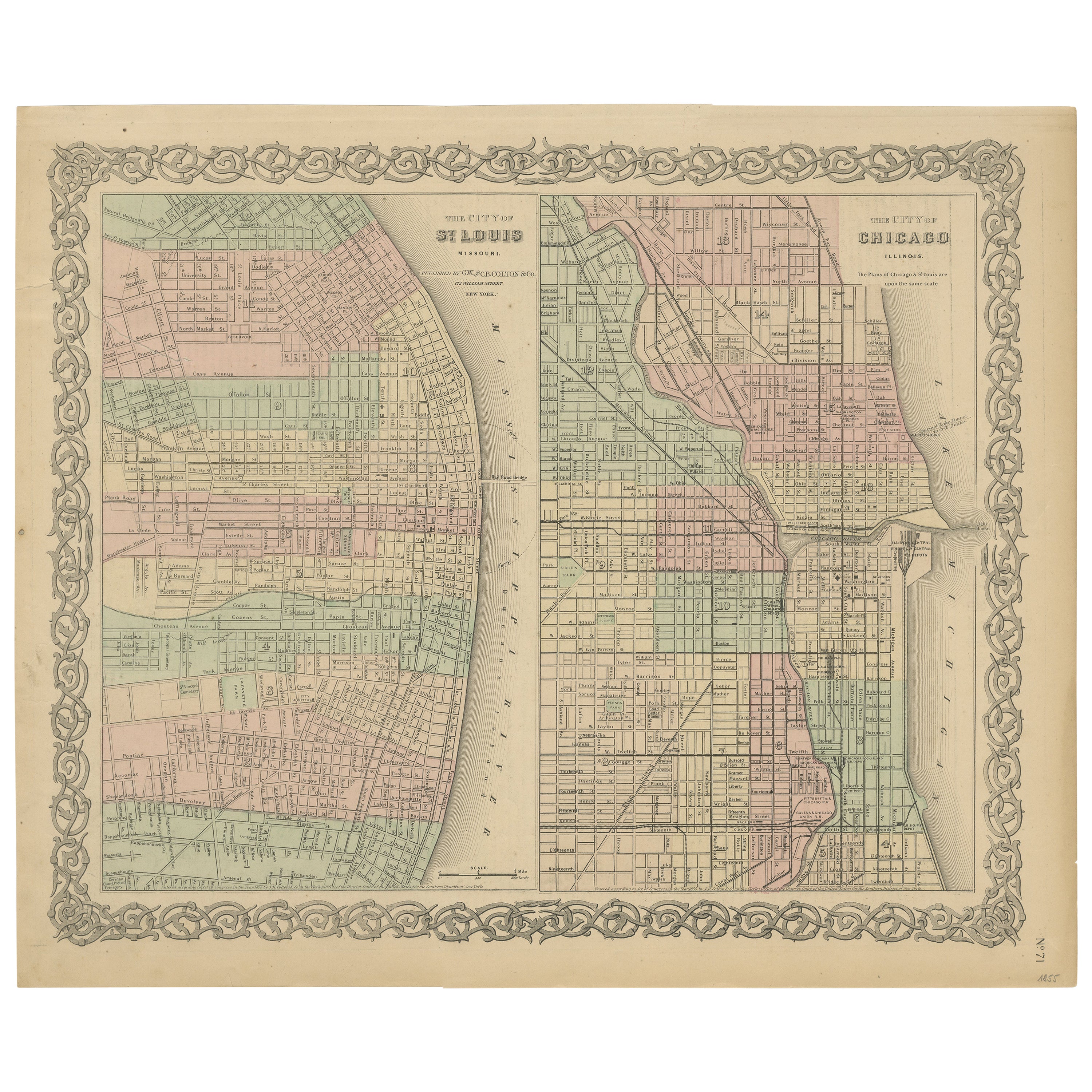
Antique Map of St. Louis and Chicago
Located in Langweer, NL
Antique map titled 'The City of St. Louis Missouri - The City of Chicago Illinois'. Dual map on single page showing St. Louis and Chicago. Finely produ...
Category
Antique Mid-19th Century Maps
Materials
Paper

$142 Sale Price
20% Off
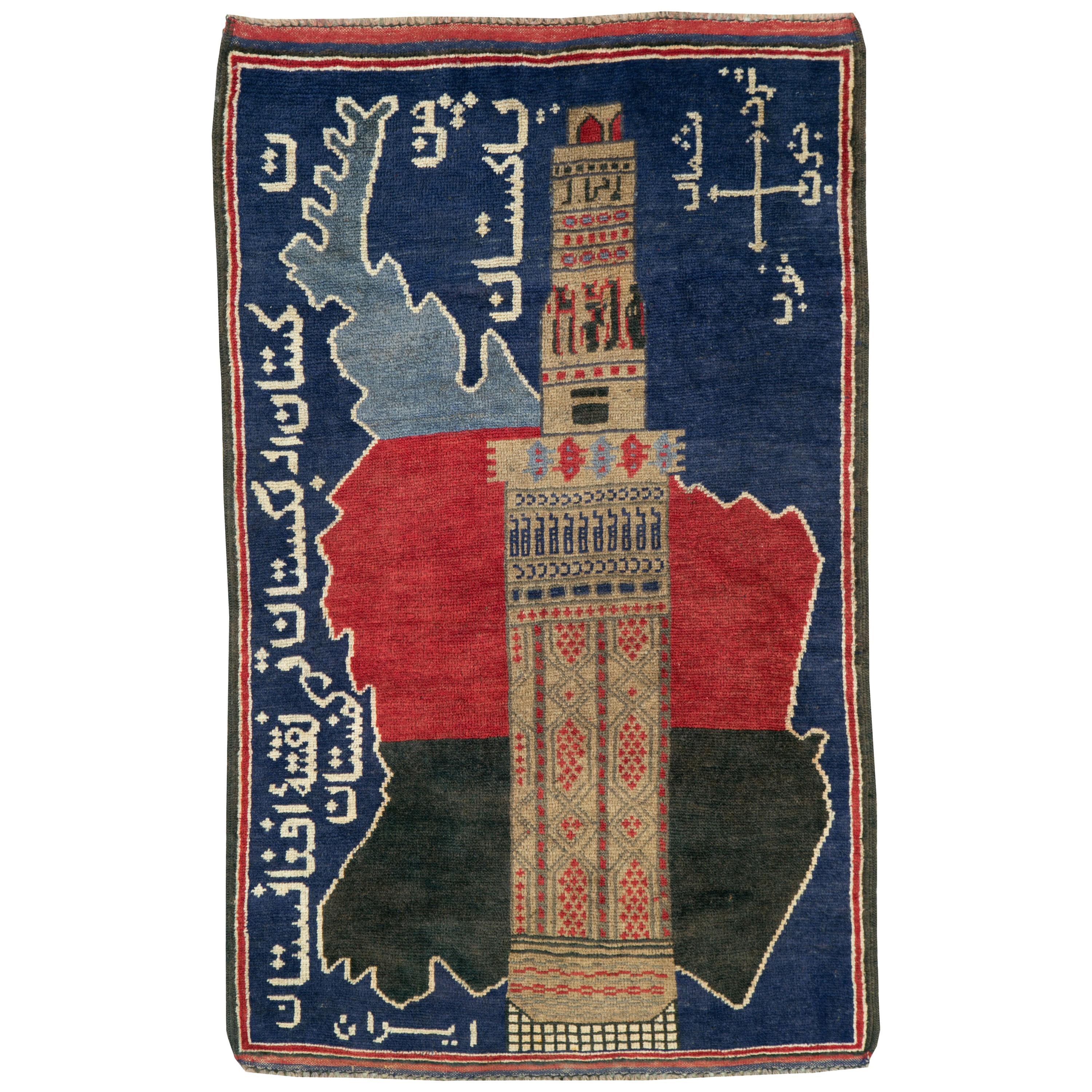
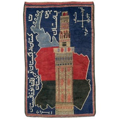
Vintage Afghan Pictorial Map Rug
Located in New York, NY
A vintage Afghan Pictorial map rug from the mid-20th century.
Measures: 3' 0" x 4' 10"
Category
Mid-20th Century Afghan Folk Art Central Asian Rugs
Materials
Wool
$660 Sale Price
20% Off
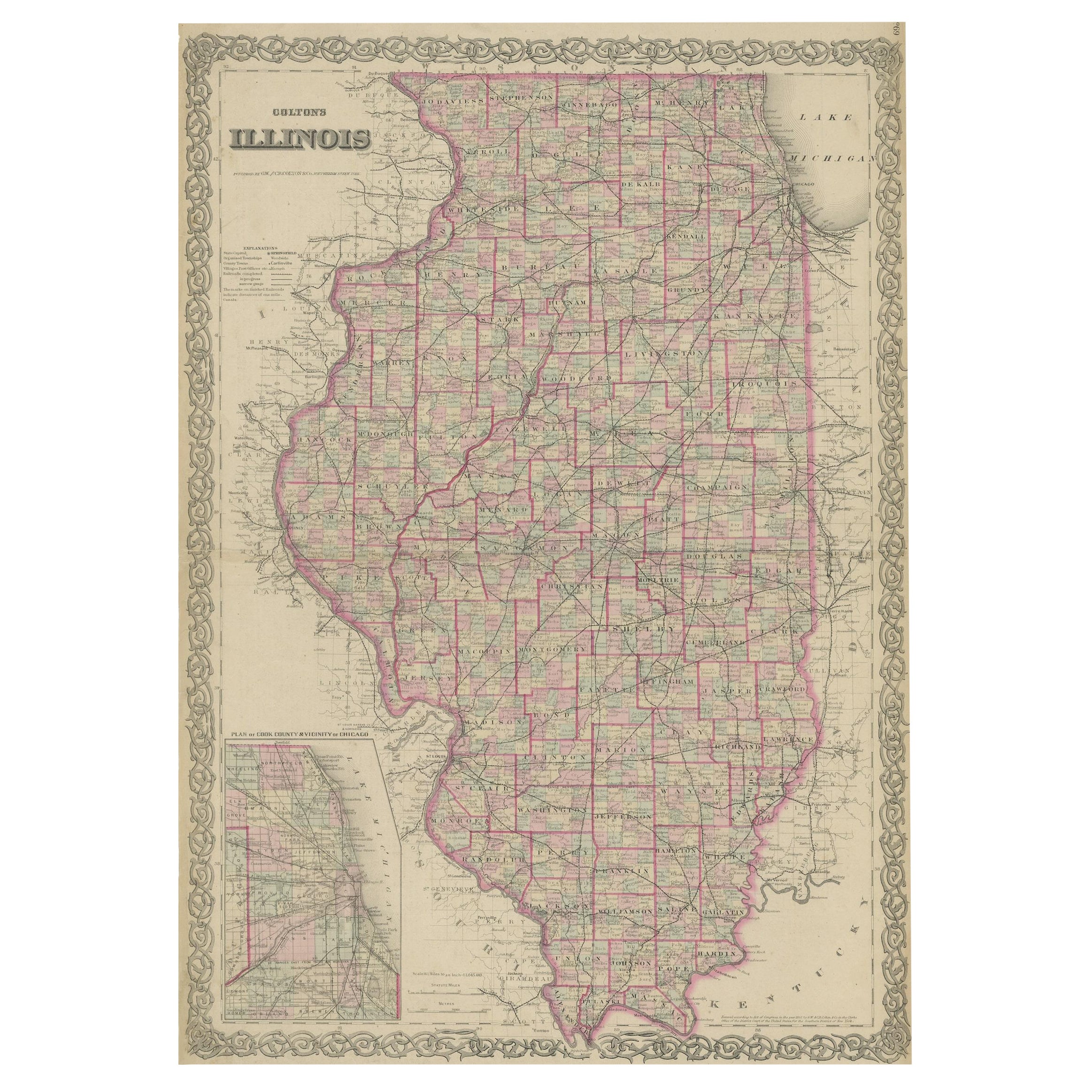
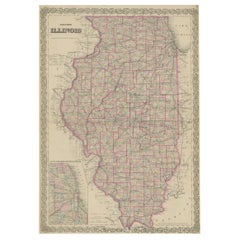
Colton's Map of Illinois, with an Inset of Chicago
Located in Langweer, NL
Antique map titled 'Colton's Illinois'. Antique map of Illinois, a state in the Midwestern United States. With an inset map of of Cook County &...
Category
Antique Mid-19th Century Maps
Materials
Paper
$228 Sale Price
20% Off
Antique Chicago Illinois National Map Commercial Rollup Classroom Census Map 47"
Located in Dayton, OH
Antique early to mid 20th century double sided hanging map titled the New Commercial and Census Map of Illinois, Edition 1073. Verso shows the National Map of Chicago and Suburbs - O...
Category
Early 20th Century North American Maps
Materials
Paper

$940 Sale Price
20% Off
Gold Leaf Foil Pictorial Plan Map of the West Country of England Antique Style
Located in West Sussex, Pulborough
We are delighted to offer for sale this lovely Antique style pictorial plan map of the West Country of England etched in gold leaf foil
This is a very interesting and decorative p...
Category
20th Century English Adam Style Maps
Materials
Gold Leaf

$266 Sale Price
30% Off
Recently Viewed
View AllMore Ways To Browse
Antique Chicago Maps
London Antique Maps
Antique Map Of England
Gold Maps
China Map
17th Century World Map
Antique Maps Of Britain
Antique Furniture Edinburgh
Antique English Maps
Map Of India
British Empire Furniture
American West Antiques
Furniture Russian 18th Century
Antique Law Office Furniture
Map Stand
Antique Maps Of Italy
Antique Doctors
Antique Map India