18th Century and Earlier Collectibles and Curiosities

to
2,707
3,891
557
4,483
216
93
41
35
30
14
10
7
4
2
2
2
1
1
1
6,816
13,514
2,735
3,521
4,715
3,086
513
298
604
745
483
907
906
907
660
593
3,383
601
526
139
127
1,359
274
266
223
184
4,483
4,483
4,483
58
21
14
13
12
Period: 18th Century and Earlier
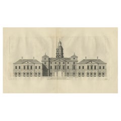
Antique Print of the Horse Guards at Whitehall, Westminster, London, ca.1770
Located in Langweer, NL
Description: Antique print titled 'East Front of the Horse Guards at Whitehall'. Architectural elevation of the Horse Guards at Whitehall. T...
Category

Antique 18th Century and Earlier Collectibles and Curiosities

Materials

Paper

Circa 1659 Blaeu Family Map: Glogau and the Odra River Valley, Silesia
Located in Langweer, NL
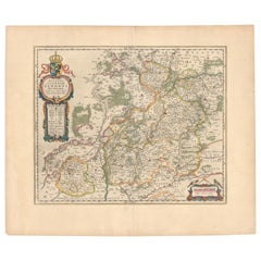
Circa 1659 Blaeu Family Map: Glogau and the Odra River Valley, Silesia This hand-colored map from circa 1659 by the Blaeu Family, titled "Ducatus Silesiae Glogani Vera Delineatio," provides a detailed view of the Odra River valley in western Poland, centered around the city of Glogau. The map, based on the work of Silesian cartographer Jonas Scultetus, is oriented with north to the left. It intricately details forests, rivers, lakes, and numerous small villages. A large decorative title cartouche features an ornate coat of arms and a key to the map's symbols. The bottom right includes a finely crafted scale of miles cartouche, adorned with calipers and a pair of falcons. Published between 1659 and 1672, the map has Spanish text on the verso. Measuring 19.9 inches wide by 16.4 inches high, it is in good condition with full contemporary color on a bright sheet, a watermark of the god Atlas, some marginal soiling, and a few short tears along the edges. Keywords: - Blaeu Family map - Silesia historical map - Glogau map - Odra River valley - 17th-century Poland map - Jonas Scultetus - Decorative cartouches - Historical cartography - Antique maps of Poland...
Category

Antique 18th Century and Earlier Collectibles and Curiosities

Materials

Paper

Antique Print of a Woman's Boat Know as Imiak and a Kayak for Men, 1770
Located in Langweer, NL
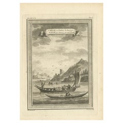
Antique print titled '1. Umiak ou Bateau de Femmes 2. Kaiak ou Canot à un seul Homme'. Copper engraving of an Umiak or women's boat and a one man kayak or canoe. This print originate...
Category

Antique 18th Century and Earlier Collectibles and Curiosities

Materials

Paper

Antique Print with Views of Tinian Island, the Northern Mariana Islands, 1749
Located in Langweer, NL
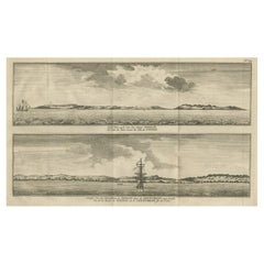
Antique print titled 'Le cote du sud-ouest de l'Ile de Tinian' and 'Vue de la rade de Tinian, ou le Centurion fit de l'eau.' Views of the south-west side of the island of Tinian and a view of the anchorage of Tinian, where the Centurion got water. This print originates from 'Reize rondsom de Werreld (..)' by George Anson, published 1749. Tinian is one of the three principal islands of the Commonwealth of the Northern Mariana Islands...
Category

Antique 18th Century and Earlier Collectibles and Curiosities

Materials

Paper

Rare Hand-Colored Map of Champagne and Brie, France, by Frederik De Wit c. 1688
Located in Langweer, NL
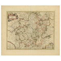
Title: Rare Hand-Colored Map of Champagne and Brie by Frederik De Wit c. 1688 Description: This exquisite 17th-century map, "Champagne et Brie," beau...
Category

Antique 18th Century and Earlier Collectibles and Curiosities

Materials

Paper

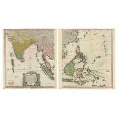
1748 Homann Heirs Double Map of the East Indies and Southeast Asia
Located in Langweer, NL
Title: 1774 Homann Heirs Double Map of the East Indies and Southeast Asia Description: This stunning 1774 double map by the Homann Heirs showcases the East Indies and Southeast ...
Category

Antique 18th Century and Earlier Collectibles and Curiosities

Materials

Paper

Beautiful Antique Map with Views of Dendermonde, Belgium, 1735
Located in Langweer, NL
Antique map titled 'Teneramonda vulgo Dendermonde'. Beautiful map with views of Dendermonde, Belgium. This map originates from 'Flandria illustrata, sive provinciae ac comitatus huju...
Category

Antique 18th Century and Earlier Collectibles and Curiosities

Materials

Paper

Antique Map of the City of Bolsward, Friesland in The Netherlands, c.1598
Located in Langweer, NL
Antique map titled ‘Bolzvardia vetus in Frisia Foederis (..)’. Old map of the city of Bolsward, Friesland. Originally part of a sheet together with the cities of Stavoren, Harlingen ...
Category

Antique 18th Century and Earlier Collectibles and Curiosities

Materials

Paper

Original Antique Map of the Dutch Provinces of Overijssel and Drenthe, 1635
Located in Langweer, NL
Antique map titled 'Transiselania Dominium vernacule Over-Yssel.' - Map of the Dutch Provinces of Overijssel and Drenthe. Dedicated to Mr. Bartold Wich...
Category

Antique 18th Century and Earlier Collectibles and Curiosities

Materials

Paper

Old Map of the Arabian Peninsula with Parts of Egypt, Sudan, Eritrea & Ethiopia
Located in Langweer, NL
"Carte de l'Arabie, du Golfe Persique, et de la Mer Rouge, avec l'Egypte, la Nubie et l'Abissinie", Bonne, Rigobert Subject: Arabia Period: 1780 (circa) Publication: Atlas de Toutes...
Category

Antique 18th Century and Earlier Collectibles and Curiosities

Materials

Paper

Interesting Original Antique Print of the Hunting Methods of Persians, 1731
Located in Langweer, NL
Antique print titled 'De Manier van Jagen der Persianen'. This print shows the hunting methods of Persians. This print originates from 'Hedendaagsche historie of Tegenwoordige staat ...
Category

Antique 18th Century and Earlier Collectibles and Curiosities

Materials

Paper

Gilpin, Wm: Observations... on Great Britain, and High-Lands of Scotland, 2 vols
Located in Middletown, NY
This is Gilpin's third in his series of works tracing picturesque beauty in British natural landscapes. In it he portrays the landscapes of Scottish Highlands, and describes them lyrically in his text. Prefacing the list of Prints at the end of the second volume, the author says "With regards to the prints, which adorn these volumes, I can only say..... that few of them pretend to be 'exact portraits.' They in general 'only characterize the countries,' through which the reader is carried." The illustrations, based on Gilpin's sketches, were etched by his nephew William Sawrey Gilpin using the newly invented aquatint process. This volume also includes a technical discourse about drawing and the mixing of colors, including a chart (vol. 1, p. 131-134) William Gilpin (1724 – 1804) was an English artist, Church of England cleric, schoolmaster and author. He is best known as a travel writer and as one of those who originated the idea of the picturesque. Gilpin's tour journals circulated in manuscript to friends such as the poet William Mason and a wider circle including Thomas Gray...
Category

English Antique 18th Century and Earlier Collectibles and Curiosities

Materials

Leather, Paper

Ancient Sealing Wax Seal, 18th Century
Located in Roma, IT
Ancient Sealing Wax Seal. Italy, late 18th Century. Good condition with signs of age.
Category

Italian Antique 18th Century and Earlier Collectibles and Curiosities

Materials

Other

1692 Engraved Map: Detailed Mogul Empire, India to Afghanistan, Hand-Colored
Located in Langweer, NL
1692 Map of the Mogul Empire by Jacques Peeters This finely engraved map, published in 1692 by Jacques Peeters, showcases the Mogul Empire region, covering areas from northern India...
Category

Antique 18th Century and Earlier Collectibles and Curiosities

Materials

Paper

The 1649 Haderschleben Map of Western Jutland and North Sea Islands
Located in Langweer, NL
This is a beautiful example of an antique map, titled "Westertheil des Amptes Haderschleben Zusambt Rieben und dem Loehmcloster Anno 1649." It's a hand-colored copper etching by Matt...
Category

Antique 18th Century and Earlier Collectibles and Curiosities

Materials

Paper

VOC Ships, Native People & Coastal Views of Islands near Papua New Guinea, 1726
Located in Langweer, NL
Antique print titled 'Het Eylandt Takel, als gy daar langhs seylt (..)'. Five engravings on one sheet showing the native boats and peoples and coastal views of islands near New Gui...
Category

Antique 18th Century and Earlier Collectibles and Curiosities

Materials

Paper

Large Original Antique Folding Map of Manchester, England, Dated 1793
Located in St Annes, Lancashire
Superb map of Manchester and Salford Folding map. Printed on paper laid on to the original canvas Unframed. Published by C. Laurent, 1793. Free shippi...
Category

English Georgian Antique 18th Century and Earlier Collectibles and Curiosities

Materials

Canvas, Paper

2 Iron-Red and Gilt Chinese Miniature Porcelain Vases, Kangxi
Located in Delft, NL
2 iron-red and gilt Chinese miniature porcelain Vases, Kangxi Kangxi (1662-1722) The bottles has minuscule chips The measurements are 4 cm high and 2.7 cm diagonal The weight i...
Category

Chinese Antique 18th Century and Earlier Collectibles and Curiosities

Materials

Porcelain

Old Print of Farmers Harvesting Cinnamon on the Island Ceylon or Sri Lanka, 1672
Located in Langweer, NL
Antique print, titled: 'Hoe men de Caneel schilt opt Eyland Ceylon.' This rare original plate shows a group of farmers harvesting cinnamon on the island of Ceylon / Sri Lanka. Du...
Category

Antique 18th Century and Earlier Collectibles and Curiosities

Materials

Paper

18th Century French Copper and Brass Braisier or Serving Piece
Located in Fayetteville, AR
This rare eighteenth century copper and brass braisier hails from the city of Villedieu-les-Poeles, the French capital of copper artisans in Normandy, France. It boasts ornately wor...
Category

French Antique 18th Century and Earlier Collectibles and Curiosities

Materials

Brass, Copper

Antique Roman Battle Print of the Greater and Lesser Camp by Duncan, c.1753
Located in Langweer, NL
Antique battle map showing the greater and lesser camp. With detailed legend explaining the various elements of the print. This print most likely originates from an edition of 'The C...
Category

Antique 18th Century and Earlier Collectibles and Curiosities

Materials

Paper

Antique Map of the East Indies by Bonne '1776'
Located in Langweer, NL
Antique map titled 'Indes IVe Feuille'. Very decorative original antique map of the East Indies. Covbers from the Gulf of Siam (Gulf of Thailand) and Malacca (Malaysia) eastward to i...
Category

Antique 18th Century and Earlier Collectibles and Curiosities

Materials

Paper

Antique Map of France at the Beginning of the 17th Century by Zannoni, 1765
Located in Langweer, NL
Antique map France titled 'Carte pour servir à intelligence de l'Histoire de France (..)'. Beautiful old map of France. This map originates from 'At...
Category

Antique 18th Century and Earlier Collectibles and Curiosities

Materials

Paper

Haute Epoque bronze ladle - 17th century - France
Located in Beuzevillette, FR
Very pretty Haute Epoque / Louis XIII bronze ladle from the beginning of the 17th century. Probably decorated with a lion's head on the end of the handle. Wonderful witness to the h...
Category

French Louis XIII Antique 18th Century and Earlier Collectibles and Curiosities

Materials

Bronze

Antique Map of the Region of Poitou by Janssonius, 1657
Located in Langweer, NL
Antique map 'Pictauiae Ducatus Descriptio vulgo le Pais de Poictov'. Decorative map of the region of Poitou with Rochelle, Nantes, etc., France. This map originates from 'Atlas Novus...
Category

Antique 18th Century and Earlier Collectibles and Curiosities

Materials

Paper

Antique Map of the Region of Pays de Caux by Janssonius, 1657
Located in Langweer, NL
Antique map 'Le Pais de Caux'. Decorative map of the region of Pays de Caux, France. This map originates from 'Atlas Novus, Sive Theatrum Orbis Orbis Terrarum: In quo Galliae, Helvet...
Category

Antique 18th Century and Earlier Collectibles and Curiosities

Materials

Paper

17th Century Cartographic Marvel: A Detailed Engraving of Guangzhou (Kanton)
Located in Langweer, NL
This engraving of Guangzhou ("Kanton") is from a French edition of Olfert Dapper's work. The French edition titled "Description de l’Empire de la Chine" was published in 1674. It is ...
Category

Antique 18th Century and Earlier Collectibles and Curiosities

Materials

Paper

Original Engraving of Japanese Musicians Playing Native Music Instruments, 1669
Located in Langweer, NL
Antique print, titled: 'Japansche kamerspeelders.' - ('Japanese musicians'). Four chamber musicians are playing on native instruments outside. Arnol...
Category

Antique 18th Century and Earlier Collectibles and Curiosities

Materials

Paper

18th Century French Oil on Canvas Painting "Sixth Station of the Cross"
Located in Dallas, TX
Decorate a wall with this colorful religious antique painting. Created in France, circa 1780, the artwork is set in the original frame and depicts the 6th station of the cross " Vero...
Category

French Antique 18th Century and Earlier Collectibles and Curiosities

Materials

Canvas

Antique Print of the Baptism of Christians by Bernaerts, 1736
Located in Langweer, NL
Antique print titled 'Le Baptême de Rhinsbourg'. This print depicts the baptism of Christians in Katwijk-Rijnsburg in The Netherlands. Engraved by B. Bernaerts.
Category

Dutch Antique 18th Century and Earlier Collectibles and Curiosities

Antique Map of the Franconia Region by Scherer, 1699
Located in Langweer, NL
Antique map titled 'Franconia multa numerat loca deiparae sacra in quibus magna recipit à dei matre beneficia.' Detailed uncommon map of the Franconia region in Germany. Source unkno...
Category

Antique 18th Century and Earlier Collectibles and Curiosities

Materials

Paper

Alnmått (Cubit measure) in iron with gilded details. Baroque, dated 1731
Located in Knivsta, SE
Swedish Alnmått (Cubit measure) in iron with gilded details. Baroque, dated 1731. Provenance: Baron Carl Emanuel Cederström, great collector during the mid-19th Century in Sweden. W...
Category

Swedish Baroque Antique 18th Century and Earlier Collectibles and Curiosities

Materials

Iron

Original Antique Map of Turkey, Asia Minor and Cyprus
Located in Langweer, NL
Antique map titled 'Natoliae sive Asia Minor'. Original old map of Turkey, Asia Minor and Cyprus. Includes a decorative cartouches, sailing ship, sea mon...
Category

Antique 18th Century and Earlier Collectibles and Curiosities

Materials

Paper

Old Handcolored Antique Map of Pays De Caux in Normandy, France, ca.1640
Located in Langweer, NL
Antique map titled 'Le Pais de Caux'. Old map of Pays de Caux, France. Pays de Caux is an area in Normandy occupying the greater part of the French département of Seine Maritime ...
Category

Antique 18th Century and Earlier Collectibles and Curiosities

Materials

Paper

Copper-Engraved Map Showing the Algerian Coast of North Africa, Published 1683
Located in Langweer, NL
Antique map titled 'Partie de Barbarie, ou est le Royaume d'Alger (..)'. Copper-engraved map showing the Algerian coast of North Africa. Published 1683. Artists and Engravers:...
Category

Antique 18th Century and Earlier Collectibles and Curiosities

Materials

Paper

Original Antique Map of Egypt by Van Dùren '1749'
Located in Langweer, NL
Decorative German antique engraving with titled 'Neue Vorstellung von Aegypten (..)'. It concerns a rare original antique map of Egypt. This map o...
Category

Antique 18th Century and Earlier Collectibles and Curiosities

Materials

Paper

Old Ptolemaic Map of the Region Between the Persian Gulf and Caspian Sea, 1598
Located in Langweer, NL
"Tabula Asiae V", Ptolemy/Ruscelli Subject: Persia - Iran Period: 1598 (published) Publication: Geografia di Claudio Tolomeo Allessadrino… Claudius Ptolemy was a mathematician, ast...
Category

Antique 18th Century and Earlier Collectibles and Curiosities

Materials

Paper

Antique Architectural Print of Pavilions for English Gardens by Le Rouge, 1776
Located in Langweer, NL
Antique print titled 'Pavillons Grottes pour les Jardins Anglais'. Copper engraving showing pavilions for English gardens. This print originates from 'J...
Category

Antique 18th Century and Earlier Collectibles and Curiosities

Materials

Paper

Pl. 2 Antique Print of Vauxhall Gardens by Le Rouge, c.1785
Located in Langweer, NL
Antique print titled 'Vue d'une partie du Voxhal de Londres'. Copper engraving of Vauxhall gardens, London. This print originates from 'Jardins Anglo-Chinois à la Mode' by Georg Loui...
Category

Antique 18th Century and Earlier Collectibles and Curiosities

Materials

Paper

18th Century French Religious Fer a Hosties Eucharist Host Iron Waffle Press
Located in Forney, TX
A scarce antique, circa 1765, French fer a hosties (cast iron host press / host mold). Exquisitely hand forged in France in the 18th century, showcasing the blacksmith's high qual...
Category

French Medieval Antique 18th Century and Earlier Collectibles and Curiosities

Materials

Iron

Antique Map of Southern Germany by F. de Wit, circa 1680
Located in Langweer, NL
This antique map depicts a portion of southern Germany that included the historic regions of Bavaria, the Palatinate, Prussia-Brandenburg, the Rhineland and Saxony. Regensberg, Freis...
Category

Antique 18th Century and Earlier Collectibles and Curiosities

Materials

Paper

Marseille Ancienne et Moderne - FIRST ED WITH THE GILT ARMS OF NAPOLEON - 1786
Located in Hillsborough, NJ
AUTHOR: M. Guys [Pierre-Augustin]. TITLE: Marseille Ancienne et Moderne. PUBLISHER: Paris: Veuve Duchesne, 1786. DESCRIPTION: FIRST EDITION WITH THE GILT ARMS OF NAPOLEON. 1 vol....
Category

French Antique 18th Century and Earlier Collectibles and Curiosities

Materials

Leather

Very Rare Antique Print of the Kings Celebrations in Pegu, Myanmar, 1682
Located in Langweer, NL
Plate: 'Konings feesten tot Pegu.' (Kings celebrations in Pegu.) On this plate: 1. The King. 2. And the Queen, sprinkling water on each other. 3. Their children. 4. Officers. 5. ...
Category

Antique 18th Century and Earlier Collectibles and Curiosities

Materials

Paper

Europe Divided into Principal States by Jean Denis Janvier, Paris, 1782
Located in Langweer, NL
This is a historical map of Europe titled "L'Europe divisee en ses Principaux Etats," created by Jean Denis Janvier in 1782. This beautiful map depicts the political boundaries and...
Category

Antique 18th Century and Earlier Collectibles and Curiosities

Materials

Paper

Old Map of the Eastern Region of the Kingdom of Algiers, Algeria, 1773
Located in Langweer, NL
Antique map titled 'Kaart van het Oostelyke Deel van het Ryk van Algiers'. Old map of the eastern region of the Kingdom of Algiers, Algeria. Originates from the first Dutch edito...
Category

Antique 18th Century and Earlier Collectibles and Curiosities

Materials

Paper

Antique Plan of Ancient Syracuse, Plan of ancient Syracuse, Sicily, Italy
Located in Langweer, NL
Antique print titled 'Plan de l'Ancienne Ville de Syracuse'. Plan of ancient Syracuse, Sicily, Italy. This print originates from 'Histoire Universelle (..)'. Artists and Engravers...
Category

Antique 18th Century and Earlier Collectibles and Curiosities

Materials

Paper

Original Antique Engraving of Algiers in Algeria, 1773
Located in Langweer, NL
Antique print titled 'Algiers'. Old print with a view of Algiers, Algeria. With Dutch legend. Originates from the first Dutch editon of an interesting travel account of Northern Afri...
Category

Antique 18th Century and Earlier Collectibles and Curiosities

Materials

Paper

Antique Map of the City of Copenhagen in Denmark c.1720
Located in Langweer, NL
Antique map titled 'Copenhagen'. Original antique map of the city of Copenhagen, Denmark. This map originates from 'Unterschiedliche dieser Zeit Beruffene Laender, Gegenden, Staedte ...
Category

Danish Antique 18th Century and Earlier Collectibles and Curiosities

Materials

Paper

Antique Print with a View of Amsterdam from the IJ Dock by H. Schouten
Located in Langweer, NL
This rare authentic old antique print / plate originates from: 'Nieuwe atlas, van de voornaamste gebouwen en gezigten der stad Amsterdam, met derzelver beknopte beschryvingen.' (tran...
Category

Antique 18th Century and Earlier Collectibles and Curiosities

Materials

Paper

Antique Print of Phineus, Son of Poseidon or Phoenix, 1733
Located in Langweer, NL
Antique print titled 'Phinée délivré des Harpyes (..)'. This print depicts Phineus delivered from the Harpies by Calais & Zethes. Phineas was said to be a son of Poseidon, or of Phoenix, and had the gift of prophecy. Zeus, angry that Phineas revealed too much of the plans of the gods, punished him by blinding him and setting him on an island with a buffet of food. However, he could eat none of it because the harpies, vicious, winged women, stole the food out of his hands right before he could eat. This continued until the arrival of Jason and the Argonauts...
Category

Antique 18th Century and Earlier Collectibles and Curiosities

Materials

Paper

Antique Print of Graves Near the City of Nanjing in China, 1665
Located in Langweer, NL
Antique print titled 'Graf-Steden'. Old print depicting graves near the city of Nanjing, China. This print originates from 'Het gezantschap der Nee^rlandtsche Oost-Indische Compagnie...
Category

Antique 18th Century and Earlier Collectibles and Curiosities

Materials

Paper

Antique Map of the Island of Psara by Dapper, 1688
Located in Langweer, NL
Antique map titled 'Sara.' Map of Psara ( Psyra or Ipsera) Island (North East Aegean Islands), Greece. This map originates from 'Nauwkeurige Beschrijving der eilanden in de Archipel ...
Category

Antique 18th Century and Earlier Collectibles and Curiosities

Materials

Paper

1726 Valentyn's Map of Bali and Lombok, Original Engraving
Located in Langweer, NL
This antique map is a detailed 18th-century chart of the island of Bali, one of the many islands of Indonesia, with an inset of the neighboring island Lombok, attributed to François ...
Category

Antique 18th Century and Earlier Collectibles and Curiosities

Materials

Paper

Old Map of the Lower Bishopric of Münster (1726-1750) by Sanson & Ottens, c.1750
Located in Langweer, NL
Historical Map of the Lower Bishopric of Münster (1726-1750) by Sanson & Ottens – Hand-Colored Copperplate Engraving The map titled "BASSE PARTIE DE L'EVESCHE DE MUNSTER" is a detai...
Category

Antique 18th Century and Earlier Collectibles and Curiosities

Materials

Paper

Antique Map of Java 'Indonesia' by Chatelain, 1719
Located in Langweer, NL
Antique map titled 'Carte de l'Ile de Java: Partie Occidentale, Partie Orientale, Dressee tout Nouvellement Sur Les Memoires Les Plus Exacts (..)'. This beautiful map of Java exists ...
Category

Antique 18th Century and Earlier Collectibles and Curiosities

Materials

Paper

18th Century Processional Gilt Iron IHS Cross Mounted on a Baroque Altar Vase
Located in Hastings, GB
A rare and exceptional 18th century gilt iron processional cross with IHS to the centre, mounted on a magnificent painted gesso, carved wooden altar vase dating to the baroque period...
Category

Italian Baroque Antique 18th Century and Earlier Collectibles and Curiosities

Materials

Iron

Imperii Persici Delineatio: A 1722 Cartographic Masterpiece of Persia by Schenk
Located in Langweer, NL
Title: IMPERII PERCICI delineatio ex scriptis potissimum geographicis Arabum et Persarum Cartographer: Petrus Schenk (Pieter Schenk), 1722 An original antique hand-colored engraved...
Category

Antique 18th Century and Earlier Collectibles and Curiosities

Materials

Paper

18th-Century French Master’s Lock
Located in New Orleans, LA
French Master’s Lock 18th Century Ingeniously crafted with a hidden mechanism, this 18th-century French lock, known as a serrure de maîtrise, or master’s lock, was likely used by sa...
Category

French Antique 18th Century and Earlier Collectibles and Curiosities

Materials

Iron

Antique Engravings of Mauritius and Indonesia, incl de Banda Islands, c.1730
Located in Langweer, NL
Title on page: "Ins. de Cerno a. Nostatibus Mauritius Nominata [on sheet with] Gunnanappi Labetacq [and] Civitas Gammelamme [and] Rex Tubatus", Le Clerc, Jean This sheet includes fo...
Category

Antique 18th Century and Earlier Collectibles and Curiosities

Materials

Paper

1700 Guillaume Delisle Map: Western Mediterranean & Moorish North Africa
Located in Langweer, NL
1700 Guillaume Delisle Map: Western Mediterranean & Moorish North Africa This hand-colored map from 1700 by Guillaume Delisle, titled "In Notitiam Ecclesiasticam Africae Tabula Geographica," offers a detailed look at the regions under Moorish control during the later medieval period. It encompasses the northern African coast from Morocco to Libya, the Iberian Peninsula, and the western Mediterranean, including notable islands such as Sardinia, Corsica, Malta, the Balearics, and Sicily, where a smoking Mount Etna is depicted. The map is embellished with three decorative cartouches, adding artistic flair to the detailed geographical renderings. Engraved by Jean Baptiste Liebaux, the map measures 25.2 inches wide by 19.1 inches high. It features a sharp impression with contemporary outline color, later enhanced cartouches, and is printed on a bright sheet with a Society of Jesus watermark. The condition is very good, with an archivally repaired centerfold separation at the bottom and light toning along the edges. Keywords: - Guillaume Delisle map - Western Mediterranean historical map - Northern Africa map...
Category

Antique 18th Century and Earlier Collectibles and Curiosities

Materials

Paper

Read More

Medal-Worthy Memorabilia from Epic Past Olympic Games

Get into the games! These items celebrate the events, athletes, host countries and sporting spirit.

Ahoy! You’ve Never Seen a Collection of Sailor Art and Kitsch Quite Like This

French trendsetter and serial collector Daniel Rozensztroch tells us about his obsession with objects related to seafaring men.

Pamela Shamshiri Shares the Secrets behind Her First-Ever Book and Its Effortlessly Cool Interiors

The sought-after designer worked with the team at Hoffman Creative to produce a monograph that beautifully showcases some of Studio Shamshiri's most inspiring projects.

Moroccan Artworks and Objects Take Center Stage in an Extraordinary Villa in Tangier

Italian writer and collector Umberto Pasti opens the doors to his remarkable cave of wonders in North Africa.

Montecito Has Drawn Royalty and Celebrities, and These Homes Are Proof of Its Allure

Hollywood A-listers, ex-pat aristocrats and art collectors and style setters of all stripes appreciate the allure of the coastal California hamlet — much on our minds after recent winter floods.

Whaam! Blam! Pow! — a New Book on Pop Art Packs a Punch

Publishing house Assouline and writer Julie Belcove have teamed up to trace the history of the genre, from Roy Lichtenstein, Andy Warhol and Yayoi Kusama to Mickalene Thomas and Jeff Koons.

What Makes a Gem-Encrusted Chess Set Worth $4 Million?

The world’s most opulent chess set, weighing in at 513 carats, is literally fit for a king and queen.

Tauba Auerbach’s Geometric Pop-Up Book Is Mighty Rare, Thanks to a Hurricane

This sculptural art book has an epic backstory of its own.
Recently Viewed

View All