18th Century Collectibles and Curiosities

to
1,819
2,416
344
2,776
111
89
40
38
32
12
5
4
2
1
1
1
4,393
6,609
13,347
2,717
3,496
4,623
3,044
519
300
589
738
464
900
879
904
664
575
2,169
373
274
95
82
695
169
140
131
122
2,776
2,776
2,776
24
16
14
13
12
Period: 18th Century
Gorgeous 18th Century Baroque South American Floral Shrine
Located in Rio De Janeiro, BR
Lovely 18th Century shrine in polychrome cedar. Rectangular box, topped by a cut pediment carved with flowers, flanked by a pair of tips – like simplified obelisks. Sides and pair of...
Category

Brazilian Baroque Antique 18th Century Collectibles and Curiosities

Materials

Cedar

Detailed 18th-Century Map of Paris and Its Surrounding Regions by Johann Homann
Located in Langweer, NL
This map, titled “Agri Parisiensis Tabula particularis,” was created and published by the German cartographer Johann Baptist Homann (1664–1724), or his workshop, in Nuremberg. Homann...
Category

Antique 18th Century Collectibles and Curiosities

Materials

Paper

Large Map of Russian Discoveries in Siberia, Alaska & the Bering Strait, 1784
Located in Langweer, NL
1784 Russian Discoveries in Siberia, Alaska & the Bering Strait - Gerhard Friedrich Muller "Nouvelle Carte des Decouvertes Faites par des Vaisseaux Russiens Aux Cotes Inconnues de L'Amerique Septentrionale avec Les Pais Adiacents" is a seminal map by Gerhard Friedrich Muller, showcasing Russian discoveries in Siberia, Alaska, and the Bering Strait region. Originally published in 1754, this map served as a direct counter to Guillaume de L'Isle's speculative "fantasy" map of the same area, which prominently featured the fictitious Mer de l'Ouest (Sea of the West). This edition, published in 1784 by the Imperial Academy of Sciences in St. Petersburg, reflects the substantial geographic knowledge gained through Russian explorations, particularly the voyages of Vitus Bering. It accurately depicts the northern Pacific coasts, focusing on Siberia, the Aleutian Islands, and the Alaskan coast. The hand-coloring remains vibrant, emphasizing key geographic details, and a richly decorated rococo cartouche adorns the upper right, indicating the map's origins. This map is a significant artifact, illustrating the progression of cartographic accuracy and the influence of Russian expeditions in shaping the early knowledge of the North Pacific and Arctic regions. The 1784 edition of Gerhard Friedrich Muller's map features the routes of key Russian voyages that explored the North Pacific, specifically those related to the exploration of Siberia, Alaska, and the Bering Strait. These include: 1. Vitus Bering's Voyages (1728 and 1741) - The map shows routes of Vitus Bering, a Danish explorer in the Russian Navy, who led two important expeditions: - During his first Kamchatka Expedition (1728), Bering navigated through what is now known as the Bering Strait, proving that Siberia and Alaska were separated by a sea. - His second Kamchatka Expedition (1741) extended further eastward to Alaska. This journey greatly expanded European knowledge of the northern Pacific and confirmed Alaska as part of the North American continent. 2. Aleksei Chirikov's Route (1741) - As part of the second Kamchatka Expedition, Aleksei Chirikov, who was Bering's second-in-command, led a separate ship and reached the Alaskan coast, discovering the southeastern parts of Alaska and providing further detailed knowledge of the area. 3. Russian Navigators in the Aleutian Islands - The map also shows the exploration routes in and around the Aleutian Islands, which were instrumental for Russian fur...
Category

Antique 18th Century Collectibles and Curiosities

Materials

Paper

Large Scale Antique Scroll Map of Lincolnshire, England, Dated 1778
Located in St Annes, Lancashire
Wonderful scroll map of Lincolnshire By Captain Armstrong, 1778 Copper plate engraving on paper laid on canvas Original ebonized wood frame with lovely t...
Category

English Georgian Antique 18th Century Collectibles and Curiosities

Materials

Wood, Paper

Original Antique Engraving of Algiers in Algeria, 1773
Located in Langweer, NL
Antique print titled 'Algiers'. Old print with a view of Algiers, Algeria. With Dutch legend. Originates from the first Dutch editon of an interesting travel account of Northern Afri...
Category

Antique 18th Century Collectibles and Curiosities

Materials

Paper

Antique Bible World Map by R. & J. Wetstein, 1743
Located in Langweer, NL
Antique world map titled 'De Werelt Caart'. A scarce and richly detailed double hemisphere world map that was probably based on an earlier work by Cornelis Dankerts. This map has t...
Category

Antique 18th Century Collectibles and Curiosities

Materials

Paper

Antique Map of Asia Minor including part of the Greek Archipelago and Cyprus
Located in Langweer, NL
Antique map titled 'Chersonesi quae hodie Natolia Descriptio'. Decorative, smaller map of Asia Minor including part of the Greek Archipelago and Cyprus. The drape-style title cartouc...
Category

Antique 18th Century Collectibles and Curiosities

Materials

Paper

Antique 1798 James Colnett A Voyage to the South Atlantic & Round Cape Hope Book
Located in Hamilton, Ontario
This antique book titled "A Voyage to the South Atlantic and Round Cape Horn into the Pacific Ocean", and authored by W. Bennett, on the work of James Colnet...
Category

English Georgian Antique 18th Century Collectibles and Curiosities

Materials

Leather, Paper

Original Antique Map of Southern India and Ceylon 'Present-Day Sri Lanka'
Located in Langweer, NL
Antique map titled 'Suite de la Carte de l'Indoustan (..) - Vervolg van de Kaart van Hindoestan (..)'. Original antique map of Southern India and Ceylon (present-day Sri Lanka). This...
Category

Antique 18th Century Collectibles and Curiosities

Materials

Paper

Old Map of the Sinai Peninsula Showing the Mediterranean and the Red Sea, 1773
Located in Langweer, NL
Antique map of the Sinai Peninsula showing the Mediterranean Sea to the north and the Red Sea to the south. The map is decorated with images of a Persian wheel and a view of a vi...
Category

Antique 18th Century Collectibles and Curiosities

Materials

Paper

Antique Roman Battle Print of the Greater and Lesser Camp by Duncan, c.1753
Located in Langweer, NL
Antique battle map showing the greater and lesser camp. With detailed legend explaining the various elements of the print. This print most likely originates from an edition of 'The C...
Category

Antique 18th Century Collectibles and Curiosities

Materials

Paper

Antique Map of the Region of Aigues-Mortes and Camargue, France
Located in Langweer, NL
Antique map titled 'Environs d'Aiguemortes de Peccais &a et la petite Camargue'. Original map of the region of Aigues-Mortes and Camargue, France. This map originates from 'Le Petit ...
Category

Antique 18th Century Collectibles and Curiosities

Materials

Paper

Rare Map of Rama or Ramma 'Ramallah?' in Palestine or the Holy Land, ca.1730
Located in Langweer, NL
Antique map titled 'Rama'. This maps shows a view of Ramma (Ramallah?) in Palestine or the Holy Land. With Dutch legend. Source unknown, to be determined. Artists and Engraver...
Category

Antique 18th Century Collectibles and Curiosities

Materials

Paper

Antique Map of the Maluku Islands by Bellin, c.1750
Located in Langweer, NL
Antique map titled 'Carte Particuliere des Isles Moluques'. This map depicts the islands of Herij, Ternate, Tidor, Pottebackers, Timor, Machian and Bachian. The Moluccan islands were...
Category

Antique 18th Century Collectibles and Curiosities

Materials

Paper

Weather in Style: Exquisite 18th-Century French Barometer by Charles Desnioulin
Located in New York, NY
This exquisite 18th-century French barometer, crafted in 1778 by Charles Desnioulin (Signed), is a true masterpiece of both science and art. The finely carved wood frame, adorned wi...
Category

French Louis XVI Antique 18th Century Collectibles and Curiosities

Materials

Wood, Glass

Antique Plan of the City of Damietta Egypt by C. Niebuhr, 1774
Located in Langweer, NL
Antique print titled 'Grundris der Stadt Damiât'. This print originates from 'Reisebeschreibung nach Arabien und andern umliegenden Ländern' by C. Niebuhr, 1774.
Category

Antique 18th Century Collectibles and Curiosities

Materials

Paper

Barados and St Christopher or St Kitts and Nevis Islands in the Caribbean, 1748
Located in Langweer, NL
This original map, a copperplate engraving by Le Rouge, presents two significant areas in the Caribbean. Titled "Isle St. Christophle une des Antilles aux anglois" and "La Barbade. d...
Category

Antique 18th Century Collectibles and Curiosities

Materials

Paper

Antique Print of the Road Between Semarang and Kartosuro, Java, 1726
Located in Langweer, NL
Antique print titled 'Caarte Gemaakt ter Ordre van den Edelen Heer Herman de Wilde ..... Van de weg tusschen Samarang en Cartasoera.' This print shows a map of the road between Semar...
Category

Antique 18th Century Collectibles and Curiosities

Materials

Paper

James Paine – Plans, Elevations and Section of Noblemen and Gentlemen's Houses
Located in Middletown, NY
A fine FIRST EDITION ELEPHANT FOLIO of Jame's Paine monumental work: Plans, Elevations and Section of Noblemen and Gentlemen's Houses, and also of Stabling, Bridges, Public and Priv...
Category

English Antique 18th Century Collectibles and Curiosities

Materials

Leather, Paper

Decorative Map of Hanover, Lower Saxony by Lodge, ca. 1785
Located in Langweer, NL
Title: Decorative Map of Hanover, Lower Saxony by Lodge, ca. 1785 This decorative map, titled "A New & Correct Plan of Hanover, a City in the circle of Lower Saxony," was engraved b...
Category

Antique 18th Century Collectibles and Curiosities

Materials

Paper

Beautiful Antique Handcolored Map of Switzerland with 33 Coats of Arms, ca.1705
Located in Langweer, NL
Antique map Switerzland titled 'La Suisse Divisee en ses Treze Cantons, ses Alliez & ses Sujets (..)'. Beautiful map of Switzerland with 33 coats of arms. The map is dedicated to t...
Category

Antique 18th Century Collectibles and Curiosities

Materials

Paper

Imperii Persici Delineatio: A 1722 Cartographic Masterpiece of Persia by Schenk
Located in Langweer, NL
Title: IMPERII PERCICI delineatio ex scriptis potissimum geographicis Arabum et Persarum Cartographer: Petrus Schenk (Pieter Schenk), 1722 An original antique hand-colored engraved...
Category

Antique 18th Century Collectibles and Curiosities

Materials

Paper

Detailed Original Antique Map of the Turkish Empire with Arabia, 1778
Located in Langweer, NL
Title: Etats Due Grand-Seigneur En Asie, Empire De Perse, Pays Des Usbecs, Arabie et Egypte . . . 1753 Detailed map of the Turkish Empire, extending to the Black Sea, Georgia, the...
Category

Antique 18th Century Collectibles and Curiosities

Materials

Paper

18th Century Chinese Porcelain Dollhouse Miniatures Blue and White Vases
Located in Delft, NL
18th Century Chinese Porcelain Dollhouse Miniatures Blue and White Vases Two miniature Chinese porcelain dollhouse vases. Chinese porcel...
Category

Chinese Antique 18th Century Collectibles and Curiosities

Materials

Porcelain

Old Map of The Mughal Empire and the Indian Peninsula South of the Ganges, 1787
Located in Langweer, NL
This is a historical map titled "L'Empire Du Mogol, Et La Presqu Isle De L'Inde En Deca Du Gange." An original authentic map, created by Rigobert Bonne (1727-1794), an influential ...
Category

Antique 18th Century Collectibles and Curiosities

Materials

Paper

Original and Decorative Antique Engraved Map of Finland and Sweden, ca.1720
Located in Langweer, NL
Antique map titled 'Ducatus Uplandiae cum Westmanniae Sudermanniae (..)' This map shows parts of Finland and Sweden. Originally published by Frederick de Wit in the late 1600's. ...
Category

Antique 18th Century Collectibles and Curiosities

Materials

Paper

Antique Plan of the City of Bayonne, France
Located in Langweer, NL
Antique map titled 'Plan de Bayonne'. Original old plan of the city of Bayonne, France. This map originates from 'Le Petit Atlas Maritime (..)' by J.N. Bellin. Published 1764. Be...
Category

Antique 18th Century Collectibles and Curiosities

Materials

Paper

Les Pavillons: French Pavilions of the Eighteenth Century (Book)
Located in North Yorkshire, GB
by Cyril Connolly and Jerome Zerbe A first edition copy from 1962 of this fascinating book which is beautifully illustrated with photographs taken by Jerome Zerbe and also with an i...
Category

Antique 18th Century Collectibles and Curiosities

Materials

Paper

Antique Map of Guadelupe in the Caribbean, 1759
Located in Langweer, NL
Antique map titled 'Carte De L'Isle De La Guadeloupe'. Detailed map of Guadalupe, Mari-Galante and the Isles de Saintes. Produced by Nichlas Bellin for Prevost d'Exiles influential t...
Category

French Antique 18th Century Collectibles and Curiosities

Materials

Paper

Antique Plan of Batavia, Nowadays Jakarta, Indonesia, 1780
Located in Langweer, NL
Antique map titled 'Plan der Stad en 't Kasteel Batavia'. A very rare late 18th century detailed plan of Batavia with an alpha-numeric key showing the main areas and buildings (only ...
Category

Antique 18th Century Collectibles and Curiosities

Materials

Paper

Map of Northern India and Pakistan 'Mogol', Showing Kabul, Delhi Etc., 1758
Located in Langweer, NL
Antique map titled 'Mogol'. Map of Northern India and Pakistan ('Mogol'), showing Kabul, Delhi and surroundings. This map originates from 'Kort begrip der Oude en Nieuwe Staatkun...
Category

Antique 18th Century Collectibles and Curiosities

Materials

Paper

Antique Print of the Marketplace in Anamooka, Tonga Islands, c.1790
Located in Langweer, NL
Antique print titled 'View in Anamooka and the Inhabitants'. Depicts the marketplace that was established in a ring in front of the main house in Anamooka, Tonga - named the Friendly Islands because of his reception when James Cook's third Pacific voyage arrived there in May 1777. Artists and Engravers: Engraved for Bankes's 'New System of Geography'. Published by Royal Authority. Condition: Good, age-related toning. Please study image carefully. Date: c.1790 Overall size: 38.6 x 23.2 cm. Image size: 30.6 x 21.5 cm. A View at Anamooka This engraving after a drawing comes from the official account of Cook's third voyage, 'A voyage to the Pacific Ocean'. Captain James Cook (1728-1779) made three separate voyages to the Pacific (with the ships Endeavour, Resolution, Adventure, and Discovery) and did more than any other voyager to explore the Pacific and Southern Ocean. Cook not only encountered Pacific cultures for the first time, but also assembled the first large-scale collections of Pacific objects to be brought back to Europe. He was killed in Hawaii in 1779. Cook was in Nomuka (Annamooka), Tonga or Friendly Isles from May 1-14, 1777. "On May 2 1777 the expedition reached Nomuka and anchored in the harbour on the north side of the island, which Cook had already used in June 1774. Both ships were in want of refreshments. A camp was erected on shore both as a trading post and a workshop for repairs. Watering, cutting wood...
Category

Antique 18th Century Collectibles and Curiosities

Materials

Paper

Antique Map of Switzerland by Homann Heirs, c.1732
Located in Langweer, NL
Antique map titled 'Potentissimae Helvetiorum Reipublicae (..)'. Beautiful detailed map of Switzerland, showing the 13 cantons. The large title cartouche showing 13 coat of arms of t...
Category

Antique 18th Century Collectibles and Curiosities

Materials

Paper

Moullart-Sanson Map of the Holy Land and Sacred Geography of the Old Testament
Located in Langweer, NL
"1716 Moullart-Sanson Map of the Holy Land and Sacred Geography of the Old Testament" This engraved map, created by Pierre Moullart-Sanson and reissued by Robert de Vaugondy in 1740...
Category

Antique 18th Century Collectibles and Curiosities

Materials

Paper

Antique Map of the Bay of Bengal Printed for Robert Sayer, 1787
Located in Langweer, NL
Antique map titled 'A Chart of the Eastern Coast of the Gulf of Bengal'. Original antique map of the Bay of Bengal. The Bay of Bengal is the northeastern...
Category

Antique 18th Century Collectibles and Curiosities

Materials

Paper

Welsh Cider Flask - 18th Century
Located in Brussels, Brussels
18th century Welsh cider flask that farmers took with them to the fields for their lunch Small wrought iron carrying handle to carry it or hang it on the horse Wrought iron reinforce...
Category

British Aesthetic Movement Antique 18th Century Collectibles and Curiosities

Materials

Wood

Antique Print of the City of Ten-Tchoo-Foo, China, 1796
Located in Langweer, NL
Antique print titled 'View of the City of Ten-Tchoo-Foo from the Anchorage of the Hindostan in the Strait of Mi-a-Tau Bearing South-West'. Together on a sheet with 'Cape Maccartney and Cape Gower'. The top two views depict coastal profile views of local islands named after important people in the Embassy, including Macartney, Staunton, and Gower. Below, a view of the city of Ten-Tchoo-Foo taken from aboard the Hindostan, one of the ships on the mission. These land approach views appeared in the account of George Macartney's travels to China, published by George Nicol. Macartney was Britain's first envoy to China, and was tasked with convincing Emperor Qianlong to ease restrictions on trade between Great Britain and China by allowing the British to have a permanent embassy in the country. Sir George Staunton prepared the official report, 'An Authentic Account of an Embassy from the King of Great Britain to the Emperor of China', which included charts and views based on manuscript sketches and drawings by Sir John Barrow...
Category

Antique 18th Century Collectibles and Curiosities

Materials

Paper

Engraving of Idols of Secotam Village in Virginia 'or now North Carolina', 1721
Located in Langweer, NL
Two religious images on one plate. Upper image 'Kiwasa idole des Virginiens'. Kiwasa, this Idol is placed in the temple of the town of Secotam, as the keeper of the king's dead c...
Category

Antique 18th Century Collectibles and Curiosities

Materials

Paper

The Angel & Jesus with the Sick in Bethesda Near Jerusalem's Sheep Gate, 1754
Located in Langweer, NL
Antique religious print titled 'L'Ange du Seigneur descend dans la piscine des brebis pour la guerison des malades'. The Angel descending into the pool of Bethesda...
Category

Antique 18th Century Collectibles and Curiosities

Materials

Paper

Vintage Portuguese Handcrafted Wooden Stand Cross with Gilt Bronze Christ
Located in Frankfurt am Main, DE
Vintage handcrafted wooden stand cross with gilt bronze Christ and ornaments on a beautiful carved wooden base, Portugal, 1930-1939. Measures: Height 19...
Category

Italian Gothic Revival Antique 18th Century Collectibles and Curiosities

Materials

Bronze

Alnmått (Cubit measure) in Birch with a Noble Crown. Gustavian, dated 1783
Located in Knivsta, SE
Rare Alnmått (Cubit measure) made in Birch with a Noble Crown. From the Gustavian period of the late 1700s, roughly corresponding to the Louis XVI period in France, made in Sweden an...
Category

Swedish Gustavian Antique 18th Century Collectibles and Curiosities

Materials

Brass

Antique Copper Engraving with a Panoramic View of Mexico City, ca.1760
Located in Langweer, NL
Description: Antique print titled 'Nouveau Mexico'. Copper engraving with a panoramic view of Mexico city. Source unknown, to be determined. Artists and Engravers: Engraved after ...
Category

Antique 18th Century Collectibles and Curiosities

Materials

Paper

Very Attractive Antique Map of the World as Planisphere, Shows Cook's Voyages
Located in Langweer, NL
Antique map titled 'Chart of the World, according to Mercators Projection'. This world map shows the various discoveries of Captain James Cook during his 3 voyages between 1768 and 1780, and the English and French Explorers who followed immediately thereafter, including Vancouver and La Perouse. This edition of the map is significantly revised from the editions issued immediately after the official report of Cook's Voyages were integrated into the map, showing better detail in New Zealand, Australia, the Northwest Coast of America and North East coast of Asia, along with Greenland. A new large lake also appears for the first time in the Western part of North America, shortly before the commencement of the Lewis...
Category

Antique 18th Century Collectibles and Curiosities

Materials

Paper

Antique Print of Various Designs for Garden Temples by Le Rouge, c.1785
Located in Langweer, NL
Untitled antique print showing various garden temples. This print originates from 'Jardins Anglo-Chinois à la Mode' by Georg Louis le Rouge. Artists and ...
Category

Antique 18th Century Collectibles and Curiosities

Materials

Paper

Rare Engraved City Plan of Nuremberg, Bavaria by Christoph Weigel, 1718
Located in Langweer, NL
Title: Rare Engraved City Plan of Nuremberg, Bavaria by Christoph Weigel, 1718 Description: This detailed city plan of Nuremberg, Bavaria was crafted by Christoph Weigel in 1718 an...
Category

Antique 18th Century Collectibles and Curiosities

Materials

Paper

Hand-Colored City Plan of Cologne by Nicolas de Fer, 1705
Located in Langweer, NL
Title: Hand-Colored City Plan of Cologne by Nicolas de Fer, 1705 This hand-colored map, titled "Cologne Ville Considerable Situee sur le Bord Occidentale du Rhein Capit. de l'Electo...
Category

Antique 18th Century Collectibles and Curiosities

Materials

Paper

Old Map of the Eastern Region of the Kingdom of Algiers, Algeria, 1773
Located in Langweer, NL
Antique map titled 'Kaart van het Oostelyke Deel van het Ryk van Algiers'. Old map of the eastern region of the Kingdom of Algiers, Algeria. Originates from the first Dutch edito...
Category

Antique 18th Century Collectibles and Curiosities

Materials

Paper

Antique Colourful Map of the Island of Java and Madura, Indonesia, C.1760
Located in Langweer, NL
Antique map titled 'Nouvelle Carte de l'Isle de Java'. Chart of the island of Java, depicting soundings around the coast, all principal harbors, rivers and elevations, bays and p...
Category

Antique 18th Century Collectibles and Curiosities

Materials

Paper

Antique Map of Saldanha Bay 'Near Cape Town, South Africa' by Bellin, 1750
Located in Langweer, NL
Antique map titled ‘Carte De La Baye De Saldana ou Saldane Dressee sur les Remarques des Navigateurs’. Detailed plan of Saldanha Bay, northwest of Cape Town, South Africa. This map o...
Category

Antique 18th Century Collectibles and Curiosities

Materials

Paper

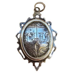
Sterling Silver Medallion reliquary – 18th Century
Located in Madrid, ES
Elegant 18th-century reliquary in solid silver, finely hand-engraved, with ornamental decoration typical of Baroque religious art. Its oval shape features floral and symbolic detail...
Category

European Baroque Antique 18th Century Collectibles and Curiosities

Materials

Sterling Silver

1705 Golfe de Mexico and Florida Framed Map
Located in Stamford, CT
Framed map of Mexico & Florida circa 1705, Paris. Small map with Mexico and the Gulf Coast. Inset text indicating Panama, Acapulco, Mexico City and the Mississippi. Extends North to ...
Category

French Spanish Colonial Antique 18th Century Collectibles and Curiosities

Materials

Glass, Wood, Paper

Senex Map of Castile, Leon & La Mancha in The Spanish Heartland, 1714
Located in Langweer, NL
This antique map, titled "A Map of Old & New Castile from the Observations of Rodrigo Mendes Silva and others," depicts the regions of Old Castile and New Castile in Spain, along with the Kingdom of Leon, Estremadura, La Mancha, among others. The map dates back to the early 18th century, a period marked by significant political shifts and territorial changes in Europe, particularly illustrated by the War of the Spanish Succession (1701–1714) that reshaped Spain’s governance and regional boundaries. The map itself was published in 1714 by John Senex, a prominent English mapmaker, surveyor, globemaker, and geographer of the early eighteenth century. He was apprenticed as a young man to bookseller Robert Clavell and collaborated with notable mapmakers such as Jeremiah Seller and Charles Price. In 1728, Senex's contributions to geography and mapping were recognized when he was elected a Fellow of the Royal Society, an exceptional honor for a mapmaker, underlining his significant role as the Society's engraver and a publisher of maps by Edmund Halley and other notable figures. John Senex is renowned for his English Atlas, first published in the same year as this map, 1714, and continued to be printed until the 1760s. Following his death in 1740, his widow Mary Senex managed the business until 1755. Afterward, the stock passed to William Herbert and Robert Sayer for maps, and to James Ferguson for globes. The map serves not just as a geographical record but also as a historical document, reflecting the territorial divisions significant to Spain's political and economic structure at the time. The focus on Old and New Castile underscores their importance during a transformative era in Spanish history. Here are some potentially significant places and features of this map: 1. **Old Castile (Castilla la Vieja)**: Historically significant as part of the former Kingdom of Castile, this region includes major cities such as Burgos and Valladolid. These cities could be popular search...
Category

Antique 18th Century Collectibles and Curiosities

Materials

Paper

Antique Map of the North Sea and Dunkirk
Located in Langweer, NL
Untitled map of the North Sea, top left a large compass rose, bottom right Dunkirk (Duinkerke / Dunkerque), France. Part of a bundled collection of plans of battles and cities renown...
Category

Antique 18th Century Collectibles and Curiosities

Materials

Paper

Dutch VOC Silver Shipwreck Treasure Coins From The Akerendam Shipwreck 1724
Located in AMSTERDAM, NH
Origin: Holland Value: 2 pennies / 2 stuiver Date: 1724 A VOC Akerendam shipwreck treasure of nine 2 stuivers minted by the Province of Holland ...
Category

Dutch Antique 18th Century Collectibles and Curiosities

Materials

Silver

Antique Map of Yemen by Schraembl, 1789
Located in Langweer, NL
Antique map titled 'Karte von dem groessten Theil des Landes Jemen'. Original map of Yemen, this map is the first printed map specifically of Yemen, and t...
Category

Antique 18th Century Collectibles and Curiosities

Materials

Paper

Attractive Hand-Tinted Antique Map of Japan, Published in 1752
Located in Langweer, NL
Nice decorative hand tinted map of Japan with the title (in French): Carte de L'Empire du Japon Bellin, 1752 This antique map is engraved with very attractive title cartouche. ...
Category

Antique 18th Century Collectibles and Curiosities

Materials

Paper

Antique Plan of Aigues-Mortes, France
Located in Langweer, NL
Antique map titled 'Plan d'Aiguesmortes et environs'. Original plan of the region of Aigues-Mortes, France. This map originates from 'Le Petit Atlas Maritime (..)' by J.N. Bellin. Pu...
Category

Antique 18th Century Collectibles and Curiosities

Materials

Paper

18th Century French Cuir-ciselé Extra Large Reliquary Chalice or Monstrance Case
Located in Haarlem, NL
Large decorative antique 18th century 2-piece reliquary or monstrance case to hold a religious relic. This is a large case, 87cm high, 38cm wide and 20cm deep (34.3" x 15" x 7.9")...
Category

French Antique 18th Century Collectibles and Curiosities

Materials

Leather, Damask, Wood

Read More

Medal-Worthy Memorabilia from Epic Past Olympic Games

Get into the games! These items celebrate the events, athletes, host countries and sporting spirit.

Ahoy! You’ve Never Seen a Collection of Sailor Art and Kitsch Quite Like This

French trendsetter and serial collector Daniel Rozensztroch tells us about his obsession with objects related to seafaring men.

Pamela Shamshiri Shares the Secrets behind Her First-Ever Book and Its Effortlessly Cool Interiors

The sought-after designer worked with the team at Hoffman Creative to produce a monograph that beautifully showcases some of Studio Shamshiri's most inspiring projects.

Moroccan Artworks and Objects Take Center Stage in an Extraordinary Villa in Tangier

Italian writer and collector Umberto Pasti opens the doors to his remarkable cave of wonders in North Africa.

Montecito Has Drawn Royalty and Celebrities, and These Homes Are Proof of Its Allure

Hollywood A-listers, ex-pat aristocrats and art collectors and style setters of all stripes appreciate the allure of the coastal California hamlet — much on our minds after recent winter floods.

Whaam! Blam! Pow! — a New Book on Pop Art Packs a Punch

Publishing house Assouline and writer Julie Belcove have teamed up to trace the history of the genre, from Roy Lichtenstein, Andy Warhol and Yayoi Kusama to Mickalene Thomas and Jeff Koons.

The Sparkling Legacy of Tiffany & Co. Explained, One Jewel at a Time

A gorgeous new book celebrates — and memorializes — the iconic jeweler’s rich heritage.

What Makes a Gem-Encrusted Chess Set Worth $4 Million?

The world’s most opulent chess set, weighing in at 513 carats, is literally fit for a king and queen.
Recently Viewed

View All