Items Similar to Antique Engraving of Women of Kazegut in Sierra Leone, Africa, c.1750

Want more images or videos?
Request additional images or videos from the seller
1 of 6
Antique Engraving of Women of Kazegut in Sierra Leone, Africa, c.1750
About the Item
Antique print titled 'Femmes de Kazegut en differens habits'. Old print showing women of Kazegut (Sierra Leone) in different costumes. This print originates from Prevost's 'Histoire Generale des Voyages'.
Artists and Engravers: Antoine Francois Prevost d'Exiles (1697-1763), usually known simply as the Abbe Prevost, was a French author and novelist.
Condition: Very good, general age-related toning. Please study image carefully.
Date: c.1750
Overall size: 19.9 x 25.2 cm.
Image size: 14 x 19.4 cm.
Whilst cartography holds a special place in our collection, we also offer thousands of antique prints covering fields of interest as diverse as architecture, natural history, religion, ethnology and many more. Antique prints have long been appreciated for both their aesthetic and investment value. They were the product of engraved, etched or lithographed plates. These plates were handmade out of wood or metal, which required an incredible level of skill, patience and craftsmanship. Whether you have a house with Victorian furniture or more contemporary decor an old engraving can enhance your living space.
- Dimensions:Height: 9.93 in (25.2 cm)Width: 7.84 in (19.9 cm)Depth: 0 in (0.01 mm)
- Materials and Techniques:
- Period:
- Date of Manufacture:circa 1750
- Condition:Condition: Very good, general age-related toning. Please study image carefully.
- Seller Location:Langweer, NL
- Reference Number:
About the Seller
5.0
Platinum Seller
These expertly vetted sellers are 1stDibs' most experienced sellers and are rated highest by our customers.
Established in 2009
1stDibs seller since 2017
1,922 sales on 1stDibs
Typical response time: <1 hour
- ShippingRetrieving quote...Ships From: Langweer, Netherlands
- Return PolicyA return for this item may be initiated within 14 days of delivery.
More From This SellerView All
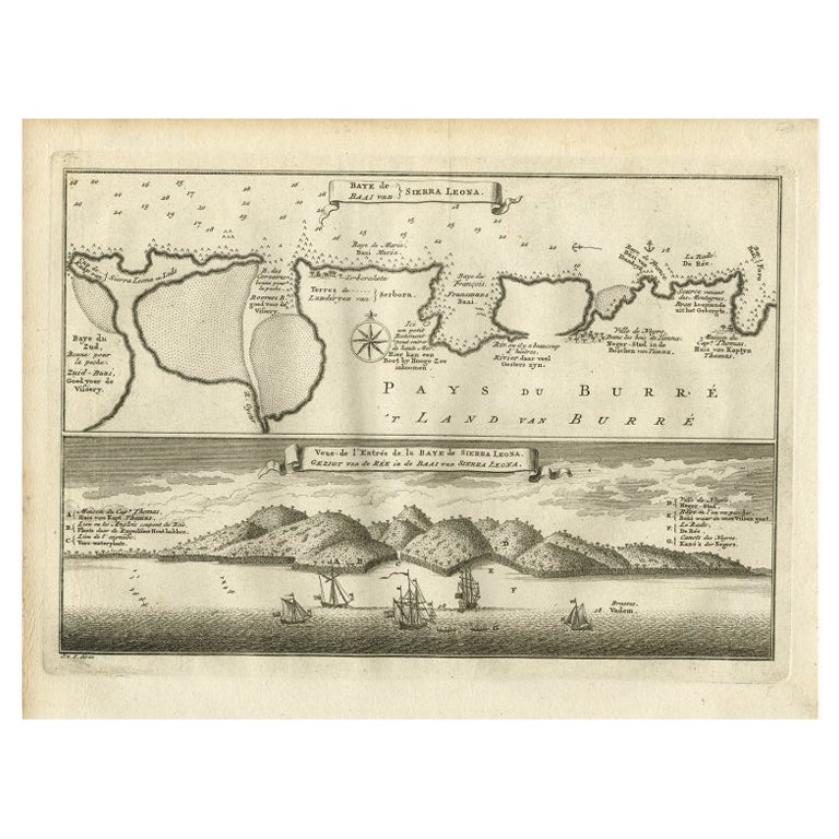
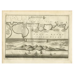
- Antique Map and View of the Bay of Sierra Leone in Africa, C.1750Located in Langweer, NLAntique print titled 'Baye de Sierra Leona (..) - Baai van Sierra Leona (..)'. Map and view of the bay of Sierra Leone. This print originates from 'Historische beschryving der Reizen...Category
Antique 18th Century Prints
MaterialsPaper
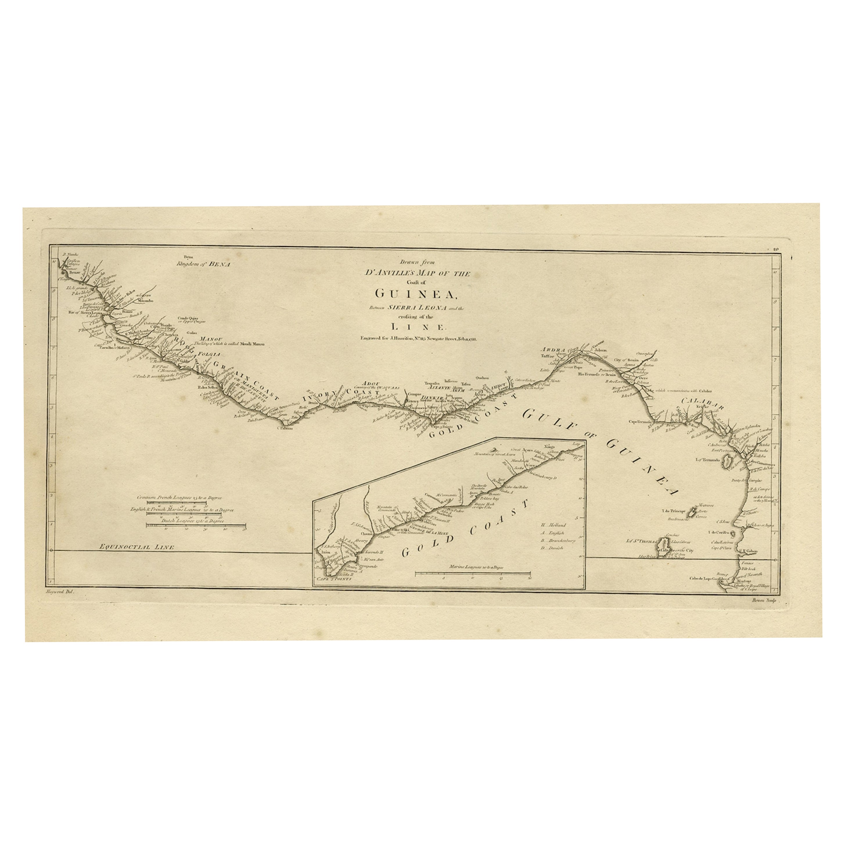
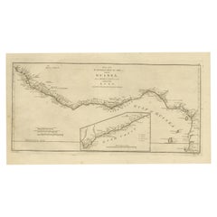
- Map of the African Coast, Gulf of Guinea, from Sierra Leone to Gabon, 1788Located in Langweer, NLAntique map titled 'Drawn from d'Anvilles Map of the Coast of Guinea, Between Sierra Leone and the crossing of the Line.' Map of the African coast, Gulf of Guinea, from Sierra Le...Category
Antique 1780s Maps
MaterialsPaper
- Antique Print of the Bay of Sierra Leone by J. Van Der Schley, 1758Located in Langweer, NLBeautiful map and bird's-eye view of the Bay of Sierra Leone. While these maps by Van Schley after Bellin were initially made for 'Histoire Generale des Voyages' (Paris, 1746-1759), ...Category
Antique Mid-18th Century Prints
MaterialsPaper
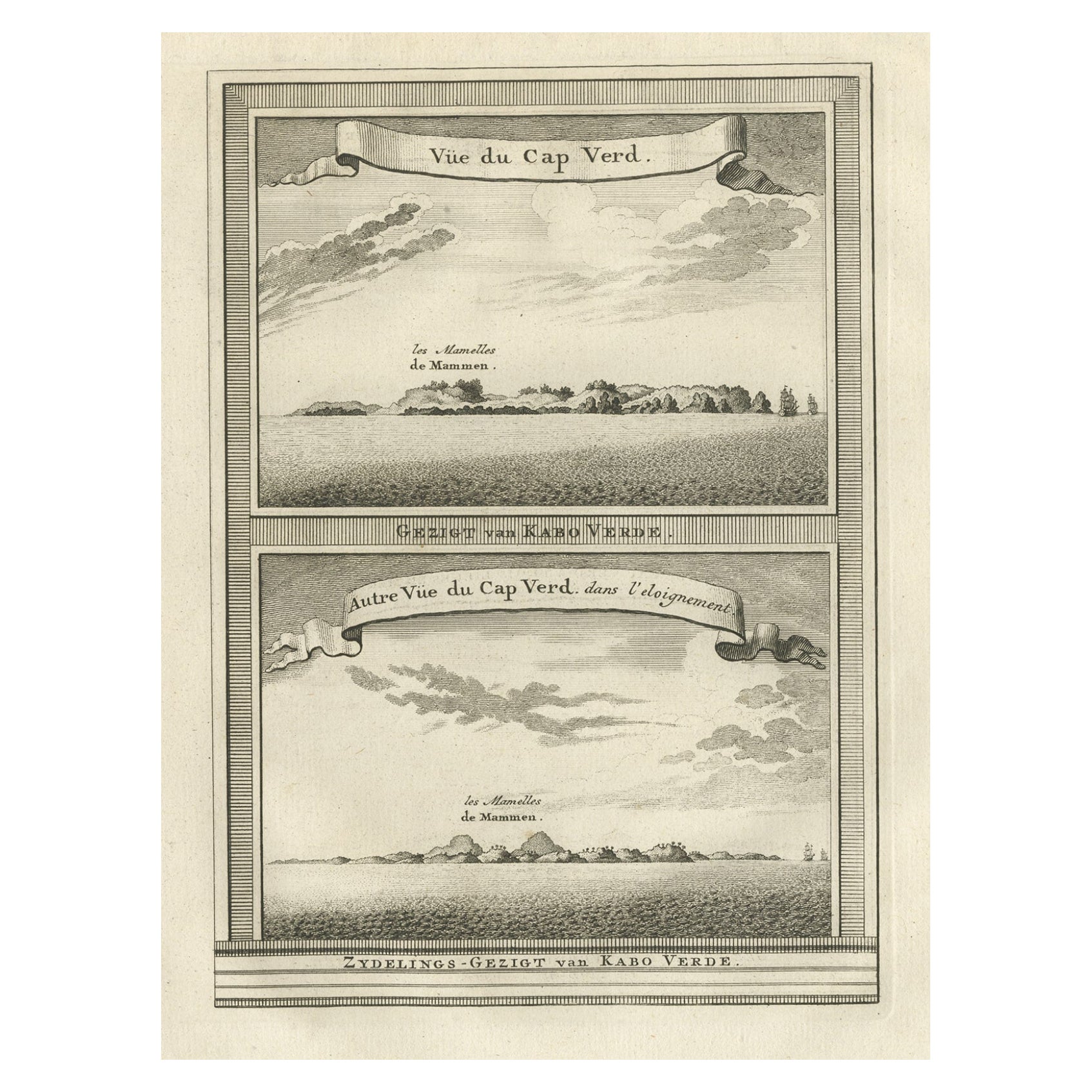
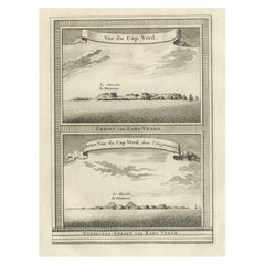
- Antique Print of Cape or Cabo Verde, Africa, c.1750By Jakob van der SchleyLocated in Langweer, NLAntique print titled 'Gezigt van Kabo Verde' and 'Zydelings Gezigt van Kabo Verde'. Old print of Cabo Verde with a double view of the island coast. Engraved...Category
Antique 18th Century Prints
MaterialsPaper
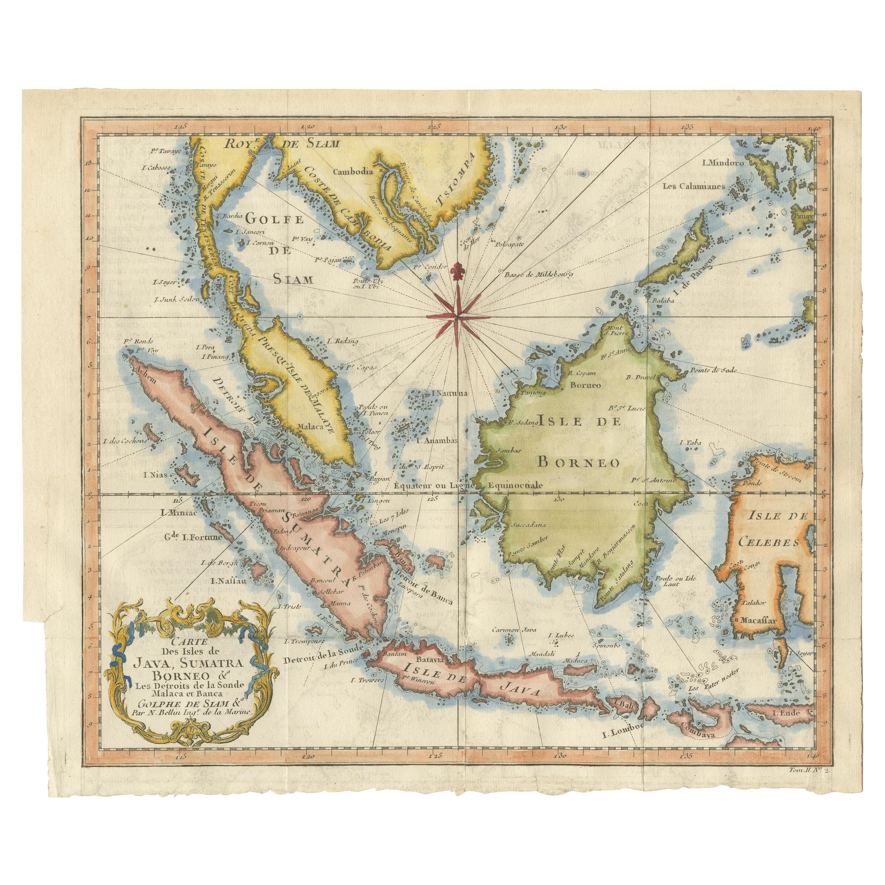
- Antique Engraving of Malaysia, Brunei, Singapore, Java, Borneo, Sumatra, c.1750Located in Langweer, NLNice decorative and detailed map from the Gulf of Siam and Mindoro to Timo, Java and Sumatra Borneo and Roy de Siam. Large compass rose and nice cartouche. Title: Carte des Isles ...Category
Antique Mid-18th Century Maps
MaterialsPaper
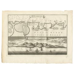
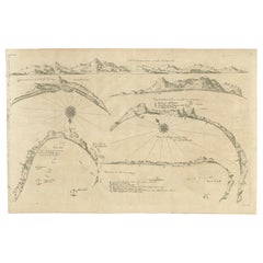
- Rare Map of Six Coast Views and Anchorages of Sierra Leone and Indonesia, 1660Located in Langweer, NLThis rare antique map includes six coastal elevation views of anchorages and bays favored by Dutch and French vessels on their way to Asia. Two views of the coast of Sierra Leone, Africa "Tagrin" opposite Freetown. A view of the coast of Aceh on the northern coast of Sumatra and a further unidentified anchorage "Baye de l'Encau". A view of the African coast including the Bay of Saldagne and Table Bay...Category
Antique 17th Century Maps
MaterialsPaper

You May Also Like
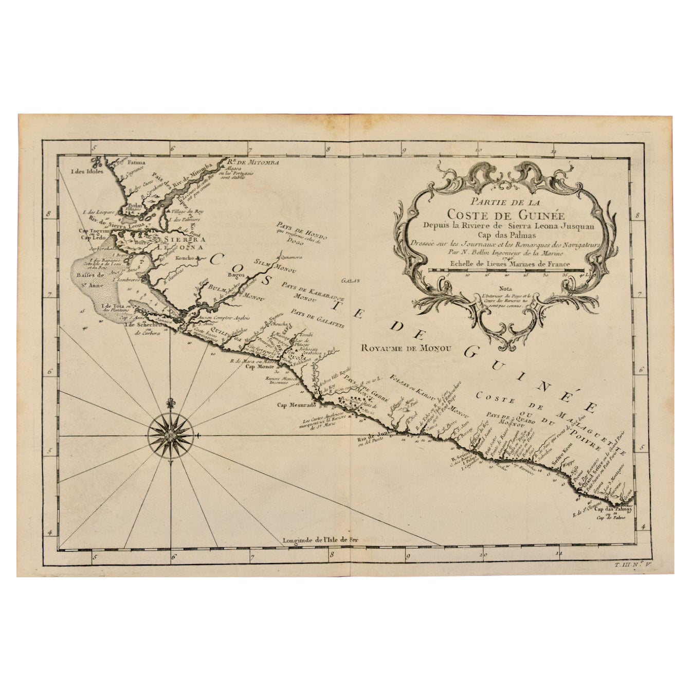
- West Coast of Africa, Guinea & Sierra Leone: An 18th Century Map by BellinBy Jacques-Nicolas BellinLocated in Alamo, CAJacques Bellin's copper-plate map entitled "Partie de la Coste de Guinee Dupuis la Riviere de Sierra Leona Jusquau Cap das Palmas", depicting the coast of Guinea and Sierra Leone in ...Category
Antique Mid-18th Century French Maps
MaterialsPaper
- 1864 "Proclamation of Emancipation, " Antique Engraving by Charles ShoberLocated in Colorado Springs, COThis 1865 engraving features the Emancipation Proclamation in elaborate calligraphic text, with five patriotic vignettes and a small portrait...Category
Antique 1860s American Historical Memorabilia
MaterialsPaper
- Original Antique Map of South Africa, Arrowsmith, 1820Located in St Annes, LancashireGreat map of South Africa. Drawn under the direction of Arrowsmith. Copper-plate engraving. Published by Longman, Hurst, Rees, Orme and Br...Category
Antique 1820s English Maps
MaterialsPaper
- “A Football Match, Scotland v. England” Antique Engraving, Proof Edition of 100By Overend and SmytheLocated in Colorado Springs, COThis is the 1889 William H. Overend (1851-1898) and Lionel Smythe (1839-1918) first edition, photogravure of the Calcutta Cup – a Rugby match between Scotland and England, that has been played over 100 times, the first match...Category
Antique 19th Century English Prints
MaterialsPaper
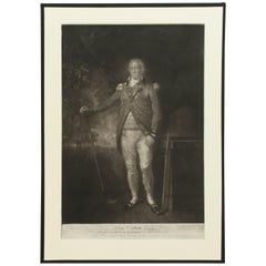
- Antique Golf Engraving, Henry Callender ESQ, Golf MezzotintLocated in Oxfordshire, GBGolf mezzotint of 'Henry Callender Esq' (Captain of the society of Golfers at Blackheath) after Lemuel Francis Abbott (1760-1803). Henry Callend...Category
Antique 1810s British Sporting Art Sports Equipment and Memorabilia
MaterialsPaper
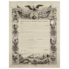
- 1864 Abraham Lincoln's Emancipation Proclamation, Antique Engraving by W RobertsLocated in Colorado Springs, COPresented is a Proclamation of Emancipation wood engraving by W. Roberts. The engraving was published in 1864, just one year after President Abraham Lincoln signed the original Proclamation. W. Roberts was the artist and engraver and Corydon Alexis Alvord was the printer. The engraving was published by R. A Dimmick, in New York, 1864. The text of the Proclamation is set in a variety of typefaces, which is encased in a pictorial border. The border is decorated with a portrait of Abraham Lincoln and seven other vignettes, including the horrors of slavery at left, the bombardment of Fort Sumter at bottom, and scenes from a prosperous and united nation at right. On September 22, 1862, five days after the Union victory at the Battle of Antietam, Lincoln issued a preliminary decree stating that, unless the rebellious states returned to the Union by January 1, freedom would be granted to slaves within those states. No Confederate states took the offer, and on January 1, 1863 Lincoln presented the Emancipation Proclamation...Category
Antique 1860s American Historical Memorabilia
MaterialsPaper


Recently Viewed
View AllMore Ways To Browse
C Sierra France
Antique Display Cabinet Cabinets And Cupboards
Glass Large Display Cases
19th Bamboo Cabinet
Light Wood Chest
Early Antique Cupboards
19th Century Bamboo Cabinet
Mid Century Chest Of Drawers With Doors
Deco Cabinet Display
Modern Desk Chair With Upholstery
Safe Cabinet
Tapestry Of Flowers
Le Button
Gold Frame Chinese
Georgian Key
French Ormolu Commodes
Face Wall Sculpture
French Cabinet Sliding Doors