17th Century Prints
to
902
1,010
28
1,041
Height
to
Width
to
14
1
5,226
9,686
5,517
878
1,208
1,734
1,681
202
80
207
260
250
313
413
699
369
225
1,039
9
5
3
3
116
43
29
16
7
1,041
1,041
1,041
42
18
5
5
4
Period: 17th Century
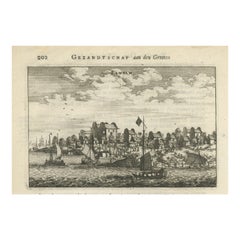
Antique Print of Chinese Vessels Near Lantam, China, 1665
Located in Langweer, NL
Antique print titled 'Lantam'. Old print depicting Chinese ships on the coast of Lantam. Also depicted are Chinese village houses. This print originates f...
Category
Antique 17th Century Prints
Materials
Paper
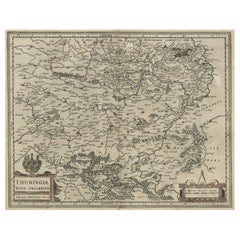
Detailed Original Antique Map of Thuringia, Germany by J. Janssonius, ca.1650
Located in Langweer, NL
Antique map titled 'Thuringiae Nova Descriptio.' Detailed map of Thuringia, Germany by J. Janssonius. With one cartouche, coat-of-arms and a mileage scale. With Erfurt in the centre....
Category
Antique 17th Century Prints
Materials
Paper
$631 Sale Price
20% Off
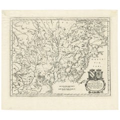
Antique Map of the Burgundy Region by Merian '1646'
Located in Langweer, NL
Antique map titled 'Utriusque Burgundiae tum Ducatus tum Comitatus descriptio'. Old map of the Burgundy (Bourgogne) region of France. This map originates from 'Neuwe Archontologia co...
Category
Antique 17th Century Prints
Materials
Paper
$235 Sale Price
20% Off
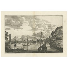
Antique Print of the City of Nangan in Fujian, China, 1668
Located in Langweer, NL
Antique print China titled 'Nangan'. Old print depicting a view on the city of Nangan with its ramparts and a Pagoda. This print originates from the Latin edition of Nieuhof's work t...
Category
Antique 17th Century Prints
Materials
Paper
$377 Sale Price
20% Off
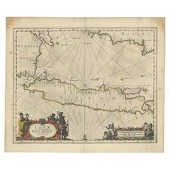
Antique Map of Java and Part of Borneo, Indonesia, c.1657
Located in Langweer, NL
Antique map titled 'Insulae Iavae cum parte insularum Boreno Sumatrae (..)'.
Beautiful map of the island of Java and part of Borneo, Bali, Madura and Sumatra. With decorative carto...
Category
Antique 17th Century Prints
Materials
Paper
$2,592 Sale Price
20% Off
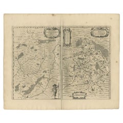
Antique Map of the Region of Vermandois and Cappelle, France by Janssonius, 1657
Located in Langweer, NL
Antique map of France titled 'Descriptio Veromanduorum - Gouvernement de la Cappelle'. Two detailed maps of France on one sheet.
The Vermandois map is centered on the Oyse and So...
Category
Antique 17th Century Prints
Materials
Paper
$631 Sale Price
20% Off
Antique Print of Graves Near the City of Nanjing in China, 1665
Located in Langweer, NL
Antique print titled 'Graf-Steden'. Old print depicting graves near the city of Nanjing, China. This print originates from 'Het gezantschap der Nee^rlandtsche Oost-Indische Compagnie...
Category
Antique 17th Century Prints
Materials
Paper
$207 Sale Price
20% Off
Antique Map of Piedmonte and Savoie 'Italy' by N. Visscher, circa 1683
Located in Langweer, NL
Antique map titled 'Regiae Celsitudinis Sabaudicae Status consistens in Sabaudiae ac Montisferrati Ducatus, Pedemontii Principatum (..). This map originates from 'Atlas Minor Sive Ge...
Category
Dutch Antique 17th Century Prints
Materials
Paper
$584 Sale Price
20% Off
Antique Map of the Artois Region 'France' by F. de Wit, circa 1680
Located in Langweer, NL
Antique map titled 'Tabula Comitatus Artesiae emendata'. Large map of the Artois region, France. Published by F. de Wit, circa 1680.
Category
Antique 17th Century Prints
Materials
Paper
$508 Sale Price
25% Off
Large Copper Engraved Map of the Coastline of Friesland and Terschelling, c.1670
Located in Langweer, NL
Antique print, titled: 'Dominii Frisiae Tabula, inter Flevum et Lavicum (…)'
This large copper engraved map details the coastline of Friesland and Terschelling. At east is a part...
Category
Antique 17th Century Prints
Materials
Paper
$839 Sale Price
20% Off
Antique Map of the Vermandois Region by Janssonius, circa 1650
Located in Langweer, NL
Antique map titled 'Vermandois'. Old map of the Vermandois region, France. Vermandois was a French County that appeared in the Merovingian period. Its na...
Category
Antique 17th Century Prints
Materials
Paper
$424 Sale Price
20% Off
Original Hand-Coloured Nautical Chart of West-Africa, c.1680
Located in Langweer, NL
NIEUWE PASKAERT VAN DE KUST VAN GENEHOA (Senegal) alsmede een gedeelte van Gambia beginnende an C. Blanco tot C. Verde (...). Amsterdam, Johannus van Keulen, c. 1680.
Large folio...
Category
Antique 17th Century Prints
Materials
Paper
$1,367 Sale Price
20% Off
Antique Map of the Region of Blois by Janssonius, 'circa 1640'
Located in Langweer, NL
Antique map titled 'Description du Blaisois'. Old map of the region of Blois, France. It shows the city of Blois, Amboise, the Loire River and more. Published by J. Janssonius, circa...
Category
Antique 17th Century Prints
Materials
Paper
$383 Sale Price
35% Off
Antique Print of Water Fountains in Paris by Perelle, c.1660
Located in Langweer, NL
Antique print titled 'Fontaine de la Ruë St. Louis au Marais - Fontaine de la Porte St. Germain - Fontaine St. Ovide'. Elevations of water fountains in Paris, France. Source unknown,...
Category
Antique 17th Century Prints
Materials
Paper
$103 Sale Price
20% Off
Vintage Graphic Art, Peter Freudenthal, Sweden
Located in Karis, Nyland
Framed lithograph by Swedish artist Peter Freudenthal.
Signed.
Category
Swedish Post-Modern Antique 17th Century Prints
Materials
Glass, Wood, Paper
$801 Sale Price
20% Off
Engraved Map of Northern England, Focusing on Northumberland, 1658
Located in Langweer, NL
Antique map titled 'Ancien Royaume de Northumberland, aujourdhuy Provinces de Nort (..)'.
Engraved map of northern England, focusing on Northumber...
Category
Antique 17th Century Prints
Materials
Paper
$414 Sale Price
20% Off
Antique Print of the University of Franeker by Winsemius, 1622
Located in Langweer, NL
Antique print titled 'De Academia van Vrieslant'. Original antique print of the university of Franeker, Friesland, the Netherlands. This print originates from volume 1 of 'Chroniqve ...
Category
Antique 17th Century Prints
Materials
Paper
Antique Miniature Map of Ceylon 'Sri Lanka' and the Maldives by Bertius, 1618
Located in Langweer, NL
Antique map titled 'Descriptio Zeilan, et Maldivarum Inss'. Rare, original antique miniature map of Ceylon/Sri Lanka and the Maldives. This map originate...
Category
Antique 17th Century Prints
Materials
Paper
$471 Sale Price
20% Off
Antique Map of the Region of Salzburg by Ortelius 'circa 1606'
Located in Langweer, NL
Antique map titled 'Salisburgensis Iurisdictionis'. Original antique map of the region of Salzburg, Austria. Published by A. Ortelius, circa 1606.
Category
Antique 17th Century Prints
Materials
Paper
$707 Sale Price
20% Off
Jacques Callot "Misères Et Malheurs De La Guerre" Collection of Engraving 17th
Located in Beuzevillette, FR
“Les Misères Et Les Malheurs De La Guerre” (“The misfortunes of war”) more commonly called “the great miseries of war” (“The great miseries of war”) is a major work by the 17th centu...
Category
French Louis XIII Antique 17th Century Prints
Materials
Paper
Two Maps of Asia on One Sheet, India, Bangladesh and Malaysia & Burma etc., 1617
Located in Langweer, NL
Antique map titled 'Tabula Asiae'.
Two maps of Asia on one sheet, recto and verso. The recto features an interesting map of India, Bangladesh and the Ganges River. On the verso, ...
Category
Antique 17th Century Prints
Materials
Paper
$603 Sale Price
20% Off
Antique Map of the Ancient British Isles by Janssonius 'circa 1640'
Located in Langweer, NL
Antique map titled 'Insularum Britannicarum Acurata Delineatio'. Original antique map of the ancient British Isles. England and Wales are labelled as B...
Category
Antique 17th Century Prints
Materials
Paper
$895 Sale Price
20% Off
Antique Uncommon Map of Bohemia, Moravia and Silesia, 1699
Located in Langweer, NL
Antique map titled 'B. V. Boleslaviensis in Bohemia, Moravia et Silesia (..).' Detailed uncommon map of the Bohemia, Moravia and Silesia. Source unknown, to be determined.
Artists...
Category
Antique 17th Century Prints
Materials
Paper
$452 Sale Price
20% Off
Antique Map of the Maine Region by Janssonius, 1657
Located in Langweer, NL
Antique map of France titled 'Diocese du Mans vulgo le Mains'. Decorative map of the region of Maine, France. This map originates from 'Atlas Novus, Sive Theatrum Orbis Orbis Terraru...
Category
Antique 17th Century Prints
Materials
Paper
Antique Print of the Igel Column and Church, c.1650
Located in Langweer, NL
Untitled print of the Igel Column (Igeler Säule) near Trier. The Igel Column is a multi-storeyed Roman sandstone column in the municipality of Igel, Ge...
Category
Antique 17th Century Prints
Materials
Paper
$172 Sale Price
20% Off
Antique Map of the Region of Sedan and Doncheri in France by Janssonius, c.1650
Located in Langweer, NL
Antique map of France titled 'La Souveraineté de Sedan et de Raucourt, et la prevosté de Doncheri'. Lovely map centered on Sedan and Doncheri and the Meuze River from Charleville and...
Category
Antique 17th Century Prints
Materials
Paper
$622 Sale Price
20% Off
Antique Map of the Lower Alsace Region of France by Mapmaker Hondius, c.1630
Located in Langweer, NL
Antique map titled 'Alsatia Inferior'. Original antique map of the northern Alsace (Elzas) region of France. The map is centered on the course of the Rhine River, with Strasbourg at ...
Category
Antique 17th Century Prints
Materials
Paper
Antique Map of the Region of Dauphiné by Janssonius, 1657
Located in Langweer, NL
Antique map of France titled 'Nova et Accurata descriptio Delphinatus vulgo Dauphiné'. Decorative map of Dauphiné region in France. Originally a seperate province in southeastern Fra...
Category
Antique 17th Century Prints
Materials
Paper
$452 Sale Price
20% Off
Antique Map of the Moluccas in Indonesia by Janssonius, C.1650
Located in Langweer, NL
Antique map titled 'Insularum Moluccarum Nova Descriptio.' Old map of the Moluccas. The famous Spice Islands, the cornerstone of the Dutch trading ...
Category
Antique 17th Century Prints
Materials
Paper
$528 Sale Price
20% Off
Antique Map of the Region of Zevenwouden in Friesland, The Netherlands, 1635
Located in Langweer, NL
Antique map titled 'De Zeeven Wolden'. Map of the region of Zevenwouden (or Zevenwolden) in Friesland, the Netherlands. This region include the villages of Langweer, Echtenerbrug, Le...
Category
Antique 17th Century Prints
Materials
Paper
$330 Sale Price
20% Off
Antique Map of the Rethelois or Rethel Region in France by Janssonius, ca.1650
Located in Langweer, NL
Antique map of France titled 'Dioecese de Rheims et le Païs de Rethel'.
Detailed map, centered on the River Ayne and the River Velle and sowing Reims, Chalons, Rethel, Sedan, Cha...
Category
Antique 17th Century Prints
Materials
Paper
$330 Sale Price
20% Off
Antique Old Hand-Colored Bird Print of Two Eagles and an Eagle Claw, 1657
Located in Langweer, NL
Antique bird print of two eagles and an eagle claw. This print originates from 'Historiae Naturalis De Avibus Libri VI' by John Johnston, published by Matthias Merian in 1657.
Artis...
Category
Antique 17th Century Prints
Materials
Paper
$424 Sale Price
20% Off
Beautiful Antique Map of Madagascar, The Comoros Islands & Reunion Island, 1667
Located in Langweer, NL
Antique map titled 'Isle d'Auphine, communement Nommée par les Europeens Madagascar, et St. Laurens, et par les Habitans du pays Madecase'.
Beautiful map of Madagascar...
Category
Antique 17th Century Prints
Materials
Paper
$858 Sale Price
20% Off
Antique Map of the Region of Le Mans 'France' by Blaeu, circa 1640
By Willem Blaeu
Located in Langweer, NL
Antique Map: Cenomanorum Galliae regionis typus vulgo le Mans – Blaeu, circa 1640
This beautifully engraved and hand-colored map depicts the historical province of Maine in northw...
Category
Antique 17th Century Prints
Materials
Paper
$471 Sale Price
20% Off
Scandinavia & Baltic Map – Antique by G. & L. Valk, incl. Sweden, Finland, c1700
Located in Langweer, NL
Scandinavia & Baltic Map – Antique by G. & L. Valk, incl. Sweden, Finland, 1700
Antique map titled 'Sueciae Magnae, totius orbis regni antiquissimi (..)' by Gerard and Leonard Valk....
Category
Dutch Antique 17th Century Prints
Materials
Paper
$612 Sale Price
20% Off
Early Antique Map of the Dutch Provinces of Friesland and Groningen, 1604
Located in Langweer, NL
Antique map titled 'Frisiae Occidentalis.'
This attractive map shows the Dutch Provinces of Friesland and Groningen. Embellished with strapwork tit...
Category
Antique 17th Century Prints
Materials
Paper
$990 Sale Price
25% Off
The Iron Duke of Alva of Spain Planning the Atrocities Against the Dutch, c.1680
Located in Langweer, NL
Antique print titled ‘Afbeeldinge van de Spaansche Bloedraad in den Jaare 1567 door den Hartog van Alva aangestelt’.
The Duke of Alva and his entourage seated at a table planning...
Category
Antique 17th Century Prints
Materials
Paper
$528 Sale Price
20% Off
Antique Map of the Region of Franche-Comté by Janssonius, circa 1650
Located in Langweer, NL
Antique map titled 'Burgundiae Comitatus Franche Comté'. Old map of the historical and former region of Franche-Comté, France. As a region, it encompasse...
Category
Antique 17th Century Prints
Materials
Paper
$565 Sale Price
20% Off
Antique Botany Print of a Limonium Flowering Plant, circa 1680
Located in Langweer, NL
Antique botany print titled 'Limonium minus Bellidis (..)'. Original antique print of a limonium flowering plant. This print originates from 'Me´moires pour servir a' l'histoire des ...
Category
Antique 17th Century Prints
Materials
Paper
$235 Sale Price
20% Off
Very Old and Rare Print of Various Sea Snakes, 1657
Located in Langweer, NL
Antique print titled 'Serpens Marinus Mari Norvegico - Serpens Marinus flavi coloris Maris Suedici Aldro - Scolopendra Marina aldro - Scolopendra Marina amethystini Coloris - Serpens Americana Indicus'. Old print of various sea snakes. This print originates from 'Historiae Naturalis De Piscibus Et Cetis Libri V' by J. Johnston.
Artists and Engravers: Published by M. Merian. John Johnston (or Johnstone, 1603-1675) was a descendant of a Scottish family...
Category
Antique 17th Century Prints
Materials
Paper
$207 Sale Price
20% Off
Antique Print of various Mammals Porcupine, Capybara, Otter, Monkey etc., 1657
Located in Langweer, NL
Antique print of various mammals; porcupine, capybara, otter, monkey etc. This print originates from 'Historiae Naturalis De Piscibus Et Cetis Libri V' by John Johnston, published by Matthias Merian in 1657.
Artists and Engravers: John Johnston (or Johnstone, 1603-1675) was a descendant of a Scottish family...
Category
Antique 17th Century Prints
Materials
Paper
$226 Sale Price
20% Off
Antique Map of the Rhine-Palatinate by Janssonius, circa 1630
Located in Langweer, NL
Antique map titled 'Nova Descriptio Palatinatus Rheni'. Detailed map of the Rhine-Palatinate, a state of Germany located in the west of the country. The map tracks the course of the ...
Category
Antique 17th Century Prints
Materials
Paper
$471 Sale Price
20% Off
Original Old Map of Leeuwarden, European Cultural Capital 2018, Holland, 1649
Located in Langweer, NL
Antique print, titled: 'Leoverdia.'
This map shows Leoverdia (Leeuwarden). Bird's-eye view plan of Leeuwarden in The Netherlands, with key to locations and coats of arms. Text in...
Category
Antique 17th Century Prints
Materials
Paper
$1,272 Sale Price
20% Off
Antique Map of the Region of Beauvais by Hondius, circa 1630
Located in Langweer, NL
Antique map titled 'Beauvaisis - Comitatus Belovacium'. Old map of the region of Beauvais, France. This map originates from a composite atlas and is signed by J. Hondius.
Category
Antique 17th Century Prints
Materials
Paper
$471 Sale Price
20% Off
Old Map of the Alsace 'Elzas' Region with Lotharingen 'Lorraine', France, c1650
Located in Langweer, NL
Antique map titled 'Alsatia superior cum Suntgoia et Brisgoia'.
Old map of the Alsace (or Elzas) region with Lotharingen (Lorraine), Strassburg, Freiburg, Basel etc. Source unkno...
Category
Antique 17th Century Prints
Materials
Paper
$414 Sale Price
20% Off
Decorative Antique Map of the Berry Region, France, 1657
Located in Langweer, NL
Antique map of France titled 'Bituricum Ducatus - Duche de Berri'.
Decorative map of the Berry region, France. Berry is a region located in the center of France. It was a provinc...
Category
Antique 17th Century Prints
Materials
Paper
$528 Sale Price
20% Off
Original Antique Map of the City of Stavoren, Friesland, The Netherlands, 1649
Located in Langweer, NL
Antique map titled 'Staveren'. Original antique map of the city of Stavoren, Friesland, The Netherlands. This map originates from 'Toonneel der Steden van de Vereenighde Nederlanden'...
Category
Antique 17th Century Prints
Materials
Paper
$1,084 Sale Price
20% Off
Old Print of Vishnu and the Fifth Incarnation, 1672
Located in Langweer, NL
Antique print, untitled. This original antique print shows Vishnu in his fifth incarnation or avatar. Dutch text on verso. From: 'Naauwkeurige Beschryvinge van Malabar en Choromandel...
Category
Antique 17th Century Prints
Materials
Paper
$320 Sale Price
20% Off
Map of the Duchy Clivia & Ravestein, Brabant in The Netherlands & Germany, 1635
Located in Langweer, NL
Antique map titled 'Clivia Ducatus et Ravestein Dominium.'
Map of the Duchy Clivia and Ravestein, part of Brabant in The Nethe...
Category
Antique 17th Century Prints
Materials
Paper
$707 Sale Price
20% Off
Original Rare Antique Map of the Ancient German Empire in Northern Europe, c1650
Located in Langweer, NL
Antique map titled 'Germaniae Veteris typus.'
Map of the ancient German Empire in Northern Europe, based upon an earlier map by Ortelius. Extends fr...
Category
Antique 17th Century Prints
Materials
Paper
$622 Sale Price
20% Off
Large Panoramic View of Eisenerz, an Old Mining Town in Styria, Austria, c.1650
Located in Langweer, NL
Description: Antique print titled 'Der weyt berümpte Marckt und Bergwerck Eysenärtz im Hertzogtum Steyer'.
Large panoramic view of Eisenerz, an old mining town in the Austrian st...
Category
Antique 17th Century Prints
Materials
Paper
$688 Sale Price
20% Off
17th Century Jan Van De Velde Print "January" from the Months, 1618
Located in Cagliari, IT
Beautiful burin from the rare suite "The Months" performed by the artist and engraved by Claens Jansz Visscher (1587-19 June 1652).
Very fresh and well contrasted, laid paper with w...
Category
Dutch Antique 17th Century Prints
Materials
Paper
$924 Sale Price
20% Off
Antique Copper Engraving of Various Rodent Species, 1657
Located in Langweer, NL
Antique print of various rodent species; Aperea cuniculi species, Veld Ratte (Rodent, Rat species) - Carigueya (Opossum species) - Aguti (Agouti) - Cavia Cobaya - Cuniculi Inda Gesne...
Category
Antique 17th Century Prints
Materials
Paper
$216 Sale Price
20% Off
Old Print of a Large Procession of the Emperor's Niece in Japan, 1669
Located in Langweer, NL
Antique print titled 'Groote Staatsie der Kaisarlyke Nicht.'
This print shows a large procession of the Emperor's Niece. It shows a small carriage d...
Category
Antique 17th Century Prints
Materials
Paper
$301 Sale Price
20% Off
Antique Map of Frisian Cities Sloten, Ylst, Workum and Hindelopen by Blaeu, 1652
Located in Langweer, NL
Antique print titled 'Slooten - Ylst - Worcum - Hinloopen'. Three plans and a bird's eye view on one sheet. The plans show the Frisian cities Sloten, IJlst, Workum and the view shows...
Category
Antique 17th Century Prints
Materials
Paper
$1,084 Sale Price
20% Off
Decorative Antique Map of the Dutch Province of Noord-Brabant, ca.1640
Located in Langweer, NL
Antique map titled 'Quarta pars Brabantiae cujus Sylvaducis Willebordus vanderBurgt desrib'.
Highly detailed original antique map of the province of Noord-Brabant, the Netherlands. It shows the cities of 's-Hertogenbosch, Eindhoven and surroundings. Includes a decorative cartouche, 6 coats of arms, topped by winged cherubs and two larger coats of arms...
Category
Antique 17th Century Prints
Materials
Paper
$2,592 Sale Price
20% Off
Print of William of Orange, Leader of the Dutch Revolt Against the Spanish, 1624
Located in Langweer, NL
Antique portrait of William of Orange I. With text in oval 'tranquillus in undis saevis'. Latin text below: 'Guihelmus D:G: Princeps Arausionensum; comes Nassavia, Cattimelibocii, Vianda, Dietzia, Linga, Buyra Leerdami; etc. Marchio Vera et Flissinga; dominus et baro Breda, Diest, Grimbergia, Arlay, Noseretti, Castelbellin; etc. vice comes hereditarius Antverpia et Bisancia Gubernator generalis Brabantia Hollandia Zelandia Frisia Ultrajecti Arcdithalassus maris inferioris Germania: quam celeberimi Pr: effigiem a Cornelio Vischero ad visum depictam et Guilismo Jacobi Delphio coelo hac forma expressam dedicat consecratq ipse sculptor DD: principibus Mauritio et Henrico filijs paternarum virtutum heredibus. Cum privilegio illus tr: DD : Ordinum gener. ad annos octo An. Dom'.
William the Silent (24 April 1533 – 10 July 1584), also known as William the Taciturn or, more commonly in the Netherlands, William of Orange, was the main leader of the Dutch Revolt against the Spanish Habsburgs that set off the Eighty Years' War (1568–1648) and resulted in the formal independence of the United Provinces in 1581. Born into the House of Nassau, he became Prince of Orange in 1544 and is thereby the founder of the Orange-Nassau branch and the ancestor of the monarchy of the Netherlands. In the Netherlands, he is also known as Father of the Fatherland (Pater Patriae).
A wealthy nobleman, William originally served the Habsburgs as a member of the court of Margaret of Parma, governor of the Spanish Netherlands. Unhappy with the centralisation of political power away from the local estates and with the Spanish persecution of Dutch Protestants, William joined the Dutch uprising and turned against his former masters. The most influential and politically capable of the rebels, he led the Dutch to several successes in the fight against the Spanish. Declared an outlaw by the Spanish king...
Category
Dutch Antique 17th Century Prints
Materials
Paper
$433 Sale Price
20% Off
Detailed Original Antique Map of the Picardy Region of France, 1657
Located in Langweer, NL
Antique map of France titled 'Picardia vera et inferior'.
Detailed map of the Picardy region of France. This map originates from 'Atlas Novus, Sive Theatrum Orbis Orbis Terrarum:...
Category
Antique 17th Century Prints
Materials
Paper
$462 Sale Price
20% Off
Charming Map of Northeastern Spain with the Areas of Pamplona & Valladolid, 1634
Located in Langweer, NL
Antique map titled 'Biscaia, Guipiscoa, Navarra et Asturias de Santillana'.
Charming map of Northeastern Spain with the areas of Pamplona and Valladolid. This map originates from...
Category
Antique 17th Century Prints
Materials
Paper
$414 Sale Price
20% Off
Old Portrait of Painter Gerard Seghers 'Segers', born in Antwerp, Belgium, 1694
Located in Langweer, NL
Antique print, titled: 'Gerard Segers' -
Portrait of the Flemish painter Gerard Seghers ( Segers ) 1591-1651, born in Antwerp, Belgium. Gerard Segher...
Category
Antique 17th Century Prints
Materials
Paper
$226 Sale Price
20% Off
Recently Viewed
View AllMore Ways To Browse
Antique Enamel Coffee Pot
Antique Glass Sugar Shakers
Antique Hand Painted Nippon
Antique Hunting Flasks
Antique India Sword
Antique Jacobean Chest
Antique Japanese Satsuma Tea Sets
Antique Japanese Shibayama
Antique Military Saddles
Antique Milk Glass Vase
Antique Nantucket Signs
Antique Oak Card Cabinet
Antique Pegasus
Antique Peugeot
Antique Red Transferware
Antique Salt Dishes
Antique Silver Grape Scissors
Antique Smiths Clocks
