Benelux - Collectibles and Curiosities

to
4,923
6,565
14,761
11,487
6,511
40
14
116
30
30
25
22
18
16
13
13
6
5
4
4
4
2
1
3,133
2,462
916
54
378
200
63
83
18
9
17
7
31
41
28
12
6
5,602
490
332
103
97
847
190
165
83
76
6,565
6,564
6,564
104
59
20
14
14
Item Ships From: Benelux
Antique Plan of the Overground Area of Baths of Emperor Titus, Rome, Italy, 1786
Located in Langweer, NL
Antique print titled 'Plan des Thermes de Titus Partie Superieure'. Plan of the overground area of the Baths of Titus. The Baths of Titus or Thermae Titi were public baths (Thermae) built in 81 AD at Rome, by Roman emperor Titus...
Category

18th Century Antique Benelux - Collectibles and Curiosities

Materials

Paper

Original Antique Bird's Eye View Plan of Hoorn, The Netherlands by Blaeu, c.1700
Located in Langweer, NL
Antique map titled 'Horna vulgo Hoorn'. Bird's eye view plan of Hoorn, The Netherlands. With title cartouche, coats of arms and key. From an atlas published by De Wit, ca. 1698-1...
Category

Early 1700s Antique Benelux - Collectibles and Curiosities

Materials

Paper

Imperii Persici Delineatio: A 1722 Cartographic Masterpiece of Persia by Schenk
Located in Langweer, NL
Title: IMPERII PERCICI delineatio ex scriptis potissimum geographicis Arabum et Persarum Cartographer: Petrus Schenk (Pieter Schenk), 1722 An original antique hand-colored engraved...
Category

1720s Antique Benelux - Collectibles and Curiosities

Materials

Paper

The Mountain Flora of Java by Van Steenis '1972'
Located in Langweer, NL
'The Mountain Flora of Java' by C.G.G.J. van Steenis. Containing 57 plates with pictures of 456 species of flowering plants native in the mountains of Java, made from living specimen...
Category

20th Century Benelux - Collectibles and Curiosities

Materials

Paper

Antique Map of the British Isles by Johnston '1909'
Located in Langweer, NL
Antique map titled 'The British Isles'. Original antique map of the British Isles. With inset maps of the Shetland Islands, Chanel Islands, and London. T...
Category

Early 20th Century Benelux - Collectibles and Curiosities

Materials

Paper

Antique Print with Coastal Views of Kamchatka in Russia by Cook, 1803
Located in Langweer, NL
Antique print Russia titled 'Gezigten der Kust van Kamtchatka'. Print with coastal views of Kamchatka including volcanoes. Originates from 'Reizen...
Category

19th Century Antique Benelux - Collectibles and Curiosities

Materials

Paper

Original Antique Map of Egypt in Frame by C. Weigel, circa 1720
Located in Langweer, NL
The map is an antique depiction of ancient Egypt, divided into its regions and nomes, also including areas like Troglodytica, Marmarica, and Ethiopia above Egypt. Christophorus Weige...
Category

Early 18th Century Antique Benelux - Collectibles and Curiosities

Materials

Paper

Original Antique Map of the Road from Marlborough to Huntspil
Located in Langweer, NL
Antique map titled 'The Continuation of the Road from London to Bristol (..)'. A strip map of the continuation of the road from London to Bristol, this particular sheet showing the r...
Category

Late 17th Century Antique Benelux - Collectibles and Curiosities

Materials

Paper

Antique Bible Print of the Shepherds of Bethlehem by Kronheim 'c.1860'
Located in Langweer, NL
Antique bible print titled 'The Shepherds of Bethlehem'. This print most likely originates from an illustrated bible, published by J.M. Kronheim & Co...
Category

Mid-19th Century Antique Benelux - Collectibles and Curiosities

Materials

Paper

Old Print of the Cruelty of the Spaniards in Antwerp, Belgium '1576', ca.1730
Located in Langweer, NL
Antique print titled 'Voorbeeldt van d'afgryselyke Wreedtheit der Spanjaarden, aan seekere Bruydt getoont, by 't plonderen van Antwerpen'. Old print of the cruelty of the Spaniards in Antwerp, 1576. It was the time of the Sack of Antwerp, often known as the Spanish Fury at Antwerp, an episode of the Eighty Years' War. It is the greatest massacre in Belgian history. This print orginates from 'Geschiedenissen der Vereenigde Nederlanden (..)' by Jean le Clerc...
Category

1730s Antique Benelux - Collectibles and Curiosities

Materials

Paper

Antique Map of the World on Mercator's Projection, 1788
Located in Langweer, NL
Antique map titled 'Kaart van de Geheele Wereld (..)'. Uncommon small world map on Mercator's projection. Nice detail of the islands throughout the wor...
Category

Late 18th Century Antique Benelux - Collectibles and Curiosities

Materials

Paper

Territorium Norimbergense - Antique Map of Nürnberg by Janssonius (1645-58)
Located in Langweer, NL
This is an antique map of Nürnberg, titled "Territorium Norimbergense," created by Johannes Janssonius and published between 1645 and 1658. It is a copperplate engraving printed on p...
Category

1650s Antique Benelux - Collectibles and Curiosities

Materials

Paper

Antique Print of the Family Tree of Muhammad, 1745
Located in Langweer, NL
Antique print titled 'Arbore Genealogico'. Family tree of Muhammad. This print originates from 'Vita di Maometo cavata dagli autori arabi maometani (..)' by H. de Boulainvilliers. ...
Category

18th Century Antique Benelux - Collectibles and Curiosities

Materials

Paper

Antique Map of the Islands Near Ceylon by Baldaeus, 1672
By Philip Baldaeus
Located in Langweer, NL
Antique print, untitled. This original antique print shows the islands Leyden, Middelburg, Hammenhiel, Bramines, Dona Clara and Deserta near Ceylon / Sri Lanka, with their Dutch name...
Category

17th Century Antique Benelux - Collectibles and Curiosities

Materials

Paper

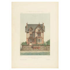
Pl. XLVII Maison de Campagne, Chabat, c.1900
Located in Langweer, NL
Antique print titled 'Maison de Campagne, Mr. Bonnier Architecte'. This print depicts the design of a building in France. Originates from 'La Brique et La Terre Cuite' by P. Chabat. ...
Category

20th Century Benelux - Collectibles and Curiosities

Materials

Paper

Antique Religious Print 'No. 6' The Adoration of the Magi, circa 1840
Located in Langweer, NL
Antique print titled ‘Histoire Sainte, Nouveau Testament, Adoration des Mages.’ This plate shows a scene from the New Testament; The Adoration of the Magi.’ This print originates ...
Category

Mid-19th Century Antique Benelux - Collectibles and Curiosities

Materials

Paper

Modernist Abstract Carved Hardwood Crucifix, Corpus of Christ Sculpture Cross
Located in Lisse, NL
Beautifully stylized, midcentury crucifix. This handcrafted religious work of art shows us that Christ and what He stands for continuous to inspi...
Category

Mid-20th Century European Mid-Century Modern Benelux - Collectibles and Curiosities

Materials

Hardwood

The 17th Century Map of Northern Dithmarschen and Its Towns in Germany
Located in Langweer, NL
This is a detailed colored copperplate engraving depicting northern Dithmarschen, accompanied by town plans of Weßlingburen (now Wesselburen), Lunden, and Heyde (now Heide) at the to...
Category

1640s Antique Benelux - Collectibles and Curiosities

Materials

Paper

Map of Styria by William Blaeu, 1645: A Masterpiece of 17th-Century Cartography
Located in Langweer, NL
This 1645 map, created by Willem Janszoon Blaeu, represents Styria (Steyrmark), a historical region in present-day Austria, located in the Alpine regions. Blaeu, one of the most sign...
Category

1640s Antique Benelux - Collectibles and Curiosities

Materials

Paper

Antique Map of New Ireland Island in the Bismarck Archipelago, New Guinea, 1772
Located in Langweer, NL
Antique map titled 'Nova Hibernia'. Antique map of New Ireland, an island in the Bismarck Archipelago, New Guinea. Lying just north of New Britain, from which it is separated by St. ...
Category

18th Century Antique Benelux - Collectibles and Curiosities

Materials

Paper

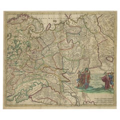
Antique Hand-Colored Map of Western Russia and Ukraine, c.1680
Located in Langweer, NL
Description: Antique map titled 'Novissima et Accuratissima Totius Russiae vulgo Muscoviae Tabula'. Antique map of Western Russia and Ukraine, published by Justus Danckerts. The ma...
Category

1680s Antique Benelux - Collectibles and Curiosities

Materials

Paper

Rare Antique Map of Calcutta 'Kolkata' in India, 1893
Located in Langweer, NL
Antique map titled 'Calcutta (India)'. Old map of Calcutta/Kolkata, India. On verso, a map of Egypt, Arabia, Upper Nubia and Abyssinia. Originates from 'The Columbian World's Fair at...
Category

19th Century Antique Benelux - Collectibles and Curiosities

Materials

Paper

Antique Print of the City of Hukoen in China, 1668
By Johannes Nieuhof
Located in Langweer, NL
Antique print China titled 'Hukoen of ou Hukeu'. Old print depicting a view on the Chinese city of Hukoen with its ramparts. This print originates ...
Category

17th Century Antique Benelux - Collectibles and Curiosities

Materials

Paper

Old Decorative Pictorial Map of the United States, circa 1953
Located in Langweer, NL
Antique map titled 'A Pictorial Map of the United States of America Showing Principal Regional Resources, Products, and Natural Features'. This information-packed map was create by the General Drafting Company for the New Jersey Bell Telephone Company. The main map features over 700 drawings in full color including points of interest, natural resources, and agricultural products. At bottom are inset maps showing railroad lines, air routes, telephone lines, as well as a pictorial map of New Jersey...
Category

20th Century Benelux - Collectibles and Curiosities

Materials

Paper

Early Woodcut Map of the Rhine River Region in Germany and Holland, circa 1628
Located in Langweer, NL
Early Woodcut Map of the Rhine River Region, "Die Dritte Tafel des Rheinstroms," ca. 16th Century This early woodcut map, titled "Die Dritte Tafel des Rheinstroms Innhaltend das Nid...
Category

1620s Antique Benelux - Collectibles and Curiosities

Materials

Paper

Print of Makassar 'Ujung Pandang' in the Dutch East Indies 'Indonesia', c.1725
By Pieter Van Der Aa
Located in Langweer, NL
Antique print titled 'Macasar, Capitale du Roiaume de même nom'. This rare print shows Makassar, the present capital of South Sulawesi, Indonesia. In the foreground several VOC ships...
Category

18th Century Antique Benelux - Collectibles and Curiosities

Materials

Paper

Trás-os-Montes: A Cartographic Exploration of Portugal's Hidden Province in 1903
Located in Langweer, NL
This print is an original historical map of the Trás-os-Montes region in the northeastern part of Portugal, dated 1903. Trás-os-Montes is often translated as "behind the mountains," ...
Category

Early 1900s Antique Benelux - Collectibles and Curiosities

Materials

Paper

Remarkable Antique Print of a Horse Drawn Float with Religious Figures, 1775
Located in Langweer, NL
Antique print of a horse drawn float with religious figures. Double page with joined sheets and original folding lines. This print originates fro...
Category

1770s Antique Benelux - Collectibles and Curiosities

Materials

Paper

Early Woodcut Map of Swabia and Bavaria in Germany, 1628
Located in Langweer, NL
Title: Early Woodcut Map of Swabia and Bavaria, 16th Century This early woodcut map titled "Schwaben und Bayernlande / Darbey auch begreiffen der Oenwaldt / Nordgaw / etc." provides...
Category

1620s Antique Benelux - Collectibles and Curiosities

Materials

Paper

Original Antique Map of the Area of Bremen and Lower Saxony
By Johannes Janssonius
Located in Langweer, NL
Antique map titled 'Ducatus olim Episcopatus Bremensis et ostiorum Albis et Visurgis Fluviorum novissima Descriptio'. Original old map of the area of ??Bremen and Lower Saxony. Uncom...
Category

Mid-17th Century Antique Benelux - Collectibles and Curiosities

Materials

Paper

Antique Map of Eastern Tartary as Surveyed by the Jesuits, 1746
By Thomas Kitchin
Located in Langweer, NL
Antique map titled 'A Map of Eastern Tartary as Surveyed by the Jesuits in 1709, 10 & 11'. The map covers much of the course of the Amur River or Heilong Jiang, the world's tenth lon...
Category

18th Century Antique Benelux - Collectibles and Curiosities

Materials

Paper

Historical Map of the Black Sea and Surrounding Regions, 1705
Located in Langweer, NL
Title: "Map of Turcomania, Georgia, and Comania" This print presents an intricately detailed map of the Caucasus region, titled “Turcomania, Georgien Commanie,” by the esteemed cart...
Category

Early 1700s Antique Benelux - Collectibles and Curiosities

Materials

Paper

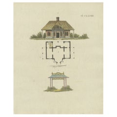
Beautiful Antique Print of Garden Architecture by Van Laar, 1802
Located in Langweer, NL
Untitled print of garden architecture. It shows a garden building. This print originates from 'Magazijn van tuin-sieraden'. The book is compile...
Category

19th Century Antique Benelux - Collectibles and Curiosities

Materials

Paper

German Antique Map of Australia and Polynesia, c.1870
Located in Langweer, NL
Antique map titled 'Inseln des Grossen Oceans, Australien und Polynesien'. Old map of Australia and Polynesia. This map originates from 'H. Kiepert's Kleiner Atlas der Neueren Geogra...
Category

19th Century Antique Benelux - Collectibles and Curiosities

Materials

Paper

Cemetery on Amsterdam Island, French Territory in the Indian Ocean, ca.1785
Located in Langweer, NL
Antique print titled 'Begraafplaats op het eiland Amsterdam'. Engraved view of a local cemetery on Amsterdam Island, a small French territory in the southern Indian Ocean. Origin...
Category

1780s Antique Benelux - Collectibles and Curiosities

Materials

Paper

Rare Sea Chart of the East Frisian Islands or Watten and the North Sea, c.1700
Located in Langweer, NL
Description: Antique map titled 'Paskaarte van de rievier de Elve streckende van Oldenbroek tot Hamburgh.' Rare and interesting chart of the East Frisian Islands (or Watten) and ...
Category

Early 1700s Antique Benelux - Collectibles and Curiosities

Materials

Paper

Detailed 18th-Century Map of Paris and Its Surrounding Regions by Johann Homann
Located in Langweer, NL
This map, titled “Agri Parisiensis Tabula particularis,” was created and published by the German cartographer Johann Baptist Homann (1664–1724), or his workshop, in Nuremberg. Homann...
Category

1720s Antique Benelux - Collectibles and Curiosities

Materials

Paper

Hand-Colored City Plan of Cologne by Nicolas de Fer, 1705
Located in Langweer, NL
Title: Hand-Colored City Plan of Cologne by Nicolas de Fer, 1705 This hand-colored map, titled "Cologne Ville Considerable Situee sur le Bord Occidentale du Rhein Capit. de l'Electo...
Category

Early 1700s Antique Benelux - Collectibles and Curiosities

Materials

Paper

1902 Murcia: A Cartographic Snapshot of Spain's Southeastern Province
Located in Langweer, NL
The map represents the province of Murcia, Spain, as it was in 1902. Here's an overview of its characteristics: - **Geography**: It displays the varied terrain of Murcia, from the c...
Category

Early 1900s Antique Benelux - Collectibles and Curiosities

Materials

Paper

Antique Map of Africa with French Cartouche and Scale, c.1780
Located in Langweer, NL
Antique map titled 'L'Afrique'. Original antique map of Africa. With beautiful title cartouche and scale. Source unknown, to be determined. Artists and Engravers: Gilles Robert de...
Category

18th Century Antique Benelux - Collectibles and Curiosities

Materials

Paper

Large Map of Russian Discoveries in Siberia, Alaska & the Bering Strait, 1784
Located in Langweer, NL
1784 Russian Discoveries in Siberia, Alaska & the Bering Strait - Gerhard Friedrich Muller "Nouvelle Carte des Decouvertes Faites par des Vaisseaux Russiens Aux Cotes Inconnues de L'Amerique Septentrionale avec Les Pais Adiacents" is a seminal map by Gerhard Friedrich Muller, showcasing Russian discoveries in Siberia, Alaska, and the Bering Strait region. Originally published in 1754, this map served as a direct counter to Guillaume de L'Isle's speculative "fantasy" map of the same area, which prominently featured the fictitious Mer de l'Ouest (Sea of the West). This edition, published in 1784 by the Imperial Academy of Sciences in St. Petersburg, reflects the substantial geographic knowledge gained through Russian explorations, particularly the voyages of Vitus Bering. It accurately depicts the northern Pacific coasts, focusing on Siberia, the Aleutian Islands, and the Alaskan coast. The hand-coloring remains vibrant, emphasizing key geographic details, and a richly decorated rococo cartouche adorns the upper right, indicating the map's origins. This map is a significant artifact, illustrating the progression of cartographic accuracy and the influence of Russian expeditions in shaping the early knowledge of the North Pacific and Arctic regions. The 1784 edition of Gerhard Friedrich Muller's map features the routes of key Russian voyages that explored the North Pacific, specifically those related to the exploration of Siberia, Alaska, and the Bering Strait. These include: 1. Vitus Bering's Voyages (1728 and 1741) - The map shows routes of Vitus Bering, a Danish explorer in the Russian Navy, who led two important expeditions: - During his first Kamchatka Expedition (1728), Bering navigated through what is now known as the Bering Strait, proving that Siberia and Alaska were separated by a sea. - His second Kamchatka Expedition (1741) extended further eastward to Alaska. This journey greatly expanded European knowledge of the northern Pacific and confirmed Alaska as part of the North American continent. 2. Aleksei Chirikov's Route (1741) - As part of the second Kamchatka Expedition, Aleksei Chirikov, who was Bering's second-in-command, led a separate ship and reached the Alaskan coast, discovering the southeastern parts of Alaska and providing further detailed knowledge of the area. 3. Russian Navigators in the Aleutian Islands - The map also shows the exploration routes in and around the Aleutian Islands, which were instrumental for Russian fur...
Category

1780s Antique Benelux - Collectibles and Curiosities

Materials

Paper

Original 1806 Engraved Map of Asia and Surrounding Regions by John Cary
Located in Langweer, NL
The map titled "A New Map of Asia, From the Latest Authorities" was published in 1806. It is a detailed and comprehensive depiction of the continent of Asia, extending from Europe and the Arabian Peninsula in the west to Japan and the Pacific Islands in the east, and from the Arctic regions in the north to parts of New Holland (Australia) and the Indian Ocean in the south. The map is finely engraved, with political boundaries delineated using color to distinguish different empires, kingdoms, and colonial possessions of the time. Key geographical features such as mountain ranges, rivers, and major cities are clearly marked. It also includes significant maritime routes and islands across the Indian and Pacific Oceans, reflecting the global trade and exploration activities of the early 19th century. Notable Features: - Asia is represented with its vast and diverse regions, including the extensive Russian Empire in the north, the Ottoman Empire in the west, the Qing Dynasty's control over China, and the Mughal Empire's influence in India, which is under increasing British control. - India is shown with its numerous princely states, many of which are under British influence or control. - Southeast Asia includes the colonial possessions of European powers, particularly the Dutch East Indies, Spanish Philippines...
Category

Early 1800s Antique Benelux - Collectibles and Curiosities

Materials

Paper

Woodcut Map of the Rhine River Region Covering the Palatinate, Austria and Elsa
Located in Langweer, NL
Early Woodcut Map of the Rhine River Region Covering the Palatinate, Austria, and Elsass, ca. 1628 This early woodcut map, titled "Die ander Tafel des Rheinstromes/begriffen die Pfa...
Category

1620s Antique Benelux - Collectibles and Curiosities

Materials

Paper

Set of 4 Mushroom Models
Located in Schellebelle, BE
Set of 4 Mushroom models, mounted on a wooden base and placed in a glass original box, from the East-European Slovakia used as display in schools,different colors good an original p...
Category

1970s Vintage Benelux - Collectibles and Curiosities

Materials

Softwood

Rare Handcolored Map of Isle de Juan Fernandes 'Robinson Crusoe Island', Chili
Located in Langweer, NL
Antique map titled 'Die Insel Iuan Fernandes in der Sudsee (..)'. This map depicts Robinson Crusoe, one of the Juan Fernández Islands. Robinson Crusoe Island, formerly known as Más a Tierra, is the second largest of the Juan Fernández Islands. From 1704 to 1709, the island was home to the marooned sailor Alexander Selkirk, who at least partially inspired novelist Daniel Defoe's fictional Robinson Crusoe in his 1719 novel, although the novel is explicitly set in the Caribbean. This was just one of several survival stories from the period of which Defoe would have been aware. To reflect the literary lore associated with the island and attract tourists, the Chilean government renamed the place Robinson Crusoe Island in 1966. This map originates from a German edition of 'Voyage around the World...
Category

Mid-18th Century Antique Benelux - Collectibles and Curiosities

Materials

Paper

Architectural French print of Pavillon du Concierge in France, Chabat, c.1900
Located in Langweer, NL
Antique print titled 'Bureau d'Architecte a Houlgate, Pavillon du Concierge a Bénéreville, Mr. Edouard Lewicki Architecte'. This print depicts the design of a building in France. Ori...
Category

20th Century Benelux - Collectibles and Curiosities

Materials

Paper

Antique Map of Australia and Polynesia, inset of Tasmania c.1860
Located in Langweer, NL
German antique map titled 'Australien und Polynesien'. Old map of Australia (New Holland) and Polynesia. With an inset map of Southern Australia including Tasmania (Van Diemen's Land...
Category

19th Century Antique Benelux - Collectibles and Curiosities

Materials

Paper

Antique Map of Denmark and Oldenburg ‘Germany’ by A. Ortelius, circa 1598
Located in Langweer, NL
Antique map titled 'Daniae Regni Typus' and 'Oldenburg Comit'. A nice example of Ortelius maps of Denmark and Oldenburg, which first appeared in the 1584 edition of his Theatrum Orbi...
Category

16th Century Antique Benelux - Collectibles and Curiosities

Materials

Paper

Antique Map of Germany from a 17th Century Pocket Atlas, 1685
Located in Langweer, NL
Antique map titled 'Nova Totius Germaniae descriptio.' Miniature map of Germany, from the pocket atlas 'Introductionis in Universam Geographiam tam Veterem...
Category

17th Century Antique Benelux - Collectibles and Curiosities

Materials

Paper

Old Map the United States and Central America, Including Mexico, ca.1860
Located in Langweer, NL
Antique map titled 'Vereinigte Staaten von Nord America und Mexico'. Old map the United States and Central America, including Mexico. This print originates from 'Stieler's Schul-...
Category

1860s Antique Benelux - Collectibles and Curiosities

Materials

Paper

Antique Black Forest Carved Walnut Tobacco or Cigar Box Humidor Great Poodle Dog
Located in Lisse, NL
Late 19th century, sizeable Swiss black forest table piece. This finely carved Black Forest table piece brings a smile to everybody's face. This wonderful piece of craftsmanship fro...
Category

Late 19th Century Swiss Antique Benelux - Collectibles and Curiosities

Materials

Wood

Antique Religion Print of Six Roman Catholic Habits, Rituals, Ceremonies, 1723
Located in Langweer, NL
Antique religion print depicting six Roman Catholic habits, rituals and ceremonies. Procession with holy oil, benediction of same, the Bishop's hand...
Category

1720s Antique Benelux - Collectibles and Curiosities

Materials

Paper

Original 1882 Map of Arabia, Red Sea & Persian Gulf
Located in Langweer, NL
This print is a historically significant map titled "Arabia, the Red Sea, and the Persian Gulf," originally published in 1882 as part of the 'Comprehensive Atlas and Geography of the...
Category

1880s Antique Benelux - Collectibles and Curiosities

Materials

Paper

Old Hand-Colored Print of the Guards of the King of France, 1890
Located in Langweer, NL
Antique print titled 'Gardes-du-Crops du Roi'. Old print of the Guards of the King of France. This print originates from 'Histoire de la maison militaire du roi de 1814 à 1830 : ...
Category

1890s Antique Benelux - Collectibles and Curiosities

Materials

Paper

Original Copper Engraving Depicting Dutch Merchants visting China, ca.1700
Located in Langweer, NL
Title: 'The departure of the Empirour Hockflieuw to the Emprial Court at Peking' with further description in Dutch. The Dutch man Pieter van Hoorn, his son...
Category

Early 1700s Antique Benelux - Collectibles and Curiosities

Materials

Paper

Antique Chart of the US Consumption Deaths, '1874'
Located in Langweer, NL
Antique chart titled 'Map showing the proportion of deaths from consumption to deaths from all causes. Compiled from the returns of mortality at the nint...
Category

Late 19th Century Antique Benelux - Collectibles and Curiosities

Materials

Paper

Antique Chart of the US Enteric, Cerebro-Spinal, Typhus Deaths, '1874'
Located in Langweer, NL
Antique chart titled 'Map showing the proportion of deaths from enteric, cerebro-spinal and typhus fevers to deaths from all causes. Compiled from the returns of mortality at the nin...
Category

Late 19th Century Antique Benelux - Collectibles and Curiosities

Materials

Paper

Antique Religious Print 'No. 28' The Bronze Serpent, circa 1840
Located in Langweer, NL
Antique print titled ‘Histoire Sainte, Ancien Testament, Le Serpent d'Airain.’ This plate shows a scene from the Old Testament; The Bronze Serpent.’ This...
Category

Mid-19th Century Antique Benelux - Collectibles and Curiosities

Materials

Paper

Read More

Medal-Worthy Memorabilia from Epic Past Olympic Games

Get into the games! These items celebrate the events, athletes, host countries and sporting spirit.

Ahoy! You’ve Never Seen a Collection of Sailor Art and Kitsch Quite Like This

French trendsetter and serial collector Daniel Rozensztroch tells us about his obsession with objects related to seafaring men.

Pamela Shamshiri Shares the Secrets behind Her First-Ever Book and Its Effortlessly Cool Interiors

The sought-after designer worked with the team at Hoffman Creative to produce a monograph that beautifully showcases some of Studio Shamshiri's most inspiring projects.

Moroccan Artworks and Objects Take Center Stage in an Extraordinary Villa in Tangier

Italian writer and collector Umberto Pasti opens the doors to his remarkable cave of wonders in North Africa.

Montecito Has Drawn Royalty and Celebrities, and These Homes Are Proof of Its Allure

Hollywood A-listers, ex-pat aristocrats and art collectors and style setters of all stripes appreciate the allure of the coastal California hamlet — much on our minds after recent winter floods.

Whaam! Blam! Pow! — a New Book on Pop Art Packs a Punch

Publishing house Assouline and writer Julie Belcove have teamed up to trace the history of the genre, from Roy Lichtenstein, Andy Warhol and Yayoi Kusama to Mickalene Thomas and Jeff Koons.

The Sparkling Legacy of Tiffany & Co. Explained, One Jewel at a Time

A gorgeous new book celebrates — and memorializes — the iconic jeweler’s rich heritage.

What Makes a Gem-Encrusted Chess Set Worth $4 Million?

The world’s most opulent chess set, weighing in at 513 carats, is literally fit for a king and queen.

Recently Viewed

View All