Benelux - Collectibles and Curiosities

to
4,852
6,737
15,004
11,555
6,684
39
14
124
31
30
27
27
18
17
14
13
11
6
6
4
4
3
2
2
3,199
2,553
932
53
382
202
74
83
19
10
17
7
32
41
29
14
7
5,719
524
354
109
98
1,116
270
252
114
88
6,737
6,736
6,736
104
59
20
14
14
Item Ships From: Benelux
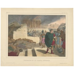
Antique Religious Print "No. 48" Jerusalem and the Destroyed Temple, circa 1840
Located in Langweer, NL
Antique print titled ‘Histoire Sainte, Nouveau Testament, Jérusalem et le Temple Détruits.’ This plate shows a scene from the New Testament; Jerusalem and the destroyed Temple.’ T...
Category

Mid-19th Century Antique Benelux - Collectibles and Curiosities

Materials

Paper

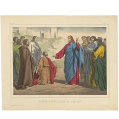
Antique Religious Print ‘No. 23’ Peter Appointed Head of the Church, circa 1840
Located in Langweer, NL
Antique print titled ‘Histoire Sainte, Nouveau Testament, Pierre établi Ched de l'Église.’ This plate shows a scene from the New Testament; Peter appointed Head of the Church.’ Th...
Category

Mid-19th Century Antique Benelux - Collectibles and Curiosities

Materials

Paper

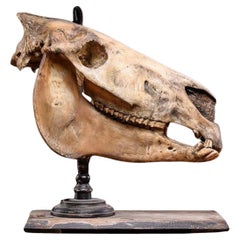
Didactic Horseskull, before 1947.
Located in Leuven , BE
The horse skull has been opened up on one side showing the inplant of the teeth below the gum line and the inside of the cranium.
Category

20th Century European Benelux - Collectibles and Curiosities

Materials

Bone, Organic Material, Wood

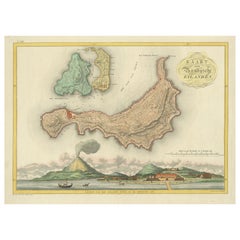
Colonial Cartography: The Banda Islands - the Epicenter of the Spice Trade, 1818
Located in Langweer, NL
Antique map titled 'Kaart der Bandasche Eilanden' with a view titled 'Gezigt van het Eiland Neira en de Goening Api'. Rare and attractive map of the Banda Islands with a large view of Banda Neira and Gunung Api. One of 12 maps from ‘Atlas van Overzeesche bezittingen’ (Atlas of Oversea Possessions) by J.S. van den Bosch. J.S. van den Bosch (1780 – 1844), Major General, Knight of the 3rd Class of the Military William Order. It is a rare and visually appealing representation of the Banda Islands, a group of ten small volcanic islands in the Banda Sea, part of present-day Indonesia. The map is one of twelve from the “Atlas van Overzeesche bezittingen” (Atlas of Overseas Possessions) by J.S. van den Bosch, who was a Major General and a Knight of the Military William Order. Johannes van den Bosch, who lived from 1780 to 1844, had a significant military and administrative career, including serving as Governor-General of the Dutch East Indies. His works and collections are reflective of the Dutch colonial interest and administration in the region. The Banda Islands, depicted in this map, are particularly famous for being the sole source of nutmeg and mace before the mid-19th century. Nutmeg was highly valued in European cuisine, as a preservative, and as a medicine. The monopoly on these spices made the Banda Islands extremely important during the age of spice trade, which also led to intense colonial competition and conflict, notably between the Dutch and the British. The map itself provides a detailed topographical representation of the Banda Islands, possibly with depth soundings and navigational hazards indicated, which would have been essential information for the ships of the Dutch East India Company and other seafarers. The large view of Banda Neira and Gunung Api (literally "Fire Mountain...
Category

Early 19th Century Antique Benelux - Collectibles and Curiosities

Materials

Paper

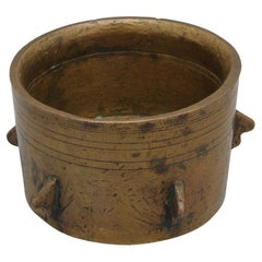
Spanish Moorish Gothic Mortar 15th century
Located in DELFT, NL
Spanish - Moorish Gothic bronze mortar and with ribs, most likely from Andalusia. Of conical shape, resting on a circular base, the exterior decorated with a series of wing-shaped pr...
Category

15th Century and Earlier Spanish Gothic Antique Benelux - Collectibles and Curiosities

Materials

Bronze

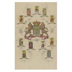
Coat of Arms of the Netherlands, Including Coats of Arms of the Provinces, 1864
Located in Langweer, NL
Antique print titled 'Je Mantiendrai'. Coat of arms of the Netherlands, also includes coats of arms of the individual Dutch provinces. This print origi...
Category

1860s Antique Benelux - Collectibles and Curiosities

Materials

Paper

Mir Space Station USSR CCCP Original Scale Model; Soviet Scene
Located in Mortsel, BE
Presenting an extraordinary piece of aerospace history - the original Mir prototype scale model from Russia. This remarkable artifact has been in our possession for the past 30 years, cherished as a prized collectible. Acquired from the individual who first imported it from Russia, it stands as a testament to the ingenuity and engineering prowess of space exploration. This scale model is truly one-of-a-kind, bearing witness to the pioneering spirit that led to the construction of the iconic Mir space...
Category

1980s Russian Vintage Benelux - Collectibles and Curiosities

Materials

Metal

Antique Print of the Hindu God Vishnu Incarnated as Krishna, 1672
Located in Langweer, NL
This original antique print shows the Hindu god Vishnu incarnated as Krishna. Dutch text on verso. From: 'Naauwkeurige Beschryvinge van Malabar en Choromande...
Category

1670s Antique Benelux - Collectibles and Curiosities

Materials

Paper

Antique Church Angel Candle Holders with Brass Chandeliers – 19th Century
Located in Mortsel, BE
These stunning antique church candle holders, dating back to the 19th century, are captivating examples of religious artistry and craftsm...
Category

Mid-19th Century European Antique Benelux - Collectibles and Curiosities

Materials

Brass

1802 Map of Australasia and the South Pacific - European Exploration Routes
Located in Langweer, NL
1802 Johann Walch Map of Australasia and the South Pacific - European Exploration Routes This 1802 map by Johann Walch provides a highly detailed view of Australasia and the South P...
Category

Early 1800s Antique Benelux - Collectibles and Curiosities

Materials

Paper

1667 Melchior Tavernier Map of the Patriarchate of Constantinople – Black Sea, G
Located in Langweer, NL
This 1667 map titled "Patriarchatus Constantinopolitani Geographica Descriptio" was crafted by renowned French cartographer Melchior Tavernier, who was a prominent map engraver during the 17th century. This rare and historically significant map focuses on the territories under the ecclesiastical jurisdiction of the Patriarchate of Constantinople, one of the most important centers of the Eastern Orthodox Church. It covers regions around the Black Sea (Pontus Euxinus), parts of Greece, and adjacent areas in Asia Minor and the Balkans, which were historically vital during the Byzantine and Ottoman Empires. The map is filled with ancient place names, making it a valuable resource for both historical and cartographic enthusiasts. Key Features: - Antique ecclesiastical map illustrating the influence of the Orthodox Patriarchate of Constantinople in the 17th century. - Features beautifully detailed ancient coastlines, rivers, and terrains, providing a comprehensive geographical view of the region. - Rich with historic place names - like Byzantium, Nicomedia, Nicaea, Cyzicus, Bithynia, Pontus, Macedonia, and Thrace - that date back to the classical era, offering insights into the ancient geography of the eastern Mediterranean. - A finely engraved strapwork cartouche in the lower right corner with Baroque-style decoration, featuring two putti (cherubic figures) – a hallmark of 17th-century map art. - The map extends to include the Mediterranean Sea (Mare Mediterraneum) to the south and the Black Sea to the north, highlighting its ecclesiastical and geopolitical significance. - Original hand coloring may still be present, enhancing the decorative appeal for collectors of antique maps. This rare map offers a unique perspective on the religious influence and historical geography of the Eastern Mediterranean during the late 17th century. It would appeal to collectors interested in: - **Byzantine history** - **Ottoman Empire** - **Eastern Orthodox Church** - **Antique cartography...
Category

1660s Antique Benelux - Collectibles and Curiosities

Materials

Paper

Map of Cape Verde and the Mouth of the River Niger by Coronelli, 1691
Located in Langweer, NL
Map of Cape Verde and the Mouth of the River Niger by Coronelli, 1691 This finely engraved map, titled "Bocche del Fiume Negro et Isole di Capo Verde," was created in 1691 by Vincen...
Category

Late 17th Century Antique Benelux - Collectibles and Curiosities

Materials

Paper

Mid-Century Desk Model of the 'Atomium' Building
Located in London, GB
A small desk top model of the Atomium building in Brussels. Marble base, metal model. Belgium, c1960s. Some small nicks and scuffs, wear commensurate with age. Location: London G...
Category

1960s Belgian Vintage Benelux - Collectibles and Curiosities

Materials

Marble, Metal

Large Gothic Revival Wrought Iron Chandelier for Dining Room / Restaurant Etc
Located in Lisse, NL
Great quality workmanship, forged in fire Gothic Art candle chandelier or pendant light. This beautiful quality and all hand forged chandelier comes with clearly visible, Gothic qua...
Category

Early 20th Century Dutch Gothic Revival Benelux - Collectibles and Curiosities

Materials

Wrought Iron

Antique Map of France at the Beginning of the 17th Century by Zannoni, 1765
By G. A. Rizzi-zannoni
Located in Langweer, NL
Antique map France titled 'Carte pour servir à intelligence de l'Histoire de France (..)'. Beautiful old map of France. This map originates from 'At...
Category

18th Century Antique Benelux - Collectibles and Curiosities

Materials

Paper

Colored wall map of the WORLD
By Chambon
Located in ZWIJNDRECHT, NL
“Mappe Monde, contenant les Parties Connues du Globe Terrestre” CHAMBON, Gobert-Denis (France, 17.. - 1781) Paris, Longchamps et Janvier, 1754 Size H. 115 x W. 145 cm. Gobert-Denis Chambon made copper engraving after the work of Guillaume De L’Isle, published in 1754 by Jean Janvier and S.G. Longschamps. A huge wall map of the world in two hemispheres printed on two sheets, depicting the Eastern and Western hemispheres supported by two male figures, decorated at the bottom right and left with two celestial hemispheres (boreal and southern) and at the bottom in the middle with an armillary sphere, in addition. This map is most notable for its depiction of the Sea of Japan labeled "Mer de Corée" and of "Mer de L'Ouest" or Sea of the West - a great sea, easily the size of the Mediterranean, to flow from the then-known Strait of Juan de Fuca...
Category

Mid-18th Century French French Provincial Antique Benelux - Collectibles and Curiosities

Materials

Wood, Paper

Colored wall map of the WORLD
$28,354 Sale Price
20% Off
Early 19th Century Polychrome Sculpture of the Immaculate Virgin - Germany
Located in Casteren, Noord-Brabant
This finely carved and polychrome-painted wooden sculpture depicts the Immaculate Virgin Mary in a classic pose, standing atop the globe with a serpent beneath her feet — a powerful ...
Category

1820s German Baroque Antique Benelux - Collectibles and Curiosities

Materials

Plaster, Pine

Annette Himstedt Doll Kima 1993/1994
Located in Delft, NL
Annette Himstedt doll "Kima" 1993/1994, Germany "Kima" a vinyl doll made by Annette Himstedt, produced during 1993/1994. Kima in a beautiful lace dres...
Category

20th Century German Benelux - Collectibles and Curiosities

Materials

Fabric, Plastic

Southwestern U.S. Immigration Map for Texas, Arkansas, and Louisiana, 1881
Located in Langweer, NL
Southwestern U.S. Immigration Map - Published by The Southwestern Immigration Company, Austin, Texas. Detailed Railroad Routes and Regional Statistics for Texas, Arkansas, and Louisi...
Category

1880s Antique Benelux - Collectibles and Curiosities

Materials

Paper

Antique Religion Print of the Seven Sacraments, Penance '1913'
Located in Langweer, NL
Large antique print of the seven sacraments. Published by Mosella-Verlag, 1913. This print originates from a series titled 'Kathol. Schulbibelwerk von Dr. Ecker'.
Category

Early 20th Century Benelux - Collectibles and Curiosities

Materials

Paper

Map of Kingdoms of Castile, León, Galicia, Asturias, Biscay and Navarre in Spain
Located in Langweer, NL
Antique map titled 'Partie Septentrionale de la Couronne de Castille (..)'. Decorative and highly detailed map of Northwestern Spain, including Gallicia...
Category

Mid-18th Century Antique Benelux - Collectibles and Curiosities

Materials

Paper

Antique Pair of Brass & Bronze Gothic Wall Picture Frames with Saint Sculptures
Located in Lisse, NL
For the collectors of rare and ready to use Gothic antiques. These beautiful and all handcrafted Gothic Revival picture frames with Biblical texts in Latin are an absolute joy to ow...
Category

Early 20th Century European Gothic Revival Benelux - Collectibles and Curiosities

Materials

Brass, Bronze

László Jurcsák for Hollohaza Large Porcelain Vase
Located in Delft, NL
László Jurcsák for hollohaza large porcelain vase, Hungary 1982-1992 A Hungarian porcelain vase of 24 cm high. White porcelain with black pain...
Category

20th Century Hungarian Benelux - Collectibles and Curiosities

Materials

Porcelain

Historical Map of Canaan with Insets of Jerusalem and Surrounding Regions, 1880
Located in Langweer, NL
The map titled "CANAAN" depicts the historical region known as Canaan, located in the Levant, which corresponds to modern-day Israel, Palestinian territories, Lebanon, and parts of S...
Category

1880s Antique Benelux - Collectibles and Curiosities

Materials

Paper

Antique Map of the Empire of Morocco by Kitchin, c.1760
By Thomas Kitchin
Located in Langweer, NL
Antique map titled 'A Map of the Empire of Morocco Comprehending the Kingdoms of Fez, Morocco'. Original antique map of the kingdoms of Fez, Algiers, Segelmese, Tafilet and Morocco. ...
Category

18th Century Antique Benelux - Collectibles and Curiosities

Materials

Paper

Biblical Journeys: Apostle Paul's Voyages and the Israelites' Exodus, 1856
Located in Langweer, NL
Two maps in matting board. From the Pictorial Bible Atlas, published in 1856. Title for Map 1: Voyages and Travels of Apostle Paul – Illustrated Antique...
Category

1850s Antique Benelux - Collectibles and Curiosities

Materials

Paper

18th-Century Map of the Eastern Roman Empire by Henri Chatelain, c. 1719
Located in Langweer, NL
Title: 18th-Century Map of the Eastern Roman Empire by Henri Chatelain, c. 1719 Description: This intricately detailed map, titled *Nouvelle Carte pour Servir à l'Histoire de l'Empi...
Category

1710s Antique Benelux - Collectibles and Curiosities

Materials

Paper

Pair of Kneeling Angel Candle Holders with Chandeliers - 19th Century
Located in Mortsel, BE
This exceptional pair of kneeling angel candle holders, crafted in the 19th century, are truly rare and unique pieces. Sourcing such highly detailed religious sculptures is incredibl...
Category

Mid-19th Century European Antique Benelux - Collectibles and Curiosities

Materials

Brass

19th Century Brass and Gold Watch-Key
Located in Delft, NL
19th Century Brass and Gold Watch-Key 19th century brass and gold Watch-Key hanging on a small chain The measurement is 6 cm high in total and the key is 2,5 cm wide The weight is...
Category

Early 19th Century Dutch Antique Benelux - Collectibles and Curiosities

Materials

Gold, Brass

Pop Art Exhibition Catalogue 1964 Stockholm Museum of Modern Art
By (after) Roy Lichtenstein
Located in Waddinxveen, ZH
Unique catalogue of an exhibition in the Moderna Museet in Stockholm in 1964. Amazing cover with the iconic artwork of Roy Lichtenstein. 106 works of: Jim Dine, Roy Lichtenstein, Ro...
Category

1960s Swedish Mid-Century Modern Vintage Benelux - Collectibles and Curiosities

Materials

Paper

Circa 1691 Frederick de Wit Map: Middle East with Arabia, Persia & More
Located in Langweer, NL
Circa 1691 Frederick de Wit Map: Middle East with Arabia, Persia & More This exquisite hand-colored map, circa 1691, by Frederick de Wit, illustrates the Middle East, spanning from Turkey and Egypt to Afghanistan, with a detailed representation of the Arabian Peninsula. The map's detailing in Arabia is based on Nicolas Sanson's influential 1654 map, which was one of the most accurate and detailed depictions of the region up to the mid-seventeenth century. The decorative title cartouche is richly adorned with images of exotic figures, animals, and a merchant ship, symbolizing the region's historical trade importance. Additionally, a mapmaker is shown working with traditional tools, adding a touch of authenticity to the cartographic art. This is the fourth state of the map, published between 1691 and 1696. The map measures 21.8 inches in width by 18.5 inches in height, featuring a sharp impression, with minimal staining and a carefully repaired centerfold separation at the bottom. Keywords: - Middle East historical map - Frederick de Wit map - 17th century maps - Arabian Peninsula map - Persia (Iran) map - Turkey and Egypt map...
Category

1690s Antique Benelux - Collectibles and Curiosities

Materials

Paper

Antique Crucifix w. Bronze Corpus and Stunning Hand Carved Oakwood Cross
Located in Lisse, NL
Good size, finest quality and superb condition antique wall crucifix. This antique work of religious art consists of a top quality carved, oakwooden cross and a superbly hand-crafted bronze corpus of Christ with a beautiful patina. The rare wooden cross comes with superbly hand carved 'fleur de lis' symbols on all ends which makes us believe that this ecclesiastical antique in the Renaissance Style originates from France. This bronze sculpture of Christ clearly depicts Jesus just shortly after the suffering has ended and His body could no longer hold on to life. People think of different things when looking at Christ who died on the cross, but no matter what you think of most, this antique crucifix...
Category

Late 19th Century French Renaissance Revival Antique Benelux - Collectibles and Curiosities

Materials

Bronze

Christ On The Cold Stone, Carved Wooden Panel, 17th Century
Located in Bilzen, BE
A large panel carved in deep relief depicting Christ on cold stone. This panel was probably part of a tabernacle. 17th century. Panel height 57 cm, width 40 cm, thickness 5 cm.
Category

17th Century German Baroque Antique Benelux - Collectibles and Curiosities

Materials

Wood

Antique Map of Scandinavia: Norway, Sweden and Denmark
Located in Langweer, NL
Antique map titled 'Suède, Norwège & Danemark'. Attractive map of Scandinavia, with Sweden, Norway and Denmark. With an inset map of Iceland and th...
Category

Mid-19th Century Antique Benelux - Collectibles and Curiosities

Materials

Paper

An extremely rare antique taxidermy Giant Anteater (Myrmecophaga tridactyla)
Located in Amsterdam, NL
An extremely rare antique taxidermy Giant Anteater (Myrmecophaga tridactyla) 1st half 20th century The marvellous creature in very good condition and o...
Category

Early 20th Century Dutch Benelux - Collectibles and Curiosities

Materials

Animal Skin

1864 Johnson's Map of the West Indies and Bermuda
Located in Langweer, NL
Title: 1864 Johnson's Map of the West Indies and Bermuda Description: This is an 1864 map titled "Johnson's West Indies," published by Johnson and Ward. The map provides a detailed ...
Category

1860s Antique Benelux - Collectibles and Curiosities

Materials

Paper

French 19th century Beauvais tobacco stoneware
Located in Delft, NL
French 19th century Beauvais tobacco stoneware A collection of six stoneware pots, early 19th Century, raised decoration with salt glaze finish and pewter (hinged) lids. Three toba...
Category

Early 19th Century French Antique Benelux - Collectibles and Curiosities

Materials

Pottery

Antique Map of the Antilles in the Caribbean, '1875'
Located in Langweer, NL
Antique map titled 'Carte des Iles Antilles'. Large map of the Antilles. This map originates from 'Atlas de Géographie Moderne Physique et Politique' by A. Levasseur. Published, 1875.
Category

Late 19th Century Antique Benelux - Collectibles and Curiosities

Materials

Paper

Stunning Art Deco Bronze Religious Plaque of Christ on Crucifix by Sylvain Norga
By Sylvain Norga
Located in Lisse, NL
Perfectly stylized work of religious art by S. Norga. This practical size and very good condition bronze plaque depicts Christ on the cross with Mary and Saint John mourning on eith...
Category

1910s Belgian Art Deco Vintage Benelux - Collectibles and Curiosities

Materials

Bronze

Filigree Miniature Furniture for a Doll's House
Located in Delft, NL
A filigree miniature furniture for a doll's house A filigree furniture for a doll's house with a piano wing and piano chair, a table with 4 chair...
Category

19th Century European Antique Benelux - Collectibles and Curiosities

Materials

Silver

Original 17th-Century Antique Map of Nanjing Province, China – by Blaeu
Located in Langweer, NL
Title: 17th-Century Antique Map of Nanjing Province, China – "Nanking sive Kiangnan" by Blaeu, with Decorative Details Description: This captivating 17th-century map of Nanjing Pr...
Category

1650s Antique Benelux - Collectibles and Curiosities

Materials

Paper

1876 Map of the United States: Detailing the Railroads and Unsettled Territories
Located in Langweer, NL
Stanford’s Smaller Railway Map of the United States, 1876 This original 1876 map, titled "Stanford's Smaller Railway Map of the United States Distinguishing the Unsettled Territorie...
Category

1870s Antique Benelux - Collectibles and Curiosities

Materials

Paper

Antique Map of the Eastern Hemisphere by Valk & Chenk '1708'
Located in Langweer, NL
Antique map titled 'Hemispherium Orbis Antiqui, Cumzonis Circulis, Et Sity populorum Diverso'. Decorative example of Andreas Cellarius's map of the Eastern Hemisphere, illustrating with climatic zones ranging from Frigida Borealis to Torrida, with planetary details superimposed. The elaborate border includes fine scrollwork, numerous putti, and additional diagrams showing armillary spheres and climatic zones. Andreas Cellarius was born in 1596 in Neuhausen and educated in Heidelberg. He emigrated to Holland in the early 17th century and 1637 moved to Hoorn, where he became the rector of the Latin School. Cellarius' best known work is his Harmonia Macrocosmica, first issued in 1660 by Jan Jansson, as a supplement to Jansson's Atlas Novus. The work consists of a series of Celestial Charts...
Category

Early 18th Century Dutch Antique Benelux - Collectibles and Curiosities

Materials

Paper

Marvelous High-Quality Taxidermy Red Patas or Hussar Monkey
Located in Amsterdam, NL
A taxidermy red patas or hussar monkey (Erythrocebus patas) Mid 20th century, including CITES H. approx. 40 cm Provenance: Private collection, the Netherlands The patas monkey lives in multi-female groups...
Category

Mid-20th Century Dutch Benelux - Collectibles and Curiosities

Materials

Animal Skin

Rare Victorian Firescreen with Taxidermy Hummingbirds by Henry Ward
By Henry Ward
Located in Amsterdam, NL
England, third quarter of the 19th century On two scrolling foliate feet with casters, above which a rectangular two-side glazed frame, with on top a two-sided shield with initial...
Category

Mid-19th Century English High Victorian Antique Benelux - Collectibles and Curiosities

Materials

Other

1882 Detailed Map of South America showing Political and Geographical Features
Located in Langweer, NL
This 1882 map of South America, published by Blackie and Son as part of the 'Comprehensive Atlas and Geography of the World,' showcases the continent in remarkable detail. It provide...
Category

1880s Antique Benelux - Collectibles and Curiosities

Materials

Paper

Set of Vintage Snowshoes, 1943
Located in Eindhoven, NL
Vintage pair of snow shoes. Manufatured in 1943 by Snowcraft Inc. in Norway, Maine, US.  
Category

1940s Vintage Benelux - Collectibles and Curiosities

Materials

Leather, Hardwood

Bird’s-Eye View of Basel from Braun & Hogenberg’s Civitates Orbis Terrarum, 1575
Located in Langweer, NL
Bird’s-Eye View of Basel from Braun & Hogenberg’s "Civitates Orbis Terrarum" (Circa 1572-1617) This highly detailed map of Basel is a bird's-eye view, originally based on Sebastian Münster’s map...
Category

16th Century Antique Benelux - Collectibles and Curiosities

Materials

Paper

Pair of Victorian Cabinets with Taxidermy Quetzal by Henry Ward
By Henry Ward
Located in Amsterdam, NL
A pair of extremely rare Victorian display cabinets with taxidermy resplendent quetzal (PHAROMACHRUS MOCINNO), cotinga and hummingbirds, attribute...
Category

Early 19th Century English High Victorian Antique Benelux - Collectibles and Curiosities

Materials

Other

Gipuzkoa 1902: A Cartographic Snapshot of the Basque Coastline and Highlands
Located in Langweer, NL
The map showcases the province of Gipuzkoa (also known as Guipúzcoa in Spanish), which is part of the autonomous community of the Basque Country in northern Spain, as of the year 190...
Category

Early 1900s Antique Benelux - Collectibles and Curiosities

Materials

Paper

Old Map of the Spice Islands, Moluccas by Bellin, Published in 1771
Located in Langweer, NL
Title: 1771 Jacques-Nicolas Bellin Map of the Moluccas, the Spice Islands of Indonesia Description: This finely engraved eighteenth-century map, titled Carte Particulière des Is...
Category

1770s Antique Benelux - Collectibles and Curiosities

Materials

Paper

Antique Pike in a Display Case
Located in Delft, NL
An antique pike in a display case A taxidermy pike on a sandy black surface. In a beautifully finished display cabinet. The pike measures 68 cm and...
Category

19th Century Dutch Antique Benelux - Collectibles and Curiosities

Materials

Wood

1690 Frederick de Wit Sea Chart of Hudson Bay, Baffin Bay and Greenland
Located in Langweer, NL
Title: c. 1690 Frederick de Wit Sea Chart of Hudson Bay, Baffin Bay, and Greenland - Engraved by Romeyn de Hooghe This striking sea chart by Frederick de Wit, titled "Septemtrionali...
Category

1690s Antique Benelux - Collectibles and Curiosities

Materials

Paper

Navigational Chart of Jamaica, Cape Gracias a Dios, and the Mosquito Coast, 1775
Located in Langweer, NL
The map titled "The Island of Jamaica and Cape Gracias a Dios with the Banks (Shows Moskito Kings Party)" illustrates a significant historical period marked by shifting colonial infl...
Category

1770s Antique Benelux - Collectibles and Curiosities

Materials

Paper

Rare Print of The Factories in Guangzhou, China, 1835
Located in Langweer, NL
Antique print titled 'Factoreries a Canton'. This print (on india paper) depicts factories in Guangzhou, China. Originates from 'Voyage Autour du Monde par les Mers...
Category

1830s Antique Benelux - Collectibles and Curiosities

Materials

Paper

Antique Print of the Notre-Dame de Paris Cathedral in Paris, France, 1835
Located in Langweer, NL
Antique print titled 'Front of the Cathedral of Notre Dame'. Old print of the Notre-Dame de Paris Cathedral, France. This print originates from 'One Hundred and Fifty Wood Cuts selec...
Category

19th Century Antique Benelux - Collectibles and Curiosities

Materials

Paper

Steiff wool miniature Toy Raven Crow, Germany 1938-43
By Steiff
Located in Delft, NL
Steiff wool miniature Toy Raven Crow, Germany 1938-43 This Raven Crow bird made of wool and felt fabric with iron feet was made in Germany by Steiff in the ...
Category

20th Century German Benelux - Collectibles and Curiosities

Materials

Fabric

Gorgeous Antique World Map by the Dutch Mapmaker Visscher, published circa 1679
Located in Langweer, NL
Antique map titled 'Novissima Totius Terrarum Orbis Tabula, Auctore Nicolao Visscher'. Gorgeous example of Nicholas Visscher's World map, which appeared...
Category

Late 17th Century Dutch Antique Benelux - Collectibles and Curiosities

Materials

Paper

Antique Map of the British Isles with Contemporary Hand Coloring
Located in Langweer, NL
Antique map titled 'Les Isles Britanniques'. Original antique map of the British Isles, with original/contemporary hand coloring. Published by Crepe, circa 1767.
Category

Late 18th Century Antique Benelux - Collectibles and Curiosities

Materials

Paper

Composition of a Plaster Skull Decorated with Butterflies
Located in Leuven , BE
A modern approach to taxidermy with this plastered skull covered with shells of green beetles. The helmet-like covering is made from the Blue Morpho butterfly, and they are known to ...
Category

21st Century and Contemporary Belgian Benelux - Collectibles and Curiosities

Materials

Organic Material, Plaster

Read More

Medal-Worthy Memorabilia from Epic Past Olympic Games

Get into the games! These items celebrate the events, athletes, host countries and sporting spirit.

Ahoy! You’ve Never Seen a Collection of Sailor Art and Kitsch Quite Like This

French trendsetter and serial collector Daniel Rozensztroch tells us about his obsession with objects related to seafaring men.

Pamela Shamshiri Shares the Secrets behind Her First-Ever Book and Its Effortlessly Cool Interiors

The sought-after designer worked with the team at Hoffman Creative to produce a monograph that beautifully showcases some of Studio Shamshiri's most inspiring projects.

Moroccan Artworks and Objects Take Center Stage in an Extraordinary Villa in Tangier

Italian writer and collector Umberto Pasti opens the doors to his remarkable cave of wonders in North Africa.

Montecito Has Drawn Royalty and Celebrities, and These Homes Are Proof of Its Allure

Hollywood A-listers, ex-pat aristocrats and art collectors and style setters of all stripes appreciate the allure of the coastal California hamlet — much on our minds after recent winter floods.

Whaam! Blam! Pow! — a New Book on Pop Art Packs a Punch

Publishing house Assouline and writer Julie Belcove have teamed up to trace the history of the genre, from Roy Lichtenstein, Andy Warhol and Yayoi Kusama to Mickalene Thomas and Jeff Koons.

The Sparkling Legacy of Tiffany & Co. Explained, One Jewel at a Time

A gorgeous new book celebrates — and memorializes — the iconic jeweler’s rich heritage.

What Makes a Gem-Encrusted Chess Set Worth $4 Million?

The world’s most opulent chess set, weighing in at 513 carats, is literally fit for a king and queen.
Recently Viewed

View All