Benelux Maps
to
4,198
5,136
5,521
197
5,135
1
1
2,839
1,984
312
1
180
8
68
3
3
3
1
2
5,126
10
8
2
2
441
178
93
79
51
5,136
5,136
5,136
104
58
20
14
13
Item Ships From: Benelux
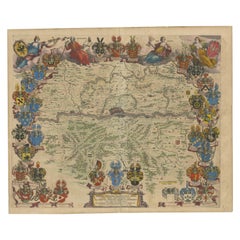
1663 Blaeu's Engraved Map of Frankfurt with Decorative Coats of Arms
Located in Langweer, NL
This map, titled "Novam Hanc Territorii Francofurtensis Tabulam," is an exquisite hand-colored engraved map from around 1663, created by the renowned cartographers J. and C. Blaeu of...
Category
1660s Antique Benelux Maps
Materials
Paper
$941 Sale Price
20% Off
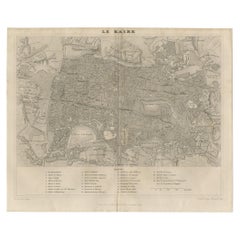
Antique Map of Cairo and Surroundings by Balbi '1847'
Located in Langweer, NL
Antique map titled 'Le Kaire'. Original antique map of Cairo and surroundings, Egypt. This map originates from 'Abrégé de Géographie (..)' by Adrien Balbi. Published 1847.
Category
Mid-19th Century Antique Benelux Maps
Materials
Paper
$142 Sale Price
20% Off
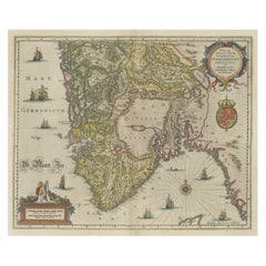
Old Map of The Southern Part of Norway, Covering the Region Around Bergen, c1650
Located in Langweer, NL
Antique map titled 'Nova et Accurata Tabula Episcopatuum Stavangriensis et Asloiensis'.
Old map of the southern part of Norway, it covers the region around Bergen. Decorated with...
Category
1650s Antique Benelux Maps
Materials
Paper
$780 Sale Price
20% Off
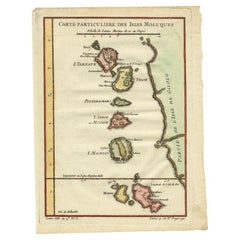
Antique Map of the Maluku Islands by Bellin, c.1750
By Jacques-Nicolas Bellin
Located in Langweer, NL
Antique map titled 'Carte Particuliere des Isles Moluques'. This map depicts the islands of Herij, Ternate, Tidor, Pottebackers, Timor, Machian and Bachian. The Moluccan islands were...
Category
18th Century Antique Benelux Maps
Materials
Paper
$118 Sale Price
20% Off
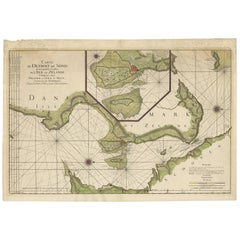
Antique Map: Carte du Détroit du Sond with Copenhagen Inset, 1693
Located in Langweer, NL
Antique Map: Carte du Détroit du Sond with Copenhagen Inset, Jaillot/Mortier, 1693
This rare and striking antique map, titled *Carte du détroit du Sond contenant les costes de l’Is...
Category
Late 17th Century Antique Benelux Maps
Materials
Paper
$2,140 Sale Price
20% Off
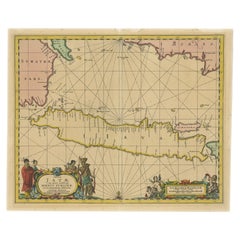
Antique Map of Java in The Dutch East Indies, Now Indonesia, c.1690
Located in Langweer, NL
Antique map titled 'Insulae Iavae cum parte insularum Boreno Sumatrae (..)'.
Beautiful map of the Island of Java and part of Borneo, Bali, Madura and Sumatra. Artists and Engrave...
Category
17th Century Antique Benelux Maps
Materials
Paper
$2,616 Sale Price
20% Off
Decorative Print of Costumes of Hungary, England, Germany Holland Etc., C.1875
Located in Langweer, NL
Antique costume print including many different costumes including costumes of Hungary, Holland and others. This print originates from 'Blätter für Kostümkunde. Historische und Volks-...
Category
1870s Antique Benelux Maps
Materials
Paper
$209 Sale Price
20% Off
Antique Map of the Tunquin River and Bay to Cacho, the Capital City, Siam, 1758
Located in Langweer, NL
Antique map titled ‘Kaart van den Loop der Rivier van Tonkin van Cacho tot aan de Zee / Carte du Cours de la Riviere de Tunquin Depuis Cacho jusqu'à la Mer J. v. Schley direx.’ Detailed map of the Tunquin River and Bay, extending north to Cacho, the capital...
Category
18th Century Antique Benelux Maps
Materials
Paper
$209 Sale Price
20% Off
Antique Map of the West Indies and Ambon in Indonesia, 1900
Located in Langweer, NL
Two maps on one sheet titled 'De West-Indische Eilanden (Nederlandsch Gedeelte)' and 'Ambon, Leasi-Eilanden en Banda-Eilanden'. Old map of the Dutch West Indies and Ambon Island, Ind...
Category
20th Century Benelux Maps
Materials
Paper
$133 Sale Price
20% Off
Antique Map of Batavia and Surabaya by Winkler Prins, 1905
Located in Langweer, NL
Antique map titled 'Batavia en Soerabaja'. Detailed plan of Batavia (Jakarta) and Soerabaja (Surabaya), Indonesia. The plans include important places like Tandjoeng Priok, Oedjong, W...
Category
20th Century Benelux Maps
Materials
Paper
Antique Map of Northern Africa from a Rare Dutch Atlas, 1825
Located in Langweer, NL
Antique map titled 'Africa'. Old map of the African continent originating from 'Atlas der Oude Wereld'.
Artists and Engravers: Published by C. Ph. Funke and W. van Boekeren, Gron...
Category
19th Century Antique Benelux Maps
Materials
Paper
$114 Sale Price
20% Off
Interesting Original Antique Hemisphere Map Showing the Latest Discoveries
Located in Langweer, NL
Antique world map titled 'A Map of the World from the best Authorities'. Detailed map of the World, showing tracks of Captain James Cook in his 3 voyages in great detail. The map is ...
Category
Late 18th Century Antique Benelux Maps
Materials
Paper
$1,046 Sale Price
20% Off
Original Antique Map of England with Hand Coloring
Located in Langweer, NL
Antique map titled 'Engand'. Original old map of England. Engraved by W. Milton. Published by John Mc. Gowan, circa 1829.
Category
Mid-19th Century Antique Benelux Maps
Materials
Paper
$209 Sale Price
20% Off
Antique Map of the Holy Land by Delamarche, 1806
By Charles Francois Delamarche
Located in Langweer, NL
Antique map titled 'Judee ou Terre Sainte sous les Turcs.' This map shows the holy land under the Turcs. By Robert de Vaugondy, revised and published by ...
Category
19th Century Antique Benelux Maps
Materials
Paper
Antique Map of Essex by Overton, circa 1710
Located in Langweer, NL
Antique map titled 'Essex, devided into Hundreds, with the most antient and fayre Towne Colchester (..)'. Map of Essex, England. Includes an inset town pl...
Category
Early 18th Century Antique Benelux Maps
Materials
Paper
$903 Sale Price
20% Off
Antique Map of the Hemelumer Oldeferd Township by Behrns, 1861
Located in Langweer, NL
Antique map titled 'Gemeente Hemelumer Oldephaert en Noordwolde'. Old map depicting the Hemelumer Oldeferd en Noordwolde township including cities and villages like Workum, Koudum, H...
Category
19th Century Antique Benelux Maps
Materials
Paper
$84 Sale Price
20% Off
Original Old Map of the Environs of Batavia in the Dutch East Indies (Indonesia)
Located in Langweer, NL
Antique map titled 'Carte des Environs de Batavia'. Map of the environs of Batavia (now Jakarta), Indonesia. This print originates from volume 8 of 'Histoire générale des voyages'. P...
Category
Mid-18th Century Antique Benelux Maps
Materials
Paper
$285 Sale Price
20% Off
Antique Map of Egypt, '1875'
Located in Langweer, NL
Antique map titled 'Carte des l'Égypte'. Large map of Egypt. This map originates from 'Atlas de Géographie Moderne Physique et Politique' by A. Levasseur....
Category
Late 19th Century Antique Benelux Maps
Materials
Paper
$333 Sale Price
30% Off
Antique Map of Overijssel by Visscher, c.1652
Located in Langweer, NL
Antique map titled 'Transisalania provincia vulgo Over-yssel'. Original antique map of the province of Overijssel, the Netherlands. Published by N. Visscher after N. ten Have, circa ...
Category
17th Century Antique Benelux Maps
Materials
Paper
$521 Sale Price
20% Off
Antique Original Map of the City of Deventer, the Netherlands, 1588
Located in Langweer, NL
Antique map titled 'Liberae et Hanseaticae urbis Daventriensis delineatio'.
Original bird's eye plan of the Dutch hanseatic city Deventer, on the situated IJssel river. This map ...
Category
16th Century Antique Benelux Maps
Materials
Paper
$751 Sale Price
20% Off
Detailed Original Antique Map of India, Southeast Asia and the Far East, 1719
Located in Langweer, NL
Antique map titled 'Carte des Indes, de la Chine & des Iles de Sumatra, Java & c'.
Detailed map of India, Southeast Asia and the Far East, extending from Gujerat to the supposed "T...
Category
1710s Antique Benelux Maps
Materials
Paper
$1,665 Sale Price
20% Off
Antique Map of Virginia, with Inset Map of the Northern Part of West Viriginia
Located in Langweer, NL
Antique map titled 'West Virginia'. Original antique map of Virginia, United States. With inset map of the 'Panhandle' or northern part of West...
Category
Late 19th Century Antique Benelux Maps
Materials
Paper
$275 Sale Price
20% Off
Antique Map of the German Empire with decorative Title Cartouche
Located in Langweer, NL
Antique map titled 'Germania, Non ea tantum quae Rheno, Vistula, Danubio, mariqz Germanico Veteribus claudebatur; Sed tota illa continens quae hodie communiter Germanica lingua utitu...
Category
Early 17th Century Antique Benelux Maps
Materials
Paper
$2,093 Sale Price
20% Off
Dutch Municipality of Oldekerk in Groningen, The Netherlands, 1865
Located in Langweer, NL
Groningen: Gemeente Niekerk, Oldekerk.
These scarse detailed maps of Dutch Towns originate from the 'Gemeente-atlas' of Jacob Kuyper. This atlas of all towns in the Netherlands w...
Category
19th Century Antique Benelux Maps
Materials
Paper
$114 Sale Price
20% Off
Black Sea in Antiquity: Pontus Euxinus Map, Published in 1880
Located in Langweer, NL
This map, titled "PONTUS EUXINUS," depicts the Black Sea region, historically known as the Pontus Euxinus. The Black Sea was central to ancient trade routes and cultural exchange, bo...
Category
1880s Antique Benelux Maps
Materials
Paper
$352 Sale Price
20% Off
Original Antique Map of Egypt in Frame by C. Weigel, circa 1720
Located in Langweer, NL
The map is an antique depiction of ancient Egypt, divided into its regions and nomes, also including areas like Troglodytica, Marmarica, and Ethiopia above Egypt. Christophorus Weige...
Category
Early 18th Century Antique Benelux Maps
Materials
Paper
$927 Sale Price
20% Off
Antique Map of a Bay of Borneo, Indonesia, c.1760
Located in Langweer, NL
Antique map titled 'La Baye de l'isle et Ville de Borneo'. Small map depicting a Bay of Borneo.
Artists and Engravers: Anonymous.
Condition: Good, general age-related toning. ...
Category
18th Century Antique Benelux Maps
Materials
Paper
Antique Map of the Region of Blois by Janssonius, c.1650
Located in Langweer, NL
Antique map titled 'Description du Blaisois'. Old map of the region of Blois, France. It shows the city of Blois, Amboise, the Loire River and more.
Artists and Engravers: Johann...
Category
17th Century Antique Benelux Maps
Materials
Paper
$297 Sale Price
20% Off
Antique Print of the Ryukyu Islands in Japan, 1856
Located in Langweer, NL
Antique print titled ‘Lew Chew'. Lithograph of the Ryukyu Islands, from about 1829 until the mid-20th century, the islands' English name was spelled Luchu, Loochoo, or Lewchew. The R...
Category
19th Century Antique Benelux Maps
Materials
Paper
$158 Sale Price
30% Off
Antique Map of the German Empire, Johannes Janssonius van Waesbergen, circa 1670
Located in Langweer, NL
Antique map titled 'Nova Totius Germaniae Descriptio'. Uncommon map of the German Empire including the Netherlands, Germany, Switzerland, Austria, Bohemia,...
Category
Late 17th Century Antique Benelux Maps
Materials
Paper
$666 Sale Price
20% Off
Old Engraving of French Visiting Tomari, a Village in Far East Russia, 1797
Located in Langweer, NL
Plate: 'Costumes des Habitants de la Baie de Langle.' (Costumes of the inhabitants of Langle Bay, Russia).
Tomari (Russian: ??????) is a coastal town and the administrative cente...
Category
1790s Antique Benelux Maps
Materials
Paper
$323 Sale Price
20% Off
Antique Map of the Rivers and Mountains in Asia, c.1895
By Meyer
Located in Langweer, NL
Antique map titled 'Asien. Fluss- und Gebirgssysteme.' Map of Asia, showing river- and mountain systems. This map originates from 'Meyers grosses Konversations-Lexikon.', published in Leipzig and Vienna. Meyers Konversations-Lexikon was a major German encyclopedia that existed in various editions from 1839 until 1984, when it merged with the Brockhaus encyclopedia. Several of the plates were also used in Dutch Encyclopedia's like Winkler Prins...
Category
19th Century Antique Benelux Maps
Materials
Paper
$85 Sale Price
20% Off
Original Antique Map of the Coast of Part of Greece, with Athens and Thebes
Located in Langweer, NL
Original antique map titled 'Achaia quae et Hellas hodie Livadia'. Detailed map of the coast of part of Greece. With inset maps of Athens and Thebes. This map originates from 'Philippi Cluveri Introductionis in universam geographiam (..)' by P. Clüver. Published 1729.
Philipp Clüver was an Early Modern German geographer and historian. Cluver's Geography was one of the most enduring works of the 17th & 18th Centuries, issued by several different publishers with many different sets of maps...
Category
Early 18th Century Antique Benelux Maps
Materials
Paper
$418 Sale Price
20% Off
North African Coasts: Marmarica to Mauretania in Roman Times, Published in 1880
Located in Langweer, NL
The map with the title "MARMARICA, CYRENAICA, AFRICA, NUMIDIA, MAURETANIA secundum Italiam Poetarum" presents a historical geographical view of the northern coast of Africa, detailin...
Category
1880s Antique Benelux Maps
Materials
Paper
$352 Sale Price
20% Off
Original Hand-Colored Antique Map of Ancient Germany, circa 1630
Located in Langweer, NL
Antique map titled 'Germaniae Veteris typus'. Very attractive map of ancient Germany. Published by G. Blaeu after A. Ortelius, circa 1630.
Willem Jans...
Category
Mid-17th Century Antique Benelux Maps
Materials
Paper
$799 Sale Price
20% Off
Duchy of Brunswick-Lüneburg, 1595: A Renaissance Cartographic Masterpiece
Located in Langweer, NL
Title: "Braunschweig and Lüneburg Duchies: Authentic Depiction by Abraham Ortelius"
This is an exquisite example of Abraham Ortelius’s cartographic craftsmanship: an original antiqu...
Category
16th Century Antique Benelux Maps
Materials
Paper
$333 Sale Price
20% Off
Antique Print of the Office of the Earl of Abercorn in Ireland or Scotland, 1770
Located in Langweer, NL
Antique print titled 'Elevation of the Earl of Abercorn's Offices (..)'.
Old engraving of the office of the Earl of Abercorn. James Hamilton, 8th Earl of Abercorn PC (Ire) (22 Oc...
Category
18th Century Antique Benelux Maps
Materials
Paper
$599 Sale Price
20% Off
Antique Map of Hérault ‘France’ by V. Levasseur, 1854
Located in Langweer, NL
Antique map titled 'Dépt. de l'Hérault'. Map of the French department of Herault, France. This area is home to a wide variety of vineyards and is part of the larger Languedoc wine-gr...
Category
Mid-19th Century Antique Benelux Maps
Materials
Paper
$171 Sale Price
20% Off
Detailed Map of the Island of Gorée off of the Coast of Dakar, Senegal, 1747
Located in Langweer, NL
Antique plan titled 'Plan de l'Isle de Goree
The island of Gorée lies off the coast of Senegal, opposite Dakar. From the 15th to the 19th century, it was the largest slave-tradin...
Category
1740s Antique Benelux Maps
Materials
Paper
$323 Sale Price
20% Off
Detailed Antique Map of Jamaica - Published in Weimar, 1825
Located in Langweer, NL
This map of Jamaica is an interesting historical document.
This map is part of an atlas that was issued in six editions in English, French, and German ...
Category
1820s Antique Benelux Maps
Materials
Paper
$513 Sale Price
20% Off
Rare Engraving of New Caledonia & New Hebrides from Capt. Cook's Travels, 1777
Located in Langweer, NL
Antique map titled 'Chart of Discoveries made in the South Pacific Ocean'.
Rare engraving from the official British Admiralty sanctioned edition of the accounts of Cook’s second voyage. All other later copies made of this image by other publishers were unauthorised, usually smaller and inferior in quality. Made after Cook's discovery of the island group on 4 September 1774, which he named New Caledonia...
Category
1770s Antique Benelux Maps
Materials
Paper
$713 Sale Price
20% Off
Antique Map of the City of Grave by Blaeu, 1649
Located in Langweer, NL
Antique map titled 'Grave'. Original antique map of the city of Grave, the Netherlands. Published by J. Blaeu, 1649.
Artists and Engravers: Joan Blaeu (23 September 1596 - 28 May...
Category
17th Century Antique Benelux Maps
Materials
Paper
$666 Sale Price
20% Off
Antique Map of Russia by N. Sanson, 1705
Located in Langweer, NL
A strongly engraved map of European Russia showing its political divisions, major topographical features, cities and towns. Extends to the Sea of Azov and the tip of the Caspian Sea ...
Category
Early 18th Century Antique Benelux Maps
Materials
Paper
$285 Sale Price
20% Off
Antique Map of the Island of Borneo by Janssonius, circa 1650
Located in Langweer, NL
Antique map titled 'Insula Borneo et Occidentalis pars Celebis cum adjacentibus Insulis'. Rare sea chart of the island of Borneo. Published by J. Janssonius, circa 1650.
Category
Mid-17th Century Antique Benelux Maps
Materials
Paper
$1,754 Sale Price
24% Off
Antique Map of Lower Saxony in Germany, c.1740
Located in Langweer, NL
Antique map titled 'Nieuwe Kaart van de Neder Saxise Kreits (..).' Attractive detailed map showing Lower Saxony, Germany, including Mekelenburg, Lauwenburg, Holstein, Bremen, Verden ...
Category
18th Century Antique Benelux Maps
Materials
Paper
$523 Sale Price
20% Off
Map of Southern Spain Depicting Castile, Andalusia, Granada, Murcia and Valencia
Located in Langweer, NL
Antique map titled 'Partie Meridionale Des Etats de Castille (..)'. Decorative and highly detailed map of the southern part of Castile, Spain, including a decorative cartouche. Publi...
Category
Mid-18th Century Antique Benelux Maps
Materials
Paper
$627 Sale Price
20% Off
Antique Map of German Colonies by Meyer, 1895
Located in Langweer, NL
Antique map titled 'Deutsche Kolonien.' Lithographed map of the German Colonies. German East-Africa, German Southeast-Africa, Cameroon, Marshall-Islands, German Colonies in the Pacif...
Category
19th Century Antique Benelux Maps
Materials
Paper
$104 Sale Price
20% Off
Old Engraved Map of Hungary, European Balkan Countries, Greece and Crete, 1806
Located in Langweer, NL
Antique map titled 'Hongrie, Turquie Europe'.
Decorative map of Hungary, southeast European countries in the Balkan peninsula and Greece by Robert de Vaugondy, revised and publis...
Category
19th Century Antique Benelux Maps
Materials
Paper
$428 Sale Price
20% Off
Antique Map of the French Colony Martinique by V. Levasseur, 1854
By Victor Levasseur
Located in Langweer, NL
Antique map titled 'Colonies Françaises. Martinique, Amérique du Sud'. This map originates from ‘Atlas National de la France Illustré’. Published by A. Combette, Paris, 1854.
Category
Mid-19th Century Antique Benelux Maps
Materials
Paper
$190 Sale Price
20% Off
Antique Print with Coastal Views of Asia by Cook, c.1784
Located in Langweer, NL
Antique print titled 'Views of the Coast of Asia (..)'. Antique print depicting various coastal views of Asia including Kamchatka. Originates from an edition of Cook's Voyages.
A...
Category
18th Century Antique Benelux Maps
Materials
Paper
$342 Sale Price
20% Off
Detailed Map of Dutch Rivers, with the Rhine, Maas, de Merwe en de Lek, C.1750
Located in Langweer, NL
Antique map titled 'Kaart van den Loop der Rivieren de Rhyn, de Maas, de Waal, de Merwe en de Lek, door de Provincien van Gelderland, Holland en Utrecht'.
...
Category
1750s Antique Benelux Maps
Materials
Paper
$532 Sale Price
20% Off
Scarce Antique Map of the Island of Java, Indonesia
Located in Langweer, NL
Title: "Kaart van 't Eyland Groot Java: Antique Map of Java, Indonesia"
Description: This antique map, titled "Kaart van 't Eyland Groot Java," offers a rare and valuable depiction ...
Category
Late 18th Century Antique Benelux Maps
Materials
Paper
$618 Sale Price
20% Off
Antique Print of the Bold Hall in Warwickshire in England, 1714
Located in Langweer, NL
Antique print titled 'The Elevation of Nen Bold-Hall in Warwickshire (..)'.
View of the Bold Hall in Warwickshire, England. This print originates from 'Vitruvius Britannicus' by Co...
Category
18th Century English Antique Benelux Maps
Materials
Paper
Antique Map of Northeastern Spain by Mercator, 1634
Located in Langweer, NL
Antique map titled 'Biscaia, Guipiscoa, Navarra et Asturias de Santillana'. Charming map of Northeastern Spain with the areas of Pamplona and Valladolid. This map originates from 'At...
Category
17th Century Antique Benelux Maps
Materials
Paper
$132 Sale Price
20% Off
Antique Map of the Burmese Empire by Symes, '1800'
Located in Langweer, NL
Antique map titled 'Empire Birman d'après une carte'. Map of the Burmese Empire. This map originates from 'Relation de l'Ambassade Anglaise, envoyée en 1795 dans le Royaume d'Ava, ou...
Category
Early 19th Century Antique Benelux Maps
Materials
Paper
$166 Sale Price
20% Off
Antique Map of South America by Johnston, 1861
Located in Langweer, NL
Antique map titled 'South America'.
Old map of South America, with an inset map of the Galapagos Isles. This map originates from 'The Royal Atlas of Modern Geography, Exhibiting, i...
Category
19th Century Antique Benelux Maps
Materials
Paper
Antique Map of Greece by J. Jansson, circa 1653
Located in Langweer, NL
This is an authentic antique map of the Greece by Jan Jansson. The map was published in Amsterdam, circa 1653. This striking 17th century map of Greece was based on “Totius Graeciae ...
Category
Mid-17th Century Antique Benelux Maps
Materials
Paper
$837 Sale Price
20% Off
1859 Denmark and Schleswig-Holstein Map: A Historical View from Blackie's Atlas
Located in Langweer, NL
The "Antique Map of Denmark with Schleswig & Holstein" from 'The Imperial Atlas of Modern Geography', published by W. G. Blackie in 1859, is a valuable historical document that provi...
Category
Mid-19th Century Antique Benelux Maps
Materials
Paper
$145 Sale Price
30% Off
Antique Colourful Map of the Island of Java and Madura, Indonesia, C.1760
Located in Langweer, NL
Antique map titled 'Nouvelle Carte de l'Isle de Java'.
Chart of the island of Java, depicting soundings around the coast, all principal harbors, rivers and elevations, bays and p...
Category
18th Century Antique Benelux Maps
Materials
Paper
$428 Sale Price
20% Off
Antique Map of Macedonia by the Famous Mapmaker Blaeu, c.1650
Located in Langweer, NL
Antique map titled 'Macedonia, Epirus et Achaia'.
Ornated with a nice allegoric cartouche, one ship and a milage scale. Macedonia is shown in the centre of the map. With many detai...
Category
17th Century Antique Benelux Maps
Materials
Paper
$1,094 Sale Price
20% Off
Recently Viewed
View AllMore Ways To Browse
Greek Key Dresser
Green Glass Bud Vase Vintage
Gucci Tray
Half Moon Shelves
Handblown Glass Decanter
Heart Shaped Glass Dish
Hepplewhite Drop Leaf Table
Herend Cup
Hermes Dish
Horse Head Barware
Horse Mantel Clock
Large Limoges Platter
Michelangelo David Statue
Michelin Guide
Persian Khatam
Royal Worcester Aesthetic
Russell Woodard Aluminum
Russian Silver Niello
