Continental Europe Maps
to
4,204
5,169
5,522
199
5,168
1
2
2
2
1
2,845
2,005
318
1
179
12
1
68
3
3
3
2
3
1
5,150
17
11
10
8
455
188
86
81
52
5,169
5,169
5,169
104
59
20
14
13
Item Ships From: Continental Europe
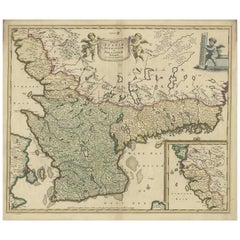
South Sweden Map with Inset of Halmstad – Antique Map by Frederik de Wit, c.1680
Located in Langweer, NL
South Sweden Map with Inset of Halmstad – Antique Map by Frederik de Wit, c.1680
This richly detailed antique map titled Accurata Scaniae, Blekingae et Hallandiae Descriptio present...
Category
Late 17th Century Dutch Antique Continental Europe Maps
Materials
Paper
$801 Sale Price
20% Off
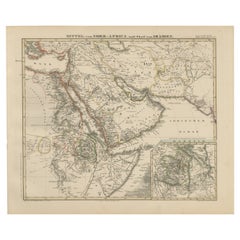
Historic 1857 Map of North-East Africa & Arabia – Fine Engraving
Located in Langweer, NL
North-East Africa and Arabia Map 1857
This detailed antique print shows “Mittel- und Nord-Afrika (östl. Theil) und Arabien” meaning “Central and North Africa (eastern part) and Arab...
Category
Mid-19th Century German Antique Continental Europe Maps
Materials
Paper
19th-Century Decorative Map of British America with Arctic and Pacific Vignettes
Located in Langweer, NL
19th-Century Decorative Map of British America with Arctic and Pacific Vignettes
This 19th-century map of British America, drawn and engraved by J. Rapkin and published by J & F T...
Category
1850s Antique Continental Europe Maps
Materials
Paper
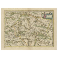
An Original Antique Mid-17th Century Blaeu Map of Styria in Southeastern Austria
Located in Langweer, NL
This is an antique map of Styria (referred to as “Stiria” or “Steyrmarck”), published by the renowned Dutch cartographer Willem Janszoon Blaeu (often simply “Blaeu”). The first editi...
Category
1640s Antique Continental Europe Maps
Materials
Paper
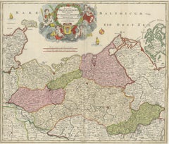
Antique Map of Mecklenburg-Vorpommern in Germany by J.B. Homann, c.1720
Located in Langweer, NL
Antique Map of Mecklenburg-Vorpommern by J.B. Homann, c.1720
Old colored antique map of Mecklenburg-Vorpommern by Johann Baptist Homann. This stunning map, titled "Ducatus Meklenbur...
Category
1720s Antique Continental Europe Maps
Materials
Paper
$512 Sale Price
20% Off
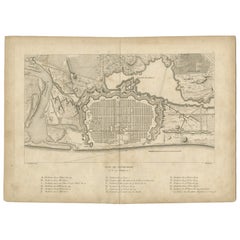
Plan of Pondicherry Fortifications and Attacks, France, c.1750
Located in Langweer, NL
Plan of Pondicherry Fortifications and Attacks, France, c.1750
This finely engraved map depicts the fortified city of Pondicherry, titled "Plan de Pondichéry et de ses attaques." It...
Category
Mid-18th Century French Antique Continental Europe Maps
Materials
Paper
18th Century Original Dutch Map of Martinique in The West Indies by Isaak Tirion
Located in Langweer, NL
This is an 18th-century Dutch map of Martinique, titled *Het Westindisch Eiland Martinique*. The map was produced by Isaak Tirion, a renowned Dutch cartographer and publisher known for his precise and beautifully crafted maps. The cartouche in the lower left corner, adorned with decorative elements, adds to the aesthetic appeal of the map.
### Key Features:
- Martinique: The map offers detailed topographical information of the island, including mountains, rivers, and settlements.
- Geographical Details: Locations such as Fort Royal, Bay de St. Pierre, and Point de Cloche are marked, showcasing significant features of the island.
- Cartouche: The ornate cartouche, featuring tropical plants, reflects the importance of the island's agricultural production during the colonial period, particularly its sugar plantations.
This map captures Martinique during its time as a French colony and provides valuable insight into the island’s layout and strategic significance in the Caribbean. The attention to coastal detail highlights the importance of Martinique as a hub of maritime activity.
The map’s combination of aesthetic elegance and cartographic precision makes it a remarkable piece for collectors and those interested in Caribbean colonial...
Category
1760s Antique Continental Europe Maps
Materials
Paper
$417 Sale Price
20% Off
Map of Comitatus Marchia et Ravensberg: Historical Counties in Germany, c.1660
Located in Langweer, NL
Antique map titled 'Comitatus Marchia et Ravensberg'. This map depicts two historical counties of the Holy Roman Empire: Marks and Ravensberg. Major cities, towns, mountains, and riv...
Category
Mid-17th Century Antique Continental Europe Maps
Materials
Paper
$417 Sale Price
20% Off
Rare 1864 Civil War Era Map of Massachusetts, Connecticut, and Rhode Island
Located in Langweer, NL
Title: Rare 1864 Civil War Era Map of Massachusetts, Connecticut, and Rhode Island
Description: This exquisite antique map, titled "Johnson's Massachusetts, Connecticut, and Rhode I...
Category
1860s Antique Continental Europe Maps
Materials
Paper
Rare Victorian Mid-19th Century Gothic Revival Library Architects Plan Chest
Located in Worpswede / Bremen, DE
A neo-gothic mid-19th century library plan chest having an arrangement of eleven short and three long drawers to one side, the other side with three short drawers above gothic style linen fold panelling, centred with the carved monogram ‘HP’, further matching panelling to the sides. A stunning plan chest of good propartions and with a nice patina. Provenance: Sherborne School, an independent school in north-west Dorset, England, established in 1550. Among the ‘Old Shirburnians’ are for example the writer John Cowper Powys, the actors Jeremy Irons und Charlie Cox, Chris Martin, leadsinger of the band Coldplay as well as Sheikh Tamim bin Hamad Al Thani...
Category
Mid-19th Century English Gothic Revival Antique Continental Europe Maps
Materials
Oak
Pair of Miniature Globes Lane’s on Tripod Bases, London post 1833, ante 1858
By Lane's
Located in Milano, IT
Pair of miniature globes
Lane’s, London, post 1833, ante 1858
Papier-mâché, wood and paper
They measure:
Height 9.44 in (24 cm);
Sphere diameter 2.75 in (7 cm);
Diameter of t...
Category
1840s English Early Victorian Antique Continental Europe Maps
Materials
Paper, Wood
Decorative Antique Print of Nice Near Mont Boron in France, c.1865
Located in Langweer, NL
Antique print titled 'Nice, vue prise de l'extremité du Mont Boron'. View of the city of Nice, near Mont Boron, France. This print originates from 'Nice Et Savoie, Sites Pittoreques,...
Category
19th Century Antique Continental Europe Maps
Materials
Paper
$436 Sale Price
20% Off
Antique Print of the Imperial Palace in Peking, China, 1668
Located in Langweer, NL
Antique print China titled ‘Interior aulae Imperatoriae facies'.
Antique print of the Imperial Palace in Peking, China. This print originates from ...
Category
1660s Antique Continental Europe Maps
Materials
Paper
$322 Sale Price
20% Off
1802 Map of Australasia and the South Pacific - European Exploration Routes
Located in Langweer, NL
1802 Johann Walch Map of Australasia and the South Pacific - European Exploration Routes
This 1802 map by Johann Walch provides a highly detailed view of Australasia and the South P...
Category
Early 1800s Antique Continental Europe Maps
Materials
Paper
$1,706 Sale Price
20% Off
Antique Map of the French Coast at Boulogne and Picardy
Located in Langweer, NL
Antique map titled 'Les Costes du Boulenois et de la Picardie'. Map of the French coast at Boulogne and Picardy. Left a large wind rose. Part of a bundled collection of plans of batt...
Category
Early 18th Century Antique Continental Europe Maps
Materials
Paper
$464 Sale Price
20% Off
Original Old Map of Northeastern Greece & Northwestern Turkey, Published in 1661
Located in Langweer, NL
This small map was engraved by Petrus Kaerius and is based on Ortelius' map of the same title. It covers the ancient region of Thrace, present-day European Turkey and part of Greece....
Category
1660s Antique Continental Europe Maps
Materials
Paper
$398 Sale Price
20% Off
Mediterranean, Black Sea & Ottoman Empire Map 1853
Located in Langweer, NL
Mediterranean, Black Sea & Ottoman Empire Map 1853
This impressive antique print shows the Mediterranean and Black Sea regions with a focus on the Ottoman Empire, titled “Das Mittel...
Category
Mid-19th Century German Antique Continental Europe Maps
Materials
Paper
Antique Print of the Chinese City of Anhing by Nieuhof, 1668
By Johannes Nieuhof
Located in Langweer, NL
Antique print China titled 'Anhing'. Old print depicting a view on the Chinese city of Anhing with its ramparts. This print originates from the Latin editio...
Category
17th Century Antique Continental Europe Maps
Materials
Paper
$322 Sale Price
20% Off
Guadalajara 1902: A Cartographic Image of Castilla-La Mancha's Northern Province
Located in Langweer, NL
The map illustrates the province of Guadalajara, part of the autonomous community of Castilla-La Mancha in Spain, as of 1902. The map includes various geographic and infrastructural ...
Category
Early 1900s Antique Continental Europe Maps
Materials
Paper
$274 Sale Price
20% Off
Large Antique Map of Delfland by Cruquius, 1712
Located in Langweer, NL
Map no. 20 of a large wall map of Delfland, The Netherlands. The map covers the region of Pijnacker with a large compass rose with allegorical figures a...
Category
18th Century Antique Continental Europe Maps
Materials
Paper
$701 Sale Price
20% Off
Pl. 8 Antique Plan of the House of Mr. Morel by Le Rouge, c.1785
Located in Langweer, NL
Antique print titled 'Plan de la Maison de Ville et de Campagne de Mr. Morel'. Copper engraving showing a plan of the house of Mr. Morel. This print originates from 'Jardins Anglo-Ch...
Category
18th Century French Antique Continental Europe Maps
Materials
Paper
Scare Map of Canaan, with Portraits of the Apostles of Matheaus and Others
Located in Langweer, NL
Antique map titled 'Geographische Beschreibung des Belobten Landes Canaan (..)'. Scarce map of Canaan, with portraits of the Apostles of Matheaus, S. Marcus, S. Lucas, S. Johannes. With Christ in lower part. The map extends along the coast of the eastern Mediterranean. Published by Georg Andreas...
Category
Late 17th Century Antique Continental Europe Maps
Materials
Paper
$417 Sale Price
20% Off
Large Antique County Map of Somersetshire, England
Located in Langweer, NL
Antique map titled 'A Map of Somersetshire from the best Authorities'. Original old county map of Somersetshire, England. Engraved by John Cary. Originates from 'New British Atlas' b...
Category
Early 19th Century Antique Continental Europe Maps
Materials
Paper
$303 Sale Price
20% Off
Large Antique County Map of Essex, England
Located in Langweer, NL
Antique map titled 'A Map of Essex from the best Authorities'. Original old county map of Essex, England. Engraved by John Cary. Originates from 'New Brit...
Category
Early 19th Century Antique Continental Europe Maps
Materials
Paper
$293 Sale Price
20% Off
Large Antique County Map of Northamptonshire, England
Located in Langweer, NL
Antique map titled 'A Map of Northamptonshire from the best Authorities'. Original old county map of Northamptonshire, England. Engraved by John Cary. Originates from 'New British At...
Category
Early 19th Century Antique Continental Europe Maps
Materials
Paper
$265 Sale Price
20% Off
Large Antique County Map of Ruthlandshire, England
Located in Langweer, NL
Antique map titled 'A Map of Ruthlandshire from the best Authorities'. Original old county map of Ruthlandshire, England. Engraved by John Cary. Originates from 'New British Atlas' b...
Category
Early 19th Century Antique Continental Europe Maps
Materials
Paper
$265 Sale Price
20% Off
Large Antique County Map of Cumberland, England
Located in Langweer, NL
Antique map titled 'A Map of Cumberland from the best Authorities'. Original old county map of Cumberland, England. Engraved by John Cary. Originates...
Category
Early 19th Century Antique Continental Europe Maps
Materials
Paper
$151 Sale Price
20% Off
Original Antique Map of the Southern Coast of France by Janssonius, 1657
By Johannes Janssonius
Located in Langweer, NL
Antique map of France titled 'Comté et Gouvernement de Provence'. Decorative map of the southern coast of France. This map originates from 'Atlas Novus,...
Category
17th Century Antique Continental Europe Maps
Materials
Paper
$682 Sale Price
20% Off
1876 Map of the United States: Detailing the Railroads and Unsettled Territories
Located in Langweer, NL
Stanford’s Smaller Railway Map of the United States, 1876
This original 1876 map, titled "Stanford's Smaller Railway Map of the United States Distinguishing the Unsettled Territorie...
Category
1870s Antique Continental Europe Maps
Materials
Paper
Observatory & Spakaia Church, Beryozovo, Demyanskoye, Tyumen Oblast in Russia
Located in Langweer, NL
Antique print titled 'Vue de l'Observatoire et de l 'Eglise de Spaskaia (..)'. Copper engraving of the Observatory and the Church of Spakaia at Beryozovo on the North side. Below, a ...
Category
18th Century Antique Continental Europe Maps
Materials
Paper
$274 Sale Price
20% Off
Rare 1864 Civil War Era Map of Arkansas, Mississippi, and Louisiana
Located in Langweer, NL
Title: Rare 1864 Civil War Era Map of Arkansas, Mississippi, and Louisiana
Description: This captivating antique map, titled "Johnson's Arkansas, Mississippi, and Louisiana," was pu...
Category
1860s Antique Continental Europe Maps
Materials
Paper
Antique Map of the Old World Projection, Entitled Orbis Terrarum Ad Mentem, 1825
Located in Langweer, NL
Antique map titled 'Orbis Terrarum ad Mentem (..)'. Old map of the world originating from 'Atlas der Oude Wereld'.
Artists and Engravers: Published by C. Ph. Funke and W. van Boe...
Category
19th Century Antique Continental Europe Maps
Materials
Paper
$208 Sale Price
20% Off
Antique Map of a Hemisphere by Scherer, c.1703
Located in Langweer, NL
Antique map depiciting a horizon/hemisphere. Printed for Scherer's 'Atlas Novus' (1702-1710).
Artists and Engravers: Heinrich Scherer (1628-1704) was a Professor of Hebrew, Mathematics and Ethics at the University of Dillingen until about 1680. Thereafter he obtained important positions as Official Tutor to the Royal Princes...
Category
18th Century Antique Continental Europe Maps
Materials
Paper
$180 Sale Price
20% Off
Antique Map Depiciting a Horizon or Hemisphere c.1703
Located in Langweer, NL
Antique map depiciting a horizon/hemisphere. Printed for Scherer's 'Atlas Novus' (1702-1710).
Artists and Engravers: Heinrich Scherer (1628-1704) was a Professor of Hebrew, Mathematics and Ethics at the University of Dillingen until about 1680. Thereafter he obtained important positions as Official Tutor to the Royal Princes...
Category
18th Century Antique Continental Europe Maps
Materials
Paper
$180 Sale Price
20% Off
Terrestrial Table Globe by Félix Delamarche, Paris, 1821
By Félix Delamarche
Located in Milano, IT
Terrestrial table globe
Félix Delamarche
Paris, 1821
It measures 20.47 in height, Ø max 14.17 in; the sphere Ø 9.44 in (h 52 cm x Ø max 36.5 cm; the sphere Ø 24 cm)
Wood, printed...
Category
1820s French Restauration Antique Continental Europe Maps
Materials
Metal
Comore Island Original Antique Engraving by Van Schley, 1749
Located in Langweer, NL
Antique map titled 'Carte des Isles de Comore Johanna ou Anouan Mohilla ou Moaly et Mayote (..) - Kaart van de Eilanden Komoro, Anjuan, Moelia, en Mayotta (..)'. Copper engraving of ...
Category
18th Century Antique Continental Europe Maps
Materials
Paper
Antique Print of a Porphyry Vase by Sandberg, c.1864
Located in Langweer, NL
Antique print titled 'Porphyr Vas'. View of the giant Porphyry vase of Rosendal Palace, a Swedish palace pavilion located on Djurgården, an island in central Stockholm. This print or...
Category
19th Century Antique Continental Europe Maps
Materials
Paper
$64 Sale Price
20% Off
Map of Choromandel & Malabar, Incl Kerala, Tamil Nadu & Part of Sri Lanka, 1726
Located in Langweer, NL
Antique map titled 'Nieuwe kaart van Choromandel ende Malabar.'
Original antique map of Southern India documenting the VOC's areas of influence. Included is Kerala, Tamil Nadu...
Category
1720s Dutch Antique Continental Europe Maps
Materials
Paper
$580 Sale Price
50% Off
Antique Map of the Region of Bourbon by Janssonius, 1657
Located in Langweer, NL
Antique map of France titled 'Borbonium Ducatus - Bourbonnois'. Decorative map of the Bourbon region. This map originates from 'Atlas Novus, Sive Theatrum Orbis Orbis Terrarum: In qu...
Category
17th Century Antique Continental Europe Maps
Materials
Paper
$391 Sale Price
20% Off
Southern Africa & Madagascar Antique Map – Beautiful 1857 Edition
Located in Langweer, NL
Southern Africa and Madagascar Map 1857
This detailed antique print shows “Süd-Africa mit Madagascar” meaning “Southern Africa with Madagascar,” published in 1857 by Justus Perthes ...
Category
Mid-19th Century German Antique Continental Europe Maps
Materials
Paper
Handcolored Print of an Estate by Smallegange, Zeeland, The Netherlands, 1696
Located in Langweer, NL
Antique print titled 'Rynsburch'. Copper engraving of the estate of Rijnsburg, the Netherlands. This print originates from 'Nieuwe Cronyk van Zeeland' by Mattheus Smallegange.
Ar...
Category
17th Century Antique Continental Europe Maps
Materials
Paper
Antique Print of the 'Korenbeurs' in Amsterdam, c.1760
Located in Langweer, NL
Antique print titled 'Gezicht van de Nieuwe Koren-Beurs tot Amsterdam - Vue de la Nouvelle Bourse (..)'.
Optical print of the 'Korenbeurs' in Amsterdam, the Netherlands. The Korenbeurs (""grain bourse"") was a 17th-century commodity market in Amsterdam where grain was traded. The building stood on the banks of the Amstel, on the western side (Nieuwezijde) of the Damrak. It was directly south of the Oude Brug bridge, on a spot now occupied by the former stock and commodity exchange Beurs van Berlage...
Category
18th Century Antique Continental Europe Maps
Materials
Paper
$341 Sale Price
20% Off
Antique Print of the Rokin Canal in Amsterdam, The Netherlands, c.1765
Located in Langweer, NL
Antique print titled 'Gezigt langs het Rokin op de Nieuwe-Zyds-Kapel en Beurs'. Original antique print of the 'Rokin' canal in Amsterdam, the Netherlands. Published circa 1765.
Ar...
Category
18th Century Antique Continental Europe Maps
Materials
Paper
$227 Sale Price
20% Off
1858 Map of Southwestern Germany & Switzerland – Bavaria, Württemberg, Baden
Located in Langweer, NL
Antique Map of Southwestern Germany & Switzerland – Bavaria, Württemberg, Baden, 1858
Detailed antique map titled "Südwestliches Deutschland mit Bayern, Würtemberg, Baden, Hohenzoll...
Category
Mid-19th Century German Antique Continental Europe Maps
Materials
Paper
Decorative Antique Map of Sweden and Part of Finland, 1806
Located in Langweer, NL
Antique map titled 'La Suede.'
Decorative map of Sweden and part of Finland by Robert de Vaugondy, revised and published by Delamarche. Source unknown, to be determined.
Artists and Engravers: Made by 'Charles Francois Delamarche' after an anonymous artist. Charles Francois Delamarche (1740-1817) founded the important and prolific Paris based Maison Delamarche map publishing firm in the late 18th century. A lawyer by trade Delamarche entered the map business with the acquisition from Jean-Baptiste Fortin of Robert de Vaugondy's map plates...
Category
Early 1800s French Antique Continental Europe Maps
Materials
Paper
Large Antique Map of the Region of Berry, Nivernois & Bourbonnais, France, 1753
Located in Langweer, NL
Antique map titled 'Gouvernements généraux du Berry, du Nivernois et du Bourbonois'.
Large, original antique map of the region of Berry, Nivernois and Bourbonnais, France. Featur...
Category
1750s Antique Continental Europe Maps
Materials
Paper
$530 Sale Price
20% Off
Antique Print of the City of Nanking in China, 1668
Located in Langweer, NL
Antique print China titled ‘Nanking'. This plate shows a view on the Chinese city of Nanking with its ramparts. Also depicted are several pagodas and on the foreground there is a pal...
Category
17th Century Antique Continental Europe Maps
Materials
Paper
$398 Sale Price
20% Off
Ottoman Empire in Europe – Antique Map by Reilly, Vienna, 1796
Located in Langweer, NL
Map of the Ottoman Empire in Europe – Reilly, Vienna circa 1794-1796
This large original antique map, titled “Karte von dem Oschmanischen Reiche in Europa,” was published between 17...
Category
Late 18th Century Austrian Antique Continental Europe Maps
Materials
Paper
Original Old Map of St Kitts, Antigua, Bermuda, Barbados, and Jamaica, ca.1745
Located in Langweer, NL
Antique map titled 'Dominia Anglorum in praecipuis Insulis Americae ut sunt Insula S. Christophori, Antegoa, Iamaica, Barbados nec non Insulae Bermudes vel Sommers dictae. Die Englis...
Category
1740s Antique Continental Europe Maps
Materials
Paper
$1,374 Sale Price
20% Off
Historic 1858 Map of South America – Pre-Border Consolidation
Located in Langweer, NL
Antique Map of South America – Stülpnagel Engraving Published by Perthes, 1858
Detailed 19th-century engraved map titled "Süd-America", designed and drawn by F. von Stülpnagel and p...
Category
Mid-19th Century German Antique Continental Europe Maps
Materials
Paper
Antique Map of Spain and Portugal – Hand-Colored Engraving by Stülpnagel, 1857
Located in Langweer, NL
Antique Map of Spain and Portugal – Hand-Colored Engraving by Stülpnagel, 1857
Fine 19th-century engraved map of the Iberian Peninsula titled "Spanien und Portugal", designed by F. ...
Category
Mid-19th Century German Antique Continental Europe Maps
Materials
Paper
Antique Map of Germany & Railways – Transport Network Overview, 1857
Located in Langweer, NL
Antique Map of Germany & Railways – Transport Network Overview, 1857
Striking 19th-century map titled "Deutschland und angränzende Länder zur Übersicht der Eisenbahnen und Hauptstra...
Category
Mid-19th Century German Antique Continental Europe Maps
Materials
Paper
Antique Map of Southwestern France – With Insets of Paris & Lyon, 1858
Located in Langweer, NL
Antique Map of Southwestern France – With Insets of Paris & Lyon, 1858
Detailed copperplate map of "Südwestliches Frankreich" (Southwestern France), created by Friedrich von Stülpna...
Category
Mid-19th Century German Antique Continental Europe Maps
Materials
Paper
Antique Map of Northeastern France – Alsace, Lorraine & Champagne, 1858
Located in Langweer, NL
Antique Map of Northeastern France – Alsace, Lorraine & Champagne, 1858
Detailed 19th-century engraved map titled "Nordöstliches Frankreich", drawn by Friedrich von Stülpnagel and p...
Category
Mid-19th Century German Antique Continental Europe Maps
Materials
Paper
Antique Map of France at the End of the Ministry of Cardinal Richelieu, 1765
By G. A. Rizzi-zannoni
Located in Langweer, NL
Antique map France titled 'Etat du Domaine à la fin du Ministère du Cardinal de Richelieu (..)'. Beautiful old map of France. This map originates fr...
Category
18th Century Antique Continental Europe Maps
Materials
Paper
$140 Sale Price
20% Off
Antique Map of France with Beautiful Title Cartouche and Border, c.1740
Located in Langweer, NL
Antique map titled 'La France suivant les nouvelles Observations de Messrs de l'Academie Royale des Sciences etc.'. Rare map of France with beautiful title cartouche and decorative b...
Category
18th Century Antique Continental Europe Maps
Materials
Paper
$426 Sale Price
20% Off
Antique Map of the Kingdom of Denmark by Wyld '1845'
Located in Langweer, NL
Antique map titled 'Kingdom of Denmark'. Original antique map of the Kingdom of Denmark. This map originates from 'An Atlas of the World, Comprehending Separate Maps of its Various C...
Category
Mid-19th Century Antique Continental Europe Maps
Materials
Paper
$154 Sale Price
35% Off
Antique Map of the Caribbean & Central America – West Indies, 1857
Located in Langweer, NL
Antique Map of the Caribbean & Central America – West Indies, 1857
This finely engraved and hand-colored map titled "West-Indien und Centro-America" was published in 1857 by Justus ...
Category
Mid-19th Century German Antique Continental Europe Maps
Materials
Paper
Frederic de Wit Map of Palestine – Terra Sancta, Amsterdam c.1670
Located in Langweer, NL
Terra Sancta sive Promissionis, olim Palestina – hand-coloured copper-engraved map of the Holy Land by Frederic de Wit, Amsterdam, circa 1670
This impressive folio sheet, bearing th...
Category
Late 17th Century Dutch Antique Continental Europe Maps
Materials
Paper
Antique Map of West and Central Africa – Stieler Atlas, Justus Perthes 1857
Located in Langweer, NL
Antique Map of West and Central Africa – Stieler Atlas, Justus Perthes 1857
This finely engraved map titled "Mittel- und Nord-Africa. Westl. Theil." was published in 1857 by Justus ...
Category
Mid-19th Century German Antique Continental Europe Maps
Materials
Paper
Recently Viewed
View AllMore Ways To Browse
Vintage Industrial Bins
Vintage Liquor Labels
Vintage Utensil Holders
Vintage Wicker Wine Bottles
Vintage Wrought Iron Fire Screen
Viso Porcelain
Wall Mount Water Fountains
Wedding Cabinets and Armoires
Wedgwood Green Jasperware
Wedgwood Portrait
West German Pot
White Ceramic Garden Stool
White Ironstone China
White Lacquer Bar Cart
Woman With Water Jug
Wooden Chest 1800
Wooden Tea Cart
Worcester Jug
