Continental Europe Maps
to
4,196
5,166
5,518
200
5,165
1
2
2
2
1
2,843
2,003
319
1
180
12
1
68
3
3
3
2
3
1
5,147
17
11
10
8
472
195
92
81
56
5,166
5,166
5,166
104
58
20
14
13
Item Ships From: Continental Europe
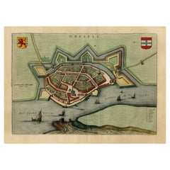
Stunning Bird's-Eye View Plan of Hasselt by Blaeu in The Netherlands, 1649
Located in Langweer, NL
Antique print, titled: 'Hasselt.'
Bird's-eye view plan of Hasselt in The Netherlands. With key to locations and coats of arms. Text in Dutch on verso. This plan originates from the famous city Atlas: 'Toneel der Steeden' published by Joan Blaeu...
Category
1640s Antique Continental Europe Maps
Materials
Paper
$1,094 Sale Price
20% Off
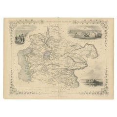
Gateway to the Steppes: Tallis's Masterpiece Map of Indepent Tartary, 1851
Located in Langweer, NL
The map is of "Independent Tartary," a historical region in Central Asia that covered parts of what are now Kazakhstan, Uzbekistan, Turkmenistan, and surrounding areas. The map was p...
Category
1850s Antique Continental Europe Maps
Materials
Paper
$313 Sale Price
20% Off
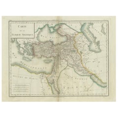
Antique Map of Asian Turkey, Levant, and Mesopotamia by Tardieu, circa 1802
Located in Langweer, NL
This is an original antique map titled "Carte de la Turquie Asiatique," depicting the Asian territories of the Ottoman Empire. Created by Pierre Antoine Tardieu, this map illustrates...
Category
Early 1800s French Antique Continental Europe Maps
Materials
Paper
$418 Sale Price
20% Off
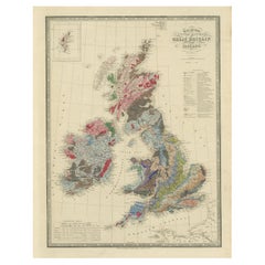
Beneath the Surface: James Wyld's 1844 Geological Map of the British Isles
Located in Langweer, NL
This superb original geological map of the United Kingdom of Great Britain and Ireland by James Wyld, produced in 1844, is a remarkable Victorian artifact.
Description:
Explore th...
Category
1840s Antique Continental Europe Maps
Materials
Paper
$856 Sale Price
20% Off
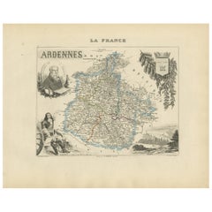
Map of Ardennes France with Sedan and Military History by Vuillemin, c.1850
Located in Langweer, NL
Map of Ardennes France with Sedan and Military History by Vuillemin, 19th c
Description:
This detailed and decorative 19th-century map of the Ardennes department in northeastern Fra...
Category
Mid-19th Century French Antique Continental Europe Maps
Materials
Paper
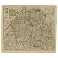
Map of Switzerland by Justus Danckerts, Hand-Colored Engraving ca. 1690
Located in Langweer, NL
Map of Switzerland by Justus Danckerts, Hand-Colored Engraving ca. 1690
This detailed and attractively hand-colored antique map titled *Helvetiae Rhaetiae et Valesiae, nec non parti...
Category
Late 17th Century Antique Continental Europe Maps
Materials
Paper
Maritime and Terrestrial Survey of Spanish Santander in 1901, An Original Map
Located in Langweer, NL
This antique map is a historical map of the province of Santander (currently known as Cantabria) from the year 1901. Santander is located along the northern coast of Spain, bordering...
Category
Early 1900s Antique Continental Europe Maps
Materials
Paper
$275 Sale Price
20% Off
Antique Map of the Middle East by Brion de la Tour '1772'
Located in Langweer, NL
Antique map titled 'Carte des Pays et Principaux Lieux (..)'. Original antique map of Middle East, extending to the Red Sea, Egypt, the Eastern Medi...
Category
Late 18th Century Antique Continental Europe Maps
Materials
Paper
$618 Sale Price
20% Off
Map of Eure France with Evreux, Poussin and Normandy Countryside, 19th Century
Located in Langweer, NL
Map of Eure France with Evreux, Poussin and Normandy Countryside, 19th Century
Description:
This 19th-century engraved map of the Eure department in the Normandy region of northern ...
Category
Mid-19th Century French Antique Continental Europe Maps
Materials
Paper
Map of Aude France with Carcassonne and Languedoc Vineyards, 19th Century
Located in Langweer, NL
Map of Aude France with Carcassonne and Languedoc Vineyards, 19th Century
Description:
This elegant 19th-century map of Aude, a department in southern France along the Mediterranean...
Category
Mid-19th Century French Antique Continental Europe Maps
Materials
Paper
Map of Ariège France with Foix and Pyrenees Landscape by Vuillemin, 19th c
Located in Langweer, NL
Map of Ariège France with Foix and Pyrenees Landscape by Vuillemin, 19th c
Description:
This beautifully detailed 19th-century map of the Ariège department in southwestern France wa...
Category
Mid-19th Century French Antique Continental Europe Maps
Materials
Paper
Map of Charente France with Cognac Region and Château de La Rochefoucauld, 1850
Located in Langweer, NL
Map of Charente France with Cognac Region and Château de La Rochefoucauld, 19th c
Description:
This richly illustrated 19th-century map of the Charente department in southwestern Fr...
Category
Mid-19th Century French Antique Continental Europe Maps
Materials
Paper
Map of Hautes-Alpes France with Gap and Alpine Scenery by Vuillemin, c.1850
Located in Langweer, NL
Map of Hautes-Alpes France with Gap and Alpine Scenery by Vuillemin
Description:
This elegant 19th-century map of the Hautes-Alpes department in southeastern France was created by A...
Category
Mid-19th Century French Antique Continental Europe Maps
Materials
Paper
Old Map of Guyana, Suriname and French Guiana with Paramaribo and Cayenne, c1760
Located in Langweer, NL
Description: Antique map titled 'Carte de la Guiane.'
Antique map of the Guianas - present day Guyana, Suriname and French Guiana, including Paramaribo and Cayenne. Source unknown, to be determined.
Artists and Engravers: Made by 'Jacques-Nicholas Bellin...
Category
1760s Antique Continental Europe Maps
Materials
Paper
$428 Sale Price
20% Off
1726 Valentyn's Map of Bali and Lombok, Original Engraving
Located in Langweer, NL
This antique map is a detailed 18th-century chart of the island of Bali, one of the many islands of Indonesia, with an inset of the neighboring island Lombok, attributed to François ...
Category
Early 18th Century Antique Continental Europe Maps
Materials
Paper
$1,427 Sale Price
20% Off
Rare Hand-Colored Map of Lorraine and Barrois, France by Frederik De Wit c. 1688
Located in Langweer, NL
Title: Rare Hand-Colored Map of Lorraine and Barrois by Frederik De Wit c. 1688
Description: This remarkable 17th-century map, titled "Generalis Lotharingiae Ducatus," offers a deta...
Category
1680s Antique Continental Europe Maps
Materials
Paper
Map of Zurich and Basel Region by Mercator, Uncolored Engraving c.1600
Located in Langweer, NL
Map of Zurich and Basel Region by Mercator, Uncolored Engraving c.1600
This original uncolored copperplate engraving, titled *Zurichgow et Basiliensis Provincia*, was created by the...
Category
Early 17th Century Antique Continental Europe Maps
Materials
Paper
Map of Aveyron France with Rodez, Millau and Wine Routes, 19th Century
Located in Langweer, NL
Map of Aveyron France with Rodez, Millau and Wine Routes, 19th Century
Description:
This detailed and decorative 19th-century map of Aveyron, a department in southern France, was dr...
Category
Mid-19th Century French Antique Continental Europe Maps
Materials
Paper
Antique Map of England and Wales, 1903, with Detailed Counties and Railways
Located in Langweer, NL
Title: Antique Map of England and Wales, 1903, with Detailed Counties and Railways
Description:
This beautifully detailed antique map, titled "England and Wales," was engraved and p...
Category
Early 20th Century Continental Europe Maps
Materials
Paper
Map of the Region of Basel and Northern Switzerland by Ortelius, circa 1603
Located in Langweer, NL
Two original antique maps on one sheet titled 'Basiliensis Territorii Descriptio Nova [with] Circulus sive Liga Sueviae'. The first centers on Basel, Switzerland, located on the Rhine River...
Category
Early 17th Century Antique Continental Europe Maps
Materials
Paper
$523 Sale Price
20% Off
Map of Soria Province, 1901: Detailed Cartography of Northeastern Spain
Located in Langweer, NL
The map is a historical map of the province of Soria from 1901.
A decorative coat of arms enhances the aesthetic of the map, signifying the historical and cultural significance of ...
Category
Early 1900s Antique Continental Europe Maps
Materials
Paper
$313 Sale Price
20% Off
Decorative Original Antique Map of Valencia in Southern Spain, circa 1601
Located in Langweer, NL
This is an original antique map titled 'Valentiae Regni olim Contestanorum Si Ptolemaeo, Edentanorum Si Plinio Credimus Typus'. This is a historical map of the Kingdom of Valencia in...
Category
Early 17th Century Antique Continental Europe Maps
Materials
Paper
$1,332 Sale Price
20% Off
Bonne Map of Philippines, Formosa, Siam, Indochina & South China, 1780
Located in Langweer, NL
Bonne Map of Philippines, Formosa, Siam, Indochina & South China, 1780
Les Isles Philippines, celle de Formose, le Sud de la Chine, les Royaumes de Tunkin, de Cochinchine, de Cambog...
Category
1780s Antique Continental Europe Maps
Materials
Paper
$275 Sale Price
20% Off
Ancient Cartography of the Indian Subcontinent, Published in 1880
Located in Langweer, NL
This map is titled "INDIA," and it provides a detailed view of the Indian subcontinent with various inset maps that offer additional historical and geographical context.
The main ma...
Category
1880s Antique Continental Europe Maps
Materials
Paper
$352 Sale Price
20% Off
Map of Lake Geneva and Surroundings by Hondius, Geneva Region, circa 1612
Located in Langweer, NL
Map of Lake Geneva and Surroundings by Hondius, Geneva Region, 1606
This rare and intricately engraved map, titled *Chorographica Tabula Lacus Lemanni Locorumque Circumiacentium*, w...
Category
Early 17th Century Dutch Antique Continental Europe Maps
Materials
Paper
Antique Architecture Print of a Composite Portico by Neufforge, c.1770
Located in Langweer, NL
Antique print titled 'Plan et Elevation d'un Portique Composite (..)'. Old print showing the design of a Composite portico. This print originates from 'Recueil Élémentaire d?Architec...
Category
18th Century Antique Continental Europe Maps
Materials
Paper
Map of Saintonge and Aunis with Cognac and Rochefort, France - 1665 Original
Located in Langweer, NL
Map of Saintonge and Aunis, with Charente Coast and Cognac, 1665
This beautifully hand-colored antique map, titled *Xaintonge, avec Le Pays D’Avlnis* (Saintonge, with the Country of...
Category
1660s Antique Continental Europe Maps
Materials
Paper
A Tallis Map of British Guiana with Colonial Vignettes and Other Landmarks, 1851
Located in Langweer, NL
This Tallis map of British Guiana (now known as Guyana) is a richly decorated document, much like other maps from the esteemed cartographic publisher John Tallis & Company. The firm,...
Category
1850s Antique Continental Europe Maps
Materials
Paper
$275 Sale Price
20% Off
Ancient Babylon with The Tower of Babel According to Herodotus & Kircherus, 1730
Located in Langweer, NL
Antique print titled 'Platte Grond van de Stad Babilon, volgens Herodotus en A. Kircherus'.
This original antique print shows a view of ancient Babylon with the tower of Babel...
Category
1730s Antique Continental Europe Maps
Materials
Paper
$456 Sale Price
20% Off
Antique Engraved Map of the Northern Part of Greece and the Aegean Sea, Ca.1730
Located in Langweer, NL
Title: "GRÆCIÆ PARS Septentrionalis".
Hand Coloured Engraved map by G. Delisle of the northern part of the Aegean. In the top left corner a distance scale included.
Condition...
Category
1730s Antique Continental Europe Maps
Materials
Paper
$618 Sale Price
20% Off
1645 Blaeu Map of Westmorland, Northern England – Hand Colored, Decorative
Located in Langweer, NL
This map, "Westmoria Comitatus; Anglice Westmorland", was created by the esteemed Dutch cartographer Willem Blaeu and was published around 1645 in 'Le Theatre du Monde ou Nouvel Atlas'. It provides a detailed look at Westmorland, a historic county in northern England, based on John Speed’s earlier map. The map features numerous place names, parks, and estates, including Brigster Park, Colnhead Park, Crosbye, and Midleton, along with a detailed depiction of Windermere (spelled Wynandermere) and the surrounding regions.
Additional Features:
- Hand-colored map, with vibrant and detailed colors that bring out the topographical and decorative features.
- Includes intricate cartouches, such as the royal coat of arms, a decorative title cartouche topped with putti (cherubic figures), and six coats of arms (two left blank).
- Depicts the region’s rich landscape, including the rolling hills and mountainous terrain of northern England.
- French text on the verso, indicative of the publication period from 1645-1648, part of Blaeu’s highly sought-after atlases.
- Map shows precise details of small towns, estates, and parks, such as Brigster Park, Colnhead Park, Crosbye, and Wynandermere (now Windermere Lake).
This map would be of particular interest to collectors of English county maps, antique maps of northern England, 17th-century cartography, and the decorative works of Willem Blaeu. Blaeu's maps are renowned for their accuracy, artistic beauty, and historical significance.
Keywords: Willem Blaeu, Westmorland map, northern England, 17th-century map, antique map, English county map, John Speed, Windermere, decorative cartography, hand-colored map, rare map, antique cartography...
Category
1640s Dutch Antique Continental Europe Maps
Materials
Paper
$1,040 Sale Price
30% Off
Original Antique Plan of the Fortress of Charedsch in Persia or Iran, ca.1780
Located in Langweer, NL
Antique map, titled: 'Plan de la Citadelle de la Ville de Charedsch.'
Plan of the fortress of Charedsch, Iran / Persia. This original antique print originates from 'Reize naar Ar...
Category
1780s Antique Continental Europe Maps
Materials
Paper
$304 Sale Price
20% Off
Map of Western United States 1903 – Railroads, State Borders, and Terrain
Located in Langweer, NL
Map of Western United States 1903 – Railroads, State Borders, and Terrain
This beautifully engraved map titled "United States of North America (Western Sheet)" was created by Keith ...
Category
Early 20th Century Continental Europe Maps
Materials
Paper
Original Detailed Antique Map of Southern India and Most of Ceylon, 1744
Located in Langweer, NL
Antique map titled 'A Map of India on the west Side of the Ganges, comprehending the coasts of Malabar, Coromandel and the Island Ceylon'.
Map of Southern India and most of Ceylo...
Category
1740s Antique Continental Europe Maps
Materials
Paper
$418 Sale Price
20% Off
Antique Map of Northern India, Featuring Boundaries & Himalayan Detail, 1903
Located in Langweer, NL
Antique Map of Northern India, 1903, Featuring Provincial Boundaries and Himalayan Detail
This antique map, titled "India (Northern Sheet)," was engraved and published in 1903 by W....
Category
Early 20th Century Continental Europe Maps
Materials
Paper
Extremely Large Hand-Drawn Manuscript Map of Surinam, 1830, History of Slavery
Located in Amsterdam, NL
A unique large hand-drawn map of Surinam by Albrecht Helmut Hiemcke (German, 1760-1839)
?
'Colonie Surinaame', 1830
A large hand-drawn and coloured map of the colony of Suri...
Category
Mid-19th Century Surinamer Antique Continental Europe Maps
Materials
Paper
Highly Detailed Antique Map of the Holy Land Showing 12 Tribes of Israel, c.1720
Located in Langweer, NL
Antique map titled 'Heylige Land verdeeld in de Twaalf Stammen Israels (..).'
Highly detailed map of the Holy Land divided into 12 tribes of Israel...
Category
1720s Antique Continental Europe Maps
Materials
Paper
$456 Sale Price
20% Off
Antique Map of Trincomalee and Tambalagam Bay, 1758
Located in Langweer, NL
Antique map titled 'Bay de Trinquemale'. Map of Trincomalee and Tambalagam Bay in Sri Lanka. While these maps by Van Schley after Bellin were initially made for 'Histoire Generale de...
Category
18th Century Antique Continental Europe Maps
Materials
Paper
$171 Sale Price
20% Off
Old Map of the French Department of Ardèche, France
By Victor Levasseur
Located in Langweer, NL
Antique map titled 'Dépt. de l'Ardèche'. Map of the Department of Ardèche, France. This region is known for its fine wines, agriculture, distilled spirits, and cheese. The capital ci...
Category
Mid-19th Century Antique Continental Europe Maps
Materials
Paper
$323 Sale Price
20% Off
Explore North America in 1903 - Intricately Detailed Antique Map
Located in Langweer, NL
North America, 1903 - A Colorful Historical Map with Detailed Borders
This attractive map of North America was engraved, printed, and published by W. & A.K. Johnston in 1903. A wond...
Category
Early 20th Century Continental Europe Maps
Materials
Paper
Antique Map of Southern India and South Eastern Provinces, 1903
Located in Langweer, NL
Title: Antique Map of Southern India and South Eastern Provinces, 1903, with Intricate Detail
Description:
This antique map, titled "India (Southern Sheet) and the South Eastern Pro...
Category
Early 20th Century Continental Europe Maps
Materials
Paper
Map of the West India Islands and Central America – Colorful 1903 Engraving
Located in Langweer, NL
Map of the West India Islands and Central America – Colorful 1903 Engraving
This vibrant engraved map, titled "West India Islands and Central America," was created by Keith Johnston...
Category
Early 20th Century Continental Europe Maps
Materials
Paper
Rare and Interesting Small Antique Woodcut Map of the Mediterranean, 1568
Located in Langweer, NL
Very rare untitled antique woodcut map showing the region of the missionary journeys of Apostle Paul. It shows the Mediterranean with Greece, Asia Minor (Turkey), Northern Africa, So...
Category
16th Century Antique Continental Europe Maps
Materials
Paper
$2,497 Sale Price
25% Off
Detailed 18th-Century Map of Paris and Its Surrounding Regions by Johann Homann
Located in Langweer, NL
This map, titled “Agri Parisiensis Tabula particularis,” was created and published by the German cartographer Johann Baptist Homann (1664–1724), or his workshop, in Nuremberg. Homann...
Category
1720s Antique Continental Europe Maps
Materials
Paper
Canada Dominion Map 1903 - A Detailed View of Eastern Canada and Newfoundland
Located in Langweer, NL
North America, 1903 - A Colorful Historical Map with Detailed Borders
This attractive map of North America was engraved, printed, and published by W. & A.K. Johnston in 1903. A wond...
Category
Early 20th Century Continental Europe Maps
Materials
Paper
Antique Map of Central Asia - Featuring the Caspian Sea and Silk Road Regions
Located in Langweer, NL
Antique Map of Central Asia, 1903, Featuring the Caspian Sea and Silk Road Regions
This antique map, titled "Central Asia," was engraved and published in 1903 by W. & A.K. Johnston ...
Category
Early 20th Century Continental Europe Maps
Materials
Paper
Antique Map of the Bay of Bantam, c.1720
Located in Langweer, NL
Rare, untitled miniature map of the Bay of Bantam with various Islands including Pulo Dua and Pulo Batto. This map originates from a small travelogue and may originate from an editio...
Category
18th Century Antique Continental Europe Maps
Materials
Paper
$57 Sale Price
20% Off
Antique Map of New Brunswick by W. G. Blackie, 1859
Located in Langweer, NL
Antique map titled 'New Brunswick, Nova Scotia, Prince Edward Island and Part of Canada east'. Original antique map of New Brunswick, Nova Scotia,...
Category
Mid-19th Century Antique Continental Europe Maps
Materials
Paper
$237 Sale Price
20% Off
1782 Map of the East Indies – India, Siam, Philippines, Java, Borneo, Ganges
Located in Langweer, NL
1782 Bayly Map of the East Indies – India, Siam, Philippines, Java, Borneo, Ganges
This finely engraved and vibrantly hand-colored map titled 'A New Map of the East Indies' was dr...
Category
1780s Antique Continental Europe Maps
Materials
Paper
$313 Sale Price
20% Off
Ornate 1850s Map of the United States: Featuring Iconic Landmarks and Portrets
Located in Langweer, NL
Ornate 1850s Map of the United States: Featuring Iconic Landmarks and Historical Portraits
This decorative 19th-century map of the United States, created by J. Rapkin and publishe...
Category
1850s Antique Continental Europe Maps
Materials
Paper
Abyssinia and Upper Nubia, 1903 - Detailed Map of the Horn of Africa Region
Located in Langweer, NL
Title: Abyssinia and Upper Nubia, 1903 - Detailed Map of the Horn of Africa Region
This fascinating map titled "Abyssinia and Upper Nubia" was engraved, printed, and published by W....
Category
Early 20th Century Continental Europe Maps
Materials
Paper
Antique Map of the Netherlands and IJmuiden by Beekman & Schuiling, 1927
Located in Langweer, NL
Two maps on one sheet titled 'Nederland Landbouwkaart' and 'Nederland Groote Verkeerswegen'. With an inset map of the harbour of IJmuiden (The Netherlands). This map originates from ...
Category
20th Century Continental Europe Maps
Materials
Paper
$61 Sale Price
20% Off
Antique Map of the Maine Region by Janssonius, 1657
By Johannes Janssonius
Located in Langweer, NL
Antique map of France titled 'Diocese du Mans vulgo le Mains'. Decorative map of the region of Maine, France. This map originates from 'Atlas Novus, Sive Theatrum Orbis Orbis Terraru...
Category
17th Century Antique Continental Europe Maps
Materials
Paper
Antique Map of Hindustan, or India
Located in Langweer, NL
Antique map titled 'Hindoostan, or India'. Original antique map of India (Hindustan) and Sri Lanka (Ceylon). Engraved by Russell. Published by Nuttall, Fisher & Co, 1814.
Category
Early 19th Century Antique Continental Europe Maps
Materials
Paper
$275 Sale Price
20% Off
Antique Map of Saxony and Westphalia by Scherer, 1699
Located in Langweer, NL
Antique map titled 'Saxonia et Westphalia varijs in locis sacris erga dei matre est officiosa & ipsa vicissim erga utramq. Munifica.' Detailed uncommon map of Saxony and Westphalia i...
Category
17th Century Antique Continental Europe Maps
Materials
Paper
$214 Sale Price
20% Off
Antique Map of Persia and Afghanistan, 1903, with Delicate Pastel Borders
Located in Langweer, NL
Title: Antique Map of Persia and Afghanistan, 1903, with Delicate Pastel Borders and Detailed Topography
Description:
This antique map, titled "Persia and Afghanistan," was engraved...
Category
Early 20th Century Continental Europe Maps
Materials
Paper
Antique Map of the German Empire, 1903, with Intricate Provincial Boundaries
Located in Langweer, NL
Title: Antique Map of the German Empire, 1903, with Intricate Provincial Boundaries
Description:
This antique map, titled "Empire of Germany (Southern Portion)," was engraved and pu...
Category
Early 20th Century Continental Europe Maps
Materials
Paper
Antique Map of Spain & Portugal 'Iberian Peninsula', Decorative Cartouche, c1755
Located in Langweer, NL
Antique map titled 'Spain and Portugal'.
Small, detailed antique map of Spain and Portugal (Iberian Peninsula). Decorative title cartouche.
Artists and Engravers: Thomas Jeff...
Category
1750s Antique Continental Europe Maps
Materials
Paper
$228 Sale Price
20% Off
Antique Map of South Australia, New South Wales, Victoria and Queensland, 1903
Located in Langweer, NL
Title: Antique Map of South Australia, New South Wales, Victoria, and Queensland, 1903
Description:
This antique map, titled "South Australia, New South Wales, Victoria, and Queensl...
Category
Early 20th Century Continental Europe Maps
Materials
Paper
Old Map of Anatolia, part of modern-day Turkey, Armenia and Syria, 1745
Located in Langweer, NL
Title: "Kaartje van Natolie en Syrie opgesteld door de Hr. Lucas en de Hr. Guil de L'Isle en andere auteuren"
The title "Kaartje van Natolie en Syrie opgesteld door de Hr. Lucas en...
Category
1740s Antique Continental Europe Maps
Materials
Paper
$418 Sale Price
20% Off
Recently Viewed
View AllMore Ways To Browse
Vintage Industrial Bins
Vintage Liquor Labels
Vintage Utensil Holders
Vintage Wicker Wine Bottles
Vintage Wrought Iron Fire Screen
Viso Porcelain
Wall Mount Water Fountains
Wedding Cabinets and Armoires
Wedgwood Green Jasperware
Wedgwood Portrait
West German Pot
White Ceramic Garden Stool
White Ironstone China
White Lacquer Bar Cart
Woman With Water Jug
Wooden Chest 1800
Wooden Tea Cart
Worcester Jug
