Continental Europe Maps
to
4,203
5,119
5,472
200
5,118
1
2
2
2
1
2,810
1,990
318
1
179
12
1
68
3
3
3
2
3
1
5,100
17
10
10
7
391
131
81
80
51
5,119
5,119
5,119
104
59
20
14
13
Item Ships From: Continental Europe
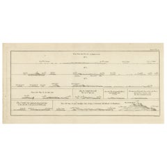
Antique Map of the Admiralty Islands, Bismarck Archipelago
Located in Langweer, NL
Antique map titled 'Trois Vues des Isles de l'Amirauté'. Several coastal views of the Admiralty Islands, Bismarck Archipelago, to the north of New Guinea in the South Pacific Ocean.
...
Category
Late 18th Century Antique Continental Europe Maps
Materials
Paper
$361 Sale Price
20% Off
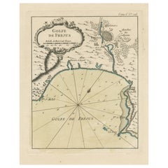
Antique Map of the Region of Fréjus, France
Located in Langweer, NL
Title: "Golf de Fréjus"
Description: This antique map, titled "Golf de Fréjus," is an original depiction of the region of Fréjus, France. It is part of the work "Le Petit Atlas Mari...
Category
Mid-18th Century Antique Continental Europe Maps
Materials
Paper
$282 Sale Price
30% Off
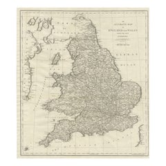
Large Antique Map of England and Wales
Located in Langweer, NL
Antique map titled 'An Accurate Map of England and Wales'. Original old map of England and Wales. Engraved by John Cary. Originates from 'New British Atlas' by John Stockdale, publis...
Category
Early 19th Century Antique Continental Europe Maps
Materials
Paper
$313 Sale Price
20% Off
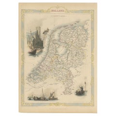
Antique Map of Holland with Colorful Vignettes, 1851
Located in Langweer, NL
Antique map titled 'Holland'.
Decorative map of Holland. Includes vignettes of Rotterdam, Dutch Peasants and a boating scene on the Dort, the Netherlands.
Originates from 'Th...
Category
19th Century Antique Continental Europe Maps
Materials
Paper
$156 Sale Price
20% Off
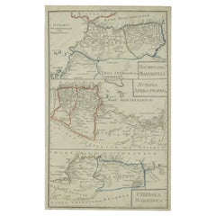
Antique Map of Mauritania, Massaesylia, Numidia, Tunisia, Cyrenaica & Marmarica
Located in Langweer, NL
Three maps on one sheet showing Mauritania, Massaesylia, Numidia, Tunisia, Cyrenaica and Marmarica (ancient Libya). This map originates from 'Schul-Atlas für die alte Erdbeschreibung...
Category
Early 19th Century Antique Continental Europe Maps
Materials
Paper
$342 Sale Price
20% Off
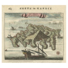
Old Print of Standia, a Greek Island 'Heraklion, Crete, Greece, Balkans', 1688
Located in Langweer, NL
Antique print Greece titled 'Het Eilant Standia'. Old print of the island Standia, near Crete, Greece. This print originates from 'Nauwkeurige Bes...
Category
17th Century Antique Continental Europe Maps
Materials
Paper
$275 Sale Price
20% Off
Antique Map of the War Situation in Europe and Asia, 1944
Located in Langweer, NL
Antique map titled 'Newsmap for the Armed Forces'. This "newsmap" was issued on Monday, December 18, 1944, and covers the news from December 6-13, 1945 - the 275th week of the war. T...
Category
20th Century Continental Europe Maps
Materials
Paper
$712 Sale Price
20% Off
Antique Map of the Region Around the Nile and the City of Carthage
Located in Langweer, NL
Antique map titled 'Aegypti recentior descriptio - Carthaginis Celeberrimi sinus typus'. Two detailed regional maps by Ortelius. One map shows the region around the Nile, as far as A...
Category
16th Century Antique Continental Europe Maps
Materials
Paper
$551 Sale Price
20% Off
Antique Print of a Lock of Hair by Gibb, 1890
Located in Langweer, NL
Antique print titled 'Lock of Hair of Mary Queen of Scots - Lock of Hair of King Charles I'. Chromolithographic plate originating from 'The Royal House of...
Category
19th Century Antique Continental Europe Maps
Materials
Paper
$80 Sale Price
20% Off
Old Map of the British Isles with the Faroes and Shetlands, Showing Cock Fights
Located in Langweer, NL
Antique map titled 'Les Isles Britaniques ou sont les Royaumes d'Angleterre (..)'. Original old map of the British Isles with inset maps of the Faroes and Shetlands. The title cartouche depicts dog...
Category
Early 18th Century Antique Continental Europe Maps
Materials
Paper
$437 Sale Price
20% Off
Antique Map of the Westerkwartier Region, a Region in Groningen, 1791
Located in Langweer, NL
Antique map titled 'Das Wester Quartier'. Original antique map of Westerkwartier, a region in the province of Groningen, the Netherlands. This map orginates from 'Schauplatz der fünf...
Category
18th Century Antique Continental Europe Maps
Materials
Paper
Antique Panoramic View of the Town of Malacca, Malaysia, 1726
Located in Langweer, NL
Antique print Malaysia titled 'De Stad Malacka'.
Decorative panoramic view of the town of Malacca with European vessels in the foreground. The old C...
Category
1720s Antique Continental Europe Maps
Materials
Paper
$706 Sale Price
30% Off
Antique Map of the Islands of Iwo Jima and Sulfur
Located in Langweer, NL
Untitled Antique Map of the islands of Iwo Jima and Sulfur, with a view of Sulphur with the hill. This map originates from 'A new, authentic, and complete collection of voyages round...
Category
Late 18th Century Antique Continental Europe Maps
Materials
Paper
$247 Sale Price
20% Off
Antique Map of Berkshire, South East England
By Joan (Johannes) Blaeu
Located in Langweer, NL
Antique map titled 'Bercheria vernacule Barkshire'. Original old map of Berkshire, a historic county in South East England. Published circa 1665 by J. Blaeu. Willem Jansz. Blaeu and ...
Category
Mid-17th Century Antique Continental Europe Maps
Materials
Paper
$1,140 Sale Price
20% Off
Antique Map of the Island of Borneo in Asia (Indonesia), 1726
Located in Langweer, NL
Antique map titled 'Kaart van het Eyland Borneo'. Early map of the island of Borneo. This map originates from 'Oud en Nieuw Oost-Indiën' by F. Valentijn.
Artists and Engravers: Fran...
Category
18th Century Antique Continental Europe Maps
Materials
Paper
$3,665 Sale Price
20% Off
Old Hand-Colored Map of Western Tartary with Focus on Present-Day Mongolia, 1749
Located in Langweer, NL
Antique map titled 'Carte de la Tartarie Occidentale pour Servir a l'Histoire Générale des Voyages. Tirée des Auteurs Anglois.'
This map covers western Tartary and focuses on the...
Category
1740s Antique Continental Europe Maps
Materials
Paper
$418 Sale Price
20% Off
Maps of the Ancient World and the Posterity of Noah, 1820
Located in Langweer, NL
Two maps on one sheet. Hhand colored engraved lithograph, depicting the world as known to the Ancients on Mercator's projection and the Posterity of Noah. The first showns the Empire...
Category
19th Century Antique Continental Europe Maps
Materials
Paper
$237 Sale Price
20% Off
Antique Map of Zaltbommel in the Netherlands, by Guicciardini, 1613
Located in Langweer, NL
Antique print titled 'Civitas Bommelia (..)'. Beautiful plan of Zaltbommel, Gelderland (the Netherlands). This map originates from 'Discrittione di tutti i Paesi Bassi' by L. Guiccia...
Category
17th Century Antique Continental Europe Maps
Materials
Paper
$361 Sale Price
20% Off
Antique Map of Hondarribia Near the Bidasoa River, France & Spain
Located in Langweer, NL
Antique map titled 'Plan de Fontarabie et de la redoute d'Andaye'. Original old map of Hondarribia near the Bidasoa river, a river in the Basque Country of northern Spain and souther...
Category
Mid-18th Century Antique Continental Europe Maps
Materials
Paper
$323 Sale Price
20% Off
Antique Map of Siberia by Lapie, 1842
Located in Langweer, NL
Antique map titled 'Carte de la Sibérie ou Russie d'Asie'. Map of Siberia. This map originates from 'Atlas universel de géographie ancienne et moderne (..)' by Pierre M. Lapie and Al...
Category
19th Century Antique Continental Europe Maps
Materials
Paper
$332 Sale Price
20% Off
Original Antique Map of the Township of Winschoten in The Netherlands, 1862
Located in Langweer, NL
Groningen: Gemeente Winschoten-St. Vitus Holt. These scarse detailed maps of Dutch Towns originate from the 'Gemeente atlas van de Provincie Groningen in 62 kaarten.' by C. Fehse. Th...
Category
19th Century Antique Continental Europe Maps
Materials
Paper
$152 Sale Price
20% Off
Old Print from Capt. Cooks Travels with Boats and a Ship in the South Sea, 1803
Located in Langweer, NL
Antique print titled 'Gezigt van eenen grooten Ys-klomp drijvende in de Zuid-Zee 9. jan. 1773'.
Antique print depicting boats and a ship near ice islands. Originates from 'Reizen...
Category
Early 1800s Antique Continental Europe Maps
Materials
Paper
$304 Sale Price
20% Off
Large Antique County Map of Middlesex, England
Located in Langweer, NL
Antique map titled 'A Map of Middlesex from the best Authorities'. Original old county map of Middlesex, England. Engraved by John Cary. Originates from 'New British Atlas' by John S...
Category
Early 19th Century Antique Continental Europe Maps
Materials
Paper
$266 Sale Price
20% Off
Antique Print with Coastal Views of Kamchatka in The Russian Far East, c.1784
Located in Langweer, NL
Antique print titled 'Views of the Coast of Kamtschatka (..)'. Print with coastal views of Kamchatka including volcanoes. Originates from an edition of Cook's Voyages.
Artists and ...
Category
18th Century Antique Continental Europe Maps
Materials
Paper
$304 Sale Price
20% Off
Large Title Cartouche and a View of Wilhermsdorf, Beieren, Germany, 1744
Located in Langweer, NL
Antique print titled 'Sauber und nach dem Leben gezeichnete Prospecten und Plans, von den wichtigsten der Holländisch-Ost-Indischen-Compagnie in Africa u: Asia (..)'. Frontispiece of...
Category
1740s Antique Continental Europe Maps
Materials
Paper
$275 Sale Price
20% Off
Antique Map of the Region of Winschoten, Groningen in The Netherlands, 1862
Located in Langweer, NL
Groningen: Gemeente Arrondisement Winschoten. These scarse detailed maps of Dutch Towns originate from the 'Gemeente atlas van de Provincie Groningen in 62 kaarten.' by C. Fehse. Thi...
Category
19th Century Antique Continental Europe Maps
Materials
Paper
$180 Sale Price
20% Off
Antique Map of the City of Berlin in Germany, '1847'
Located in Langweer, NL
Antique map titled 'Berlin'. Original antique map of the city of Berlin, Germany. This map originates from 'Abrégé de Géographie (..)' by Adrien Balbi. Published 1847.
Category
Mid-19th Century Antique Continental Europe Maps
Materials
Paper
$142 Sale Price
20% Off
Antique Map of the State of Ohio by Titus '1871'
Located in Langweer, NL
Antique map titled 'Railroad & Township Map of the State of Ohio'. Original antique map of the State of Ohio. This map originates from 'Atlas of Preble County Ohio' by C.O. Titus. Pu...
Category
Late 19th Century Antique Continental Europe Maps
Materials
Paper
$1,069 Sale Price
25% Off
View of the City Banten or Bantam Near the Western End of Java, Indonesia, c1725
Located in Langweer, NL
Antique print titled 'La Ville de Bantam capitale du Roiaume de meme nom'.
A bird's eye view of the city Banten or Bantam near the western end of Java in Indonesia. Several tall ...
Category
1720s Antique Continental Europe Maps
Materials
Paper
$703 Sale Price
20% Off
Antique Map of the Extension of the Russian Empire in the XIXth Century, 1806
Located in Langweer, NL
Antique map titled 'L'Empire Russe en Europe et en Asie'.
Map showing the extension of the Russian Empire at the beginning of the XIXth century. Several letterpress notations are...
Category
Early 1800s Antique Continental Europe Maps
Materials
Paper
$532 Sale Price
20% Off
Antique Map of the Region of Étampes and Sens by Janssonius, c.1650
Located in Langweer, NL
Antique map titled 'Gastinois et Senonois'. Old map of the region of Étampes and Sens, France. It shows the cities of Sens, Melun, Étampes, Orleans, Fontainebleau, Montargis and othe...
Category
17th Century Antique Continental Europe Maps
Materials
Paper
$337 Sale Price
20% Off
Antique Map of the Eastern Part of Germany, with Parts of Poland and Slovakia
Located in Langweer, NL
Antique map titled 'A New Map of the Circle of Upper Saxony: with the Duchy of Silesi and Lusatia, from the latest authorities'. Clear and accurate map of what is now the eastern par...
Category
Early 19th Century Antique Continental Europe Maps
Materials
Paper
$418 Sale Price
20% Off
Antique Map of Java, Madura, Bali and the Sunda Strait, Indonesia, c.1770
Located in Langweer, NL
Antique map Indonesia titled 'Nouvelle Carte de l'Isle de Java - Nieuwe kaart, van het Eiland Java'. Chart of the island of Java, depicting soun...
Category
18th Century Antique Continental Europe Maps
Materials
Paper
$427 Sale Price
20% Off
Print of the British Parliament & an Assembly before the King of England, 1732
Located in Langweer, NL
Antique print titled 'Representation du Parlement d'Angletrre (..)'.
Series of scenes, which include from the British Parliament and an assembly...
Category
1730s Antique Continental Europe Maps
Materials
Paper
$703 Sale Price
20% Off
1850 Old French Map Depicting the Entire Earth's Surface Divided into Two Parts
Located in Milan, IT
Geographical map depicting the entire earth's surface divided into two parts that correspond to the two hemispheres or globes, the map deals with the earth in general. Detailed expla...
Category
Mid-19th Century French Antique Continental Europe Maps
Materials
Glass, Wood, Paper
Original Map of the Military Situation After the Dutch Blockade of Antwerp, 1648
Located in Langweer, NL
Antique map titled 'Tabula Castelli ad Sandflitam (..)'.
This map depicts the complex military situation that had developed after the Dutch blockade of Antwerp. All entrenchment'...
Category
1640s Antique Continental Europe Maps
Materials
Paper
$636 Sale Price
20% Off
Very Detailed Antique Map of the Jesuit Province of Bavaria, Germany, c.1700
Located in Langweer, NL
Antique map titled 'Provinciae Superior Germaniae Societatis.' Very detailed map of the Jesuit province of Bavaria, Germany. Source unknown, to be determined.
Artists and Engravers:...
Category
18th Century Antique Continental Europe Maps
Materials
Paper
$570 Sale Price
20% Off
Antique Map of the Niederrhein region, Germany
Located in Langweer, NL
Antique map titled 'Circulus Electorum Rheni sive Rhenanus Inferior (..)'. Original antique map of the Niederrhein region, Germany. By F. de Wit, circa 1690.
Frederick de Wit (1629-...
Category
Late 17th Century Antique Continental Europe Maps
Materials
Paper
$427 Sale Price
20% Off
Old Engraving of Volcano Piton de la Fournaise on Reunion Island, c.1750
By Jakob van der Schley
Located in Langweer, NL
Antique print titled 'Eiland van St. Filippus, of van Fuego, met zyn vuurberg'. Old print of Piton de la Fournaise, a shield volcano on the eastern side of Reunion island...
Category
18th Century Antique Continental Europe Maps
Materials
Paper
$228 Sale Price
20% Off
Antique Map of the Region of Nivernais by Janssonius, 1657
By Johannes Janssonius
Located in Langweer, NL
Antique map of France titled 'Carte du Païs et Duché de Nivernois'. Decorative map of the Nivernais region, part of Burgundy, France. This map originates from 'Atlas Novus, Sive Thea...
Category
17th Century Antique Continental Europe Maps
Materials
Paper
$370 Sale Price
20% Off
Original Antique Map of the Township of Borger in The Netherlands, 1865
Located in Langweer, NL
Drenthe - Gemeente Borger, Drouwen, Buinene, Westdorp. These scarse detailed maps of Dutch Towns originate from the 'Gemeente-atlas' of Jacob Kuyper. This atlas of all towns in the N...
Category
19th Century Antique Continental Europe Maps
Materials
Paper
$171 Sale Price
20% Off
Antique Map of India, the East Indies and the Philippines
Located in Langweer, NL
Antique map titled 'Les Indes Orientales et leur Archipel'. Original antique map of India, the East Indies and the Philippines. Source unknown, to be determined. Published circa 1760.
Category
Mid-18th Century Antique Continental Europe Maps
Materials
Paper
$361 Sale Price
20% Off
Antique Print with Coastal Views of Kamchatka in Russia by Cook, 1803
Located in Langweer, NL
Antique print Russia titled 'Gezigten der Kust van Kamtchatka'. Print with coastal views of Kamchatka including volcanoes. Originates from 'Reizen...
Category
19th Century Antique Continental Europe Maps
Materials
Paper
$275 Sale Price
20% Off
Architectural Antique Print of Various Garden Temples by Le Rouge, c.1785
Located in Langweer, NL
Untitled antique print showing various garden temples. This print originates from 'Jardins Anglo-Chinois à la Mode' by Georg Louis le Rouge. Artists and ...
Category
18th Century Antique Continental Europe Maps
Materials
Paper
Antique Print of the Palace of Justice in Leeuwarden by Terwen, 1858
Located in Langweer, NL
Antique print titled 'Leeuwarden. Het Paleis van Justitie.' Old print of the city of Leeuwarden showing the Palace of Justice. This print originates from 'Het koningrijk der Nederlan...
Category
19th Century Antique Continental Europe Maps
Materials
Paper
Antique French Map of the Pacific Ocean with Australia and Polynesia, 1806
Located in Langweer, NL
Antique map titled 'Australasie et Polynesie'. Old map of Oceania and the Pacific Ocean. Originates from 'Atlas Portatif contenant la Géographie Universelle Ancienne et Moderne' by H...
Category
19th Century Antique Continental Europe Maps
Materials
Paper
$114 Sale Price
20% Off
Antique Map of Peru and Bolivia by Thierry, 1836
Located in Langweer, NL
Antique map titled 'Pérou et Bolivia'. Decorative map of Peru and Bolivia with outline coloring. Originates from 'Atlas Complet Du Precis De La Geographie ...
Category
19th Century Antique Continental Europe Maps
Materials
Paper
$123 Sale Price
20% Off
Antique Map of the region of Lennep, Blankenburg and Dortmund, Germany
Located in Langweer, NL
Antique map titled 'Berge Ducatus Marck Comitatus'. Original antique map of the region of Lennep, Blankenburg and Dortmund, Germany. Published by Hondius, circa 1644.
Category
Mid-17th Century Antique Continental Europe Maps
Materials
Paper
$648 Sale Price
30% Off
Antique Map of the French Colonies in Senegal and Madagascar by V. Levasseur
By Victor Levasseur
Located in Langweer, NL
The antique map titled 'Colonies Françaises (en Afrique)' presents a decorative depiction of the French colonies located in Senegal and Madagascar within Africa. Surrounding the map ...
Category
Mid-19th Century Antique Continental Europe Maps
Materials
Paper
$190 Sale Price
20% Off
Antique Map op Siberia and Chinese Tartary with original hand coloring, 1732
Located in Langweer, NL
Antique map titled 'Nieuwe Kaart van Tartarie na de alderlaatste ontdekking int ligt gebragt'. Map op Siberia and Chinese tartary. In the north Novaya Zemlya curls back to attach its...
Category
Mid-18th Century Antique Continental Europe Maps
Materials
Paper
$760 Sale Price
20% Off
Large Antique Map of Gaul under Roman Rule, ca.1760
Located in Langweer, NL
Antique map titled 'Gallia Augustiniana in suas provincias divisa (..)'. Large antique map of Roman Gaul, it refers to Gaul under provincial rule in ...
Category
1760s Antique Continental Europe Maps
Materials
Paper
$399 Sale Price
20% Off
Antique Map of Southeast Asia by J. Ottens, 1710
Located in Langweer, NL
Antique map titled 'Le Royaume de Siam avec Les Royaumes Qui Luy sont Tributaries'. Influential map of Southeast Asia. Ottens incorporated information provided by the French Jesuits ...
Category
Early 18th Century Antique Continental Europe Maps
Materials
Paper
$1,008 Sale Price
41% Off
Copper Engraving Showing the Neptune Fountain of Versailles, Paris, France, 1785
Located in Langweer, NL
Antique print titled 'Plan de la décoration du Bassin de Neptune à Versailles'.
Copper engraving showing parts of the Neptune fountain of Versaill...
Category
1780s Antique Continental Europe Maps
Materials
Paper
$370 Sale Price
20% Off
Antique Lithograph of a Japanese Junk, a Type of Sailing Ship, 1856
Located in Langweer, NL
Antique print titled ‘Japanese Junk'.
Lithograph of a Japanese junk, a type of sailing ship. This print originates from 'Narrative of the expedition of an A...
Category
1850s Antique Continental Europe Maps
Materials
Paper
$361 Sale Price
20% Off
Antique Map of the Westphalia region of Germany
Located in Langweer, NL
Antique map titled 'Circulus Westphaliae (..)'. Original old map of the Westphalia region, Germany. Published by Justus Danckerts, circa 1696.
Justus Danckerts I (11 November 1635 ...
Category
Late 17th Century Antique Continental Europe Maps
Materials
Paper
$655 Sale Price
20% Off
Antique Map of Ijlst , Friesland in the Netherlands, 1865
Located in Langweer, NL
Friesland: Gemeente IjJlst. These scarse detailed maps of Dutch Towns originate from the 'Gemeente-atlas' of Jacob Kuyper. This atlas of all towns in the Netherlands was published fr...
Category
19th Century Antique Continental Europe Maps
Materials
Paper
$180 Sale Price
20% Off
Antique Map of Western Russia by Levasseur, '1875'
Located in Langweer, NL
Antique map titled 'Carte de la Russie Occidentale (..)'. Large map of Western Russia. This map originates from 'Atlas de Géographie Moderne Physique et Politique' by A. Levasseur. P...
Category
Late 19th Century Antique Continental Europe Maps
Materials
Paper
$332 Sale Price
20% Off
Old Copper Engraving of the City of Kajutsiu in China, 1668
By Johannes Nieuhof
Located in Langweer, NL
Antique print China titled ‘Kajutsiu'. This plate shows a view on the Chinese city of Kajutsiu. This print originates from the Latin edition of Nie...
Category
17th Century Antique Continental Europe Maps
Materials
Paper
$323 Sale Price
20% Off
Antique Map of Barbary and Biledulgerid by Sanson, 1705
Located in Langweer, NL
Antique map, titled: 'Gedeelte van Barbaryen (…).' - Decorative hand colored map of a part of Barbary (Algeria) and Biledulgerid (Tegoryn, Zeb etc.), North Africa. Source unknown, to...
Category
18th Century Antique Continental Europe Maps
Materials
Paper
$304 Sale Price
20% Off
Map of East Friesland, The Netherlands & the Area Emden & Norden, Germany, 1635
Located in Langweer, NL
Antique map titled 'Typus Frisiae Orientalis.'
Map of East Friesland and the area around Emden and Norden. Large inset map of the mouth of the Amasis River. The map is decorated with a large title cartouche and two large coats of arms...
Category
1630s Antique Continental Europe Maps
Materials
Paper
$1,758 Sale Price
20% Off
Recently Viewed
View AllMore Ways To Browse
Vintage Industrial Bins
Vintage Liquor Labels
Vintage Utensil Holders
Vintage Wicker Wine Bottles
Vintage Wrought Iron Fire Screen
Viso Porcelain
Wall Mount Water Fountains
Wedding Cabinets and Armoires
Wedgwood Green Jasperware
Wedgwood Portrait
West German Pot
White Ceramic Garden Stool
White Ironstone China
White Lacquer Bar Cart
Woman With Water Jug
Wooden Chest 1800
Wooden Tea Cart
Worcester Jug
