Netherlands - More Furniture and Collectibles

to
4,881
7,314
30,911
28,195
7,117
162
35
337
116
55
47
33
21
20
17
17
16
10
7
6
5
3
2
2
3,187
2,583
1,347
197
488
435
157
104
15
64
49
18
113
143
101
25
12
5,798
781
614
226
173
1,814
478
434
231
168
7,314
7,216
7,262
104
58
28
20
18
Item Ships From: Netherlands
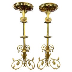
Antique Hand Crafted Pair of Gothic Revival Church Columns / Pedestal Stands
Located in Lisse, NL
Beautiful quality and very good condition pair of Gothic church sculpture or candle stands. If only the rarest is good enough for you then this, possibly unique, pair of antique chu...
Category

Late 19th Century European Gothic Revival Antique Netherlands - More Furniture and Collectibles

Materials

Brass, Bronze

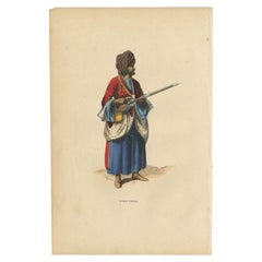
Antique Handcolored Print of an Afghan from Herat in Afghanistan, 1843
Located in Langweer, NL
Antique costume print titled 'Afghan d'Herat'. Original antique print of an Afghan from Herat. This print originates from 'Moeurs, usages et costumes de tous les peuples du monde' by...
Category

19th Century Antique Netherlands - More Furniture and Collectibles

Materials

Paper

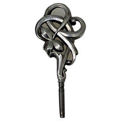
19th Century Dutch Art Nouveau silver watch-key, 1890
Located in Delft, NL
19th Century Dutch Art Nouveau silver watch-key, 1890 A silver watch key with Art Nouveau leaf pattern. The key is Dutch silver hallmarked with "Boar...
Category

Late 19th Century Dutch Antique Netherlands - More Furniture and Collectibles

Materials

Silver

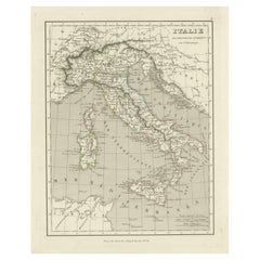
Antique Map of Italy and Other Regions Near the Adriatic Sea
Located in Langweer, NL
Antique map titled 'Italie et Provinces Autrichnes sur l'Adriatique'. Original old map of Italy and surroundings. Also shows Sicily and Sardinia. Ori...
Category

Mid-19th Century Antique Netherlands - More Furniture and Collectibles

Materials

Paper

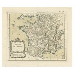
Antique Map of France with Decorative Title Cartouche
Located in Langweer, NL
Antique map titled 'Carte de la France'. Original old map of France. This map originates from 'Le Petit Atlas Maritime Recueil De Cartes et Plans Des Quatre Parties Du Monde (..) by ...
Category

Mid-18th Century Antique Netherlands - More Furniture and Collectibles

Materials

Paper

Old Map of the Sinai Peninsula Showing the Mediterranean and the Red Sea, 1773
Located in Langweer, NL
Antique map of the Sinai Peninsula showing the Mediterranean Sea to the north and the Red Sea to the south. The map is decorated with images of a Persian wheel and a view of a vi...
Category

1770s Antique Netherlands - More Furniture and Collectibles

Materials

Paper

Antique Print of an Augustinian in White Habit of a Christian Religious Order
Located in Langweer, NL
Antique print titled 'Augustin en Habit Ordinaire dans la Maison'. Print of an Augustinian in white habit. This print originates from 'Histoire et Costumes des Ordres Religieux'. ...
Category

19th Century Antique Netherlands - More Furniture and Collectibles

Materials

Paper

Antique Map of Edom, an Ancient Kingdom in Transjordan, 1773
Located in Langweer, NL
Antique print titled 'Idumea, of thet Land der Philistynen'. Old map of Edom, an ancient kingdom in Transjordan located between Moab to the northeast, the Arabah to the west and the ...
Category

18th Century Antique Netherlands - More Furniture and Collectibles

Materials

Paper

19th Century wooden dollhouse cabinet filled with pewter and bear
Located in Delft, NL
19th Century wooden dollhouse cabinet filled with pewter and bear A cabinet painted with the look of pine, made of soft wood with 2 doors in the low...
Category

19th Century Dutch Antique Netherlands - More Furniture and Collectibles

Materials

Pewter

Antique Print of The Roman Catholic Cathedral in Fribourg, Switzerland, 1860
Located in Langweer, NL
Antique print titled 'Abside de la Cathedrale de Fribourg'. Antique print depicting the Chancel End of Freyburg Cathedral. Fribourg Cathedral (French: Cathédrale Saint-Nicolas de Fribourg) is a Roman Catholic...
Category

19th Century French Antique Netherlands - More Furniture and Collectibles

Materials

Paper

A Pair Early 20th Century Bookends - Dog and Cat Figurines - Art Deco
Located in Casteren, Noord-Brabant
A lovely pair of Art Deco bookends with spelter figurines of a cat and dog with glass eyes. On a Porte Nero marble plint. Made in France, 1920-1930. The set is in good condition. Di...
Category

1920s French Art Deco Vintage Netherlands - More Furniture and Collectibles

Materials

Marble, Spelter

1692 Jacq. Peeters Map: East Indies, Indonesia, Japan, Philippines and Singapore
Located in Langweer, NL
1692 Jacques Peeters Map: East Indies, Indonesia & Japan with Unique Inset This hand-colored map from 1692, created by Jacques Peeters, captures the islands of Indonesia, the Philippines, and features a unique inset of Japan. It closely resembles Nicolas de Fer's map and is primarily based on Sanson's influential maps. The map meticulously details cities, smaller settlements, rivers, mountain chains, and forests, offering a comprehensive view of the region's geography. The inset map of Japan stands out due to its distinctive shape and influences, reflecting different cartographic sources. Notable features include the marked equator and detailed latitude and longitude indications on the borders. The map measures 6.5 inches in width by 5.5 inches in height and is in excellent condition, with a dark impression, slight toning, and a minor centerfold crease. Keywords: - East Indies map - Indonesia historical map - Philippines map...
Category

1690s Antique Netherlands - More Furniture and Collectibles

Materials

Paper

Arctic Exploration: An Original Map of the North Circumpolar Regions, 1882
Located in Langweer, NL
This map, extracted from the 1882 atlas by Blackie & Son, presents the North Circumpolar Regions in a projection centered on the North Pole, offering a unique view of the Arctic territories. The map's radial lines emanate from the pole, focusing on the northernmost parts of continents and the intricate archipelagos that are scattered across the Arctic Ocean. The territories of Canada, Greenland, Northern Europe, Russia, and the northern extremities of Asia are portrayed with careful detail, highlighting the geography known to Victorian explorers. Notably, the map's color palette is subdued, with the cold regions depicted in pale hues, while coastlines and political boundaries are traced in warmer tones, providing a stark contrast that emphasizes the frigid environment. The map likely served purposes both educational and navigational, capturing the extent of polar exploration at the time. Names of seas, straits, and islands honor explorers and patrons of the age of Arctic exploration, and the map also hints at the incomplete knowledge of the era, with some areas less detailed than others, reflecting the limits of exploration and cartographic knowledge of the Arctic region at that time. Moreover, the map includes longitudinal and latitudinal markers, which would have been crucial for navigation and expedition planning. The inclusion of such detail illustrates the growing interest in polar exploration during the late 19th century...
Category

1880s Antique Netherlands - More Furniture and Collectibles

Materials

Paper

Austria by Wolfgang Lazius – A Magnificent 16th-Century Map from Ortelius
Located in Langweer, NL
Title: Avstriae Descrip – Wolfgang Lazius’ Map of Austria, 16th Century Description: This extraordinary map of Austria pays homage to the Austrian humanist and cartographer Wo...
Category

16th Century Antique Netherlands - More Furniture and Collectibles

Materials

Paper

Original Antique Map of the English counties Cornwall, Devon, Dorset, etc, 1633
Located in Langweer, NL
Antique map titled 'Cornubia, Devonia, Somersetus, Dorcestria, Wiltonia, Glocestria, Monumetha, Glamorgan, Caermarden, Penbrok, Cardigan, Radnor, Breknoke et Herfordia'. Old map of the English counties of Cornwall, Devon, Somerset, Dorset, Wiltshire, Gloucestershire, Herefordshire, Worcestershire etc. Originates from the 1633 German edition of the Mercator-Hondius Atlas Major, published by Henricus Hondius and Jan Jansson under the title: 'Atlas: das ist Abbildung der gantzen Welt, mit allen darin begriffenen Laendern und Provintzen: sonderlich von Teutschland, Franckreich, Niderland, Ost und West Indien: mit Beschreibung der selben.' Artists and Engravers: Gerard Mercator (1512 - 1594) originally a student of philosophy was one of the most renowned cosmographers and geographers of the 16th century, as well as an accomplished scientific instrument maker. He is most famous for introducing Mercators Projection, a system which allowed navigators to plot the same constant compass bearing on a flat...
Category

1630s Antique Netherlands - More Furniture and Collectibles

Materials

Paper

Gilt Bronze Gothic Revival Table Clock w. Earth Angel Sculpture by Devaulx Paris
By devaulx
Located in Lisse, NL
Rare and wonderful antique clock from the early 1800s. Marked: S. Devaulx, Paris. Having an impressive, stylish and sizable antique clock like this gracing your mantel piece or sid...
Category

Early 19th Century French Gothic Revival Antique Netherlands - More Furniture and Collectibles

Materials

Brass, Bronze

Antique Map of Italy by Lapie, 1842
Located in Langweer, NL
Antique map titled 'Carte de l'Italie Ancienne'. Map of Italy. This map originates from 'Atlas universel de géographie ancienne et moderne (..)' by Pierre...
Category

Mid-19th Century Antique Netherlands - More Furniture and Collectibles

Materials

Paper

Old Original Hand-Colored Engraving of Various Apples, 1758
Located in Langweer, NL
Antique print depicting apple variaties including the Pigeon of Passe Pomme, Rode Herfst- of Winter Calville, Witte Ribbert of Ribling, Winter Parmain Pepping, Paasch Appel, Wyker Pe...
Category

18th Century Antique Netherlands - More Furniture and Collectibles

Materials

Paper

Old Map of the Black Sea, The Krim, Ukraine, Russia, etc in Historic Times, 1848
Located in Langweer, NL
Antique map titled 'Pontus Euxinus'. Old map of the black Sea and surroundings originating from 'Orbis Terrarum Antiquus in usum Scholarum'. Artists and Engravers: Published by J...
Category

1840s Antique Netherlands - More Furniture and Collectibles

Materials

Paper

Antique Map of Guadeloupe and Dependencies – France Pittoresque, c. 19th Century
Located in Langweer, NL
Antique Map of Guadeloupe and Dependencies – France Pittoresque, c. 19th Century This finely engraved antique map of Guadeloupe and its dependencies originates from France Pittore...
Category

1830s Antique Netherlands - More Furniture and Collectibles

Materials

Paper

Antique World Map by Lesage, 1823
Located in Langweer, NL
Antique world map titled 'Mappe Monde Historique'. The map depicts both the Eastern and Western Hemispheres, with the hemispheres meeting in the midd...
Category

Early 19th Century Antique Netherlands - More Furniture and Collectibles

Materials

Paper

Antique World Map by Lesage, 1823
$286 Sale Price
20% Off
Engraving of the Deity Quante-Cong 'or Shangdi', First Ruler of China, 1808
Located in Langweer, NL
Antique print titled 'Quantecong, a divinity of the Chinese, which they suppose to have been their first Emperor'. Engraving of the deity Quante-Cong (or Shangdi), first ruler of C...
Category

Early 1800s Antique Netherlands - More Furniture and Collectibles

Materials

Paper

Antique Map of North America by Dufour 'circa 1834'
Located in Langweer, NL
Antique map titled 'Amérique Septentrionale'. Uncommon map of North America. Published by or after A.H. Dufour, circa 1834. Source unknown, to be determined.
Category

Mid-19th Century Antique Netherlands - More Furniture and Collectibles

Materials

Paper

Antique Map of Java and Madura Island, Indonesia, c.1760
Located in Langweer, NL
Antique map titled 'Idee de l'Isle de Java.' Well engraved and attractive chart of the island shows all principal harbors and coastal details, plus rivers, mountains and volcanoe...
Category

18th Century Antique Netherlands - More Furniture and Collectibles

Materials

Paper

Antique Map of the Township of Zuidhorn in The Netherlands, 1862
Located in Langweer, NL
Groningen: Gemeente Noordhorn-Zuidhorn. These scarse detailed maps of Dutch Towns originate from the 'Gemeente atlas van de Provincie Groningen in 62 kaarten.' by C. Fehse. This atla...
Category

19th Century Antique Netherlands - More Furniture and Collectibles

Materials

Paper

Vintage School Chart of Coal Mining Operation Plus Cross Section on Verso, 1931
Located in Langweer, NL
Title: De Mijn Maurits bij Sittard (The Maurits Mine near Sittard). On the verso 'Doorsnede van een kolen mijn in Limburg'. Translated: Cross Section of a Coalmine in Limburg (a province in the South of The Netherlands). Sittard is a city in the province of Limburg, in the south of Holland. In 1947 this coal mine was connected to another mine: the Emma Mine, by a 13 km straight tunnel. In the second half of the 1940s and in the 1950s the mine was expanded, and mining reached a depth of 810 m. A third shaft was completed in 1958. At the time of completion of the third shaft, the Maurits mine was the largest two-shafts mine in the world. It was the largest coal mine in the Netherlands. When in the beginning of the 1960s the economic tide for coal mining...
Category

Early 20th Century European Netherlands - More Furniture and Collectibles

Materials

Other

Old German Map of the Austrian Empire, ca.1870
Located in Langweer, NL
Antique map titled 'Kaiserthum Österreich'. Old map of the Austrian Empire. This map originates from 'H. Kiepert's Kleiner Atlas der Neueren Geographie für Schule und Haus'. Arti...
Category

1870s Antique Netherlands - More Furniture and Collectibles

Materials

Paper

Antique Map of the British Isles with Outline Coloring
Located in Langweer, NL
Antique map titled 'Iles Britanniques'. Attractive map of the British Isles. Details England, Scotland and Ireland as well as parts of neighboring France. Upper right corner features...
Category

Mid-19th Century Antique Netherlands - More Furniture and Collectibles

Materials

Paper

Antique Map of Western Russia by Covens & Mortier, 1740
Located in Langweer, NL
Antique map titled 'Carte de Moscovie'. Antique map of the western portion of Russia. The map centers on Moscow (shown near the top of the lower sheet) and spans from the Sea of Azov...
Category

Mid-18th Century Antique Netherlands - More Furniture and Collectibles

Materials

Paper

Old Map of Vaucluse, France: A Cartographic Celebration of Viticulture, 1852
Located in Langweer, NL
This original hand-colored map is from the "Atlas National Illustré," a work by Victor Levasseur, a French geographer and cartographer known for his richly illustrated maps. The map...
Category

1850s Antique Netherlands - More Furniture and Collectibles

Materials

Paper

Antique Map of the United States with Vignette of Washington
Located in Langweer, NL
Antique map titled 'États-Unis'. A very attractive and detailed late 19th century map of the United States, with a fine decorative vignette of Washington. The extensive railway netwo...
Category

Late 19th Century Antique Netherlands - More Furniture and Collectibles

Materials

Paper

Rare Antique Engraving of a Large Ornamental Bacchic Altar or Pedestal, 1740
Located in Langweer, NL
Antique print titled 'Ara, o Base con Baccanali'. Plate XXXVI: A large, ornamental Bacchic altar or pedestal, with a relief in the centre showing a female sitting beside a reclinin...
Category

1740s Antique Netherlands - More Furniture and Collectibles

Materials

Paper

Antique Map of the Province of Zeeland, The Netherlands by Coronelli, 1692
Located in Langweer, NL
Antique map titled 'Contado di Zelanda'. Beautiful map of the Dutch province of Zeeland. With the islands of Walcheren, Schouwen-Duiveland, Noord-Beveland, Zuid-Beveland, Tholen and ...
Category

17th Century Antique Netherlands - More Furniture and Collectibles

Materials

Paper

Antique Map of the Hainaut Region by Visscher, c.1690
By Nicolaes Visscher II
Located in Langweer, NL
Antique map titled 'Comitatus Hannoniae et Archiepiscopatus Cameracensis Tabula'. Large map of the Hainaut region, France. Artists and Engravers: Nicolaes Visscher II (1649, Amst...
Category

17th Century Antique Netherlands - More Furniture and Collectibles

Materials

Paper

Antique Map of a Bay on the Coast of Chile, South America, c.1749
Located in Langweer, NL
Antique map titled 'Plan van een Baai en Haven aan de Kust van Chili (..) - Plan d'une Baye de la Côte du Chili (..)'. Original antique map of a bay on the coast of Chile discovered ...
Category

18th Century Antique Netherlands - More Furniture and Collectibles

Materials

Paper

1882 Cartographic Views of Ireland's North and South Regions
Located in Langweer, NL
Title: 1882 Maps of Ireland: Northern and Southern Regions These two maps provide a detailed representation of Ireland as it was in 1882, divided into the northern and southern regi...
Category

1880s Antique Netherlands - More Furniture and Collectibles

Materials

Paper

Antique Map of Spain and Portugal, 1882
Located in Langweer, NL
"Antique map titled 'Spain & Portugal'. Old map of Spain and Portugal. This map originates from 'The Royal Atlas of Modern Geography, Exhibiting, in a S...
Category

19th Century Antique Netherlands - More Furniture and Collectibles

Materials

Paper

17th Century Rosewood and Ebony Coat Rack Attributed to Herman Doomer Amsterdam
Located in Amsterdam, NL
Magnificent and ultra rare Baroque period wall coat rack. Design attributed to Herman Doomer Amsterdam. Striking Dutch design from the 17th century. S...
Category

1650s Dutch Baroque Antique Netherlands - More Furniture and Collectibles

Materials

Ebony, Oak, Rosewood

Print of the Bridge of Painshill & Windsor Park, Belfast, Northern Ireland, 1785
Located in Langweer, NL
Antique print titled 'Pont de Painshill á M. Hamilton (..)'. Copper engraving of the bridge of Painshill and Windsor Park. This print originates from 'Jardins Anglo-Chinois à la ...
Category

18th Century Antique Netherlands - More Furniture and Collectibles

Materials

Paper

Map of the Electorate of Bavaria, Incl Lake Constance, by Jesuit Scherer, c.1700
Located in Langweer, NL
Antique map titled 'Electorat Bavariae.' Map of the Electorate of Bavaria by the Jesuit Heinrich Scherer. The lower map shows the Lake Constance. Source unknown, to be determined. ...
Category

Early 1700s Antique Netherlands - More Furniture and Collectibles

Materials

Paper

Antique Map of the Main Comoro Islands by Van Schley, 1749
By Jakob van der Schley
Located in Langweer, NL
Antique map titled ‘Carte des Isles de Comore (..) - Kaart van de Eilanden Komoro (..)’. Original antique map of the main Comoro Islands or Comoros including Comore, Mohéli, Anjouan ...
Category

18th Century Antique Netherlands - More Furniture and Collectibles

Materials

Paper

Antique Map of the World by Ferrario '1831'
Located in Langweer, NL
Original antique map of the world. This print originates from 'Costume Antico e Moderno: Palestine, China, India, Oceania' by Ferrario. Publis...
Category

Mid-19th Century Antique Netherlands - More Furniture and Collectibles

Materials

Paper

Wrought Iron Blue and Gold Colored Umbrella stand, France 1940's
Located in Den Haag, NL
Wrought Iron Blue and Gold Colored Umbrella stand, France 1940's
Category

1940s French Mid-Century Modern Vintage Netherlands - More Furniture and Collectibles

Materials

Wrought Iron

Early Woodcut Map of Franconia and Surrounding Regions, 1628
Located in Langweer, NL
Title: Early Woodcut Map of Franconia and Surrounding Regions, 1628 Franconia (Franckenlande) is a region in Germany. Historically, Franconia was a significant part of the Holy Roma...
Category

1620s Antique Netherlands - More Furniture and Collectibles

Materials

Paper

Old Hand-colored Antique Print of Garden Architecture by Van Laar, 1802
Located in Langweer, NL
Untitled print of garden architecture. It shows garden buildings. This print originates from 'Magazijn van tuin-sieraden'. The book is compiled by Gijsbert van Laar, providing a surv...
Category

19th Century Antique Netherlands - More Furniture and Collectibles

Materials

Paper

Antique Map of Stavoren by Priorato, 1673
Located in Langweer, NL
Antique map titled 'Staveren'. Original antique map of the city of Stavoren, Friesland, the Netherlands. This map orginates from 'Teatro del Belgio (..)', published in Frankfurt am Main in 1673 by Gualdo Priorato. Artists and Engravers: Author: Galeazzo Gualdo Priorato (1606-1678) entered military service at a very young age and served in Flanders under the Prince of Orange. After his retirement, he authored several historical accounts including the Teatro del Belgio, which described the Catholic/Protestant wars in Belgium and Netherlands during the seventeenth century. His superb plans do not show the internal layout of the cities, except for showing the locations of the major churches. Instead the emphasis is on the fortification, as well as on the surrounding site, rivers and canals...
Category

17th Century Antique Netherlands - More Furniture and Collectibles

Materials

Paper

Antique Map of Russia and Siberia by Migeon, 1880
Located in Langweer, NL
Antique map titled 'Sibérie ou Russie d'Asie'. Migeon's map covers the Russian empire in Asia from european Russia and the Ural Mountains to the Bering Strait and from the Arctic Cir...
Category

19th Century Antique Netherlands - More Furniture and Collectibles

Materials

Paper

Pl. XXV Villa Marguerite a Houlgate, Chabat, c.1900
Located in Langweer, NL
Antique print titled 'Villa Marguerite a Houlgate, Mr. E.M. Auburtin, Architecte'. This print depicts the design of a villa in France. Originates from 'La Brique et La Terre Cuite' b...
Category

20th Century Netherlands - More Furniture and Collectibles

Materials

Paper

Rare Antique Print of Temptation and Expulsion, c.1780
Located in Langweer, NL
Antique print religion titled 'Tulit Igitur Mulier de Fructu Illius, et Comedit (..)'. This print depicts Temptation and Expulsion. Originates from 'Frescoes in the Sistine Chapel'. ...
Category

18th Century Antique Netherlands - More Furniture and Collectibles

Materials

Paper

Antique Map of South Africa showing the Travels of Truter and Somerville
Located in Langweer, NL
Antique map titled 'Charte von Süd-Afrika'. Original antique map of South Africa showing the travels of Truter and Somerville. Published ci...
Category

Early 19th Century Antique Netherlands - More Furniture and Collectibles

Materials

Paper

Antique Print of 'Madonna del Gran Duca' Made after Perugino 'c.1890'
Located in Langweer, NL
Antique print titled 'Madonna del Gran Duca'. Original antique print on chine collé, made after the painting by Raphael. Source unknown, to be determined. Published circa 1890.
Category

Late 19th Century Antique Netherlands - More Furniture and Collectibles

Materials

Paper

Antique Map of the World on Mercator Projection by Anson, 1749
Located in Langweer, NL
Antique map titled 'Nieuwe Wereld Kaart waar in de Reizen van den Hr. Anson rondsom de Wereld'. Original antique map of the world on Mercator'...
Category

18th Century Antique Netherlands - More Furniture and Collectibles

Materials

Paper

Antique Hand-Colored Map of Western Russia and Ukraine, c.1680
Located in Langweer, NL
Description: Antique map titled 'Novissima et Accuratissima Totius Russiae vulgo Muscoviae Tabula'. Antique map of Western Russia and Ukraine, published by Justus Danckerts. The ma...
Category

1680s Antique Netherlands - More Furniture and Collectibles

Materials

Paper

Cartographic Survey of Pontevedra, 1902: Crossroads of Galicia"
Located in Langweer, NL
This original old map of over 100 years old depicts the province of Pontevedra as it was in 1902. Pontevedra is located in the northwest of Spain, in the autonomous community of Galicia. This coastal province is bordered by the Atlantic Ocean to the west and Portugal to the south. It is a region known for its rugged coastline, which includes the famous Rías Baixas, a series of four estuarine inlets that are known for their scenic beauty, beaches, and seafood. The interior of the province is characterized by a hilly landscape that gradually rises from the coast to the interior. Pontevedra's capital, which shares the same name, is renowned for its well-preserved old town, rich medieval history, and the iconic Sanctuary of the Pilgrim Virgin...
Category

Early 1900s Antique Netherlands - More Furniture and Collectibles

Materials

Paper

Map of the Duchy of Pomerania – Antique Engraving by P. Schenk Jr., c. 1750
Located in Langweer, NL
Map of the Duchy of Pomerania – Antique Engraving by P. Schenk Jr., c. 1750 Antique map titled 'Ducatus Pomeraniae Tabula Generalis'. This historical map presents the Duchy of Pomer...
Category

Mid-18th Century Dutch Antique Netherlands - More Furniture and Collectibles

Materials

Paper

Blaeu Map of Ottoman Balkans – Walachia Bulgaria Romania, circa 1665
Located in Langweer, NL
Blaeu Map of Ottoman Balkans – Walachia Bulgaria Romania, circa 1665 This is an original hand-coloured antique map titled “Walachia, Servia, Bulgaria, Romania,” published by Joan Bl...
Category

17th Century Dutch Antique Netherlands - More Furniture and Collectibles

Materials

Paper

Rare 17th-Century Map of Dauphiné in Southeastern France by F. De Wit, ca.1688
Located in Langweer, NL
Title: Rare Hand-Colored 17th-Century Map of Dauphiné by Frederik De Wit c. 1688 Description: This captivating 17th-century map of Dauphiné, titled "Nova et Accurata Delphinatus Vul...
Category

1680s Antique Netherlands - More Furniture and Collectibles

Materials

Paper

Antique Map of the Sunda Islands by Tirion 'c.1760'
Located in Langweer, NL
Antique map titled 'Nuova Carta delle Isole di Sunda come Borneo, Sumatra e Iava Grande'. Detailed map of the Sunda Islands, Southeast Asia, extending from the tip of Cambodia to Jav...
Category

Mid-18th Century Antique Netherlands - More Furniture and Collectibles

Materials

Paper

Original Antique Map of the Region Between the Gulf of Lybia and the Red Sea
Located in Langweer, NL
Original antique map titled 'Aegyptus et Cyrene'. Detailed ancient map of the region between the Gulf of Lybia and the Red Sea, with marvelous detail along the Mediterranean Coastline and the Nile, Egypt. This map originates from 'Philippi Cluveri Introductionis in universam geographiam (..)' by P. Clüver. Published 1729. Philipp Clüver was an Early Modern German geographer and historian. Cluver's Geography was one of the most enduring works of the 17th & 18th Centuries, issued by several different publishers with many different sets of maps...
Category

Early 18th Century Antique Netherlands - More Furniture and Collectibles

Materials

Paper

Huelva 1901: A Cartographic Presentation of Andalusia's Atlantic Frontier
Located in Langweer, NL
The map displays the province of Huelva, located in the southwestern part of the autonomous community of Andalusia in Spain, as of the year 1901. It outlines various geographic and m...
Category

Early 1900s Antique Netherlands - More Furniture and Collectibles

Materials

Paper

Read More

Patchwork Quilts Are the Latest Nostalgic Design Trend

New or old, the coverlets add old-time charm to any space.

Medal-Worthy Memorabilia from Epic Past Olympic Games

Get into the games! These items celebrate the events, athletes, host countries and sporting spirit.

Ahoy! You’ve Never Seen a Collection of Sailor Art and Kitsch Quite Like This

French trendsetter and serial collector Daniel Rozensztroch tells us about his obsession with objects related to seafaring men.

39 Incredible Swimming Pools

It's hard to resist the allure of a beautiful pool. So, go ahead and daydream about whiling away your summer in paradise.

Pamela Shamshiri Shares the Secrets behind Her First-Ever Book and Its Effortlessly Cool Interiors

The sought-after designer worked with the team at Hoffman Creative to produce a monograph that beautifully showcases some of Studio Shamshiri's most inspiring projects.

Moroccan Artworks and Objects Take Center Stage in an Extraordinary Villa in Tangier

Italian writer and collector Umberto Pasti opens the doors to his remarkable cave of wonders in North Africa.

Montecito Has Drawn Royalty and Celebrities, and These Homes Are Proof of Its Allure

Hollywood A-listers, ex-pat aristocrats and art collectors and style setters of all stripes appreciate the allure of the coastal California hamlet — much on our minds after recent winter floods.

Whaam! Blam! Pow! — a New Book on Pop Art Packs a Punch

Publishing house Assouline and writer Julie Belcove have teamed up to trace the history of the genre, from Roy Lichtenstein, Andy Warhol and Yayoi Kusama to Mickalene Thomas and Jeff Koons.
Recently Viewed

View All