Netherlands - More Furniture and Collectibles

to
4,881
7,313
30,928
28,193
7,116
162
35
337
116
55
47
33
21
20
17
17
16
10
7
6
5
3
2
2
3,187
2,583
1,346
197
488
434
157
104
15
64
49
18
113
143
101
25
12
5,798
780
613
225
173
1,812
478
434
231
168
7,313
7,215
7,261
104
58
28
20
18
Item Ships From: Netherlands
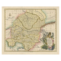
A Stunning 1744 Bowen Map: South East Germany & Queen of Hungary’s Dominions
Located in Langweer, NL
Title: A New and Correct Map of the South East part of Germany, 1744 This map by Emanuel Bowen, dating to around 1744, beautifully captures the southeastern part of Germany. The det...
Category

1740s Antique Netherlands - More Furniture and Collectibles

Materials

Paper

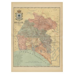
Huelva 1901: A Cartographic Presentation of Andalusia's Atlantic Frontier
Located in Langweer, NL
The map displays the province of Huelva, located in the southwestern part of the autonomous community of Andalusia in Spain, as of the year 1901. It outlines various geographic and m...
Category

Early 1900s Antique Netherlands - More Furniture and Collectibles

Materials

Paper

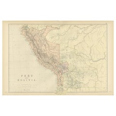
Antique 1882 Antique Map of Peru and Bolivia: Andes Mountains and Amazon Rivers
Located in Langweer, NL
Antique 1882 Map of Peru and Bolivia: Andes Mountains, Amazon Rivers, Historic Borders This map from 1882 provides a detailed representation of the countries of Peru and Bolivia in ...
Category

1880s Antique Netherlands - More Furniture and Collectibles

Materials

Paper

Antique Print of 'The Academy Cartoon' Made after Leonardo da Vinci 'c.1890'
Located in Langweer, NL
Antique print titled 'The Academy Cartoon'. Original antique print on chine collé, made after the painting by Leonardo da Vinci. Source unknown, to be determined. Published circa 1890.
Category

Late 19th Century Antique Netherlands - More Furniture and Collectibles

Materials

Paper

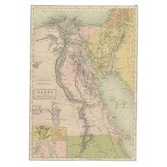
Antique Map of Egypt and Arabia Petraea by A & C. Black, 1870
Located in Langweer, NL
Antique map titled 'Egypt and Arabia Petraea'. Original antique map of Egypt and Arabia Petraea. This map originates from ‘Black's General Atlas of The World’. Published by A & C. Bl...
Category

Late 19th Century Antique Netherlands - More Furniture and Collectibles

Materials

Paper

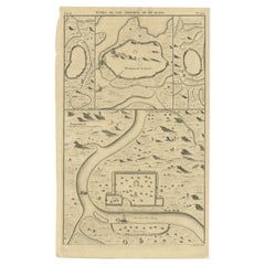
Antique Map of the Cities of the Province of Hu-Quang by Basire, 1738
Located in Langweer, NL
Antique print titled 'Cities of the Province of Hu-Quang'. Old map depicting four walled cities of the Chinese Qing dynasty province of Hu-Quang (modern day HUNAN and part of surroun...
Category

18th Century Antique Netherlands - More Furniture and Collectibles

Materials

Paper

Oriental Velvet Chest Brass Decoration, 1960s
Located in Den Haag, NL
Unique and great looking chest, for your blankets or anything else. Covert with a pink velvet fabric. And decorated with brass nails and medallions....
Category

1960s Moroccan Moorish Vintage Netherlands - More Furniture and Collectibles

Materials

Velvet

Original Antique 17th-Century Map of Shanxi (Xansi) Province, China – by Blaeu
Located in Langweer, NL
Antique 17th-Century Map of Shanxi Province, China – "Xansi" by Blaeu, with Artistic Cartouches Description: This beautifully engraved map of Shanxi Province, historically referred to as "Xansi," was created by Johannes Blaeu in 1655 as part of his renowned *Novus Atlas Sinensis*. This atlas was the first comprehensive Western collection focused on Chinese geography, produced with the guidance of Jesuit missionary Martino Martini. Blaeu’s attention to detail and artistic flair are evident in this representation of Shanxi, highlighting mountains, rivers, cities, towns, and key geographic features. The Great Wall of China, an iconic landmark, is also depicted. The map includes decorative cartouches that enhance its aesthetic appeal. The upper-left corner features the map's title framed in an ornate design, while the lower-right corner showcases a seated figure in traditional Chinese attire alongside a small globe, symbolizing the merging of European cartographic expertise and Chinese knowledge. Each city and geographic feature is labeled in Latin, making it a fascinating historical artifact of cross-cultural exploration. This map was crafted using the copperplate engraving technique, prized for its ability to produce fine, precise details. It is further embellished with hand-coloring, which brings the landscape and decorative elements to life. Blaeu’s maps are highly regarded for their accuracy, artistry, and historical significance, making this piece a valuable collectible. Shanxi Province, historically referred to as "Xansi," is renowned for its historical significance, natural landscapes, and rich cultural heritage. The region has been a crucial center of Chinese history and culture for centuries. Its name, meaning "West of the Mountains," refers to its location west of the Taihang Mountains. Shanxi has long been known for its coal resources, which have made it an important economic hub in modern times. Important places in Shanxi include Pingyao, a UNESCO World Heritage Site known for its well-preserved ancient city walls and traditional Chinese architecture. The Yungang Grottoes, near Datong, are another UNESCO site, famous for their intricate Buddhist carvings and statues. Mount Wutai, one of China’s Four Sacred Buddhist Mountains, is a significant religious site that attracts pilgrims and tourists alike. Taiyuan, the provincial capital, is known for its historical sites, including the Jinci Temple. Shanxi is also known for its role in the early development of Chinese banking, particularly during the Ming and Qing Dynasties. Keywords include antique map of Shanxi, Xansi map, Pingyao, Yungang Grottoes, Mount Wutai, 17th-century China map...
Category

1650s Antique Netherlands - More Furniture and Collectibles

Materials

Paper

Dutch Silver Miniature Sweeper and Dustpan by Anne Venema, Sneek
Located in Delft, NL
A Dutch silver miniature sweeper and dustpan by Anne Venema, Sneek A Dutch silver miniature sweeper and dustpan, both engraved. The dust pan has an eyelet. Marked with the Dutch silver Hallmark "Sord" (before 1906) and silver smith hallmark AV...
Category

Late 19th Century Dutch Antique Netherlands - More Furniture and Collectibles

Materials

Silver

Northern Schleswig and Haderslev Map by Johannes Mejer and Johannes Blaeu, 1662
Located in Langweer, NL
The map shows the Duchy of Schleswig, which spans the area between the North Sea coast, Kolding, and Flensburg. The maps were originally published by Johannes Mejer in the regional a...
Category

1660s Antique Netherlands - More Furniture and Collectibles

Materials

Paper

Detailed Map of Southeast Asia From the Tip of Cambodia to Java, 1739
Located in Langweer, NL
Antique map titled 'Nieuwe kaart van de Sundasche Eilanden als Borneo, Sumatra en Groot Iava & c'. Detailed map of Southeast Asia, extending from the tip of Cambodia to Java. Thi...
Category

1730s Antique Netherlands - More Furniture and Collectibles

Materials

Paper

Antique Engraving of Tinian, an Island of the Northern Mariana Islands, 1757
Located in Langweer, NL
Antique print titled 'Vue de la Rde de Tinian Gezigt van de Rheede van Tinian (..)'. Views of the south-west side of the island of Tinian and a view of the anchorage of Tinian, w...
Category

1750s Antique Netherlands - More Furniture and Collectibles

Materials

Paper

Decorative Map of the French Regions of Picardy, Artois & French Flanders, c1780
Located in Langweer, NL
Antique map titled 'Carte des Gouvernements de Flandre Francoise, d'Artois, de Picardie et du Boulenois.' An attractive example of Rigobert Bonne's 1771 decorative map of the Fre...
Category

1780s Antique Netherlands - More Furniture and Collectibles

Materials

Paper

Antique Map of the Siege of Syracuse by the Athenians, 1648 – Thucydides
Located in Langweer, NL
Antique Map of the Siege of Syracuse by the Athenians, 1648 – Thucydides This finely engraved plan depicts the Siege of Syracuse, one of the most dramatic episodes of the Peloponnes...
Category

Mid-17th Century English Antique Netherlands - More Furniture and Collectibles

Materials

Paper

Entretiens Sur Les Vies Et Sur Les Ouvrages Des Plus Excellens Peintres Anciens
Located in Delft, NL
Entretiens sur les vies et sur les ouvrages des plus excellens peintres anciens et modernes Title: Entretiens sur les vies et sur les ouvrages des plus excellens peintres anciens et modernes Par Mr. Felibien, Secretaire de l' Academie des Sciences & Historiographe du Roi. Tome premier, 1705, Nouvelle Edition revue, corrigeer & augmentée des Conferences de l'Academie Royale de Peinture & de Sculpture and Tome second, 1705 A londres, chez David Mortier, Libraire dans le Strand, a l'enseigne d' Erafme Tome premier 68 pages and on page 69 second entretien till page 248 8 pages with table des martieres, Continues dans le premier Tome Tome second 165 pages with troisieme entretien and on page 166 quatrième entretien till page 297 5 pages 'table' Brown leather binding with paper board and 5 spine...
Category

Early 18th Century British Antique Netherlands - More Furniture and Collectibles

Materials

Leather, Paper

Antique Print of Chinese Vessels Near Lantam, China, 1665
Located in Langweer, NL
Antique print titled 'Lantam'. Old print depicting Chinese ships on the coast of Lantam. Also depicted are Chinese village houses. This print originates f...
Category

17th Century Antique Netherlands - More Furniture and Collectibles

Materials

Paper

Relief Atlas Map of Europe by Hachette – Antique French Map c.1883
Located in Langweer, NL
Antique Map of Europe – Physical Relief Map by Hachette, circa 1883 Description: This antique map titled “Europe Physique” was published by Hachette in Paris around 1883 and origina...
Category

Late 19th Century French Antique Netherlands - More Furniture and Collectibles

Materials

Paper

Relief Atlas Map of Africa by Hachette – Antique c.1883 French Map
Located in Langweer, NL
Antique Map of Africa – Relief Atlas Map by Hachette, circa 1880 Description: This is an attractive antique map titled “Afrique,” published by Hachette...
Category

Late 19th Century Antique Netherlands - More Furniture and Collectibles

Materials

Paper

A Catalonian Cartographic Depiction of Tarragona Province, 1901
Located in Langweer, NL
This image depicts a historical map of the province of Tarragona, which is in the northeastern part of Spain, within the autonomous community of Catalonia. The map is dated 1901, sug...
Category

Early 1900s European Antique Netherlands - More Furniture and Collectibles

Materials

Paper

Antique Map of Eastern Europe, Incl Montenegro & Serbia & a Budapest Map, 1890
Located in Langweer, NL
Antique map titled 'Osterreich-Ungarn in 4 Blattern, Blatt 4.' Map of Eastern Europe, with Montenegro in the lower left corner, the southern ...
Category

1890s Antique Netherlands - More Furniture and Collectibles

Materials

Paper

1767 D’Anville Map of the Holy Land: Ancient Divisions and Biblical Geography
Located in Langweer, NL
Ancient Map of Palestine or the Holy Land by D'Anville (1767) This detailed map, created by the renowned French cartographer Jean Baptiste Bourguignon d'Anville in 1767, depicts the...
Category

1670s Antique Netherlands - More Furniture and Collectibles

Materials

Paper

Antique Print of the Town Hall of Batavia or Jakarta in Todays Indonesia, 1770
Located in Langweer, NL
Antique optical print titled 'Prospect des Rathhauses in Batavia (..)'. View of the town hall of Batavia, Indonesia. This is an optical print, also called 'vue optique' or 'vue d'opt...
Category

18th Century Antique Netherlands - More Furniture and Collectibles

Materials

Paper

Antique Map of Champagne France by Johann Baptist Homann circa 1710 Hand-Colored
Located in Langweer, NL
Antique Map of Champagne France by Johann Baptist Homann circa 1710 Hand-Colored This richly detailed antique map titled Tabula Geographica Campani...
Category

1720s Antique Netherlands - More Furniture and Collectibles

Materials

Paper

Colonial Cartography: The Banda Islands - the Epicenter of the Spice Trade, 1818
Located in Langweer, NL
Antique map titled 'Kaart der Bandasche Eilanden' with a view titled 'Gezigt van het Eiland Neira en de Goening Api'. Rare and attractive map of the Banda Islands with a large view of Banda Neira and Gunung Api. One of 12 maps from ‘Atlas van Overzeesche bezittingen’ (Atlas of Oversea Possessions) by J.S. van den Bosch. J.S. van den Bosch (1780 – 1844), Major General, Knight of the 3rd Class of the Military William Order. It is a rare and visually appealing representation of the Banda Islands, a group of ten small volcanic islands in the Banda Sea, part of present-day Indonesia. The map is one of twelve from the “Atlas van Overzeesche bezittingen” (Atlas of Overseas Possessions) by J.S. van den Bosch, who was a Major General and a Knight of the Military William Order. Johannes van den Bosch, who lived from 1780 to 1844, had a significant military and administrative career, including serving as Governor-General of the Dutch East Indies. His works and collections are reflective of the Dutch colonial interest and administration in the region. The Banda Islands, depicted in this map, are particularly famous for being the sole source of nutmeg and mace before the mid-19th century. Nutmeg was highly valued in European cuisine, as a preservative, and as a medicine. The monopoly on these spices made the Banda Islands extremely important during the age of spice trade, which also led to intense colonial competition and conflict, notably between the Dutch and the British. The map itself provides a detailed topographical representation of the Banda Islands, possibly with depth soundings and navigational hazards indicated, which would have been essential information for the ships of the Dutch East India Company and other seafarers. The large view of Banda Neira and Gunung Api (literally "Fire Mountain...
Category

Early 19th Century Antique Netherlands - More Furniture and Collectibles

Materials

Paper

Mid-20th Century Decorative German Suitcase Set
Located in Delft, NL
Mid 20th Century decorative German suitcase set A German suitcase set from the 1950s and 1960s, flown with the Royal Dutch Airlines, SAS, Tee, among ot...
Category

Mid-20th Century German Netherlands - More Furniture and Collectibles

Materials

Leather

Antique Decorative County Map of Huntingdonshire, England, 1804
Located in Langweer, NL
Antique county map of Huntingdonshire first published c.1800. Cities illustrated include Kimbolton, Chesterton, Folkesworth, and Great Stewkeley. Charles Smith was a cartographer ...
Category

Early 1800s Antique Netherlands - More Furniture and Collectibles

Materials

Paper

Map of Constantinople, Bosphorus, the Coasts of Greece and the Archipelago, 1785
Located in Langweer, NL
This is a large 1785 map titled "Carte de la Ville de Constantinople et du Bosphore de Thrace", which includes detailed maps of Constantinople (modern-day Is...
Category

1780s French Antique Netherlands - More Furniture and Collectibles

Materials

Paper

Antique Map of Peru, Ecuador and Bolivia by Lapie, 1842
Located in Langweer, NL
Antique map titled 'Carte du Perou et du Haut Perou'. Map of Peru, Ecuador and Bolivia. This map originates from 'Atlas universel de géographie ancienne et...
Category

19th Century Antique Netherlands - More Furniture and Collectibles

Materials

Paper

Large Antique County Map of North Wales, England
Located in Langweer, NL
Antique map titled 'A Map of North Wales from the best Authorities'. Original old county map of North Wales, England. Engraved by John Cary. Originates from 'New British Atlas' by Jo...
Category

Early 19th Century Antique Netherlands - More Furniture and Collectibles

Materials

Paper

Antique Map of the Area around the Abbey in Soligny-la-Trappe 'c.1710'
Located in Langweer, NL
Antique map titled 'La nouvelle Thebaide ou la Carte tres particuliere et exacte de l'Abbaye de la Maison Dieu Nostre Dame de la Trappe (..)'. Rare, original map of the area around t...
Category

Early 18th Century Antique Netherlands - More Furniture and Collectibles

Materials

Paper

French 1970s Dior Home Lucite and Cane Magazine Holders
By Dior Home
Located in Delft, NL
French 1970s Dior Home lucite and cane magazine holders A French design by Dior Home Collection, 1970s. Lucite magazine racks or holders with cane Woven cane set in lucite in a...
Category

20th Century French Netherlands - More Furniture and Collectibles

Materials

Cane, Lucite

Antique Map of Catalonia by Blaeu, circa 1650
Located in Langweer, NL
Antique map titled 'Catalonia'. Antique map of Catalonia, extending from C. De Romani on the Northern Coast to Alfachs and Panicola in Valencia on the southern end of the coast and s...
Category

Mid-17th Century Antique Netherlands - More Furniture and Collectibles

Materials

Paper

Original Antique Bird's Eye View Plan of Hoorn, The Netherlands by Blaeu, c.1700
Located in Langweer, NL
Antique map titled 'Horna vulgo Hoorn'. Bird's eye view plan of Hoorn, The Netherlands. With title cartouche, coats of arms and key. From an atlas published by De Wit, ca. 1698-1...
Category

Early 1700s Antique Netherlands - More Furniture and Collectibles

Materials

Paper

Girona 1902: Geographic and Infrastructural Map of Catalonia’s Northern Province
Located in Langweer, NL
The map provided is of the province of Girona (in Catalan, Girona), located in the northeast of Spain, within the autonomous community of Catalonia, as of the year 1902. Here are the...
Category

Early 1900s Antique Netherlands - More Furniture and Collectibles

Materials

Paper

1882 Map of the Pacific Ocean Highlighting Islands and Surrounding Regions
Located in Langweer, NL
This 1882 map of the Pacific Ocean, published by Blackie and Son as part of the 'Comprehensive Atlas and Geography of the World,' presents a detailed and fascinating overview of the ...
Category

1880s Antique Netherlands - More Furniture and Collectibles

Materials

Paper

Original Antique 17th-Century Map of Shaangxi (Xensi) Province, China – by Blaeu
Located in Langweer, NL
Antique 17th-Century Map of Shaangxi Province, China – "Xensi" by Blaeu, Featuring Decorative Cartouches Description: This exquisite 17th-century map of Shaangxi Province, historically known as Xensi Province, is an exceptional work by Johannes Blaeu, one of the most celebrated mapmakers of the Dutch Golden Age. Originally published in Blaeu's groundbreaking 'Novus Atlas Sinensis', this map is a masterful blend of geography and artistry. Blaeu's atlas was created in collaboration with Martino Martini, a Jesuit missionary whose insights into China provided European audiences with unprecedented geographical accuracy. The map meticulously charts Shaangxi's mountains, rivers, mines, cities, and towns, with names rendered in Latin. It also features a detailed section of the Great Wall of China, a symbol of the region's historical significance. The artistry of this map is further enhanced by its elaborate cartouches. At the top, a Chinese warrior is beautifully illustrated, while the lower-left corner displays a deer, possibly a reference to the elusive Pere David deer...
Category

1650s Antique Netherlands - More Furniture and Collectibles

Materials

Paper

Antique Miniature Map of the Turkish Empire by Bertius '1618'
Located in Langweer, NL
Antique miniature map titled 'Turcicum Imperium'. Rare miniature map of the Turkish Empire. This map originates from 'Tabularum Geographicarum Contractarum Libri septem (..)' by P. B...
Category

Early 17th Century Antique Netherlands - More Furniture and Collectibles

Materials

Paper

Hand Colored Antique Map of the Department of Haute Loire, France
By Victor Levasseur
Located in Langweer, NL
Antique map titled 'Dept. de la Haute Loire'. Map of the French department of Haute Loire, France. This area of France is part of the Loire Valley wine growing...
Category

Mid-19th Century Antique Netherlands - More Furniture and Collectibles

Materials

Paper

Antique Map of South America by Reichard, 1820
By Thomas Kitchin
Located in Langweer, NL
Antique map titled 'Süd America'. Decorative antique map of South America with an inset map of Ecuador. Artists and Engravers: Published b...
Category

19th Century Antique Netherlands - More Furniture and Collectibles

Materials

Paper

Antique Map of Spain and Portugal by Levasseur, '1875'
Located in Langweer, NL
Antique map titled 'Carte générale de l'Espagne et du Portugal (..)'. Large map of Spain and Portugal. This map originates from 'Atlas de Géographie Moder...
Category

Late 19th Century Antique Netherlands - More Furniture and Collectibles

Materials

Paper

Antique Map of Denmark with Schleswig & Holstein by A & C. Black, 1870
Located in Langweer, NL
Antique map titled 'Denmark with Schleswig & Holstein'. Original antique map of Denmark with Schleswig & Holstein. This map originates from ‘Black's General Atlas of The World’. Publ...
Category

Late 19th Century Antique Netherlands - More Furniture and Collectibles

Materials

Paper

Old Map of Ancient Spain and Portugal – Hispania Antiqua Featuring Roman Cities
Located in Langweer, NL
Title: "Hispania Antiqua in Tres Praecipuas Partes Divisa: Tarraconensem, Lusitaniam, et Bæticam" by Robert de Vaugondy, 18th Century Description: This beautifully detailed map titl...
Category

Late 18th Century Antique Netherlands - More Furniture and Collectibles

Materials

Paper

Map of East Frisian Islands & Northwestern Tip of Germany, Ostfriesland, c.1595
Located in Langweer, NL
Antique map titled 'Frisia Orientalis'. Beautiful map of east Frisian islands and the northwestern tip of Germany, Ostfriesland. With people in local costumes. Ornamented inset of the Eems estuary. Based on a manuscript map...
Category

16th Century Antique Netherlands - More Furniture and Collectibles

Materials

Paper

Antique Map of South America by A & C. Black, 1870
Located in Langweer, NL
Antique map titled 'South America'. Original antique map of Map of South America. This map originates from ‘Black's General Atlas of The World’. Published by A & C. Black, 1870.
Category

Late 19th Century Antique Netherlands - More Furniture and Collectibles

Materials

Paper

Antique Print of the Residence of Sir Gregory Page by Miller, c.1770
Located in Langweer, NL
Antique print titled 'Elevation of the Flank of Sir Gregory Page'. Architectural elevation of the residence of Sir Gregory Page. Sir Gre...
Category

18th Century Antique Netherlands - More Furniture and Collectibles

Materials

Paper

Antique Plan of Aigues-Mortes, France
Located in Langweer, NL
Antique map titled 'Plan d'Aiguesmortes et environs'. Original plan of the region of Aigues-Mortes, France. This map originates from 'Le Petit Atlas Maritime (..)' by J.N. Bellin. Pu...
Category

Mid-18th Century Antique Netherlands - More Furniture and Collectibles

Materials

Paper

Wrought Iron Blue and Gold Colored Umbrella stand, France 1940's
Located in Den Haag, NL
Wrought Iron Blue and Gold Colored Umbrella stand, France 1940's
Category

1940s French Mid-Century Modern Vintage Netherlands - More Furniture and Collectibles

Materials

Wrought Iron

Antique Map of Siberia, Russia, 1859
Located in Langweer, NL
Antique map titled 'Siberia or Northern Asia'. Original antique map of Siberia or Northern Asia. This map originates from ‘The Imperial Atlas of Modern Geography’. Published by W. G....
Category

Mid-19th Century Antique Netherlands - More Furniture and Collectibles

Materials

Paper

Old Print of a Peasant of Hermannstadt 'Sibiu', Transylvania, 1804
Located in Langweer, NL
Old print of a peasant of the neighbourhood of Hermannstadt (Sibiu), Transylvania. This print originates from 'The Costume of the Hereditary States of the House of Austria' by William Miller. Artists and Engravers: Engraved by William Ellis.
Category

Early 1800s Antique Netherlands - More Furniture and Collectibles

Materials

Paper

Antique Print of 'Madonna and Sleeping Child' Made after Vivarini 'c.1890'
Located in Langweer, NL
Antique print titled 'Madonna and Sleeping Child with Angels'. Original antique print on chine collé, made after the painting by Vivarini. Source unknown, to be determined. Published...
Category

Late 19th Century Antique Netherlands - More Furniture and Collectibles

Materials

Paper

Antique Map of Western Europe by H. Kiepert, circa 1870
By Heinrich Kiepert
Located in Langweer, NL
Antique map titled 'Gallia, Britannia, Germania'. This map depicts a large part of Western Europe including countries like Germany, France, Great Britain, The Netherlands and more. T...
Category

Late 19th Century German Antique Netherlands - More Furniture and Collectibles

Materials

Paper

Antique Map of Germany, the Netherlands, Bohemia, Bavaria and Switzerland, 1785
Located in Langweer, NL
Antique map titled 'Germany and the Netherlands from the latest authorities'. Depicts Germany, the Netherlands and the surrounding region including Bohemia, Bavaria, and Switzerland....
Category

18th Century Antique Netherlands - More Furniture and Collectibles

Materials

Paper

Antique Print of a Wedding Ceremony in Japan, ca.1824
Located in Langweer, NL
Isaac Titsingh, Bijzonderheden van Japan. Het huwelijksprotocol uitgebeeld. This print is from a work of Titsingh, who had a long and successful career in Asia. It shows the cere...
Category

1820s Antique Netherlands - More Furniture and Collectibles

Materials

Paper

Detailed Original Antique Map of the Region of Rome in Italy, c.1870
By Heinrich Kiepert
Located in Langweer, NL
Antique map titled 'Roma Urbs'. Old map of Italy, it shows three inset maps of the region of Rome. This map originates from 'Atlas Antiquus, twaalf k...
Category

19th Century Antique Netherlands - More Furniture and Collectibles

Materials

Paper

Pavillon de la Grande Tuilerie – French Architectural Lithograph, La Brique
Located in Langweer, NL
Pavillon de la Grande Tuilerie – French Architectural Lithograph, La Brique This striking antique architectural lithograph shows the pavilion of the Grande Tuilerie de Bourgogne (Mo...
Category

20th Century French Netherlands - More Furniture and Collectibles

Materials

Paper

Antique Map of England and Wales, with References to the Counties
Located in Langweer, NL
Antique map titled 'England and Wales'. Original antique map of England and Wales, with references to the counties. Source unknown, to be determined. Published circa 1820.
Category

Early 19th Century Antique Netherlands - More Furniture and Collectibles

Materials

Paper

Nubuck Leather Magazine Rack, 1970s
Located in Delft, NL
Nubuck leather magazine rack, 1970s A magazine rack of metal with nubuck leather liner Unknown maker The size closed is 49 cm high and 44 cm wi...
Category

20th Century Scandinavian Netherlands - More Furniture and Collectibles

Materials

Metal

Antique Map of Switzerland by Lapie, 1842
Located in Langweer, NL
Antique map titled 'Carte de la Suisse ou Helvetie'. Map of Switzerland. This map originates from 'Atlas universel de géographie ancienne et moderne...
Category

Mid-19th Century Antique Netherlands - More Furniture and Collectibles

Materials

Paper

Antique Map of the Netherlands, Belgium and Luxembourg
Located in Langweer, NL
Antique map titled 'Carte des Royaumes Hollande et Belgique'. Attractive map of the Netherlands, Belgium and Luxembourg. This map originates fro...
Category

Mid-19th Century Antique Netherlands - More Furniture and Collectibles

Materials

Paper

Antique Map of French Colonies – La France, 19th Century
Located in Langweer, NL
Title: Antique Map of French Colonies – La France, 19th Century Description: This antique 19th-century map, titled La France, presents a detailed depiction of France’s overseas c...
Category

1870s Antique Netherlands - More Furniture and Collectibles

Materials

Paper

Read More

Patchwork Quilts Are the Latest Nostalgic Design Trend

New or old, the coverlets add old-time charm to any space.

Medal-Worthy Memorabilia from Epic Past Olympic Games

Get into the games! These items celebrate the events, athletes, host countries and sporting spirit.

Ahoy! You’ve Never Seen a Collection of Sailor Art and Kitsch Quite Like This

French trendsetter and serial collector Daniel Rozensztroch tells us about his obsession with objects related to seafaring men.

39 Incredible Swimming Pools

It's hard to resist the allure of a beautiful pool. So, go ahead and daydream about whiling away your summer in paradise.

Pamela Shamshiri Shares the Secrets behind Her First-Ever Book and Its Effortlessly Cool Interiors

The sought-after designer worked with the team at Hoffman Creative to produce a monograph that beautifully showcases some of Studio Shamshiri's most inspiring projects.

Moroccan Artworks and Objects Take Center Stage in an Extraordinary Villa in Tangier

Italian writer and collector Umberto Pasti opens the doors to his remarkable cave of wonders in North Africa.

Montecito Has Drawn Royalty and Celebrities, and These Homes Are Proof of Its Allure

Hollywood A-listers, ex-pat aristocrats and art collectors and style setters of all stripes appreciate the allure of the coastal California hamlet — much on our minds after recent winter floods.

Whaam! Blam! Pow! — a New Book on Pop Art Packs a Punch

Publishing house Assouline and writer Julie Belcove have teamed up to trace the history of the genre, from Roy Lichtenstein, Andy Warhol and Yayoi Kusama to Mickalene Thomas and Jeff Koons.
Recently Viewed

View All