Netherlands Maps
to
4,198
5,131
5,521
197
5,130
1
2,838
1,984
308
1
180
6
68
3
3
3
2
5,125
9
7
2
1
437
177
93
78
50
5,131
5,131
5,131
104
58
20
14
13
Item Ships From: Netherlands
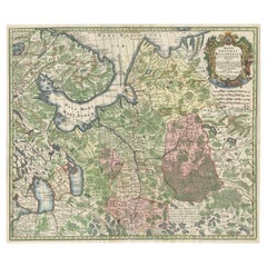
Imperial map of Northern Russia with Archangel, Lapland and Permia, c.1730
Located in Langweer, NL
Imperial map of Northern Russia with Archangel, Lapland, and Permia, c.1730
Description:
This intricately engraved and hand-colored map presents the northern reaches of the Russian ...
Category
Early 18th Century German Antique Netherlands Maps
Materials
Paper
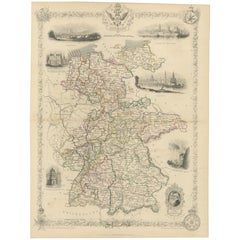
Ornate Hand-Colored Map of Germany by John Tallis with Vignettes, ca. 1850
Located in Langweer, NL
Title: Hand-Colored Map of Germany by J. Tallis, ca. 1850
This beautifully hand-colored map of Germany, published by John Tallis & Co. around 1850, provides a comprehensive depictio...
Category
1850s Antique Netherlands Maps
Materials
Paper
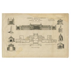
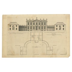
Pl. 1 Antique Print of the Stowe House by Le Rouge, 1776
Located in Langweer, NL
Antique print titled 'Chateau de Stowe, du Coté des Jardins'. Copper engraving showing the garden side of the Stowe House. This print originates from 'Jard...
Category
18th Century Antique Netherlands Maps
Materials
Paper
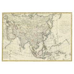
Antique Map of Asia by Ferrario '1815'
Located in Langweer, NL
Antique map titled 'Carta generale dell' Asia (..)'. Original antique map of Asia. This map originates from ' Le Costume Ancien et Moderne' by Jule...
Category
Early 19th Century Antique Netherlands Maps
Materials
Paper
$903 Sale Price
20% Off
Antique Print of the House of John Waller by Campbell, 1725
Located in Langweer, NL
Antique print titled 'The Elevation of Iohn Waller Esqr. his house in Beaconsfield in Buckinghamshire (..)'. Old engraving of the house of John Waller in Beaconsfield. This print ori...
Category
18th Century Antique Netherlands Maps
Materials
Paper
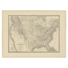
Antique Map of the United States of America by Lapie '1842'
Located in Langweer, NL
Antique map titled 'Carte des États-Unis d'Amérique'. Map of the United States of America (USA). This map originates from 'Atlas universel...
Category
Mid-19th Century Antique Netherlands Maps
Materials
Paper
$570 Sale Price
20% Off
Original Antique Map of Ancient Asia, 1847
Located in Langweer, NL
Description: Antique map Asia titled 'Asie Ancienne'.
This is an original antique map of Ancient Asia and originates from 'Atlas de la Geographie ...
Category
1840s Antique Netherlands Maps
Materials
Paper
$171 Sale Price
20% Off
Antique Engraving of the Dead Chief of Tahiti Island in the Pacific, 1803
By James Cook
Located in Langweer, NL
Antique print titled 'Het Lijk van Thee, Opperste van O-Tahiti, zoodanig als men zulks na zijnen dood bewaarde'. Antique print depicting the remnents of Thee, Chief of Tahiti. Origin...
Category
19th Century Antique Netherlands Maps
Materials
Paper
$275 Sale Price
20% Off
Antique Print of the Freiburg Minster by Knight, 1835
Located in Langweer, NL
Antique print titled 'Minster of Freiburg'. Old print of the Freiburg Minster, the cathedral of Freiburg im Breisgau, southwest Germany. This print originates from 'One Hundred and F...
Category
19th Century Antique Netherlands Maps
Materials
Paper
$75 Sale Price
20% Off
Antique Colored Engraving of Madras 'Chennai' and Fort St. George in India, 1751
By Jacques-Nicolas Bellin
Located in Langweer, NL
Antique print titled 'Plan de Madras et du Fort St. Georges'. Plan of the city of Madras (or Chennai), the capital of the state of Tamil Nadu, India. Also shows a plan of Fort St. Ge...
Category
18th Century Antique Netherlands Maps
Materials
Paper
$342 Sale Price
20% Off
Antique Map of Central Asia between the Caspian Sea and Lake Balkhash
Located in Langweer, NL
Antique map titled 'Independent Tartary'. Original steel engraved map of Central Asia. It covers the regions between the Caspian Sea and Lake Balkhash and between Russia and Afghanis...
Category
Mid-19th Century Antique Netherlands Maps
Materials
Paper
$551 Sale Price
20% Off
Set of two Antique Maps of the region of Oregon, Idaho, Wyoming, Nebraska & Iowa
Located in Langweer, NL
Set of two individual antique maps of part of the United States. It shows the region and surroundings of Oregon, Idaho, Wyoming, Nebraska, Iowa, Dakota and Wisconsin. Published as pa...
Category
Late 19th Century Antique Netherlands Maps
Materials
Paper
$456 Sale Price / set
20% Off
Antique Print of Garden Architecture showing a Garden Bridge by Van Laar, 1802
Located in Langweer, NL
Untitled print of garden architecture. It shows garden bridges. This print originates from 'Magazijn van tuin-sieraden'. The book is compiled by Gijsbert...
Category
19th Century Antique Netherlands Maps
Materials
Paper
Decorative Map of Hanover, Lower Saxony by Lodge, ca. 1785
Located in Langweer, NL
Title: Decorative Map of Hanover, Lower Saxony by Lodge, ca. 1785
This decorative map, titled "A New & Correct Plan of Hanover, a City in the circle of Lower Saxony," was engraved b...
Category
1780s Antique Netherlands Maps
Materials
Paper
Antique Map of China and Japan, with Frame Style Border
Located in Langweer, NL
Antique map titled 'Empires Chinois et Japonnais'. Attractive map of China and Japan. This map originates from Maison Basset's 1852 edition of 'Atlas Illustre Destine a l'enseignemen...
Category
Mid-19th Century Antique Netherlands Maps
Materials
Paper
$161 Sale Price
20% Off
Antique Chart of the US Population in 1870, published in 1874
Located in Langweer, NL
Antique chart titled 'Map showing, in five degrees of density, the distribution, within the territory of the United States, of the constitutional population, i.e., excluding Indians ...
Category
Late 19th Century Antique Netherlands Maps
Materials
Paper
$856 Sale Price
20% Off
Antique Map of the Electorate of Brandenburg by Georges-Louis Le Rouge, 1768
Located in Langweer, NL
Antique Map of the Electorate of Brandenburg by Georges-Louis Le Rouge, 1748
This 1748 map by Georges-Louis Le Rouge, titled "Le Marquisat et Electorat de Brandenbourg," depicts the...
Category
1760s Antique Netherlands Maps
Materials
Paper
Early Woodcut Bird's Eye View of Rouffach, France, by Sebastian Münster, 1554
Located in Langweer, NL
Early Woodcut Bird's Eye View of Rouffach, France, by Sebastian Münster, 1554
Description: This rare 1554 woodcut is a bird's eye view of Rouffach, a town in the Haut-Rhin departmen...
Category
16th Century Antique Netherlands Maps
Materials
Paper
Original Map of the East Indies Including Sumatra, Java, Borneo & Malaysia, 1747
Located in Langweer, NL
Antique map titled 'Carte des Isles Java, Sumatra, Borneo (..) - Kaart van de Eilanden van Iava, Sumatra, Borneo (..)'.
Map of the East Indies including Sumatra, Java, Borneo and...
Category
1740s Antique Netherlands Maps
Materials
Paper
$428 Sale Price
20% Off
Antique Map of Calais ‘France’ by V. Levasseur, 1854
By Victor Levasseur
Located in Langweer, NL
Antique map titled 'Dépt. du Pas de Calais'. Map of the French department of Calais, France. This area is known for producing Maroilles, a soft cheese made from cow’s milk and with a...
Category
Mid-19th Century Antique Netherlands Maps
Materials
Paper
$171 Sale Price
20% Off
Dutch Antique Engraving with Coastal Views of Asia by Cook, 1803
Located in Langweer, NL
Antique print Asia titled 'Gezigt der Kust van Asiën'. Antique print depicting various coastal views of Asia including Kamchatka. Originates from 'Reizen Rondom de Waereld door James...
Category
19th Century Antique Netherlands Maps
Materials
Paper
$456 Sale Price
20% Off
Antique Map of Germany from a 17th Century Pocket Atlas, 1685
Located in Langweer, NL
Antique map titled 'Nova Totius Germaniae descriptio.' Miniature map of Germany, from the pocket atlas 'Introductionis in Universam Geographiam tam Veterem...
Category
17th Century Antique Netherlands Maps
Materials
Paper
$118 Sale Price
20% Off
Antique Map of Gloucestershire by Camden, c.1607
Located in Langweer, NL
Antique map titled 'Glocestriae comitatus olim sedes Dobunorum'. Map of Gloucestershire, England. This map originates from Camden?s 'Britannia' ...
Category
17th Century Antique Netherlands Maps
Materials
Paper
$228 Sale Price
20% Off
Old Antique Colourful Decorative Map of Northern Italy, 1846
Located in Langweer, NL
Description: Antique map titled 'Italy North Part'.
Old map of Northern Italy. This map originates from 'A New Universal Atlas Containing Maps of the various Empires, Kingdoms, S...
Category
1840s Antique Netherlands Maps
Materials
Paper
$209 Sale Price
20% Off
Antique Map of Arkansas, Mississippi and Louisiana by Johnson, 1872
Located in Langweer, NL
Antique map titled 'Johnson's Arkansas (..)'. Original map of Arkansas, Mississippi and Louisiana. This map originates from 'Johnson's New Illustrated ...
Category
Late 19th Century Antique Netherlands Maps
Materials
Paper
$237 Sale Price
20% Off
Antique Map of of Brazil, Paraguay and Uruguay
Located in Langweer, NL
Antique map titled 'Bresil Paraguay et Uruguay'. Fine steel engraved map of Brazil, Paraguay and Uruguay. Engraved by Leclercq and published by Armand Aubree in "Atlas Classique et U...
Category
Mid-19th Century Antique Netherlands Maps
Materials
Paper
$323 Sale Price
20% Off
Antique Engraved Map of Italy in Roman Times, ca.1730
Located in Langweer, NL
Plain engr. map of Italy according to the division of Emperor Augustus by G. Delisle.
Title: "Tabula Italiae Antiquae In Regiones XI Ab Augusto Divisae Et Tum Ad Mensuras Itinerari...
Category
1730s Antique Netherlands Maps
Materials
Paper
$647 Sale Price
20% Off
Old Map Depicting Turkey, Persia, Arab and Black Sea Etc, 1778
Located in Langweer, NL
Antique map titled 'Turquie d'Asie, Arabie, Perse, Tartarie Independante'.
Old map of Turkey in Asia. The map shows all of Turkey and the Black Sea, and extends east to include t...
Category
1770s Antique Netherlands Maps
Materials
Paper
$513 Sale Price
20% Off
Antique Map of the Region of Île-de-France by Hondius, circa 1630
Located in Langweer, NL
Antique map titled Gouvernement de l'Isle de France'. Old map of the region of Île-de-France, France. It is located in the north-central part of the country and often called the régi...
Category
Mid-17th Century Antique Netherlands Maps
Materials
Paper
$523 Sale Price
20% Off
Antique Print of Inhabitants of Arakan in Southern Myanmar 'Burma', 1738
Located in Langweer, NL
Antique print titled 'Il mode nel quale si vestono gti abilanti di Arakan'. Engraving of inhabitants of Arakan, a historic coastal region in Southeast Asia. This print originates fro...
Category
18th Century Antique Netherlands Maps
Materials
Paper
$171 Sale Price
20% Off
Antique Map of the Province of Overijssel by Coronelli, c.1692
Located in Langweer, NL
Antique map titled 'Tran-siselana' Splendid detailed and decorative map of the province of Overijssel in the Netherlands by Vincenzo Coronelli. An elaborate title cartouche garlanded...
Category
17th Century Antique Netherlands Maps
Materials
Paper
$512 Sale Price
20% Off
Print of Tenggarong in East-Kalimantan on The Island of Borneo, Indonesia, 1881
Located in Langweer, NL
Antique print with a view of Tenggarong, Indonesia. This print originates from 'Reis in Oost- en Zuid-Borneo van Koetei naar Banjermassin (..)' by Carl Bock....
Category
19th Century Antique Netherlands Maps
Materials
Paper
$228 Sale Price
20% Off
Antique Map of Spain and Portugal by Tirion, c.1760
Located in Langweer, NL
Antique map titled 'Nieuwe Kaart van Spanje en Portugal.' Attractive detailed map showing Spain and Portugal. Including Majorca, Minorca and Ibiza. Title in block-style cartouche wit...
Category
18th Century Antique Netherlands Maps
Materials
Paper
$259 Sale Price
20% Off
Antique Map of Sulawesi by Winkler Prins, c.1900
Located in Langweer, NL
Antique map titled 'Celebes.' (Sulawesi .) This map shows the Indonesian island of Sulawesi, one of the Sunda islands. With inset maps of South-west Sulawesi and Semenanjung Minahassa. Legend and scale. This map originates from 'De Grote Winkler Prins...
Category
20th Century Netherlands Maps
Materials
Paper
$69 Sale Price
20% Off
Original Rare Map of the Holy Land Showing the Twelve Tribes of Israel's, 1782
Located in Langweer, NL
Antique map titled 'Carte des Douze Tribus D'Israel (..).'
Map of the Holy Land showing the twelve tribes of Israel's. Tribes are all named...
Category
1780s Antique Netherlands Maps
Materials
Paper
$656 Sale Price
20% Off
Dutch Municipality of Wedde in Groningen, Fehse, 1862
Located in Langweer, NL
These scarse detailed maps of Dutch Towns originate from the 'Gemeente atlas van de Provincie Groningen in 62 kaarten.' by C. Fehse. This atlas of all towns in Groningen, the Netherl...
Category
19th Century Antique Netherlands Maps
Materials
Paper
$114 Sale Price
20% Off
Interesting Antique Print of Garden Architecture by Van Laar, 1802
Located in Langweer, NL
Untitled print of garden architecture. It shows a garden building. This print originates from 'Magazijn van tuin-sieraden'. The book is compiled by...
Category
19th Century Antique Netherlands Maps
Materials
Paper
$114 Sale Price
20% Off
Ancient Realms of Northeast Africa: Arabia, Ethiopia, and Egypt, Published 1880
Located in Langweer, NL
This map, titled "ARABIA, AETHIOPIA, AEGYPTUS," illustrates the regions of ancient Arabia, Ethiopia, and Egypt.
Features that make this map interesting include:
1. **Geographical ...
Category
1880s Antique Netherlands Maps
Materials
Paper
$447 Sale Price
20% Off
Antique Map of the Burgundy Region by Merian, 1646
Located in Langweer, NL
Antique map titled 'Utriusque Burgundiae tum Ducatus tum Comitatus descriptio'. Old map of the Burgundy region of France. This map originates from 'Neuwe Archontologia cosmica'. Arti...
Category
17th Century Antique Netherlands Maps
Materials
Paper
$178 Sale Price
20% Off
Bishopric of Hildesheim Map in Northern Germany by Willem & Joan Blaeu, 1645
Located in Langweer, NL
This beautifully hand-colored map, titled "Episcopatus Hildesiensis Descriptio Novissima," depicts the Bishopric of Hildesheim, a historical ecclesiastical territory in present-day L...
Category
1640s Antique Netherlands Maps
Materials
Paper
$494 Sale Price
20% Off
Antique Map of West Asia, circa 1900
Located in Langweer, NL
Antique map titled 'Persia, Afghanistan and Beloochistan'. Folding map on linen.
Published circa 1900. Stamp below title.
Category
Early 20th Century Netherlands Maps
Materials
Paper
Antique Map of the Distribution of Vegetation throughout the World '1851'
Located in Langweer, NL
Antique map titled 'Umrisse der Pflanzengeographie'. Original antique map showing the distribution of vegetation throughout the world. Five drawings above the map show the vegetation...
Category
Mid-19th Century Antique Netherlands Maps
Materials
Paper
$713 Sale Price
20% Off
Map of Independent Tartary with Vignettes of the Region's Culture, 1851
Located in Langweer, NL
The map of Independent Tartary is part of the collection by John Tallis & Company, which were unique for their elaborate decorative elements and detailed illustrations.
**The Maker ...
Category
1850s Antique Netherlands Maps
Materials
Paper
$275 Sale Price
20% Off
Antique Map of India as Described It Was before the 5th Century, 1744
Located in Langweer, NL
Antique map titled 'India, as described by all Authors before the fifth Century'. Detailed map of part of India, including Hyrcania, Parthia, Carmania, Gedorossii, Drangiana, Aria, M...
Category
18th Century Antique Netherlands Maps
Materials
Paper
$304 Sale Price
20% Off
Antique Print of a Malayan Houses in Sumatra, Indonesia, 1881
Located in Langweer, NL
Antique print with a view of the place of the Sultan of Koetai and a Malayan house in Sumatra. This print originates from 'Reis in Oost- en Zuid-Borneo van Koetei naar Banjermassin (..)' by Carl Bock...
Category
19th Century Antique Netherlands Maps
Materials
Paper
$247 Sale Price
20% Off
Antique Map of Southern India by Andree, 1904
Located in Langweer, NL
"Antique map titled 'Vorderindien, sudlicher Teil'. Map of India, southern part. This map originates from 'Andrees Allgemeiner Handatlas in 126 Haupt-Und 139 Nebenkarten', Bielefeld;...
Category
20th Century Netherlands Maps
Materials
Paper
$69 Sale Price
20% Off
Old Map of the French Department of Nièvre, France
By Victor Levasseur
Located in Langweer, NL
Antique map titled 'Dept. de la Nièvre'. Map of the French department of Nievre, France. Part of the prestiegous Burgundy or Bourgogne wine region this area is known for its producti...
Category
Mid-19th Century Antique Netherlands Maps
Materials
Paper
$323 Sale Price
20% Off
Antique Map of New England and Eastern Canada by Homann Heirs, circa 1755
Located in Langweer, NL
Antique map titled 'Partie Orientale de la Nouvelle France ou du Canada (..)'. Original antique map of New England and Eastern Canada made a...
Category
Mid-18th Century Antique Netherlands Maps
Materials
Paper
$1,783 Sale Price
25% Off
1684 Mallet Map of Amazon River & Kingdom of Amazons – Hand Colored, Miniature
Located in Langweer, NL
This map, titled 'Royaume des Amazones', was created by Alain Manesson Mallet and published in 1684 in a German edition of *Beschreibung des Gantzen Welt-Kreisses*, a renowned work d...
Category
1680s Antique Netherlands Maps
Materials
Paper
$418 Sale Price
20% Off
Antique Map of the West African Coast and the Cape Verde Islands, c.1680
Located in Langweer, NL
Antique map Africa titled 'Isles du Cap Verd Coste et Pays des Negres'. Antique map of the coast of Africa and the Cape Verde islands.
Artists and...
Category
17th Century Antique Netherlands Maps
Materials
Paper
$342 Sale Price
20% Off
Antique Map of the Sunda Islands Including Sumatra, Java, and Borneo, 1705
Located in Langweer, NL
Title: “Antique Map of the Sunda Islands Including Sumatra, Java, and Borneo”
This print is a beautifully detailed and relatively rare map of Western Indonesia, encompassing the reg...
Category
Early 1700s Antique Netherlands Maps
Materials
Paper
$818 Sale Price
20% Off
Map of Languedoc by Willem Blaeu, Antique French Copper Engraving 1635
Located in Langweer, NL
Map of Languedoc by Willem Blaeu, Antique French Copper Engraving 1635
This fine antique map titled "Langvedoc" depicts the historical province of Languedoc in southern France and w...
Category
1630s Antique Netherlands Maps
Materials
Paper
Map of Brittany and Western France by Gerard Valk, circa 1690
Located in Langweer, NL
Map of Brittany and Western France by Gerard Valk, circa 1700
This finely detailed antique map, titled *Praefectura Ducatus Britanniae, Quae Superior et Inferior*, was created aroun...
Category
Late 17th Century Dutch Antique Netherlands Maps
Materials
Paper
Antique Map of Piedmont, Savoy and Liguria by Justus Danckerts, Amsterdam c.1690
Located in Langweer, NL
Map of Piedmont, Savoy and Liguria by Justus Danckerts, Amsterdam c.1690
This richly detailed and decorative map, titled *Tabula Generalis Ducatus Sabaudiae Principatus Pedemontii C...
Category
Late 17th Century Antique Netherlands Maps
Materials
Paper
Antique Map of the City of Emden by Blaeu, 1649
Located in Langweer, NL
Antique map titled 'Emda'. Old map of the city of Emden, Germany. This map originates from 'Novum Ac Magnum Theatrum Urbium Belgicæ Liberæ ac Foederatæ' by J. Blaeu. Artists and Engr...
Category
17th Century Antique Netherlands Maps
Materials
Paper
$485 Sale Price
20% Off
Antique Map of the Antilles by Lapie, '1842'
Located in Langweer, NL
Antique map titled 'Carte des Antilles du Golfe du Méxique'. Map of the Antilles. This map originates from 'Atlas universel de géographie ancienne et moderne (..)' by Pierre M. Lapie...
Category
Mid-19th Century Antique Netherlands Maps
Materials
Paper
$475 Sale Price
20% Off
Antique Map of the Island of Tinos by Dapper, 1687
Located in Langweer, NL
Antique map titled 'Tino.' This original antique map shows the island of Tinos, Greece. Source unknown, to be determined.
Artists and Engravers: Made by 'Olfert Dapper' after an a...
Category
17th Century Antique Netherlands Maps
Materials
Paper
$166 Sale Price
20% Off
Map of Gard France with Pont du Gard and Wine Regions by Vuillemin, 19th c
Located in Langweer, NL
Title: Map of Gard France with Pont du Gard and Wine Regions by Vuillemin, 19th c
Description:
This finely engraved 19th-century map of the department of Gard in southern France was...
Category
Mid-19th Century French Antique Netherlands Maps
Materials
Paper
Map of Finistère France with Brest, Quimper and Brittany Coastline, 19th Century
Located in Langweer, NL
Map of Finistère France with Brest, Quimper and Brittany Coastline, 19th Century
Description:
This richly engraved 19th-century map of Finistère, the westernmost department of mainl...
Category
Mid-19th Century French Antique Netherlands Maps
Materials
Paper
Map of Doubs France with Besançon and Swiss Border Landscape, 19th Century
Located in Langweer, NL
Map of Doubs France with Besançon and Swiss Border Landscape, 19th Century
Description:
This decorative 19th-century map of the department of Doubs in eastern France was drawn by Al...
Category
Mid-19th Century French Antique Netherlands Maps
Materials
Paper
Recently Viewed
View AllMore Ways To Browse
Flemish Cabinets 17th Century
Fox Figurine
Fox Hunt Plate
French Art Deco Rosewood Buffet
French Bulldog Gold
French Louis Xvi Enfilade
French Provincial Antique Dresser
French Provincial Furniture Antique Dresser
French Zinc Bar
Frog Figurine
Georgian Mahogany Longcase Clock
German Folding Trolley
Glass And Brass Fireplace Screen
Glass Nude Woman Sculpture
Glass Parrots
Glass Poodle
Gothic Corbel
Granite Pagoda
