Recognized Dealers
to
217
419
111
165,275
109,563
76,908
41,912
35,672
27,782
14,100
11,977
11,918
10,957
10,501
10,157
9,697
9,656
8,864
7,615
6,111
6,098
5,922
4,000
3,626
2,689
2,097
1,950
1,809
1,784
1,728
1,564
941
818
803
801
749
722
610
586
569
491
446
416
368
360
327
239
228
201
201
197
187
161
117
102
89
73
72
58
57
56
43
26
23
19
11
6
5
4
3
Period: 1780s
Period: 1730s
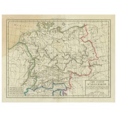
Historical Map of Ancient Germany (1787): Tribes and Territories by Mentele
Located in Langweer, NL
This antique map, titled "Carte Ancienne d'Allemagne," represents ancient Germany and surrounding regions. It was published by the well-known Parisian mapmakers and publishers Jean-Baptiste-Louis Clouet and Alexandre Aimé Vuillemin in the late 18th century, specifically in 1787.
The map covers the extensive geographical area of ancient Germany, highlighting various tribes and regions known at the time. Key features include:
1. **Geographical Boundaries**: The map outlines the territorial extents of ancient Germany, bordered by Gallia (France) to the west, Sarmatia (parts of Eastern Europe) to the east, and the Italian regions to the south. The northern boundary reaches the Oceanus Germanicus (North Sea) and the Sarmatian Sea (Baltic Sea).
2. **Tribal Regions**: It details numerous ancient Germanic...
Category
Antique 1780s Maps
Materials
Paper
$345 Sale Price
20% Off
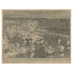
The Siege of Antwerp Engraved: Parma's Bridge Aflame on the Schelde, 1730
Located in Langweer, NL
This exquisite copperplate engraving, titled "Parmaas Schipbrugh over de Schelde," is a masterful work by Coenraet Decker, an esteemed artist active around the latter half of the 17t...
Category
Antique 1730s Prints
Materials
Paper
$345 Sale Price
20% Off
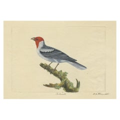
Red-Crested Cardinal - Antique Hand-Colored Print with William Hayes Sign, 1780
Located in Langweer, NL
Red-Crested Cardinal Antique Hand-Colored Bird Print by William Hayes, 1780
This charming eighteenth-century hand-colored copper engraving, signed “W. Hayes 1780” and inscribed “Car...
Category
Antique 1780s Prints
Materials
Paper
$1,869 Sale Price
35% Off
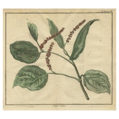
Old Hand-Colored Copper Engraving of a Pepper Branch, 1739
Located in Langweer, NL
Antique print titled 'Peper-Takje'.
Copper engraving of a pepper branch. This print originates from: 'Hedendaagsche Historie, of tegenwoordige staat van alle volkeren II deel ', ...
Category
Antique 1730s Prints
Materials
Paper
$210 Sale Price
20% Off
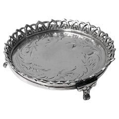
18th century Continental Silver Coaster Évora Portugal C.1780.
Located in Toronto, Ontario
18th century Continental Silver Coaster Évora Portugal C.1780. The round coaster on three foliate paw supports, the centre with engraved pin pricked an...
Category
Antique 1780s Barware
Materials
Silver
$236 Sale Price
20% Off
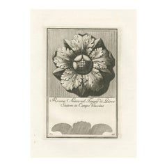
Original Antique Roman Rosette Engraving #26, Campo Vaccino
Located in Langweer, NL
This elegant engraving from the late 18th century features a rosette, an ornamental design resembling a stylized rose, which has been a recurring motif in architectural design throug...
Category
Antique 1780s Prints
Materials
Paper
$210 Sale Price
20% Off
1780s Villa Albani-inspired Rosette Engraving
Located in Langweer, NL
This exquisite engraving, dating back to around 1780, presents a masterfully crafted rosette, a decorative motif that captures the elegance and refined aesthetic of the neoclassical ...
Category
Antique 1780s Prints
Materials
Paper
$210 Sale Price
20% Off
Detailed Antique Map of Santa Domingo, Puerto Rico, Eastern Bahamas, ca. 1780
Located in Langweer, NL
Description: Antique map titled 'L'Isle De St. Domingue, et celle De Porto-Rico.'
Detailed map of Santa Domingo, Puerto Rico, etc. Includes substanti...
Category
Antique 1780s Maps
Materials
Paper
$670 Sale Price
20% Off
Antique Map of Italy, Corsica, Sardinia and Sicily, ca.1780
Located in Langweer, NL
Description: Antique map titled 'L'Italie.'
Map of Italy, Corsica, Sardinia and Sicily. Highly detailed, showing towns, rivers, some topographical features and political boundari...
Category
Antique 1780s Maps
Materials
Paper
$306 Sale Price
20% Off
Indigenous Peoples of the Bering Sea: Portraits from the 18th-Century Engravings
Located in Langweer, NL
This original engraving contains four portrait engravings, two each of individuals from Unalaska (Oonalashka) and Kamchatka. These engravings, like the previous ones, are from "Banke...
Category
Antique 1780s Prints
Materials
Paper
$316 Sale Price
20% Off
Print of Water Nymph Clytia, Daughter of Oceanus, Turning into a Sunflower, 1733
Located in Langweer, NL
Antique print titled 'Clytie changée en Tournesol (..)'.
This print depicts Clytia turning into a sunflower. Clytia (or Clytie) was a water nymph, daughter of Oceanus and Tethys ...
Category
Antique 1730s Prints
Materials
Paper
$325 Sale Price
20% Off
Antique Bird's Eye View of Scheveningen Near The Hague, the Netherlands, 1730
Located in Langweer, NL
Antique print titled 'Afbeeldinge van Schevelinge in den Jaare 1729'.
Bird's eye view of Scheveningen near The Hague / Den Haag, the Netherlands. This print originates from 'Beschr...
Category
Antique 1730s Maps
Materials
Paper
$1,294 Sale Price
20% Off
Print of the British Parliament & an Assembly before the King of England, 1732
Located in Langweer, NL
Antique print titled 'Representation du Parlement d'Angletrre (..)'.
Series of scenes, which include from the British Parliament and an assembly...
Category
Antique 1730s Prints
Materials
Paper
$709 Sale Price
20% Off
The Economic Balancing Act: A Satirical View of 1780 Britain
Located in Langweer, NL
Title: "The Economic Balancing Act: A Satirical View of 1780 Britain"
This original etching and engraving, circa 1780, is a satirical commentary on the precarious state of the Briti...
Category
Antique 1780s Prints
Materials
Paper
$498 Sale Price
20% Off
Copper Engraving Showing the Neptune Fountain of Versailles, Paris, France, 1785
Located in Langweer, NL
Antique print titled 'Plan de la décoration du Bassin de Neptune à Versailles'.
Copper engraving showing parts of the Neptune fountain of Versaill...
Category
Antique 1780s Prints
Materials
Paper
$373 Sale Price
20% Off
Antique 18th Century Creamware Covered Box Made circa 1780
Located in Katonah, NY
We are pleased to offer this sweet 18th-century English creamware covered box decorated with well-painted sprigs of flowers on the cover and along the sides of the circular box (see ...
Category
Antique 1780s English Rococo Pottery
Materials
Creamware
Navigating History: An Allegorical Frontispiece Honoring Captain Cook, ca.1788
Located in Langweer, NL
An antique engraving of the frontispiece to "Bankes's New System of Geography." The detailed artwork typically found in frontispieces of this era was designed to capture the essence ...
Category
Antique 1780s Prints
Materials
Paper
$517 Sale Price
20% Off
Georgian Marble Top Console Table
Located in Greenwich, CT
Georgian mahogany marble top console table, the inset green marble top with ogee molded surround, standing on square tapered legs ending in s...
Category
Antique 1780s English Georgian Console Tables
Materials
Marble
Hester Bateman English Georgian Neoclassical Creamer 1787
By Hester Bateman
Located in New York, NY
George III sterling silver creamer. Made by Hester Bateman in London in 1787. Tapering bowl on raised foot mounted to square base; beaded helmet mouth and high-looping handle with ch...
Category
Antique 1780s British Neoclassical Tea Sets
Materials
Sterling Silver
Large Scale Map of Greece, Extending to Cythera with Inset of Macedonia, ca.1786
Located in Langweer, NL
Antique map titled 'Graeciae Antiquae'.
Large scale map of Greece, extends south to the island of Cythera. Inset map shows details of Macedonia. Pu...
Category
Antique 1780s Maps
Materials
Paper
$594 Sale Price
20% Off
Old Antique Print of Fort Noordwijk, Batavia in the Dutch East Indies, 1739
Located in Langweer, NL
Antique print titled 'Ein Prospect des Forts Nortweijck, wie sich dasselbe wan man von Jacatra komt, mit seiner Gegend präsentiret'.
Old print of Fort Noordwijk, Batavia (Jakarta). This print originates from from 'Allerneuester Geographische- und Topographischer Schau-platz, von Africa und Ost-Indien'.
Artists and Engravers: Johann Wolfgang Heydt, a German artist who worked for the Dutch East India...
Category
Antique 1730s Maps
Materials
Paper
$536 Sale Price
20% Off
Map of the West African coast from the North of Mauretania to Guinee, 1788
Located in Langweer, NL
Antique map titled 'Particular Map of the Western Coast of Africa, from Cape Blanco to Cape de Verga, and of the Course of the Rivers Senega and Gambia.'
Map of the African coast...
Category
Antique 1780s English Maps
Materials
Paper
$364 Sale Price
20% Off
Antique Engravings of Mauritius and Indonesia, incl de Banda Islands, c.1730
Located in Langweer, NL
Title on page: "Ins. de Cerno a. Nostatibus Mauritius Nominata [on sheet with] Gunnanappi Labetacq [and] Civitas Gammelamme [and] Rex Tubatus", Le Clerc, Jean
This sheet includes fo...
Category
Antique 1730s Maps
Materials
Paper
$527 Sale Price
20% Off
Old Print of the Cruelty of the Spaniards in Antwerp, Belgium '1576', ca.1730
Located in Langweer, NL
Antique print titled 'Voorbeeldt van d'afgryselyke Wreedtheit der Spanjaarden, aan seekere Bruydt getoont, by 't plonderen van Antwerpen'.
Old print of the cruelty of the Spaniards in Antwerp, 1576. It was the time of the Sack of Antwerp, often known as the Spanish Fury at Antwerp, an episode of the Eighty Years' War. It is the greatest massacre in Belgian history. This print orginates from 'Geschiedenissen der Vereenigde Nederlanden (..)' by Jean le Clerc...
Category
Antique 1730s Prints
Materials
Paper
$345 Sale Price
20% Off
Cemetery on Amsterdam Island, French Territory in the Indian Ocean, ca.1785
Located in Langweer, NL
Antique print titled 'Begraafplaats op het eiland Amsterdam'.
Engraved view of a local cemetery on Amsterdam Island, a small French territory in the southern Indian Ocean. Origin...
Category
Antique 1780s Prints
Materials
Paper
$277 Sale Price
20% Off
Old Map of Ceylon 'Sri Lanka' with The North Oriented to The Left, 1731
Located in Langweer, NL
Description: Antique map Ceylon titled 'Nieuwe Kaart van t Eland Ceilon'.
Old map of present-day Sri Lanka with north oriented to the left. The ...
Category
Antique 1730s Maps
Materials
Paper
$623 Sale Price
20% Off
Louis XVI Chaise Percée
Located in New York, NY
An 18th century chaise percée, from the bathroom of Baron Max Fould-Springer, Palais Abbatial de Royaumont and by descent his sister Baroness Elie (Lilia...
Category
Antique 1780s French Louis XVI Armchairs
Materials
Mahogany
$9,000
Explorator
Located in Myrtle Beach, SC
Giovanni Domenico Campiglia, 'Explorator', engraving, 1734, edition unknown, scarce. Signed 'Dom. Campiglia del.' in the matrix, lower left. A fine impression, on handmade antique, l...
Category
1730s Realist Nude Prints
Materials
Engraving
Antique Print of Natives in Florida Making Offerings to the Sun God, ca.1730
Located in Langweer, NL
Description: Antique print titled 'Sacrifice que les Floridiens sont au Soleil, de leurs Premiers nez' and 'Ofrande que les Floridiens sont d'un Cerf au soleil'.
Two copper engra...
Category
Antique 1730s Prints
Materials
Paper
$325 Sale Price
20% Off
Large, Original Antique Print of the Roman Tropaeum Alpium, Near Monaco, ca.1780
Located in Langweer, NL
Antique print titled 'Ruines du Monument de la Turbie, près de Monaco'. Large, original antique print of the Tropaeum Alpium, a Roman trophy (tropaeum) ce...
Category
Antique 1780s Prints
Materials
Paper
$440 Sale Price
20% Off
Print of the Interior of the Governor General's Home on Java (Indonesia), 1739
Located in Langweer, NL
Antique print titled 'Ein Prospect der Gallerie, von des General-Gouverneurs Wohnung, nach dem Versammlungs-Saal derer Herren Rathen von Indien.'
View of the interior of the Governor General's home on Java (Indonesia). It shows the ceiling painting and row of columns leading to the ornate door...
Category
Antique 1730s Prints
Materials
Paper
$527 Sale Price
20% Off
Original Antique Engraved View of Porchester Castle in Hampshire, ca.1780
Located in Langweer, NL
Antique print, titled: 'View of Porchester Castle in Hampshire.' -
A view of Portchester Castle, a medieval castle built within a former Roman fort at Portchester to the east of Fa...
Category
Antique 1780s Prints
Materials
Paper
$134 Sale Price
20% Off
Old Map of Indian Ocean & Sumatra, Java, Borneo, India, Arabia, Africa, c.1783
Located in Langweer, NL
Antique map titled 'Carte des Declinaisons et Inclinaisons de L'Aiguille Aimantée redigée d'après la table des observations Magnetiques faites par les Voyageurs depuis l'Année 1775'....
Category
Antique 1780s Maps
Materials
Paper
$1,341 Sale Price
20% Off
Antique Map of the World with California as an Island, 1788
Located in Langweer, NL
Description: Antique map titled 'De wareld in een ronde gedaante van de Noord Pool te zien - De Wareld verbeeld in de gedaante van een hard'. This interesting composition contains three world maps on the sheet. At left is a northern projection showing all the landmasses. At right is a cordiform projection (heart-shaped). At top is a map of the world as known to the ancients. Both the polar and cordiform projections show California as an island...
Category
Antique 1780s Maps
Materials
Paper
$623 Sale Price
20% Off
Old Sea Charts of Tourane Bay & the Con Dao Islands 'Pulo Condor', Vietnam, 1780
Located in Langweer, NL
Description: Two maps on one sheet titled 'Carte d'une partie de la Cote de Cochinchine [and] Plan de l'Isle Condor'.
Sea charts of the coast of Vietnam around the Tourane Bay an...
Category
Antique 1780s Maps
Materials
Paper
$623 Sale Price
20% Off
Old Hand-Colored Bird Print of the Male Ruff Wading Bird, a Sandpiper, ca.1738
Located in Langweer, NL
Description: Antique print titled 'Avis pugnax mas'. Old bird print of the male ruff bird (Calidris pugnax), amedium-sized wading bird that breeds in marshes...
Category
Antique 1730s Prints
Materials
Paper
$306 Sale Price
20% Off
Old Map of the Rhine & German Cities Incl Düsseldorf, Bonn, Köln, Etc., c.1730
Located in Langweer, NL
Antique map Germany titled 'Mappa Geographica continens Archiepiscopatum et Electoratum Coloniensem (..)'.
This antique map depicts the Rhine r...
Category
Antique 1730s Maps
Materials
Paper
$939 Sale Price
20% Off
Original and Colourful Map of Northern India with Surrounding Regions, 1783
Located in Langweer, NL
Antique map titled 'Indes'. A map of Northern India with surrounding regions. From Lattre's 'Atlas moderne ou collection de cartes sur toutes les parties du globe terrestre...
Category
Antique 1780s Maps
Materials
Paper
$546 Sale Price
20% Off
Original Antique Print of the 'Korenbeurs' in Amsterdam, the Netherlands, 1787
Located in Langweer, NL
Antique print titled 'De Nieuwe Koornbeurs, in 1786'.
Original antique print of the 'Korenbeurs' in Amsterdam, the Netherlands. The Korenbeurs ("grain bourse") was a 17th-century commodity market in Amsterdam where grain was traded. The building stood on the banks of the Amstel, on the western side (Nieuwezijde) of the Damrak. It was directly south of the Oude Brug bridge, on a spot now occupied by the former stock and commodity exchange Beurs van Berlage...
Category
Antique 1780s Prints
Materials
Paper
$345 Sale Price / set
20% Off
Antique Map of the Russian Empire in Europe, ca.1780
Located in Langweer, NL
Description: Antique map titled 'Bowles's New Pocket Map of the Russian Empire in Europe, Comprehending the West Part of the Empire in Asia' Large and detai...
Category
Antique 1780s Maps
Materials
Paper
$814 Sale Price
20% Off
A Pair of Georgian Library Chairs
Located in Greenwich, CT
A fine pair of George III mahogany and suede library chairs of small but well-proportioned scale, the shaped back over downswept arms, the padded seat over square tapered legs with b...
Category
Antique 1780s English Georgian Armchairs
Materials
Suede, Mahogany
Old Print with a View of the Dutch Church in Batavia 'Jakarta, Indonesia', 1738
Located in Langweer, NL
Antique print titled 'Ein Perspectivischer Aufzug der neu erbauten Holländischen Kirch zu Batavia, welche von Ao. 1733. bis 1736. mit grossen Kosten der Ed;en Ost-Indischen Compagnie...
Category
Antique 1730s Maps
Materials
Paper
$747 Sale Price
20% Off
Original Antique Print of a Woman with Hair in a Polish Plait, 1734
Located in Langweer, NL
Description: Untitled Print of a Polish Plait. Polish plait ( Plica polonica in Latin), plica, or trichoma is a formation of hair.
This term can refer to a hairstyle or supposes ...
Category
Antique 1730s Prints
Materials
Paper
$230 Sale Price
20% Off
Map of the Western Coast of South America from Ecuador into Chili, ca.1780
Located in Langweer, NL
Antique map titled 'Carte du Perou avec une partie des pays qui en sont a l'est.'
Map of the western coast of South America extending from Ecuador, through Peru and present-day B...
Category
Antique 1780s Maps
Materials
Paper
$325 Sale Price
20% Off
Old Print with a Genealogical Tree of the Chinese Imperial Dynasties, 1732
Located in Langweer, NL
Antique print titled 'Succession des Empereurs de la Chine divisée en XXII Familles'.
Old print with a genealogical tree of the Chinese imperial dynasties. This print originates ...
Category
Antique 1730s Prints
Materials
Paper
$527 Sale Price
20% Off
Map of the African Coast, Gulf of Guinea, from Sierra Leone to Gabon, 1788
Located in Langweer, NL
Antique map titled 'Drawn from d'Anvilles Map of the Coast of Guinea, Between Sierra Leone and the crossing of the Line.'
Map of the African coast, Gulf of Guinea, from Sierra Le...
Category
Antique 1780s English Maps
Materials
Paper
$440 Sale Price
20% Off
Map of Spain & Portugal Incl. the islands of Ibiza, Minorque & Majorque, 1780
Located in Langweer, NL
Antique map titled 'Les Royaumes d'Espagne et de Portugal.'
Map of Spain and Portugal. Includes the islands of Ibiza, Minorque, and Majorque. Shows towns, rivers, some topographi...
Category
Antique 1780s Maps
Materials
Paper
$335 Sale Price
20% Off
Antique Engraving of Greek Religious Ceremonies, ca.1730
Located in Langweer, NL
Antique print of various Greek religious ceremonies. With French description.
Artists and Engravers: Anonymous
Condition: Very good. Stamp on ...
Category
Antique 1730s Prints
Materials
Paper
$268 Sale Price
20% Off
Antique Map with Details of Berings' Expedition into Russians' Far East, 1737
Located in Langweer, NL
Antique map titled 'Carte Des Pays traverses par le Capne. Beerings depuis la Ville de Tobolsk jusqua'a Kamtschatka'.
This is the first printed map to illustrate Vitus Bering's fir...
Category
Antique 1730s Maps
Materials
Paper
$1,389 Sale Price
20% Off
Copper Engraving of Cluster Mallow and Malva Sylvestris Flowers, 1737
Located in Langweer, NL
Antique botany print titled 'Malva Crispa, Malva Mauritana'. Copper engraving of cluster mallow and malva sylvestris. This print originates from 'Phytanthoza Iconographia' by J.W. We...
Category
Antique 1730s Prints
Materials
Paper
$249 Sale Price
20% Off
Large and Detailed Map of the Russian Empire in Asia, ca.1780
Located in Langweer, NL
Description: Antique map titled 'Bowles's New Pocket Map of the East Part of the Russian Empire in Asia'. Large and detailed map of the Russian Empire in Asia. Source unknown, to be determined.
Artists and Engravers: Made by 'Thomas & Carington Bowles' after 'D'Anville'. Thomas Bowles, born around 1712, was map publisher and seller in London...
Category
Antique 1780s Maps
Materials
Paper
$814 Sale Price
20% Off
Antique Print Depicting the Personification of Hope, with English 4-Liner, c1780
Located in Langweer, NL
Antique print, titled: 'Hope.'
Personification of Hope, a female figure beside an anchor, with a sailing ship in the background. With a four-line English caption. From 'The Unive...
Category
Antique 1780s Prints
Materials
Paper
$201 Sale Price
20% Off
Nice Sheet of the Sangihe Archipelago in Indonesia & California Island, 1788
Located in Langweer, NL
Antique map titled 'De Noord Pool waar in aangetoont werd alle de Nieuwe Landen (..)
De Eilanden van Sangir Sjauw en Pangasare (..)'. Interesting map that includes a map of the N...
Category
Antique 1780s Maps
Materials
Paper
$584 Sale Price
25% Off
Religious Antique Engravings of Confucius and Buddha Amida in Japan, ca.1782
Located in Langweer, NL
Original (proof) engraving of two religions. Adoration of the statue of Confucius and Boeddha Amida in Japan.
Title on the leaf:
1) Het beeld van Confucius, zo als het in de ope...
Category
Antique 1780s Prints
Materials
Paper
$383 Sale Price
20% Off
American-market Chinese Export Porcelain Blue Enamel Plate
Located in Downingtown, PA
Chinese export Porcelain blue enamel plate made for the American Market,
circa 1785.
The small Chinese Export American-market plate has a central roundel in brown depicting an, ...
Category
Antique 1780s Chinese Chinese Export Porcelain
Materials
Porcelain
Two Antique Sea Charts of the Thousand Islands between Batavia and Bantam, c1734
Located in Langweer, NL
Antique maps titled 'A large draught of the Coast of Iava from Bantam Point to Batavia'. Two seperate sheets, joined together they depict the island of Java, Indonesia.
Condition...
Category
Antique 1730s Maps
Materials
Paper
$1,581 Sale Price / set
20% Off
Engraving of an Orang-Utan on Borneo 'Kalimantan' or Sumatra, Indonesia, 1739
Located in Langweer, NL
Antique print titled 'Orang-Oetang of Bosch-mensch'. This print depicts an Orang-Utan on Borneo or Sumatra, Indonesia. Originates from 'Hedendaagsche Historie, of tegenwoordige staat...
Category
Antique 1730s Prints
Materials
Paper
$134 Sale Price
20% Off
Old Print of Univalve 'Gastropod' Species; Ear Shells, Limpets, Etc., 1787
Located in Langweer, NL
Antique print titled 'Univalves'. Old print of various Univalve (Gastropod) species; Ear shells, Limpets, Tooth shells, Nerite etc.
This antique print originates from William Fre...
Category
Antique 1780s Prints
Materials
Paper
$153 Sale Price
20% Off
Old Original Copper Engraving Depicting a Viceroy with Entourage in China, 1735
Located in Langweer, NL
Original handtinted copper engraving with title: 'Cortege d'un Viceroy tout les fois qu'il sort de son palais'.
Translate in English: 'Procession of a Viceroy whenever he leaves h...
Category
Antique 1730s Prints
Materials
Paper
$345 Sale Price
20% Off
Copper Engraved Map of Tierra del Fuego and the Strait of Magellan, c1780
Located in Langweer, NL
Antique map titled 'Extremite Meridionale de l'Amerique.'
Copper engraved map of Tierra del Fuego and the Strait of Magellan with five detailed insets of the region showing soundings, anchorages, etc. Engraved by Andre. This map originates from 'Atlas de Toutes les Parties Connues du Globe Terrestre'.
Artists and Engravers: Rigobert Bonne (1727-1795 ) was one of the most important cartographers of the late 18th century. In 1773 he succeeded Jacques Bellin as Royal Cartographer to France in the office of the Hydrographer at the Depôt de la Marine. Working in his official capacity Bonne compiled some of the most detailed and accurate maps of the period. Bonne's work represents an important step in the evolution of the cartographic ideology away from the decorative work of the 17th and early 18th century towards a more detail oriented and practical aesthetic. With regard to the rendering of terrain Bonne maps...
Category
Antique 1780s Maps
Materials
Paper
$345 Sale Price
20% Off
