Antique Maps New Zealand

to
26
48
1
35
13
9
9
8
7
7
5
5
3
3
2
2
2
2
2
1
1
1
1
1
Sort By
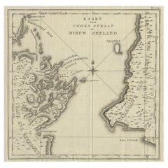
Antique Map of Cook's Strait in New Zealand, 1803
Located in Langweer, NL
Antique map New Zealand titled 'Kaart van Cooks Straat in Nieuw Zeeland'. Antique map of Cook's
Category

19th Century Antique Maps New Zealand

Materials

Paper

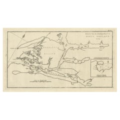
Antique Map of the Dusky Bay or Dusky Sound of New Zealand by Captain Cook, 1803
Located in Langweer, NL
Antique map New Zealand titled 'Schets van de Donkere Baai in Nieuw Zeeland 1773'. Antique map
Category

Early 1800s Antique Maps New Zealand

Materials

Paper

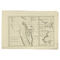
Detailed Map of New Zealand Showing the Route of Capt. Cook's First Voyage, 1803
Located in Langweer, NL
Antique map New Zealand titled 'De Rivier de Theems en Mercurius Baai in Nieuw Zeeland'. Detailed
Category

19th Century Antique Maps New Zealand

Materials

Paper

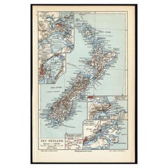
Antique Map of New Zealand, 1895
Located in Langweer, NL
Antique map titled 'Neu-Seeland.' Map of New Zealand. With inset maps of the large cities. This
Category

19th Century Antique Maps New Zealand

Materials

Paper

Antique Map of New Zealand, 1895
H 9.65 in W 6.3 in D 0 in
Antique Map of New Zealand by Johnston '1909'
Located in Langweer, NL
Antique map titled 'New Zealand'. Original antique map of New Zealand. With inset maps of Chatham
Category

Early 20th Century Antique Maps New Zealand

Materials

Paper

Antique Map of New Zealand by Johnston '1909'
H 19.49 in W 24.41 in D 0.02 in
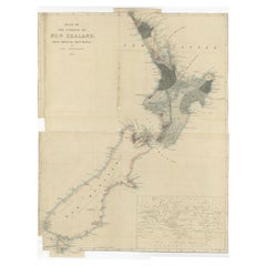
Antique Map of New Zealand by Arrowsmith '1844'
Located in Langweer, NL
Antique map titled 'Map of the colony of New Zealand from official documents'. A scarce map of New
Category

Mid-19th Century Antique Maps New Zealand

Materials

Paper

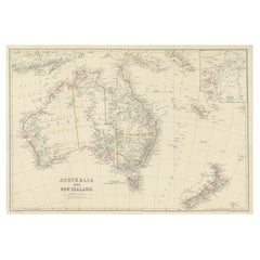
Antique Map of Australia and New Zealand, c.1860
Located in Langweer, NL
Antique map titled 'Australia and New Zealand'. Unusual edition of this map of Australia and New
Category

19th Century Antique Maps New Zealand

Materials

Paper

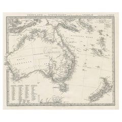
German Antique Map of Australia and New Zealand, 1857
Located in Langweer, NL
Australia and New Zealand, including excellent detail in the settled regions of both. Large list of
Category

19th Century Antique Maps New Zealand

Materials

Paper

Antique Map of New Zealand by A & C. Black, 1870
Located in Langweer, NL
Antique map titled 'New Zealand'. Original antique map of New Zealand with inset Maps of Australia
Category

Late 19th Century Antique Maps New Zealand

Materials

Paper

Antique Map of New Zealand by Scottish Geographer Johnston, 1882
Located in Langweer, NL
Antique map titled 'New Zealand'. Old map of New Zealand. This map originates from 'The Royal
Category

19th Century Antique Maps New Zealand

Materials

Paper

Large Original Vintage Map of New Zealand, North Island, circa 1920
Located in St Annes, Lancashire
Great map of North Island, New Zealand Original color. Good condition / minor foxing to
Category

1920s English Edwardian Antique Maps New Zealand

Materials

Paper

Large Original Vintage Map of New Zealand, South Island, circa 1920
Located in St Annes, Lancashire
Great map of South Island, New Zealand Original color. Good condition / repair to a minor
Category

1920s English Edwardian Antique Maps New Zealand

Materials

Paper

Antique Map of Australasia, New Zealand, Polynesia & the Pacific Ocean, 1840
Located in Langweer, NL
Antique map titled 'The Pacific Ocean'. This map depicts Australasia, New Zealand, Polynesia
Category

1840s Antique Maps New Zealand

Materials

Abalone, Paper

Antique Map of Australia and New Zealand by W. G. Blackie, 1859
Located in Langweer, NL
Antique map titled 'Australia and New Zealand'. Original antique map of Australia and New Zealand
Category

Mid-19th Century Antique Maps New Zealand

Materials

Paper

1882 Map of Australia and New Zealand with Regional and Geographical Features
Located in Langweer, NL
This 1882 map of Australia and New Zealand, published by Blackie and Son as part of the
Category

1880s Antique Maps New Zealand

Materials

Paper

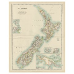
1882 Original Antique Map of New Zealand with Inset of Auckland's Environs
Located in Langweer, NL
This 1882 map of New Zealand, published by Blackie and Son as part of the 'Comprehensive Atlas and
Category

1880s Antique Maps New Zealand

Materials

Paper

Map of New Zealand Showing Maori Culture and Early Colonial Settlements, 1851
Located in Langweer, NL
being depicted. The map of New Zealand you've mentioned would have been created when New Zealand was a
Category

1850s Antique Maps New Zealand

Materials

Paper

Old Map of the Oceans Around Australia, Indonesia and New Zealand, 1880
Located in Langweer, NL
Antique map titled 'Océanie'. Old map of the oceans around Australia, Indonesia and New Zealand
Category

1880s Antique Maps New Zealand

Materials

Paper

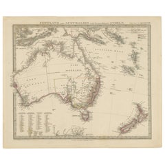
Antique Map of Australia, New Zealand and Oceania by F. von Stülpnagel, 1850
Located in Langweer, NL
Antique map titled 'Australien und Polynesien in Mercators Projection'. A map of Australia, New
Category

Mid-19th Century Antique Maps New Zealand

Materials

Paper

Map of Australia, New Zealand, Part of China, Japan and Southeast Asia, 1857
Located in Langweer, NL
German Antique map titled 'Australien'. Map of Australia, New Zealand, part of China, Japan and
Category

19th Century Antique Maps New Zealand

Materials

Paper

Antique Map of Oceania and the Pacific Ocean, Australia and New Zealand, 1826
Located in Langweer, NL
Antique map of Australia titled 'Karte von Australien'. Old map of Australia and New Zealand
Category

19th Century Antique Maps New Zealand

Materials

Paper

Antique Map of Oceania by Johnston, 1882
Located in Langweer, NL
New Zealand. This map originates from 'The Royal Atlas of Modern Geography, Exhibiting, in a Series of
Category

19th Century Antique Maps New Zealand

Materials

Paper

Antique Map of Oceania by Johnston, 1882
H 19.53 in W 24.18 in D 0 in
Antique Map of Oceania by Levasseur, circa 1860
Located in Langweer, NL
Antique map titled 'Carte générale de l'Océanie'. Large map of Oceania including New Zealand
Category

Mid-19th Century Antique Maps New Zealand

Materials

Paper

Antique Map of Australia by H. Kiepert, 1875
Located in Langweer, NL
Antique map titled 'Australien'. Large and detailed map of Australia and New Zealand. With color
Category

Late 19th Century Antique Maps New Zealand

Materials

Paper

Antique Map of Australia by H. Kiepert, 1875
H 19.1 in W 23.63 in D 0.02 in
Antique Map of East Asia by Coronelli, circa 1690
Located in Langweer, NL
Antique map of East Asia showing New Holland and parts of Van Diemens Land and New Zealand. This
Category

Late 17th Century Antique Maps New Zealand

Materials

Paper

Antique Map of Harvey Island and Surroundings by Cook, 1803
Located in Langweer, NL
largely uncharted areas of the globe. He mapped lands from New Zealand to Hawaii in the Pacific Ocean in
Category

19th Century Antique Maps New Zealand

Materials

Paper

Antique Map of Australia and surrounding Islands by F. von Stülpnagel, 1850
Located in Langweer, NL
Zealand, Southern New-Guinea and surrounding islands. This map originates from Stieler's Hand-Atlas, 1850.
Category

Mid-19th Century Antique Maps New Zealand

Materials

Paper

Very Attractive Antique Map of the World as Planisphere, Shows Cook's Voyages
Located in Langweer, NL
of Cook's Voyages were integrated into the map, showing better detail in New Zealand, Australia, the
Category

Late 18th Century Antique Maps New Zealand

Materials

Paper

Antique Miniature Map of the Western Hemisphere, with California as an Island
Located in Langweer, NL
Northwest Coast of America and an incomplete New Zealand. This map originates from 'Description de l
Category

Late 17th Century Antique Maps New Zealand

Materials

Paper

Print of Maps of Islands of the South Pacific, Incl. Pitcairn & Dusky Bay, 1788
Located in Langweer, NL
rose and inset of Dusky Bay on New Zealand. This map originates from 'Atlas encyclopedique: contenant
Category

1780s Antique Maps New Zealand

Materials

Paper

Original Antique Poster British Empire Our Master Hope Britain Stanley Baldwin
Located in London, GB
and New Zealand, South Africa, the Indian Empire and Canada on the corners of the decorative text box
Category

1920s British Antique Maps New Zealand

Materials

Paper

Captain James Cook: 18th C. Portrait by William Hodges After Cook's 2nd Voyage
By William Hodges
Located in Alamo, CA
to explore the eastern coast of Australia, and he was the first to map the New Zealand coastline. He
Category

1770s Antique Maps New Zealand

Materials

Engraving

Rare Robert Bénard Map Engraving - South Pacific Australia New Zealand 1774
Located in Malvern, Victoria
Rare Robert Bénard map of the South Pacific, showing Australia and New Zealand Bénard, Robert
Category

1770s Antique Maps New Zealand

Map of New Zealand - Etching / engraving - 18th Century
Located in Zeeland, Noord-Brabant
door den Luitenant J. Cook met het schip de Endeavour' - (Map / Chart of New Zealand explored in the
Category

1790s Contemporary Antique Maps New Zealand

Materials

Engraving

Antique Map of Australia and New Zealand with Dutch Text, 1852
Located in Langweer, NL
Antique map titled 'Het vaste land van Australië met de voornaamste omliggende eilanden'. Map of
Category

19th Century Antique Maps New Zealand

Materials

Paper

Antique Map of New Zealand by Lowry '1852'
Located in Langweer, NL
Antique map titled 'New Zealand'. Original map of New Zealand. This map originates from 'Lowry's
Category

Mid-19th Century Antique Maps New Zealand

Materials

Paper

Antique Map of New Zealand by Lowry '1852'
H 12.21 in W 9.65 in D 0.02 in
Large Original Vintage Map of New Zealand, 1903
Located in St Annes, Lancashire
Great map of New Zealand Original color. Published by W. & A.K. Johnston. 1903 Unframed.
Category

Early 1900s English Antique Maps New Zealand

Materials

Paper

Original Antique Map of New Zealand, Grattan & Gilbert, 1843
Located in St Annes, Lancashire
Great map of New Zealand. Drawn and engraved by Archer. Published by Grattan and Gilbert
Category

1840s English Other Antique Maps New Zealand

Materials

Paper

Large Original Vintage Map of New Zealand, circa 1920
Located in St Annes, Lancashire
Great map of New Zealand Original color. Published by Alexander Gross Repairs to a couple
Category

1920s English Victorian Antique Maps New Zealand

Materials

Paper

Antique Map of New Zealand by W. G. Blackie, 1859
Located in Langweer, NL
Antique map titled 'New Zealand'. Original antique map of New Zealand included map of Sandwich
Category

Mid-19th Century Antique Maps New Zealand

Materials

Paper

Antique Map of Hawaii, New Zealand, Fiji and Surrounding Islands
Located in Langweer, NL
Original antique map of Hawaii, New Zealand, Fiji, Tonga, Samoa, French Polynesia, Marquesas, and
Category

Late 19th Century Antique Maps New Zealand

Materials

Paper

Large Original Vintage Map of New Zealand, North Island, circa 1920
Located in St Annes, Lancashire
Great map of North Island, New Zealand Original color. Good condition Published by
Category

1920s English Edwardian Antique Maps New Zealand

Materials

Paper

Large Original Vintage Map of New Zealand, South Island, circa 1920
Located in St Annes, Lancashire
Great map of South Island, New Zealand Original color. Good condition Published by
Category

1920s English Edwardian Antique Maps New Zealand

Materials

Paper

Antique Map of Australia and New Zealand by H. Kiepert, 1874
Located in Langweer, NL
and New Zealand. With color key in lower left. The map is prepared by H. Kiepert and published in
Category

Late 19th Century Antique Maps New Zealand

Materials

Paper

Large Original Vintage Map of New Zealand, North Island, circa 1920
Located in St Annes, Lancashire
Great map of North Island, New Zealand Original color. Good condition / minor foxing to
Category

1920s English Edwardian Antique Maps New Zealand

Materials

Paper

Large Original Antique Map of New Zealand by William Hughes, 1847
Located in St Annes, Lancashire
Great map of New Zealand Drawn and engraved by William Hughes Steel engraving Original
Category

1840s Scottish Antique Maps New Zealand

Materials

Paper

Antique Dutch Map of Australia 'Nieuwe Holland' and New Zealand, c.1873
Located in Langweer, NL
Antique map titled 'Het vaste land van Australië'. Old map depicting Australia and New Zealand with
Category

19th Century Antique Maps New Zealand

Materials

Paper

Old Print Showing New Zealand, Cuba, Iceland etc. Lakes, Mountains, Rivers, 1851
Located in Langweer, NL
Mountains in the Western Hemisphere'. This map depicts the islands of New Zealand, Cuba, Iceland etc., the
Category

1850s Antique Maps New Zealand

Materials

Paper

Antique Map of Australia by C. Gräf, 1857
Located in Langweer, NL
Antique map titled 'Australien'. Map of Australia, New Zealand, part of China, Japan and Southeast
Category

Mid-19th Century Antique Maps New Zealand

Materials

Paper

Antique Map of Australia by C. Gräf, 1857
H 22.64 in W 27.96 in D 0.02 in
Antique Map of Australia and the East Indies by Johnson, '1872'
Located in Langweer, NL
Indies, with an inset map of New Zealand. This map originates from 'Johnson's New Illustrated Family
Category

Late 19th Century Antique Maps New Zealand

Materials

Paper

'Australien', antique map of Australia, New Zealand, Indonesia, SW Pacific, 1812
Located in Melbourne, Victoria
). Published in Augsburg, circa 1812. Early German map of Australia. The imperial city of Augsburg was a
Category

Early 19th Century Naturalistic Antique Maps New Zealand

Materials

Engraving

Get Updated with New Arrivals
Save "Antique Maps New Zealand", and we’ll notify you when there are new listings in this category.

Antique Maps New Zealand For Sale on 1stDibs

Find many varieties of an authentic antique maps new zealand available at 1stDibs. Each antique maps new zealand for sale was constructed with extraordinary care, often using paper, abalone and shell. Your living room may not be complete without an antique maps new zealand — find older editions for sale from the 18th Century and newer versions made as recently as the 20th Century.

How Much is a Antique Maps New Zealand?

Prices for an antique maps new zealand start at $112 and top out at $4,500 with the average selling for $280.

Read More

Medal-Worthy Memorabilia from Epic Past Olympic Games

Get into the games! These items celebrate the events, athletes, host countries and sporting spirit.

Ahoy! You’ve Never Seen a Collection of Sailor Art and Kitsch Quite Like This

French trendsetter and serial collector Daniel Rozensztroch tells us about his obsession with objects related to seafaring men.

39 Incredible Swimming Pools

It's hard to resist the allure of a beautiful pool. So, go ahead and daydream about whiling away your summer in paradise.

Pamela Shamshiri Shares the Secrets behind Her First-Ever Book and Its Effortlessly Cool Interiors

The sought-after designer worked with the team at Hoffman Creative to produce a monograph that beautifully showcases some of Studio Shamshiri's most inspiring projects.

Moroccan Artworks and Objects Take Center Stage in an Extraordinary Villa in Tangier

Italian writer and collector Umberto Pasti opens the doors to his remarkable cave of wonders in North Africa.

Montecito Has Drawn Royalty and Celebrities, and These Homes Are Proof of Its Allure

Hollywood A-listers, ex-pat aristocrats and art collectors and style setters of all stripes appreciate the allure of the coastal California hamlet — much on our minds after recent winter floods.

Whaam! Blam! Pow! — a New Book on Pop Art Packs a Punch

Publishing house Assouline and writer Julie Belcove have teamed up to trace the history of the genre, from Roy Lichtenstein, Andy Warhol and Yayoi Kusama to Mickalene Thomas and Jeff Koons.

The Sparkling Legacy of Tiffany & Co. Explained, One Jewel at a Time

A gorgeous new book celebrates — and memorializes — the iconic jeweler’s rich heritage.