Maps

to
4,204
5,544
200
5,749
3
74
35
18
14
9
6
5
4
4
3
1
1
2,965
2,305
479
3
295
34
10
127
10
37
9
2
5
4
3
3
5,663
127
59
35
32
907
359
247
227
180
5,752
5,752
5,752
104
58
28
21
15
Maps For Sale
Hand-Colored Map of the Holy Land Divided Among the Twelve Tribes, c.1720
Located in Langweer, NL
Hand-Colored Map of the Holy Land Divided Among the Twelve Tribes, c.1720
This striking antique map, titled "Iudaea seu Palaestina ob Sacratissima Redemtoris Vestigia Hodie Dicta Te...
Category
Early 18th Century European Antique Maps
Materials
Paper

Original Antique Map of the Route of M. Zurabek – Caspian Sea to Isfahan, 1722
Located in Langweer, NL
Original Antique Map of the Route of M. Zurabek – Caspian Sea to Isfahan, 1722
This 18th-century copperplate map, titled Carte de la Route de M. Zurabek, Ambassadeur du Roi de Polog...
Category
Early 18th Century French Antique Maps
Materials
Paper

Antique Map of Rhodesia & British Central Africa – Published by Philip, 1895
Located in Langweer, NL
Antique Map of Rhodesia & British Central Africa – Published by George Philip & Son, 1895
This detailed antique map titled "Rhodesia & British Central Africa" was published in 1895 ...
Category
Late 17th Century English Antique Maps
Materials
Paper

Antique Map of Alexander the Great's Empire & Campaigns, de Vaugondy, 1753
Located in Langweer, NL
Antique Map of Alexander the Great's Empire & Campaigns, de Vaugondy, 1753
This rare and elegantly engraved map, titled "Antiquor Imperiorum Tabula, in qua Prae Caeteris, Macedonicu...
Category
Mid-18th Century European Antique Maps
Materials
Paper

Antique 1743 Map – Travels of Jesus Christ & Apostles by Seutter
Located in Langweer, NL
Antique 1743 Map – Travels of Jesus Christ & Apostles by Seutter
This is an original antique map titled “Carte des Voyages de Notre Seigneur Jesus-Christ et des Actes des Apotres St...
Category
Mid-18th Century German Antique Maps
Materials
Paper


$1,616 Sale Price
20% Off
Antique Map of the Mediterranean Basin, 1903, with Detailed Coastal and Inland
Located in Langweer, NL
Title: Antique Map of the Mediterranean Basin, 1903, with Detailed Coastal and Inland Geography
Description: This antique map, titled "Basin of the Mediterranean," was engraved and ...
Category
Early 20th Century Maps
Materials
Paper

Original Antique Map of the American State of Maryland & Delaware, 1903
Located in St Annes, Lancashire
Antique map of Maryland And Delaware
Published By A & C Black. 1903
Original colour
Good condition
Unframed.
Free shipping
Category
Early 1900s English Antique Maps
Materials
Paper

Paris and Surroundings – Antique Map by Gall and Inglis, Published 1843
Located in Langweer, NL
Antique Map of Paris and Environs by Gall and Inglis, 1843
This finely detailed map titled "Gall & Inglis’ Plan of Paris and Environs" was published in 1843 and provides a fascinati...
Category
Mid-19th Century English Antique Maps
Materials
Paper

1709 Map of the Holy Land - Twelve Tribes of Israel, Hand-Colored, Antique Map
Located in Langweer, NL
This is a beautiful 1709 map of the Holy Land, titled "Iudaea seu Terra Sancta quae Hebraeorum sive Israelitarum in suas duodecim Tribus divisa," by Guillaume Sanson and Alexis Huber...
Category
Early 1700s French Antique Maps
Materials
Paper

$1,551 Sale Price
20% Off
Original Antique Map of the American State of Michigan ( Northern Part ), 1903
Located in St Annes, Lancashire
Antique map of Michigan ( Northern part )
Published By A & C Black. 1903
Original colour
Good condition
Unframed.
Free shipping
Category
Early 1900s English Antique Maps
Materials
Paper
, 1903")
1720 Weigel Engraving of Jerusalem: A Biblical View from Josephus' Perspective
Located in Langweer, NL
1720 Weigel Map of Jerusalem Based on Josephus' Writings
This intricate 1720 bird's-eye view map of ancient Jerusalem by I.H. Coccejo, engraved by Christoph Weigel, offers a fasc...
Category
1720s Antique Maps
Materials
Paper

Dresden Germany, Old Town Plan by Baldwin & Cradock 1833
Located in Langweer, NL
Dresden, depicted in this antique map by Baldwin & Cradock from 1833, was a historically significant city in Saxony, Germany. This map, published under the supervision of the Society...
Category
1830s Antique Maps
Materials
Paper

Unusual Benedictine Map of Italy, Showing Various States of the Church, C.1745
Located in Langweer, NL
Antique map titled 'Italia Benedictina Delineata A.P.R.C.P.W.' Unusual Benedictine map of Italy, showing the various states of the church, with an elaborate cartouche. Part of a seri...
Category
18th Century Antique Maps
Materials
Paper

$1,435 Sale Price
20% Off
Constantinople (Istanbul) – City View by Werner and Gläser, Augsburg ca.1730
Located in Langweer, NL
Constantinople (Istanbul) – Panoramic City View by Werner and Gläser, Augsburg c.1730
This striking hand-colored copper engraving offers a grand panoramic view of Constantinople (mo...
Category
Early 18th Century German Antique Maps
Materials
Paper
 – City View by Werner and Gläser, Augsburg ca.1730")
An Ornate and Historical Tallis Map of Jamaica with Decorative Vignettes, 1851
Located in Langweer, NL
This original antique map of Jamaica is part of the renowned series created by the Tallis Company, known for their detailed and decorative maps ...
Category
1850s English Antique Maps
Materials
Paper

Very Decorative Rare Antique Map of the Northern Part of Africa, 1702
Located in Langweer, NL
Antique map titled 'Africae Pars Borealis.'
Very decorative antique map of the northern part of Africa by Heinrich Scherer. The map is full of the spurious geography of the perio...
Category
Early 1700s German Antique Maps
Materials
Paper

$828 Sale Price
30% Off
Small Map of the United States, circa 1870
Located in Langweer, NL
Antique map titled 'Amérique septe. Physique'. Small map of the United States. lithographed by C. Callewaert brothers in Brussels circa 1870.
Category
Mid-19th Century Belgian Antique Maps
Materials
Paper

Very Attractive Antique Map of the World as Planisphere, Shows Cook's Voyages
Located in Langweer, NL
Antique map titled 'Chart of the World, according to Mercators Projection'. This world map shows the various discoveries of Captain James Cook during his 3 voyages between 1768 and 1780, and the English and French Explorers who followed immediately thereafter, including Vancouver and La Perouse. This edition of the map is significantly revised from the editions issued immediately after the official report of Cook's Voyages were integrated into the map, showing better detail in New Zealand, Australia, the Northwest Coast of America and North East coast of Asia, along with Greenland. A new large lake also appears for the first time in the Western part of North America, shortly before the commencement of the Lewis...
Category
Late 18th Century Antique Maps
Materials
Paper

$1,345 Sale Price
25% Off
Original Antique Map of The London Underground. 1911
Located in St Annes, Lancashire
Superb map of The London Underground
Published by Ward Lock, 1911
Folding map. Printed on paper
Unframed.
Good condition/ Minor repair to an edge tear on right edge ( shown in ...
Category
1910s English Vintage Maps
Materials
Canvas, Paper

Original Antique Map of Ancient Greece, Achaia, Corinth, 1786
Located in St Annes, Lancashire
Great map of Ancient Greece. Showing the region of Thessaly, including Mount Olympus
Drawn by J.D. Barbie Du Bocage
Copper plate engraving by P.F Tardieu
Original hand color...
Category
1780s French Other Antique Maps
Materials
Paper

Antique Map of California, Utah, Nevada, Colorado, New Mexico & Arizona '1872'
Located in Langweer, NL
Antique map titled 'Johnson's California (..)'. Original map of California, Utah, Nevada, Colorado, New Mexico and Arizona. This map originates from ...
Category
Late 19th Century Antique Maps
Materials
Paper

$239 Sale Price
20% Off
Antique Map of the Northeastern United States and Canada by Tardieu, 1802
Located in Langweer, NL
This antique map titled "Carte de la Partie Septentrionale des Etats Unis," created by Pierre Antoine Tardieu, depicts the northeastern part of the United States and parts of Canada....
Category
Early 1800s Antique Maps
Materials
Paper

$535 Sale Price
20% Off
1792 Hand-Colored Plan of St. Petersburg and Moscow in Russia
Located in Langweer, NL
Title: 1792 Hand-Colored Plan of St. Petersburg and Moscow
Description: This rare 1792 map features detailed plans of two iconic Russian cities, St. Petersburg and Moscow. The upp...
Category
1790s Antique Maps
Materials
Paper

Antique Map of Italy, Showing Corsica, Sardinia, Croatia, Malta and More, C.1740
Located in Langweer, NL
Antique map titled 'Nieuwe Kaart van Italie na de Nieuwste waarnemingen van de l'Isle en andere.'
Attractive detailed map showing Italy as well as Corsica, Sardinia, Minorca, Croat...
Category
18th Century Antique Maps
Materials
Paper

Finely Engraved Historical Map of Middle East and Asia, c.1745
Located in Langweer, NL
Description: Antique map titled'Theatrum Historicum pars Orientalis.'
Finely engraved historical map with a profusion of details. It shows the Middle East and Asia. Decorative ti...
Category
1740s Antique Maps
Materials
Paper

$1,387 Sale Price
20% Off
Large Original Antique Map of Massachusetts, USA, circa 1900
Located in St Annes, Lancashire
Fabulous map of Massachusetts
In 2 sheets. They can be joined but I have not done it
Original color
Engraved and printed by the George F. Cram ...
Category
1890s American Antique Maps
Materials
Paper

Antique Map of Epirus 'Albania, Greece' by J. Janssonius, circa 1650
Located in Langweer, NL
This map covers the northwestern coast of Greece and part of present-day Albania. The map was drawn by Johannes Wilhelm Laurenberg, a mathematician and historian who produced several...
Category
Mid-17th Century Antique Maps
Materials
Paper

Original Antique Map or City Plan of Amsterdam, Netherlands. Circa 1835
Located in St Annes, Lancashire
Nice map of Amsterdam
Drawn and engraved by J.Dower
Published by Orr & Smith. C.1835
Unframed.
Free shipping
Category
1830s English Antique Maps
Materials
Paper

Large Original Antique Map of the World, Fullarton, circa 1870
Located in St Annes, Lancashire
Great map of the World.
From the celebrated Royal Illustrated Atlas
Lithograph. Original color.
Published by Fullarton, Edinburgh, circa 1870.
Unframed.
Category
1870s Scottish Antique Maps
Materials
Paper

Rare Antique Map of the Americas with Island California by Danckerts, c.1680
Located in Langweer, NL
Rare Antique Map of the Americas with Island California by Justus Danckerts, ca. 1696
This exceptional antique map titled Novissima et Accuratissima Totius Americae Descriptio per I...
Category
Late 17th Century Dutch Antique Maps
Materials
Paper

$3,348 Sale Price
20% Off
Antique Map of the Northern Hemisphere and North Pole by Tirion, circa 1754
Located in Langweer, NL
Antique map titled 'Nieuwe Kaart van de Noord Pool na de alderlaatste ondekking int licht gebracht'. Map of the Northern Hemisphere and North Pole, which shows the NE Passage, but no...
Category
Mid-18th Century Antique Maps
Materials
Paper

$673 Sale Price
24% Off
Antique Map of the United States by Titus '1871'
Located in Langweer, NL
Antique map titled 'The United States of America'. Original antique map of the United States. This map originates from 'Atlas of Prebl...
Category
Late 19th Century Antique Maps
Materials
Paper

$765 Sale Price
20% Off
Mexico City by Braun & Hogenberg c. 1590
Located in Stamford, CT
Mexico by Braun & Hogenberg c. 1590
Category
Mid-19th Century European Spanish Colonial Antique Maps
Materials
Glass, Wood, Paper

Rare 1572 Map of Ancient Rome with Monuments by Ligorio, Braun & Hogenberg
Located in Langweer, NL
Rare 1572 Map of Ancient Rome with Monuments by Ligorio, Braun & Hogenberg
This remarkable 16th-century map, *Urbis Romae Situs cum ils quae adhuc Conspiciuntur Veter. Monumet Rel...
Category
16th Century Antique Maps
Materials
Paper

Antique Map of France by Janssonius, c.1650
Located in Langweer, NL
Antique map titled 'Gallia Vetus'. Beautiful map of France based on Caesar's De Bello Gallico. In the columns to the left and right important tribes and people are described.
Art...
Category
17th Century Antique Maps
Materials
Paper

$502 Sale Price
20% Off
The Highlands and Lowlands of Scotland as Mapped in 1882
Located in Langweer, NL
Title: 1882 Blackie Atlas Maps of Scotland: Northern and Southern Regions
Description: These two maps from the 1882 Blackie Atlas provide a detailed representation of Scotland, spli...
Category
1880s Antique Maps
Materials
Paper

Maine County Map – Johnson, Hand-Colored, USA c.1864
Located in Langweer, NL
Johnson’s Maine Map, USA Published c.1864 – Hand-Colored County Map
This is a finely engraved and hand-colored map titled Johnson’s Maine, published by Johnson and Ward in New York ...
Category
Mid-19th Century American Antique Maps
Materials
Paper

18th-Century Biblical Map of the Colonies of Ham: Africa, Middle East and Beyond
Located in Langweer, NL
This map, titled "A Map of the Colonies of the Descendants of Ham," dates to around 1790. It illustrates regions in Africa, the Middle East, and parts of Europe that were traditional...
Category
1790s Antique Maps
Materials
Paper

$267 Sale Price
20% Off
Antique 1683 Map of Hispaniola and Puerto Rico in the Caribbean by Mallet
Located in Langweer, NL
Title: 17th Century Map of Hispaniola and Puerto Rico by Mallet (1683)
This exquisite 17th-century map by Mallet, titled "I. d'Hispaniola et P.to Rico," showcases the islands of Hispaniola and Puerto Rico with remarkable detail. Published in Paris in 1683 as part of Mallet's monumental "Description de l'Univers," this map is a prime example of historical cartography from the era.
Map Features:
- Detailed depiction of Hispaniola and Puerto Rico
- Nearby islands: Inagua islands, Mayaguana, Île-à-Vache, Saona, and Mona
- Three illustrated naval battles surrounding the islands
- Hand-colored illustrations typical of the period
- Published in Paris, 1683, as part of the "Description de l'Univers"
- Engraved with artistic and geographic precision
Collectors and enthusiasts of antique maps will appreciate the historical significance and artistic detail of this rare print. Although small, the map is perfect for framing and this map serves as a captivating piece of history, reflecting the maritime exploration and territorial knowledge of the late 17th century.
The maker of the map is Allain Manesson Mallet, a notable 17th-century cartographer, military engineer, and author. Born in Paris in 1630, Mallet served in the French army and worked as a military engineer under Louis XIV. He later became a professor of mathematics and military architecture.
Mallet is best known for his monumental work, "Description de l'Univers," published in Paris in 1683. This extensive publication is considered one of the greatest works of its kind in the 17th century, providing detailed descriptions and maps of various parts of the world. Mallet's maps are renowned for their artistic quality, intricate details, and the inclusion of illustrative elements such as ships, sea creatures, and topographical features.
Mallet's contributions to cartography and his work in "Description de l'Univers" have left a lasting impact on the field, making his maps highly valued by collectors and historians.
Keywords:
- 17th-century map
- Mallet map 1683
- Hispaniola map
- Puerto Rico map
- Antique Caribbean map...
Category
1830s Antique Maps
Materials
Paper

$363 Sale Price
20% Off
Egypt & Red Sea Antique Map – Detailed 1865 Chart of Nubia and Nile Regions
Located in Langweer, NL
Antique Map of Egypt, Nubia & Red Sea Coast – Andriveau-Goujon, Paris 1865
This delicately colored antique map, titled *Partie du Cours du Nil comprenant l'Égypte, la Nubie, l'Abyss...
Category
Mid-19th Century French Antique Maps
Materials
Paper

Original Antique Map of Jerusalem Based on Josephus' Writings by Weigel, ca.1720
Located in Langweer, NL
1720 Weigel Map of Jerusalem Based on Josephus' Writings
This intricate 1720 bird's-eye view map of ancient Jerusalem by I.H. Coccejo, engraved by Christoph Weigel, offers a fasc...
Category
1720s Antique Maps
Materials
Paper

Antique County Map, Shropshire, English, Atlas Engraving, Richard Blome, C.1673
Located in Hele, Devon, GB
This is an antique county map of Shropshire. An English, framed atlas engraving by Richard Blome, dating to the 17th century and later.
A treat for the collector or county native, ...
Category
17th Century British Restauration Antique Maps
Materials
Glass, Wood, Paper

Iran and Turan Map – Persia, Afghanistan, Baluchistan, Turkestan 1858
Located in Langweer, NL
Iran and Turan Map – Persia, Afghanistan, Baluchistan, Turkestan 1858
This impressive antique print shows “Iran und Turan (Persien, Afghanistan, Beludschistan, Turkestan),” meaning ...
Category
Mid-19th Century German Antique Maps
Materials
Paper

Original Antique Map of the American State of Indiana, 1903
Located in St Annes, Lancashire
Antique map of Indiana
Published By A & C Black. 1903
Original colour
Good condition
Unframed.
Free shipping
Category
Early 1900s English Antique Maps
Materials
Paper

Old Map of Anatolia, part of modern-day Turkey, Armenia and Syria, 1745
Located in Langweer, NL
Title: "Kaartje van Natolie en Syrie opgesteld door de Hr. Lucas en de Hr. Guil de L'Isle en andere auteuren"
The title "Kaartje van Natolie en Syrie opgesteld door de Hr. Lucas en...
Category
1740s Antique Maps
Materials
Paper

$420 Sale Price
20% Off
Vintage Map of the Greater Antilles and Lesser Antilles
Located in Langweer, NL
Vintage map titled 'Antilles'. Original map of the Antilles. Shows the Cayman Islands, Cuba, Hispaniola (subdivided into the nations of the Dominican Republic and Haiti), Jamaica, and Puerto Rico. Also shows the Lesser Antilles...
Category
20th Century Maps
Materials
Paper

$133 Sale Price
20% Off
Antique World Map by P. Schenk '1706'
By Peter Schenk
Located in Langweer, NL
Antique map titled 'Diversa Orbis Terrae. Visu Incedente per Coluros Tropicorum, Ambos Ejus Polos, et Parciularis Sphaerae Zenith, in Planum Orthographica Projectio (..) Plat Ontwerp van verscheyde Aert-klooten (..)'. One of the earliest Dutch World Maps to focus on a more modern cartographic style, based on Carel Allard's map of 1696. This map represented a noteworthy shift from the traditional decorative Dutch 17th century maps where the margins would be full of classical mythological...
Category
Early 18th Century Antique Maps
Materials
Paper

$5,166 Sale Price
20% Off
Map of Florida, Louisiana and the Bahamas – Set of Rare French Sea Charts, 1777
Located in Langweer, NL
1777 Le Rouge Map of Florida, Louisiana, and the Bahamas. Lot of 2 large maps: "Carte de la Floride Occidentale et Louisiane & La Peninsule et Golfe de la Floride"
This rare and im...
Category
1770s Antique Maps
Materials
Paper

Antique Map of the Islands of Banda, Indonesia from a Very Rare Edition, 1725
Located in Langweer, NL
Antique map titled 'Les Iles de Banda (..).' (The islands of Banda, Indonesia.)
Extremely rare in this edition. This plate originates from the very scarse: 'La galerie agreable d...
Category
1720s Antique Maps
Materials
Paper

$851 Sale Price
20% Off
18th-Century Map of the Swiss Confederation by Robert de Vaugondy
Located in Langweer, NL
Title: 18th-Century Map of the Swiss Confederation by Robert de Vaugondy
Description: This detailed 18th-century map by Gilles Robert de Vaugondy presents the Swiss Confederation,...
Category
1750s Antique Maps
Materials
Paper

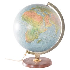
c1920's French Art Deco World Globe on Pedestal
Located in Opa Locka, FL
c1920's French Art Deco Worl Globe On Pedestal. Rare form, this globe stands beautifully on this original base.
Category
1920s French Art Deco Vintage Maps
Materials
Wood

Map of the Hawaiian Islands with a Large Inset of Karakakooa Bay, 1803
Located in Langweer, NL
Antique map titled 'Kaart van de Sandwich Eilanden'.
Map of the Hawaiian Islands with a large inset of Karakakooa Bay, including soundings and anchorages. Originates from 'Reizen R...
Category
Early 1800s Antique Maps
Materials
Paper

$2,152 Sale Price
20% Off
The 'Brazen Sea' in Solomon's Temple and a Cross Section of the Brazen Sea, 1725
Located in Langweer, NL
Two religious images on one sheet titled 'Kopere Zee in den Tempel van Salomon' and 'Doorsnede van de Kopere Zee des Tempels van Salomon'.
The 'Brazen Sea' in Solomon's Temple an...
Category
1720s Dutch Antique Maps
Materials
Paper

Scotland Map – Highlands, Islands, and Northern England 1858
Located in Langweer, NL
Scotland Map – Highlands, Islands, and Northern England 1858
This attractive antique print shows Scotland and its surroundings titled “Schotland mit der ...
Category
Mid-19th Century German Antique Maps
Materials
Paper

Original Antique Blaeu Map of Karst, Carniola, Istria, and Trieste, circa 1640
Located in Langweer, NL
Blaeu Map of Karst, Carniola, Istria, and Trieste, circa 1640
This is an original antique map titled “Karstia, Carniola, Histria et Windorum Marchia,” published by Willem Blaeu in Amsterdam circa 1640. The map depicts the historical regions of Karst (Karstia), Carniola (modern-day Slovenia), Istria (the peninsula shared by Croatia, Slovenia, and Italy), and the Windic March, a medieval border territory.
The engraving shows detailed place names, rivers, mountains, and settlements across present-day Slovenia, northeastern Italy, and northwestern Croatia. The Gulf of Trieste is prominently illustrated at the lower left, with Trieste labelled and coastal settlements clearly indicated. The Adriatic Sea is elegantly engraved with stippled waters, a compass rose, rhumb lines, and a sailing ship, enhancing its decorative maritime appeal.
In the upper left corner is a beautifully designed cartouche bearing the title within a scrollwork frame with foliage and drapery motifs. The lower left includes a mileage scale in Italian miles and a dedication to Guiljelmus Blaeu excudit, confirming its publication from the Blaeu workshop.
Willem Janszoon Blaeu (1571–1638) was one of the leading Dutch cartographers of the early 17th century, succeeded by his son Joan Blaeu. Their maps were known for their precision, aesthetic engraving, and clarity, making the Blaeu atlases the most prestigious publications of the Dutch Golden Age.
Condition:
Good condition. Strong, clean impression on laid paper with wide margins. Light age toning and faint foxing in blank margins, minor creasing along the original centre fold as issued. No tears or repairs noted. Fully suitable for framing.
Framing tips:
Frame this map in a thin black, walnut, or gilt frame to enhance its historic character. Use an off-white or cream archival mat to highlight the detailed engraving and preserve the sheet edges. UV-protective glazing is recommended to protect the paper and ensure its clarity and integrity over time.
Keywords: Here are short keyword blocks formatted for direct copy-pasting into your website SEO or 1stdibs tags:
karst map, carniola map, istria map, trieste map, blaeu map, willem blaeu,
17th century map, dutch cartography, antique balkan map, slovenia antique map,
croatia antique...
Category
17th Century Dutch Antique Maps
Materials
Paper

1742 Antique Map of the Persian Empire with Detailed Borders and Cartouche
Located in Langweer, NL
Title: 1742 Covens & Mortier Map of the Persian Empire by Guillaume De L'Isle
This remarkable 1742 map, "Carte de Perse," was originally designed by Guillaume De L'Isle, a preemin...
Category
1740s Dutch Antique Maps
Materials
Paper

$1,549 Sale Price
20% Off
Antique Map of North America, 1821
Located in Langweer, NL
Antique map of America titled 'Carte de l'Amerique septentrionale'. Scarce map of North America, shortly after the Louisiana Purchase and the first ...
Category
19th Century French Antique Maps
Materials
Paper

$621 Sale Price
20% Off
Original Antique Map of the American State of Connecticut & Rhode Island, 1903
Located in St Annes, Lancashire
Antique map of Connecticut and Rhode Island
Published By A & C Black. 1903
Original colour
Good condition
Unframed.
Free shipping
Category
Early 1900s English Antique Maps
Materials
Paper

United States, Canada & Mexico – 1857 North America Map
Located in Langweer, NL
North America Map – United States, Canada, Mexico 1857
This impressive antique print shows “Nord-America” meaning “North America,” published in 1857 by Justus Perthes in Gotha as pa...
Category
Mid-19th Century German Antique Maps
Materials
Paper

Antique Map of Idaarderadeel, Township In Frieslands, The Netherlands, 1868
Located in Langweer, NL
Antique map titled 'Provincie Friesland - Gemeente Idaarderadeel'.
Map of the township of Idaarderadeel including Grou, Idaard, Warrega and many other villages. This map originat...
Category
19th Century Antique Maps
Materials
Paper

$133 Sale Price
20% Off
Recently Viewed
View AllMore Ways To Browse
Antique Wellington Chests
Antonio Cassi Ramelli
Archimede Seguso Birds
Art Deco Coasters
Art Deco Footballer
Art Deco Music Cabinet
Art Deco Waterfall Bedroom Furniture
Art Deco Waterfall Bedroom
Art Deco Whisky
Art Foulard
Art Nouveau Sunflower
Arts And Crafts Silver Coffee Pot
Asian Pink Bowl
Avesn Vase
Baccarat Carafe
Bakelite Bird
Bakelite Cocktail Picks
Bamboo Ikebana Vase