Maps
to
2,341
2,866
116
2,986
26
12
5
2
1
1
2,976
2,230
476
3
290
34
10
126
9
37
9
2
5
4
3
3
2,967
33
22
7
3
328
124
78
63
48
2,986
2,986
2,986
63
24
16
13
13
Maps For Sale
Period: Late 20th Century
Period: 18th Century and Earlier
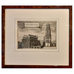
Framed View of St. Martin's Cathedral or Domkerk, Utrecht, The Netherlands, 1770
Located in Langweer, NL
Antique print titled 'L'Eglise Metropolitaine de Saint Martin a' Utrecht'.
View of St. Martin's Cathedral in Utrecht, also known as 'Domkerk'.
Artists and Engravers: Publishe...
Category
1770s Antique Maps
Materials
Paper
$409 Sale Price
20% Off
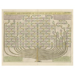
Old Print with a Genealogical Tree of the Chinese Imperial Dynasties, 1732
Located in Langweer, NL
Antique print titled 'Succession des Empereurs de la Chine divisée en XXII Familles'.
Old print with a genealogical tree of the Chinese imperial dynasties. This print originates ...
Category
1730s Antique Maps
Materials
Paper
$512 Sale Price
20% Off
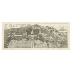
Antique Print of a Castle or Château de Baudour, Hainaut, Belgium, c.1785
Located in Langweer, NL
Antique print titled 'Vue du Chateau de Boudour (..)'. Copper engraving of a castle and garden. Includes a French legend. This print originates from 'Jardins Anglo-Chinois à la Mode'...
Category
18th Century Antique Maps
Materials
Paper
$363 Sale Price
20% Off
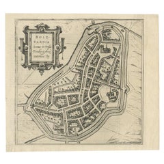
Antique Map of the City of Bolsward, Friesland in The Netherlands, c.1598
Located in Langweer, NL
Antique map titled ‘Bolzvardia vetus in Frisia Foederis (..)’. Old map of the city of Bolsward, Friesland. Originally part of a sheet together with the cities of Stavoren, Harlingen ...
Category
16th Century Antique Maps
Materials
Paper
$326 Sale Price
20% Off
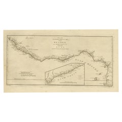
Map of the African Coast, Gulf of Guinea, from Sierra Leone to Gabon, 1788
Located in Langweer, NL
Antique map titled 'Drawn from d'Anvilles Map of the Coast of Guinea, Between Sierra Leone and the crossing of the Line.'
Map of the African coast, Gulf of Guinea, from Sierra Le...
Category
1780s English Antique Maps
Materials
Paper
$428 Sale Price
20% Off
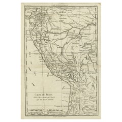
Map of the Western Coast of South America from Ecuador into Chili, ca.1780
Located in Langweer, NL
Antique map titled 'Carte du Perou avec une partie des pays qui en sont a l'est.'
Map of the western coast of South America extending from Ecuador, through Peru and present-day B...
Category
1780s Antique Maps
Materials
Paper
$316 Sale Price
20% Off
Antique Map of the City of Dokkum, Friesland by Blaeu, c.1650
Located in Langweer, NL
Antique map titled ?Dockum?. Plan of Dokkum in Friesland, the Netherlands. A cartouche with two coats of arms. Originates from the town atlas 'Toneel der Steden', published by Joan Blaeu...
Category
17th Century Antique Maps
Materials
Paper
Antique Print of the Monuments of Herculaneum by Bayardi, 1762
Located in Langweer, NL
Antique print originating from 'Le Antichita di Ercolano Esposte'. A vast survey of the bronzes, statues, wall-paintings, and monuments of Herculaneum. This monumental work was the f...
Category
18th Century Antique Maps
Materials
Paper
Antique Map of France by Bowen, c.1790
Located in Langweer, NL
Antique map titled 'France from the best Authorities'. Original antique map of France. Engraved for Barlow's General history of Europe. Published circa 1790.
Artists and Engraver...
Category
18th Century Antique Maps
Materials
Paper
$316 Sale Price
20% Off
Antique Map of The Netherlands in The The Saxons and The Franks Period, 1718
Located in Langweer, NL
Antique map Friesland titled 'Summaria descriptio Fresiae Universae (..)'. Old map of Friesland, the Netherlands. Depicts the general delineation of Friesland during its widest sprea...
Category
18th Century Antique Maps
Materials
Paper
$298 Sale Price
20% Off
Map of the Alsace, France Incl the Rhine from Phillipsburg to South Basle, c1650
Located in Langweer, NL
Antique map titled 'Utriusquae Alsatiae Superioris Ac Inferioris Nova Tabula'.
Map of the Alsace region (France) including the Rhine from Phillipsburg to south of Basle. Two deco...
Category
1650s Antique Maps
Materials
Paper
$335 Sale Price
20% Off
Antique Map of New England and Part of Canada by Vaugondy 'circa 1755'
Located in Langweer, NL
Antique map titled 'Partie de l'Amérique septent qui comprend la nouvelle France ou le Canada'. Decorative and highly detailed map of New England an...
Category
Mid-18th Century Antique Maps
Materials
Paper
$1,529 Sale Price
24% Off
Views of Saunders, Osnaburg, Boscawens, Admiral Keppel's & Wallis Island, c.1774
Located in Langweer, NL
Antique print titled 'Isles de Sir Charles Saunder Latitude (..)'.
Coastal views of Sir Charles Saunders Island ; Osnaburg Island [Mehetia, in French Polynesia] ; Boscawens Islan...
Category
1770s Antique Maps
Materials
Paper
$382 Sale Price
20% Off
Antique Print of the Royal Palace of Naples in Italy, c.1760
Located in Langweer, NL
Antique print titled 'Amplissimas Aedes quas Pro Regio (..)'.
Old engraving of the Royal Palace of Naples, Italy. It was one of the four residences near Naples used by the House of...
Category
18th Century Antique Maps
Materials
Paper
$773 Sale Price
20% Off
Map of Spain & Portugal Incl. the islands of Ibiza, Minorque & Majorque, 1780
Located in Langweer, NL
Antique map titled 'Les Royaumes d'Espagne et de Portugal.'
Map of Spain and Portugal. Includes the islands of Ibiza, Minorque, and Majorque. Shows towns, rivers, some topographi...
Category
1780s Antique Maps
Materials
Paper
$326 Sale Price
20% Off
Antique Map of The Frisian Cities Leeuwarden and Franeker in Friesland, 1580
Located in Langweer, NL
Antique map titled 'Lewardum Occidentlis Frisiae Opp: 1580, Franicher Nobiliu hominum, in Frisia Occidentali, ut plurimum saedes'.
This sheet contains two very detailed bird?s-ey...
Category
16th Century Antique Maps
Materials
Paper
$605 Sale Price
20% Off
Decorative Original Antique Print Depicting the Cavalry Marching in China, 1665
Located in Langweer, NL
Antique print titled ‘Kryghs-Ordre in het Marseren. L’Ordre de la Cavallerie en Marchant’.
Decorative print depicting the cavalry. This print originates from ‘Joan Nieuhof, Het G...
Category
1660s Antique Maps
Materials
Paper
$335 Sale Price
20% Off
Original Antique Map of the Region of Picardy, France, ca.1602
Located in Langweer, NL
Antique map titled 'Picardiae Belgicae regionis descriptio'.
Original antique map of the region of Picardy, France. Superb example of the decorative style of Ortelius and filled ...
Category
Early 1600s Antique Maps
Materials
Paper
$605 Sale Price
20% Off
Antique Map of the Region of Grave by Orlers, 1615
Located in Langweer, NL
Antique map of the region of Grave, also including Cuijk and Ravestein. This map originates from 'La genealogie des illustres Comtes de Nassau' by Jan Jansz. Orlers.
Artists and E...
Category
17th Century Antique Maps
Materials
Paper
$149 Sale Price
20% Off
Old Map Guiana, Columbia Venezuela, Andalusia in South America by Bonne, c.1780
Located in Langweer, NL
Antique map titled 'Carte du Nouv. Rme. de Grenade, de la Nou'le Andalousie, et de la Guyane, avec les pays Limitrophes qui en sont au sud'.
Detailed map covering part of South Ame...
Category
18th Century Antique Maps
Materials
Paper
Antique Print of the West Front of Cholmondeley Hall by Campbell, 1717
Located in Langweer, NL
Antique print titled 'The West Prospect of Cholmondeley Hall (..)'. Elevation of the west front of Cholmondeley Hall, seat of the Earl of Cholmondeley. This print originates from 'Vitruvius Britannicus...
Category
18th Century Antique Maps
Materials
Paper
Stunning Decorative Antique Map of East Frisia with an Inset of Emden, c.1610
Located in Langweer, NL
Description: Antique map titled 'Typus Frisie Orientalis a Dullarto (..)'. One of the most decorative maps of East Frisia and its important shipping center of Emden and the Watten Is...
Category
1610s Antique Maps
Materials
Paper
$3,028 Sale Price
20% Off
Antique Miniature Map of the Old World and France by Mallet, circa 1683
Located in Langweer, NL
Antique map titled 'Planisphere du Monde - France'. Two miniature maps on one sheet. The upper map shows a hemisphere of the Old World. The lower map shows France. This map originate...
Category
Late 17th Century Antique Maps
Materials
Paper
$163 Sale Price
20% Off
Antique Map of Batavia, Capital of The Dutch East Indies at the Time, 1751
Located in Langweer, NL
Antique map titled 'Carte von den Gegenden um Batavia ...' (Map of Batavia and surroundings.) This print shows a map and a view of Batavia, (Jakarta) Indones...
Category
18th Century Antique Maps
Materials
Paper
$419 Sale Price
20% Off
Antique Map with Details of Berings' Expedition into Russians' Far East, 1737
Located in Langweer, NL
Antique map titled 'Carte Des Pays traverses par le Capne. Beerings depuis la Ville de Tobolsk jusqua'a Kamtschatka'.
This is the first printed map to illustrate Vitus Bering's fir...
Category
1730s Antique Maps
Materials
Paper
$1,351 Sale Price
20% Off
Old Map by Blaeu of the City of Franeker, Friesland, The Netherlands, 1649
Located in Langweer, NL
Antique map titled 'Franekera'.
Old map of the city of Franeker, Friesland. Also shows two cartouches, coats of arms and legend. This map originates from a Latin edition of the t...
Category
1640s Antique Maps
Materials
Paper
$1,071 Sale Price
20% Off
Antique Map of the Dutch Provinces Groningen and Drenthe, C.1660
Located in Langweer, NL
Antique map titled 'Dominii Groningae nec non maximae partis Drentiae (..)'. Map of Groningen and Drenthe in the north-east part of the Netherlands. Inset upper right corner of the "...
Category
17th Century Antique Maps
Materials
Paper
$526 Sale Price
20% Off
Antique Map of the Congo, Gabon and Angola by N. Sanson, circa 1700
Located in Langweer, NL
Attractive map of Gabon, the Congo and Angola from Cape Lopez and Sao Tomé to approximately the border with present-day Namibia. The map is fully engraved with mountains, rivers, for...
Category
Early 18th Century Antique Maps
Materials
Paper
$260 Sale Price
20% Off
Antique Map of Drenthe, the Netherlands, with Original Hand Coloring
Located in Langweer, NL
Original antique map titled 'Illustribus ac Potentibus Comitatus Drentiae (..)'. Old map of the province of Drenthe, the Netherlands. Published by H. Hondius circa 1639.
Hendrik ...
Category
Mid-17th Century Antique Maps
Materials
Paper
$419 Sale Price
20% Off
Original Antique Hand-Colored Map of The East Indies and Southeast Asia, c.1644
Located in Langweer, NL
Antique map titled 'India quae Orientalis dicitur, et Insulae adiacentes'.
Old map of the East Indies and Southeast Asia showing the area between India in the West and parts of J...
Category
1640s Antique Maps
Materials
Paper
$2,329 Sale Price
20% Off
Antique View of The N.W. side of Saypan and one of The Ladrones Islands, 1757
Located in Langweer, NL
Antique print titled 'Vue de deux des Iles des Larrons - Gezigt van twee der Eilanden Ladrones (..)'.
View of two Ladrones Islands; View of the N.W. side of Saypan, one of the La...
Category
1750s Antique Maps
Materials
Paper
$335 Sale Price
20% Off
Antique Map of the Region of Saintonge by Janssonius, 1657
Located in Langweer, NL
Antique map of France titled 'La Saintonge vers le Septentrion avecq le Pays d'Aulnis'. Decorative map of the Saintonge region. Includes Ile de Re, Ile d'Oleron and the cities of Nio...
Category
17th Century Antique Maps
Materials
Paper
$396 Sale Price
20% Off
Antique Map of the City of Franeker by Bast, 1598
Located in Langweer, NL
Antique map titled 'Franeker'. Very rare and early map of the city of Franeker, Friesland. With decorative cartouche and Dutch legend. Artists and Engravers: Pieter Bast (1550-1605) ...
Category
16th Century Antique Maps
Materials
Paper
$1,043 Sale Price
20% Off
Nice Sheet of the Sangihe Archipelago in Indonesia & California Island, 1788
Located in Langweer, NL
Antique map titled 'De Noord Pool waar in aangetoont werd alle de Nieuwe Landen (..)
De Eilanden van Sangir Sjauw en Pangasare (..)'. Interesting map that includes a map of the N...
Category
1780s Antique Maps
Materials
Paper
$567 Sale Price
25% Off
Antique Map of Fortification of Bellingwolderschans, The Netherlands, 1673
Located in Langweer, NL
Antique map titled 'Bellingwolderschans'. Original map of the fortification of Bellingwolderschans, the Netherlands. This map originates from 'Teatro del Belgio', by G. Gualdo Priora...
Category
17th Century Antique Maps
Materials
Paper
$186 Sale Price
20% Off
Decorative Bird's-Eye View Plan of Ieper or Ypres in Belgium, 1649
Located in Langweer, NL
Antique print, titled: 'Ypra.'
Bird's-eye view plan of Ieper / Ypres in Belgium. With key to locations and coats of arms. Text in Latin on verso. This plan originates from the famous city Atlas: 'Toneel der Steeden' published by Joan Blaeu...
Category
1640s Antique Maps
Materials
Paper
$1,351 Sale Price
20% Off
Large Antique Detailed Map of a Part of the Spice Islands, Indonesia, 1726
Located in Langweer, NL
Antique matitled 'De Landvoogdy der Moluccos met de aangrenzende Eylanden'.
Large detailed map of a part of the Spice Islands. It includes Baru (Boero), Ambon, Seram and part of Ma...
Category
1720s Antique Maps
Materials
Paper
$1,351 Sale Price
20% Off
Large and Detailed Map of the Russian Empire in Asia, ca.1780
Located in Langweer, NL
Description: Antique map titled 'Bowles's New Pocket Map of the East Part of the Russian Empire in Asia'. Large and detailed map of the Russian Empire in Asia. Source unknown, to be determined.
Artists and Engravers: Made by 'Thomas & Carington Bowles' after 'D'Anville'. Thomas Bowles, born around 1712, was map publisher and seller in London...
Category
1780s Antique Maps
Materials
Paper
$791 Sale Price
20% Off
Antique Engraving of Dutch and German North Sea Coast of Friesland, ca.1680
Located in Langweer, NL
Antique map titled 'Tabula Nova In qua accuratè demonstratur tota Navigatio ab Amstelodami Statione per Vada vulgo de Watten Hamburgum usq.' -
Two maps with the Dutch and German North Sea coast of Friesland, with West Frisian Islands and below East Frisian Islands with inset map of the Elbe around Hamburg. With title and a scale cartouche. Map by Henricus Hondius...
Category
1680s Antique Maps
Materials
Paper
$1,071 Sale Price
20% Off
Antique Engraving of Edo 'or Jeddo, Yedo, Now Tokyo', 1669
Located in Langweer, NL
Antique print, titled: 'Iedo'
A bird's eye view of Edo (or Jeddo, Yedo, now Tokyo) as seen from a nearby hill. 62 places are identified in a list (both in French and Dutch). Arno...
Category
1660s Antique Maps
Materials
Paper
$885 Sale Price
20% Off
Antique Map of Africa, Cartouche with Elephant Tusks and Horned Serpent, 1737
Located in Langweer, NL
Antique map of Africa titled 'Africa Secundum Legitimas Projectionis Stereographicae regulas (..)'.
Johann Matthias Haas' revision of J.B. Homann's 1715 map of Africa, augmented to include important cartographic developments as recorded by Guillaume Delisle and D'Anville. The map presents a fairly accurate picture without most of the fictitious lakes and rivers of previous cartography, focusing on the known coastal regions of the continent, leaving the interior blank or marked Terra Incognito. Egypt, Nubia and Abyssinia are shown as distinct entities, Lake Nyasa is shown as Lac Marawi, and the Congo is located. The Dutch settlements of Castell Batov and Stellenbosch are shown at the Cape. The most striking feature of the map is the large title cartouche that is framed by elephant tusks and a horned serpent. In the foreground is a scene of natives negotiating with European traders, surrounded by indigenous animals. In the background is a view of Table Bay...
Category
18th Century Antique Maps
Materials
Paper
$913 Sale Price
20% Off
Antique Map of the region between Bergen op Zoom, Sandvliet, Hulst and Antwerp
Located in Langweer, NL
Original antique map titled 'Tabula Castelli ad Sandflitam (..)'. Detailed map of the region between Bergen op Zoom, Sandvliet, Hulst and Antwerp. Published by J. Janssonius, circa 1...
Category
Mid-17th Century Antique Maps
Materials
Paper
$503 Sale Price
20% Off
Views of Amsterdam, Middelburg and Pylsteerten Island, Indonesia, 1726
Located in Langweer, NL
Antique print from an old Dutch publication of a VOC mission to nowadays Indonesia titled 'Pylsteerten Eyland als het O.N.O. 6 Mylen van u is ; Pylsteerten Eyland als het O.Z.O. 3 Mylen van u is ; Aldus vertoond t'Eyland Amsterdam als het Oost Noort Oost 3 Mylen van u is ; Aldus vertoond't Eyland Middelburg als het Oost ten Zuyde 4 Mylen van u is'. Views of Amsterdam...
Category
18th Century Antique Maps
Materials
Paper
$149 Sale Price
20% Off
Detailed Antique Map of Northern Spanish Region of Aragon, c.1650
Located in Langweer, NL
Antique map titled 'Arragonia Regnum'.
Detailed map of northern Spanish region of Aragon. The map is centered on the city of Zaragoza, aka, Saragossa. Shows towns, rivers, castle...
Category
1650s Antique Maps
Materials
Paper
$1,071 Sale Price
20% Off
Regional Map of Germany, inc Hamburg, Luneberg, Hannover, Braunsweig etc, c.1720
Located in Langweer, NL
Antique map titled 'Ducatus Luneburgici et Comitatus Dannebergensis accurata Descriptio.'
This detailed regional map includes Hamburg, Luneberg, and as far south as Hannover, Bra...
Category
1720s Antique Maps
Materials
Paper
$1,071 Sale Price
20% Off
Rare Theodore Danckerts Map of the Lower Rhine and Moselle River Regions
Located in Langweer, NL
Original antique map titled 'Accuratissima Rheni Inferioris Mosae et Mosellae Tabula'. Rare Theodore Danckerts map of the Lower Rhine and Moselle River Regions. The map covers the lo...
Category
Early 18th Century Antique Maps
Materials
Paper
$2,049 Sale Price
20% Off
Charming 18th Century Miniature Map of Greece, 1685
Located in Langweer, NL
Antique map titled 'Graeciae Descriptio.' Charming miniature map of Greece from the pocket atlas 'Introductionis in Universam Geographiam tam Veterem qu...
Category
17th Century Antique Maps
Materials
Paper
$326 Sale Price
20% Off
Antique Map of Gloucestershire in Britain by Camden, 1637
Located in Langweer, NL
Antique map titled 'Glocestriae comitatus olim sedes Dobunorum'. Map of Gloucestershire, England. This map originates from Camden?s 'Britannia' ...
Category
17th Century Antique Maps
Materials
Paper
$335 Sale Price
20% Off
Old Map of Ancient Rome Illustrating Major Monuments and the Seven Hills, c.1704
Located in Langweer, NL
Antique map Rome titled 'Omnia Romanae cedant Miracula Terrae (..)'. Map of Ancient Rome Illustrating Major Monuments and the Seven Hills. This map or...
Category
18th Century Antique Maps
Materials
Paper
$354 Sale Price
20% Off
Antique French Map of Asia with Original Border Colouring, c.1785
Located in Langweer, NL
Antique map titled 'L'Asie divisee en ses principaux Etats.' (Map of Asia and its principal states). This map originates from an Atlas by Didier Robert de Vaugondy or his successor D...
Category
18th Century Antique Maps
Materials
Paper
$111 Sale Price
20% Off
Antique Print of Forts and Views of the East Indies by Chatelain (1719)
Located in Langweer, NL
Antique print titled 'Vue et Description de Quelques-Uns des Principaux Forts des Hollandois dans les Indes'. Interesting sheet with seven detailed views illustrating the most import...
Category
18th Century Antique Maps
Materials
Paper
$456 Sale Price
20% Off
Antique Map of the Region of Calais and The Vermandois Region by Ortelius
Located in Langweer, NL
Antique map titled 'Caletensium et Bononiensium (..) - Veromandorum eorum que confinium (..)'. Two detailed regional maps by Ortelius. The first map shows Belgian and French Coastal ...
Category
17th Century Antique Maps
Materials
Paper
Antique Map of the Region of Batavia by Van Schley, c.1750
Located in Langweer, NL
Antique map titled 'Carte des environs de Batavia - Kaart van de Buitenstreken van Batavia'. Map of the Batavia area (Jakarta) in Indonesia. With cartouche, scale and compass rose. P...
Category
18th Century Antique Maps
Materials
Paper
$156 Sale Price
20% Off
Antique Map of the Eastern Hemisphere in Frame, 'circa 1683'
Located in Langweer, NL
Antique map titled 'Climats selon les Anciens'. Miniature map of the Eastern Hemisphere showing the climatic regions. This map originates from 'Description de l'Univers' by A.M. Mall...
Category
Late 17th Century Antique Maps
Materials
Paper
Antique Map of the Region of Loudun and Mirebeau by Janssonius, c.1650
Located in Langweer, NL
Antique map 'Loudunois Laudunum - Mirebalais'. Decorative map of the region of Loudun and Mirebeau, France. It shows the city of Moncontour, Loudun, Mirebeau and more.
Artists ...
Category
17th Century Antique Maps
Materials
Paper
$338 Sale Price
20% Off
Antique Map of the Region of Gaasterland, Friesland, The Netherlands, 1664
Located in Langweer, NL
Antique map titled 'De Grietenie van Gaesterlandt (..)'. Map of the region of Gaasterland in Friesland, the Netherlands. This region includes the villages of Balk, Sloten, Wyckel and...
Category
17th Century Antique Maps
Materials
Paper
$111 Sale Price
20% Off
Antique Map of the Region of Zevenwouden, Friesland, The Netherlands, 1660
Located in Langweer, NL
Antique map titled 'De Zeeven Wolden'. Map of the region of Zevenwouden (or Zevenwolden) in Friesland, the Netherlands.
This region include the villages of Langweer, Echtenerbrug...
Category
17th Century Antique Maps
Materials
Paper
Antique Map of Overijssel by Colom, 1635
Located in Langweer, NL
Antique map titled 'Ditio Trans-Isulana'. Original antique map of the province of Overijssel, the Netherlands. This map originates from 'Vyerige Colom verthonende de 17 Nederlandsche...
Category
17th Century Antique Maps
Materials
Paper
$204 Sale Price
20% Off
Homann Heirs Map of France – Antique Hand-Colored, circa 1745
Located in Langweer, NL
Antique map titled 'Gallia Postarum geographice designata in qua Cursus Postarum Secundum Statum (..)'. Unusual postal map of France, with coat of arms. Very detailed map showing all...
Category
Mid-18th Century German Antique Maps
Materials
Paper
$372 Sale Price
20% Off
Antique French Map of Java, Indonesia by Chatelain, '1719'
Located in Langweer, NL
Antique map titled 'Carte de l'Ile de Java: Partie Occidentale, Partie Orientale, Dressee tout Nouvellement Sur Les Memoires Les Plus Exacts (..)'. This beautiful map of Java (Indone...
Category
Early 18th Century Antique Maps
Materials
Paper
$2,608 Sale Price
20% Off
Recently Viewed
View AllMore Ways To Browse
Antique Wellington Chests
Antonio Cassi Ramelli
Archimede Seguso Birds
Art Deco Coasters
Art Deco Footballer
Art Deco Music Cabinet
Art Deco Waterfall Bedroom Furniture
Art Deco Waterfall Bedroom
Art Deco Whisky
Art Foulard
Art Nouveau Sunflower
Arts And Crafts Silver Coffee Pot
Asian Pink Bowl
Avesn Vase
Baccarat Carafe
Bakelite Bird
Bakelite Cocktail Picks
Bamboo Ikebana Vase
