Items Similar to Antique Print of Forts and Views of the East Indies by Chatelain (1719)


Want more images or videos?
Request additional images or videos from the seller
1 of 6
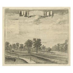
Antique Print of Forts and Views of the East Indies by Chatelain (1719)
About the Item
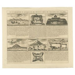
Antique print titled 'Vue et Description de Quelques-Uns des Principaux Forts des Hollandois dans les Indes'. Interesting sheet with seven detailed views illustrating the most important Dutch trading outposts and fortified colonial possessions in the East Indies, including four harbour views Batavia (Jakarta), Amboina, Ternate, and Solor, and three fort plans, with descriptive French text, from Chatelian's monumental seven volume Atlas Historique.
Artists and Engravers: Henri Abraham Chatelain (1684-1743), his father Zacharie Chatelain (d.1723) and Zacharie Junior (1690-1754), worked as a partnership publishing the Atlas Historique, Ou Nouvelle Introduction A L'Histoire under several different Chatelain imprints, depending on the Chatelain family partnerships at the time of publication.
Condition: Good, genearl age-related toning. Please study image carefully.
Date: 1719
Overall size: 51 x 43.5 cm.
Image size: 43 x 37 cm.
We sell original antique maps to collectors, historians, educators and interior decorators all over the world. Our collection includes a wide range of authentic antique maps from the 16th to the 20th centuries. Buying and collecting antique maps is a tradition that goes back hundreds of years. Antique maps have proved a richly rewarding investment over the past decade, thanks to a growing appreciation of their unique historical appeal. Today the decorative qualities of antique maps are widely recognized by interior designers who appreciate their beauty and design flexibility. Depending on the individual map, presentation, and context, a rare or antique map can be modern, traditional, abstract, figurative, serious or whimsical. We offer a wide range of authentic antique maps for any budget.
- Dimensions:Height: 17.13 in (43.5 cm)Width: 20.08 in (51 cm)Depth: 0 in (0.01 mm)
- Materials and Techniques:
- Period:
- Date of Manufacture:1719
- Condition:Condition: Good, genearl age-related toning. Please study image carefully.
- Seller Location:Langweer, NL
- Reference Number:
About the Seller
5.0
Platinum Seller
These expertly vetted sellers are 1stDibs' most experienced sellers and are rated highest by our customers.
Established in 2009
1stDibs seller since 2017
1,946 sales on 1stDibs
Typical response time: <1 hour
- ShippingRetrieving quote...Ships From: Langweer, Netherlands
- Return PolicyA return for this item may be initiated within 14 days of delivery.
More From This SellerView All
- Antique Print of Forts and Views of the East Indies or Nowadays Indonesia, 1719Located in Langweer, NLAntique print titled 'Vue et Description de Quelques-Uns des Principaux Forts des Hollandois dans les Indes'. Interesting sheet with seven detailed views illustrating the most import...Category
Antique 18th Century Prints
MaterialsPaper
- Antique Map of the British Isles by H. Chatelain, 1719By Henri-Abraham ChatelainLocated in Langweer, NLBeautiful hand colored large format map of the British Isles, with large insets of the Eastern and Western Hemispheres and the coats of arms for Engl...Category
Antique Early 18th Century Maps
MaterialsPaper
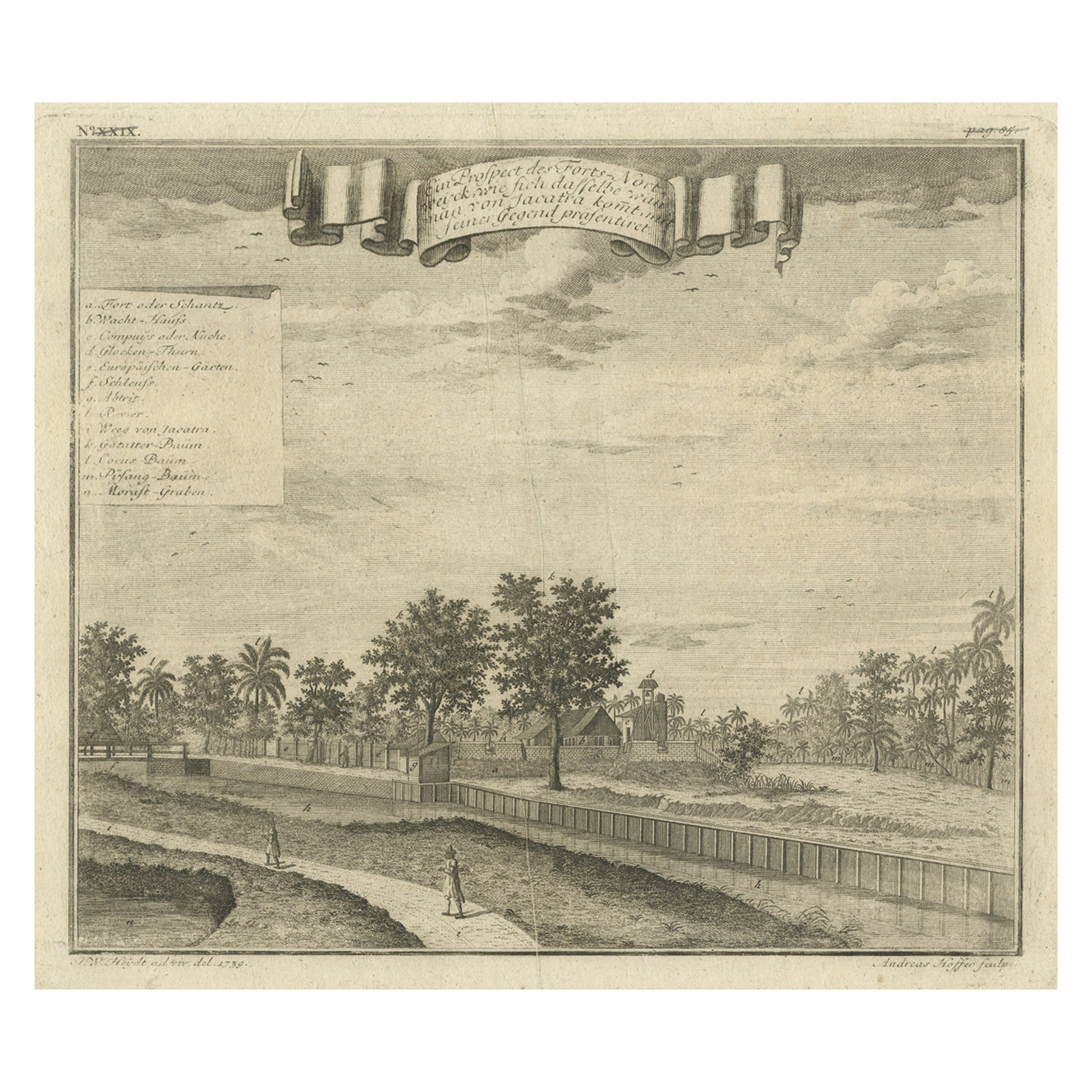
- Old Antique Print of Fort Noordwijk, Batavia in the Dutch East Indies, 1739Located in Langweer, NLAntique print titled 'Ein Prospect des Forts Nortweijck, wie sich dasselbe wan man von Jacatra komt, mit seiner Gegend präsentiret'. Old print of Fort Noordwijk, Batavia (Jakarta). This print originates from from 'Allerneuester Geographische- und Topographischer Schau-platz, von Africa und Ost-Indien'. Artists and Engravers: Johann Wolfgang Heydt, a German artist who worked for the Dutch East India...Category
Antique 1730s Maps
MaterialsPaper
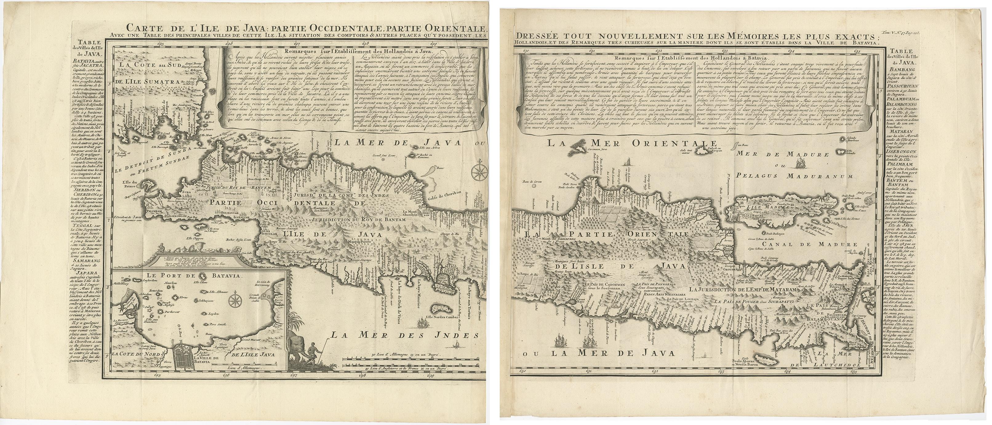
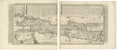
- Antique Map of Java 'Indonesia' by Chatelain, 1719Located in Langweer, NLAntique map titled 'Carte de l'Ile de Java: Partie Occidentale, Partie Orientale, Dressee tout Nouvellement Sur Les Memoires Les Plus Exacts (..)'. This beautiful map of Java exists ...Category
Antique Early 18th Century Maps
MaterialsPaper
- Antique French Map of Java, Indonesia by Chatelain, '1719'Located in Langweer, NLAntique map titled 'Carte de l'Ile de Java: Partie Occidentale, Partie Orientale, Dressee tout Nouvellement Sur Les Memoires Les Plus Exacts (..)'. This beautiful map of Java (Indone...Category
Antique Early 18th Century Maps
MaterialsPaper
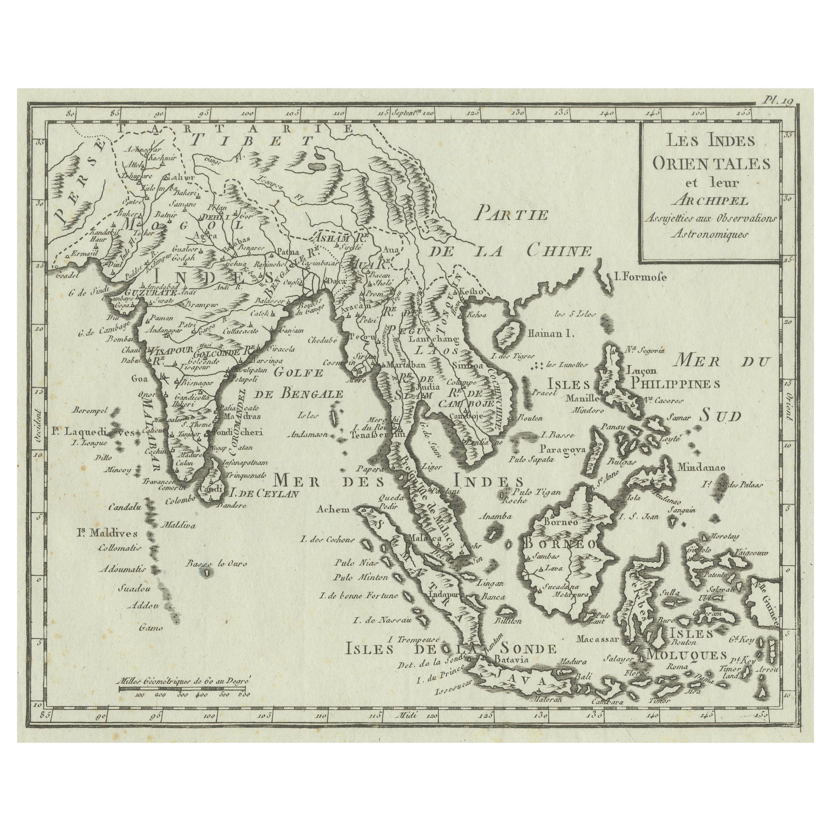
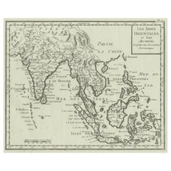
- Antique Map of India, the East Indies and the PhilippinesLocated in Langweer, NLAntique map titled 'Les Indes Orientales et leur Archipel'. Original antique map of India, the East Indies and the Philippines. Source unknown, to be determined. Published circa 1760.Category
Antique Mid-18th Century Maps
MaterialsPaper


You May Also Like
- Cricket Print, England v. West Indies at the Oval, by Arthur WeaverBy Arthur WeaverLocated in Oxfordshire, GB1990's Arthur Weaver Oval Cricket Ground Print, England v West Indies. A colourful cricket lithograph signed by the artist, Arthur Weaver, of the 'Final Test' at The Oval Cricket Gr...Category
1990s English Sporting Art Sports Equipment and Memorabilia
MaterialsPaper
- N.E. View of the United States Capitol, Washington, DC Antique Proof Print 1858Located in Colorado Springs, COThis engraved print shows a view of the United States Capitol Building, in Washington, D.C. The print depicts the neoclassical building from the northeast orientation, with a bustling street scene in front. The steel engraving is a proof printing, drawn and engraved by Henry Sartain and published in 1858. Plans began in May 1854 to build a new cast-iron dome for the United States Capitol. The then-architect of the Capitol Thomas Walter and his team were sold on the aesthetics of a new dome, as well as the utility of a fire-proof one. A year later, on March 3, 1855, President Franklin Pierce...Category
Antique 1850s American Prints
MaterialsPaper
- Original Antique Map of South East Asia by Becker, circa 1840Located in St Annes, LancashireGreat map of South East Asia Steel engraving with original color outline Engraved by Becker Published by Virtue, circa 1840. Unframed.Category
Antique 1840s English Other Maps
MaterialsPaper
- Original Antique Map of South East Asia by Thomas Clerk, 1817Located in St Annes, LancashireGreat map of South East Asia Copper-plate engraving Drawn and engraved by Thomas Clerk, Edinburgh. Published by Mackenzie And Dent, 1817 Unframed.Category
Antique 1810s English Maps
MaterialsPaper
- Original Antique Map of South East Asia, Arrowsmith, 1820Located in St Annes, LancashireGreat map of South East Asia Drawn under the direction of Arrowsmith Copper-plate engraving Published by Longman, Hurst, Rees, Orme and Brown, 1820 Unframed.Category
Antique 1820s English Maps
MaterialsPaper
- Civil War Panorama of the Seat of War by John Bachmann, Antique Print circa 1864Located in Colorado Springs, COPanorama of the seat of war. Bird's-eye View of Virginia, Maryland, Delaware and the District of Columbia. This third state of this fascinating bird's eye view of the northernmost p...Category
Antique 1860s American Maps
MaterialsPaper


Recently Viewed
View AllMore Ways To Browse
20th Century Dutch Colonial Furniture
Antique Dutch Colonial
Dutch Colonial 18th Century
Dutch Harbour
French Harbour View
Batavia Map
Antique Outpost
Pair Double Doors
Corner Cabinet Glass Door
Textured Doors
Clamp On
Tapestry Antique Style
Unique Chest On Chest
Antique Chest Hand Carved
Antique Pine Corner Cabinet
Mid Century Metal Chest
Vintage Wall Brackets
Chest With White Marble Top