Items Similar to Antique View of The N.W. side of Saypan and one of The Ladrones Islands, 1757
Want more images or videos?
Request additional images or videos from the seller
1 of 5
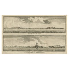
Antique View of The N.W. side of Saypan and one of The Ladrones Islands, 1757
About the Item
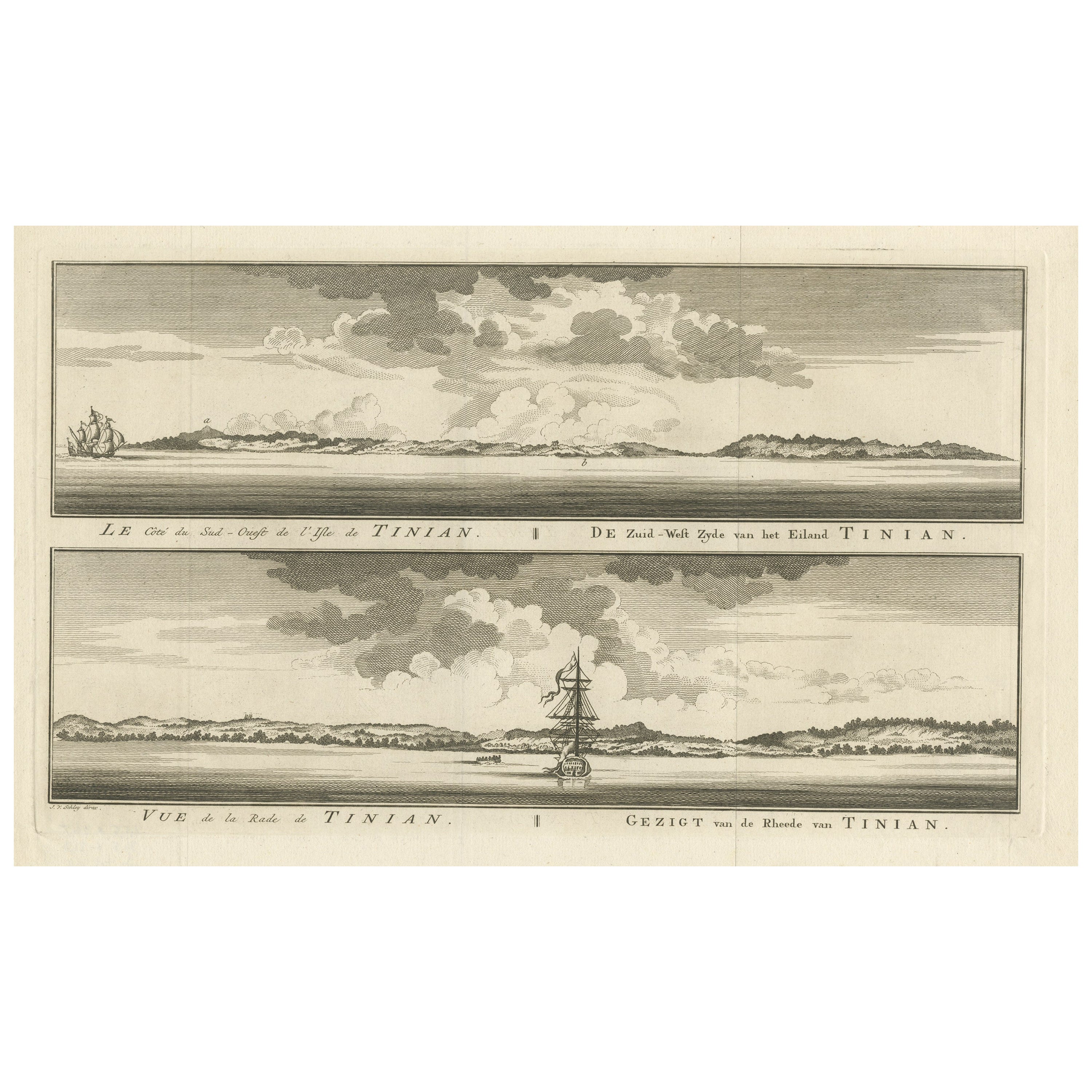
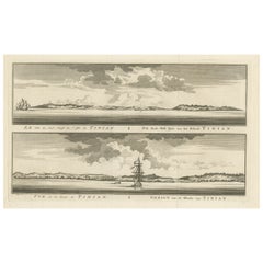
Antique print titled 'Vue de deux des Iles des Larrons - Gezigt van twee der Eilanden Ladrones (..)'.
View of two Ladrones Islands; View of the N.W. side of Saypan, one of the Ladrones Islands. This print originates from 'Histoire Générale des Voyages' published by P. de Hondt, 1757.
Artists and Engravers: Engraved by Jakob van der Schley (Dutch 1715-1779).
Condition: Very good, general age-related toning. Original folding lines, blank verso. Please study image carefully.
- Dimensions:Height: 10.63 in (27 cm)Width: 16.26 in (41.3 cm)Depth: 0 in (0.02 mm)
- Materials and Techniques:
- Period:1750-1759
- Date of Manufacture:1757
- Condition:
- Seller Location:Langweer, NL
- Reference Number:
About the Seller
5.0
Platinum Seller
These expertly vetted sellers are 1stDibs' most experienced sellers and are rated highest by our customers.
Established in 2009
1stDibs seller since 2017
1,933 sales on 1stDibs
Typical response time: <1 hour
- ShippingRetrieving quote...Ships From: Langweer, Netherlands
- Return PolicyA return for this item may be initiated within 14 days of delivery.
More From This SellerView All
- Antique Engraving of Tinian, an Island of the Northern Mariana Islands, 1757Located in Langweer, NLAntique print titled 'Vue de la Rde de Tinian Gezigt van de Rheede van Tinian (..)'. Views of the south-west side of the island of Tinian and a view of the anchorage of Tinian, w...Category
Antique 1750s Prints
MaterialsPaper
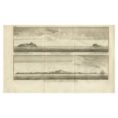
- Antique Print with Views of the Ladrones Islands and Saipan by Anson, 1749Located in Langweer, NLAntique print titled 'Gezigt van 2 der Ladrones Eilanden' and 'Gezigt van de N.W. zyde van Saypan'. Coastal views of the Ladrones Islands and the island of Saipan. This print origina...Category
Antique 18th Century Prints
MaterialsPaper
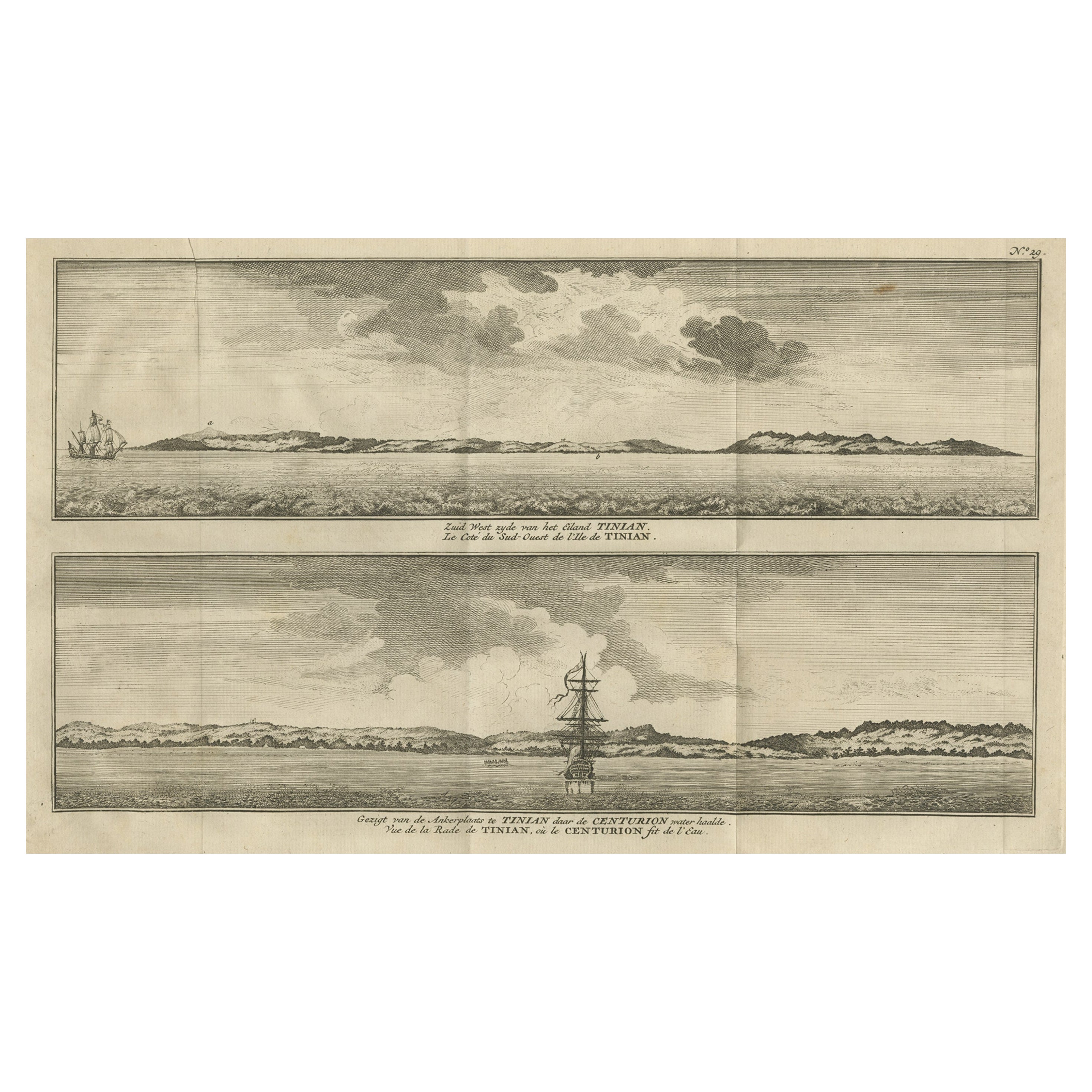
- Antique Print with Views of Tinian Island, the Northern Mariana Islands, 1749Located in Langweer, NLAntique print titled 'Le cote du sud-ouest de l'Ile de Tinian' and 'Vue de la rade de Tinian, ou le Centurion fit de l'eau.' Views of the south-west side of the island of Tinian and a view of the anchorage of Tinian, where the Centurion got water. This print originates from 'Reize rondsom de Werreld (..)' by George Anson, published 1749. Tinian is one of the three principal islands of the Commonwealth of the Northern Mariana Islands...Category
Antique 18th Century Prints
MaterialsPaper
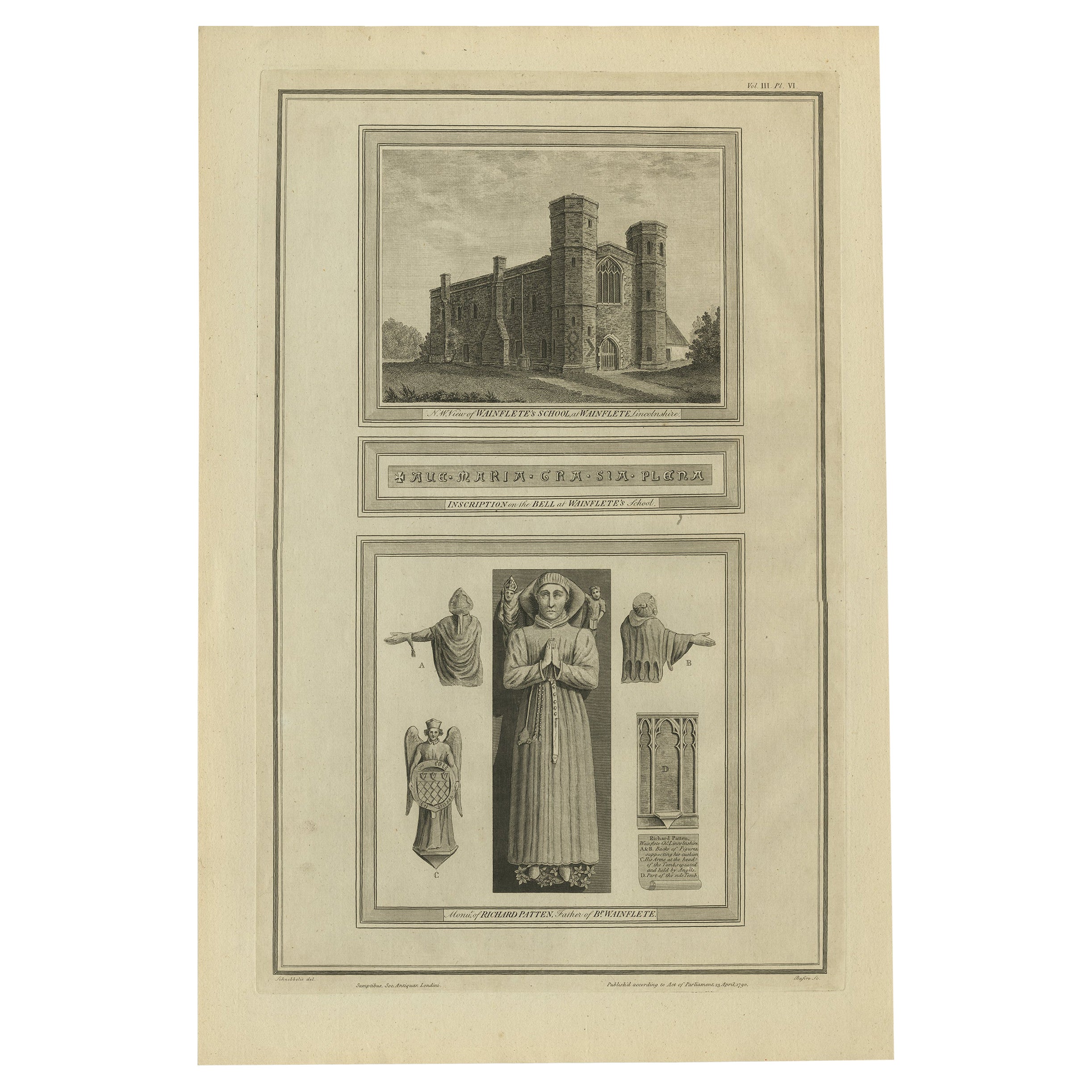
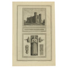
- N.W. View of Wainflete's School, Basire, 1790Located in Langweer, NLAntique print titled 'N.W. View of Wainflete's School (..)'. Antique print depicting a view of Wainflete's school, Inscription of the bell of Wainflete's school and Monument of Richa...Category
Antique 18th Century Prints
MaterialsPaper
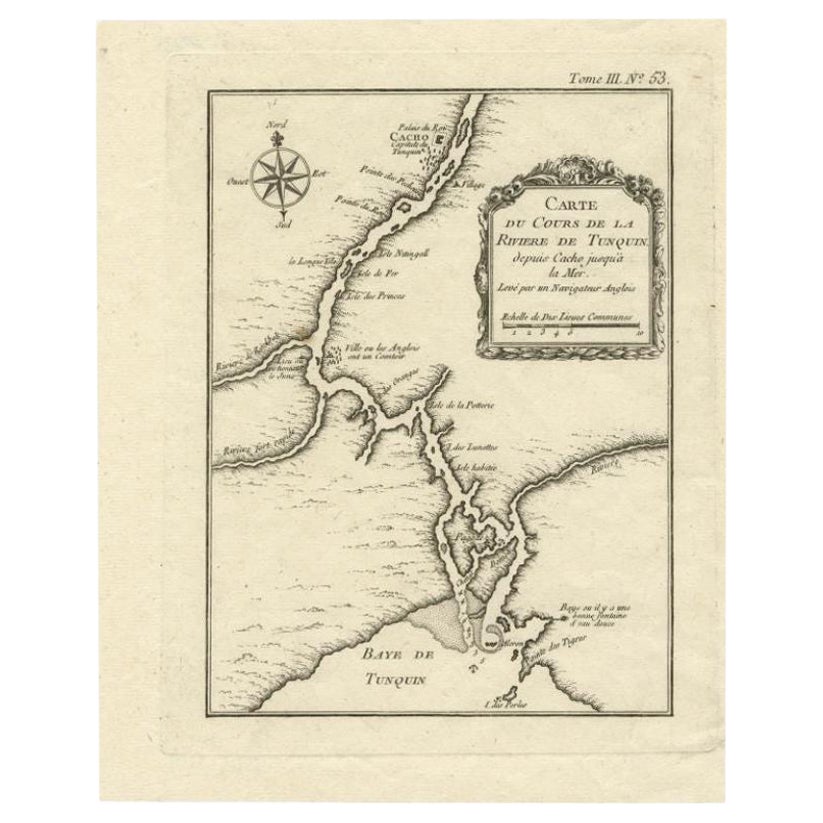
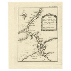
- Antique Map of the Tunquin River and Bay, Siam, 1757Located in Langweer, NLAntique map titled ‘Carte du Cours de la Riviere de Tunquin Depuis Cacho jusqu'à la Mer’. Detailed map of the Tunquin River and Bay, extending north to Cacho, the capital city. Made ...Category
Antique 18th Century Maps
MaterialsPaper
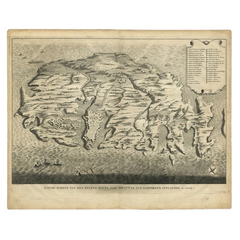
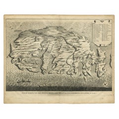
- Rare Antique Bird's-eye View Map of The Island of Malta, 1729Located in Langweer, NLAntique print titled 'D'oude Schets van het Eyland Malta, alwaer, Paulus na zyn Schipbreuk Aenlandde.' This is an uncommon bird's-eye view map of the island of Malta. The map pre...Category
Antique 18th Century Maps
MaterialsPaper
You May Also Like
- N.E. View of the United States Capitol, Washington, DC Antique Proof Print 1858Located in Colorado Springs, COThis engraved print shows a view of the United States Capitol Building, in Washington, D.C. The print depicts the neoclassical building from the northeast orientation, with a bustling street scene in front. The steel engraving is a proof printing, drawn and engraved by Henry Sartain and published in 1858. Plans began in May 1854 to build a new cast-iron dome for the United States Capitol. The then-architect of the Capitol Thomas Walter and his team were sold on the aesthetics of a new dome, as well as the utility of a fire-proof one. A year later, on March 3, 1855, President Franklin Pierce...Category
Antique 1850s American Prints
MaterialsPaper
- Vintage "View of the Center of Paris Taken from the Air" Lithograph MapLocated in San Diego, CAA very stylish "View of the Center of Paris Taken from the Air" lithograph map published by the Paris Ministry of Tourism, circa early 1950s. The piece measures 27" x 43" and shows...Category
20th Century French Mid-Century Modern Prints
MaterialsPaper
- Hand-Colored 18th Century Homann Map of Denmark and Islands in the Baltic SeaBy Johann Baptist HomannLocated in Alamo, CAAn 18th century copper plate hand-colored map entitled "Insulae Danicae in Mari Balthico Sitae utpote Zeelandia, Fionia, Langelandia, Lalandia, Falstria, Fembria Mona" created by Joh...Category
Antique Early 18th Century German Maps
MaterialsPaper
- LIFE OF SAINT JOHN AND THE APOCALYPSE - One-time only limited-edition facsimileLocated in BARCELONA, ESThis is a one-time only facsimile edition limited to 987 copies of an illuminated manuscript from the Middle Ages, the Life of Saint John and the Apocalypse, owned by the British Lib...Category
2010s Dutch Renaissance Books
MaterialsMetal
- Antique 18th Century Map of the Province of Pensilvania 'Pennsylvania State'Located in Philadelphia, PAA fine antique of the colony of Pennsylvania. Noted at the top of the sheet as a 'Map of the province of Pensilvania'. This undated and anonymous map is thought to be from the Gentleman's Magazine, London, circa 1775, although the general appearance could date it to the 1760's. The southern boundary reflects the Mason-Dixon survey (1768), the western boundary is placed just west of Pittsburgh, and the northern boundary is not marked. The map has a number of reference points that likely refer to companion text and appear to be connected to boundaries. The western and southern boundaries are marked Q, R, S, for example. A diagonal line runs from the Susquehanna R to the Lake Erie P. A broken line marked by many letters A, B, N, O, etc., appears in the east. There are no latitude or longitude markings, blank verso. Framed in a shaped contemporary gilt wooden frame and matted under a cream colored matte. Bearing an old Graham Arader Gallery...Category
Antique 18th Century British American Colonial Maps
MaterialsPaper
- 18th Century French Map and City View of Joppe/Jaffa 'Tel Aviv' by SansonBy Nicolas SansonLocated in Alamo, CAAn original antique engraving entitled "Joppe; in ’t Hebreeusch by ouds Japho; hedendaags Japha, of Jaffa; volgens d’aftekening gedaan 1668", by Nicholas Sanson d'Abbeville (1600 - 1667). This is a view of the city of Joppe (in Hebrew Japho), now called Japha or Jaffa, the harbor portion of modern day Tel Aviv, Israel as it appeared in 1668 . It depicts a very busy harbor with numerous boats. A large ship on the left appears to be firing its canons and a small ship on the right appears to be sitting very low in the water, either heavily loaded with cargo or sinking. The town is seen on the far shore with a fortress on a hill across in the background. The map is printed from the original Sanson copperplate and was published in 1709 by his descendants. The map is presented in an ornate brown wood frame embellished by gold-colored leaves and gold inner trim with a double mat; the outer mat is cream-colored and the inner mat is black. There is a central vertical fold, as issued. There are two small spots in the lower margin and one in the upper margin, as well as two tiny spots adjacent to the central fold. 1717 is written below the date 1668 in the inscription. The map is otherwise in very good condition. Another map of the "Holy Land" (by Claes Visscher in 1663), with an identical style frame and mat is available. This pair of maps would make a wonderful display grouping. Please see Reference #LU5206220653552. A discount is available for the purchase of the pair of maps. Artist: Nicholas Sanson d'Abbeville (1600-1667) and his descendents were important French cartographer's active through the 17th century. Sanson started his career as a historian and initially utilized cartography to illustrate his historical treatises. His maps came to the attention of Cardinal Richelieu and then King Louis XIII of France, who became a supporter and sponsor. He subsequently appointed Sanson 'Geographe Ordinaire du Roi' the official map maker to the king. Sanson not only created maps for the king, but advised him on geographical issues and curated his map collection...Category
Antique Early 18th Century French Maps
MaterialsPaper


Recently Viewed
View AllMore Ways To Browse
Used Handkerchief
Wall Mount Relief
Inlaid Ring
Door Frame Italy
Series Of Wall Sculptures
Long Glass Cabinet
Dress Maker
Curved Glass Cabinet
Wall Embroidery
Hand Woven Wall Hanging
Large Vintage Metal Cabinet
Raised Panel Wood Doors
Antique Rings In London
Mid Century Wood And Brass Shelf
Antique Victorian Charms
Vintage Industrial Metal Storage Cabinet
Ornate Bands
Small Antique Display Case