Maps
to
4,237
5,466
195
5,666
3
75
35
18
14
6
5
5
4
4
3
1
1
2,930
2,261
475
3
290
34
10
126
10
37
9
2
5
4
3
3
5,579
123
55
34
32
760
335
222
155
148
5,669
5,669
5,669
104
59
28
21
15
Maps For Sale
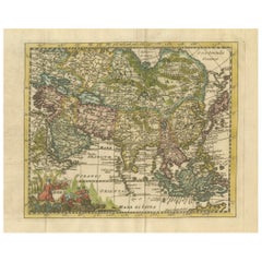
Cartographic Elegance: The Art and Science of 17th-Century Asian Maps, ca.1681
Located in Langweer, NL
This original antique map is an artifact from a pivotal era in cartography, reflecting not only the geographical knowledge of its time but also the intertwining of art and science in...
Category
1680s Antique Maps
Materials
Paper
$371 Sale Price
20% Off
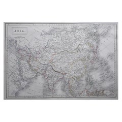
Large Original Antique Map of Asia by Sidney Hall, 1847
Located in St Annes, Lancashire
Great map of Asia
Drawn and engraved by Sidney Hall
Steel engraving
Original colour outline
Published by A & C Black. 1847
Unframed
Free shipping
Category
1840s Scottish Antique Maps
Materials
Paper
Original Antique Map of India by Dower, circa 1835
Located in St Annes, Lancashire
Nice map of India
Drawn and engraved by J.Dower
Published by Orr & Smith. C.1835
Unframed.
Free shipping
Category
1830s English Antique Maps
Materials
Paper
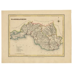
Old Map of Glamorganshire by Lewis 1844 – Swansea Cardiff Merthyr Tydfil Neath
Located in Langweer, NL
Title: Old Map of Glamorganshire by Samuel Lewis 1844 – Swansea Cardiff Merthyr Tydfil Neath
Description: This detailed map of Glamorganshire was published in 1844 for Samuel Lewis’ Topographical Dictionary of Wales. It showcases major towns such as Swansea, Cardiff, Merthyr Tydfil, Neath, and Bridgend. The map features original hand coloring that outlines the county borders and includes shaded topographical elements to show the landscape. A decorative compass rose and a reference to the seven unions add both style and historical context.
Condition:
The map is in good antique condition with minor age toning and clean margins. The engraving remains sharp and the original colors are clear and unfaded. No major damage or repairs are visible.
Framing suggestions:
Use a soft cream or ivory acid-free mat to match the natural tone of the paper. Choose a dark wood, antique gold, or black frame with a soft patina to enhance the historical feel. UV-protective glass is recommended to preserve the colors. This map is ideal for a home office, study, or as a thoughtful gift for those with Welsh heritage.
Keywords:
Glamorganshire map 1844 Samuel Lewis antique...
Category
1840s Antique Maps
Materials
Paper
$228 Sale Price
20% Off
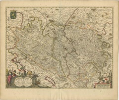
Rare Hand-Colored Map of Franche-Comté and Burgundy by Frederik De Wit c. 1688
Located in Langweer, NL
Title: Rare Hand-Colored Map of Franche-Comté and Burgundy by Frederik De Wit c. 1688
Description: This stunning 17th-century map, titled "Comitatus Burgundiae vulgo La Franche Comt...
Category
1680s Antique Maps
Materials
Paper
Original Antique Map of the Dutch Provinces of Overijssel and Drenthe, 1635
Located in Langweer, NL
Antique map titled 'Transiselania Dominium vernacule Over-Yssel.' - Map of the Dutch Provinces of Overijssel and Drenthe. Dedicated to Mr. Bartold Wich...
Category
1630s Antique Maps
Materials
Paper
$456 Sale Price
20% Off
Antique Map of the World by Balbi '1847'
Located in Langweer, NL
Antique map titled 'Planisphère'. Original antique map of the world. This map originates from 'Abrégé de Géographie (..)' by Adrien Balbi. Pub...
Category
Mid-19th Century Antique Maps
Materials
Paper
$237 Sale Price
20% Off
Original Antique Map of Munich, Germany by J. Stockdale, 1800
Located in Langweer, NL
Title: Vintage Map of Munich, Germany by J. Stockdale, 1800
This vintage map, titled "A Plan of the City of Munich," was published by J. Stockdale in Piccadilly, London, in 1800. Th...
Category
Early 1800s Antique Maps
Materials
Paper
Antique Map of the East Indies by Bonne '1776'
Located in Langweer, NL
Antique map titled 'Indes IVe Feuille'. Very decorative original antique map of the East Indies. Covbers from the Gulf of Siam (Gulf of Thailand) and Malacca (Malaysia) eastward to i...
Category
Late 18th Century Antique Maps
Materials
Paper
$523 Sale Price
20% Off
Martinique Map by Rigobert Bonne – French Antique Map, c.1768
Located in Langweer, NL
Map of Martinique by Rigobert Bonne, circa 1768
This is a detailed antique map of Martinique titled “Isle de la Martinique,” engraved by Rigobert Bonne around 1768 for the Atlas Encyclopédique. Bonne, a renowned French hydrographer and successor to Bellin, is celebrated for his scientifically precise and elegantly engraved maps.
The map shows Martinique with its mountainous interior, rivers, and settlements labelled, including Fort Royal, Fort St. Pierre, Le Marin, and Le Prêcheur. Coastal features, bays, and capes are marked, along with anchorages important for maritime navigation in the 18th century. The depiction includes relief shown pictorially, characteristic of Bonne’s cartographic style, enhancing both geographic understanding and aesthetic appeal.
This copperplate engraving retains original hand colouring outlining the coastlines in delicate blue and brown tones, typical for the period. It served as a key reference for scholars, navigators, and colonial administrators during France’s colonial presence in the Caribbean.
Condition:
Good condition overall. A strong impression with bright, original hand-colour outlines. General age toning, faint offsetting, and a vertical fold as issued in the atlas. Margins ample all around for framing.
Framing suggestions:
This historic Caribbean map...
Category
1760s French Antique Maps
Materials
Paper
Original Antique Map of the American State of Washington, 1903
Located in St Annes, Lancashire
Antique map of Washington
Published By A & C Black. 1903
Original colour
Good condition
Unframed.
Free shipping
Category
Early 1900s English Antique Maps
Materials
Paper
Antique Railway Folding Map of Central Europe by Müller, 1870
Located in Langweer, NL
Antique map titled 'Karte der Eisenbahnen Mittel-Europa's (..)'. Railway folding map of Central Europe. Published by Carl Flemming, 1870.
Category
Late 19th Century Antique Maps
Materials
Paper
$713 Sale Price
20% Off
Map of Guyane (French Guiana) with Cayenne, circa 1826
Located in Langweer, NL
Map of Guyane (French Guiana) with Cayenne, circa 1826
This is an antique French map titled “Guyane” from *Petit Atlas National (Colonies françaises)* published by Blaisot around 18...
Category
Early 19th Century French Antique Maps
Materials
Paper
Map of Martinique, Guadeloupe, Marie-Galante, Désirade & Saintes by Bonne, 1788
Located in Langweer, NL
Map of Martinique, Guadeloupe, Marie-Galante, Désirade & Saintes by Bonne, 1788
This fine antique map, titled *Isle de la Martinique, Isles de la Guadeloupe, de Marie Galante, de la...
Category
Late 18th Century French Antique Maps
Materials
Paper
1758 Bellin Map of Guadeloupe and Marie-Galante – Caribbean Islands
Located in Langweer, NL
Thank you for noting the correct date on the map. Here is your **updated plain text catalog listing**:
---
**Title (under 80 characters):**
1758 Bellin Map of Guadeloupe and Marie-Galante – Caribbean Islands
**Description:**
Original antique map titled *Carte de l’Isle de la Guadeloupe* by Jacques Nicolas Bellin, engraved for the *Histoire Générale des Voyages*, published in Paris in 1758.
This finely engraved copperplate map depicts the French Caribbean island of Guadeloupe, showing its distinctive butterfly-shaped division into Basse-Terre and Grande-Terre. The surrounding smaller islands include Marie-Galante (bottom right) and Les Saintes. The map details numerous place names, parishes, rivers, bays, mountains, and anchorages. A decorative rococo title cartouche graces the upper right corner, complemented by a scale bar cartouche in the upper left.
Jacques Nicolas Bellin (1703-1772) served as Hydrographer to the King and was one of the most prominent French cartographers of the 18th century, producing maps noted for their accuracy, elegance, and clarity. This map was created for the influential *Histoire Générale des Voyages* by Abbé Prévost.
Condition report:
Excellent condition. Strong and clean impression on fine laid paper with wide margins. Original hand coloring in outline and wash, highlighting coastlines and cartouches. Minor age toning at edges; verso blank.
Framing suggestion:
Frame with a classic gold or dark wood moulding and a neutral cream archival mat to emphasize the fine engraving and delicate color washes. Museum glass is recommended to preserve this 18th-century Caribbean map...
Category
Mid-18th Century French Antique Maps
Materials
Paper
Antique Map of Southern Germany by F. de Wit, circa 1680
Located in Langweer, NL
This antique map depicts a portion of southern Germany that included the historic regions of Bavaria, the Palatinate, Prussia-Brandenburg, the Rhineland and Saxony. Regensberg, Freis...
Category
Late 17th Century Antique Maps
Materials
Paper
$661 Sale Price
20% Off
Antique Plan of Duinkerke or Dunkirk in France by Guicciardini, 1612
Located in Langweer, NL
Antique map Duinkerke titled 'Duijnkerken'. Small plan of the city of Duinkerke/Dunkerque, France.
Artists and Engravers: Lodovico Guicciardini (1521-1589): an Italian merchant fr...
Category
17th Century Antique Maps
Materials
Paper
$218 Sale Price
20% Off
Original Antique Map of England, Ireland, Scotland and Wales
Located in Langweer, NL
Antique map titled 'Les Isles Britanniques, ou sont les Royaumes d Angleterre (..)'. Detailed map of England, Ireland, Scotland and Wales, with French coast and part of the Netherlan...
Category
Early 18th Century Antique Maps
Materials
Paper
$276 Sale Price
20% Off
Old Map of Radnorshire 1844 – Presteigne Rhayader Knighton Llandrindod Wells
Located in Langweer, NL
Old Map of Radnorshire by Samuel Lewis 1844 – Presteigne Rhayader Knighton Llandrindod Wells
Description: This original 1844 map of Radnorshire was engraved for Samuel Lewis’ Topographical Dictionary of Wales. It features key locations such as Presteigne, Rhayader, Knighton, Llandrindod Wells, and New Radnor. Hand-colored borders outline the county’s administrative divisions, and the map includes topographical shading, roads, rivers, and a decorative compass rose. A union reference key is clearly listed in the lower left.
Condition:
The map is in good condition with light toning and wide margins. The engraved lines remain crisp and the hand coloring is clear and unfaded. No tears or stains are present, with only minor age-related marks on the edges.
Framing suggestions:
Pair with an acid-free mat in cream or soft beige to match the aged tone of the paper. A dark wood or antique gold frame will enhance the historical feel. UV-protective glass is recommended. This piece is ideal for framing in a study, office, or heritage-themed space.
Keywords:
Radnorshire map 1844 Samuel Lewis antique...
Category
1840s Antique Maps
Materials
Paper
$228 Sale Price
20% Off
VOC Ships, Native People & Coastal Views of Islands near Papua New Guinea, 1726
Located in Langweer, NL
Antique print titled 'Het Eylandt Takel, als gy daar langhs seylt (..)'.
Five engravings on one sheet showing the native boats and peoples and coastal views of islands near New Gui...
Category
1720s Antique Maps
Materials
Paper
$418 Sale Price / item
20% Off
Antique Map of Peloponnesus, Greece by Pierre Antoine Tardieu, 1797
Located in Langweer, NL
This antique map, titled "Carte Ancienne d'Allemagne," represents ancient Germany and surrounding regions. It was published by the well-known Parisian mapmakers and publishers Jean-Baptiste-Louis Clouet and Alexandre Aimé Vuillemin in the late 18th century, specifically in 1787.
The map covers the extensive geographical area of ancient Germany, highlighting various tribes and regions known at the time. Key features include:
1. **Geographical Boundaries**: The map outlines the territorial extents of ancient Germany, bordered by Gallia (France) to the west, Sarmatia (parts of Eastern Europe) to the east, and the Italian regions to the south. The northern boundary reaches the Oceanus Germanicus (North Sea) and the Sarmatian Sea (Baltic Sea).
2. **Tribal Regions**: It details numerous ancient Germanic...
Category
1790s Antique Maps
Materials
Paper
$323 Sale Price
20% Off
Antique Map of Turkey in Asia 'Asia Minor' by Vuillemin, 1846
Located in Langweer, NL
Antique map titled 'Turqui D'Asie'. Map of Turkey in Asia / Asia Minor. This attractive original old antique print / plate / map originates from: 'Atlas Uni...
Category
19th Century Antique Maps
Materials
Paper
$71 Sale Price
20% Off
1851 Tallis Map of China with Tibet, Formosa, and Burma – Engraved by J. Rapkin
Located in Langweer, NL
Title: 1851 Tallis Map of China with Tibet, Formosa, and Burma – Engraved by J. Rapkin
Description: This is a finely engraved and delicately hand-colored map of China, published a...
Category
1850s Antique Maps
Materials
Paper
$323 Sale Price
20% Off
Antique Map of British North America, The Dominion of of Canada, 1882
Located in Langweer, NL
This map is titled "British North America, Dominion of Canada," from the 1882 Blackie Atlas. It features the geographical area that comprises modern-day Canada, with notable features...
Category
1880s Antique Maps
Materials
Paper
$237 Sale Price
20% Off
Map of Constantinople, Bosphorus, the Coasts of Greece and the Archipelago, 1785
Located in Langweer, NL
This is a large 1785 map titled "Carte de la Ville de Constantinople et du Bosphore de Thrace", which includes detailed maps of Constantinople (modern-day Is...
Category
1780s French Antique Maps
Materials
Paper
$1,748 Sale Price
40% Off
Map of Liverpool and Birkenhead by Bartholomew, circa 1880, with Key Buildings
Located in Langweer, NL
Map of Liverpool and Birkenhead by J. Bartholomew, circa 1880, with key buildings
Detailed city plan titled 'Liverpool and Birkenhead with the surrounding districts', drawn by J. Ba...
Category
1880s Antique Maps
Materials
Paper
$228 Sale Price
20% Off
Antique Plan of Meaco, Kyoto, Japan
Located in Langweer, NL
Antique map titled 'Plan de la Ville de Meaco - Platte-Grond van de Stad Miaco'. Detailed and unusual antique copper engraved plan of Kyoto, ancient named Meaco, when it was the capi...
Category
Mid-18th Century Antique Maps
Materials
Paper
$361 Sale Price
20% Off
Map of the Ottoman Empire in Europe, incl. the Balkans, Greece & Turkey, c.1760
Located in Langweer, NL
Antique map Turkey titled 'An Accurate Map of Turky in Europe drawn from the best Authorities'.
Map of the Ottoman Empire in Europe, the Balkans, Greece, and Turkey in Europe. Engr...
Category
1760s Antique Maps
Materials
Paper
$437 Sale Price
20% Off
Antique Map of the Ancient Greek Colonization
Located in Langweer, NL
Antique map titled 'Map I containing the Western Division of the Grecian Colonies & Conquests'. Original antique map of the ancient Greek colonization. Frontispiece map of 'The Histo...
Category
Late 18th Century Antique Maps
Materials
Paper
$171 Sale Price
20% Off
Large Original Antique Folding Map of Manchester, England, Dated 1793
Located in St Annes, Lancashire
Superb map of Manchester and Salford
Folding map. Printed on paper laid on to the original canvas
Unframed.
Published by C. Laurent, 1793.
Free shippi...
Category
1790s English Georgian Antique Maps
Materials
Canvas, Paper
Brazil Coastline Map – Broenner Carte du Bresil, 1772 Captaincies
Located in Langweer, NL
Carte du Bresil Map, Broenner Krefeld 1772 – Brazil Coastline Captaincies
This is an engraved map titled Carte du Bresil Prem. Partie, published in Krefeld (Germany) by J.J. Broenne...
Category
Late 18th Century French Antique Maps
Materials
Paper
Central America Map – Johnson, Hand-Colored with Insets, c.1864
Located in Langweer, NL
Johnson’s Central America Map, USA c.1864 – Hand-Colored with Insets
This is a finely engraved and hand-colored map titled Johnson’s Central America, published by Johnson and Ward i...
Category
Mid-19th Century American Antique Maps
Materials
Paper
Washington Oregon Idaho Map – Johnson, Hand-Colored, c.1864
Located in Langweer, NL
Johnson’s Washington Oregon Idaho Map, USA c.1864 – Hand-Colored
This is a finely engraved and hand-colored map titled Johnson’s Washington, Oregon, and Idaho, published by Johnson ...
Category
Mid-19th Century American Antique Maps
Materials
Paper
Antique Map of Japan, the Kurile Islands and Liu Kiu Islands, 1886
Located in Langweer, NL
The map is an exquisite piece, showcasing Japan's vibrant geography. Engraved by J. Bartholomew and published by George Philip & Son in London & Liverpool, it presents a detailed and...
Category
Late 19th Century Antique Maps
Materials
Paper
$114 Sale Price
20% Off
Antique Map of Java 'Indonesia' by Chatelain, 1719
Located in Langweer, NL
Antique map titled 'Carte de l'Ile de Java: Partie Occidentale, Partie Orientale, Dressee tout Nouvellement Sur Les Memoires Les Plus Exacts (..)'. This beautiful map of Java exists ...
Category
Early 18th Century Antique Maps
Materials
Paper
Old Map of the French department of Creuse, France
Located in Langweer, NL
Antique map titled 'Dépt. de la Creuse'. Map of the French department of Creuse, France. This region is well known for its apple cider made from Limousin apples and its international...
Category
Mid-19th Century Antique Maps
Materials
Paper
$323 Sale Price
20% Off
Original Antique City Plan of Buffalo, New York, USA, circa 1900
Located in St Annes, Lancashire
Fabulous colorful map of Buffalo
Original color
By Rand, McNally & Co.
Published, circa 1900
Unframed
Minor edge tears
Free shipping.
Category
1890s American Antique Maps
Materials
Paper
Historical Map of Northern Europe and Russia - Engraved for I. Harrison, 1788
Located in Langweer, NL
Historical Map of Northern Europe and Russia - Engraved for I. Harrison, 1788
This impressive historical map titled A New Map of Europe Containing Denmark, Norway, Sweden and Russ...
Category
1780s Antique Maps
Materials
Paper
$799 Sale Price
20% Off
Antique Print of Decorative Art in the Renaissance Period, 1869
Located in Langweer, NL
Old print of decorative art in the Renaissance period. This print originates from 'L'Ornement polychrome'. A beautiful work containing about 2000 patterns of all the styles of Art ol...
Category
19th Century Antique Maps
Materials
Paper
$171 Sale Price
20% Off
1640 Willem Blaeu Map Entitled "Contado di molise et principato vltra, " Ric.a003
By Willem Blaeu
Located in Norton, MA
1640 Willem Blaeu map entitled
"Contado di molise et principato vltra,"
Colored
Ric. a003
Measures: 38 x 49.6 cm and wide margins
DBLAEU.
Cou...
Category
17th Century Dutch Antique Maps
Materials
Paper
Original Antique Map of Egypt by Van Dùren '1749'
Located in Langweer, NL
Decorative German antique engraving with titled 'Neue Vorstellung von Aegypten (..)'. It concerns a rare original antique map of Egypt. This map o...
Category
Mid-18th Century Antique Maps
Materials
Paper
$245 Sale Price
25% Off
Alicante in a 1901 Antique Map: Maritime Gateway of Spain's Costa Blanca
Located in Langweer, NL
An original antique map of the province of Alicante, dated 1901. It is part of the atlas series by D. Benito Chias y Carbo, featuring cartographic elements.
Here are some characteri...
Category
Early 1900s Antique Maps
Materials
Paper
$418 Sale Price
20% Off
Large Original Antique Map of Africa. C.1900
Located in St Annes, Lancashire
Fabulous map of Africa
Original color.
Engraved and printed by the George F. Cram Company, Indianapolis.
Published, C.1900.
Unframed.
Free shipping.
Category
1890s American Antique Maps
Materials
Paper
Mid-19th Century Map of Australasia by Carl Flemming - 1855
Located in Langweer, NL
Title: "Mid-19th Century Map of Australasia by Carl Flemming - 1855"
Description: This original 1855 antique map from the Sohr-Berghaus Atlas, created by Carl Flemming, is a detaile...
Category
1850s Antique Maps
Materials
Paper
$399 Sale Price
20% Off
Hindostan or British India Map – Johnson, Hand-Colored USA c.1864
Located in Langweer, NL
Johnson’s Hindostan or British India Map, USA c.1864 – Hand-Colored
This is a finely engraved and hand-colored map titled Johnson’s Hindostan or British India, published by Johnson ...
Category
Mid-19th Century American Antique Maps
Materials
Paper
Detailed Antique Map of Northern Sumatra, Indonesia, circa 1825
Located in Langweer, NL
Antique map titled 'Partie de l'Ile de Sumatra'. Chart showing the northern part of Sumatra. Originates from 'Atlas Universel' by P.M. Vandermaelen.
Artists and Engravers: Philip...
Category
19th Century Antique Maps
Materials
Paper
$399 Sale Price
20% Off
Johnson’s China Map with Canton Inset, USA Published c.1864 – Hand-Colored
Located in Langweer, NL
Johnson’s China Map with Canton Inset, USA Published c.1864 – Hand-Colored
This is a finely engraved and hand-colored map titled Johnson’s China, publis...
Category
Mid-19th Century American Antique Maps
Materials
Paper
Antique Map of West Kalimantan, Borneo, Indonesia, 1900
Located in Langweer, NL
Antique map titled 'Borneo en Belitoeng'. Old map of West Kalimantan, Borneo. This map originates from 'Atlas van Nederlandsch Oost- en West-Indië' by I. Dornseiffen.
Artists and...
Category
20th Century Maps
Materials
Paper
$276 Sale Price
20% Off
Large Original Antique Map of Madagascar. 1894
Located in St Annes, Lancashire
Superb Antique map of Madagascar
Published Edward Stanford, Charing Cross, London 1894
Original colour
Good condition
Unframed.
Free shipping
Category
1890s English Antique Maps
Materials
Paper
Detailed 1720s Map – Siege of Douay and Lines of Circumvallation, France
Located in Langweer, NL
Detailed 1720s Map – Siege of Douay and Lines of Circumvallation, France
This engraved map shows the detailed fortifications and surrounding region of Douay (Douai) in northern Fran...
Category
Early 18th Century French Antique Maps
Materials
Paper
Batavia Market Scenes & Government House – Antique Prints VOC Period, c.1780
Located in Langweer, NL
Batavia Views – Government House and Market Scenes, circa 1780
This is an original late 18th-century engraving featuring two detailed views of Batavia (now Jakarta, Indonesia) under...
Category
Late 18th Century Dutch Antique Maps
Materials
Paper
Original Antique Map of the Ancient Netherlands and Belgium, c.1750
Located in Langweer, NL
Description: Antique map titled 'Naauwkeurige Kaart van het Oude Nederland (..)'.
Original antique map of the Netherlands and Belgium. This map originates from 'Vaderlandsche his...
Category
1750s Antique Maps
Materials
Paper
$333 Sale Price
20% Off
Greece 1660 Jan Jansson Watercolour Map Peloponesus Sive Morea I Laurenbergio
Located in West Sussex, Pulborough
We are delighted to offer for sale this Jan Jansson Date: 1660 (published) Amsterdam map of Greece.
This is an authentic antique map of Peloponnese or...
Category
1660s Danish Dutch Colonial Antique Maps
Materials
Copper
Historical Map of the Duchy of Lauenburg by Johann Baptist Homann - Circa 1720
Located in Langweer, NL
Historical Map of the Duchy of Lauenburg by Johann Baptist Homann - Circa 1720
This splendid historical map titled Ducatus Lauemburgicus is a highly detailed and beautifully engra...
Category
1720s Antique Maps
Materials
Paper
$513 Sale Price
20% Off
Old Print of the City of Anyer, West-Java Near Krakatau Volcano, Indonesia, 1833
Located in Langweer, NL
Antique print titled 'Vue d'Anger (Détroit de la Sonde)'. View of the city of Anyer, a coastal town in Banten, formerly West Java, Indonesia. This print originates from 'Voyage de la Corvette l'Astrolabe exécuté par ordre du Roi pendant les années 1826, 1827, 1828, 1829' by Jules Sebastien Cesar Dumont D'Urville.
Artists and Engravers: Published by J. Tastu. Dumont was a French explorer and naval officer. For thirty-eight months he explored the south and western Pacific...
Category
19th Century Antique Maps
Materials
Paper
$456 Sale Price
20% Off
Large Original Antique City Plan of Philadelphia, USA, circa 1900
Located in St Annes, Lancashire
Fabulous colorful map of Philadelphia
Original color
By Rand, McNally & Co.
Published, circa 1900.
Unframed
Free shipping.
Category
Early 1900s American Antique Maps
Materials
Paper
Copper-Engraved Map Showing the Algerian Coast of North Africa, Published 1683
Located in Langweer, NL
Antique map titled 'Partie de Barbarie, ou est le Royaume d'Alger (..)'.
Copper-engraved map showing the Algerian coast of North Africa. Published 1683.
Artists and Engravers:...
Category
1680s Antique Maps
Materials
Paper
$323 Sale Price
20% Off
Antique Map of The United States Southern Section by A & C. Black, 1870
Located in Langweer, NL
Antique map titled 'United States Southern Section'. Original antique map of Map of The United States Southern Section. This map originates from ‘Black's General Atlas of The World’....
Category
Late 19th Century Antique Maps
Materials
Paper
$237 Sale Price
20% Off
1732 Henri Chatelain Map of the Holy Land Divided Among the Tribes of Israel
Located in Langweer, NL
Title: 1732 Henri Chatelain Map of the Holy Land Divided Among the Tribes of Israel
This exquisite 18th-century map by Henri Chatelain, published in 1732, offers a detailed depict...
Category
1710s Antique Maps
Materials
Paper
Antique Map of France in Ancient Roman Times, 1880
Located in Langweer, NL
Antique map titled 'Gaule indépendante et Romaine'.
Old map of Gaul or France in ancient Roman times. The map covers from the southern part of England (Britannia) to the north of S...
Category
19th Century Antique Maps
Materials
Paper
$180 Sale Price
20% Off
Recently Viewed
View AllMore Ways To Browse
Antique Wellington Chests
Antonio Cassi Ramelli
Archimede Seguso Birds
Art Deco Coasters
Art Deco Footballer
Art Deco Music Cabinet
Art Deco Waterfall Bedroom Furniture
Art Deco Waterfall Bedroom
Art Deco Whisky
Art Foulard
Art Nouveau Sunflower
Arts And Crafts Silver Coffee Pot
Asian Pink Bowl
Avesn Vase
Baccarat Carafe
Bakelite Bird
Bakelite Cocktail Picks
Bamboo Ikebana Vase
