European Maps
to
104
587
128
720
2
69
35
13
12
4
3
2
1
1
1
1
1
322
289
109
2
82
16
2
47
1
30
1
4
2
1
659
99
46
21
14
722
332
218
146
140
722
722
722
11
10
9
7
5
Place of Origin: European
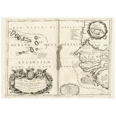
Antique Map of Western Africa and the Cape Verde Islands by Coronelli, 1691
By Vincenzo Coronelli
Located in Langweer, NL
Antique map titled 'Bocche del Fiume Negro et Isole di Capo Verde'. Antique map of Western Africa with the Cape Verde Islands and an inset of Goree Island. Originates from 'Atlante V...
Category
Late 17th Century Antique European Maps
Materials
Paper
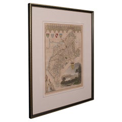
Antique Lithography Map, Cumberland, English, Framed, Cartography, Victorian
Located in Hele, Devon, GB
This is an antique lithography map of Cumberland. An English, framed atlas engraving of cartographic interest, dating to the mid 19th century and la...
Category
Mid-19th Century Victorian Antique European Maps
Materials
Wood
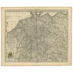
Germany & Bordering Kingdoms Map – N. Visscher, c.1680 Antique Engraving
Located in Langweer, NL
Antique map covering the central part of Europe with Germany in the centre and the Netherlands in west. With one cartouche containing cherubs and coat of arms. Published in Amsterdam...
Category
Late 17th Century Antique European Maps
Materials
Paper
$614 Sale Price
20% Off
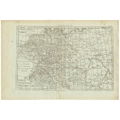
Antique Map of Germany, Bohemia, Hungary and Part of Poland by R. Bonne ‘1780’
Located in Langweer, NL
Antique map titled "L'Allemagne, La Bohême, et la Hongrie avec une partie de la Pologne" by Rigobert Bonne (1729-1795) for "Atlas de toutes les parties connues du globe terrestre" by...
Category
Late 18th Century Antique European Maps
Materials
Paper
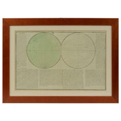
1850 Old French Map Depicting the Entire Earth's Surface Divided into Two Parts
Located in Milan, IT
Geographical map depicting the entire earth’s surface divided into two parts that correspond to the two hemispheres or globes, the map deals with the latitudes and longitudes, the me...
Category
Mid-19th Century Antique European Maps
Materials
Glass, Wood, Paper
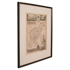
Antique Lithography Map, Hertfordshire, English, Framed Engraving, Cartography
Located in Hele, Devon, GB
This is an antique lithography map of Hertfordshire. An English, framed atlas engraving of cartographic interest, dating to the mid 19th century an...
Category
Mid-19th Century Victorian Antique European Maps
Materials
Wood
Original Antique Map of the American State of Oregon, 1903
Located in St Annes, Lancashire
Antique map of Oregon
Published By A & C Black. 1903
Original colour
Good condition
Unframed.
Free shipping
Category
Early 1900s Antique European Maps
Materials
Paper
Original Antique Map of the American State of North Dakota, 1903
Located in St Annes, Lancashire
Antique map of North Dakota
Published By A & C Black. 1903
Original colour
Good condition
Unframed.
Free shipping
Category
Early 1900s Antique European Maps
Materials
Paper
Original Antique Map of the American State of Pennsylvania( Western Part ), 1903
Located in St Annes, Lancashire
Antique map of Pennsylvania ( Western part )
Published By A & C Black. 1903
Original colour
Good condition
Unframed.
Free shipping
Category
Early 1900s Antique European Maps
Materials
Paper
Original Antique Map of the American State of Pennsylvania( Eastern Part ), 1903
Located in St Annes, Lancashire
Antique map of Pennsylvania ( Eastern part )
Published By A & C Black. 1903
Original colour
Good condition
Unframed.
Free shipping
Category
Early 1900s Antique European Maps
Materials
Paper
Original Antique Map of the American State of New York ( Northern Part ) 1903
Located in St Annes, Lancashire
Antique map of New York ( Northern Part )
Published By A & C Black. 1903
Original colour
Good condition
Unframed.
Free shipping
Category
Early 1900s Antique European Maps
Materials
Paper
Original Antique Map of the American States of Vermont & New Hampshire, 1903
Located in St Annes, Lancashire
Antique map of Vermont and New Hampshire
Published By A & C Black. 1903
Original colour
Good condition
Unframed.
Free shipping
Category
Early 1900s Antique European Maps
Materials
Paper
Antique County Map, Rutlandshire, English, Framed, Cartography, Victorian, 1860
Located in Hele, Devon, GB
This is an antique lithography map of Rutlandshire. An English, framed atlas engraving of cartographic interest, dating to the mid 19th century and later.
Superb lithography of Rutl...
Category
Mid-19th Century Victorian Antique European Maps
Materials
Wood
Framed Map of China
Located in Greenwich, CT
Map of China, 19th century. European print map of China
Conservation frame with walnut frame
Overall dimension : 28 1/2" wide 31" high 2" depth with fra...
Category
19th Century Qing Antique European Maps
Materials
Paper
$3,800
Antique Coach Road Map, East Devon, English, Framed, Cartography, Georgian, 1720
Located in Hele, Devon, GB
This is an antique coach road map of East Devon. An English, framed lithograph engraving of regional interest, dating to the early 18th century and later.
Fascinating 18th century h...
Category
Early 18th Century Georgian Antique European Maps
Materials
Wood
Antique Lithography Map, Isle of Thanet, Kent, English, Cartography, Victorian
Located in Hele, Devon, GB
This is an antique lithography map of The Isle of Thanet in Kent. An English, framed atlas engraving of cartographic interest, dating to the mid 19th century and later.
Superb litho...
Category
Mid-19th Century Victorian Antique European Maps
Materials
Wood
Antique Coaching Road Map, Devon, English, Regional Cartography, Georgian, 1720
Located in Hele, Devon, GB
This is an antique coaching road map of Devon. An English, framed lithograph engraving of regional interest, dating to the early 18th century and later.
Fascinating 18th century hig...
Category
Early 18th Century Georgian Antique European Maps
Materials
Wood
Antique Lithography Map, Black Sea, English, Framed, Cartography, Victorian
Located in Hele, Devon, GB
This is an antique lithography map of the Black Sea region. An English, framed atlas engraving of cartographic interest by John Rapkin, dating to the early Victorian period and later...
Category
Mid-19th Century Early Victorian Antique European Maps
Materials
Wood
Antique Lithography Map, Worcestershire, English, Framed Engraving, Cartography
Located in Hele, Devon, GB
This is an antique lithography map of Worcestershire. An English, framed atlas engraving of cartographic interest, dating to the early 19th centur...
Category
Early 19th Century Regency Antique European Maps
Materials
Wood
Framed Mercator Hondius Hispania Nova Atlas Minor Map
Located in Stamford, CT
Framed colored example of this decorative and important minature map. Newly framed in brown wood frame with gold trim.
Mercator Hondius “Atlas Minor” pu...
Category
17th Century Spanish Colonial Antique European Maps
Materials
Glass, Wood, Paper
1612 Abraham Ortelius, Entitled "Lorraine, Lotharingiae, Nova Desciptio, " Ric008
Located in Norton, MA
1612 Abraham Ortelius, entitled
"Lorraine, Lotharingiae, Nova Desciptio,"
Hand Colored
Description:
Artists and Engravers: Ortelius is the best known for producing the atla...
Category
17th Century Antique European Maps
Materials
Paper
Mid-18th Century Hand Drawn English Farm Map on Vellum, circa 1740s
Located in San Francisco, CA
Mid-18th century hand drawn English farm map on Vellum circa 1740s
Henry Maxted & Isaac Terry, Surveyors.
A Map of a Farm in the Parish of Blean in the County of KENT: Belonging to Mrs Elizabeth Hodgson circa 1743.
A beautiful hand drawn map...
Category
Mid-18th Century Antique European Maps
Materials
Lambskin
1594 Maurice Bouguereau Map of the Region Limoges, France, Ric0015
Located in Norton, MA
1594 Maurice Bouguereau map of the region Limoges, France, entitled
"Totivs Lemovici et Confinium Pro Uinciarum Quantum ad Dioecefin Lemo Uicenfen Fpectant,"
Hand Colored
Ric0015
Jean IV Le Clerc...
Category
16th Century Antique European Maps
Materials
Paper
1590 Ortelius Map of Calais and Vermandois, France and Vicinity Ric.a014
Located in Norton, MA
1590 Ortelius map of
Calais and Vermandois, France and Vicinity
Ric.a014
Two rare regional Abraham Ortelius maps on a single folio sheet. Left map, entitled Caletensium, depic...
Category
16th Century Antique European Maps
Materials
Paper
Portugal: A Large 17th Century Hand-colored Map by Sanson and Jaillot
By Nicolas Sanson
Located in Alamo, CA
This large hand-colored map entitled "Le Royaume de Portugal et des Algarves Divisee en see Archeveches, Eveches et Territoires Par le Sr Sanson" was originally created by Nicholas S...
Category
1690s Antique European Maps
Materials
Paper
1633 Map Entitled "Beauvaisis Comitatus Belova Cium, Ric.0002
Located in Norton, MA
1633 map entitled
"Beauvaisis Comitatus Belova Cium,"
Hand Colored
Ric.0002
Description: Cartographer : - Hondius, Henricus 1587-1638
Artists and Engravers:Jodocus Hondius, one of the most notable engravers of his time. He is known for his work in association with many of the cartographers and publishers prominent at the end of the sixteenth and the beginning of the seventeenth century. A native of Flanders, he grew up in Ghent, apprenticed as an instrument and globe maker and map engraver. In 1584, to escape the religious troubles sweeping the Low Countries at that time, he fled to London where he spent some years before finally settling in Amsterdam about 1593. In the London period he came into contact with the leading scientists and geographers of the day and engraved maps in The Mariner\\\\\\\\\\\\\\\'s Mirrour, the English edition of Waghenaer\\\\\\\\\\\\\\\'s Sea Atlas, as well as others with Pieter van den Keere, his brother-in-law. No doubt his temporary exile in London stood him in good stead, earning him an international reputation, for it could have been no accident that Speed chose Hondius to engrave the plates for the maps in The Theatre of the Empire of Great Britaine in the years between 1605 and 1610. In 1604 Hondius bought the plates of Mercator\\\\\\\\\\\\\\\'s Atlas which, in spite of its excellence, had not competed successfully with the continuing demand for the Ortelius Theatrum Orbis Terrarum. To meet this competition Hondius added about 40 maps to Mercator\\\\\\\\\\\\\\\'s original number and from 1606 published enlarged editions in many languages, still under Mercator\\\\\\\\\\\\\\\'s name but with his own name as publisher. These atlases have become known as the Mercator/Hondius series. The following year the maps were reengraved in miniature form and issued as a pocket Atlas Minor. After the death of Jodocus Hondius the Elder in 1612, work on the two atlases, folio and miniature, was carried on by his widow and sons, Jodocus II and Henricus, and eventually in conjunction with Jan Jansson in Amsterdam.
In all, from 1606 onwards, nearly 50 editions with increasing numbers of maps with texts in the main European languages were printed. Summaries of these issues are given under the entry for Gerard Mercator. Jodocus Hondius the Elder * 1588 Maps in The Mariner\\\\\\\\\\\\\\\'s Mirrour (Waghenaer/Ashley) * 1590 World Map...
Category
17th Century Antique European Maps
Materials
Paper
1571-1638 Willem Blaeu map entitled, "Ilcadorino, " Hand Colored Ric0009
Located in Norton, MA
Willem Blaeu map entitled,
"Ilcadorino,".
Hand colored.
Description: large, unusual, and nice antique copper engraved map of Ilcadorino, by Willem BL...
Category
16th Century Antique European Maps
Materials
Paper
1643 Willem&Joan Blaeu Map NW Flanders "Flandriae Teutonicae Pars Prientalior
Located in Norton, MA
1643 Willem and Joan Blaeu map of northwest Flanders, entitled
"Flandriae Teutonicae Pars Prientalior,"
Ric0012
" Authentic" - Map of the northwest Fl...
Category
17th Century Antique European Maps
Materials
Paper
1625 Mercator Map of the Provenience of Quercy, "Quercy Cadvrcivm Ric.0013
Located in Norton, MA
1625 Mercator map of the provenience of Quercy, entitled
"Quercy Cadvrcivm,"
Ric.0013
" Authentic" - Map of the provenience of Quercy Cadvrcivm
D...
Category
17th Century Antique European Maps
Materials
Paper
England, Scotland & Ireland: A Hand Colored Map of Great Britain by Tirion
By Isaak Tirion
Located in Alamo, CA
This is a hand-colored double page copperplate map of Great Britain entitled "Nieuwe Kaart van de Eilanden van Groot Brittannien Behelzende de Kon...
Category
Mid-18th Century Antique European Maps
Materials
Paper
Antique Map Of Brabantia Ducantus By Bleau Circa 1640
Located in Brussels, Brussels
map of theBrabantia Ducantus (Belgium) circa 1640 by Bléau. Bléau was well known for antique atlas that he draw during the 17 century
beautiful map, double page folded in the middle,...
Category
17th Century Renaissance Antique European Maps
Materials
Paper
Flanders, Holland & Norfolk: Hand-Colored 17th Century Sea Chart by Collins
By Captain Greenvile Collins
Located in Alamo, CA
This hand-colored chart of the seas about Flanders, Holland, Frisia, and Norfolk is from "Great Britain's Coasting Pilot. Being a New and Exact Survey of the Sea-Coast of England" by...
Category
Late 17th Century Antique European Maps
Materials
Paper
18th Century Hand-Colored Homann Map of Germany, Including Frankfurt and Berlin
By Johann Baptist Homann
Located in Alamo, CA
An 18th century hand-colored map entitled "Tabula Marchionatus Brandenburgici et Ducatus Pomeraniae quae sunt Pars Septentrionalis Circuli Saxoniae Superioris" by Johann Baptist Homa...
Category
Early 18th Century Antique European Maps
Materials
Paper
Prussia, Poland, N. Germany, Etc: A Hand-colored 17th Century Map by Janssonius
By Johannes Janssonius
Located in Alamo, CA
This is an attractive hand-colored copperplate engraved 17th century map of Prussia entitled "Prussia Accurate Descripta a Gasparo Henneberg Erlichensi", published in Amsterdam by Joannes Janssonius in 1664. This very detailed map from the golden age of Dutch cartography includes present-day Poland, Latvia, Lithuania, Estonia and portions of Germany. This highly detailed map is embellished by three ornate pink, red, mint green and gold...
Category
Mid-17th Century Antique European Maps
Materials
Paper
Antique Map of Italy by Andriveau-Goujon, 1843
By Andriveau-Goujon
Located in New York, NY
Antique Map of Italy by Andriveau-Goujon, 1843. Map of Italy in two parts by Andriveau-Goujon for the Library of Prince Carini at Palazzo Carini i...
Category
1840s Antique European Maps
Materials
Linen, Paper
$3,350 / set
Map of the Kingdom of Sardinia and Part of the Kingdom of Genoa, Rome
By Giovanni Maria Cassini
Located in Hamilton, Ontario
18th century map by Italian engraver Giovanni Maria Cassini (Italy 1745-1824). Map of Part of the Kingdom of Sardinia and Part of the Kingdom of Genoa: Rome. This is a hand colored a...
Category
18th Century Antique European Maps
Materials
Paper
$795 Sale Price
36% Off
Large Original Antique Map of Afghanistan. Edward Weller, 1861
Located in St Annes, Lancashire
Great map of Afghanistan
Lithograph engraving by Edward Weller
Original colour
Published, 1861
Unframed
Good condition
Category
1860s Victorian Antique European Maps
Materials
Paper
Map of the Holy Land "Carte de la Syrie et de l'Egypte" by Pierre M. Lapie
By Pierre M. Lapie
Located in Alamo, CA
An early 19th century map of ancient Syria and Egypt entitled "Carte de la Syrie et de l'Egypte anciennes/dressée par M. Lapie, Colonel d'Etat Major, et...
Category
Early 19th Century Antique European Maps
Materials
Paper
17th Century Framed Map of Ancient France Titled "Typus Galliae Veteris"
Located in Dallas, TX
Decorate an office or a library with this elegant historic map. Crafted in the Netherlands circa 1630, this beautifully framed antique map with pr...
Category
17th Century Baroque Antique European Maps
Materials
Glass, Giltwood, Paper
Rare Set of 3 Map Samplers by A Charles. Italy, Spain & France
Located in Chelmsford, Essex
Set of 3 Map Samplers by A Charles. All depict countries, cities, seas and landmarks of the respective countries. The first entitled, 'SPAIN and PORTUGAL'. The second, 'MAP OF FRANCE...
Category
Early 19th Century Antique European Maps
Materials
Linen
1812 United States Map, by Pierre Tardieu, Antique French Map Depicting the U.S.
By Pierre François Tardieu
Located in Colorado Springs, CO
1812 "United States of Nth America -- Carte des Etats-Unis De L'Amerique Septentrionale" Two-Sheet Map by Tardieu
This attractive map, published in Paris in 1812, is one of the most rare large format maps from the period. It features a view of the East Coast of the U.S. from Maryland to just below South Carolina. Additionally, Ellicott’s plan for the City of Washington D.C. is included at the top right and an illustration of Niagara Falls is shown at the bottom right with a description in both French and English. This extremely detailed map not only depicts the mountainous regions of the southeastern U.S., but also includes names of regions, rivers, and towns.
Based on the first state of Arrowsmith’s 4-sheet map of the United States, this map is completely engraved by Tardieu in Paris and showcases high quality engravings. This detailed map of the recently independent United States includes one of the largest and earliest examples of the Ellicott plan of Washington DC.
The artist, Pierre François Tardieu (PF Tardieu) was a very well-known map engraver, geographer, and illustrator. Awarded a bronze medal by King Louis-Phillipe for the accuracy and beauty of his map-making, Tardieu produced many fine works including maps of Louisiana...
Category
1810s Antique European Maps
Materials
Paper
The Kingdom of Naples and Southern Italy: A Hand-Colored 18th Century Homann Map
By Johann Baptist Homann
Located in Alamo, CA
"Novissima & exactissimus Totius Regni Neapolis Tabula Presentis Belli Satui Accommo Data" is a hand colored map of southern Italy and the ancient Kingdom of Naples created by Johann...
Category
Early 18th Century Antique European Maps
Materials
Paper
Southern Greece: A Large 17th C. Hand-colored Map by Sanson and Jaillot
By Nicolas Sanson
Located in Alamo, CA
This large original hand-colored copperplate engraved map of southern Greece and the Pelopponese Peninsula entitled "La Moree Et Les Isles De Zante, Cefalonie, Ste. Marie, Cerigo & C...
Category
1690s Antique European Maps
Materials
Paper
Northern Scotland: A 16th Century Hand-colored Map by Mercator
By Gerard Mercator
Located in Alamo, CA
A framed hand-colored 16th century map of Northern Scotland by Gerard Mercator entitled "Scotiae pars Septentrionalis", published in Amsterdam in 1636. It is a highly detailed map of the northern part of Scotland, with the northwest Highlands and the cities Inverness and Aberdeen, as well as the Orkney Islands and the Hebrides. There is a decorative title cartouche in the upper left corner.
The map is presented in an antiqued brown wood...
Category
16th Century Antique European Maps
Materials
Paper
Antique Map of Eastern Hemisphere from the collection of Thierry Despont
Located in New York, NY
Designed by Enrico Bonetti (E. Bonatti) and published by Francesco Vallardi Editore. Based on an earlier map by Evangelista Azzi (Ev. Azzi). Labeled as such at bottom edge of map.
T...
Category
Late 19th Century Antique European Maps
Materials
Canvas, Wood
California, Alaska and Mexico: 18th Century Hand-Colored Map by de Vaugondy
By Didier Robert de Vaugondy
Located in Alamo, CA
This is an 18th century hand-colored map of the western portions of North America entitled "Carte de la Californie et des Pays Nord-Ouest separés de l'Asie par le détroit d'Anian, ex...
Category
1770s Antique European Maps
Materials
Paper
Vienna, Austria: A Large 17th Century Hand-Colored Map by Sanson and Jaillot
By Nicolas Sanson
Located in Alamo, CA
This large 17th century hand-colored map of Vienna, Austria and the surrounding countryside and villages entitled "Plan de la Ville de Vienne en Austrich...
Category
1690s Antique European Maps
Materials
Paper
Original Antique English County Map, Cambridgeshire, J & C Walker, 1851
Located in St Annes, Lancashire
Great map of Cambridgeshire
Original colour
By J & C Walker
Published by Longman, Rees, Orme, Brown & Co. 1851
Unframed.
Category
1850s Other Antique European Maps
Materials
Paper
Original Antique English County Map, Buckinghamshire, J & C Walker, 1851
Located in St Annes, Lancashire
Great map of Buckinghamshire
Original colour
By J & C Walker
Published by Longman, Rees, Orme, Brown & Co. 1851
Unframed.
Category
1850s Other Antique European Maps
Materials
Paper
Original Antique English County Map, Durham, J & C Walker, 1851
Located in St Annes, Lancashire
Great map of Durham
Original colour
By J & C Walker
Published by Longman, Rees, Orme, Brown & Co. 1851
Unframed.
Category
1850s Other Antique European Maps
Materials
Paper
Original Antique English County Map - Middlesex. J & C Walker. 1851
Located in St Annes, Lancashire
Great map of Middlesex
Original colour
By J & C Walker
Published by Longman, Rees, Orme, Brown & Co. 1851
Unframed.
Category
1850s Other Antique European Maps
Materials
Paper
Original Antique English County Map, Derbyshire, J & C Walker, 1851
Located in St Annes, Lancashire
Great map of Derbyshire
Original colour
By J & C Walker
Published by Longman, Rees, Orme, Brown & Co. 1851
Unframed.
Category
1850s Other Antique European Maps
Materials
Paper
Original Antique English County Map, Rutland, J & C Walker, 1851
Located in St Annes, Lancashire
Great map of Rutland
Original colour
By J & C Walker
Published by Longman, Rees, Orme, Brown & Co. 1851
Unframed.
Category
1850s Other Antique European Maps
Materials
Paper
Hand Colored 18th Century Homann Map of Austria Including Vienna and the Danube
By Johann Baptist Homann
Located in Alamo, CA
"Archiducatus Austriae inferioris" is a hand colored map of Austria created by Johann Baptist Homann (1663-1724) and published in Nuremberg, Germany in 1728 shortly after his death. ...
Category
Early 18th Century Antique European Maps
Materials
Paper
Large Original Antique Map of Java and Borneo, Fullarton, C.1870
Located in St Annes, Lancashire
Great map of Java and Borneo
Wonderful figurative borders
From the celebrated Royal Illustrated Atlas
Lithograph. Original color.
Published by Fullarton, Edinburgh. C.1870
Unfr...
Category
1870s Antique European Maps
Materials
Paper
Antique County Map, Berkshire, English Framed Lithograph, Cartography, Victorian
Located in Hele, Devon, GB
This is an antique lithography map of Berkshire. An English, framed atlas engraving of cartographic interest, dating to the mid 19th century and later.
Superb lithography of Berksh...
Category
Mid-19th Century Victorian Antique European Maps
Materials
Paper
Map of Asia Minor & Cyprus with Medallions – Weigel Engraving c.1720
Located in Langweer, NL
Map of Asia Minor & Cyprus with Medallions – Weigel Engraving c.1720
This finely engraved antique map, titled Asiae Peninsula sive Asia intra Taurum, presents an early 18th-century ...
Category
Early 18th Century Antique European Maps
Materials
Paper
$444 Sale Price
20% Off
17th Century Nicolas Visscher Map of Southeastern Europe
Located in Hamilton, Ontario
A beautiful, highly detailed map of southeastern Europe by Nicolas Visscher. Includes regions of Northern Italy (showing the cities Bologna, Padua, and Venice), Bohemia, Austria (sho...
Category
17th Century Antique European Maps
Materials
Paper
$1,350 Sale Price
38% Off
Antique County Map, Middlesex, English, Framed, Litho, Cartography, Victorian
Located in Hele, Devon, GB
This is an antique lithography map of Middlesex. An English, framed atlas engraving of cartographic interest, dating to the mid 19th century and later.
Superb lithography of Middle...
Category
Mid-19th Century Victorian Antique European Maps
Materials
Paper
Large Original Vintage Map of New Zealand, North Island, circa 1920
Located in St Annes, Lancashire
Great map of North Island, New Zealand
Original color.
Good condition / minor foxing to right edge
Published by Alexander Gross
Unframed.
Category
1920s Edwardian Vintage European Maps
Materials
Paper
Recently Viewed
View AllMore Ways To Browse
Antique Wellington Chests
Antonio Cassi Ramelli
Archimede Seguso Birds
Art Deco Coasters
Art Deco Footballer
Art Deco Music Cabinet
Art Deco Waterfall Bedroom Furniture
Art Deco Waterfall Bedroom
Art Deco Whisky
Art Foulard
Art Nouveau Sunflower
Arts And Crafts Silver Coffee Pot
Asian Pink Bowl
Avesn Vase
Baccarat Carafe
Bakelite Bird
Bakelite Cocktail Picks
Bamboo Ikebana Vase
