18th Century and Earlier Maps
to
2,336
2,869
64
2,936
26
12
1
1
2,936
2,266
475
3
290
34
10
126
10
37
9
2
5
4
3
3
2,922
30
20
3
3
307
111
81
53
52
2,936
2,936
2,936
59
21
13
12
12
Period: 18th Century and Earlier
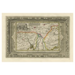
Benedictus Goes’ Route – Antique Map of Tartary to China by Van der Aa, 1714
Located in Langweer, NL
Benedictus Goes’ Route – Antique Map of Tartary to China by Van der Aa, 1714
This fascinating antique map titled De Land-Reyse door Benedictus Goes, van Lahor gedaan, door Tartaryen...
Category
Dutch Antique 18th Century and Earlier Maps
Materials
Paper
$513 Sale Price
20% Off
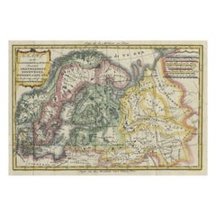
Uncommon Old Map of Lapland to Russia and Denmark to Kazan in the South, 1785
Located in Langweer, NL
Description: Antique map titled 'Kaart van het Noorderdeel van Europa, Bevattende Deenmarken, Noorwegen, Zweden, Lapland en het Grootste Gedeelte van Europeesch Rusland.'
This un...
Category
Antique 18th Century and Earlier Maps
Materials
Paper
$523 Sale Price
20% Off
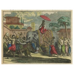
Original Antique Print of a Procession of Monks in Ceylon 'Sri Lanka', 1672
Located in Langweer, NL
Antique print, untitled. This original antique print shows a procession of monks in Ceylon. A group of dancing monks, beating drums, in front of the abbot, seated on an elephant. Dut...
Category
Antique 18th Century and Earlier Maps
Materials
Paper
$256 Sale Price
20% Off
Antique Map of the Rhine centered on Cologne, Germany
Located in Langweer, NL
Antique map titled 'Archiepsiscopatus et Electoratus Coloniensis (..)'. Original antique map of the Rhine river, centered on Cologne, Germany. The Rhine River cuts across this map fr...
Category
Antique 18th Century and Earlier Maps
Materials
Paper
$523 Sale Price
20% Off
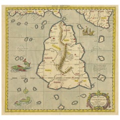
Antique Ptolemaic Map of Ceylon or nowadays Sri Lanka
Located in Langweer, NL
Antique map titled 'Tab XII. Asiae Taprobanam'. Ptolemaic map of Sri Lanka. Ptolemy drew on the accounts of travelers and sailors and though the information was secondhand and often ...
Category
Antique 18th Century and Earlier Maps
Materials
Paper
$656 Sale Price
20% Off
Antique Map of the Gaspar Strait by Huddart, '1788'
Located in Langweer, NL
Antique map titled 'Sketch of the Straits of Gaspar'. Detailed sea chart of the Gaspar Strait, showing part of the Island of Banca on the east coast of Sumatra just to the south of S...
Category
Antique 18th Century and Earlier Maps
Materials
Paper
$790 Sale Price
30% Off
Detailed Map of Friesland, Groningen and Drenthe, The Netherlands, 1706
Located in Langweer, NL
Antique map tited 'Frisiae Dominium vernacule Friesland verdeeld met de hoofd-deelen van Oostergoo, Westergoo en Sevenwolden (..)'. Detailed map of Friesland, Groningen and Drenthe, ...
Category
Antique 18th Century and Earlier Maps
Materials
Paper
$903 Sale Price
20% Off
Antique Map of the Philippines and Guam by Scherer, circa 1702
Located in Langweer, NL
Antique map titled 'Nova et Vera Exhibitio Geographica Insularum Marianarum (..)'. Rare and very attractive map of the Mariana Islands, Philippines, Ko...
Category
Antique 18th Century and Earlier Maps
Materials
Paper
$2,140 Sale Price
20% Off
Antique Map of Spain and Portugal by Tardieu, circa 1795
Located in Langweer, NL
The image is an antique map titled "Hispanie Betique et Lusitanie", which depicts the Iberian Peninsula during the Roman times, highlighting the provinces of Hispania Baetica (Betiqu...
Category
Antique 18th Century and Earlier Maps
Materials
Paper
$237 Sale Price
20% Off
Antique Map of the World with Polar Projections by Keizer & de Lat, 1788
Located in Langweer, NL
Antique map titled 'Schuine Ronde Aard-Klooten (..)'. Interesting double hemisphere world map with polar projections. In North America, there is a...
Category
Antique 18th Century and Earlier Maps
Materials
Paper
$445 Sale Price
25% Off
Colourful Antique Map Centered on Nuremberg and Bamberg in Germany, ca.1703
Located in Langweer, NL
Antique map titled 'Circuli Franconiae pars Occidentalis, exhibes simul integrum fere Electoratum Moguntinum (..)'.
Antique map centered on Nuremberg and Bamberg. Extends from th...
Category
Antique 18th Century and Earlier Maps
Materials
Paper
$704 Sale Price
20% Off
Antique Map of the Auvergne-Rhône-Alpes region of France by Valk, circa 1730
Located in Langweer, NL
Antique map titled 'Praefectura Lugdunensis Generalis'. Detailed map of the Auvergne-Rhône-Alpes region in the southeast of France. To the east the Rhône from Chalon-sur-Saône, Mâcon...
Category
Antique 18th Century and Earlier Maps
Materials
Paper
$475 Sale Price
20% Off
Antique Map of the City of Groningen by Merian, 1659
Located in Langweer, NL
Antique map titled 'Gröningen'. This print depicts the city of Groningen, the Netherlands. This print originates from 'Topographia Germaniae Inferioris (..)' by C. Merian.
Artist...
Category
Antique 18th Century and Earlier Maps
Materials
Paper
$87 Sale Price
20% Off
Antique Map of France by Mortier 'c.1710'
Located in Langweer, NL
Antique map titled 'Gallia vetus ex C. Iulii Caesaris (..)'. Original antique map of France. Published by P. Mortier, c.1710.
Category
Antique 18th Century and Earlier Maps
Materials
Paper
$951 Sale Price
20% Off
Set of Two Antique Maps of Northern Italy by Homann Heirs, 1754
Located in Langweer, NL
Set of two maps of northern Italy showing the position of troups during the war in April and March 1746. The area covered includes the course of the River Po between Valenza (north of Alexandria) and San Benedetto...
Category
Antique 18th Century and Earlier Maps
Materials
Paper
$846 Sale Price / set
20% Off
1752 Vaugoundy Map of Flanders : Belgium, France, and the Netherlands, Ric.a002
Located in Norton, MA
Large Vaugoundy Map of Flanders:
Belgium, France, and the Netherlands
Colored -1752
Ric.a002
Description: This is a 1752 Didier Robert de Vaugondy map of Flanders. The map de...
Category
Unknown Antique 18th Century and Earlier Maps
Materials
Paper
Large Antique Map of the Kingdom of France
Located in Langweer, NL
Antique map titled 'The Kingdom of France (..)'. Large antique map of the Kingdom of France. Engraved by T. Kitchin. Published J. Blair, circa 1779.
Category
Antique 18th Century and Earlier Maps
Materials
Paper
$656 Sale Price
20% Off
Exploring Ancient Persia: Ptolemaic Map of Iran and Iraq by Ptolemy and Mercator
Located in Langweer, NL
Claudius Ptolemy was a mathematician, astronomer and geographer who worked in Alexandria, then a part of the Roman Empire, in the 2nd century AD. One of the most learned and influent...
Category
Antique 18th Century and Earlier Maps
Materials
Paper
$466 Sale Price
20% Off
Antique Map of the Region of Bouchain and Cambrai by Visscher 'circa 1680'
Located in Langweer, NL
Antique map titled 'Carte Nouvelle des Environs de Bouchain & Cambray'. Uncommon map of the region of Bouchain and Cambrai (Cambray, France) showing the camps of two armies.
Category
Antique 18th Century and Earlier Maps
Materials
Paper
$475 Sale Price
20% Off
Antique Map of the Caspian Sea, Uzbekistan, Northern Persia Etc, C.1735
Located in Langweer, NL
Antique map titled 'Nova Maris Caspii et Regions Usbeck (..).' Detailed map of Central Asia centered on the Caspian Sea, showing Uzbekistan to the east of ...
Category
Antique 18th Century and Earlier Maps
Materials
Paper
$1,569 Sale Price
20% Off
Cartographic Elegance of Touraine: A 17th-Century Map Showing French Heritage
Located in Langweer, NL
"Ducatus Turonensis - Touraine," is a original antique historical map of the Touraine region, which is located in the heart of France, centered...
Category
Antique 18th Century and Earlier Maps
Materials
Paper
$466 Sale Price
20% Off
Original Antique Map of England and Wales
Located in Langweer, NL
Antique map titled 'A New and Correct Map of England and Wales from the Latest and Best Improvements'. Original antique map of England and Wales. Printed by Alex Hogg, London for George Henry Millar's 'New, Complete and Universal System...
Category
Antique 18th Century and Earlier Maps
Materials
Paper
$228 Sale Price
20% Off
Loudun and Mirebeau: A Cartographic Masterpiece of 17th Century France by Blaeu
Located in Langweer, NL
Cartography, 17th century. Willem (1571-1638) and Joan Blaeu (1596-1673), Theatrum Orbis Terrarum sive Atlas Novus..., 1635. Figure: Loudonois. Laudunum (Loudun); Mirebalais (Mirebea...
Category
Antique 18th Century and Earlier Maps
Materials
Paper
$418 Sale Price
20% Off
Lyonnais, Beaujolais, Forez, Mâconnais: A 1644 Depiction of France's Provinces
Located in Langweer, NL
An original antique map from 1644, depicting the French provinces of Lyonnais, Beaujolais, Forez, and Mâconnais. In this map, north is oriented to the right, which is a cartographic ...
Category
Antique 18th Century and Earlier Maps
Materials
Paper
$456 Sale Price
20% Off
Antique Map with Plans of Cremona, Pavia, Montferrato & Others by Homann, '1734'
Located in Langweer, NL
Antique map titled 'Plan von Cremona und denen übrigen Maylaendischen (..)'. Original antique map showing plans of Cremona, Pavia, Casale Montferrato, Fort de Fuentes, Novara, Serava...
Category
Antique 18th Century and Earlier Maps
Materials
Paper
$1,159 Sale Price
35% Off
Antique Map of Westfriesland in Ancient Times by Alting, 1697
Located in Langweer, NL
Antique map titled 'Frisiae Liberae quae Westfresia Post eluviones seculi XIII'. Map of Westfriesland in ancient times. This copper engraved map shows part of Holland as it was in an...
Category
Antique 18th Century and Earlier Maps
Materials
Paper
$161 Sale Price
20% Off
Antique Map of Indochina, the Malaysian Peninsula and Northern Sumatra
Located in Langweer, NL
Antique map titled 'Nieuwe Kaart van India over de Ganges of van Malakka, Siam, Cambodia, Chiampa, Kochinchina, Laos, Pegu, Ava, enz'. Original old map of Indochina, the Malaysian Pe...
Category
Antique 18th Century and Earlier Maps
Materials
Paper
$608 Sale Price
20% Off
A Gold Highlighted Antique Map of Northamptonshire by Blaeu '1659'
Located in Langweer, NL
Antique map titled 'Comitatus Northantonensis vernacule Northamtonshire'. Original antique map of Northamptonshire, England. This map originates from 'Atlas Universal y Cosmographico...
Category
Antique 18th Century and Earlier Maps
Materials
Paper
$761 Sale Price
20% Off
Antique Map of Denmark with the Danish Royal Crest, c.1730
By Homann Heirs
Located in Langweer, NL
Antique map titled 'Regni Daniae in quo sunt Ducatus Holsatia and Slesuicum Insulae Danicae Jutia, Scania Blekingia (..).' Map of Denmark and islands, part of Sweden and Germany, dra...
Category
Antique 18th Century and Earlier Maps
Materials
Paper
$428 Sale Price
20% Off
Large Antique Map of the German Empire
Located in Langweer, NL
Antique map titled 'A Map of Germany (..)'. Large antique map of the German Empire, highly detailed. Engraved by T. Kitchin. Published J. Blair, cir...
Category
Antique 18th Century and Earlier Maps
Materials
Paper
$646 Sale Price
20% Off
Original Antique Map of the Area of Bremen and Lower Saxony
Located in Langweer, NL
Antique map titled 'Ducatus olim Episcopatus Bremensis et ostiorum Albis et Visurgis Fluviorum novissima Descriptio'. Original old map of the area of ??Bremen and Lower Saxony. Uncom...
Category
Antique 18th Century and Earlier Maps
Materials
Paper
$627 Sale Price
20% Off
Antique Map of Japan by A.M. Mallet, 1683
Located in Langweer, NL
A charming late 17th century French map with a very decorative title cartouche showing trumpet-blowing cherubs, by Allain Manneson Mallet (1630-1706), a well traveled military engine...
Category
French Antique 18th Century and Earlier Maps
Materials
Paper
Antique Map of the County of Bentheim by Hondius, c.1630
Located in Langweer, NL
Antique map titled 'Comitatus Bentheimensis nova descriptio'. Engraved map of the County of Bentheim, showing Linge, Enschede, Bad Bentheim, Coevorden, Ne...
Category
Antique 18th Century and Earlier Maps
Materials
Paper
$390 Sale Price
20% Off
Martinique Island in the Caribbean by Bellin Original Original Antique Map, 1780
Located in Langweer, NL
This mid-18th century map, "Carte de l'Isle de la Martinique pour servir a l'historie generale des voyages," was issued in 1780 by M. Bellin in Paris. It presents a detailed and visually captivating depiction of the Island of Martinique within the context of the Caribbean and the Lesser Antilles.
**Title:** Carte de l'Isle de la Martinique pour servir a l'historie generale des voyages
**Issuer:** M. Bellin
**Date:** 1780
**Location Coverage:** North America, Caribbean, Martinique, Lesser Antilles
This engraved map is notable for its pleasing aesthetics, featuring lovely hand coloring that enhances its visual appeal. The inclusion of a scroll cartouche, an ornamental frame, and measurement lines adds a distinctive and visually appealing quality to the map.
Martinique, situated within the Lesser Antilles in the Caribbean, is presented with meticulous detail, showcasing geographical features, coastlines, settlements, and other notable landmarks. Bellin, known for his accuracy in cartography, crafted this map to serve as a geographical reference within the broader context of historical voyages and exploration.
The combination of detailed cartographic information and artistic embellishments, such as hand coloring and decorative elements, makes this map not only a valuable geographical document but also a visually pleasing piece of cartographic art...
Category
Antique 18th Century and Earlier Maps
Materials
Paper
$266 Sale Price
20% Off
Antique Map of Cities of the Jiangsu Region in China, c.1760
Located in Langweer, NL
Antique map titled 'Plan de l' Enceinte de la Ville de Nan-King ou Kyang-Ning-Fou et plan de la ville de Su-Tcheou-Fou.' A map of the city of Nanking or Nanjing and a second map show...
Category
Antique 18th Century and Earlier Maps
Materials
Paper
$190 Sale Price
20% Off
Untitled Print Lincoln Cathedral ii, Basire, 1791
Located in Langweer, NL
Antique print depicting the Lincoln Cathedral, or the Cathedral Church of the Blessed Virgin Mary of Lincoln. Artists and Engravers: Made by J. Basir...
Category
Antique 18th Century and Earlier Maps
Materials
Paper
$142 Sale Price
20% Off
Daniae Regni & Oldenburg – Antique Maps of Denmark and Saxony by Ortelius, 1598
Located in Langweer, NL
Daniae Regni & Oldenburg – Antique Maps of Denmark and Saxony by Ortelius, 1584
This elegant antique map sheet features two detailed regional maps side by side: Daniae Regni Typus (...
Category
European Antique 18th Century and Earlier Maps
Materials
Paper
$856 Sale Price
20% Off
Antique Plan of the Castle & City of Batavia 'Jakarta' on Java, Indonesia, c1669
Located in Langweer, NL
Antique map Batavia titled 'Ware Affbeeldinge wegens het Casteel ende Stadt Batavia'.
Antique print of the castle and city of Batavia on the Island of Java'. Rare edition with En...
Category
Antique 18th Century and Earlier Maps
Materials
Paper
$1,189 Sale Price
20% Off
Authentic Old Map of Persia with Original Border Coloring, 1745
Located in Langweer, NL
Title: "Kaartje van Persien na de stelling van den Heer Guillaume de L'Isle"
Translates to "Map of Persia based on the work of Mr. Guillaume de L'Isle." Guillaume de L'Isle was a p...
Category
Antique 18th Century and Earlier Maps
Materials
Paper
Antique Portrait of Frederik Hendrik, Prince of Orange, Etc Etc, 1749
Located in Langweer, NL
Antique portrait titled 'Frederik Hendrik, Prins van Oranje enz. enz. enz'.
Portrait of Frederick Henry, or Frederik Hendrik in Dutch (29 January 1584 – 14 March 1647). The sover...
Category
Dutch Antique 18th Century and Earlier Maps
Materials
Paper
Antique Print of the City of Rome, Italy by Münster, C.1580
Located in Langweer, NL
Antique print titled 'Abbildung der Statt Rom/wie sie von Romulo anfänge - Von Italia'. Woodcut of ancient Rome. This print originates from Munster's Cosmographia, one of the most in...
Category
Antique 18th Century and Earlier Maps
Materials
Paper
$437 Sale Price
20% Off
Antique Print of the Residence of Sir Gregory Page by Miller, c.1770
Located in Langweer, NL
Antique print titled 'Elevation of the Flank of Sir Gregory Page'. Architectural elevation of the residence of Sir Gregory Page.
Sir Gre...
Category
Antique 18th Century and Earlier Maps
Materials
Paper
$713 Sale Price
20% Off
Original Antique Engraving of the Quangguamiau Pagoda in China, 1665
Located in Langweer, NL
Antique print titled 'Pagoda Quangguamiau'. Old print depicting the 'Quangguamiau' pagoda, China. This print originates from 'Het gezantschap der Nee^rlandtsche Oost-Indische Compagn...
Category
Antique 18th Century and Earlier Maps
Materials
Paper
Antique Print of Unterwalden, South of Lake Lucerne in Switzerland, 1654
Located in Langweer, NL
Antique print titled 'Underwaldia - Das Landt Underwalden'. View of the city of Unterwalden, the old name of a forest-canton of the Old Swiss Confederacy in central Switzerland, south of Lake Lucerne...
Category
Antique 18th Century and Earlier Maps
Materials
Paper
$485 Sale Price
20% Off
Antique Print of the 'Buitenhof' in The Hague, The Netherlands, c.1770
Located in Langweer, NL
Antique print titled 'Prospectus de Buyten Hof - Gezicht van het Buyten Hof tot Gravenhaghe'. Beautiful view of the Buitenhof, a square in The Hague, the Netherlands. This is an opti...
Category
Antique 18th Century and Earlier Maps
Materials
Paper
$275 Sale Price
20% Off
Antique Print of the Town Hall of Batavia or Jakarta in Todays Indonesia, 1770
Located in Langweer, NL
Antique optical print titled 'Prospect des Rathhauses in Batavia (..)'. View of the town hall of Batavia, Indonesia. This is an optical print, also called 'vue optique' or 'vue d'opt...
Category
Antique 18th Century and Earlier Maps
Materials
Paper
$542 Sale Price
20% Off
Antique Map of the West Coast of America with Island Views, ca.1784
Located in Langweer, NL
Antique print titled 'Views on the West Coast of America (..)'.
Coastal views of various islands of the American coast. Originates from an edition of Cook's Voyages.
Artists ...
Category
Antique 18th Century and Earlier Maps
Materials
Paper
$428 Sale Price
20% Off
Antique Map of Africa Made after Hondius, circa 1655
Located in Langweer, NL
Antique map titled 'Africa Nova Tabula Auct Jud. Hondio'. Beautiful and rare paneled map of Africa, Based Upon Hondius' map. The first derivative of the map was issued separately by ...
Category
Antique 18th Century and Earlier Maps
Materials
Paper
$2,854 Sale Price
20% Off
Antique Bird's Eye-view Atjien or Atjeh in Aceh in Northern Sumatra, Indonesia
Located in Langweer, NL
Description: Antique print Indonesia titled 'Atsjien'. Bird's eye-view of the Town of Atjien on the northernmost point of Sumatra. This print originates from 'Oud en Nieuw Oost-Indië...
Category
Antique 18th Century and Earlier Maps
Materials
Paper
$437 Sale Price
20% Off
17th Century Toulouse, Savve, Sommieres Topographical Map by Iohan Peeters
Located in New York, NY
Fine topographical 17th century map of Toulouse, Savve and Sommieres by Iohan Peeters
Beautiful engraving of the capital of France's Occitanie Region, Toulouse, called La Ville Rose- the Pink City, for the terracotta bricks used in its many buildings, giving the city a distinct apricot-rose hue. An important cultural and educational center, the city's residents included Nobel Prize winners and world renown artists- Henri de Toulouse-Lautrec, Henri Martin, Jean-Auguste-Dominique Ingres, Antonin Mercie, Alexandre Falguiere and more recently Cyril Kongo...
Category
Dutch Antique 18th Century and Earlier Maps
Materials
Paper
Antique Print of the Provincial-Executive of Leeuwarden in The Netherlands, 1793
Located in Langweer, NL
Antique print titled 't'Kollegie der Gedeputeerde Staaten, te Leeuwarden'. Old print of the provincial-executive of Leeuwarden, Friesland. This print originates from 'Vaderlandsche g...
Category
Antique 18th Century and Earlier Maps
Materials
Paper
Antique Map of Germany by T. Kitchin, circa 1770
Located in Langweer, NL
Antique map titled 'An Accurate Map of Germany (..) '. Drawn from the best Authorities by T.Kitchin Geogr." Rare edition, drawn and etched by Thomas Kitchin, published, circa 1770.
Category
Antique 18th Century and Earlier Maps
Materials
Paper
$228 Sale Price
20% Off
Antique Map of the North Sea and Dunkirk
Located in Langweer, NL
Untitled map of the North Sea, top left a large compass rose, bottom right Dunkirk (Duinkerke / Dunkerque), France. Part of a bundled collection of plans of battles and cities renown...
Category
Antique 18th Century and Earlier Maps
Materials
Paper
$418 Sale Price
20% Off
Antique Map of the Kanton Luzerne 'Switzerland' by Homann Heirs, 1763
Located in Langweer, NL
Antique map titled 'Canton Lucern (..)'. Fine decorative copper plate engraved antique map of the Canton of Lucerne in Central Switzerland with pictorial cartouche in top right corne...
Category
Antique 18th Century and Earlier Maps
Materials
Paper
$466 Sale Price
20% Off
Antique Map of Stavoren by Blaeu, 1649
Located in Langweer, NL
Antique map titled 'Staveren'. Original antique map of the city of Stavoren, Friesland, The Netherlands. This map originates from 'Toonneel der Steden van de Vereenighde Nederlanden'...
Category
Antique 18th Century and Earlier Maps
Materials
Paper
$352 Sale Price
20% Off
Old Map of Tartary with Persia, Siberia, the Mogul Territories & China, ca.1717
Located in Langweer, NL
Antique map titled 'A Map of Independent Tartary, containing the territories of Usbeck, Gasgar, Tibet, Lassa & c'.
Old map depicting east of the Caspian Sea with parts of Persia, Siberia, the Mogul territories and on to western China...
Category
Antique 18th Century and Earlier Maps
Materials
Paper
$333 Sale Price
20% Off
Fabulous Original Antique two-sheet Map of the Caspian Sea, ca.1723
Located in Langweer, NL
Carte Marine de la Mer Caspiene... [and] Coste de Perse sur la Mer Caspiene et Partie de Celles de Tartarie", Delisle, Guillaume (2 maps)
Subject: Caspian Sea
...
Category
Antique 18th Century and Earlier Maps
Materials
Paper
$2,093 Sale Price
20% Off
Very Old Original Antique Map of The City of Douai in France, ca.1575
Located in Langweer, NL
Antique Map of Douai (France) titled 'Duacum, Catuacorum Urbs, tam situ, quam incolis, et litterarum studijs elegantissime ornata'.
This map depicts the city of Douai (France) an...
Category
Antique 18th Century and Earlier Maps
Materials
Paper
$780 Sale Price
20% Off
Antique Map of Asia Minor including part of the Greek Archipelago and Cyprus
Located in Langweer, NL
Antique map titled 'Chersonesi quae hodie Natolia Descriptio'. Decorative, smaller map of Asia Minor including part of the Greek Archipelago and Cyprus. The drape-style title cartouc...
Category
Antique 18th Century and Earlier Maps
Materials
Paper
$323 Sale Price
20% Off
Asia Minor – Antique Map of Natolia by Ortelius, Theatrum Orbis Terrarum c.1600
Located in Langweer, NL
Asia Minor – Antique Map of Natolia by Ortelius, Theatrum Orbis Terrarum c.1600
This beautifully hand-colored antique map titled Natoliae quae olim Asia Minor nova descriptio presen...
Category
European Antique 18th Century and Earlier Maps
Materials
Paper
$418 Sale Price
20% Off
