18th Century and Earlier Maps
to
2,335
2,904
64
2,971
26
12
1
1
2,971
2,281
474
3
290
34
10
126
10
37
9
2
5
4
3
3
2,957
30
20
3
3
354
117
94
81
52
2,971
2,971
2,971
59
21
13
12
12
Period: 18th Century and Earlier
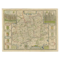
Antique Map of Surrey by Speed, 1676
Located in Langweer, NL
Antique map titled 'Surrey described and divided into hundreds'. Map of Surrey, England. Includes inset elevations of Richmond and Nonsuch Palaces. This map originates from 'Theatre ...
Category
Antique 18th Century and Earlier Maps
Materials
Paper
$466 Sale Price
20% Off
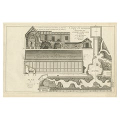
Pl. 3 Antique Print of a Winter Garden by Le Rouge, c.1785
Located in Langweer, NL
Antique print titled 'Coupe du nouveau Berceau ou Jardin d'Hiver (..)'. Copper engraving showing a winter garden. This print originates from 'Jardins Anglo-Chinois à la Mode' by Geor...
Category
Antique 18th Century and Earlier Maps
Materials
Paper
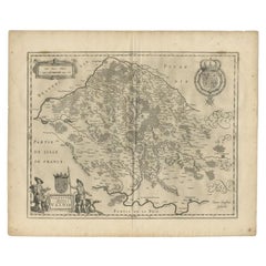
Antique Map of the Seine-et-Marne / Champagne Region by Janssonius, 1657
Located in Langweer, NL
Antique map of France titled 'Valesium Ducatus Valois'. Oriented to the north of the Picardy region with Compiegne, Senlis, Meaux, Chateau-thierry and Soissons around the perimeter. ...
Category
Antique 18th Century and Earlier Maps
Materials
Paper
$686 Sale Price
20% Off
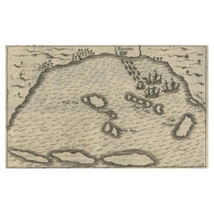
Small Map of Bantam with Dutch Ships and an Engraving of Portugese, 1614
Located in Langweer, NL
Two rare old miniature copper-engravings one one leaf. One showing the first arrival of the first Dutch in Indonesia, the so-called 'Houtman expedition' and on the reverse Portugese welcoming them with gifts.
The First Dutch Expedition to Indonesia was an expedition that took place from 1595 to 1597. It was instrumental in the opening up of the Indonesian spice trade...
Category
Antique 18th Century and Earlier Maps
Materials
Paper
$715 Sale Price
20% Off
Antique Map of the City of Leeuwarden, The Netherlands, by Guicciardini, 1612
Located in Langweer, NL
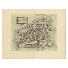
Antique map titled 'Lewardum Occidentalis Frisia Opp'. Plan of the city of Leeuwarden, in the province of Friesland, the Netherlands. This map originates from 'Beschryvinghe van alle...
Category
Antique 18th Century and Earlier Maps
Materials
Paper
Antique Map of the City of Sneek by Blaeu, 1649
Located in Langweer, NL
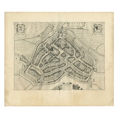
Antique map Friesland titled 'Sneeck'. Bird's-eye view plan of Sneek, the Netherlands. This map originates from 'Toneel der Steeden' published by Joan Blaeu, 1649.
Artists and Eng...
Category
Antique 18th Century and Earlier Maps
Materials
Paper
$416 Sale Price
20% Off
Antique Map of Southern Brazil and Uruguay by Bonne, c.1780
Located in Langweer, NL
"Antique map titled 'Carte de la Partie Meridional du Bresil avec les Possessions Espagnoles Voisines Qui en Sont a l'Ouest.' Map of southern Brazil and present-day Uruguay from Port...
Category
Antique 18th Century and Earlier Maps
Materials
Paper
$133 Sale Price
20% Off
Antique Map of the Banda Islands and the Route of Abel Tasman, Indonesia, 1726
Located in Langweer, NL
Antique print Indonesia with an image on each side. The first image depicts Ontong Java, one of the largest atolls on earth. On verso: antique map of the Banda Islands. With the rout...
Category
Antique 18th Century and Earlier Maps
Materials
Paper
$402 Sale Price
24% Off
Old Copper Engraving of the Siege of Syracuse, Sicily, Italy, Published, ca.1740
Located in Langweer, NL
Antique print titled 'Syracuse, Assiégée par les Atheniens'.
Old print of the siege of Syracuse, Sicily, Italy. Source unknown, to be determined.
The siege of Syracuse by the...
Category
Antique 18th Century and Earlier Maps
Materials
Paper
$266 Sale Price
20% Off
Antique Map of Gaasterland in Friesland, the Netherlands, 1718
Located in Langweer, NL
Antique map titled 'Gaasterland. De zevende Grietenije van de Zevenwolden (..)'. Original antique map of Gaasterland, Friesland, the Netherlands. Originates from 'Uitbeelding van de ...
Category
Antique 18th Century and Earlier Maps
Materials
Paper
$619 Sale Price
20% Off
Antique Map of the Bukhari Region by Van Schley, 1758
Located in Langweer, NL
Antique map titled 'Carte de la petite Bukharie et pays voisins.' Original antique map of the Bukhari (Sinkiang in north-western China) and neighboring countries. While these maps by...
Category
Antique 18th Century and Earlier Maps
Materials
Paper
$141 Sale Price
20% Off
Rare Map of St. Louis on the Island of Hispaniola 'Santa Domingo', 1748
Located in Langweer, NL
Description: Antique map titled 'A New & Exact Planof the Harbour of Port Louis (..)'.
Scarce early plan of the Harbor of St. Louis on the Island of Hispaniola (Santa Domingo), showing the the harbor at the time it was taken by Admiral Knowles in March 1748. Charles Knowles (1704 – 1777) was an officer of the Royal Navy, who saw service during the War of Jenkins' Ear, the War of the Austrian Succession, and the Seven Years War. He also briefly served with the Imperial Russian Navy...
Category
Antique 18th Century and Earlier Maps
Materials
Paper
$333 Sale Price
20% Off
Antique Map of the Moluques Islands, Part of Indonesia, circa 1750
Located in Langweer, NL
Map of the Moluques (also known as the Moluccas, Moluccan Islands or simply Maluku). Depicts the islands of Herij, Ternate, Tidor, Pottebackers, Timor, Machian and Bachian.
Category
Antique 18th Century and Earlier Maps
Materials
Paper
$200 Sale Price
20% Off
Antique Map of the City of Dokkum, Friesland by Blaeu, c.1650
Located in Langweer, NL
Antique map titled ?Dockum?. Plan of Dokkum in Friesland, the Netherlands. A cartouche with two coats of arms. Originates from the town atlas 'Toneel der Steden', published by Joan Blaeu...
Category
Antique 18th Century and Earlier Maps
Materials
Paper
Antique Print of the Monuments of Herculaneum by Bayardi, 1762
Located in Langweer, NL
Antique print originating from 'Le Antichita di Ercolano Esposte'. A vast survey of the bronzes, statues, wall-paintings, and monuments of Herculaneum. This monumental work was the f...
Category
Antique 18th Century and Earlier Maps
Materials
Paper
Original Antique Engraving of the Admiralty Islands 'Bismarck Archipelago', 1774
Located in Langweer, NL
Antique print titled 'Trois Vues des Isles de l'Amirauté (..)'. Several coastal views of the Admiralty Islands. Originates from 'Geschichte der See-Reisen und Entdeckungen im Süd-Mee...
Category
Antique 18th Century and Earlier Maps
Materials
Paper
Original Antique Print of the Waterfall of Saint-Leu in France, 1776
Located in Langweer, NL
Antique print titled 'Vue de Rocher, Temple et Cascade de St. Leu'. Copper engraving showing the rocks, temple and waterfall of Saint-Leu. This print originates from 'Jardins Anglo-C...
Category
Antique 18th Century and Earlier Maps
Materials
Paper
$330 Sale Price
11% Off
Antique Map of Japan by J.N. Bellin, 1752
Located in Langweer, NL
Bellin's wonderfully detailed map of Japan from the atlas of Prevost d'Exiles' influential collection of travel narratives, Histoire Generale des Voyages. Considered the best general...
Category
Antique 18th Century and Earlier Maps
Materials
Paper
$438 Sale Price
20% Off
Old Map of Turkmenistan, Uzbekistan, Afghanistan, Tajikistan, Kyrgyzstan, 1757
Located in Langweer, NL
Antique map titled 'Kort over det Lille Bukarie og de naest graensende Lande. af Engelske Skribentere ved N. Bellin Ingenieur ved Marinen efter Söe Etaten'.
Map of present-day Turkmenistan, Uzbekistan, Afghanistan, Tajikistan, Kyrgyzstan including part of China. Originates from 'Almindelig histoirie over reiser til lands og bands (..)'. This 17 volume set is a translation of Collection of voyages and travels edited by Awnsham and John Churchill and Thomas Osborne...
Category
Antique 18th Century and Earlier Maps
Materials
Paper
$305 Sale Price
20% Off
Antique Map of the Region of Grave by Orlers, 1615
Located in Langweer, NL
Antique map of the region of Grave, also including Cuijk and Ravestein. This map originates from 'La genealogie des illustres Comtes de Nassau' by Jan Jansz. Orlers.
Artists and E...
Category
Antique 18th Century and Earlier Maps
Materials
Paper
$152 Sale Price
20% Off
Old Map Guiana, Columbia Venezuela, Andalusia in South America by Bonne, c.1780
Located in Langweer, NL
Antique map titled 'Carte du Nouv. Rme. de Grenade, de la Nou'le Andalousie, et de la Guyane, avec les pays Limitrophes qui en sont au sud'.
Detailed map covering part of South Ame...
Category
Antique 18th Century and Earlier Maps
Materials
Paper
Antique Print of the West Front of Cholmondeley Hall by Campbell, 1717
Located in Langweer, NL
Antique print titled 'The West Prospect of Cholmondeley Hall (..)'. Elevation of the west front of Cholmondeley Hall, seat of the Earl of Cholmondeley. This print originates from 'Vitruvius Britannicus...
Category
Antique 18th Century and Earlier Maps
Materials
Paper
Antique Print of the City of Hukoen in China, 1668
Located in Langweer, NL
Antique print China titled 'Hukoen of ou Hukeu'. Old print depicting a view on the Chinese city of Hukoen with its ramparts. This print originates ...
Category
Antique 18th Century and Earlier Maps
Materials
Paper
$276 Sale Price
20% Off
Antique Optica Print of Huis ten Bosch, The Netherlands, c.1760
Located in Langweer, NL
Antique print titled 'Gesigt van het Huys de Oranje Zaal'. View of Huis ten Bosch, a royal palace in The Hague, the Netherlands. This is an optical print, also called 'vue optique' o...
Category
Antique 18th Century and Earlier Maps
Materials
Paper
$274 Sale Price
20% Off
Antique Print of Rome by Daumont, c.1770
By Daumont
Located in Langweer, NL
Antique print titled 'Vue d'Optique representant Rome dans sa Splendeur Ancienne (..)'. Optical print representing Rome in its ancient splendour. This is an optical print, also calle...
Category
Antique 18th Century and Earlier Maps
Materials
Paper
$419 Sale Price
20% Off
Antique Map of the Siege of Syracuse, Sicilia, Italy, 'ca.1675'
Located in Langweer, NL
Antique map titled 'Syracus beseeged by the Athenians.' This original uncommon antique map shows the siege of Syracuse, Italy, by the Athenians. Key top left.
The siege of Syracus...
Category
Antique 18th Century and Earlier Maps
Materials
Paper
$705 Sale Price
20% Off
Antique Map of the Vermandois Region 'Picardy' in France by Janssonius, C.1640
Located in Langweer, NL
Antique map titled 'Vermandois'. Old map of the Vermandois region, France. Vermandois was a French County that appeared in the Merovingian period. Its na...
Category
Antique 18th Century and Earlier Maps
Materials
Paper
$419 Sale Price
20% Off
Antique Print of Mount Sinai in Egypt, 1773
Located in Langweer, NL
Antique print titled 'Gezigt van de Berg Sinai uit de haven van Tor'. Old print depicting Mount Sinai and the rock of Meriba. Originates from the first Dut...
Category
Antique 18th Century and Earlier Maps
Materials
Paper
$343 Sale Price
20% Off
Antique Map of the Region of Saintonge by Janssonius, 1657
Located in Langweer, NL
Antique map of France titled 'La Saintonge vers le Septentrion avecq le Pays d'Aulnis'. Decorative map of the Saintonge region. Includes Ile de Re, Ile d'Oleron and the cities of Nio...
Category
Antique 18th Century and Earlier Maps
Materials
Paper
$405 Sale Price
20% Off
Antique Map of the City of Franeker by Bast, 1598
Located in Langweer, NL
Antique map titled 'Franeker'. Very rare and early map of the city of Franeker, Friesland. With decorative cartouche and Dutch legend. Artists and Engravers: Pieter Bast (1550-1605) ...
Category
Antique 18th Century and Earlier Maps
Materials
Paper
$1,067 Sale Price
20% Off
Antique Print of Batavia 'Jakarta' in the Dutch East Indies in Asia, 1705
Located in Langweer, NL
Antique print Indonesia titled 'Batavia'. Beautiful view of Batavia, Indonesia. This print originates from 'Algemeene weereld-beschryving, nae de rechte verdeeling der landschappen (...
Category
Antique 18th Century and Earlier Maps
Materials
Paper
$514 Sale Price
20% Off
1656 "La Souverainete de Sedan et de Raucourt, et la Prevoste de Doncheri Ric004
Located in Norton, MA
1656 map entitled
"La Souverainete de Sedan et de Raucourt, et la Prevoste de Doncheri,"
Hand Colored
Ric0004.
Description:
Lovely map centered on Sedan and Doncheri an...
Category
Dutch Antique 18th Century and Earlier Maps
Materials
Paper
Antique Print of the City of Jiangxi, formerly romanized as Kiangsi, China, 1668
Located in Langweer, NL
Antique print China titled 'Kiangsi'. Old print depicting a view on the Chinese city of Kiangsi with its ramparts. Behind the city wall a pagoda can be seen. This print originates fr...
Category
Antique 18th Century and Earlier Maps
Materials
Paper
$381 Sale Price
20% Off
Antique Plan of the Forts and Town of St. Yago in the Cape Verde Islands, 1747
Located in Langweer, NL
Antique map titled 'Plan de la Ville et des Forts de St. Yago - Grondtekening van de Stad en Forten van St. Iago'. Plan of the Forts and Town of St. Yago in the Cape Verde Islands. T...
Category
Antique 18th Century and Earlier Maps
Materials
Paper
$228 Sale Price
20% Off
Antique Map of Asia with Additional Country Information, c. 1749
Located in Langweer, NL
Antique map titled 'L'Asie divisée en ses principaux Empires et Royaumes'. Detailed map of Asia, with a large table on the right side, providing information about the various major c...
Category
Antique 18th Century and Earlier Maps
Materials
Paper
$1,716 Sale Price
20% Off
Antique Map of the Region of Calais and The Vermandois Region by Ortelius
Located in Langweer, NL
Antique map titled 'Caletensium et Bononiensium (..) - Veromandorum eorum que confinium (..)'. Two detailed regional maps by Ortelius. The first map shows Belgian and French Coastal ...
Category
Antique 18th Century and Earlier Maps
Materials
Paper
Antique Handcolored Print of the City Hall of Amsterdam, The Netherlands, c.1780
Located in Langweer, NL
Antique print titled 'Maison de Ville d'Amsterdam (..) - 't Stadhuys van Amsteldam (..)'. View of the city hall of Amsterdam. Source unknown, to be determined. Published circa 1780.
...
Category
Antique 18th Century and Earlier Maps
Materials
Paper
$228 Sale Price
20% Off
Antique Print of Chinese Vessels Near Lantam, China, 1665
Located in Langweer, NL
Antique print titled 'Lantam'. Old print depicting Chinese ships on the coast of Lantam. Also depicted are Chinese village houses. This print originates f...
Category
Antique 18th Century and Earlier Maps
Materials
Paper
Antique Map of the Eastern Hemisphere in Frame, 'circa 1683'
Located in Langweer, NL
Antique map titled 'Climats selon les Anciens'. Miniature map of the Eastern Hemisphere showing the climatic regions. This map originates from 'Description de l'Univers' by A.M. Mall...
Category
Antique 18th Century and Earlier Maps
Materials
Paper
Antique Map of the Region of Loudun and Mirebeau by Janssonius, c.1650
Located in Langweer, NL
Antique map 'Loudunois Laudunum - Mirebalais'. Decorative map of the region of Loudun and Mirebeau, France. It shows the city of Moncontour, Loudun, Mirebeau and more.
Artists ...
Category
Antique 18th Century and Earlier Maps
Materials
Paper
$346 Sale Price
20% Off
Antique Map of the Region of Gaasterland, Friesland, The Netherlands, 1664
Located in Langweer, NL
Antique map titled 'De Grietenie van Gaesterlandt (..)'. Map of the region of Gaasterland in Friesland, the Netherlands. This region includes the villages of Balk, Sloten, Wyckel and...
Category
Antique 18th Century and Earlier Maps
Materials
Paper
$114 Sale Price
20% Off
Antique Map of the Region of Zevenwouden, Friesland, The Netherlands, 1660
Located in Langweer, NL
Antique map titled 'De Zeeven Wolden'. Map of the region of Zevenwouden (or Zevenwolden) in Friesland, the Netherlands.
This region include the villages of Langweer, Echtenerbrug...
Category
Antique 18th Century and Earlier Maps
Materials
Paper
Antique Map of Overijssel by Colom, 1635
Located in Langweer, NL
Antique map titled 'Ditio Trans-Isulana'. Original antique map of the province of Overijssel, the Netherlands. This map originates from 'Vyerige Colom verthonende de 17 Nederlandsche...
Category
Antique 18th Century and Earlier Maps
Materials
Paper
$209 Sale Price
20% Off
Rare Antique Map of the Imperial Court in Peking China, 1665
Located in Langweer, NL
Antique print titled 'Platte Grondt van s Keysers Hof in Pekin. Forme de la Cour Imperiale de Peking'. This print originates from 'Joan Nieuhof, Het Gezands...
Category
Dutch Antique 18th Century and Earlier Maps
Materials
Paper
Antique Print of the Waterfall of Saint-Leu in France, 1776
Located in Langweer, NL
Antique print titled 'Vue de la deuxieme cascade de St. Leu'. Copper engraving showing the waterfall of Saint-Leu. This print originates from 'Jardins Anglo-Chinois à la Mode' by Geo...
Category
Antique 18th Century and Earlier Maps
Materials
Paper
$305 Sale Price
20% Off
Antique Map of Friesland by Guicciardini, 1613
Located in Langweer, NL
Antique map titled 'Frisia Occidenta.' (Map of the province of Friesland, the Netherlands.) This original old antique print / plate originates from the scarse French edition of 'Desc...
Category
Antique 18th Century and Earlier Maps
Materials
Paper
$266 Sale Price
20% Off
Antique Print of the City of Nangan in Fujian, China, 1668
Located in Langweer, NL
Antique print China titled 'Nangan'. Old print depicting a view on the city of Nangan with its ramparts and a Pagoda. This print originates from the Latin edition of Nieuhof's work t...
Category
Antique 18th Century and Earlier Maps
Materials
Paper
$381 Sale Price
20% Off
Interesting Map of the Thousand Islands in the Bay of Batavia 'Jakarta', ca.1740
Located in Langweer, NL
A single unfolded page border colored engraved map, printed no. 107 in top corner. This same map is found as plate 107 in Atlas Universelle aus dem Jahre 1787 by Philippe de Pretot b...
Category
Antique 18th Century and Earlier Maps
Materials
Paper
$324 Sale Price
20% Off
Antique Map of Kerguelens Island Coast in the Indian Ocean by Cook, 1785
By James Cook
Located in Langweer, NL
Antique print titled 'Kerguelen's Land (..)'. Antique map of Kerguelens island coast, known today as the Desolation islands. Originates from 'Voyage to the Pacific Ocean, undertaken ...
Category
Antique 18th Century and Earlier Maps
Materials
Paper
Antique Print of the Region of the Hayes river, Northern Manitoba, Canada, 1759
Located in Langweer, NL
Two images on one sheet titled 'Quartier d'Hyver dans la Riviere de Hayes' and 'Maison de Montagu'. The Dobbs Galley (William Moor) and California (Francis Smith...
Category
Antique 18th Century and Earlier Maps
Materials
Paper
Antique Map of the Coast of North and East Asia by Diderot, 1751
Located in Langweer, NL
Map 3: 'Nouvelle Representation des Cotes Nord et Est de L'Asie'. (New map of the coast of North and East Asia.) Three maps on one sheet. Depicting three maps centered on mainland Ch...
Category
Antique 18th Century and Earlier Maps
Materials
Paper
$209 Sale Price
20% Off
Pl. 4 Antique Print of a French Garden Summer House by Schübler, c.1724
Located in Langweer, NL
Antique print titled 'Ein Frantzösches Sommer Haus zu Ende eines Lust Gartens (..)'. Copper engraving showing a French garden summer house. This print originates from a series of gar...
Category
Antique 18th Century and Earlier Maps
Materials
Paper
$88 Sale Price
20% Off
Antique Print of the Gardens at Cape of Good Hope by Van Schley, 1756
Located in Langweer, NL
Antique print titled 'Jardin de la Compagnie au Cap de Bonne Esperance, Compagnies Tuyn aan de Kaap de Goede Hoop'. This print depicts the Gardens at Cape of Good Hope (VOC). This pr...
Category
Antique 18th Century and Earlier Maps
Materials
Paper
$157 Sale Price
20% Off
Rare Print of the Pearl Bastion of Castle Batavia in the Dutch East Indies, 1770
Located in Langweer, NL
Antique print titled 'Prospect von der Bastion Perl langst der Courtine des Castells Batavia / Vue de la Bastion Perl de Batavie.' View of the Parel Bastion (Pearl Bastion) of Castle...
Category
Antique 18th Century and Earlier Maps
Materials
Paper
$505 Sale Price
20% Off
Antique Print of a Cave in Saint-leu-taverny in France C.1785
Located in Langweer, NL
Antique print titled 'Vüe dessinée dans l'intérieur de la Grotte de St. Leu Taverni'. Copper engraving showing a cave in Saint-Leu-Taverny. This print originates from 'Jardins Anglo-...
Category
Antique 18th Century and Earlier Maps
Materials
Paper
$324 Sale Price
20% Off
Pl. 5 Antique Print of a Garden Pavilion by Schübler, c.1724
Located in Langweer, NL
Antique print titled 'Ein ansehliches neu Invertirtes Lust und Somer Haus (..)'. Copper engraving showing a garden pavilion. This print originates from...
Category
Antique 18th Century and Earlier Maps
Materials
Paper
$88 Sale Price
20% Off
Decorative Original Antique Panoramic View of Atjeh on Sumatra, Indonesia, 1756
Located in Langweer, NL
Antique print titled 'Achem - Atsjien'.
Decorative panoramic view of Atjeh on Sumatra, Indonesia. On this engraving a pagode like building is visible in the background. In the fo...
Category
Antique 18th Century and Earlier Maps
Materials
Paper
$314 Sale Price
20% Off
Antique Map of Asia by Guthrie, 1787
Located in Langweer, NL
Antique map titled 'Asia from the best Authorities'. Old map of the Asian continent. This map originates from 'A New Geographical, Historical and Commercial Grammar; and Present State of the several Kingdoms of the World' 10th ed. by W. Guthrie.
Artists and Engravers: Published by Ch.Dilly; GGJ...
Category
Antique 18th Century and Earlier Maps
Materials
Paper
$138 Sale Price
20% Off
Antique Map of Part of Southern Asia by Bonne, c.1780
Located in Langweer, NL
Antique map titled 'Carte de la Partie Superieure de l'Inde en deca du Gange. Comprise entre la Cote du Concan et celle d'Orixa, avec l'Empire du Mogol, le Bengale, le R. d'Asham, pa...
Category
Antique 18th Century and Earlier Maps
Materials
Paper
$119 Sale Price
20% Off
Decorative Antique Map of the Quercy Region in France, 1657
Located in Langweer, NL
Antique map of France titled 'Quercy olim Cadurcium'.
Decorative map of the Quercy region. Quercy is a former province of France located in the country's southwest, bounded on th...
Category
Antique 18th Century and Earlier Maps
Materials
Paper
$533 Sale Price
20% Off
