Items Similar to Antique Print of the Region of the Hayes river, Northern Manitoba, Canada, 1759
Want more images or videos?
Request additional images or videos from the seller
1 of 5
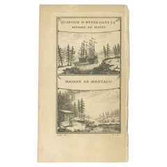
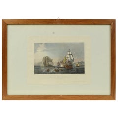
Antique Print of the Region of the Hayes river, Northern Manitoba, Canada, 1759
About the Item
Two images on one sheet titled 'Quartier d'Hyver dans la Riviere de Hayes' and 'Maison de Montagu'. The Dobbs Galley (William Moor) and California (Francis Smith) are depicted in their winter anchorage in the Hayes river on the west coast of Hudson Bay. Below it is a depiction of Montagu House. This print originates from 'Histoire generale des Voyages (..)' by A.F. Prévost.
Artists and Engravers: Published by Didot, Paris.
Whilst cartography holds a special place in our collection, we also offer thousands of antique prints covering fields of interest as diverse as architecture, natural history, religion, ethnology and many more. Antique prints have long been appreciated for both their aesthetic and investment value. They were the product of engraved, etched or lithographed plates. These plates were handmade out of wood or metal, which required an incredible level of skill, patience and craftsmanship. Whether you have a house with Victorian furniture or more contemporary decor an old engraving can enhance your living space. We offer a wide range of authentic antique prints for any budget.
- Dimensions:Height: 10.04 in (25.5 cm)Width: 7.29 in (18.5 cm)Depth: 0 in (0.01 mm)
- Materials and Techniques:
- Period:
- Date of Manufacture:1759
- Condition:Condition: Fair, some creasing and wear. Blank verso. Please study image carefully.
- Seller Location:Langweer, NL
- Reference Number:
About the Seller
5.0
Platinum Seller
These expertly vetted sellers are 1stDibs' most experienced sellers and are rated highest by our customers.
Established in 2009
1stDibs seller since 2017
1,929 sales on 1stDibs
Typical response time: <1 hour
- ShippingRetrieving quote...Ships From: Langweer, Netherlands
- Return PolicyA return for this item may be initiated within 14 days of delivery.
More From This SellerView All
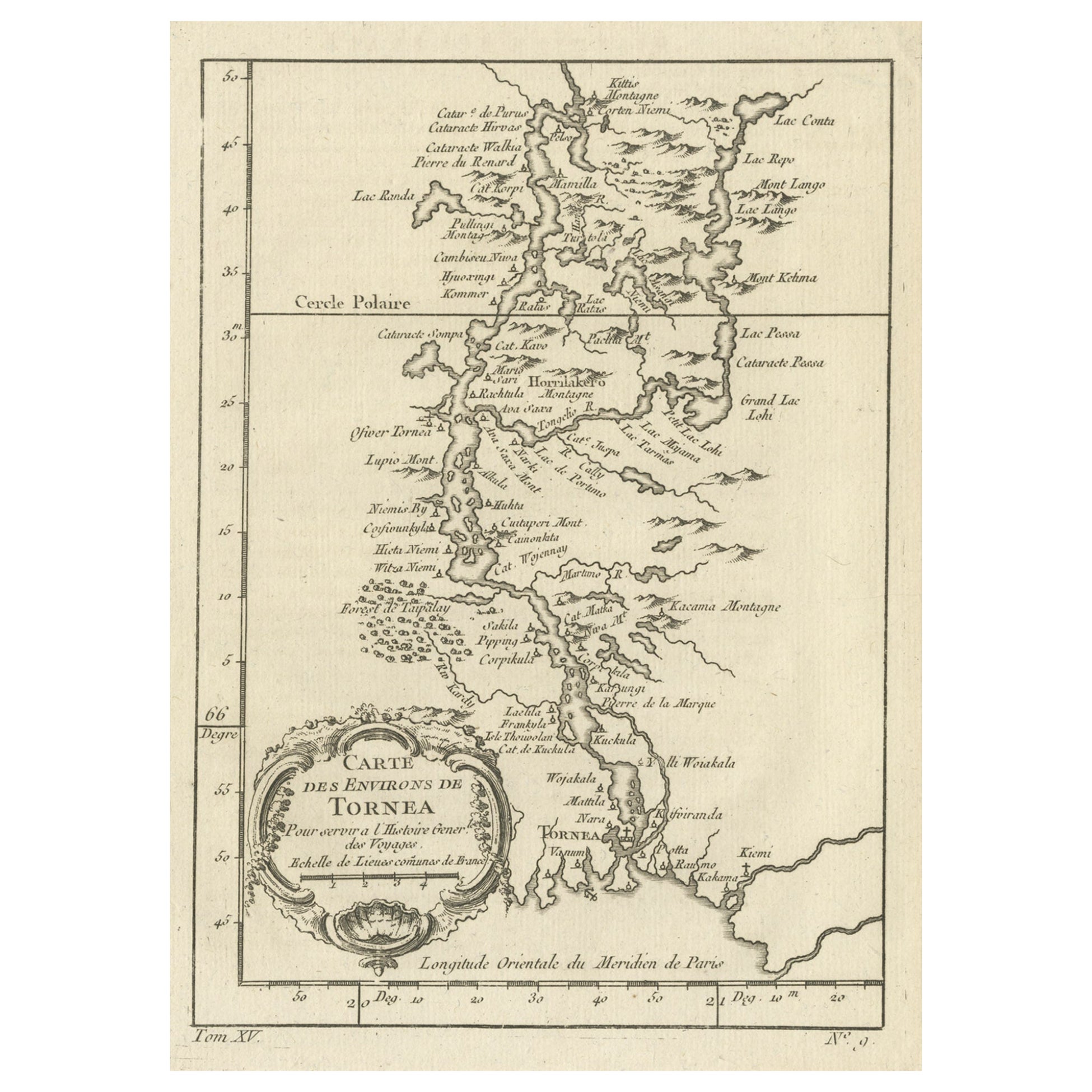
- Original Antique Map of the Region of Torneå 'Tornio' in Northern Finland, 1759Located in Langweer, NLAntique map titled 'Carte des Environs de Tornea'. Original antique map of the region of Torneå (or Tornio), in northern Finland. This print originates from volume 19 of 'Histoir...Category
Antique 1750s Maps
MaterialsPaper
- Antique Print of the Region of the Hayes River, C.1780Located in Langweer, NLThe piece is composed of two distinct illustrations on a single print. The upper artwork is titled "Winter Quarters in the Hayes River," which features two historical vessels, the Dobbs Galley under the command of William Moor and the California captained by Francis Smith...Category
Antique 18th Century Prints
MaterialsPaper
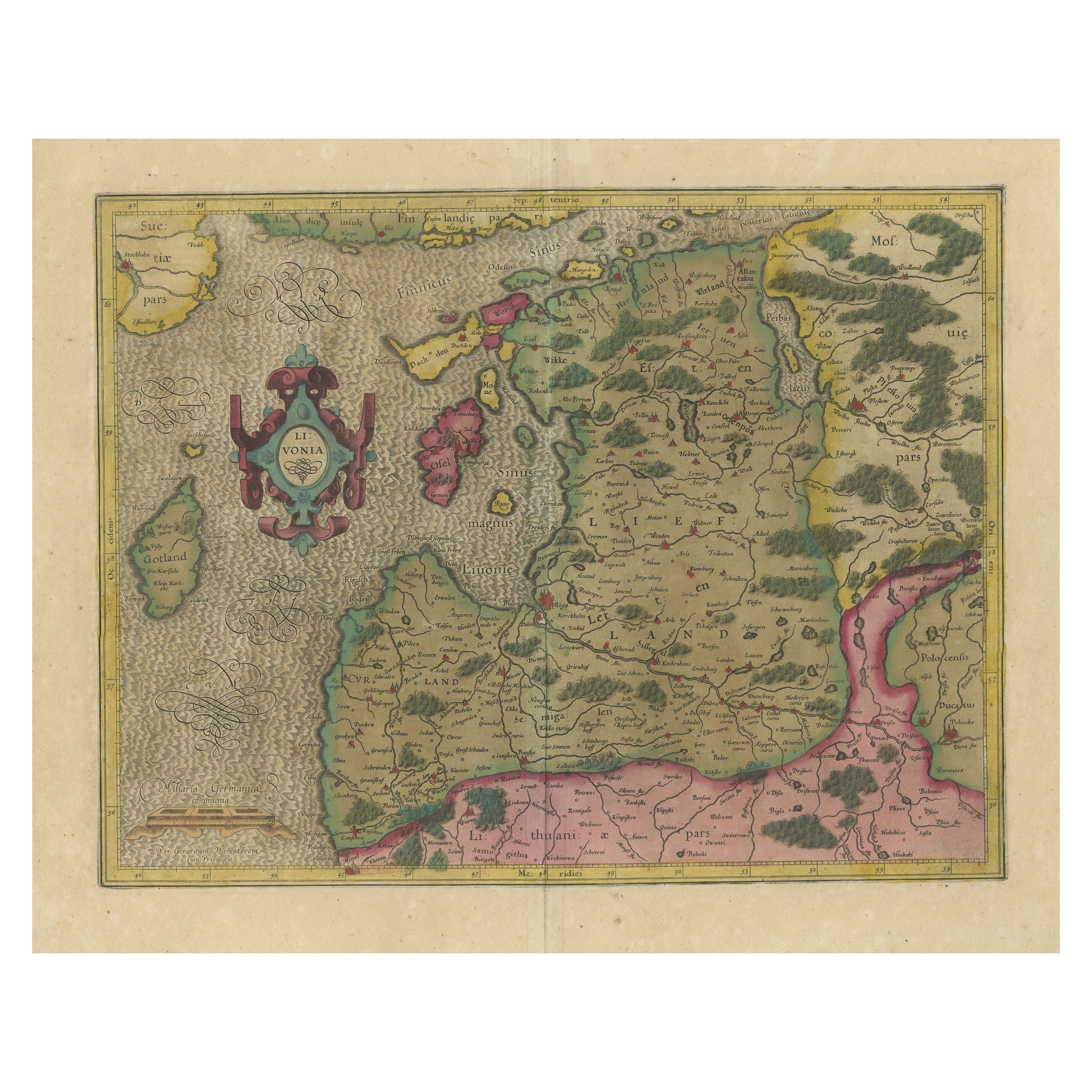
- Original Antique Map of the Northern Baltic RegionLocated in Langweer, NLTitle: "Livonia: Antique Map of the Northern Baltic Region" Description: This antique map, titled "Livonia," is a detailed representation of the northern Baltic region. Centered on ...Category
Antique Early 17th Century Maps
MaterialsPaper
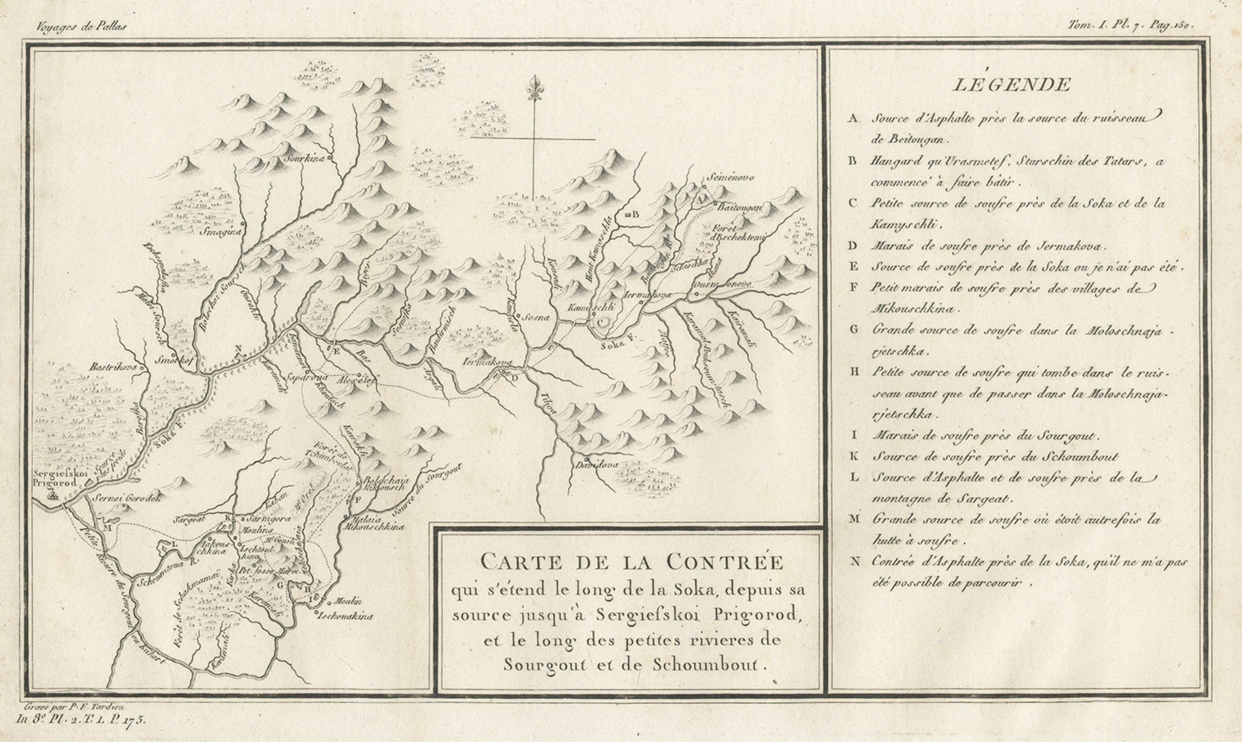
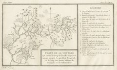
- Antique Map of the Region of the Sok River in Russia, 1794Located in Langweer, NLAntique map titled 'Carte de la Contrée qui s’étend le long de la Soka, depuis sa source jusquá Sergiefskoi Prigorod et le long des petites rivieres de Sourgout et de Schoumbout’. ...Category
Antique 18th Century Maps
MaterialsPaper
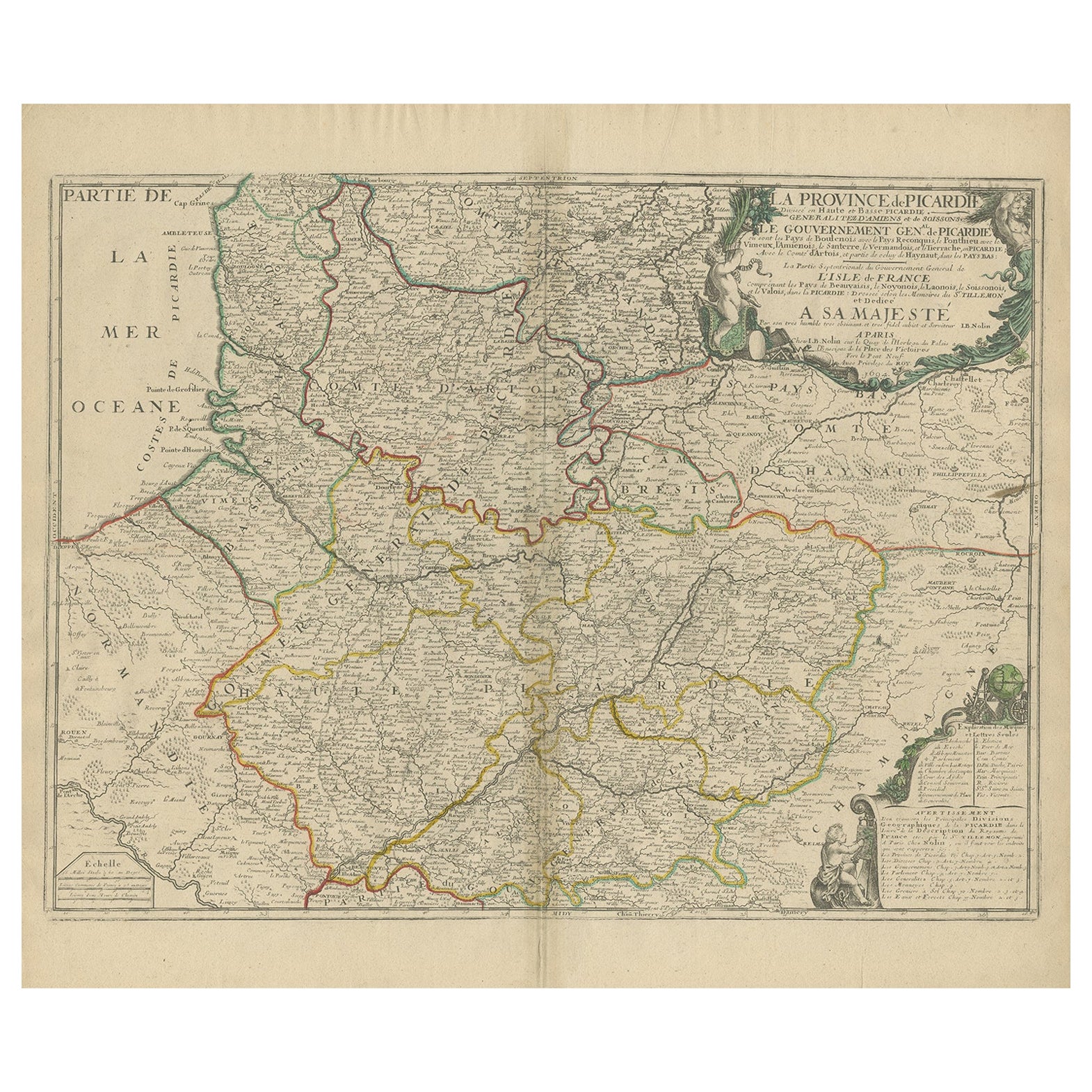
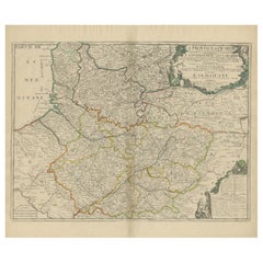
- Original Antique Map of the Picardy Region in Northern France, 1694Located in Langweer, NLAntique map titled 'La Province de Picardie (..)'. Large map of the Picardy region of France. Shows the cities of Beaumont, Mondidier, Lille and others. Artists and Engravers: Je...Category
Antique 17th Century Maps
MaterialsPaper
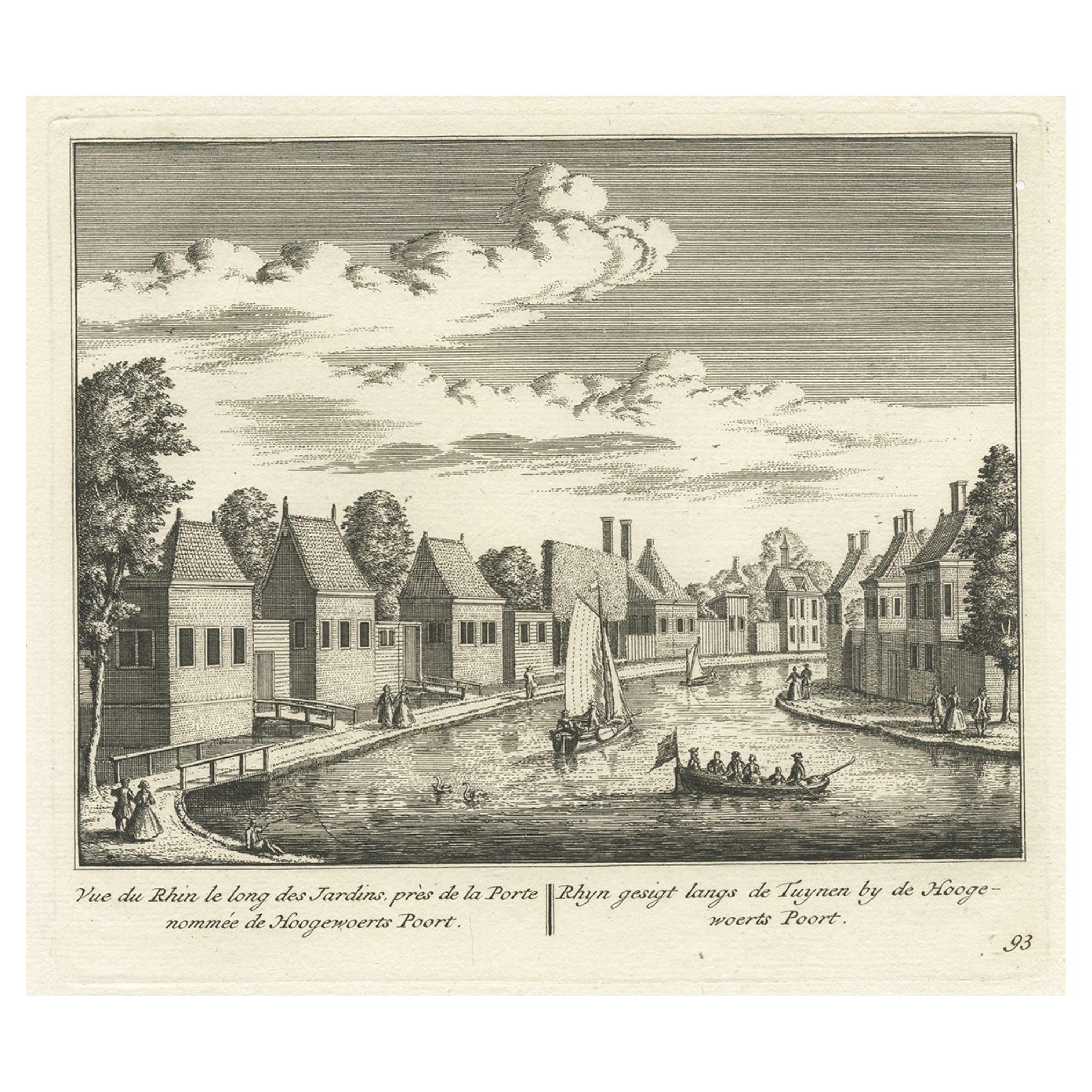
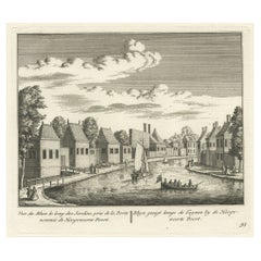
- Antique Print of the Rhine River, Leiden, The Netherlands, c.1800Located in Langweer, NLAntique print titled 'Rhyn gesigt langs de Tuynen by de Hoogewoerts Poort'. Old print depicting with a view on the Rhine river, the Netherlands. This print...Category
Antique 18th Century Prints
MaterialsPaper

You May Also Like
- Original Antique Map of Canada, Arrowsmith, 1820Located in St Annes, LancashireGreat map of Canada. Drawn under the direction of Arrowsmith. Copper-plate engraving. Published by Longman, Hurst, Rees, Orme and Brown, 1820 ...Category
Antique 1820s English Maps
MaterialsPaper
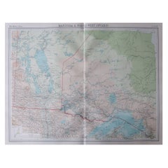
- Large Original Vintage Map of Manitoba, Canada, circa 1920Located in St Annes, LancashireGreat map of Manitoba and part of Ontario Unframed Original color By John Bartholomew and Co. Edinburgh Geographical Institute Published, circa 1920 Free shipping.Category
Vintage 1920s British Maps
MaterialsPaper
- Antique Lithographic Print of the Diamond Rock Battle Early 1900s, Oakwood FrameLocated in Milan, ITLithographic print of the diamond rock battle, the main port of the island of Martinique, taken from the book Historical Gallery of Versailles 112. Chacoane is the engraver. Original...Category
Early 20th Century French Nautical Objects
MaterialsPaper
- The Normandy Region of France: A 17th C. Hand-colored Map by Sanson and JaillotBy Nicolas SansonLocated in Alamo, CAThis large hand-colored map entitled "Le Duché et Gouvernement de Normandie divisée en Haute et Basse Normandie en divers Pays; et par evêchez, avec le Gouvernement General du Havre ...Category
Antique 1690s French Maps
MaterialsPaper
- 17th Century Hand Colored Map of the Liege Region in Belgium by VisscherBy Nicolaes Visscher IILocated in Alamo, CAAn original 17th century map entitled "Leodiensis Episcopatus in omnes Subjacentes Provincias distincté divisusVisscher, Leodiensis Episcopatus" by Nicolaes Visscher II, published in Amsterdam in 1688. The map is centered on Liege, Belgium, includes the area between Antwerp, Turnhout, Roermond, Cologne, Trier and Dinant. This attractive map is presented in a cream-colored mat measuring 30" wide x 27.5" high. There is a central fold, as issued. There is minimal spotting in the upper margin and a tiny spot in the right lower margin, which are under the mat. The map is otherwise in excellent condition. The Visscher family were one of the great cartographic families of the 17th century. Begun by Claes Jansz Visscher...Category
Antique Late 17th Century Dutch Maps
MaterialsPaper
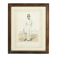
- Antique Cricket Print of Joseph Guy of NottinghamLocated in Oxfordshire, GBCricket print of Joseph Guy of Nottingham. A framed, tinted and hand colored lithographic portrait of the All- England cricketer Joseph Guy (1813 - 187...Category
Antique 1850s British Sporting Art Sports Equipment and Memorabilia
MaterialsPaper


Recently Viewed
View AllMore Ways To Browse
Antique Hudson River
Canada 18th Century
18th Century Canadian
Antique Moor
Antique Print California
Francis Smith
Francis Winter
18th Century Canadian Furniture
Prevost Paris
Antique Riviere
Long Riviere
Hudson Bay Furniture
Dan Smith
William Hayes
Victorian Riviere
Antique Hudson Bay
William Hayes Prints
Antique Furniture Manitoba