18th Century Maps
to
1,513
1,843
17
1,862
26
1
1
2,927
2,257
475
3
290
34
10
126
10
37
9
2
5
4
3
3
1,849
19
11
3
1
154
43
42
38
25
1,862
1,862
1,862
21
13
12
11
11
Period: 18th Century
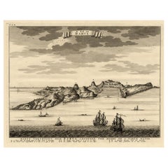
Nicely Colored Antique Print of Surat in India, 1751
Located in Langweer, NL
Antique print titled 'Vuë de Surate du côté de la Riviere'. View of Surat, a city in the state of Gujarat, India. This print originates from 'Histoire générale des voyages' by A. Pré...
Category
Antique 18th Century Maps
Materials
Paper
$340 Sale Price
20% Off
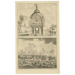
Rare Engraving of the Coast of Dabhol or Dabul, Ratnagiri, Maharashtra in India
Located in Langweer, NL
Antique print titled 'De Kust van Dabul'. Antique print depicting the coast of Dabhol / Dabul in India. This print originates from 'Oud en Nieuw Oost-Indiën' by F. Valentijn.
Artist...
Category
Antique 18th Century Maps
Materials
Paper
$604 Sale Price
20% Off
Antique Print of the Coromandel Coast in India, 1726
Located in Langweer, NL
Antique print depicting the Coromandel Coast, India. This print originates from 'Oud en Nieuw Oost-Indiën' by F. Valentijn.
Artists and Engravers: François Valentijn (1666-1727), a ...
Category
Antique 18th Century Maps
Materials
Paper
$359 Sale Price
20% Off
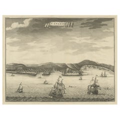
Antique Print of Kannur or Cananore with Ships, in Kerala, India, 1726
Located in Langweer, NL
Antique print India titled: 'Cananor'. Old print of a view of Kannur (or Cannanore), Kerala, India. From the monumental 'Oud en Nieuw Oost-Indiën ...
Category
Antique 18th Century Maps
Materials
Paper
$359 Sale Price
20% Off
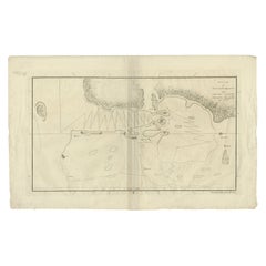
Original Antique Map of the Harbour of Tongatabu by Cook, 1784
Located in Langweer, NL
Antique map titled 'Sketch of Tongataboo Harbour (..)'. Antique map of the harbour of Tongatabu, one of the Tonga Islands. Originates from an edition of Cook's Voyages.
Artists an...
Category
Antique 18th Century Maps
Materials
Paper
$415 Sale Price
20% Off
Antique Print with Views of Cape Blanco on the Patagonia / Argentina Coast, 1749
Located in Langweer, NL
Antique print titled 'Kaap Blanco aan de kust van Patagonia (..)' and 'Kaap Blanco strekkende Zuid ten Westen.' Coastal views of Cape Blanco on the Patagonia / Argentina coast with t...
Category
Antique 18th Century Maps
Materials
Paper
$207 Sale Price
20% Off
Antique Print of a Waterfall in Lincoln Province, C.1785
Located in Langweer, NL
Antique print titled 'Nouvelles Eaux de Belton au Lord Tyrconnel province de Lincoln'. Copper engraving showing a waterfall. This print originates from 'Jardins Anglo-Chinois à la Mo...
Category
Antique 18th Century Maps
Materials
Paper
$264 Sale Price
20% Off
Original Antique Engraving of the Cave of Saint-Leu in France, C.1785
Located in Langweer, NL
Antique print titled 'Vue étant vers la droitte dans l'intérieur de la Grotte de St. Leu'. Copper engraving showing the cave, park and garden of Saint-Leu. This print originates from...
Category
Antique 18th Century Maps
Materials
Paper
Antique Engraving of West Wycombe Park and Windsor Park in England, ca.1785
Located in Langweer, NL
Antique print titled 'Cascade de Westwycob au chevalier Dashwood - Grotte du Parc de Windsor'. Copper engraving showing the waterfall of West Wycombe park and the cabe of Windsor Par...
Category
Antique 18th Century Maps
Materials
Paper
$330 Sale Price
9% Off
Antique Print of Amsterdam and St. Paul Island, 1753
Located in Langweer, NL
Antique print titled 'Isle d'Amsterdam, Isle St. Paul'. Two images on one sheet depicting Amsterdam and St. Paul island. The Dutch captain Anthonie van Diemen named it island Nieuw Amsterdam...
Category
Antique 18th Century Maps
Materials
Paper
Antique Print of the King of Barsalli & the Yamyamakunda Factory, Gambia, C1730
Located in Langweer, NL
Old Engraving with Title: Bumey Haman Seaka, King of Barsalli on the Gambia // plan of Yamyamakunda Factory on ye Gambia.
Artist/engraver/cartographer: ...
Category
Antique 18th Century Maps
Materials
Paper
$226 Sale Price
20% Off
Antique Print of the Village of Tienhoven by Spilman, C.1750
Located in Langweer, NL
Antique print titled 'Het Huis te Herlaar en het Dorp Tienhoven langs de Lek te zien'. View of the village of Tienhoven, the Netherlands. This print originates from 'Het verheerlykt ...
Category
Antique 18th Century Maps
Materials
Paper
Antique Print of the Town and Fortress of Ternate by Renneville, 1725
Located in Langweer, NL
Antique print Ternate titled 'La Ville et la Fort de Gamma lamma dans l'isle de Ternade lequel Fort apartient aux Espagnols'. Antique print of the town and fortress of the island of Ternate. Originates from 'Recueil des voyages qui ont servi à l’établissement et aux progrès de la compagnie des Indes orientales...
Category
Antique 18th Century Maps
Materials
Paper
Antique Print of a Section of Stratton Park, Hampshire, England, c.1770
Located in Langweer, NL
Antique print titled 'Section of Stratton Park'. Section of Stratton Park, Hampshire.
This print originates from 'Vitruvius Britannicus' by Colen Campbell. Artists and Engravers:...
Category
Antique 18th Century Maps
Materials
Paper
$340 Sale Price
20% Off
Antique Map of the Achtkarspelen township, Friesland, The Netherlands, 1718
Located in Langweer, NL
Antique map Friesland titled 'Achtkarspelen, de sesde Grietenije van Ooster-Goo (..)'. Old map of Friesland, the Netherlands. This map depicts the region of Achtkarspelen and include...
Category
Antique 18th Century Maps
Materials
Paper
$359 Sale Price
20% Off
Antique Map of the Region of Kennemerland and Eems by Halma, 1718
Located in Langweer, NL
Antique map Friesland titled 'Descriptio Frisiae Liberae (..)'. Old map of Friesland, the Netherlands. This map depicts the region between Kennemerland and Eems. Originates from 'Uit...
Category
Antique 18th Century Maps
Materials
Paper
$221 Sale Price
20% Off
Antique Map of the Region of Kennemerland and Eems by Halma, 1718
Located in Langweer, NL
Antique map Friesland titled 'Descriptio Frisiae Liberae (..)'. Old map of Friesland, the Netherlands. This map depicts the region between Kennemerland and Eems. Originates from 'Uit...
Category
Antique 18th Century Maps
Materials
Paper
$240 Sale Price
20% Off
Antique Map of the Region of Hainaut and Cambrésis by Reinhardt, c.1784
Located in Langweer, NL
Antique map titled 'Theatre de la Guerre ou Carte Topographique tres exacte des Pais-Bas (..)'. Detailed map showing the county of Hainaut and Cambrésis, France. Inludes the cities o...
Category
Antique 18th Century Maps
Materials
Paper
$321 Sale Price
20% Off
Antique Map of the Region of Mühlberg by Schreiber, 1749
Located in Langweer, NL
Antique map titled 'Das Amt Muhlberg'. Map of the region of Mühlberg, Germany. This map originates from 'Atlas Selectus von allen Konigreichen und Landern de...
Category
Antique 18th Century Maps
Materials
Paper
$87 Sale Price
20% Off
Antique Map of the Region of Dauphiné by Zatta, 1779
Located in Langweer, NL
Antique map titled 'Li Governi del Delfinato e di Provenza la Contea Venaissin ed il Princie d'Orange'. Old map of France showing the province of Dauphiné. This map originates from '...
Category
Antique 18th Century Maps
Materials
Paper
Antique Map of the Region of Gaasterland, Friesland, The Netherlands, 1791
Located in Langweer, NL
Antique map titled 'Der Provinz Westergo zwey südliche Grietenyen mit dem Gaasterland und der Stadt Staveren, Sloten, Workum, Ylst und Hindelopen'. Map of the region of Gaasterland, ...
Category
Antique 18th Century Maps
Materials
Paper
Antique Map of the Region of Meissen by Schreiber, 1749
Located in Langweer, NL
Antique map titled 'Der Ertz-Gebürgische Creis in Meissen (..)'. Map of the region of Meissen, Germany. This map originates from 'Atlas Selectus von allen Ko...
Category
Antique 18th Century Maps
Materials
Paper
$87 Sale Price
20% Off
Antique Map of the Region of Batavia by Conrade, 1782
Located in Langweer, NL
Antique map titled 'Carte des environs de Batavia.' (Map of Batavia and its surroundings.) Map of the Batavia area (Jakarta) in Indonesia. With cartouche, scale and compass rose. Thi...
Category
Antique 18th Century Maps
Materials
Paper
$297 Sale Price
20% Off
Antique Map of the Region of Grossenhain by Schreiber, 1749
Located in Langweer, NL
Antique map titled 'Das Amt Grossen-Hayn mit Zabeltitz'. Map of the region of Großenhain, Germany. This map originates from 'Atlas Selectus von allen Konigre...
Category
Antique 18th Century Maps
Materials
Paper
$87 Sale Price
20% Off
Antique Map of the Region of Franeker and Harlingen by Von Reilly, 1791
Located in Langweer, NL
Antique map titled 'Der Provinz Westergo vier nördliche Grietenyen mit der Stadt Franeker und Harlingen'. Map of the region of Franeker and Harlingen, Friesland, the Netherlands. Thi...
Category
Antique 18th Century Maps
Materials
Paper
$149 Sale Price
20% Off
Antique Map of the Region of Mansfeld by Schreiber, 1749
Located in Langweer, NL
Antique map titled 'Die Grafschafft Mannsfeld (..)'. Map of the region of Mansfeld, Germany. This map originates from 'Atlas Selectus von allen Konigreichen und Landern der Welt' by ...
Category
Antique 18th Century Maps
Materials
Paper
$87 Sale Price
20% Off
Antique Map of the Region of Hohenstein by Schreiber, 1749
Located in Langweer, NL
Antique map titled 'Aemter Stolpen, Hohenstein mit Lohmen'. Map of the region of Hohenstein, Germany. This map originates from 'Atlas Selectus von allen Konigreichen und Landern der ...
Category
Antique 18th Century Maps
Materials
Paper
$87 Sale Price
20% Off
Antique Map of the Region of Beauvais in France, 1737
Located in Langweer, NL
Untitled map of the region of Beauvais, France. This map originates from 'Nieuw en beknopt Kaart-Boekje vertoonende de XVII. Nederlandse Provintien (..)'.
Artists and Engravers: Au...
Category
Antique 18th Century Maps
Materials
Paper
Antique Map of the Region of Annaburg by Schreiber, 1749
By Schreiber
Located in Langweer, NL
Antique map titled 'Die Aemter Annaburg, Schweinitz (..)'. Map of the region of Annaburg, Germany. This map originates from 'Atlas Selectus von allen Konigreichen und Landern der Wel...
Category
Antique 18th Century Maps
Materials
Paper
$87 Sale Price
20% Off
Antique Map of the Region of Weißenfels by Schreiber, 1749
By Schreiber
Located in Langweer, NL
Antique map titled 'Das Amt Weissenfels (..)'. Map of the region of Weißenfels, Germany. This map originates from 'Atlas Selectus von allen Konigreichen und Landern der Welt' by Joha...
Category
Antique 18th Century Maps
Materials
Paper
$87 Sale Price
20% Off
Antique Map of the Province of Quey-Chew by Du Halde, 1738
Located in Langweer, NL
Antique map titled 'Province XV Quey-Chew drawn on the spot by the Peres Fridelli and Regis in the year 1716'. Old map of the Chinese province Quey-Chew. Originates from the Edward C...
Category
Antique 18th Century Maps
Materials
Paper
$244 Sale Price
20% Off
Antique Map of the Schoterland Township, Friesland by Halma, 1718
Located in Langweer, NL
Antique map Friesland titled 'Schooterlandt de Vijfde Grietenije van de Sevenwolden (..)'. Old map of Friesland, the Netherlands. This map depicts the region of Schoterland and inclu...
Category
Antique 18th Century Maps
Materials
Paper
$316 Sale Price
20% Off
Antique Map of the Province of Quang-Si by Du Halde, 1738
Located in Langweer, NL
Antique map titled 'Province XIII Quang-Si. Drawn on the spot by ye Peres de Tartre & Cordoso in the year 1714'. Old map of the Chinese province Quang-Si. Originates from the Edward ...
Category
Antique 18th Century Maps
Materials
Paper
$244 Sale Price
20% Off
Antique Map of the Region of Bolsward and Sneek by Von Reilly, 1791
Located in Langweer, NL
Antique map titled 'Der Provinz Westergo drey mittlere Grietenyen mit der Stadt Bolsward und Sneek'. Map of the region of Bolsward and Sneek, Friesland, the Netherlands. This map org...
Category
Antique 18th Century Maps
Materials
Paper
$144 Sale Price
20% Off
Antique Map of the Region Between the Caspian and the Sea of China by Toms, 1799
Located in Langweer, NL
Antique map titled 'Scythia et Serica'. Old map of the region between the Caspian and the Sea of China. Originates from 'Geographia Antiqua (..)'.
Artists and Engravers: Engraved ...
Category
Antique 18th Century Maps
Materials
Paper
$131 Sale Price
20% Off
Antique Map of the Province of Overijssel by Keizer & De Lat, 1788
Located in Langweer, NL
Antique map titled 'Seigneurie d'Over-Ysel'. Uncommon antique map of the province of Overijssel, the Netherlands. This map originates from 'Nieuwe Natuur- Geschied- en Handelkundige ...
Category
Antique 18th Century Maps
Materials
Paper
Antique Map of the Rauwerderhem Township, Friesland by Halma, 1718
Located in Langweer, NL
Antique map Friesland titled 'Rauwerderhem de Elfde Grietenije van Ooster Goo (..)'. Old map of Friesland, the Netherlands. This map depicts the region of Rauwerderhem and includes c...
Category
Antique 18th Century Maps
Materials
Paper
$311 Sale Price
20% Off
Antique Map of the Region of Bolsward and Sneek by Von Reilly, 1791
Located in Langweer, NL
Antique map titled 'Der Provinz Westergo drey mittlere Grietenyen mit der Stadt Bolsward und Sneek'. Map of the region of Bolsward and Sneek, Friesland, the Netherlands. This map org...
Category
Antique 18th Century Maps
Materials
Paper
$149 Sale Price
20% Off
Antique Map of the Region of Schwarzburg by Schreiber, 1749
By Schreiber
Located in Langweer, NL
Antique map titled 'Die Südliche Fürstenthum Schwartzburg (..)'. Map of the region of Schwarzburg, Germany. This map originates from 'Atlas Selectus von allen Konigreichen und Lander...
Category
Antique 18th Century Maps
Materials
Paper
$87 Sale Price
20% Off
Antique Map of the Region Between the Black and Caspian Sea by Cellarius, 1731
Located in Langweer, NL
Antique map titled 'Bosporus, Maeotis, Iberia, Albania, et Sarmatia Asiatica.' Map of the region between the Black and Caspian Seas in early Sarmatian time...
Category
Antique 18th Century Maps
Materials
Paper
$165 Sale Price
20% Off
Antique Map of the Region of Plauen by Schreiber '1749'
By Schreiber
Located in Langweer, NL
Antique map titled 'Die Aemter Plauen und Pausa (..)'. Map of the region of Plauen, Germany. This map originates from 'Atlas Selectus von allen Konigreichen und Landern der Welt' by ...
Category
Antique 18th Century Maps
Materials
Paper
$87 Sale Price
20% Off
Antique Map of the South-Western Coast of Sumatra by De la Haye, c.1780
Located in Langweer, NL
Antique map titled 'Carte de la Côte Occidentale de l'Isle Sumatra'. Sea chart of the part of the south-western coast of Sumatra with the Nassau (Nias) and Fortune isles.
Artists ...
Category
Antique 18th Century Maps
Materials
Paper
$382 Sale Price
20% Off
Antique Map of the Province of Zeeland by Keizer & De Lat, 1788
Located in Langweer, NL
Antique map titled 'Comitatus Zelandiae'. Uncommon antique map of the province of Zeeland, the Netherlands. This map originates from 'Nieuwe Natuur- Geschied- en Handelkundige Zak- e...
Category
Antique 18th Century Maps
Materials
Paper
Antique Map of the Region of Voigtsberg by Schreiber, 1749
By Schreiber
Located in Langweer, NL
Antique map titled 'Das Amt Voigtsberg (..)'. Map of the region of Voigtsberg, Germany. This map originates from 'Atlas Selectus von allen Konigreichen und Landern der Welt' by Johan...
Category
Antique 18th Century Maps
Materials
Paper
$87 Sale Price
20% Off
Antique Map of the Dongeradeel Township in Friesland, The Netherlands, 1718
Located in Langweer, NL
Antique map Friesland titled 'Donger Deel West Zyde der Pasens (..)'. Old map of Friesland, the Netherlands. This map depicts the region of Dongeradeel and includes cities and villag...
Category
Antique 18th Century Maps
Materials
Paper
Antique Map of the Coromandel Peninsula, 1754
Located in Langweer, NL
Antique map titled 'A map of Coromandel shewing the Seat of War on that coast'. Rare map of Coromandel printed for the London Magazine.
Artists and Engr...
Category
Antique 18th Century Maps
Materials
Paper
$112 Sale Price
20% Off
Antique Map of the City of Ypres by Beaulieu, 1729
Located in Langweer, NL
Antique map titled 'Plan de la Ville d'Ipren/Plan der Stadt Ipren'. Map of the city of Ieper/Ypres in Belgium. This map originates from 'Histoire Militaire du Prince Eugene de Savoye...
Category
Antique 18th Century Maps
Materials
Paper
$210 Sale Price
20% Off
Antique Map of the Coast of Guinea, Africa, c.1780
Located in Langweer, NL
Antique map Africa titled 'Carte de la Haute et de la Basse Guinée'. Map of the Coast of Guinea, Africa. Represents modern day Liberia, Ivory Coast, Ghana, Nigeria, Cameroon, Gabon, Congo, and Equatorial Guinea...
Category
Antique 18th Century Maps
Materials
Paper
$150 Sale Price
20% Off
Antique Map of the City of Leeuwarden by Harrewijn, 1743
Located in Langweer, NL
Antique map titled 'La Ville de Lewarde'. Old map of the city of Leeuwarden, Friesland. Originates from 'Les Délices des Pays-Bas' by Widow Foppens.
Artists and Engravers: Engrav...
Category
Antique 18th Century Maps
Materials
Paper
$116 Sale Price
20% Off
Antique Map of the Coast of Juan Fernandez by Van Schley, 1757
Located in Langweer, NL
Antique map titled 'Cote du Nord Est de l'Isle de Juan Fernandez (..).' Map of the Chilean South Pacific archipelago of the Juan Fernandez Islands. This island was made famous by Dan...
Category
Antique 18th Century Maps
Materials
Paper
$135 Sale Price
20% Off
Antique Map of the Dongeradeel Township 'Friesland' by Halma, 1718
Located in Langweer, NL
Antique map Friesland titled 'Donger Deel West Zyde der Pasens (..)'. Old map of Friesland, the Netherlands. This map depicts the region of Dongeradeel and includes cities and villag...
Category
Antique 18th Century Maps
Materials
Paper
$361 Sale Price
20% Off
The Cape Verde Islands Coast Antique Engraving by Van Schley, 1747
Located in Langweer, NL
Antique map titled ‘Carte Exacte de la cote du Cap Verd (..) - Naauwkeurige Kaart van de Kust van Kabo Verde (..)'. Original antique map of the coast of the Cape Verde Islands. This ...
Category
Antique 18th Century Maps
Materials
Paper
$99 Sale Price
20% Off
Antique Map of the Danube River and Surroundings by Homann Heirs, c.1730
By Homann Heirs
Located in Langweer, NL
Antique map titled 'Danubii Fluminus (a fontibus prope Doneschingam usq Posonium urbem defignati) Pars Superior, in qua Suevia, Bavaria, Asutria, Stiria, Carinthia, Carniola, Tyrolis...
Category
Antique 18th Century Maps
Materials
Paper
$396 Sale Price
20% Off
Antique Map of the Ooststellingwerf Township Friesland by Halma, 1718
Located in Langweer, NL
Antique map titled 'Stellingwerf Oost-Eynde, de negende Grietenije van de Sevenwolden'. This regional map of the Oost Stellingwerf Grietenij, part of the Province of Friesland, The N...
Category
Antique 18th Century Maps
Materials
Paper
$396 Sale Price
20% Off
Antique Map of the German Empire by De Leth, 1749
Located in Langweer, NL
Antique map Germany titled 'L'Empire d'Allemagne divisé en ses dix cercles et Autres Estats'. Detailed map of the German Empire divided in the ten ...
Category
Antique 18th Century Maps
Materials
Paper
$158 Sale Price
20% Off
Antique Map of the Malabar Coast by Baldaeus, 1744
Located in Langweer, NL
Antique map titled 'Descriptio Nova Imperii Malabar (..).' Nice map of the Malabar Coast. This map was published in 'The True and Exact Description of th...
Category
Antique 18th Century Maps
Materials
Paper
$328 Sale Price
20% Off
Antique Map of the City of Woerden by Tirion, c.1750
Located in Langweer, NL
Antique map titled 'Nieuwe Grondtekening van de Stad Woerden'. Plan of the city of Woerden, the Netherlands. Published circa 1750.
Artists and Engravers: Published by I. Tirion. ...
Category
Antique 18th Century Maps
Materials
Paper
$118 Sale Price
20% Off
Antique Map of the Franekeradeel Township 'Friesland' by Halma, 1718
Located in Langweer, NL
Antique map Friesland titled 'De Grietenije van Franeker Deel (..) '. Old map of Friesland, the Netherlands. This map depicts the region of Franekeradeel and includes cities and vill...
Category
Antique 18th Century Maps
Materials
Paper
$248 Sale Price
20% Off
Antique Map of the City of Enkhuizen by Tirion, 1743
Located in Langweer, NL
Antique map titled ?Grondtekening der Stad Enkhuisen?. Beautiful map of the City of Enkhuizen. With Dutch legend. Decorated with compass rose, several ships and the city-arms. Artist...
Category
Antique 18th Century Maps
Materials
Paper
$141 Sale Price
20% Off
Antique Map of the Circle of Bavaria by Vaugondy, 1757
Located in Langweer, NL
Antique map titled 'Le Cercle de Baviere (..)'. Map of the Circle of Bavaria, Germany. Extends from Bamberg to Innsbruck. This map originates from 'Atlas Universel (..)'. Artists and Engravers: Gilles Robert de Vaugondy (1688 - 1766), also known as Le Sieur or Monsieur Robert, and his son, Didier Robert de Vaugondy (c.1723 - 1786), were leading mapmakers in France during the 18th century. In 1757, they published The Atlas Universel, one of the most important atlases of the 18th century. To produce the atlas, the Vaugondys integrated older sources with more modern surveyed maps...
Category
Antique 18th Century Maps
Materials
Paper
$188 Sale Price
20% Off

