18th Century Maps
to
1,522
1,846
36
1,884
26
1
1
2,975
2,238
473
3
288
34
9
126
8
36
9
2
5
4
3
2
1,871
19
11
3
1
158
41
41
40
24
1,884
1,884
1,884
24
16
13
12
12
Period: 18th Century
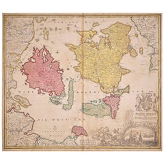
Hand-Colored 18th Century Homann Map of Denmark and Islands in the Baltic Sea
Located in Alamo, CA
An 18th century copper plate hand-colored map entitled "Insulae Danicae in Mari Balthico Sitae utpote Zeelandia, Fionia, Langelandia, Lalandia, Falstria, Fembria Mona" created by Joh...
Category
German Antique 18th Century Maps
Materials
Paper
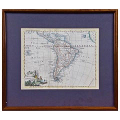
South America: Hand-colored 18th Century Framed Map by Thomas Jefferys
Located in Alamo, CA
This detailed hand-colored map of South America by Thomas Jefferys was published in London in 1750. The map shows countries, early colonial possessions, towns, rivers, mountains, and...
Category
English Antique 18th Century Maps
Materials
Paper
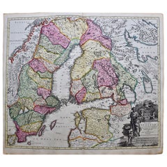
Scandinavia & Portions of Eastern Europe: 18th Century Hand-Colored Homann Map
Located in Alamo, CA
An early 18th century hand-colored copper-plate map entitled "Regni Sueciae in omnes suas Subjacentes Provincias accurate divisi Tabula Generalis" by Johann Baptist Homann (1663-1724...
Category
German Antique 18th Century Maps
Materials
Paper
England, Scotland & Ireland: A Hand Colored Map of Great Britain by Tirion
By Isaak Tirion
Located in Alamo, CA
This is a hand-colored double page copperplate map of Great Britain entitled "Nieuwe Kaart van de Eilanden van Groot Brittannien Behelzende de Kon...
Category
Dutch Antique 18th Century Maps
Materials
Paper
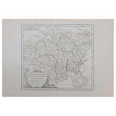
1762 Berri, Nivernois Bourbonois, Lyonois, Bourgogine, Bresse, et, Franche - Com
Located in Norton, MA
1762 Vaugondy map, entitled
"Berrl Nivernois Bourbonois Lyonois, Bourgone, Bresse, Et Franche-Comte,"
Ric.b003
About this Item
A fine Copperplate Engraving with original han...
Category
Unknown Antique 18th Century Maps
Materials
Paper
1714 Henri Chatelain "Nouvelle Carte Des Etatas Du Grand.Duc De Mos Moscovie Eur
Located in Norton, MA
A 1714 Henri Chatelain map, entitled
"Nouvelle Carte Des Etatas Du Grand Duc De Moscovie En Europe,"
Ricb001
Henri Abraham Chatelain (1684-1743) was a Huguenot pastor of Parisi...
Category
Dutch Antique 18th Century Maps
Materials
Paper
Matthaus Seutter, Framed 1730 Color Engraving Map of "Belgium Fonderatum"
Located in Bridgeport, CT
Label on verso. From Grosser Atlas. The name Belgium comes from the ancient designation "Gallis Belgica". Figural decoration upper left. M. Seutter was a famed German mapmaker in the...
Category
European Renaissance Antique 18th Century Maps
Materials
Brass
Framed 1731 Color Engraving, Map of Rotterdam by Matthaus Seutter, "Roterodami"
Located in Bridgeport, CT
"Roterodami". Seutter (1678-1757) was an important German 18th century map maker. Bird's eye view of the city above with full details, neoclassi...
Category
European Renaissance Antique 18th Century Maps
Materials
Glass, Wood, Paper
Map Lancashire 1793 John Cary engraver 37cm 14 1/2" high
Located in BUNGAY, SUFFOLK
Map of Lancashire by John Cary engraver
published 1st Jan 1793 by J Cary Engraver & Mapseller Strand
in original black and gold classic map frame
Category
English Georgian Antique 18th Century Maps
Materials
Paper
18th Century French Map and City View of Joppe/Jaffa 'Tel Aviv' by Sanson
Located in Alamo, CA
An original antique engraving entitled "Joppe; in ’t Hebreeusch by ouds Japho; hedendaags Japha, of Jaffa; volgens d’aftekening gedaan 1668", by Nicholas Sanson d'Abbeville (1600 - 1667). This is a view of the city of Joppe (in Hebrew Japho), now called Japha or Jaffa, the harbor portion of modern day Tel Aviv, Israel as it appeared in 1668 . It depicts a very busy harbor with numerous boats. A large ship on the left appears to be firing its canons and a small ship on the right appears to be sitting very low in the water, either heavily loaded with cargo or sinking. The town is seen on the far shore with a fortress on a hill across in the background. The map is printed from the original Sanson copperplate and was published in 1709 by his descendants.
The map is presented in an ornate brown wood frame embellished by gold-colored leaves and gold inner trim with a double mat; the outer mat is cream-colored and the inner mat is black. There is a central vertical fold, as issued. There are two small spots in the lower margin and one in the upper margin, as well as two tiny spots adjacent to the central fold. 1717 is written below the date 1668 in the inscription. The map is otherwise in very good condition.
Another map of the "Holy Land" (by Claes Visscher in 1663), with an identical style frame and mat is available. This pair of maps would make a wonderful display grouping. Please see Reference #LU5206220653552. A discount is available for the purchase of the pair of maps.
Artist: Nicholas Sanson d'Abbeville (1600-1667) and his descendents were important French cartographer's active through the 17th century. Sanson started his career as a historian and initially utilized cartography to illustrate his historical treatises. His maps came to the attention of Cardinal Richelieu and then King Louis XIII of France, who became a supporter and sponsor. He subsequently appointed Sanson 'Geographe Ordinaire du Roi' the official map maker to the king. Sanson not only created maps for the king, but advised him on geographical issues and curated his map collection...
Category
French Antique 18th Century Maps
Materials
Paper
Amsterdam city plan - Joost van Sassen
Located in UTRECHT, UT
“Afbeeldinge der Stad Amsterdam, gelyk deselve in den jaren 1536 door Cornelis Antonisz na ’t leven is geschildert, en Ao 1544 in druk uytgegeven.”, engraved by Joost van Sassen and ...
Category
Dutch Other Antique 18th Century Maps
Materials
Paper
Essex John Cary 1787 Cary's New & Correct English Atlas 40cm 16" long gilt frame
By John Cary
Located in BUNGAY, SUFFOLK
Map of Essex by John Cary Engraver
London published as the act directs Sept 1st 1787 by J Cary Engraver Map & Printseller no 188 the corner of Arundel Str...
Category
English Georgian Antique 18th Century Maps
Materials
Paper
Colossal Terrestrian Globe Hand Painted, French, First Half of the 18th Century
Located in Saint-Ouen, FR
Colossal Terrestrian globe hand painted, French, first half of the 18th century.
Mounted in a 19th century pedestal wood.
Category
French Antique 18th Century Maps
Materials
Beech
Geographical Antique Map of Principality of Monaco
Located in Alessandria, Piemonte
ST/609 - Interesting antique color map of Monaco Principality in French language : "Carte qui contient le Principauté de Piémont, le Monferrat et la comté de...
Category
Italian Other Antique 18th Century Maps
Materials
Paper
Map Bedfordshire General Framed
Located in BUNGAY, SUFFOLK
A general map of Bedfordshire with its hundreds
A scale of 5 miles
in the original green mount and traditional black and gold frame. Measures: 36cm 14" high.
Category
English Georgian Antique 18th Century Maps
Materials
Paper
Map North Wales Robert Marsden Anglesey
Located in BUNGAY, SUFFOLK
Map of North Wales by Robert Marsden
Including Anglesey
Charming topography and detail and colouring
just purchased more information to follow.
Category
English Georgian Antique 18th Century Maps
Materials
Paper
Map Jersey Guernsey Scilly Islands Alderney
Located in BUNGAY, SUFFOLK
Rare map of The Islands of Guernsey and Jersey, including Alderney & the Scilly Islands
just purchased more information to follow
In the original cream mount and gilded frame.
Category
English Georgian Antique 18th Century Maps
Materials
Paper
Map Kyle Carrick Aireshire Thomas Kitchen 1749
Located in BUNGAY, SUFFOLK
A Map of Kyle & Carrick Aireshire Thomas Kitchen 1749
In original black and gold frame
Just purchased more information to follow
MAKER Thomas Kitchin (1718-1784) English engrave...
Category
English Georgian Antique 18th Century Maps
Materials
Paper
Map Shropshire Joseph Ellis Robert Sayer Carington Bowles Framed
Located in BUNGAY, SUFFOLK
A modern map of Shropshire Drawn from the latest surveys corrected and improved by the best authorities.
Artist Joseph Ellis sculptor.
Joseph Ellis was an engraver and publisher from Clerkenwell in London and was apprenticed to Richard William Seale in 1749. He is best know to county map collectors for The New English Atlas published in 1765 which was later reissued as Ellis's English Atlas in 1766, 1768 1777, 1786, 1790 and 1796.
Maker carington bowles 1724 - 1793.
Carington Bowles worked in London as a publisher in partnership with his father John Bowles from about 1752 until 1763. Carington Bowles worked as a publisher in partnership with his father John Bowles from about 1752 until 1763 before taking over his uncle's business. His address was 69 St. Pauls Church Yard, London. He worked with a number of well known cartographers of the day including Emanuel Bowen, Thomas Kitchin, Robert Sayer...
Category
English Georgian Antique 18th Century Maps
Materials
Paper
Map Bedfordshire No 3 General Framed
Located in BUNGAY, SUFFOLK
A general map of Bedfordshire with its hundreds. Measure: 37cm 14 1/2" high
A scale of 5 miles.
in the original green mount and traditional black and gold frame.
charming map with...
Category
English Georgian Antique 18th Century Maps
Materials
Paper
Map Southern Scotland Thomas Conder Alex Hogg 1795
Located in BUNGAY, SUFFOLK
A new map of the southern part of Scotland containing the counties of Stirling, Lanerk, Renfrew, Linlithgow, Edinburgh, Peebles, Haddingtoun, Berwick, Selkirk, Roxburgh, Dumfries, Wigtoun, Kirkudbright & Air
Published by Alex Hogg at the Kings Arms...
Category
English Georgian Antique 18th Century Maps
Materials
Paper
Map Turkey in Europe & Hungary Thomas Kitchin, 1783
Located in BUNGAY, SUFFOLK
Thomas Kitchen (1718 - 1784) : Map of Turkey in Europe & Hungary 1783
Visible sheet within the cream mount 25.5cm., 10" height 20cm., 8"
In an ebonised frame length 33cm. 13", height 28cm., 11"
Kitchin, Thomas (1718 - 1784)
Thomas Kitchin (August 4, 1718 – June 23, 1784) was a London based engraver, cartographer, and publisher. He was born in London to a hat-dyer of the same name. At 14, Kitchin apprenticed under Emanuel Bowen, under whom he mastered the art of engraving. He married Bowen daughter, Sarah Bowen, and later inherited much of his preceptor's prosperous business. Their son, Thomas Bowen Kitchin, also an engraver joined the family business, which thereafter published in Thomas Kitchin and Son. From 1858 or so Kitchin was the engraver to the Duke of York, and from about 1773 acquired the title, 'Royal Hydrographer to King George III.' He is responsible for numerous maps published in the The Star, Gentleman's Magazine, and London Magazine, as well as partnering with, at various times, with Thomas Jefferys, Emmanuel Bowen, Thomas Hinton, Issac Tayor, Andrew Dury, John Rocque, Louis de la Rochette, and Alexander Hogg, among others. Kitchin passed his business on to his son, Thomas Bowen Kitchin, who continued to republish many of his maps well after his death. Kitchin's apprentices included George Rollos...
Category
English Georgian Antique 18th Century Maps
Materials
Paper
Map "Estuary- Mouth of the Thames"
Located in Alessandria, Piemonte
ST/426 - Antique French Map of the estuary of the Thames, map dated 1769 -
"Mape of the entrance of the Thames. Designed by filing of Navy cards fo...
Category
French Other Antique 18th Century Maps
Materials
Paper
18th Century Emanuel Bowen Map of County of York, c.1740
Located in Royal Tunbridge Wells, Kent
Antique 18th century British rare and original Emanuel Bowen (1694-1767) map of the County of York divided into its Ridings and subdivided into wapontakes, mounted in solid wood fram...
Category
British Antique 18th Century Maps
Materials
Paper


