18th Century Maps
to
1,521
1,844
36
1,882
26
1
1
2,974
2,236
473
3
288
34
9
126
8
36
9
2
5
4
3
2
1,869
19
11
3
1
158
41
41
40
24
1,882
1,882
1,882
24
16
13
12
12
Period: 18th Century
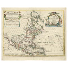
Scarce Latin Edition of Guillaume Delisle's 1700 Map of North America
Located in Langweer, NL
Scarce German Edition of Guillaume Delisle's 1700 Map of North America
This beautifully colored and highly detailed map is a rare Latin edition of Guillaume Delisle's influential 17...
Category
Antique 18th Century Maps
Materials
Paper
$1,869 Sale Price
20% Off
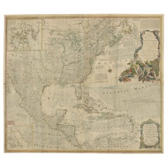
Rare Antique Wall-Map of North America: French and Indian War Boundaries, 1793
Located in Langweer, NL
Rare 1793 Map of North America: French and Indian War Boundaries and Historical Notes
This remarkable engraved map of North America, printed in 1793 by Emanuel Bowen and John Gibs...
Category
Antique 18th Century Maps
Materials
Paper
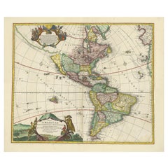
Antique Map of America with California as an Island by Homann '1710'
Located in Langweer, NL
This antique map, titled "Totius Americae Septentrionalis et Meridionalis," represents a significant cartographic piece from 1710 by Johann Baptist Homann. Here's a description of this remarkable map:
- Title: Totius Americae Septentrionalis et Meridionalis (...)
- Date: Published in 1710 by Johann Baptist Homann.
Description:
This map is a first edition of Johann Baptiste Homann's map of America, and it is notable for several cartographic features and historical representations:
1. California as an Island...
Category
Antique 18th Century Maps
Materials
Paper
$2,246 Sale Price
25% Off
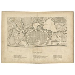
Plan of Pondicherry Fortifications and Attacks, France, c.1750
Located in Langweer, NL
Plan of Pondicherry Fortifications and Attacks, France, c.1750
This finely engraved map depicts the fortified city of Pondicherry, titled "Plan de Pondichéry et de ses attaques." It...
Category
French Antique 18th Century Maps
Materials
Paper
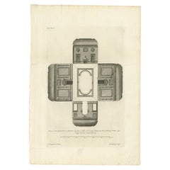
Antique Print of the New Garden Room of Hall Barn by Campbell, 1725
Located in Langweer, NL
Antique print titled 'Section of a New Garden Room at Hall Barn (..)'. Plan of the garden room for Hall Barn, near Beaconsfield, Buckinghamshire. This print originates from 'Vitruvius Britannicus...
Category
Antique 18th Century Maps
Materials
Paper
$171 Sale Price
20% Off
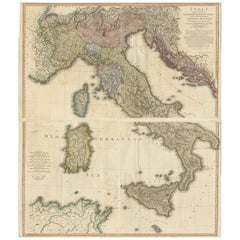
Very Large Double Page Detailed Map of Italy and Surrounding Regions, 1794
Located in Langweer, NL
This is a large (two seperate sheets) and detailed map of Italy, including the southern parts of Germany, Dalmatia, the adjacent countries, and the Illyric Islands. The map is titled...
Category
Antique 18th Century Maps
Materials
Paper
$1,907 Sale Price / set
20% Off
Ancient World Map of Europe, Asia & Northern Africa with Ancient Names, 1725
Located in Langweer, NL
Antique map titled 'Geografische Kaarte van de Oude Weereld (..).'
Original antique map of the ancient world depicting Europe, Asia, and northern Africa with ancient place names....
Category
Antique 18th Century Maps
Materials
Paper
$1,123 Sale Price
24% Off
Rare Hand-colored Map of the British Isles by Gerard Valk, Published circa 1700
Located in Langweer, NL
Map of the British Isles by Gerard Valk circa 1700 – Hand-Colored Engraving
This elegant copperplate engraving titled *Les Isles Britanniques, qui contiennent les Royaumes d'Anglete...
Category
Dutch Antique 18th Century Maps
Materials
Paper
Promised Land of Canaan – Antique Map of Israel with Biblical Scenes, van Jagen
Located in Langweer, NL
Promised Land of Canaan – Antique Map of Israel with Biblical Scenes, van Jagen
This remarkable antique map titled Het beloofde landt Canaan doorwandelt...
Category
Dutch Antique 18th Century Maps
Materials
Paper
1742 Antique Map of the Persian Empire with Detailed Borders and Cartouche
Located in Langweer, NL
Title: 1742 Covens & Mortier Map of the Persian Empire by Guillaume De L'Isle
This remarkable 1742 map, "Carte de Perse," was originally designed by Guillaume De L'Isle, a preemin...
Category
Dutch Antique 18th Century Maps
Materials
Paper
Antique Map of the Empire of Morocco by Kitchin, c.1760
Located in Langweer, NL
Antique map titled 'A Map of the Empire of Morocco Comprehending the Kingdoms of Fez, Morocco'. Original antique map of the kingdoms of Fez, Algiers, Segelmese, Tafilet and Morocco. ...
Category
Antique 18th Century Maps
Materials
Paper
$172 Sale Price
20% Off
Authentic Antique Map of the Caribbean, Gulf Coast and Central America, 1787
Located in Langweer, NL
Antique map titled 'Les Isles Antilles et le Golfe du Méxique'. Original old map of the Caribbean, Gulf Coast and Central America. With inset map of Bermuda...
Category
Antique 18th Century Maps
Materials
Paper
$297 Sale Price
20% Off
Map of Kingdoms of Castile, León, Galicia, Asturias, Biscay and Navarre in Spain
Located in Langweer, NL
Antique map titled 'Partie Septentrionale de la Couronne de Castille (..)'. Decorative and highly detailed map of Northwestern Spain, including Gallicia...
Category
Antique 18th Century Maps
Materials
Paper
$632 Sale Price
20% Off
Antique Map of the Eastern Hemisphere by Valk & Chenk '1708'
Located in Langweer, NL
Antique map titled 'Hemispherium Orbis Antiqui, Cumzonis Circulis, Et Sity populorum Diverso'. Decorative example of Andreas Cellarius's map of the Eastern Hemisphere, illustrating with climatic zones ranging from Frigida Borealis to Torrida, with planetary details superimposed. The elaborate border includes fine scrollwork, numerous putti, and additional diagrams showing armillary spheres and climatic zones. Andreas Cellarius was born in 1596 in Neuhausen and educated in Heidelberg. He emigrated to Holland in the early 17th century and 1637 moved to Hoorn, where he became the rector of the Latin School. Cellarius' best known work is his Harmonia Macrocosmica, first issued in 1660 by Jan Jansson, as a supplement to Jansson's Atlas Novus. The work consists of a series of Celestial Charts...
Category
Dutch Antique 18th Century Maps
Materials
Paper
$4,043 Sale Price
25% Off
Antique Map of Persia, Georgia and Kazakhstan by Bonne, c.1780
Located in Langweer, NL
Antique map titled 'Carte de la Perse, de la Georgie, et de la Tartarie Independante'. Map of Persia, Georgia and Kazakhstan.
This map shows current days Georgia, Iran, Irak, Kazak...
Category
Antique 18th Century Maps
Materials
Paper
1792 Map of Eastern Africa and the Arabian Peninsula by Delisle/Elwe
Located in Langweer, NL
1792 Map of Eastern Africa and the Arabian Peninsula by Delisle/Elwe
This detailed 1792 map, created by Delisle and published by Elwe, depicts northeastern Africa, including Egypt, ...
Category
Antique 18th Century Maps
Materials
Paper
$632 Sale Price
20% Off
Beautiful Large Scale Map of Spain and Portugal Published by Herman Moll in 1711
Located in Langweer, NL
Title: A New and Exact Map of Spain & Portugal
Author: Herman Moll
Date: 1711
Medium: Hand-colored copperplate engraving
Herman Moll (c. 1654-1732) was one of the most important London mapmakers in the first half of the eighteenth century. Moll was probably born in Bremen, Germany, around 1654. He moved to London to escape the Scanian Wars. His earliest work was as an engraver for Moses Pitt on the production of the English Atlas, a failed work which landed Pitt in debtor's prison. Moll also engraved for Sir Jonas Moore, Grenville Collins, John Adair, and the Seller & Price firm. He published his first original maps in the early 1680s and had set up his own shop by the 1690s.
Moll's work quickly helped him become a member of a group which congregated at Jonathan's Coffee House at Number 20 Exchange Alley, Cornhill, where speculators met to trade stock. Moll's circle included the scientist Robert Hooke...
Category
Antique 18th Century Maps
Materials
Paper
$2,396 Sale Price
20% Off
Antique Map of the Americas and West Indies by Robert de Vaugondy, 1778
Located in Langweer, NL
Antique Map of the Americas and West Indies by Robert de Vaugondy, 1778
This detailed antique map titled "Amérique ou Indes Occidentales" was published in 1778 by the renowned Frenc...
Category
French Antique 18th Century Maps
Materials
Paper
$1,347 Sale Price
25% Off
Antique Hand-Coloured Map of North and South America, ca.1765
Located in Langweer, NL
Description: Antique map titled 'Nieuwe Kaart van Amerika.' Attractive map of North and South America, the western part of Africa and south west Europe. Source unknown, to be determi...
Category
Antique 18th Century Maps
Materials
Paper
$1,198 Sale Price
20% Off
Rare Antique Engraving with Views of Qom and Kashan in Iran, 1711
Located in Langweer, NL
Antique print titled 'Kohm - Kasjan'. Old print with two views: one is Qom, the other Kashan. Both are in Iran (then known as Persia). This print originates from 'Cornelis de Bruins...
Category
Antique 18th Century Maps
Materials
Paper
$325 Sale Price
20% Off
18th-Century Map of the Eastern Roman Empire by Henri Chatelain, c. 1719
Located in Langweer, NL
Title: 18th-Century Map of the Eastern Roman Empire by Henri Chatelain, c. 1719
Description: This intricately detailed map, titled *Nouvelle Carte pour Servir à l'Histoire de l'Empi...
Category
Antique 18th Century Maps
Materials
Paper
Large Antique Map of Ceylon, Sri Lanka
Located in Langweer, NL
Antique map titled 'Nieuwe Kaart van het Eyland Ceylon opgestelt door Francois Valentyn'. Beautiful map of Sri Lanka. Originates from 'Oud en Nieuw Oost ...
Category
Antique 18th Century Maps
Materials
Paper
$757 Sale Price
20% Off
Antique Map of South America by De la Harpe '1780'
Located in Langweer, NL
Antique map titled 'Carte de l'Amerique Méridionale'. Original antique map of South America. Note the 'Laguna de Xarayes' is illustrated as the source of the Paraguay river. The laguna is now known as Pantanal, world's largest tropical wetland area. This map orginates from 'Abrégé de l'histoire générale des Voyages' by J.F. de la Harpe.
Category
Antique 18th Century Maps
Materials
Paper
$479 Sale Price
20% Off
Old Map of the Spice Islands, Moluccas by Bellin, Published in 1771
Located in Langweer, NL
Title: 1771 Jacques-Nicolas Bellin Map of the Moluccas, the Spice Islands of Indonesia
Description: This finely engraved eighteenth-century map, titled Carte Particulière des Is...
Category
Antique 18th Century Maps
Materials
Paper
$191 Sale Price
20% Off
Navigational Chart of Jamaica, Cape Gracias a Dios, and the Mosquito Coast, 1775
Located in Langweer, NL
The map titled "The Island of Jamaica and Cape Gracias a Dios with the Banks (Shows Moskito Kings Party)" illustrates a significant historical period marked by shifting colonial infl...
Category
Antique 18th Century Maps
Materials
Paper
$1,006 Sale Price
30% Off
Colored wall map of the WORLD
By Chambon
Located in ZWIJNDRECHT, NL
“Mappe Monde, contenant les Parties Connues du Globe Terrestre”
CHAMBON, Gobert-Denis (France, 17.. - 1781)
Paris, Longchamps et Janvier, 1754
Size H. 115 x W. 145 cm.
Gobert-Denis Chambon made copper engraving after the work of Guillaume De L’Isle, published in 1754 by Jean Janvier and S.G. Longschamps.
A huge wall map of the world in two hemispheres printed on two sheets, depicting the Eastern and Western hemispheres supported by two male figures, decorated at the bottom right and left with two celestial hemispheres (boreal and southern) and at the bottom in the middle with an armillary sphere, in addition.
This map is most notable for its depiction of the Sea of Japan labeled "Mer de Corée" and of "Mer de L'Ouest" or Sea of the West - a great sea, easily the size of the Mediterranean, to flow from the then-known Strait of Juan de Fuca...
Category
French French Provincial Antique 18th Century Maps
Materials
Wood, Paper
$28,755 Sale Price
20% Off
Antique Map of the Holy Land, Showing the Location of the Various Tribes
Located in Langweer, NL
Antique map titled 'Judaea seu Terra Sancta quae Hebraeorum sive Israelitarum (..)'. Map of The Holy Land, showing the location of the various tribes, in two kingdoms, Judah and Isra...
Category
Antique 18th Century Maps
Materials
Paper
$1,150 Sale Price
20% Off
Antique Engraving of Persepolis, a City Sacked by Alexander the Great, 1726
Located in Langweer, NL
Antique print titled 'Ruinen van 't Paleis van Darius, gelegen in 't oude Persepolis, door last van Alexander de Groote verbrandt (..)'.
Persepolis was sacked by the troops of Al...
Category
Antique 18th Century Maps
Materials
Paper
$469 Sale Price
20% Off
Detailed Antique Map of Italy and surrounding Islands
Located in Langweer, NL
Antique map titled 'Italie volgens de allernieuwste Uitgave van den Heere d'Anville'. Very detailed antique map, based on D'Anville's important map of It...
Category
Antique 18th Century Maps
Materials
Paper
$594 Sale Price
20% Off
Rare Engraving with a View of the City of Kom in Egypt
Located in Langweer, NL
This is an original antique print of the city of Kom in Egypt.
Category
Antique 18th Century Maps
Materials
Paper
$249 Sale Price
20% Off
Map of the Amazon River's Course and Surrounding Regions (1743-1744)
Located in Langweer, NL
This original antique map, titled "Carte du Cours du Maragnon ou de la Grande Riviere des Amazones," illustrates the course of the Amazon River (referred to here as the Maragnon) fro...
Category
Antique 18th Century Maps
Materials
Paper
$373 Sale Price
29% Off
Original Antique Map of Fez and Morocco
Located in Langweer, NL
Antique map titled 'Karte von Fes und Marócos (..)'. Original old map of Fez (or Fes) and Morocco. Also shows the Strait of Gibraltar. By Friedrich Gottlieb Canzler, published 1799.
Category
Antique 18th Century Maps
Materials
Paper
$527 Sale Price
20% Off
Original Antique Map of the Roman Empire
Located in Langweer, NL
Antique map titled 'Carte de l'Empire Romain'. Original antique map of the Roman Empire, two sheets joined. Engraved by Pierre Francois Tardieu and published by Edme Mentelle, circa ...
Category
Antique 18th Century Maps
Materials
Paper
$661 Sale Price
20% Off
Antique Hand-Colored Print of the Labyrinth of Versailles, c.1720
Located in Langweer, NL
Antique print titled 'Le Serpent à plusieurs Testes: dans le Labyrinte de Versailles'. This print illustrates the fable 'The Snake with several heads' of the labyrinth of Versailles ...
Category
Antique 18th Century Maps
Materials
Paper
$75 Sale Price
20% Off
Antique Map of Saxony, Germany
Located in Langweer, NL
Original antique map titled 'Circulus Saxoniae Superioris'. Original antique map of Saxony, Germany. The cities of Leipzig, Freiburg and many others are highlighted in gold. This map originates from 'Atlas Novus Terrarum Orbis...
Category
Antique 18th Century Maps
Materials
Paper
$575 Sale Price
20% Off
Old Genealogy Chart of the Rulers of Margraviate Brandenburg in Germany, 1732
Located in Langweer, NL
Antique print titled 'Genealogie de la Maison de Brandebourg (..)'. Genealogy of the rulers of the Margraviate Brandenburg. This print orginates from 'Atlas Historique'.
The Margraviate of Brandenburg (German: Markgrafschaft Brandenburg) was a major principality of the Holy Roman Empire from 1157 to 1806 that played a pivotal role in the history of Germany and Central Europe. Brandenburg developed out of the Northern March founded in the territory of the Slavic Wends. It derived one of its names from this inheritance, the March of Brandenburg (Mark Brandenburg). Its ruling margraves were established as prestigious prince-electors in the Golden Bull...
Category
Antique 18th Century Maps
Materials
Paper
$230 Sale Price
20% Off
Detailed 1729 Battle Map – Allied Army Camp at Denain France, 1712 Siege
Located in Langweer, NL
Map of Allied Camp at Denain, France, 1712 Attack – Published 1729
This engraved map depicts the army camp of the Allied forces at Denain, attacked by the French on July 24, 1712 du...
Category
Dutch Antique 18th Century Maps
Materials
Paper
Antique Map of the Middle East by Brion de la Tour '1772'
Located in Langweer, NL
Antique map titled 'Carte des Pays et Principaux Lieux (..)'. Original antique map of Middle East, extending to the Red Sea, Egypt, the Eastern Medi...
Category
Antique 18th Century Maps
Materials
Paper
$623 Sale Price
20% Off
Copper Engraving with a Panoramic View of Mexico City, 1754
Located in Langweer, NL
Antique print titled 'Nouveau Mexico'.
Copper engraving with a panoramic view of Mexico city. This print originates from 'Histoire générale des voyages, ou nouvelle collection de...
Category
Antique 18th Century Maps
Materials
Paper
$527 Sale Price
20% Off
1717 Johannes Van Keulen Sea Chart of the Eastern Atlantic - Amsterdam to Gambia
Located in Langweer, NL
1717 Johannes Van Keulen Sea Chart of the Eastern Atlantic - Amsterdam to Gambia
This 1717 sea chart by Johannes Van Keulen, titled "Nieuwe Paskaert vande ...
Category
Antique 18th Century Maps
Materials
Paper
Antique Map Illustrating Solar Eclipses by Scherer, C.1703
Located in Langweer, NL
Antique map of an hemisphere and several figures illustrating the position of the earth, moon and sun. Printed for Scherer's 'Atlas Novus' (1702-1710).
Artists and Engravers: Heinrich Scherer (1628-1704) was a Professor of Hebrew, Mathematics and Ethics at the University of Dillingen until about 1680. Thereafter he obtained important positions as Official Tutor to the Royal Princes...
Category
Antique 18th Century Maps
Materials
Paper
$210 Sale Price
20% Off
Original Antique View of the City of Damietta, Egypt, 1774
Located in Langweer, NL
Antique print, titled: 'Prospect der Stadt Damiat.' - Tab VIII.
View of the city of Damietta, Egypt. From 'Reisebeschreibung von Arabien und anderen umliegenden Landern (1774-1778)...
Category
Antique 18th Century Maps
Materials
Paper
$354 Sale Price
20% Off
Antique Map of the Middle East with a Large Arabia, 1799
Located in Langweer, NL
Antique map titled 'Perse, Turquie Asiatique et Arabie (..)'. Map of the Middle East with a large Arabia, extending from the Black Sea to the In...
Category
Antique 18th Century Maps
Materials
Paper
$1,428 Sale Price
20% Off
Antique Chart of the Passage of Comets in the Southern Sky, circa 1740
Located in Langweer, NL
Antique map titled 'Motus Comtarum in Hemispaerio Australi (..)'. This uncommon chart depicts the passage of comets in the southern sky between the years 1530-1704. Centered on the ecliptic poles and shows the constellation figures based on classical mythology, without showing the stars. The paths of dozens of comets are illustrated, eincluding those sighted by Tycho Brahe...
Category
Antique 18th Century Maps
Materials
Paper
$2,246 Sale Price
25% Off
Large Antique Map of Asia including All of Southeast Asia, c.1792
Located in Langweer, NL
Antique map titled 'L' Asie Divisee en ses Empires, Royaumes, et Etats'. Attractive, large map of Asia including all of Southeast Asia. The cartography is archaic for the period with...
Category
Antique 18th Century Maps
Materials
Paper
$1,437 Sale Price
20% Off
Antique Plan of the City of Bayonne, France
Located in Langweer, NL
Antique map titled 'Plan de Bayonne'. Original old plan of the city of Bayonne, France. This map originates from 'Le Petit Atlas Maritime (..)' by J.N. Bellin. Published 1764.
Be...
Category
Antique 18th Century Maps
Materials
Paper
$325 Sale Price
20% Off
Large Antique Map of Europe, Showing the Empire of Charlemagne
Located in Langweer, NL
Antique map titled 'Imperium Caroli Magni (..)'. Large antique map of Europe, showing the Empire of Charlemagne in the 8th Century. Engraved by T. Kitchin. Published J. Blair, circa ...
Category
Antique 18th Century Maps
Materials
Paper
$440 Sale Price
20% Off
Antique Print of the Malabar Coast of India showing the VOC establishments, 1726
Located in Langweer, NL
Dutch print with the title: Platte Grond van t'Fort Tricoen male met de daar aangelegen Pagoods-Berg (Trincomalee, Sri Lanka)
The map is taken from: 'Oud en Nieuw Oost-Indiën' van François Valentyn.
1) Ottens, Frederik (engraver / etcher)
2) Braam, J. van (publisher)
3) Linden, Gerard onder de (publisher)
MALABAR COAST...
Category
Antique 18th Century Maps
Materials
Paper
$268 Sale Price
20% Off
Rare Map of Rama or Ramma 'Ramallah?' in Palestine or the Holy Land, ca.1730
Located in Langweer, NL
Antique map titled 'Rama'.
This maps shows a view of Ramma (Ramallah?) in Palestine or the Holy Land. With Dutch legend. Source unknown, to be determined.
Artists and Engraver...
Category
Antique 18th Century Maps
Materials
Paper
$268 Sale Price
20% Off
Navigating the Spice Trade: A Maritime Chart of the Banda Sea, 1799
Located in Langweer, NL
This original antique map is an 18th-century nautical chart by Laurie & Whittle, a well-known British firm that was involved in the publication of maps, charts, and maritime books. ...
Category
Antique 18th Century Maps
Materials
Paper
$948 Sale Price
20% Off
Barbados Island at the Height of the Plantation Economy, Circa 1759
Located in Langweer, NL
Carte de l'Isle de la Barbade by Jacques-Nicolas Bellin (1703–1772), Circa 1759
This rare antique map of Barbados, titled Carte de l'Isle de la Barbad...
Category
Antique 18th Century Maps
Materials
Paper
$421 Sale Price
20% Off
Original Antique Map of Greece and part of Turkey
Located in Langweer, NL
Original antique map titled 'La Grece ou partie meridionale de la Turquie d'Europe'. Small map of Greece and part of Turkey. This map originates from 'Le nouveau et curieux Atlas Geo...
Category
Antique 18th Century Maps
Materials
Paper
$364 Sale Price
20% Off
Original Antique Map of Ancient Greece- Boeotia, Thebes, 1787
Located in St Annes, Lancashire
Great map of Ancient Greece. Showing the region of Boeotia, including Thebes
Drawn by J.D. Barbie Du Bocage
Copper plate engraving by P.F T...
Category
French Other Antique 18th Century Maps
Materials
Paper
Old Engraving of Longvek or Lavek (Eauweck), the Second Capital City of Cambodia
Located in Langweer, NL
Antique print titled 'Eauweck, capitale de Camboye'. Decorative panoramic view of the town of Longvek (or Lavek) in Cambodia. It was the second capital city during the Cambodia's Mid...
Category
Antique 18th Century Maps
Materials
Paper
$287 Sale Price
20% Off
Map of India and Ceylon with Inset of Calcutta and the Ganges, by Bonne, 1780
Located in Langweer, NL
The map on offer is an antique copperplate engraving of India and Ceylon (Sri Lanka), created by Rigobert Bonne (1727-1794), a prominent French cartographer. Here is a breakdown of t...
Category
Antique 18th Century Maps
Materials
Paper
$325 Sale Price
20% Off
Rare Large Etching of a Market of War Horses, Ca.1720
Located in Langweer, NL
Huchtenburg, J. van (1647-1733).
Impressive rare large etching of a 'War-" Horse-market. - This print has been professional doubled with Japanes...
Category
Antique 18th Century Maps
Antique Map of Champagne and surrounding Regions, France
Located in Langweer, NL
Antique map titled 'Carte de la Champagne et des Pays Voisins (..)'. Detailed map of Champagne and surrounding regions of Chalons and Soissons, Reims,...
Category
Antique 18th Century Maps
Materials
Paper
Spectacular 1770 Bird's-Eye View of Dunkirk Harbor by Basset, with 66 Landmarks
Located in Langweer, NL
This engraving, titled *Vue de Dunkerque du coté de la Mer*, is a spectacular bird's-eye view of Dunkirk from the sea, published by Basset around 1770.
It provides a detailed panor...
Category
Antique 18th Century Maps
Materials
Paper
$469 Sale Price
20% Off
Antique Map of France at the Beginning of the 17th Century by Zannoni, 1765
Located in Langweer, NL
Antique map France titled 'Carte pour servir à intelligence de l'Histoire de France (..)'. Beautiful old map of France. This map originates from 'At...
Category
Antique 18th Century Maps
Materials
Paper
$152 Sale Price
20% Off
Saint-Domingue (French Section): 18th Century Map from France Militaire Series
Located in Langweer, NL
This map is titled "St. Domingue (Partie Française)" and is part of the France Militaire series. It focuses on the French portion of Saint-Domingue, which corresponds to modern-day H...
Category
Antique 18th Century Maps
Materials
Paper
$115 Sale Price
20% Off
