18th Century Maps
to
1,522
1,846
36
1,884
26
1
1
2,975
2,238
473
3
288
34
9
126
8
36
9
2
5
4
3
2
1,871
19
11
3
1
158
41
41
40
24
1,884
1,884
1,884
24
16
13
12
12
Period: 18th Century
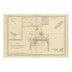
Antique Map of the Queen Charlotte Islands, Haida Gwaii
Located in Langweer, NL
Antique map titled 'Isles de la Reine Charlotte (..)'. Original old map of the Queen Charlotte Islands, based upon the explorations of James Cook, Juan Perez, and other contemporary European explorers. The map shows only partial coastal detail along the north end of the main island, and includes two insets of navigable bays and depth measurements.
Now called Haida Gwaii, after the local native population, the islands situated off Canada’s coast, south of Vancouver played an important role in the late 18th and early 19th century maritime...
Category
Antique 18th Century Maps
Materials
Paper
$277 Sale Price
20% Off
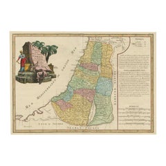
Original Rare Map of the Holy Land Showing the Twelve Tribes of Israel's, 1782
Located in Langweer, NL
Antique map titled 'Carte des Douze Tribus D'Israel (..).'
Map of the Holy Land showing the twelve tribes of Israel's. Tribes are all named...
Category
Antique 18th Century Maps
Materials
Paper
$661 Sale Price
20% Off
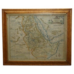
London 1744 Published Watercolour Antique Map of East Africa by Eman Bowen
Located in West Sussex, Pulborough
We are delighted to offer for sale this New and Accurate Map of Nubia & Abissinia, together with all the Kingdoms Tributary Thereto, and bordering upon them published in 1744 by Emanuel Bowen
This is a decorative antique engraved map of East Africa...
Category
English George III Antique 18th Century Maps
Materials
Paper
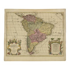
Map of South America 1792 by Elwe – Hand-Colored Antique Dutch Engraving
By J.B. Elwe
Located in Langweer, NL
Map of South America 1792 by Elwe – Hand-Colored Antique Dutch Engraving
This striking antique map of South America, titled "L'Amerique Meridionale," was published in 1792 by the Du...
Category
European Antique 18th Century Maps
Materials
Paper
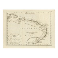
Brazil Coastline Map – Broenner Carte du Bresil, 1772 Captaincies
Located in Langweer, NL
Carte du Bresil Map, Broenner Krefeld 1772 – Brazil Coastline Captaincies
This is an engraved map titled Carte du Bresil Prem. Partie, published in Krefeld (Germany) by J.J. Broenne...
Category
French Antique 18th Century Maps
Materials
Paper
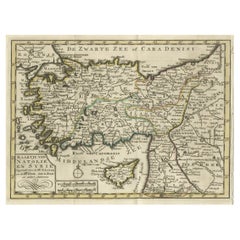
Old Map of Anatolia, part of modern-day Turkey, Armenia and Syria, 1745
Located in Langweer, NL
Title: "Kaartje van Natolie en Syrie opgesteld door de Hr. Lucas en de Hr. Guil de L'Isle en andere auteuren"
The title "Kaartje van Natolie en Syrie opgesteld door de Hr. Lucas en...
Category
Antique 18th Century Maps
Materials
Paper
$421 Sale Price
20% Off
Hand-Colored Map of Delfland by Hendrik de Leth, 1740 – Delft & The Hague
Located in Langweer, NL
Hand-Colored Map of Delfland by Hendrik de Leth, 1740 – Delft & The Hague
This beautifully preserved antique map titled "Nieuwe Gemeete Kaert van Delfland" was engraved by Hendrik d...
Category
Antique 18th Century Maps
Materials
Paper
Authentic Old Map of Sumatra, Malaysia and Singapore, 1745
Located in Langweer, NL
Title: "Kaartje van't Eiland Sumatra en de Maleidse Kust gelegen na de stelling van de G. de L'Isle"
Published by Jacob Keizer and by Jan de Lat
Creator: Keizer, Jacob, active 1706...
Category
Antique 18th Century Maps
Materials
Paper
$459 Sale Price
20% Off
Antique Coastal Map of West Sumatra 'Indonesia' by J. Mannevillette, 1745
Located in Langweer, NL
Antique map titled 'Carte de la côte occidentale de l'isle Sumatra depuis la ligne équinoctiale jusqu'au détroit de la Sonde'. Beautiful coastal map of We...
Category
Antique 18th Century Maps
Materials
Paper
$474 Sale Price
20% Off
Attack Plan of Douay Fortress, France, 1710 Siege – Brussels c.1720 Map
Located in Langweer, NL
Attack Plan of Douay Fortress, France, 1710 Siege – Brussels c.1720 Map
This engraved military map shows the detailed plan of attacks on the fortress city of Douay (Douai) in northe...
Category
French Antique 18th Century Maps
Materials
Paper
Detailed 1720s Map – Siege of Douay and Lines of Circumvallation, France
Located in Langweer, NL
Detailed 1720s Map – Siege of Douay and Lines of Circumvallation, France
This engraved map shows the detailed fortifications and surrounding region of Douay (Douai) in northern Fran...
Category
French Antique 18th Century Maps
Materials
Paper
Batavia Market Scenes & Government House – Antique Prints VOC Period, c.1780
Located in Langweer, NL
Batavia Views – Government House and Market Scenes, circa 1780
This is an original late 18th-century engraving featuring two detailed views of Batavia (now Jakarta, Indonesia) under...
Category
Dutch Antique 18th Century Maps
Materials
Paper
Antique Colored Engraving of Madras 'Chennai' and Fort St. George in India, 1751
Located in Langweer, NL
Antique print titled 'Plan de Madras et du Fort St. Georges'. Plan of the city of Madras (or Chennai), the capital of the state of Tamil Nadu, India. Also shows a plan of Fort St. Ge...
Category
Antique 18th Century Maps
Materials
Paper
$344 Sale Price
20% Off
Original Hand-colored Antique Map of the Southern Part of India
Located in Langweer, NL
Antique map titled 'Orarum Malabariae, Coromandelae &c Tabula Accuratissima - Carte des Cotes de Malabar et de Coromandel'. Beautiful map of the southern part of India. It focuses on trade routes within India, as well as the Coromandel and Malabar Coasts...
Category
Antique 18th Century Maps
Materials
Paper
$871 Sale Price
20% Off
Physical & Political Map of Switzerland: Late 18th Century - Mentelle Atlas
Located in Langweer, NL
Antique Map with Title: 'Carte Physique et Politique de la Suisse'
**Publication Details:**
- **Atlas Title:** Nouvel Atlas Universel de Géographie Ancienne et Moderne
- **Purpose:...
Category
Antique 18th Century Maps
Materials
Paper
$507 Sale Price
20% Off
Map of Saint Helena Island: Early 18th-Century Copper Engraving by F. Bernard
Located in Langweer, NL
Map of Saint Helena Island: Early 18th-Century Copper Engraving by F. Bernard
This rare and beautifully detailed copper engraving of Saint Helena Island dates from around 1722 and...
Category
Antique 18th Century Maps
Materials
Paper
$143 Sale Price
20% Off
Antique Architectural Print of the Melville House in Fife, Scotland, 1725
Located in Langweer, NL
Antique print titled 'The Elevation of Melvin House in the Shire of Fyfe (..)'.
Old engraving of Melville House in Fife, Scotland. This print originates from 'Vitruvius Britannic...
Category
Antique 18th Century Maps
Materials
Paper
$306 Sale Price
20% Off
Antique Map of Egypt and the Nile River
Located in Langweer, NL
Antique map titled 'Egypten nach dem Zustand der alten Zeit vorgestellt'. This uncommon and richly detailed map of Egypt features hundreds of place names along the Nile. The Sinai Pe...
Category
Antique 18th Century Maps
Materials
Paper
$325 Sale Price
20% Off
Isle de Ladrones: Early 18th-Century Map of the Mariana Islands by F. Bernard
Located in Langweer, NL
Isle de Ladrones: Early 18th-Century Map of the Mariana Islands by F. Bernard
This intriguing copper engraving depicts the *Isle de Ladrones*, now known as the Mariana Islands, situated in the western Pacific Ocean. The map was published around 1722 in Amsterdam by F. Bernard as part of the influential travel compilation *Recueil des voyages qui ont servi a ...*. The map offers a simplistic yet stylized portrayal of the island, emphasizing its rugged and mountainous terrain, dotted with sparse vegetation and hills.
The term *Isle de Ladrones* (Islands of Thieves) was given by the Spanish explorer Ferdinand Magellan in 1521 during his circumnavigation of the globe, as his crew encountered thefts from the native Chamorro people. The name later changed to *Mariana Islands* when they were named after Queen...
Category
Antique 18th Century Maps
Materials
Paper
$143 Sale Price
20% Off
1718 Ides & Witsen Map "Route D'amsterdam a Moscow Et De La Ispahan Et Gamron
Located in Norton, MA
1718 Ides & Witsen map, entitled
"Route D'Amsterdam A Moscow Et De La Ispahan Et Gamron,"
Ric.b005
Subject: Eastern Europe and Central Asia
Period: 1718 (published)
Publicati...
Category
Dutch Antique 18th Century Maps
Materials
Paper
Utrecht city plan
Located in UTRECHT, UT
“Platte grond der Stad Utrecht vertonende alle Gragten, Straaten, Stegen, Gangen, Markten, en plaatsen der openbare Gebouwen”, engraving published by Johannes van Schoonhoven in Amst...
Category
Dutch Other Antique 18th Century Maps
Materials
Paper
$3,892
A Stunning 1744 Bowen Map: South East Germany & Queen of Hungary’s Dominions
Located in Langweer, NL
Title: A New and Correct Map of the South East part of Germany, 1744
This map by Emanuel Bowen, dating to around 1744, beautifully captures the southeastern part of Germany. The det...
Category
Antique 18th Century Maps
Materials
Paper
Antique Map of the Kingdom of Poland by Keizer & de Lat, 1788
Located in Langweer, NL
Antique map titled 't Koninkryk Polen (..)'. Uncommon original antique map of the Kingdom of Poland. This map originates from 'Nieuwe Natuur- Geschied- en Handelkundige Zak- en Reisa...
Category
Antique 18th Century Maps
Materials
Paper
$335 Sale Price
20% Off
Antique Map of the Philippines, Taiwan and Surroundings by Bonne '1780'
Located in Langweer, NL
Antique map titled 'Les Isles Philippines, celle de Formose, le Sud de la Chine, les Royaumes de Tunkin, de Cochinchine, de Cambode, de Siam des Laos, avec partie de Pegu et D'Ava'. ...
Category
Antique 18th Century Maps
Materials
Paper
$431 Sale Price
20% Off
Map of the Southeastern Part of the Banda Islands, Incl Northern Australia, 1726
Located in Langweer, NL
Antique map titled 'Kaart van de Zuyd-Ooster Eylanden van Banda.'
Map of the southeastern part of the Banda islands. This map originates from 'Oud en Nieuw Oost-Indiën' by Franço...
Category
Antique 18th Century Maps
Materials
Paper
$1,073 Sale Price
20% Off
Antique Map of the Coast of Southern Brazil by Bellin, c.1755
Located in Langweer, NL
Antique map titled ‘Suite de Bresil’. Map of the coast of southern Brazil, with Lagoa Mirim, and Uruguay (here named as Paraguay). This print originates from 'Histoire générale des V...
Category
Antique 18th Century Maps
Materials
Paper
$93 Sale Price
20% Off
Antique Map of Southern India by Chatelain, c.1720
Located in Langweer, NL
"Antique map titled 'Carte Nouvelle des Terres de Cucan, de Canara, de Malabar, de Madura, et de Coromandel'. Map of the southern portion of India, originating from Chatelain's 'Atla...
Category
Antique 18th Century Maps
Materials
Paper
$297 Sale Price
20% Off
Antique Map of Khwarezm, Turkestan and Great Bukhara by Bellin, '1749'
Located in Langweer, NL
Antique map titled 'Carte de Karazm, Turkestan, et Grande Bukarie'. Original antique map of Khwarezm, Turkestan and Great Bukhara. Engraved by J.N. Bellin for 'Histoire Générale des ...
Category
Antique 18th Century Maps
Materials
Paper
$191 Sale Price
20% Off
1732 Henri Chatelain Map of the Holy Land Divided Among the Tribes of Israel
Located in Langweer, NL
Title: 1732 Henri Chatelain Map of the Holy Land Divided Among the Tribes of Israel
This exquisite 18th-century map by Henri Chatelain, published in 1732, offers a detailed depict...
Category
Antique 18th Century Maps
Materials
Paper
Original Antique Map of Tartary 'Northern China & Far Eastern Russia', 1757
Located in Langweer, NL
Antique map titled 'Carte de la Tartarie Orientale (..)'.
Original antique map of what is present day northern China and far eastern Russia. Centere...
Category
Antique 18th Century Maps
Materials
Paper
$277 Sale Price
20% Off
Rare Antique Map of the Dutch East Indies 'Indonesia', 1774
Located in Langweer, NL
Rare decorative engraved map of the Dutch East Indies, or nowadays Indonesia.
Title (in old Dutch): NIEUWE EN NAUKEURIGE KAART DER OOST-INDISCHE ...
Category
Antique 18th Century Maps
Materials
Paper
$1,149 Sale Price
20% Off
Rare Engraved City Plan of Nuremberg, Bavaria by Christoph Weigel, 1718
Located in Langweer, NL
Title: Rare Engraved City Plan of Nuremberg, Bavaria by Christoph Weigel, 1718
Description:
This detailed city plan of Nuremberg, Bavaria was crafted by Christoph Weigel in 1718 an...
Category
Antique 18th Century Maps
Materials
Paper
Highly Decorative Map of The Eastern Mediterranean and The Middle East, ca.1700
Located in Langweer, NL
Antique map titled 'Byzondere Kaart van de Landen Daar de Apostelen Het Evangelium Gepredikt Hebben (..).'
Highly decorative map of the eastern Mediterranean...
Category
Antique 18th Century Maps
Materials
Paper
$910 Sale Price
20% Off
Extremely Scarce Antique Map of The Island of Borneo, Indonesia, c. 1725
Located in Langweer, NL
Antique map titled 'L'Ile de Borneo Suivant les memoires des plus Celebres Navigateurs.'
A detailed map of the island Borneo, with a small part of Celebes visible. This plate origi...
Category
Antique 18th Century Maps
Materials
Paper
$814 Sale Price
20% Off
Rare Antique English SeaChart of Bali, Lombok, Floris, Borneo, Celebes etc, 1711
Located in Langweer, NL
Antique map titled 'A Large Draught from Benjar on the Island of Borneo To Macasser on the Island of Celebes Shewing the Streight of Bally with the Islands to the Eastward thereof.' ...
Category
Antique 18th Century Maps
Materials
Paper
$2,347 Sale Price
20% Off
Antique Map of Germany During the Mid-18th Century, Published in 1747
Located in Langweer, NL
Antique map Germany titled 'A New & Accurate Map of Germany'. It covers Germany during the mid-18th century, which included all of modern day Germany, Austria, Switzerland, Czech Rep...
Category
Antique 18th Century Maps
Materials
Paper
$201 Sale Price
20% Off
Antique Map of the Holy Land, c.1710
Located in Langweer, NL
Antique map titled 'Totius Terrae Sanctae Delineatio'. Map of the Holy Land extending to Egypt and showing the route of the Children of Israel in their e...
Category
Antique 18th Century Maps
Materials
Paper
$114 Sale Price
20% Off
Antique Map of Pomerania by Schenk, circa 1750
Located in Langweer, NL
The "Ducatus Pomeraniae" is a historical map depicting the Duchy of Pomerania, a region that straddles the modern border between northeastern Germany and Poland. Crafted with ornamen...
Category
Antique 18th Century Maps
Materials
Paper
$479 Sale Price
20% Off
Antique Map of the Kingdom of Hungary and Transylvania, circa 1780
Located in Langweer, NL
Antique Map of the Kingdom of Hungary and Surrounding Regions by S. Robert, circa 1780
This beautifully engraved map titled Royaume de Hongrie, Principauté de Transilvanie, Esclavon...
Category
French Antique 18th Century Maps
Materials
Paper
Bonne Map of Philippines, Formosa, Siam, Indochina & South China, 1780
Located in Langweer, NL
Bonne Map of Philippines, Formosa, Siam, Indochina & South China, 1780
Les Isles Philippines, celle de Formose, le Sud de la Chine, les Royaumes de Tunkin, de Cochinchine, de Cambog...
Category
Antique 18th Century Maps
Materials
Paper
$277 Sale Price
20% Off
Historical Map of Northern Europe and Russia - Engraved for I. Harrison, 1788
Located in Langweer, NL
Historical Map of Northern Europe and Russia - Engraved for I. Harrison, 1788
This impressive historical map titled A New Map of Europe Containing Denmark, Norway, Sweden and Russ...
Category
Antique 18th Century Maps
Materials
Paper
$804 Sale Price
20% Off
Antique Print of Duncombe Park by Campbell, 1725
Located in Langweer, NL
Antique print titled 'Elevation of Duncomb Park in Yorkshire (..)'. Old engraving of Duncombe Park, Yorkshire. Duncombe Park is the seat of the Duncombe family whose senior members a...
Category
Antique 18th Century Maps
Materials
Paper
The Valley of Inspruck: An 18th-Century Engraved Perspective, 1792
Located in Langweer, NL
Title: "The Valley of Inspruck: An 18th-Century Engraved Perspective"
This elegant original antique engraving, titled "The Valley of Inspruck," showcases a serene view of the Innsbruck Valley. The artwork is delicately rendered, capturing the grandeur of the mountains and the pastoral tranquility of the valley.
The print depicts a detailed landscape scene, replete with towering craggy peaks that loom over a peaceful settlement nestled in the valley. A striking feature is the contrast between the ruggedness of the natural environment and the cultivated lands and architecture, indicating a harmonious coexistence of humanity with nature.
It was published as directed on January 1, 1792, by T & G Egerton of Whitehall for the author. Albanis Beaumont is credited with the original design ('Del.' for delineavit, indicating he drew the initial illustration), and Cornelis Apostool is noted for the engraving work ('Sculp.' for sculpsit, indicating he engraved the image).
The publication of this print during the late 18th century aligns with a time when there was a heightened interest in natural beauty and the picturesque, reflected in the art and literature of the Romantic period. This print would have appealed to those with an appreciation for both the aesthetic and the sublime qualities of the European landscape.
The publication by T & G Egerton, a reputable firm known for their work in the arts, and the involvement of a skilled artist and engraver like Beaumont and Apostool, respectively, underline the quality and desirability of the print. It is a piece that would attract collectors of fine engravings and admirers of European landscapes, offering a window into the aesthetic values and artistic endeavors of the late 18th century.
As a historical piece, this print offers a view into the past, inviting contemplation of the rich cultural and natural heritage of the Innsbruck area. It is a valuable collectible for enthusiasts of antique maps and prints...
Category
Antique 18th Century Maps
Materials
Paper
$709 Sale Price
20% Off
Hand-Colored Dutch Map of Ancient Israel Divided by the Twelve Tribes – c.1730
Located in Langweer, NL
Hand-Colored Dutch Map of Ancient Israel Divided by the Twelve Tribes – After Ezekiel, c.1730
This beautifully hand-colored antique map is titled "Ontwerp en Erfdeeling van’t Land K...
Category
Dutch Antique 18th Century Maps
Materials
Paper
N.W. View of Wainflete's School, Basire, 1790
Located in Langweer, NL
Antique print titled 'N.W. View of Wainflete's School (..)'. Antique print depicting a view of Wainflete's school, Inscription of the bell of Wainflete's school and Monument of Richa...
Category
Antique 18th Century Maps
Materials
Paper
$143 Sale Price
20% Off
Antique Print of Hagley Hall in Worcestershire, England, ca.1770
Located in Langweer, NL
Antique print titled 'Principal Front of Hagley'. Main facade of Hagley Hall, Worcestershire.
Hagley Hall is a Grade I listed 18th-century house in Hagley, Worcestershire, the ho...
Category
Antique 18th Century Maps
Materials
Paper
$594 Sale Price
20% Off
Historical Map of the Duchy of Lauenburg by Johann Baptist Homann - Circa 1720
Located in Langweer, NL
Historical Map of the Duchy of Lauenburg by Johann Baptist Homann - Circa 1720
This splendid historical map titled Ducatus Lauemburgicus is a highly detailed and beautifully engra...
Category
Antique 18th Century Maps
Materials
Paper
$517 Sale Price
20% Off
Antique Plan of the Region of Cassis, France
Located in Langweer, NL
Antique map titled 'Plan de Cassis et environs'. Original plan of the region of Cassis, France. This map originates from 'Le Petit Atlas Maritime (..)' by J.N. Bellin. Published 1764...
Category
Antique 18th Century Maps
Materials
Paper
$325 Sale Price
20% Off
Antique Map of France with Decorative Title Cartouche
Located in Langweer, NL
Antique map titled 'Carte de la France'. Original old map of France. This map originates from 'Le Petit Atlas Maritime Recueil De Cartes et Plans Des Quatre Parties Du Monde (..) by ...
Category
Antique 18th Century Maps
Materials
Paper
$229 Sale Price
20% Off
Antique Map of the Brazilian Coast by A. Van Krevelt
Located in Langweer, NL
Uncommon edition of this accurate map of part of Brazil, from San Salvador till Rio de Janeiro and S.Paulo. In lower right engraved "29b." Originates from 'Atlas Portatif pour servir...
Category
Brazilian Antique 18th Century Maps
Materials
Paper
$231 Sale Price
22% Off
Antique Map of the Sunda Islands by Tirion 'c.1760'
Located in Langweer, NL
Antique map titled 'Nuova Carta delle Isole di Sunda come Borneo, Sumatra e Iava Grande'. Detailed map of the Sunda Islands, Southeast Asia, extending from the tip of Cambodia to Jav...
Category
Antique 18th Century Maps
Materials
Paper
$934 Sale Price
20% Off
Original Detailed Antique Map of Southern India and Most of Ceylon, 1744
Located in Langweer, NL
Antique map titled 'A Map of India on the west Side of the Ganges, comprehending the coasts of Malabar, Coromandel and the Island Ceylon'.
Map of Southern India and most of Ceylo...
Category
Antique 18th Century Maps
Materials
Paper
$421 Sale Price
20% Off
Antique Map of the Region of Paris by Homann Heirs, c.1720
By Homann Heirs
Located in Langweer, NL
Antique map titled 'Agri Parisiensis Tabula particularis, qua maxima Pars Insulae Franciae (..).' Incredibly detailed map showing everything from tiny villages to forests, farmland, ...
Category
Antique 18th Century Maps
Materials
Paper
$191 Sale Price
20% Off
Antique Map of Greece, Albania, Macedonia and Parts of Turkey and Cyprus, c.1745
Located in Langweer, NL
Antique map titled 'Accurata Totius Archipelagi Et Graeciae Universae Tabula'.
Detailed map of Greece. Includes Albania, Macedonia and parts of Turkey and Cyprus. With compass rose...
Category
Antique 18th Century Maps
Materials
Paper
$814 Sale Price
20% Off
18th Century Portugal Original Antique Engraving by Bowles
Located in Langweer, NL
Antique map titled 'Bowles's New Pocket Map of Portugal, Laid Down According to the Sr. Nolin'. Large and detailed map of Portugal. With nice vignette,...
Category
Antique 18th Century Maps
Materials
Paper
$426 Sale Price
20% Off
Old Print of Fort James on Kunta Kinteh Island on the Gambia River, Africa, 1746
Located in Langweer, NL
Antique print titled 'Plan de l’lle James sur la Gambra en 1732, Vue de Fort James du côte du Nord-Est, Vue de Fort James du côte de N.N. Ouest'.
Old print of Kunta Kinteh Island on the Gambia...
Category
Antique 18th Century Maps
Materials
Paper
$172 Sale Price
20% Off
Highly Detailed Antique Map of the Holy Land Showing 12 Tribes of Israel, c.1720
Located in Langweer, NL
Antique map titled 'Heylige Land verdeeld in de Twaalf Stammen Israels (..).'
Highly detailed map of the Holy Land divided into 12 tribes of Israel...
Category
Antique 18th Century Maps
Materials
Paper
$459 Sale Price
20% Off
Antique Map of Three Cities of China's Hubei and Hunan Provinces by Bellin
Located in Langweer, NL
Antique print titled 'Plans de Quelques villes de la province de Hou-Quang.' Three bird's-eye view plans of walled cities in what are now China's Hubei (Hou-Quang) and Hunan Province...
Category
Antique 18th Century Maps
Materials
Paper
$158 Sale Price
20% Off
Imperii Persici Delineatio: A 1722 Cartographic Masterpiece of Persia by Schenk
Located in Langweer, NL
Title: IMPERII PERCICI delineatio ex scriptis potissimum geographicis Arabum et Persarum
Cartographer: Petrus Schenk (Pieter Schenk), 1722
An original antique hand-colored engraved...
Category
Antique 18th Century Maps
Materials
Paper
$1,101 Sale Price
20% Off
Original Antique Map of Egypt in Frame by C. Weigel, circa 1720
Located in Langweer, NL
The map is an antique depiction of ancient Egypt, divided into its regions and nomes, also including areas like Troglodytica, Marmarica, and Ethiopia above Egypt. Christophorus Weige...
Category
Antique 18th Century Maps
Materials
Paper
$934 Sale Price
20% Off
