18th Century Maps
to
1,515
1,842
36
1,880
26
1
1
2,972
2,236
473
3
288
34
9
126
8
36
9
2
5
4
3
2
1,867
19
11
3
1
162
44
41
40
27
1,880
1,880
1,880
24
16
13
12
12
Period: 18th Century
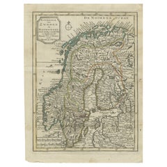
Antique Map of the Kingdom of Sweden and Norway by Keizer & de Lat, 1788
Located in Langweer, NL
Antique map titled 't Koninkryk van Zweden en Noorwegen'. Uncommon original antique map of the Kingdom of Sweden and Norway. This map originates from 'Nieuwe Natuur- Geschied- en Han...
Category
Antique 18th Century Maps
Materials
Paper
$335 Sale Price
20% Off
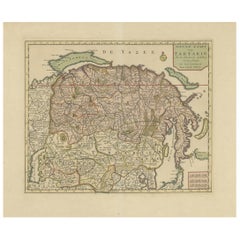
Antique Map of Siberia and Chinese Tartary, Incl Nova Zembla, ca.1732
Located in Langweer, NL
Antique map of Tartary titled 'Nieuwe Kaart van Tartarie na de alderlaatste ondekking int ligt gebracht tot Amsterdam door Isaak Tirion'.
Map op Siberia and Chinese tartary. In t...
Category
Antique 18th Century Maps
Materials
Paper
$825 Sale Price
20% Off
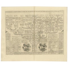
Antique Genealogy Chart of the Landgraviate Hessen-Kassel, Germany, 1732
Located in Langweer, NL
Antique print titled 'Genealogie de la Maison de Hesse Cassel'. Chart of the genealogy of the Landgraviate Hessen-Kassel / Hesse-Cassel. This includes the coats of arms of both Hesse-Cassel and Hesse-Darmstadt. This print orginates from 'Atlas Historique'.
The Landgraviate of Hesse-Kassel (German: Landgrafschaft Hessen-Kassel), spelled Hesse-Cassel during its entire existence, was a state in the Holy Roman Empire that was directly subject to the Emperor. The state was created in 1567 when the Landgraviate of Hesse was divided upon the death of Philip I, Landgrave of Hesse. His eldest son William IV inherited the northern half of the Landgraviate and the capital of Kassel. The other sons received the Landgraviate of Hesse-Marburg, the Landgraviate of Hesse-Rheinfels and the Landgraviate of Hesse-Darmstadt.
During the Napoleonic reorganisation of the Empire in 1803, the Landgrave of Hesse-Kassel was elevated to an Electorate and Landgrave William IX became an Imperial Elector. Many members of the Hesse-Kassel House served in the Danish military gaining high ranks and power in the Oldenburg realm due to the fact that many Landgraves were married to Danish princesses...
Category
Antique 18th Century Maps
Materials
Paper
$249 Sale Price
20% Off
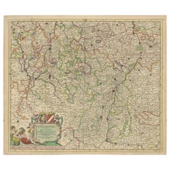
Antique Map of Lotharingia (Lorraine) by Danckerts, c. 1700 – Hand-Colored
Located in Langweer, NL
Antique Map of Lotharingia (Lorraine) by Theodorus Danckerts circa 1700 Hand-Colored
This beautifully detailed antique map of Lotharingia, now the Lorraine region in northeastern ...
Category
Antique 18th Century Maps
Materials
Paper
Antique Map of Scandinavia by Van der Aa 'circa 1710'
Located in Langweer, NL
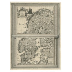
Antique map titled 'Scandinavie Septentrionale' and 'Scandinavie Meridionale'. Copper engraving with two maps on one sheet. The upper map depicts Northern Scandinavia with Norway, Sw...
Category
Antique 18th Century Maps
Materials
Paper
$671 Sale Price
20% Off
Antique Map of Sweden by Homann, 'circa 1730'
Located in Langweer, NL
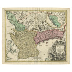
Antique map titled 'Nova Tabula Scaniae (..)'. Attractive map showing the historical provinces of Sweden: Schonen with Malmö, Blekinge with Karlskrona and the south part of Halland. ...
Category
Antique 18th Century Maps
Materials
Paper
$527 Sale Price
20% Off
Antique Map of Spain by Covens & Mortier, c.1740
Located in Langweer, NL
Antique map Spain titled 'L?Espagne dressée sur la Description qui en a eté faite par Rodrigo Mendez Sylva (..)'. Beautiful map of Spain with decorat...
Category
Antique 18th Century Maps
Materials
Paper
$503 Sale Price
20% Off
Antique Map of Mecklenburg-Vorpommern in Germany by J.B. Homann, c.1720
Located in Langweer, NL
Antique Map of Mecklenburg-Vorpommern by J.B. Homann, c.1720
Old colored antique map of Mecklenburg-Vorpommern by Johann Baptist Homann. This stunning map, titled "Ducatus Meklenbur...
Category
Antique 18th Century Maps
Materials
Paper
$518 Sale Price
20% Off
Antique Print of a Design for The Great Temple in Eastbury Park, England, 1725
Located in Langweer, NL
Antique print titled 'Plan and Elevation of the great Temple in the garden at Eastbury'.
Design for Eastbury Park, England. This print originates from 'Vitruvius Britannicus' by ...
Category
Antique 18th Century Maps
Materials
Paper
$211 Sale Price
20% Off
Authentic Map of the Coast from Cape Formosa to the Dony River, Africa, 1732
Located in Langweer, NL
Antique map titled 'The New Correct Mapp of Calbar River vulgarly call'd Calabar (..)'.
An interesting map of the coast from Cape Formosa to the Dony River stated on the map to be ...
Category
Antique 18th Century Maps
Materials
Paper
$546 Sale Price
20% Off
Antique Map of Juan Fernandez Island and Cumberland Bay, Chile - c. '1749'
Located in Langweer, NL
Antique map titled 'Plan de la Côte du N.E. de l 'Ile de Juan Fernandes - Schets van den Noord-Oost kant van het eiland Juan Fernandes '. This map depicts the northeast coast of the ...
Category
Antique 18th Century Maps
Materials
Paper
$191 Sale Price
20% Off
Antique Map of Overijssel by Bachiene, 1758
Located in Langweer, NL
Antique map titled 'Over-Yssel'. Map of the Overijssel, the Netherlands. This map originates from 'Kort begrip der Oude en Nieuwe Staatkundige Geographie', by W.A. Bachiene, publishe...
Category
Antique 18th Century Maps
Materials
Paper
$163 Sale Price
20% Off
18th Century Original Dutch Map of Martinique in The West Indies by Isaak Tirion
Located in Langweer, NL
This is an 18th-century Dutch map of Martinique, titled *Het Westindisch Eiland Martinique*. The map was produced by Isaak Tirion, a renowned Dutch cartographer and publisher known for his precise and beautifully crafted maps. The cartouche in the lower left corner, adorned with decorative elements, adds to the aesthetic appeal of the map.
### Key Features:
- Martinique: The map offers detailed topographical information of the island, including mountains, rivers, and settlements.
- Geographical Details: Locations such as Fort Royal, Bay de St. Pierre, and Point de Cloche are marked, showcasing significant features of the island.
- Cartouche: The ornate cartouche, featuring tropical plants, reflects the importance of the island's agricultural production during the colonial period, particularly its sugar plantations.
This map captures Martinique during its time as a French colony and provides valuable insight into the island’s layout and strategic significance in the Caribbean. The attention to coastal detail highlights the importance of Martinique as a hub of maritime activity.
The map’s combination of aesthetic elegance and cartographic precision makes it a remarkable piece for collectors and those interested in Caribbean colonial...
Category
Antique 18th Century Maps
Materials
Paper
$422 Sale Price
20% Off
1756 Map of Brazil from Bahia to São Paulo by Bellin – French Colonial Engraving
Located in Langweer, NL
Antique Map of Brazil from Bahia to São Paulo – Bellin for L'Histoire des Voyages
This elegant 18th-century French map titled "Suite du Bresil, Depuis la Baie de Tous les Saints jus...
Category
Antique 18th Century Maps
Materials
Paper
Map of the Mozambique and Tanzania Coast & Inset Map of Anjouan Island, ca.1700
Located in Langweer, NL
Antique map titled 'Carte particuliere des Costes de l'Afrique'.
Depicts the coasts of Mozambique and Tanzania. With an inset map of Anjouan Island.
Artists and engravers: Pub...
Category
Antique 18th Century Maps
Materials
Paper
$613 Sale Price
20% Off
Antique Bible World Map by R. & J. Wetstein, 1743
Located in Langweer, NL
Antique world map titled 'De Werelt Caart'.
A scarce and richly detailed double hemisphere world map that was probably based on an earlier work by Cornelis Dankerts. This map has t...
Category
Antique 18th Century Maps
Materials
Paper
$2,396 Sale Price
20% Off
Antique Map of the Persian Gulf and Caspian Sea Region by R. Bonne, 1780
Located in Langweer, NL
Antique print titled 'Carte de la Perse, de la Georgie, et de la Tartarie Independante'. Shows the region from the Persian Gulf and Caspian Sea in the wes...
Category
French Antique 18th Century Maps
Materials
Paper
Historical Map of the Black Sea and Surrounding Regions, 1705
Located in Langweer, NL
Title: "Map of Turcomania, Georgia, and Comania"
This print presents an intricately detailed map of the Caucasus region, titled “Turcomania, Georgien Commanie,” by the esteemed cart...
Category
Antique 18th Century Maps
Materials
Paper
$633 Sale Price
20% Off
Map Silk Embroidered Western Eastern Hemisphere New Old World Asia America Afri
Located in BUNGAY, SUFFOLK
A rare, late-18th century, silk, embroidered, double hemisphere, world map, blackwork, sampler, showing the tracks of captain cook’s three voyages
- Illustrating public understanding of the world in the late-18th century and the recent discoveries of the time delineating the tracks of Captain Cook’s three voyages.
- Shows the incentive for further exploration during the 19th century as no mass is indicated within the southern polar region, the interior portions of western North America, Africa, and Australia are still relatively void of detail even though California is no longer shown as an island.
- Includes beautifully worked allegories of the four continents Asia, the Americas, Africa & Europe, a cartouche being supported by two angels and a compass
- The cream, silk ground is finely embroidered with a variety of stiches in black, silk threads emulating the black ink on maps.
-“Recent international conflicts and voyages by Captain Cook and others made the study of geography exciting at the time this map was made. Elaborate embroidered maps...
Category
British Georgian Antique 18th Century Maps
Materials
Silk
Antique Map of the French Coast at Boulogne and Picardy
Located in Langweer, NL
Antique map titled 'Les Costes du Boulenois et de la Picardie'. Map of the French coast at Boulogne and Picardy. Left a large wind rose. Part of a bundled collection of plans of batt...
Category
Antique 18th Century Maps
Materials
Paper
$470 Sale Price
20% Off
Map of Choromandel & Malabar, Incl Kerala, Tamil Nadu & Part of Sri Lanka, 1726
Located in Langweer, NL
Antique map titled 'Nieuwe kaart van Choromandel ende Malabar.'
Original antique map of Southern India documenting the VOC's areas of influence. Included is Kerala, Tamil Nadu...
Category
Antique 18th Century Maps
Materials
Paper
$822 Sale Price
30% Off
Old Map of the Sinai Peninsula Showing the Mediterranean and the Red Sea, 1773
Located in Langweer, NL
Antique map of the Sinai Peninsula showing the Mediterranean Sea to the north and the Red Sea to the south.
The map is decorated with images of a Persian wheel and a view of a vi...
Category
Antique 18th Century Maps
Materials
Paper
$431 Sale Price
20% Off
Antique Map of the County of Devon by Overton, 1713
Located in Langweer, NL
Antique map titled 'Devoniae Descriptio - The Description of Devon Shire'. Map of the County of Devon, England. This map originates from the 1713 edition of the 'Overton Atlas'. Henry Overton only revised the Devon map...
Category
Antique 18th Century Maps
Materials
Paper
$277 Sale Price
20% Off
Antique Map of Portugal by Moll, 1727
Located in Langweer, NL
Antique map Portugal titled 'Portugal Agreeable to Modern History'. Detailed map of Portugal showing major routes, waterways, arch bishoprics, bis...
Category
Antique 18th Century Maps
Materials
Paper
$189 Sale Price
20% Off
1723 Antique Map of Asia – Carte d’Asie by Guillaume Delisle, Paris
Located in Langweer, NL
Title: Carte d'Asie – Rare Hand-Colored Map of Asia by Guillaume Delisle, Paris 1723
Description:
This rare and highly decorative antique map titled 'Carte d'Asie', engraved and han...
Category
French Antique 18th Century Maps
Materials
Paper
Antique Print of Bramham Park by Campbell, 1725
Located in Langweer, NL
Antique print titled 'The Elevation of Braman Park (..)'. Old engraving of Bramham Park in Bramham. This print originates from 'Vitruvius Britannicus' by Colen Campbell. Artists and ...
Category
Antique 18th Century Maps
Materials
Paper
Antique Map of the British Isles by H. Chatelain, 1719
Located in Langweer, NL
Beautiful hand colored large format map of the British Isles, with large insets of the Eastern and Western Hemispheres and the coats of arms for Engl...
Category
Antique 18th Century Maps
Materials
Paper
$719 Sale Price
20% Off
18th Century Map of the Southern Balkans by Giovanni Maria Cassini
Located in Hamilton, Ontario
18th century map by Italian engraver Giovanni Maria Cassini (Italy 1745-1824).
Map of the Southern Balkans: Rome. Hand colored and copper engraved print done in the year 1788. It in...
Category
Italian Antique 18th Century Maps
Materials
Paper
$795 Sale Price
36% Off
Map of the Electorate of Bavaria, Incl Lake Constance, by Jesuit Scherer, c.1700
Located in Langweer, NL
Antique map titled 'Electorat Bavariae.' Map of the Electorate of Bavaria by the Jesuit Heinrich Scherer. The lower map shows the Lake Constance. Source unknown, to be determined.
...
Category
Antique 18th Century Maps
Materials
Paper
$594 Sale Price
20% Off
Large Antique Map of Delfland by Cruquius, 1712
Located in Langweer, NL
Map no. 20 of a large wall map of Delfland, The Netherlands. The map covers the region of Pijnacker with a large compass rose with allegorical figures a...
Category
Antique 18th Century Maps
Materials
Paper
$709 Sale Price
20% Off
Comore Island Original Antique Engraving by Van Schley, 1749
Located in Langweer, NL
Antique map titled 'Carte des Isles de Comore Johanna ou Anouan Mohilla ou Moaly et Mayote (..) - Kaart van de Eilanden Komoro, Anjuan, Moelia, en Mayotta (..)'. Copper engraving of ...
Category
Antique 18th Century Maps
Materials
Paper
Map of the Republic of Genoa
Located in New York, NY
Framed antique hand-coloured map of the Republic of Genoa including the duchies of Mantua, Modena, and Parma.
Europe, late 18th century.
Dimension: 25...
Category
European Antique 18th Century Maps
Antique Map of Peru by van der Aa, 'circa 1720'
Located in Langweer, NL
Antique map titled 'Le Perou, Grand Pays de l Amerique Meridionale (..)'. Decorative map of Peru including portions of Ecuador and northern Chile and Boliv...
Category
Antique 18th Century Maps
Materials
Paper
$719 Sale Price
20% Off
Observatory & Spakaia Church, Beryozovo, Demyanskoye, Tyumen Oblast in Russia
Located in Langweer, NL
Antique print titled 'Vue de l'Observatoire et de l 'Eglise de Spaskaia (..)'. Copper engraving of the Observatory and the Church of Spakaia at Beryozovo on the North side. Below, a ...
Category
Antique 18th Century Maps
Materials
Paper
$278 Sale Price
20% Off
Antique Map of a Hemisphere by Scherer, c.1703
Located in Langweer, NL
Antique map depiciting a horizon/hemisphere. Printed for Scherer's 'Atlas Novus' (1702-1710).
Artists and Engravers: Heinrich Scherer (1628-1704) was a Professor of Hebrew, Mathematics and Ethics at the University of Dillingen until about 1680. Thereafter he obtained important positions as Official Tutor to the Royal Princes...
Category
Antique 18th Century Maps
Materials
Paper
$182 Sale Price
20% Off
Antique Map Depiciting a Horizon or Hemisphere c.1703
Located in Langweer, NL
Antique map depiciting a horizon/hemisphere. Printed for Scherer's 'Atlas Novus' (1702-1710).
Artists and Engravers: Heinrich Scherer (1628-1704) was a Professor of Hebrew, Mathematics and Ethics at the University of Dillingen until about 1680. Thereafter he obtained important positions as Official Tutor to the Royal Princes...
Category
Antique 18th Century Maps
Materials
Paper
$182 Sale Price
20% Off
Ancient Babylon with The Tower of Babel According to Herodotus & Kircherus, 1730
Located in Langweer, NL
Antique print titled 'Platte Grond van de Stad Babilon, volgens Herodotus en A. Kircherus'.
This original antique print shows a view of ancient Babylon with the tower of Babel...
Category
Antique 18th Century Maps
Materials
Paper
$460 Sale Price
20% Off
Antique Engraving of Women of Kazegut in Sierra Leone, Africa, c.1750
Located in Langweer, NL
Antique print titled 'Femmes de Kazegut en differens habits'. Old print showing women of Kazegut (Sierra Leone) in different costumes. This print originates from Prevost's 'Histoire ...
Category
Antique 18th Century Maps
Materials
Paper
$124 Sale Price
20% Off
Ottoman Empire in Europe – Antique Map by Reilly, Vienna, 1796
Located in Langweer, NL
Map of the Ottoman Empire in Europe – Reilly, Vienna circa 1794-1796
This large original antique map, titled “Karte von dem Oschmanischen Reiche in Europa,” was published between 17...
Category
Austrian Antique 18th Century Maps
Materials
Paper
Antique Print of the 'Korenbeurs' in Amsterdam, c.1760
Located in Langweer, NL
Antique print titled 'Gezicht van de Nieuwe Koren-Beurs tot Amsterdam - Vue de la Nouvelle Bourse (..)'.
Optical print of the 'Korenbeurs' in Amsterdam, the Netherlands. The Korenbeurs (""grain bourse"") was a 17th-century commodity market in Amsterdam where grain was traded. The building stood on the banks of the Amstel, on the western side (Nieuwezijde) of the Damrak. It was directly south of the Oude Brug bridge, on a spot now occupied by the former stock and commodity exchange Beurs van Berlage...
Category
Antique 18th Century Maps
Materials
Paper
$345 Sale Price
20% Off
Antique Print of the Rokin Canal in Amsterdam, The Netherlands, c.1765
Located in Langweer, NL
Antique print titled 'Gezigt langs het Rokin op de Nieuwe-Zyds-Kapel en Beurs'. Original antique print of the 'Rokin' canal in Amsterdam, the Netherlands. Published circa 1765.
Ar...
Category
Antique 18th Century Maps
Materials
Paper
$230 Sale Price
20% Off
Original Old Map of St Kitts, Antigua, Bermuda, Barbados, and Jamaica, ca.1745
Located in Langweer, NL
Antique map titled 'Dominia Anglorum in praecipuis Insulis Americae ut sunt Insula S. Christophori, Antegoa, Iamaica, Barbados nec non Insulae Bermudes vel Sommers dictae. Die Englis...
Category
Antique 18th Century Maps
Materials
Paper
$1,391 Sale Price
20% Off
Antique Map of the City of Batavia by Van der Aa 'c.1730'
Located in Langweer, NL
Antique map titled 'Plan de la Ville et du Chateau de Batavia en l'Isle de Iava - Ware affbeeldinge wegens het Casteel ende Stadt Batavia gelegen op groot Eylant Java'. Detailed plan...
Category
Antique 18th Century Maps
Materials
Paper
$1,151 Sale Price
20% Off
Antique Map of France at the End of the Ministry of Cardinal Richelieu, 1765
Located in Langweer, NL
Antique map France titled 'Etat du Domaine à la fin du Ministère du Cardinal de Richelieu (..)'. Beautiful old map of France. This map originates fr...
Category
Antique 18th Century Maps
Materials
Paper
$141 Sale Price
20% Off
Antique Map of France with Beautiful Title Cartouche and Border, c.1740
Located in Langweer, NL
Antique map titled 'La France suivant les nouvelles Observations de Messrs de l'Academie Royale des Sciences etc.'. Rare map of France with beautiful title cartouche and decorative b...
Category
Antique 18th Century Maps
Materials
Paper
$431 Sale Price
20% Off
Antique Genealogy Chart of the Margraviates and Baden-Durlach, Germany, 1732
Located in Langweer, NL
Antique print titled 'Genealogie de la Maison de Baden (..)'. Chart of the genealogy of the Margraviates Baden-Baden and Baden-Durlach. This print orginates from 'Atlas Historique'. ...
Category
Antique 18th Century Maps
Materials
Paper
$268 Sale Price
20% Off
Antique Map of Germany, the Netherlands, Bohemia, Bavaria and Switzerland, 1785
Located in Langweer, NL
Antique map titled 'Germany and the Netherlands from the latest authorities'. Depicts Germany, the Netherlands and the surrounding region including Bohemia, Bavaria, and Switzerland....
Category
Antique 18th Century Maps
Materials
Paper
$134 Sale Price
20% Off
Attractive Detailed Map of the Empire of the Great Mogul, Incl India, 1731
Located in Langweer, NL
Antique map titled 'Nieuwe Kaart van t Keyzer Ryk Grooten Mogol.'
Attractive detailed map of the Empire of the Great Mogul, which included India, Sri Lanka, Pakistan and Banglade...
Category
Antique 18th Century Maps
Materials
Paper
$901 Sale Price
20% Off
Antique Map of the Mediterranean Sea and Surroundings by Keizer & de Lat, 1788
Located in Langweer, NL
Antique map titled 't Wester Deel van de Middelandse Zee (..)'. Uncommon original antique map of the Mediterranean Sea and surroundings. This map originates from 'Nieuwe Natuur- Gesc...
Category
Antique 18th Century Maps
Materials
Paper
$335 Sale Price
20% Off
Striking Antique Map Centered on the Malay Peninsula
Located in Langweer, NL
Antique map titled 'D'Indiaanze Landschappen Zeen en Eylanden, van Couchin af tot in de Moluccos (...)'. Striking map of the region from the Philippines and Formosa to India and the ...
Category
Antique 18th Century Maps
Materials
Paper
$1,151 Sale Price
20% Off
Antique Map of Boulogne-sur-Mer by Bellin '1764'
Located in Langweer, NL
Antique map titled 'Plan de la Ville de Boulogne'. Original antique map of Boulogne-sur-Mer, France. This map originates from 'Le petit atlas maritime: recueil de cartes et plans des...
Category
Antique 18th Century Maps
Materials
Paper
$143 Sale Price
20% Off
Antique Map of the Indonesian and Philippine Archipelagos by R. de Vaugondy
Located in Langweer, NL
Striking and highly detailed map of the region from Sumatra and Malaca and Southern China to the Philipines, New Guinea and Northern Australia, centered on Borneo. Includes a large i...
Category
Antique 18th Century Maps
Materials
Paper
$1,116 Sale Price
20% Off
Antique Map of the World on Mercator Projection by Anson, 1749
Located in Langweer, NL
Antique map titled 'Nieuwe Wereld Kaart waar in de Reizen van den Hr. Anson rondsom de Wereld'. Original antique map of the world on Mercator'...
Category
Antique 18th Century Maps
Materials
Paper
$440 Sale Price
25% Off
Antique Map of the Coast of China by Bellin, 1752
Located in Langweer, NL
Antique map titled 'Carte des Costes de Cochinchine, Tunquin et Partie de celles de Chine'. Detailed map of the region from the Cambodia River to Macao, along the coast of China.
...
Category
Antique 18th Century Maps
Materials
Paper
$105 Sale Price
20% Off
Antique Map of Islands in the Mediterranean by Bowen, 'c.1760'
Located in Langweer, NL
Antique map titled 'Particular Draughts of some of the chief African Islands (..)'. Eight small maps on one sheet including 'Islands of Malta Goze & Cuming, An Accurate Chart of Cape de Verde Islands…, Island of St Helena.., Island of Madera, Island of Teneriffe, The Bay of Agoa…, The Dutch Fort at the Cape of Good Hope…, A Draught of Table Bay...
Category
Antique 18th Century Maps
Materials
Paper
$479 Sale Price
20% Off
Switzerland Map 1778 – Striking Hand-Colored Copperplate of the Thirteen Cantons
Located in Langweer, NL
Switzerland Map 1778 – Faden’s Hand-Colored Copperplate of the Thirteen Cantons
This striking copperplate engraving, published by William Faden in London in 1778, offers a detailed ...
Category
European Antique 18th Century Maps
Materials
Paper
Antique Map of the World on Mercator's Projection, 1788
Located in Langweer, NL
Antique map titled 'Kaart van de Geheele Wereld (..)'. Uncommon small world map on Mercator's projection. Nice detail of the islands throughout the wor...
Category
Antique 18th Century Maps
Materials
Paper
$718 Sale Price
20% Off
Antique Map of Anjouan Island by Valentijn, 1726
By F. Valentijn
Located in Langweer, NL
Antique map titled 'Anzuany'. This map depicts the island of Anjouan, one of the Comoros islands situated between Madagascar and Africa. The map is oriented with north to the left wi...
Category
Dutch Antique 18th Century Maps
Hand Colored 17th Century Visscher Map "Hollandiae" Southern Holland
Located in Alamo, CA
A hand colored 17th century map of the southern portions of Holland by Nicolaus (Nicolas) Visscher II entitled "Hollandiae pars Meridionalis, vulgo Zuyd-Holland", published in Amsterdam in 1678. The map shows the region between Breda, Heusden, Gornichem, Gouda, Dordrecht, and Willemstad. It includes a decorative cartouche in the lower left corner.
The map is presented in an attractive maple colored wood frame with gold trim and a fabric mat.
The Visscher family were one of the great cartographic families of the 17th century. Begun by Claes Jansz Visscher...
Category
Dutch Antique 18th Century Maps
Materials
Paper
1794 Map of Jamaica by Bryan Edwards – Parishes, Plantations, Settlements
Located in Langweer, NL
1794 Bryan Edwards Map of Jamaica – Parishes, Plantations, Settlements
This is an important antique map titled “A Map of the Island of Jamaica, Divided into Counties and Parishes,” created by Bryan Edwards in 1794. It was published in the second edition of his influential work *The History of the British West Indies*, which provided detailed insights into the geography, society, and economy of the Caribbean at the height of British colonial influence.
The map meticulously depicts Jamaica divided into its traditional counties and parishes, each shaded to aid visual differentiation. Major settlements are clearly labelled, including Kingston, Montego Bay, Spanish Town, and Falmouth. The island’s intricate network of rivers, mountains, and coastal features are rendered with careful hachure and stipple shading to indicate elevation and terrain. Edwards uses small circular symbols to denote the locations of numerous sugar plantations that formed the backbone of Jamaica’s economy during this period, each plantation representing not only agricultural wealth but also the grim history of enslaved African labour central to the island’s prosperity.
Further notations identify churches, barracks, forts, and ports, demonstrating the comprehensive utility of this map for historical research into colonial infrastructure. The map even marks Bryan...
Category
English Antique 18th Century Maps
Materials
Paper
