18th Century Maps
to
1,522
1,846
36
1,884
26
1
1
2,975
2,238
473
3
288
34
9
126
8
36
9
2
5
4
3
2
1,871
19
11
3
1
158
41
41
40
24
1,884
1,884
1,884
24
16
13
12
12
Period: 18th Century
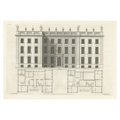
Antique Print of the Bold Hall in Warwickshire in England, 1714
Located in Langweer, NL
Antique print titled 'The Elevation of Nen Bold-Hall in Warwickshire (..)'.
View of the Bold Hall in Warwickshire, England. This print originates from 'Vitruvius Britannicus' by Co...
Category
English Antique 18th Century Maps
Materials
Paper
1720 Maps of the Holy Land: Ancient and Modern by De Fer and Danet
Located in Langweer, NL
1720 Maps of the Holy Land: Ancient and Modern by De Fer and Danet
This set of two 1720 maps, published by Nicolas de Fer and Danet in Paris, presents a unique juxtaposition of t...
Category
Antique 18th Century Maps
Materials
Paper
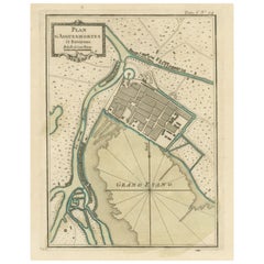
Antique Plan of Aigues-Mortes, France
Located in Langweer, NL
Antique map titled 'Plan d'Aiguesmortes et environs'. Original plan of the region of Aigues-Mortes, France. This map originates from 'Le Petit Atlas Maritime (..)' by J.N. Bellin. Pu...
Category
Antique 18th Century Maps
Materials
Paper
$325 Sale Price
20% Off
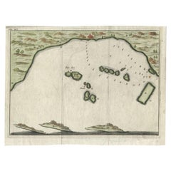
Antique Map of Banten Bay, Java, Indonesia, c.1725
Located in Langweer, NL
A small early 18th century map of Banten Bay showing the islands of Pulo Dua and Pulo Batto together with soundings within the Bay and profiles of hills on the islands published by C...
Category
Antique 18th Century Maps
Materials
Paper
$143 Sale Price
20% Off
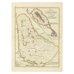
Barados and St Christopher or St Kitts and Nevis Islands in the Caribbean, 1748
Located in Langweer, NL
This original map, a copperplate engraving by Le Rouge, presents two significant areas in the Caribbean. Titled "Isle St. Christophle une des Antilles aux anglois" and "La Barbade. d...
Category
Antique 18th Century Maps
Materials
Paper
$344 Sale Price
20% Off
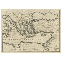
Scarce Map of the Mediterranean and Parts of Europe, Africa & Middle East, 1725
Located in Langweer, NL
Antique map titled: Byzondere afbeelding der landschappen, van de Apostelen bevaren en doorwandelt, om het Evangelium J.C. te prediken.
Scarce map of the Mediterranean and contigu...
Category
Antique 18th Century Maps
Materials
Paper
$364 Sale Price
20% Off
Antique Map of the Adour River, Near Bayonne, France
Located in Langweer, NL
Antique map titled 'Cours de la riviere de l'Adour depuis la mer jusqua Bayonne'. Original old map of the Adour river, near Bayonne, France. This map originates from 'Le Petit Atlas ...
Category
Antique 18th Century Maps
Materials
Paper
$325 Sale Price
20% Off
Original Antique Map of the Ancient Netherlands and Belgium, c.1750
Located in Langweer, NL
Description: Antique map titled 'Naauwkeurige Kaart van het Oude Nederland (..)'.
Original antique map of the Netherlands and Belgium. This map originates from 'Vaderlandsche his...
Category
Antique 18th Century Maps
Materials
Paper
$335 Sale Price
20% Off
Antique Map of the Sunda Islands Sumatra, Java, Malay Peninsula & Borneo (1739)
By Isaak Tirion
Located in Langweer, NL
Antique map titled 'Nieuwe kaart van de Sundasche Eilanden als Borneo, Sumatra en Groot Iava & c'. Detailed map of the Sunda Islands, Southeast Asia, extending from the tip of Cambod...
Category
Antique 18th Century Maps
Materials
Paper
$700 Sale Price
21% Off
Rare 18th-Century Hand-Colored Map of Southeast Asia and the East Indies, 1748
Located in Langweer, NL
1748 Homann Map of Southeast Asia and East Indies by Homann Heirs
This original 1748 map, published by the renowned Homann Heirs, depicts Southeast Asia, the East Indies, and adjace...
Category
Antique 18th Century Maps
Materials
Paper
Antique Map of Greece by Seutter or Lotter, 'c.1740'
Located in Langweer, NL
Antique map titled 'Graecia pars Septentrionalis'. Original antique map of Greece, uncommon. Signed cum Gratia et Privil. S.R.I. Vicariatus (..)'. Published by Seutter or Lotter, cir...
Category
Antique 18th Century Maps
Materials
Paper
$661 Sale Price
35% Off
Old Antique Map of Borneo 'Kalimantan Indonesia, Sabah Malaysia & Brunei'
Located in Langweer, NL
Antique map titled 'Kaart van het Eyland Borneo'. Original antique map of the island of Borneo. Published 1724-1726 by Joannes van Braam and Gerard Onder de ...
Category
Antique 18th Century Maps
Materials
Paper
$1,533 Sale Price
20% Off
Map of the Ottoman Empire in Europe, incl. the Balkans, Greece & Turkey, c.1760
Located in Langweer, NL
Antique map Turkey titled 'An Accurate Map of Turky in Europe drawn from the best Authorities'.
Map of the Ottoman Empire in Europe, the Balkans, Greece, and Turkey in Europe. Engr...
Category
Antique 18th Century Maps
Materials
Paper
$440 Sale Price
20% Off
Antique Map of the Alsace Region of France by Schenk 'circa 1700'
Located in Langweer, NL
Antique map titled 'Superioris atque Inferioris Alsatiae'. Beautiful map of the Alsace region, from Basel in the south to Philipsburg in the north, centered on Strassburg. Published ...
Category
Antique 18th Century Maps
Materials
Paper
$574 Sale Price
20% Off
Original Antique Map of Syria Phoenice by Van Dùren '1749'
Located in Langweer, NL
Interesting Antique map published in Germany titled 'Neue Vorstellung von Phoenice und Syrien (..)' This map is engraved with a lot of details. It is an original antique map of Syria...
Category
Antique 18th Century Maps
Materials
Paper
$287 Sale Price
20% Off
Antique Map of the Malacca and Bangka Strait by De Mannevillette '1775'
Located in Langweer, NL
Antique map titled 'Carte de la Partie Comprise entre la Sortie du Detroit de Malac Le Detroit de Banca et L’Isle Borneo'. Chart of the Strait of Malacca and Bangka Strait. It shows ...
Category
Antique 18th Century Maps
Materials
Paper
$1,149 Sale Price
20% Off
Original Antique Map of the Coast of Part of Greece, with Athens and Thebes
Located in Langweer, NL
Original antique map titled 'Achaia quae et Hellas hodie Livadia'. Detailed map of the coast of part of Greece. With inset maps of Athens and Thebes. This map originates from 'Philippi Cluveri Introductionis in universam geographiam (..)' by P. Clüver. Published 1729.
Philipp Clüver was an Early Modern German geographer and historian. Cluver's Geography was one of the most enduring works of the 17th & 18th Centuries, issued by several different publishers with many different sets of maps...
Category
Antique 18th Century Maps
Materials
Paper
$421 Sale Price
20% Off
Antique Map of a Bay on the Coast of Chile, South America, c.1749
Located in Langweer, NL
Antique map titled 'Plan van een Baai en Haven aan de Kust van Chili (..) - Plan d'une Baye de la Côte du Chili (..)'. Original antique map of a bay on the coast of Chile discovered ...
Category
Antique 18th Century Maps
Materials
Paper
$306 Sale Price
20% Off
Antique Plan of the Town and Harbour of Boulogne-sur-Mer by Barrow 'c.1760'
Located in Langweer, NL
Antique map titled 'Plan of the Town and Harbour of Boulogne'. Original antique plan of the town and harbour of Boulogne-sur-Mer, France. This map originates from John Barrow...
Category
Antique 18th Century Maps
Materials
Paper
$143 Sale Price
20% Off
Rare Antique Map of Persia, Incl the Caspian Sea and the Arabian Peninsula, 1726
Located in Langweer, NL
Rare untitled antique map of Persia. It covers from the Gulf of Suez eastward to Ahmedabad (Amadabad) in modern day western India. This map, centered on Persia, includes the Caspian Sea and part of the Arabian Peninsula...
Category
Antique 18th Century Maps
Materials
Paper
$814 Sale Price
20% Off
Rare Antique Map of the Moghul Empire, ca.1725
Located in Langweer, NL
Antique map titled 'Oost-Indize Voyagie door William Hawkins van Suratte gedaan na 't Hof van den Grooten Mogol tot Agra. - Voyage des Indes Orientales...
Category
Antique 18th Century Maps
Materials
Paper
$804 Sale Price
20% Off
Antique Map of Banten Bay on Java Island, Indonesia, c.1720
Located in Langweer, NL
Antique map titled 'La Rade de Bantam'. A small early 18th century black and white map of Banten Bay (or Bantam Bay), located near the northwest co...
Category
Antique 18th Century Maps
Materials
Paper
$335 Sale Price
20% Off
Europe Divided into Principal States by Jean Denis Janvier, Paris, 1782
Located in Langweer, NL
This is a historical map of Europe titled "L'Europe divisee en ses Principaux Etats," created by Jean Denis Janvier in 1782.
This beautiful map depicts the political boundaries and...
Category
Antique 18th Century Maps
Materials
Paper
Original Old Map with Many Details Around Manilla in the Philippine Islands
By F. Valentijn
Located in Langweer, NL
Original antique map titled 'Carte du Canal des Iles Philippines (..) - Kaart van het Kanaal in de Filippynsche Eilanden (..)'. Striking and highly detailed chart of the Islands of the Philippines. Shows Islands, bays, reefs, soundings tracks of the Manila Galleon route, etc. Published 1724-1726 by Joannes van Braam...
Category
Antique 18th Century Maps
Materials
Paper
$1,054 Sale Price
20% Off
Antique Print with Coastal Views of Asia by Cook, c.1784
Located in Langweer, NL
Antique print titled 'Views of the Coast of Asia (..)'. Antique print depicting various coastal views of Asia including Kamchatka. Originates from an edition of Cook's Voyages.
A...
Category
Antique 18th Century Maps
Materials
Paper
$344 Sale Price
20% Off
Antique Map of the Bay and Rocks of Petatlan by Anson, 1749
Located in Langweer, NL
Antique map titled 'Baye et Rochers de Petaplan (..) - De Baay en de Rotsen van Petaplan (..)'. Original antique map of the bay and rocks of Petatlan, Mexico. This map originates fro...
Category
Antique 18th Century Maps
Materials
Paper
$153 Sale Price
20% Off
Old Map of the Kingdom of Tonga, Also Known as the Friendly Islands, ca.1780
Located in Langweer, NL
Antique print, titled: 'Carte des Isles des Amis.'
Map of the Kingdom of Tonga, also known as the Friendly Islands, and one of the last hereditary monarchies. Cook named this gro...
Category
Antique 18th Century Maps
Materials
Paper
$249 Sale Price
20% Off
1748 Homann Heirs Double Map of the East Indies and Southeast Asia
Located in Langweer, NL
Title: 1774 Homann Heirs Double Map of the East Indies and Southeast Asia
Description:
This stunning 1774 double map by the Homann Heirs showcases the East Indies and Southeast ...
Category
Antique 18th Century Maps
Materials
Paper
Antique Map of the Russian Empire by R. Bonne, 1780
Located in Langweer, NL
Antique map titled 'Carte de l'Empire de Russie.' Drawn by R. Bonne for G. Raynal’s Atlas de Toutes les Parties Connues du Globe Terrestre, Dressé pour l'Histoire Philosophique et Po...
Category
French Antique 18th Century Maps
Materials
Paper
View of the Exchange and the Warehouses at Petersburg in Russia, ca.1790
Located in Langweer, NL
Description: antique print titled 'A view of the Exchange and the Warehouses at Petersburg in Russia / Vüe de la Bourse & du Magazin de Marchandises a Petersburg Russe'. Beautiful engraving of the Stock and Warehouses of St. Petersburg, Russia.
Artists and Engravers: Robert Sayer...
Category
Antique 18th Century Maps
Materials
Paper
$622 Sale Price
20% Off
Veteris Orbis Climata – Ancient World Map after Strabo by Cellarius, 1731
Located in Langweer, NL
Veteris Orbis Climata – Ancient World Map after Strabo by Cellarius, 1731
This fascinating hand-colored antique map, titled Veteris Orbis Climata ex Strabone, is a classical represe...
Category
Antique 18th Century Maps
Materials
Paper
$431 Sale Price
20% Off
Antique Map of Europe with Elaborate Title Cartouche, c.1750
Located in Langweer, NL
Antique map of Europe titled 'Europa Secundum legitimas Projectionis Stereographicae regulas et juxta recentissimas observationes aeque ac relationes… - L'Europe, dessinee suivant le...
Category
Antique 18th Century Maps
Materials
Paper
$622 Sale Price
20% Off
Old Antque Pirint of the New Dutch Church of Batavia 'Jakarta, Indonesia', 1744
Located in Langweer, NL
Antique print titled 'Ein Aufzug und Durchschnitt der Neuerbauten Holländischen Kirche in Batavia nach den Maastaab aufegzogen'.
Old print with a cross-section of the new Dutch church of Batavia (Jakarta). This print originates from from 'Allerneuester Geographische- und Topographischer Schau-platz, von Africa und Ost-Indien'.
Artists and engravers: Johann Wolfgang Heydt, a German artist who worked for the Dutch East India...
Category
Antique 18th Century Maps
Materials
Paper
$268 Sale Price
30% Off
Antique Map of New Ireland Island in the Bismarck Archipelago, New Guinea, 1772
Located in Langweer, NL
Antique map titled 'Nova Hibernia'. Antique map of New Ireland, an island in the Bismarck Archipelago, New Guinea. Lying just north of New Britain, from which it is separated by St. ...
Category
Antique 18th Century Maps
Materials
Paper
$210 Sale Price
20% Off
Antique Map of the City of Haarlem by Tirion, 1742
By Isaak Tirion
Located in Langweer, NL
Antique map titled 'Grondtekening van Haarlem (..)'. Original antique map of the city of Haarlem, the Netherlands. Published by I. Tirion, 1742.
Artists and Engravers: Isaak Tirio...
Category
Antique 18th Century Maps
Materials
Paper
$210 Sale Price
20% Off
Old Map of the Lower Bishopric of Münster (1726-1750) by Sanson & Ottens, c.1750
Located in Langweer, NL
Historical Map of the Lower Bishopric of Münster (1726-1750) by Sanson & Ottens – Hand-Colored Copperplate Engraving
The map titled "BASSE PARTIE DE L'EVESCHE DE MUNSTER" is a detai...
Category
Antique 18th Century Maps
Materials
Paper
Antique Print of a Great Hall by Campbell, 1725
Located in Langweer, NL
Antique print titled 'Section of the Great Hall of my Invention being a Cube of 40 feet'.
Section of a Great Hall. This print originates from 'Vitruvius...
Category
Antique 18th Century Maps
Materials
Paper
$229 Sale Price
20% Off
Old Copper Engraving of the Port City Dabhol in India, 1757
Located in Langweer, NL
Antique print titled 'Dabul'.
Old print of the port city Dabhol in India. In the 15th and 16th centuries, Dabul was an opulent Muslim trade center. Around 1660 it was annexed to th...
Category
Antique 18th Century Maps
Materials
Paper
$306 Sale Price
20% Off
Extremely Rare Map of the East-Indies towards the South-East 'Indonesia', 1725
Located in Langweer, NL
Antique map titled 'La partie des Indes Orientales vers le Zud-Est, depuis Timor jusqu'a Midanao (...).' (The part of the East-Indies towards the South-East, from Timor to Mindanao.)...
Category
Antique 18th Century Maps
Materials
Paper
$1,101 Sale Price
20% Off
Map of Europe Highlighting Ancient and Modern Geographical Divisions (1794)
Located in Langweer, NL
Map of Europe Highlighting Ancient and Modern Geographical Divisions (1794). Germany, France, Italy, Spain, and the British Isles – Map by D’Anville (1794).
This detailed 18th-cent...
Category
Antique 18th Century Maps
Materials
Paper
$1,619 Sale Price
20% Off
Antique Print of the Elevation of a New Design Dedicated to Lord Cadogan
Located in Langweer, NL
Antique print titled 'The Elevation of a new design of my Invention in the Palatial Stile (..)'. Old engraving of the elevation of a new design dedicated to Lord Cadogan. This print ...
Category
Antique 18th Century Maps
Materials
Paper
Antique Print of Thomas Wyndham's Palace by Woolfe, c.1770
Located in Langweer, NL
Antique print titled 'Elevation to the Thames of Thomas Wyndham Esqr. at Hammersmith Middlesex (..)'. View of Thomas Wyndham's Palace, Middlesex. This print originates from 'Vitruviu...
Category
Antique 18th Century Maps
Materials
Paper
$431 Sale Price
20% Off
Dutch Antique Map of the West Coast of Africa, to the Cape of Good Hope, 1747
Located in Langweer, NL
Antique map of the Coast of Africa titled 'Kaart van de West Kust van Afrika (..)'.
Map of the west coast of Africa, from 11 degrees south latitude to the Cape of Good Hope. This...
Category
Antique 18th Century Maps
Materials
Paper
$373 Sale Price
20% Off
Antique Map of Northern China and Eastern Russia by Bellin, 1757
Located in Langweer, NL
Antique map titled 'Carte de la Tartarie Orientale (..)'. Original antique map of what is present day northern China and far eastern Russia. Centered on...
Category
Antique 18th Century Maps
Materials
Paper
Antique Map of South America by J. Cook, 1775
Located in Langweer, NL
Antique map titled 'Kaart van het Zuidlyk Eind van Amerika'. Map of the sourthern part of South America, focusing on Cook's tracks around the Cape Horn and T...
Category
Antique 18th Century Maps
Materials
Paper
$814 Sale Price
20% Off
Antique Map of South America by Tirion 'circa 1765'
Located in Langweer, NL
Antique map titled 'Kaart van het Onderkoningschap van Peru, zig uitstrekkende over Chili, Paraguay en andere Spaansche Landen: als ook van Brazil en verdere Bezittingen van Portugal...
Category
Antique 18th Century Maps
Materials
Paper
$479 Sale Price
20% Off
Early Chart Identifying British Spice Trading Colony of Bencoolen, Sumatra, 1797
Located in Langweer, NL
Antique map titled 'A Chart of the West Coast of Sumatra'.
Early nautical chart identifying the British spice trading colony of Bencoolen and F...
Category
Antique 18th Century Maps
Materials
Paper
$1,197 Sale Price
20% Off
Antique Print of a Design for Belton House, Lincolnshire, England, 1725
Located in Langweer, NL
Antique print titled 'Belton in Lincolnshire, the Seat of Sr. John Brownlow Bar'.
Belton House is a Grade I listed country house in the parish of Belton near Grantham in Lincolns...
Category
Antique 18th Century Maps
Materials
Paper
$527 Sale Price
20% Off
Antique Map of Martinique, Showing Roads, Houses, Sugar Plantations, etc. c.1750
Located in Langweer, NL
Antique map titled 'Carte de l'Isle de la Martinique'.
Detailed map of Martinique. Shows hilly terrain, forests, roads, houses, and even the sugar plantations. The island was to ...
Category
Antique 18th Century Maps
Materials
Paper
$1,437 Sale Price
20% Off
Large Antique Lithography Map of Kent, English, Cartography, Robert Morden, 1700
Located in Hele, Devon, GB
This is a large antique lithography map of Kent. An English, framed atlas engraving of cartographic interest by Robert Morden, dating to the early 18th century and later.
Superb li...
Category
British Queen Anne Antique 18th Century Maps
Materials
Glass, Wood, Paper
Antique Map of the Region of Flanders in Belgium, 1737
Located in Langweer, NL
Untitled map of the region of Flanders, Belgium. This map originates from 'Nieuw en beknopt Kaart-Boekje vertoonende de XVII. Nederlandse Provintien (..)'.
Artists and Engravers: A...
Category
Antique 18th Century Maps
Materials
Paper
Antique Map of the Region of Aigues-Mortes and Camargue, France
Located in Langweer, NL
Antique map titled 'Environs d'Aiguemortes de Peccais &a et la petite Camargue'. Original map of the region of Aigues-Mortes and Camargue, France. This map originates from 'Le Petit ...
Category
Antique 18th Century Maps
Materials
Paper
$325 Sale Price
20% Off
Scarce Antique Map of the Island of Java, Indonesia
Located in Langweer, NL
Title: "Kaart van 't Eyland Groot Java: Antique Map of Java, Indonesia"
Description: This antique map, titled "Kaart van 't Eyland Groot Java," offers a rare and valuable depiction ...
Category
Antique 18th Century Maps
Materials
Paper
$622 Sale Price
20% Off
Pl. 11 Antique Print of Garden Fountains by Le Rouge, c.1785
Located in Langweer, NL
Antique print titled 'Projet de Fontaine (..)'. Copper engraving of fountain designs. This print originates from 'Jardins Anglo-Chinois à la Mode' by Georg Louis le Rouge. Artists an...
Category
Antique 18th Century Maps
Materials
Paper
Antique Map of Germany by Hederichs 'circa 1740'
Located in Langweer, NL
Antique map titled 'Germania'. Rare miniature map of Germany and surroundings. This map covers the entirety of those lands traditionally occupied by Germanic peoples, from the Blatic...
Category
Antique 18th Century Maps
Materials
Paper
$239 Sale Price
20% Off
Antique Map of South East Asia, Australia and the Indian Ocean, 1726
By F. Valentijn
Located in Langweer, NL
Antique map titled 'Tabula Indiae Orientalis'.
Beautiful detailed map of Australia, Southeast Asia and the Indian Ocean. The map features a fine depiction of the outlines of the western two-thirds of Australia, based on the discoveries of explorers working for the Dutch East India Company (the VOC). These include Willem Jansz's discoveries in the Gulf of Carpentaria in 1606; the encounters of Dirk...
Category
Dutch Antique 18th Century Maps
Materials
Paper
$6,898 Sale Price
20% Off
Original Antique Map of Northern India
Located in Langweer, NL
Antique map titled 'Carte de l'Indoustan (..) - Kaart van Hindoestan (..)'. Original antique map of northern India. This map originates from 'His...
Category
Antique 18th Century Maps
Materials
Paper
$210 Sale Price
20% Off
Very Attractive Map of North and South America and Western Part of Africa, 1744
Located in Langweer, NL
Antique map titled 'Nieuwe Kaart van America.' Very attractive map of North and South America, the western part of Africa and south west Europe. With full contemporary hand colouring...
Category
Antique 18th Century Maps
Materials
Paper
$910 Sale Price
20% Off
Antique Map of the Santa Cruz Islands with Inset of Carteret and Gower Islands
Located in Langweer, NL
Antique map titled 'Isles de la Reine Charlotte (..)'. A detailed chart of the Santa Cruz islands, to the north of the New Hebrides, with Carteret's track in "Swallow"; including an ...
Category
Antique 18th Century Maps
Materials
Paper
$287 Sale Price
20% Off
Attractive Original Map of the Province of Overijssel, the Netherlands, Ca.1700
Located in Langweer, NL
Antique print, titled: 'Transisalania Provincia vulgo Over-yssel.'
Attractive original handcoloured map of the province of Overijssel, The Netherlands. With beautiful title cartouc...
Category
Antique 18th Century Maps
Materials
Paper
$898 Sale Price
40% Off
